Longmead Wood

Wood, Forest in Gloucestershire Cotswold

England

Longmead Wood

Brimsfield Park Farm
Brimsfield Park Farm Credit: P Gaskell

Longmead Wood is a picturesque woodland located in Gloucestershire, England. Covering an area of approximately 200 acres, this enchanting forest is a haven for nature lovers and outdoor enthusiasts. It is situated near the town of Dursley, making it easily accessible for both locals and visitors.

The woodland is primarily composed of a mixture of deciduous and coniferous trees, including oak, beech, and pine. These towering trees create a dense canopy that filters the sunlight, providing a cool and tranquil atmosphere within the wood. The forest floor is adorned with a variety of wildflowers, ferns, and mosses, adding to the natural beauty of the surroundings.

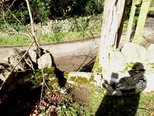
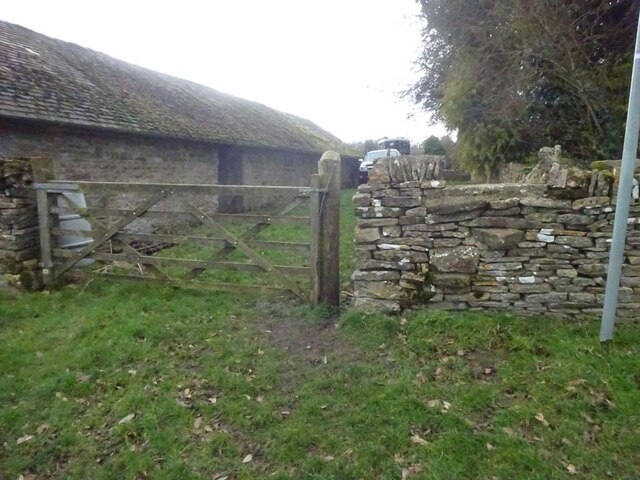
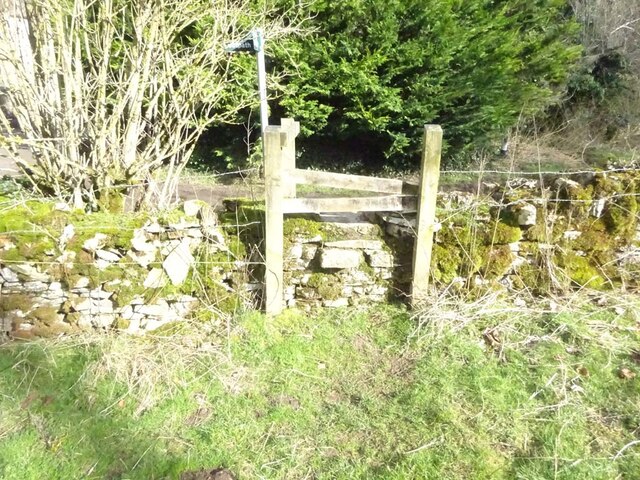
Longmead Wood is known for its network of well-maintained walking trails, which allow visitors to explore the area at their own pace. These paths wind through the forest, leading to hidden clearings, babbling brooks, and peaceful ponds. The wood is home to a diverse range of wildlife, including deer, foxes, badgers, and a multitude of bird species, making it a popular spot for wildlife enthusiasts and birdwatchers.

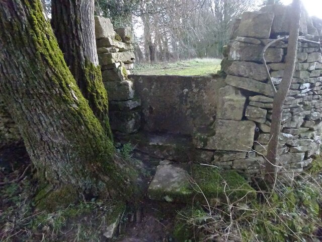
In addition to its natural beauty, Longmead Wood also holds historical significance. It is believed that the wood was once part of an ancient hunting ground, with remnants of old hunting lodges and stone structures still visible today. The wood also features a small picnic area, providing a perfect spot for visitors to relax and enjoy the peaceful ambiance.

Overall, Longmead Wood offers a tranquil retreat from the hustle and bustle of everyday life, allowing visitors to reconnect with nature and enjoy the beauty of Gloucestershire's woodlands.

If you have any feedback on the listing, please let us know in the comments section below.

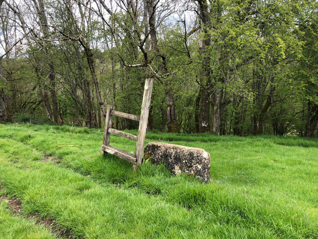
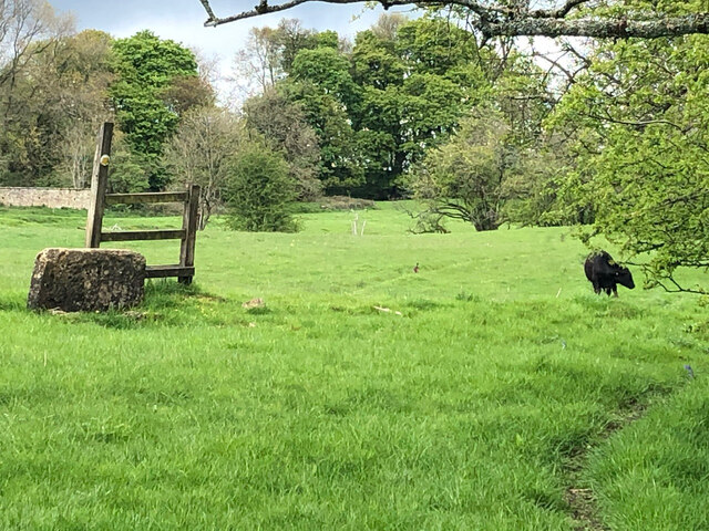
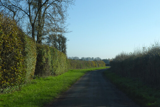
Longmead Wood Images

Images are sourced within 2km of 51.793593/-2.0791927 or Grid Reference SO9410. Thanks to Geograph Open Source API. All images are credited.

Brimsfield Park Farm
Stone Stile, Caudle Green Looking SW towards the village.
Stone Stile, Caudle Green
Looking SW towards the village.
Stone Stile, Caudle Green A step stile on the Northern side of the road approaching the village. On Gloucestershire footpath BBR28. The view from the road side is <a href="https://www.geograph.org.uk/photo/7061298">SO9410 : Stone Stile, Caudle Green</a>.
Stone Stile, Caudle Green
A step stile on the Northern side of the road approaching the village. On Gloucestershire footpath BBR28. The view from the road side is SO9410 : Stone Stile, Caudle Green.
Stone Stile, Caudle Green A step stile on the Northern side of the road approaching the village. On Gloucestershire footpath BBR28. The view from the appreciable drop on the other side is <a href="https://www.geograph.org.uk/photo/7061296">SO9410 : Stone Stile, Caudle Green</a>.
Stone Stile, Caudle Green
A step stile on the Northern side of the road approaching the village. On Gloucestershire footpath BBR28. The view from the appreciable drop on the other side is SO9410 : Stone Stile, Caudle Green.
Stone Stile, Syde On Gloucestershire footpath BSY8 just South of the Manor House in Syde. This view is looking from the road, the view looking North is <a href="https://www.geograph.org.uk/photo/7104847">SO9410 : Stone Stile, Syde</a>.
Stone Stile, Syde
On Gloucestershire footpath BSY8 just South of the Manor House in Syde. This view is looking from the road, the view looking North is SO9410 : Stone Stile, Syde.
Stone Stile, Syde On Gloucestershire footpath BSY8 just South of the Manor House in Syde. This view is looking to the road, the view looking South is <a href="https://www.geograph.org.uk/photo/7104846">SO9410 : Stone Stile, Syde</a>.
Stone Stile, Syde
On Gloucestershire footpath BSY8 just South of the Manor House in Syde. This view is looking to the road, the view looking South is SO9410 : Stone Stile, Syde.
Stone Stile, Caudle Green Looking into a field at the junction of Gloucestershire footpaths MMN23 & BBR38 where the paths transition from woodland to a field sparsely populated with "meadow flowers". The soil in the field is heavily laden with stones. The view towards the woodland is <a href="https://www.geograph.org.uk/photo/7104960">SO9310 : Stone Stile, Caudle Green</a>.
Stone Stile, Caudle Green
Looking into a field at the junction of Gloucestershire footpaths MMN23 & BBR38 where the paths transition from woodland to a field sparsely populated with "meadow flowers". The soil in the field is heavily laden with stones. The view towards the woodland is SO9310 : Stone Stile, Caudle Green.
Stone Stile, Caudle Green Looking from a field at the junction of Gloucestershire footpaths MMN23 & BBR38 where the paths transition from woodland to a field sparsely populated with "meadow flowers". The soil in the field is heavily laden with stones. The view from the woodland is <a href="https://www.geograph.org.uk/photo/7104958">SO9310 : Stone Stile, Caudle Green</a>.
Stone Stile, Caudle Green
Looking from a field at the junction of Gloucestershire footpaths MMN23 & BBR38 where the paths transition from woodland to a field sparsely populated with "meadow flowers". The soil in the field is heavily laden with stones. The view from the woodland is SO9310 : Stone Stile, Caudle Green.
Stone Stile, Caudle Green Due South of the village green at the junction of Gloucestershire footpaths MMN23 & BBR25 in woodland. This point is also on the boundaries of: county constituency, civil parishes of Miserden and Brimsfield, and the county district. This is the view looking NE, the view SW is <a href="https://www.geograph.org.uk/photo/7104970">SO9410 : Stone Stile, Caudle Green</a>.
Stone Stile, Caudle Green
Due South of the village green at the junction of Gloucestershire footpaths MMN23 & BBR25 in woodland. This point is also on the boundaries of: county constituency, civil parishes of Miserden and Brimsfield, and the county district. This is the view looking NE, the view SW is SO9410 : Stone Stile, Caudle Green.
Stone Stile, Caudle Green Due South of the village green at the junction of Gloucestershire footpaths MMN23 & BBR25 in woodland. This point is also on the boundaries of: county constituency, civil parishes of Miserden and Brimsfield, and the county district. This is the view looking SW, the view NE is <a href="https://www.geograph.org.uk/photo/7104969">SO9410 : Stone Stile, Caudle Green</a>.
Stone Stile, Caudle Green
Due South of the village green at the junction of Gloucestershire footpaths MMN23 & BBR25 in woodland. This point is also on the boundaries of: county constituency, civil parishes of Miserden and Brimsfield, and the county district. This is the view looking SW, the view NE is SO9410 : Stone Stile, Caudle Green.
Stone Stile, Caudle Green From a small field into a grazing field at the SE corner of the garden walls of 'Calley House'. This is looking SW away from the village, the view towards the village is <a href="https://www.geograph.org.uk/photo/7104983">SO9410 : Stone Stile, Caudle Green</a>.
Stone Stile, Caudle Green
From a small field into a grazing field at the SE corner of the garden walls of 'Calley House'. This is looking SW away from the village, the view towards the village is SO9410 : Stone Stile, Caudle Green.
Stone Stile, Caudle Green From a small field in to a grazing field at the SE corner of the garden wals of 'Calley House'. This is looking NE towards the village, the view towards the larger field is <a href="https://www.geograph.org.uk/photo/7104981">SO9410 : Stone Stile, Caudle Green</a>.
Stone Stile, Caudle Green
From a small field in to a grazing field at the SE corner of the garden wals of 'Calley House'. This is looking NE towards the village, the view towards the larger field is SO9410 : Stone Stile, Caudle Green.
Stone Stile, Caudle Green A step Stile off the Southern side of the village green on Gloucestershire footpath BBR25. This is looking to the village green, the view from the green is <a href="https://www.geograph.org.uk/photo/7104992">SO9410 : Stone Stile, Caudle Green</a>.
Stone Stile, Caudle Green
A step Stile off the Southern side of the village green on Gloucestershire footpath BBR25. This is looking to the village green, the view from the green is SO9410 : Stone Stile, Caudle Green.
Stone Stile, Caudle Green A step Stile off the Southern side of the village green on Gloucestershire footpath BBR25. This is looking from the village green, the view toward the green is <a href="https://www.geograph.org.uk/photo/7104990">SO9410 : Stone Stile, Caudle Green</a>.
Stone Stile, Caudle Green
A step Stile off the Southern side of the village green on Gloucestershire footpath BBR25. This is looking from the village green, the view toward the green is SO9410 : Stone Stile, Caudle Green.
Stone Stile, Caudle Green A step stile. Looking out of the field on Gloucestershire footpath BBR28 to the road. The view from the road is <a href="https://www.geograph.org.uk/photo/7041359">SO9410 : Stone Stile, Caudle Green</a>.
Stone Stile, Caudle Green
A step stile. Looking out of the field on Gloucestershire footpath BBR28 to the road. The view from the road is SO9410 : Stone Stile, Caudle Green.
Stone Stile, Syde To the NW of the village on Gloucestershire footpath BBR29 looking East to Ostrich Wood. 
The View North looking at the enclosure walls of an abandoned hamlet 
called Eddington is <a href="https://www.geograph.org.uk/photo/7329990">SO9411 : Stone Stile, Syde</a>.
Stone Stile, Syde
To the NW of the village on Gloucestershire footpath BBR29 looking East to Ostrich Wood. The View North looking at the enclosure walls of an abandoned hamlet called Eddington is SO9411 : Stone Stile, Syde.
Stone Stile, Syde To the NW of the village on Gloucestershire footpath BBR29 looking North looking at the enclosure wall
of an abandoned hamlet called Eddington.
The view East to Ostrich Wood is <a href="https://www.geograph.org.uk/photo/7329988">SO9411 : Stone Stile, Syde</a>.
Stone Stile, Syde
To the NW of the village on Gloucestershire footpath BBR29 looking North looking at the enclosure wall of an abandoned hamlet called Eddington. The view East to Ostrich Wood is SO9411 : Stone Stile, Syde.
Lane from Brimpsfield towards Caudle Green
Show me another place!

Longmead Wood is located at Grid Ref: SO9410 (Lat: 51.793593, Lng: -2.0791927)

Administrative County: Gloucestershire

District: Cotswold

Police Authority: Gloucestershire

What 3 Words

///pizzeria.brightens.blaring. Near Painswick, Gloucestershire

Related Wikis

Nearby Amenities

Located within 500m of 51.793593,-2.0791927
Caudle Green
Is In: Gloucestershire, England, UK
Is In Parish: Brimpsfield
Place: hamlet
Wikidata: Q117599691
Lat/Long: 51.7927843/-2.0835521
Syde
Is In: Gloucestershire, England, UK
Place: village
Lat/Long: 51.7964739/-2.0748068
Bus Stop
Caudle Green
Naptan AtcoCode: 1600GL937
Naptan Bearing: E
Naptan CommonName: Caudle Green
Naptan NaptanCode: glodtamp
Naptan Street: Main Street
Naptan Verified: no
Source: naptan_import
Lat/Long: 51.7930051/-2.0845624
Bus Stop
Caudle Green
Naptan AtcoCode: 1600GL938
Naptan Bearing: W
Naptan BusStopType: CUS
Naptan CommonName: Caudle Green
Naptan NaptanCode: glodtamj
Naptan Street: Main Street
Naptan Verified: no
Source: naptan_import
Lat/Long: 51.7928435/-2.0842286
Barrier: stile
Lat/Long: 51.7919253/-2.0848943
Post Box
Collection Times: Mo-Fr 09:00; Sa 07:00; Su off
Drive Through: no
Operator: Royal Mail
Operator Wikidata: Q638098
Post Box Type: wall
Ref: GL53 86D
Royal Cypher: VR
Royal Cypher Wikidata: Q33102356
Source: survey
Lat/Long: 51.7928595/-2.0840798
Telephone
Booth: K6
Covered: booth
Listed Status: Grade II
Man Made: telephone_box
Lat/Long: 51.7927052/-2.0840047
Post Box
Collection Times: Mo-Fr 16:30; Sa 09:00; Su off
Drive Through: no
Operator: Royal Mail
Operator Wikidata: Q638098
Post Box Type: wall
Ref: GL53 137
Royal Cypher: EVIIR
Royal Cypher Wikidata: Q33102324
Source: survey
Lat/Long: 51.7963816/-2.074595
Give Way
Direction: forward
Lat/Long: 51.7932273/-2.0810723
Give Way
Direction: backward
Lat/Long: 51.7920466/-2.0803774
Give Way
Direction: backward
Lat/Long: 51.7916619/-2.0801011
Barrier: stile
Lat/Long: 51.7925942/-2.0845011
Barrier: stile
Lat/Long: 51.792342/-2.0847092
Barrier: stile
Lat/Long: 51.7923666/-2.0777984
Barrier: stile
Lat/Long: 51.7916706/-2.079001
Barrier: stile
Material: wood
Stile: stepover
Lat/Long: 51.7929484/-2.0765384
Barrier: stile
Material: stone
Stile: stepover
Lat/Long: 51.7930017/-2.0819335
Barrier: stile
Material: stone
Stile: stepover
Lat/Long: 51.7932771/-2.0814366
The data included in this document is from www.openstreetmap.org. The data is made available under ODbL.

Have you been to Longmead Wood?

Leave your review of Longmead Wood below (or comments, questions and feedback).