Sgeir Fhionnlaidh
Island in Ross-shire
Scotland
Sgeir Fhionnlaidh
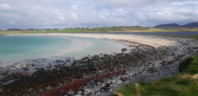
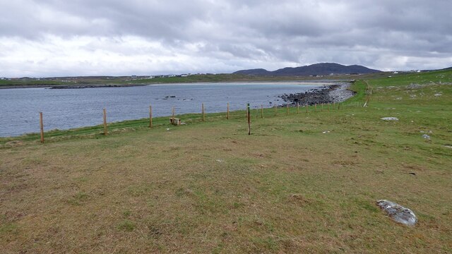
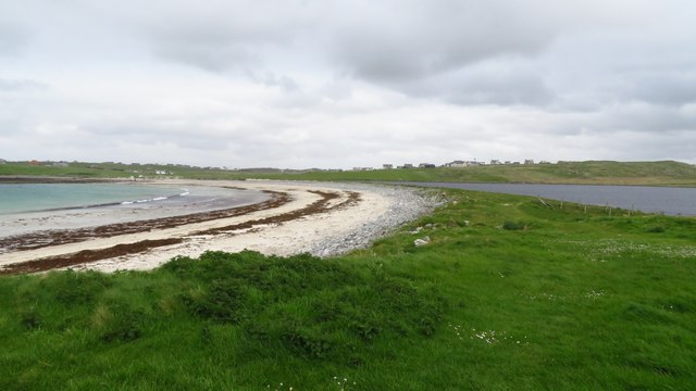
Sgeir Fhionnlaidh is a small uninhabited island located off the coast of Ross-shire, in the Scottish Highlands. The island is situated in the North Atlantic Ocean, approximately 1 mile northeast of the mainland. Sgeir Fhionnlaidh forms part of a group of islands known as the Summer Isles.
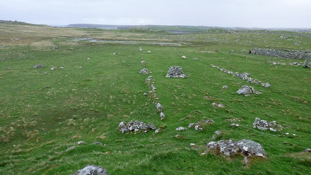
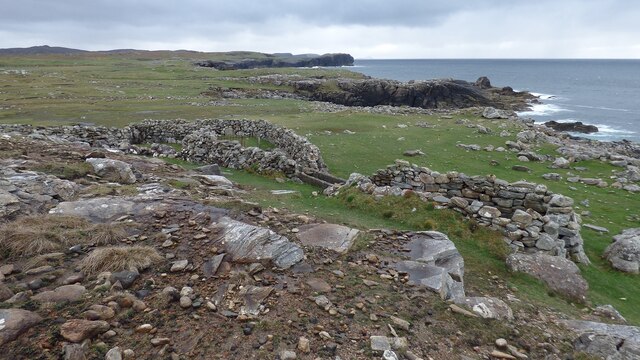
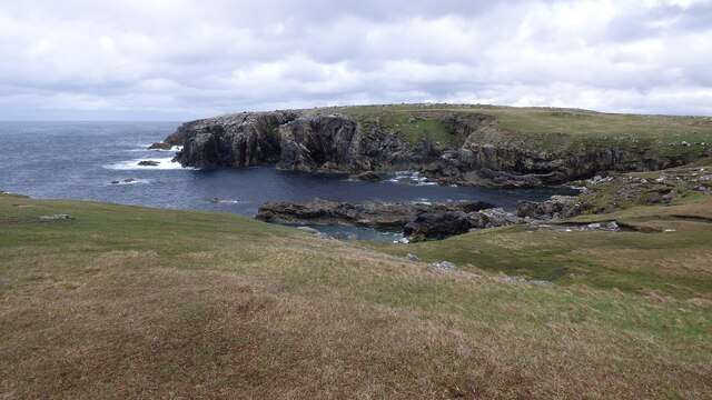
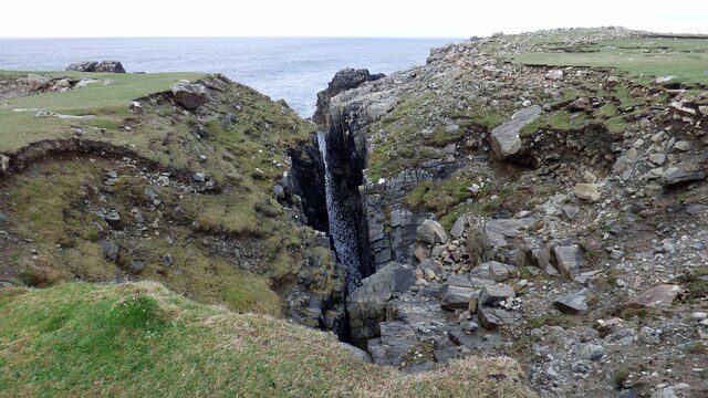
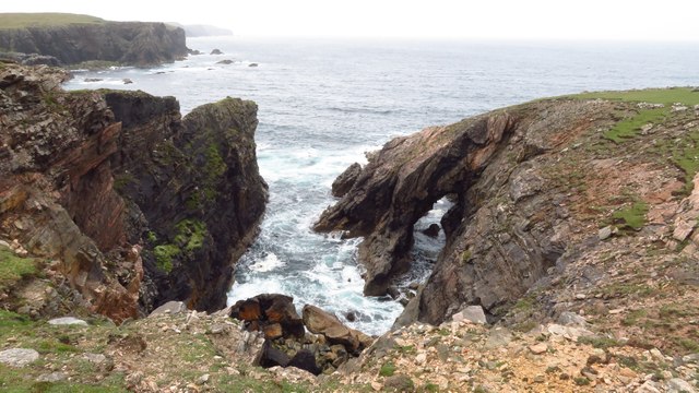
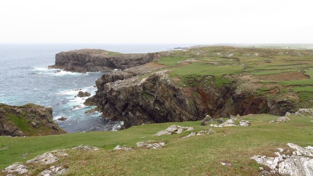
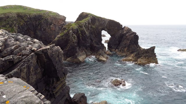
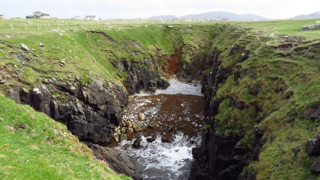
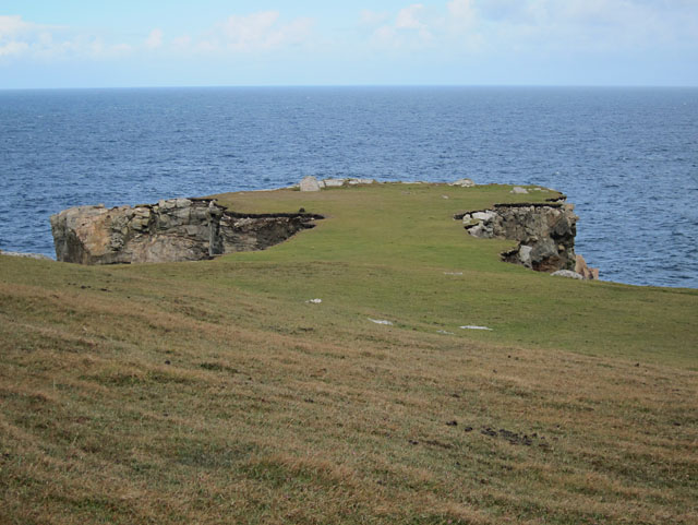
Comprising an area of just 22 hectares, Sgeir Fhionnlaidh is characterized by its rugged and rocky terrain. The island is predominantly composed of ancient Lewisian gneiss, a type of metamorphic rock that dates back over a billion years. The coastline of Sgeir Fhionnlaidh is jagged and indented, with numerous sea caves and stacks formed by the relentless action of the ocean.
Due to its remote location and challenging access, Sgeir Fhionnlaidh is rarely visited by humans. However, the island is a haven for a variety of seabird species, including fulmars, guillemots, and razorbills. These birds use the island's cliffs and crags as nesting sites during the breeding season.
Sgeir Fhionnlaidh's isolation and untouched natural beauty make it an attractive destination for wildlife enthusiasts and photographers. The island offers breathtaking panoramic views of the surrounding coastline and the open sea. Visitors to Sgeir Fhionnlaidh can also enjoy observing the abundant marine life that inhabits the waters around the island, including seals and occasionally dolphins.
In conclusion, Sgeir Fhionnlaidh is a small and remote island off the coast of Ross-shire, renowned for its rugged landscapes, rich birdlife, and stunning ocean views.
If you have any feedback on the listing, please let us know in the comments section below.
Sgeir Fhionnlaidh Images
Images are sourced within 2km of 58.332259/-6.7128047 or Grid Reference NB2447. Thanks to Geograph Open Source API. All images are credited.


Sgeir Fhionnlaidh is located at Grid Ref: NB2447 (Lat: 58.332259, Lng: -6.7128047)
Unitary Authority: Na h-Eileanan an Iar
Police Authority: Highlands and Islands
What 3 Words
///firm.rips.denoting. Near Carloway, Na h-Eileanan Siar
Related Wikis

Shawbost
Shawbost (Scottish Gaelic: Siabost) is a large village in the West Side of the Isle of Lewis. The village of Shawbost has a population of around 500 and...

Siadar Wave Power Station
The Siadar Wave Power Station (also known as Siadar Wave Energy Project or SWEP) was a proposed 4 MW wave farm 400 metres (1,300 ft) off the shore of Siadar...

Bragar
Bragar (Scottish Gaelic: Bràgar, pronounced [braːgər]) is a village on the west side of the Isle of Lewis in the Outer Hebrides, Scotland, 14 miles (23...

Garenin
Garenin (Scottish Gaelic: Na Gearrannan) is a crofting township on the west coast of the Isle of Lewis in the Outer Hebrides of Scotland. Garenin is in...

Carloway
Carloway (Scottish Gaelic: Càrlabhagh [ˈkʰaːɾɫ̪ə.ɤː]) is a crofting township and a district on the west coast of the Isle of Lewis, in the Outer Hebrides...

Arnol
Arnol (Scottish Gaelic: Àrnol) is a small village typical of many settlements of the west coast of the Isle of Lewis, in the Outer Hebrides, Scotland....

Borrowston, Lewis
Borrowston (Scottish Gaelic: Borghastan), with a population of about 50, is a crofting township situated on the Isle of Lewis, on the Outer Hebrides of...

Dun Carloway
Dun Carloway (Scottish Gaelic: Dùn Chàrlabhaigh) is a broch situated in the district of Carloway, on the west coast of the Isle of Lewis, Scotland (grid...
Nearby Amenities
Located within 500m of 58.332259,-6.7128047Have you been to Sgeir Fhionnlaidh?
Leave your review of Sgeir Fhionnlaidh below (or comments, questions and feedback).