Croite Bàn

Coastal Feature, Headland, Point in Ross-shire

Scotland

Croite Bàn

Strip Fields and Clearance Cairns The field boundaries form part of a much larger system in this area and the cairns are built upon earthfast boulders.
Strip Fields and Clearance Cairns Credit: Sandy Gerrard

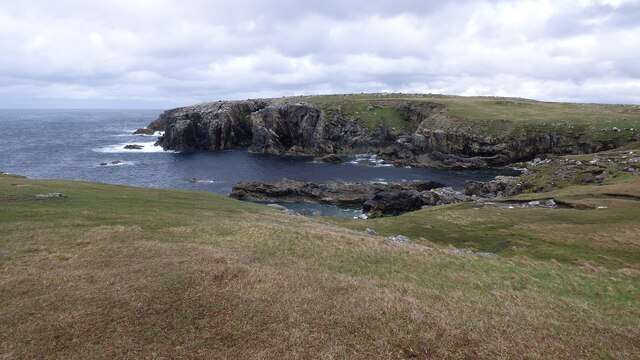
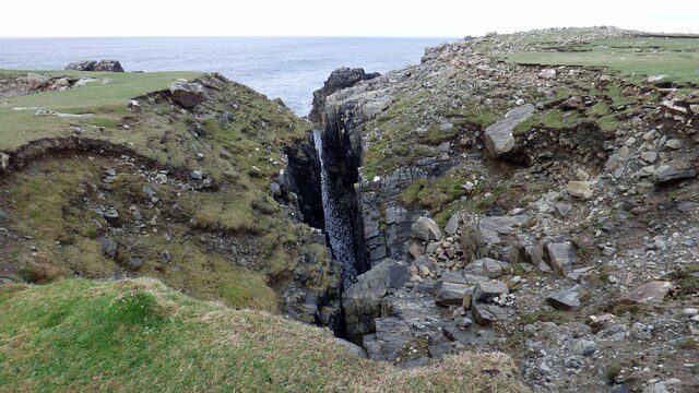
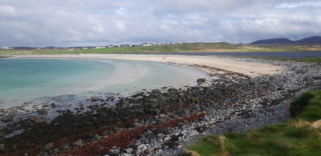
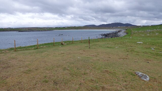
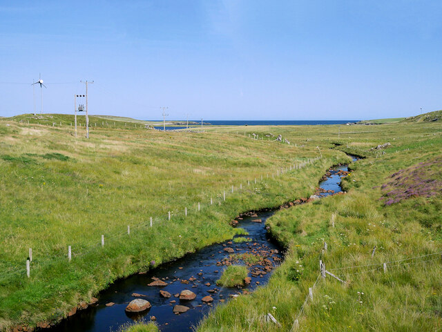
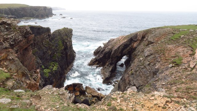
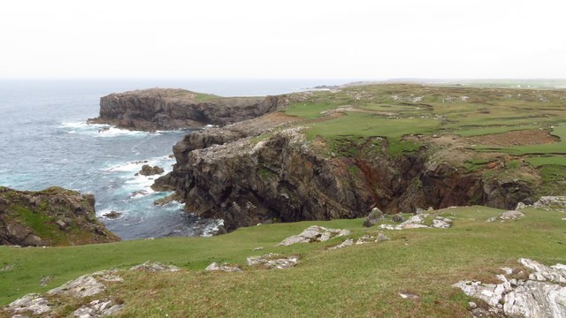
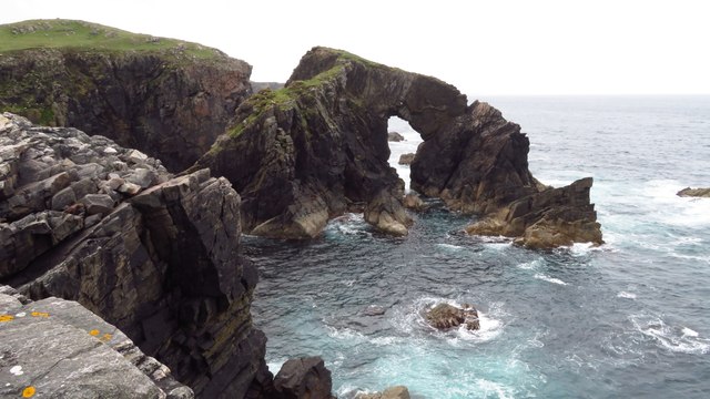
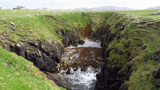
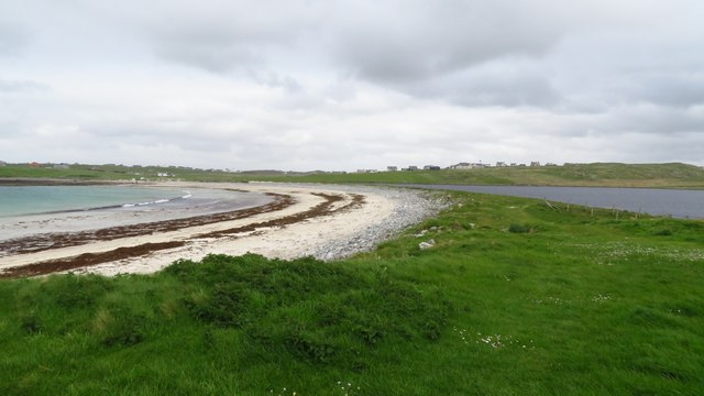
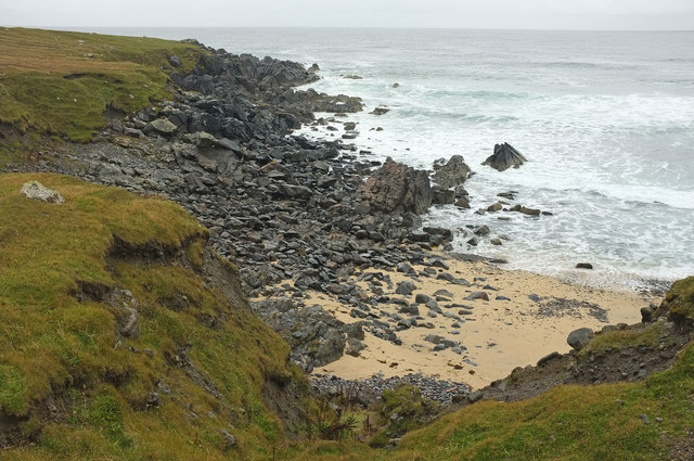
Croite Bàn is a prominent headland located in Ross-shire, Scotland. This coastal feature is known for its rugged cliffs and stunning views of the surrounding sea. The name Croite Bàn translates to "white croft" in Gaelic, likely referencing the white cliffs that can be seen from the point.

The headland is a popular destination for hikers and nature enthusiasts, offering a variety of walking trails and opportunities for birdwatching. Visitors can spot a range of seabirds such as gannets, puffins, and guillemots nesting along the cliffs.

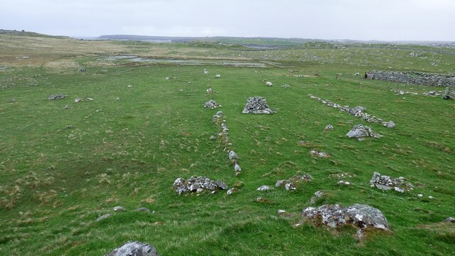
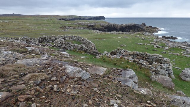
In addition to its natural beauty, Croite Bàn also has a rich history. The headland is home to ancient ruins and archaeological sites, providing insight into the area's past inhabitants.

Overall, Croite Bàn is a picturesque and historically significant coastal feature in Ross-shire, attracting visitors with its stunning landscapes and cultural heritage.

If you have any feedback on the listing, please let us know in the comments section below.

Croite Bàn Images

Images are sourced within 2km of 58.333057/-6.7060362 or Grid Reference NB2447. Thanks to Geograph Open Source API. All images are credited.

Strip Fields and Clearance Cairns The field boundaries form part of a much larger system in this area and the cairns are built upon earthfast boulders.
Strip Fields and Clearance Cairns
The field boundaries form part of a much larger system in this area and the cairns are built upon earthfast boulders.
Sheepfold and Wash
Sheepfold and Wash
Cliffs at Rubh' an Dùnain
Geodha na Laire A deep chasm leading inland at Garson Point.
Geodha na Laire
A deep chasm leading inland at Garson Point.
Beach at southern end of Loch Shiaboist
Stile and waymarker post for Siabost to Dail Beag Path
Shawbost/Siabost
Shawbost/Siabost
Shawbost Village
Shawbost Village
Abhainn Shiaboist
Abhainn Shiaboist
Cnoc Leatham
Cnoc Leatham
Parking area at Loch Raoinebhat
Loch Raoinebhat
Loch Raoinebhat
Natural arch at Tolaig Beag
Coastal scenery approaching Rubha na Beirghe
Natural arch at Stac a' Phris
Inland geo at Geodhachan Caola near Shawbost The sea reaches this beach via a subterranean passage.
Inland geo at Geodhachan Caola near Shawbost
The sea reaches this beach via a subterranean passage.
Beach at Loch Shiaboist & Loch a'Bhaile
Small beach east of Rubha Gharsan
Show me another place!

Croite Bàn is located at Grid Ref: NB2447 (Lat: 58.333057, Lng: -6.7060362)

Unitary Authority: Na h-Eileanan an Iar

Police Authority: Highlands and Islands

What 3 Words

///opponent.unrated.smothered. Near Carloway, Na h-Eileanan Siar

Related Wikis

Shawbost

Shawbost (Scottish Gaelic: Siabost) is a large village in the West Side of the Isle of Lewis. The village of Shawbost has a population of around 500 and...

Bragar

Bragar (Scottish Gaelic: Bràgar, pronounced [braːgər]) is a village on the west side of the Isle of Lewis in the Outer Hebrides, Scotland, 14 miles (23...

Siadar Wave Power Station

The Siadar Wave Power Station (also known as Siadar Wave Energy Project or SWEP) was a proposed 4 MW wave farm 400 metres (1,300 ft) off the shore of Siadar...

Garenin

Garenin (Scottish Gaelic: Na Gearrannan) is a crofting township on the west coast of the Isle of Lewis in the Outer Hebrides of Scotland. Garenin is in...

Nearby Amenities

Located within 500m of 58.333057,-6.7060362
Created By: dmgroom_coastlines
Lat/Long: 58.33132/-6.7121
Turning Circle
Noexit: yes
Lat/Long: 58.3304972/-6.7070684
Barrier: stile
Foot: yes
Material: wood
Source: survey
Lat/Long: 58.3310013/-6.7099616
Barrier: stile
Foot: yes
Material: wood
Source: survey
Lat/Long: 58.3339443/-6.7032078
Power: pole
Lat/Long: 58.330279/-6.7071638
Power: pole
Lat/Long: 58.3298979/-6.706804
Power: pole
Lat/Long: 58.3296333/-6.7065945
Power: pole
Lat/Long: 58.3292956/-6.7063333
Power: pole
Lat/Long: 58.3291643/-6.7059735
Power: pole
Lat/Long: 58.3288266/-6.7057924
Power: pole
Lat/Long: 58.3286634/-6.7065411
Barrier: cattle_grid
Lat/Long: 58.3296503/-6.7064368
Ford: yes
Lat/Long: 58.3309531/-6.7100359
Ford: yes
Lat/Long: 58.3339356/-6.7032594
The data included in this document is from www.openstreetmap.org. The data is made available under ODbL.

Have you been to Croite Bàn?

Leave your review of Croite Bàn below (or comments, questions and feedback).