Geo an Ear

Coastal Feature, Headland, Point in Inverness-shire

Scotland

Geo an Ear

Approaching Eilean Glas lighthouse A good path provides access from Ceann a Bhàigh to Eilean Glas.
The original lighthouse here, built 1789, was the first in the Hebrides, and its base still survives today,
(see <a href="https://www.geograph.org.uk/photo/4730643">NG2494 : The original Scalpay lighthouse</a>). 
The current tower was built 1824.
Approaching Eilean Glas lighthouse Credit: Richard Dorrell

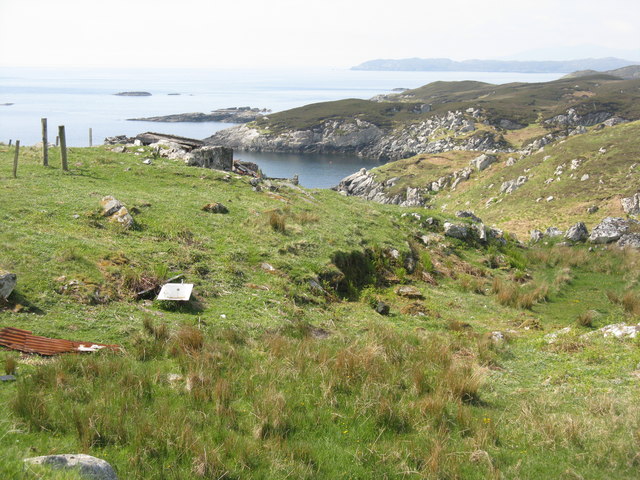
Geo an Ear is a prominent coastal feature located in Inverness-shire, Scotland. It is a headland that juts out into the sea, forming a distinct point along the coastline. The name "Geo an Ear" translates to "east cove" in the local Gaelic language, which accurately describes its geographical location relative to the surrounding areas.

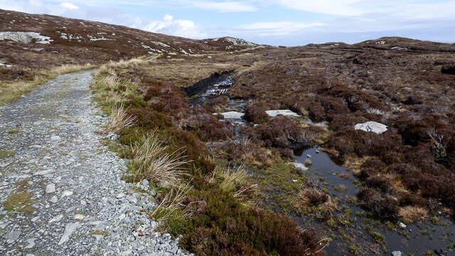
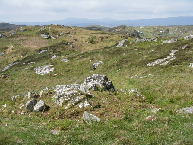
This headland is characterized by its rugged and dramatic landscape, with steep cliffs that rise up from the crashing waves below. The cliffs are composed of various types of rock formations, such as sandstone and limestone, which have been shaped over centuries by the relentless force of the sea.

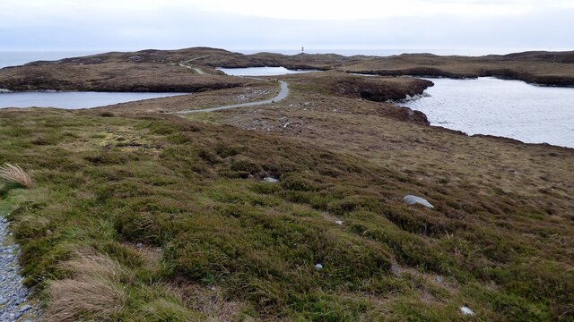
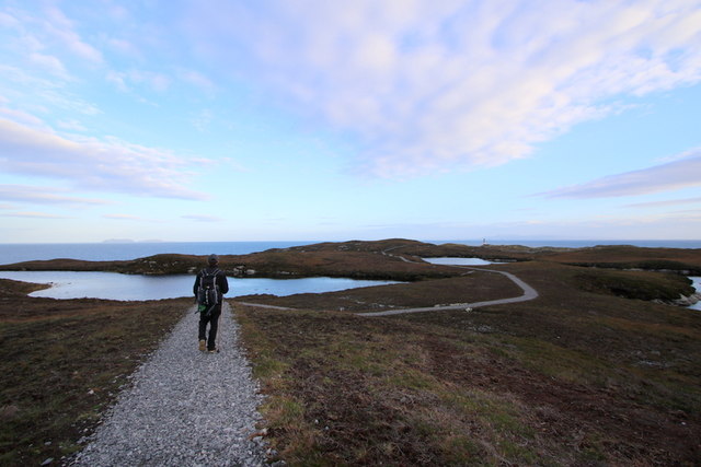
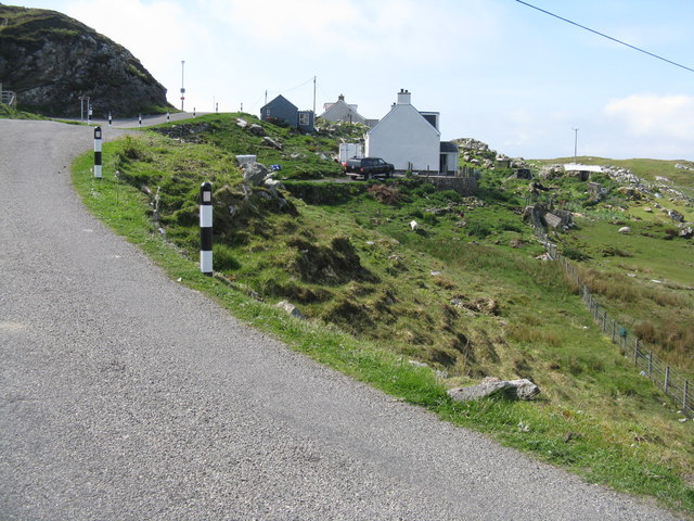
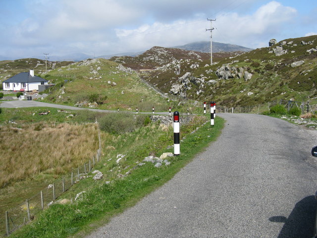
Geo an Ear is a popular destination for nature enthusiasts and hikers due to its stunning natural beauty and the breathtaking views it offers. Visitors can explore the headland on foot, following well-marked trails that wind their way along the cliff edges. From these vantage points, one can admire the vast expanse of the sea stretching out before them, as well as the diverse marine life that inhabits the waters below.

The headland is also home to a wide array of seabirds, including gulls, puffins, and razorbills, which nest in the cliffs during the breeding season. This makes Geo an Ear an ideal spot for birdwatching, as visitors can observe these fascinating creatures in their natural habitat.

Overall, Geo an Ear is a captivating coastal feature that showcases the raw beauty of nature. Its rugged cliffs, stunning views, and abundant wildlife make it a must-visit destination for those seeking a truly immersive coastal experience in Inverness-shire.

If you have any feedback on the listing, please let us know in the comments section below.

Geo an Ear Images

Images are sourced within 2km of 57.859195/-6.6429417 or Grid Reference NG2494. Thanks to Geograph Open Source API. All images are credited.
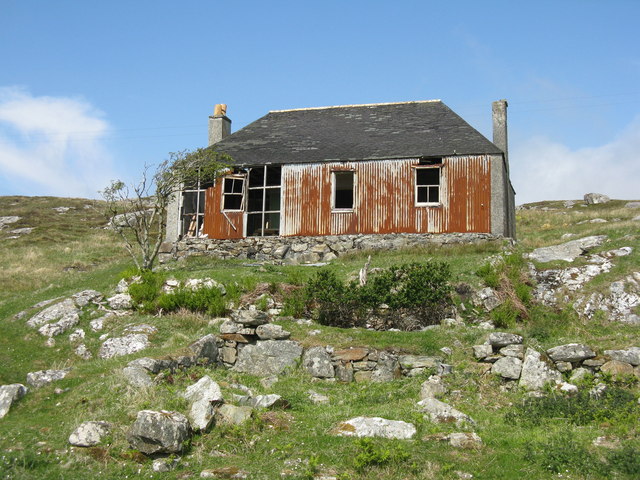
Approaching Eilean Glas lighthouse A good path provides access from Ceann a Bhàigh to Eilean Glas.
The original lighthouse here, built 1789, was the first in the Hebrides, and its base still survives today,
(see <a href="https://www.geograph.org.uk/photo/4730643">NG2494 : The original Scalpay lighthouse</a>). 
The current tower was built 1824.
Approaching Eilean Glas lighthouse
A good path provides access from Ceann a Bhàigh to Eilean Glas. The original lighthouse here, built 1789, was the first in the Hebrides, and its base still survives today, (see NG2494 : The original Scalpay lighthouse). The current tower was built 1824.
Old Peat Cuttings
Old Peat Cuttings
Track to Eilean Glas Lighthouse There is some small-scale peat cutting immediately next to the track.
Track to Eilean Glas Lighthouse
There is some small-scale peat cutting immediately next to the track.
Eilean Glas Lighthouse <span class="nowrap"><a title="https://www.nlb.org.uk/lighthouses/eilean-glas/" rel="nofollow ugc noopener" href="https://www.nlb.org.uk/lighthouses/eilean-glas/">Link</a><img style="margin-left:2px;" alt="External link" title="External link - shift click to open in new window" src="https://s1.geograph.org.uk/img/external.png" width="10" height="10"/></span>
Eilean Glas Lighthouse
Footpath to Eilean Glas Lighthouse The path is in good condition and a pleasure to walk on.
Footpath to Eilean Glas Lighthouse
The path is in good condition and a pleasure to walk on.
The lighthouse on Scalpay Island This lighthouse was manned till 1979 when it became fully automated. The last keeper here was Leonard Fraser who was on duty at the Scalpay light from 1972. This light differed from the majority of other lights in that it was a "half hour wind" whereas the norm was "hour winds". This refers to how often the mechanism of the light was wound by the keeper.
The lighthouse on Scalpay Island
This lighthouse was manned till 1979 when it became fully automated. The last keeper here was Leonard Fraser who was on duty at the Scalpay light from 1972. This light differed from the majority of other lights in that it was a "half hour wind" whereas the norm was "hour winds". This refers to how often the mechanism of the light was wound by the keeper.
A lochan on the Heritage Trail to Scalpay Lighthouse The trail is spongy underfoot but well maintained. On the horizon left of centre you can see the Shiant Islands and that's Scalpay Lighthouse lying off the cliffs to the right.
A lochan on the Heritage Trail to Scalpay Lighthouse
The trail is spongy underfoot but well maintained. On the horizon left of centre you can see the Shiant Islands and that's Scalpay Lighthouse lying off the cliffs to the right.
The original Scalpay lighthouse This is one of the first four lighthouses to be built in Scotland circa 1789. Today's lighthouse replaced this original one in 1824.
<a href="https://www.geograph.org.uk/photo/4730659">NG2494 : Oh what tales this house could tell!</a>
The original Scalpay lighthouse
This is one of the first four lighthouses to be built in Scotland circa 1789. Today's lighthouse replaced this original one in 1824. NG2494 : Oh what tales this house could tell!
Looking skyward from the old lighthouse at Scalpay Built in 1789 much credit can be given to the masonry and carpentry employed in its construction.
Looking skyward from the old lighthouse at Scalpay
Built in 1789 much credit can be given to the masonry and carpentry employed in its construction.
The foghorn at Scalpay lighthouse
Old and not so old side by side The original light to the left was built in 1789 and its colourful replacement to the right in 1824. Some people only consider the usefulness of a lighthouse in darkness but the distinctive colours of the latter offer navigation references during hours of daylight too.
<a href="https://www.geograph.org.uk/photo/4730659">NG2494 : Oh what tales this house could tell!</a>
Old and not so old side by side
The original light to the left was built in 1789 and its colourful replacement to the right in 1824. Some people only consider the usefulness of a lighthouse in darkness but the distinctive colours of the latter offer navigation references during hours of daylight too. NG2494 : Oh what tales this house could tell!
Oh what tales this house could tell!
House on Scalpay/Scalpaigh In need of some restoration.
House on Scalpay/Scalpaigh
In need of some restoration.
Bàgh Ceann na Muice Or Bagh Ceann na Muise [OS spelling varies from scale to scale]. Looking across rocky grasslend from the road to Ceann a Bhàigh.
Bàgh Ceann na Muice
Or Bagh Ceann na Muise [OS spelling varies from scale to scale]. Looking across rocky grasslend from the road to Ceann a Bhàigh.
Coast at Ceann a Bhàigh The end of the road at the southern end of Scalpay/Scalpaigh, over looking Loch an Tairbeairt.
Coast at Ceann a Bhàigh
The end of the road at the southern end of Scalpay/Scalpaigh, over looking Loch an Tairbeairt.
Rocky grassland at Ceann a Bhàigh Otherwise Kennavay, at the south of Scalpay.
Rocky grassland at Ceann a Bhàigh
Otherwise Kennavay, at the south of Scalpay.
Houses at Ceann a Bhàigh Nearing to end of the road at the south of Scalpay.
Houses at Ceann a Bhàigh
Nearing to end of the road at the south of Scalpay.
Ceann a Bhàigh on Scalpay/Scalpaigh Heading back north.
Ceann a Bhàigh on Scalpay/Scalpaigh
Heading back north.
Show me another place!

Geo an Ear is located at Grid Ref: NG2494 (Lat: 57.859195, Lng: -6.6429417)

Unitary Authority: Na h-Eileanan an Iar

Police Authority: Highlands and Islands

What 3 Words

///pitch.splints.motel. Near Tarbert, Na h-Eileanan Siar

Related Wikis

Eilean Glas, Scalpay

Eilean Glas is a peninsula of Scalpay in the Outer Hebrides, Scotland. Eilean Glas is home to a historic lighthouse. Eilean Glas means Grey/Green Island...

Eilean Glas Lighthouse

Eilean Glas Lighthouse is situated on the east coast of the island of Scalpay in the Outer Hebrides of Scotland. It was one of the original four lights...

Scalpay, Outer Hebrides

Scalpay (; Scottish Gaelic: Sgalpaigh or Sgalpaigh na Hearadh; i.e. "Scalpay of Harris" to distinguish it from Scalpay off Skye) is an island in the Outer...

East Loch Tarbert

East Loch Tarbert (Scottish Gaelic: Loch an Tairbeairt) is a sea loch that lies to the east of Harris in the Outer Hebrides of Scotland. The loch contains...

Nearby Amenities

Located within 500m of 57.859195,-6.6429417
Taigh-solais Eilean Glas
Active: yes
Alt Name Gd: Taigh-solais an Eilein Ghlais
Man Made: lighthouse
Name En: Eilean Glas Lighthouse
Name Gd: Taigh-solais Eilean Glas
Operator: Northern Lighthouse Board.
Seamark Light Character: Fl
Seamark Light Colour: white
Seamark Light Group: 3
Seamark Light Height: 43
Seamark Light Period: 20
Seamark Light Range: 23
Seamark Light Reference: A 3990
Seamark Light Sequence: 0.5+(2)+0.5+(2)+0.5+(14.5)
Seamark Name: Eilean Glas
Seamark Radar Transponder Category: racon
Seamark Radar Transponder Group: T
Seamark Radar Transponder Period: 70
Seamark Radio Station Category: ais
Seamark Radio Station Mmsi: 992356014
Seamark Type: light_major
Website: https://www.nlb.org.uk/lighthouses/eilean-glas/
Wikidata: Q14544324
Wikipedia: en:Eilean Glas Lighthouse
Lat/Long: 57.8568937/-6.6419659
Tourism: viewpoint
Lat/Long: 57.8565698/-6.6461092
Geo an Ear
Natural: bay
Lat/Long: 57.8592432/-6.6427524
Geo an Calaman
Natural: bay
Lat/Long: 57.8628503/-6.6458208
Raimeridhgeodha
Natural: bay
Lat/Long: 57.8619628/-6.6449089
Material: wood
Power: pole
Lat/Long: 57.8580015/-6.6434472
Material: wood
Power: pole
Lat/Long: 57.8576333/-6.6427953
Material: wood
Power: pole
Lat/Long: 57.8573918/-6.6424926
Material: wood
Power: pole
Lat/Long: 57.8579825/-6.6450278
Material: wood
Power: pole
Lat/Long: 57.8579485/-6.6458031
Material: wood
Power: pole
Lat/Long: 57.8582167/-6.6462971
Entrance: yes
Lat/Long: 57.8578314/-6.6423774
Entrance: yes
Lat/Long: 57.857817/-6.6423622
Bench
Backrest: yes
Seats: 3
Lat/Long: 57.861794/-6.6495919
The data included in this document is from www.openstreetmap.org. The data is made available under ODbL.

Have you been to Geo an Ear?

Leave your review of Geo an Ear below (or comments, questions and feedback).