Alfoxton Wood

Wood, Forest in Somerset Somerset West and Taunton

England

Alfoxton Wood

Telephone exchange east of Kilve
Telephone exchange east of Kilve Credit: David Smith

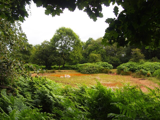
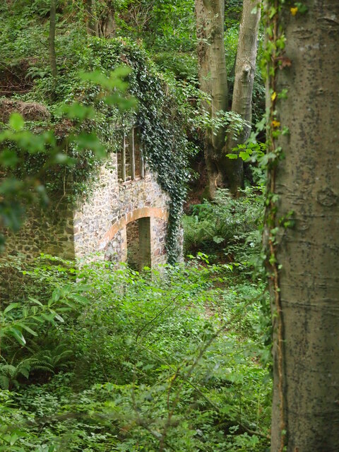
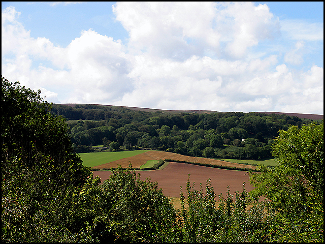
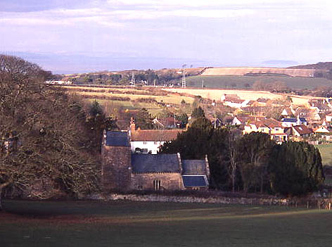
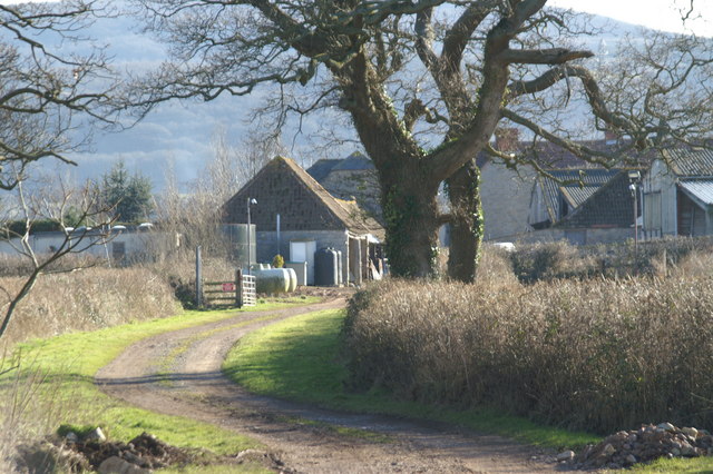
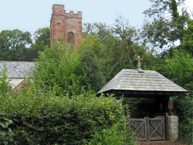
Alfoxton Wood is a picturesque woodland located in Somerset, England. Covering an area of approximately 80 acres, it is a part of the larger Quantock Hills Area of Outstanding Natural Beauty. The wood is situated near the village of Holford and is easily accessible by foot or car.

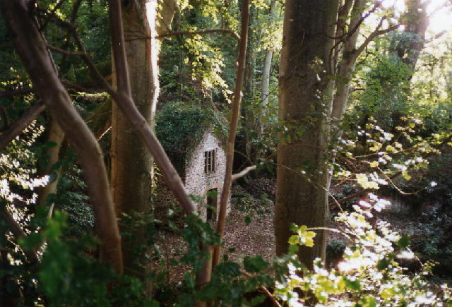
Alfoxton Wood is characterized by its diverse range of tree species, including oak, beech, ash, and birch. The woodland floor is adorned with a variety of wildflowers and ferns, creating a vibrant and enchanting atmosphere. The wood is also home to a rich array of wildlife, with deer, badgers, and numerous bird species frequently spotted by visitors.

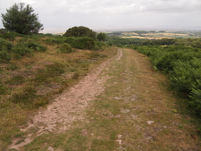
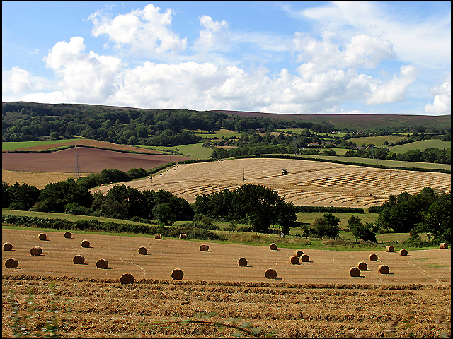
The wood offers a network of well-maintained footpaths, making it a popular destination for walkers and nature enthusiasts. There are several marked trails of varying lengths, allowing visitors to explore the wood at their own pace. Along the paths, visitors will come across several viewpoints that offer breathtaking vistas of the surrounding countryside.

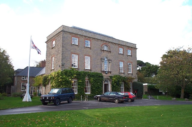
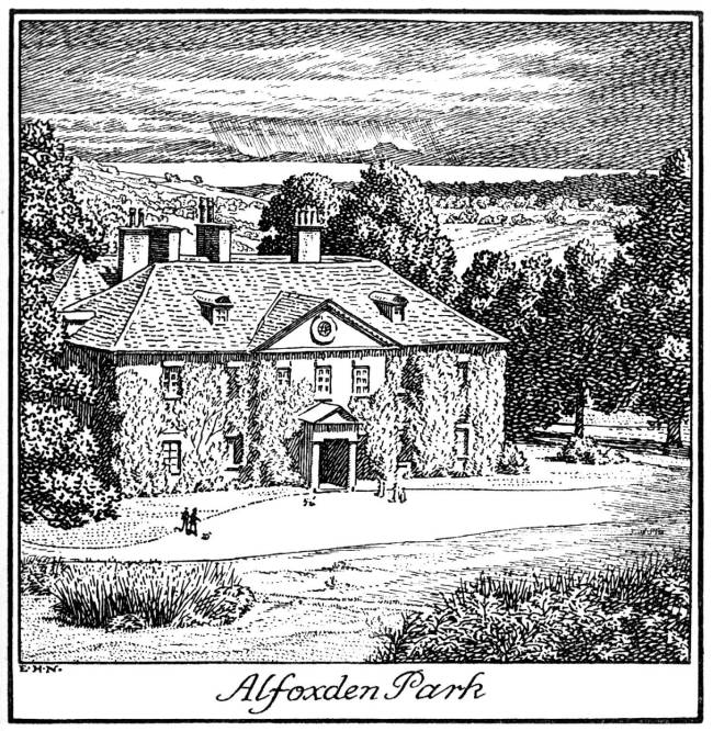
Alfoxton Wood holds historical significance as well. It is said to have inspired the famous poet William Wordsworth during his stay at Alfoxton House in the late 18th century. The wood's natural beauty and tranquil atmosphere are believed to have influenced Wordsworth's poetry, particularly his famous work, "Lines Written a Few Miles above Tintern Abbey."

Overall, Alfoxton Wood is a captivating destination for those seeking a peaceful retreat amidst nature. Its combination of stunning landscapes, diverse flora and fauna, and historical significance make it a must-visit location in Somerset.

If you have any feedback on the listing, please let us know in the comments section below.

Alfoxton Wood Images

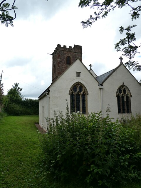
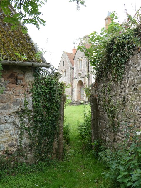
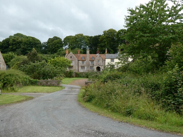
Images are sourced within 2km of 51.163947/-3.2113831 or Grid Reference ST1541. Thanks to Geograph Open Source API. All images are credited.

Telephone exchange east of Kilve
Pole by road to Stringston with overhead phone lines and  Road lined with dense hedges
Pole by road to Stringston with overhead phone lines and
Road lined with dense hedges
Dodington church In the care of: The Churches Conservation Trust <span class="nowrap"><a title="https://www.visitchurches.org.uk/visit/church-listing/all-saints-dodington.html" rel="nofollow ugc noopener" href="https://www.visitchurches.org.uk/visit/church-listing/all-saints-dodington.html">Link</a><img style="margin-left:2px;" alt="External link" title="External link - shift click to open in new window" src="https://s1.geograph.org.uk/img/external.png" width="10" height="10"/></span>
Dodington church
In the care of: The Churches Conservation Trust LinkExternal link
Tower of Dodington church
East end of Dodington church
Porch of Dodington Hall from churchyard
Dodington Hall Grade II* listed <span class="nowrap"><a title="https://en.wikipedia.org/wiki/Dodington_Hall" rel="nofollow ugc noopener" href="https://en.wikipedia.org/wiki/Dodington_Hall">Link</a><img style="margin-left:2px;" alt="External link" title="External link - shift click to open in new window" src="https://s1.geograph.org.uk/img/external.png" width="10" height="10"/></span>
Dodington Hall
Grade II* listed LinkExternal link
Pool Below Woodlands Hill
Remains of the Silk Mill, Holford Used as a backdrop in the Brian Adams video for 'Everything I do'.  Another location used was nearby at  Quantock's Head.
Remains of the Silk Mill, Holford
Used as a backdrop in the Brian Adams video for 'Everything I do'. Another location used was nearby at Quantock's Head.
Track on Lower Hare Knap
Higher Hill Roadsign Higher Hill roadsign, photographed from the junction of Higher Hill with Hilltop Lane near Kilve.
Higher Hill Roadsign
Higher Hill roadsign, photographed from the junction of Higher Hill with Hilltop Lane near Kilve.
Farmland Ge-Mare Farmland west of the A39 looking towards Crooked Copse from the A39. This farmland is situated in the centre of the lower half of the grid square.
Farmland
Ge-Mare Farmland west of the A39 looking towards Crooked Copse from the A39. This farmland is situated in the centre of the lower half of the grid square.
Crooked Copse Crooked Copse, in the centre of the picture, is found in the south eastern section of the square and includes some farmland.
Crooked Copse
Crooked Copse, in the centre of the picture, is found in the south eastern section of the square and includes some farmland.
Holford: remains of water-powered silk mill
Holford: waterwheel at Combe House Hotel The 26’ diameter overshot waterwheel was cast by Bridgwater ironfounder H Culverwell & Co in 1892 to replace an earlier wheel. It was used to grind oak bark for the tannery complex established here in the 1840s by James Hayman. When the tannery closed in 1900 the waterwheel was adapted to other uses such as grinding grain for grist, cutting chaff, chopping apples for the cider press and generating electricity. It also cracked stones in a nearby quarry. The gearing survives too. Combe House Hotel is open to non residents for lunches and teas
Holford: waterwheel at Combe House Hotel
The 26’ diameter overshot waterwheel was cast by Bridgwater ironfounder H Culverwell & Co in 1892 to replace an earlier wheel. It was used to grind oak bark for the tannery complex established here in the 1840s by James Hayman. When the tannery closed in 1900 the waterwheel was adapted to other uses such as grinding grain for grist, cutting chaff, chopping apples for the cider press and generating electricity. It also cracked stones in a nearby quarry. The gearing survives too. Combe House Hotel is open to non residents for lunches and teas
Kilve Court This residential education centre is owned by Somerset County Council
Kilve Court
This residential education centre is owned by Somerset County Council
Holford church and village, Bristol Channel in background Steepholm island visible in Bristol Channel
Holford church and village, Bristol Channel in background
Steepholm island visible in Bristol Channel
Show me another place!

Alfoxton Wood is located at Grid Ref: ST1541 (Lat: 51.163947, Lng: -3.2113831)

Administrative County: Somerset

District: Somerset West and Taunton

Police Authority: Avon and Somerset

What 3 Words

///flip.bookshop.unopposed. Near Nether Stowey, Somerset

Related Wikis

Nearby Amenities

Located within 500m of 51.163947,-3.2113831
Holford
Place: village
Population: 310
Wikidata: Q2543160
Wikipedia: en:Holford
Lat/Long: 51.1633379/-3.2087443
Post Box
Brand: Royal Mail
Brand Wikidata: Q638098
Brand Wikipedia: en:Royal Mail
Collection Times: Mo-Fr 09:00; Sa 07:00
Mapillary: 2662861227337539
Operator: Royal Mail
Operator Wikidata: Q638098
Post Box Mounting: pier
Post Box Type: lamp
Ref: TA5 178D
Royal Cypher: EIIR
Survey Date: 2020-07-31
Lat/Long: 51.161188/-3.2102511
Barrier: kissing_gate
Bicycle: yes
Foot: yes
Lat/Long: 51.1633013/-3.2077533
Telephone
Booth: KX100
Covered: booth
Man Made: telephone_box
Lat/Long: 51.1654262/-3.2060721
Post Box
Brand: Royal Mail
Brand Wikidata: Q638098
Brand Wikipedia: en:Royal Mail
Operator: Royal Mail
Operator Wikidata: Q638098
Post Box Type: lamp
Ref: TA5 190D
Royal Cypher: EIIR
Royal Cypher Wikidata: Q33102113
Lat/Long: 51.16545/-3.2060721
Defibrillator
Access: yes
Defibrillator Location: outside The Plough pub facing Williton Road
Emergency: defibrillator
Indoor: no
Lat/Long: 51.1651845/-3.2060586
Barrier: kissing_gate
Lat/Long: 51.1628451/-3.2069536
Barrier: stile
Lat/Long: 51.1625895/-3.2057011
Shelter
Shelter Type: public_transport
Lat/Long: 51.1647511/-3.2057276
Animal: dog
Historic: pound
Note: Maybe this was a kennel rather than a pound for dogs and someone got confused by the crest.
Wikimedia Commons: File:Ancient Dog Pound - geograph.org.uk - 4244367.jpg
Lat/Long: 51.1631169/-3.2132483
The data included in this document is from www.openstreetmap.org. The data is made available under ODbL.

Have you been to Alfoxton Wood?

Leave your review of Alfoxton Wood below (or comments, questions and feedback).