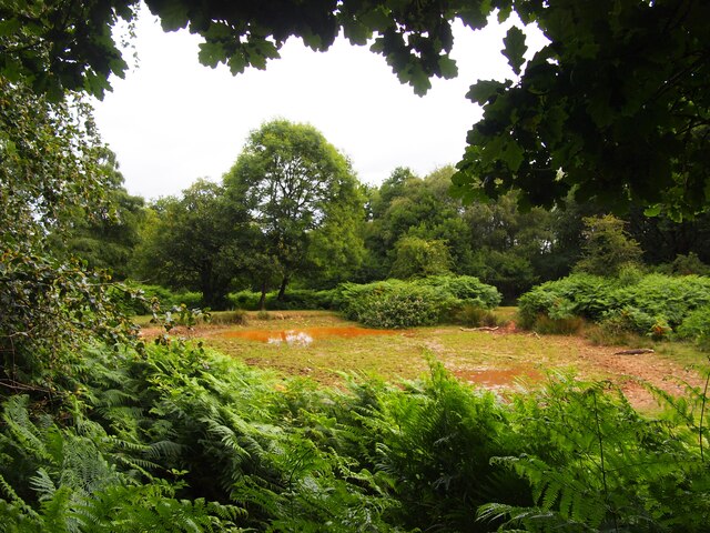
Withing Wood

Wood, Forest in Somerset Somerset West and Taunton

England

Withing Wood

Govett's Copse and Waltham's Copse, south of Kilton
Govett's Copse and Waltham's Copse, south of Kilton Credit: David Smith

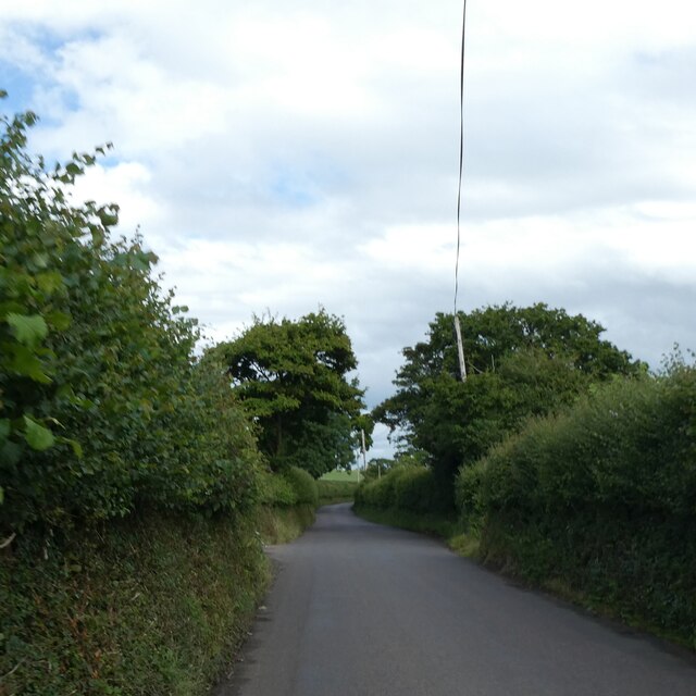
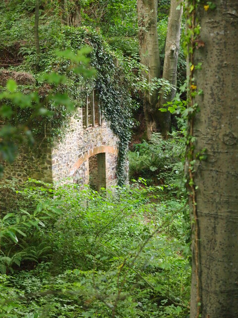
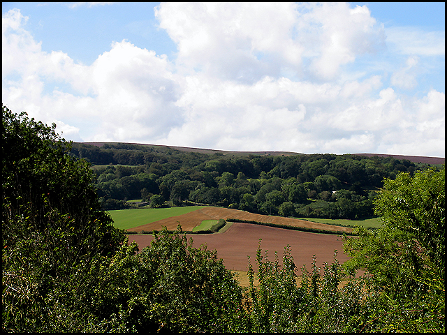
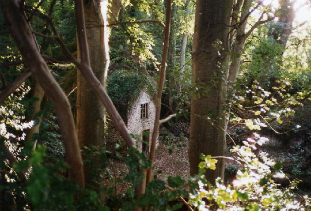
Withing Wood is a beautiful forest located in Somerset, England. Spread over a vast area, it is known for its dense foliage, towering trees, and serene atmosphere. The wood is situated near the village of Withing, and its natural beauty attracts visitors from far and wide.

The forest is home to a diverse range of flora and fauna, making it an ideal destination for nature lovers and wildlife enthusiasts. The canopy of the wood is dominated by majestic oak and beech trees, which provide shade and create a tranquil setting. The forest floor is adorned with a carpet of wildflowers, adding a splash of color to the surroundings.

Walking through Withing Wood, one can witness various species of birds chirping melodiously and squirrels scurrying up and down the trees. The forest is also inhabited by deer, foxes, and other woodland creatures, making it a haven for wildlife watchers.

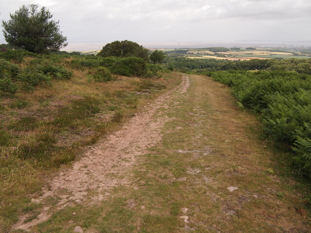
There are several well-maintained trails and paths that wind through the wood, offering visitors the opportunity to explore the area at their own pace. These trails provide a chance to immerse oneself in the natural beauty of the forest and discover hidden gems along the way, such as ancient trees and hidden ponds.

Withing Wood is not only a place of natural beauty but also holds historical significance. The wood has been mentioned in various historical documents dating back centuries, providing a glimpse into its rich past.

Overall, Withing Wood in Somerset is a captivating forest that offers a serene escape from the hustle and bustle of everyday life. It is a place where one can reconnect with nature, soak in the tranquility, and appreciate the wonders of the natural world.

If you have any feedback on the listing, please let us know in the comments section below.
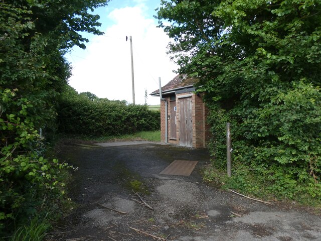
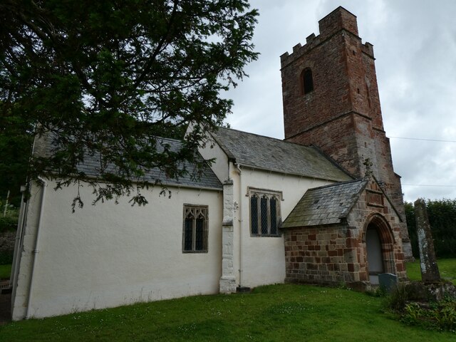
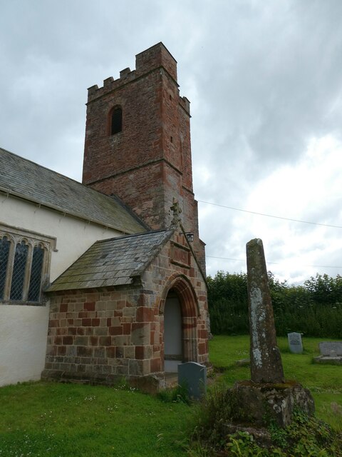
Withing Wood Images

Images are sourced within 2km of 51.165735/-3.2097566 or Grid Reference ST1541. Thanks to Geograph Open Source API. All images are credited.

Govett's Copse and Waltham's Copse, south of Kilton
Telephone exchange east of Kilve
Pole by road to Stringston with overhead phone lines and  Road lined with dense hedges
Pole by road to Stringston with overhead phone lines and
Road lined with dense hedges
Field on south-facing slope near Stringston
Dodington church In the care of: The Churches Conservation Trust <span class="nowrap"><a title="https://www.visitchurches.org.uk/visit/church-listing/all-saints-dodington.html" rel="nofollow ugc noopener" href="https://www.visitchurches.org.uk/visit/church-listing/all-saints-dodington.html">Link</a><img style="margin-left:2px;" alt="External link" title="External link - shift click to open in new window" src="https://s1.geograph.org.uk/img/external.png" width="10" height="10"/></span>
Dodington church
In the care of: The Churches Conservation Trust LinkExternal link
Tower of Dodington church
East end of Dodington church
Porch of Dodington Hall from churchyard
Dodington Hall Grade II* listed <span class="nowrap"><a title="https://en.wikipedia.org/wiki/Dodington_Hall" rel="nofollow ugc noopener" href="https://en.wikipedia.org/wiki/Dodington_Hall">Link</a><img style="margin-left:2px;" alt="External link" title="External link - shift click to open in new window" src="https://s1.geograph.org.uk/img/external.png" width="10" height="10"/></span>
Dodington Hall
Grade II* listed LinkExternal link
Pool Below Woodlands Hill
Remains of the Silk Mill, Holford Used as a backdrop in the Brian Adams video for 'Everything I do'.  Another location used was nearby at  Quantock's Head.
Remains of the Silk Mill, Holford
Used as a backdrop in the Brian Adams video for 'Everything I do'. Another location used was nearby at Quantock's Head.
Track on Lower Hare Knap
Higher Hill Roadsign Higher Hill roadsign, photographed from the junction of Higher Hill with Hilltop Lane near Kilve.
Higher Hill Roadsign
Higher Hill roadsign, photographed from the junction of Higher Hill with Hilltop Lane near Kilve.
Farmland Ge-Mare Farmland west of the A39 looking towards Crooked Copse from the A39. This farmland is situated in the centre of the lower half of the grid square.
Farmland
Ge-Mare Farmland west of the A39 looking towards Crooked Copse from the A39. This farmland is situated in the centre of the lower half of the grid square.
Crooked Copse Crooked Copse, in the centre of the picture, is found in the south eastern section of the square and includes some farmland.
Crooked Copse
Crooked Copse, in the centre of the picture, is found in the south eastern section of the square and includes some farmland.
Holford: remains of water-powered silk mill
Holford: waterwheel at Combe House Hotel The 26’ diameter overshot waterwheel was cast by Bridgwater ironfounder H Culverwell & Co in 1892 to replace an earlier wheel. It was used to grind oak bark for the tannery complex established here in the 1840s by James Hayman. When the tannery closed in 1900 the waterwheel was adapted to other uses such as grinding grain for grist, cutting chaff, chopping apples for the cider press and generating electricity. It also cracked stones in a nearby quarry. The gearing survives too. Combe House Hotel is open to non residents for lunches and teas
Holford: waterwheel at Combe House Hotel
The 26’ diameter overshot waterwheel was cast by Bridgwater ironfounder H Culverwell & Co in 1892 to replace an earlier wheel. It was used to grind oak bark for the tannery complex established here in the 1840s by James Hayman. When the tannery closed in 1900 the waterwheel was adapted to other uses such as grinding grain for grist, cutting chaff, chopping apples for the cider press and generating electricity. It also cracked stones in a nearby quarry. The gearing survives too. Combe House Hotel is open to non residents for lunches and teas
Kilve Court This residential education centre is owned by Somerset County Council
Kilve Court
This residential education centre is owned by Somerset County Council
Show me another place!

Withing Wood is located at Grid Ref: ST1541 (Lat: 51.165735, Lng: -3.2097566)

Administrative County: Somerset

District: Somerset West and Taunton

Police Authority: Avon and Somerset

What 3 Words

///shun.breathed.those. Near Nether Stowey, Somerset

Related Wikis

Holford

Holford is a village and civil parish in West Somerset within the Quantock Hills Area of Outstanding Natural Beauty. It is located about 10 miles (16 km...
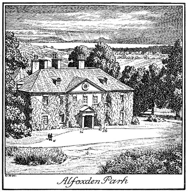
Alfoxton House

Alfoxton House, also known as Alfoxton Park or Alfoxden, is an 18th-century country house in Holford, Somerset, England, within the Quantock Hills Area...

Ge-mare Farm Fields

Ge-mare Farm Fields (grid reference ST155424) is a 4.1 hectare (10.3 acre) biological Site of Special Scientific Interest near Holford on the Quantock...

Kilve

Kilve is a village in the Somerset West and Taunton district of Somerset, England, within the Quantock Hills Area of Outstanding Natural Beauty, the first...

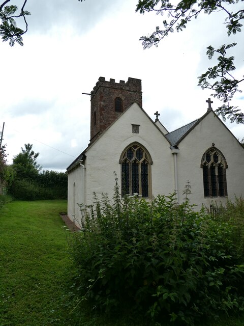
All Saints Church, Dodington

All Saints Church at Dodington in the parish of Holford, Somerset, England was rebuilt and enlarged in the 15th century. It has been designated by English...
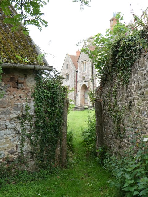
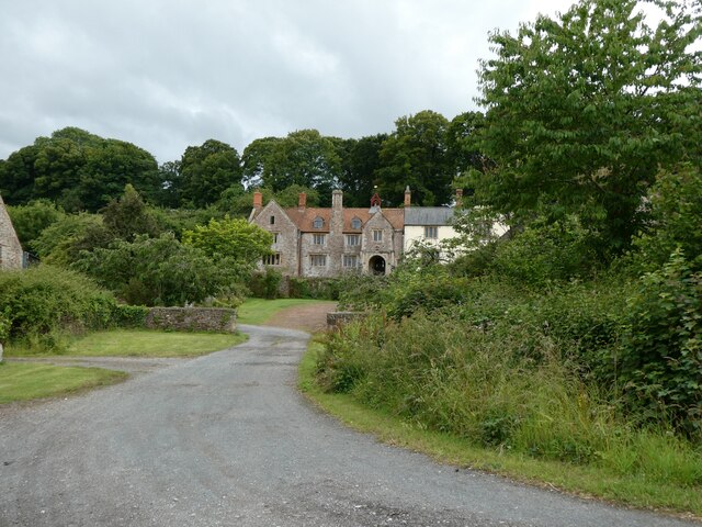
Dodington Hall

Dodington Hall in Dodington, within the English county of Somerset, was built in the 15th century. It is a Grade II* listed building.The house is built...

Dowsborough

Dowsborough Camp (or Danesborough or Dawesbury) is an Iron Age hill fort on the Quantock Hills near Nether Stowey in Somerset, England. It has been designated...

St Mary's Church, Stringston

The Anglican St Mary's Church at Stringston in the English county of Somerset dates from the 17th century. It has been designated as a Grade II listed...

Nearby Amenities

Located within 500m of 51.165735,-3.2097566
Holford
Place: village
Population: 310
Wikidata: Q2543160
Wikipedia: en:Holford
Lat/Long: 51.1633379/-3.2087443
Barrier: kissing_gate
Bicycle: yes
Foot: yes
Lat/Long: 51.1633013/-3.2077533
Telephone
Booth: KX100
Covered: booth
Man Made: telephone_box
Lat/Long: 51.1654262/-3.2060721
Post Box
Brand: Royal Mail
Brand Wikidata: Q638098
Brand Wikipedia: en:Royal Mail
Operator: Royal Mail
Operator Wikidata: Q638098
Post Box Type: lamp
Ref: TA5 190D
Royal Cypher: EIIR
Royal Cypher Wikidata: Q33102113
Lat/Long: 51.16545/-3.2060721
Defibrillator
Access: yes
Defibrillator Location: outside The Plough pub facing Williton Road
Emergency: defibrillator
Indoor: no
Lat/Long: 51.1651845/-3.2060586
Barrier: kissing_gate
Lat/Long: 51.1628451/-3.2069536
Barrier: stile
Lat/Long: 51.1625895/-3.2057011
Shelter
Shelter Type: public_transport
Lat/Long: 51.1647511/-3.2057276
Animal: dog
Historic: pound
Note: Maybe this was a kennel rather than a pound for dogs and someone got confused by the crest.
Wikimedia Commons: File:Ancient Dog Pound - geograph.org.uk - 4244367.jpg
Lat/Long: 51.1631169/-3.2132483
The data included in this document is from www.openstreetmap.org. The data is made available under ODbL.

Have you been to Withing Wood?

Leave your review of Withing Wood below (or comments, questions and feedback).