Allerpark Copse

Wood, Forest in Somerset Somerset West and Taunton

England

Allerpark Copse

Brushford: Knowle Farm
Brushford: Knowle Farm Credit: Martin Bodman

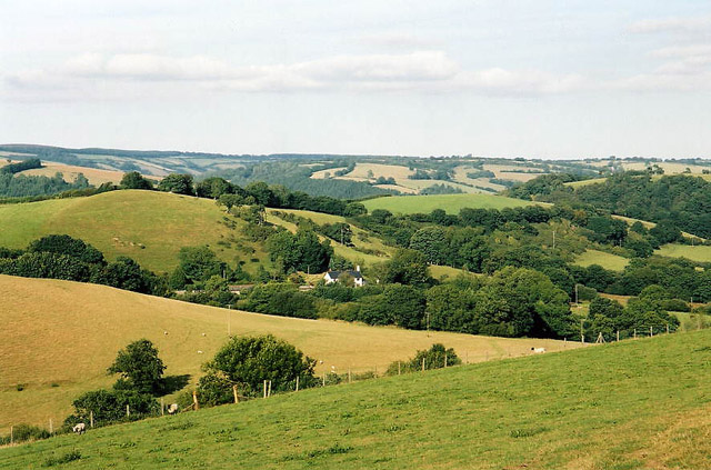
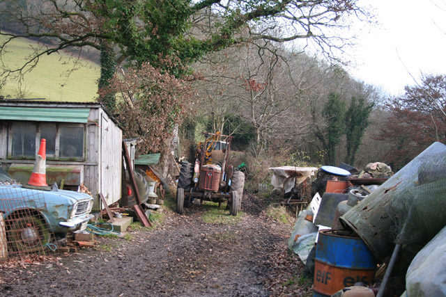
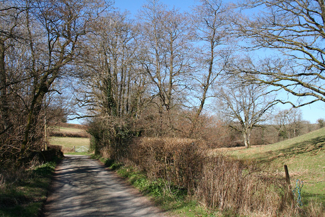
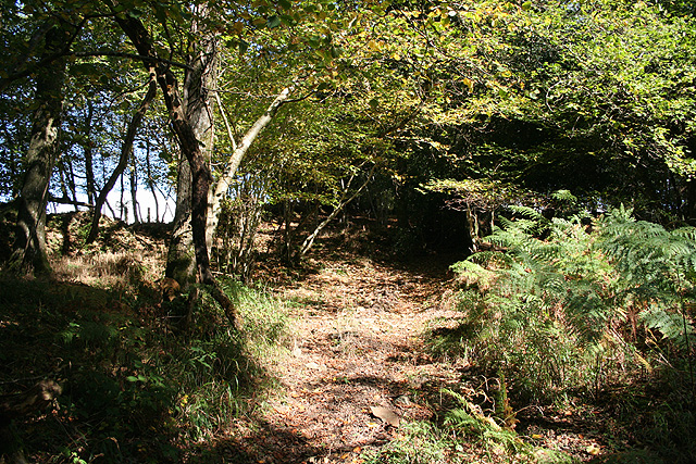
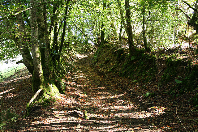
Allerpark Copse is a charming woodland area located in Somerset, England. Situated near the village of Allerford, this copse encompasses an area of approximately 12 acres. It is a significant part of the larger Exmoor National Park, known for its stunning landscapes and diverse ecosystems.

The copse is primarily composed of deciduous trees, including oak, ash, and beech, which create a dense canopy overhead, providing shelter and shade for the flora and fauna thriving beneath. The floor of the copse is adorned with an array of wildflowers, such as bluebells, primroses, and wood anemones, which add a burst of color to the woodland during springtime.

Home to a variety of wildlife, Allerpark Copse is a haven for nature enthusiasts. The trees provide nesting sites for numerous bird species, including woodpeckers, thrushes, and owls. Squirrels can often be spotted scampering through the branches, while rabbits and deer roam the forest floor. The copse is also home to a diverse range of insects, including butterflies, bees, and beetles, contributing to the overall biodiversity of the area.

Visitors to Allerpark Copse can enjoy a tranquil and peaceful environment, perfect for leisurely walks or picnics. The copse is interwoven with a network of footpaths, allowing visitors to explore and discover the natural beauty of the woodland. With its picturesque scenery and abundant wildlife, Allerpark Copse offers a serene and idyllic escape for those seeking solace in nature.

If you have any feedback on the listing, please let us know in the comments section below.

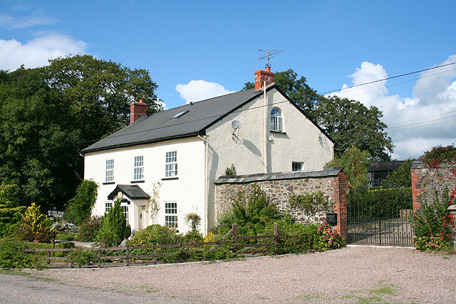
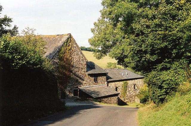
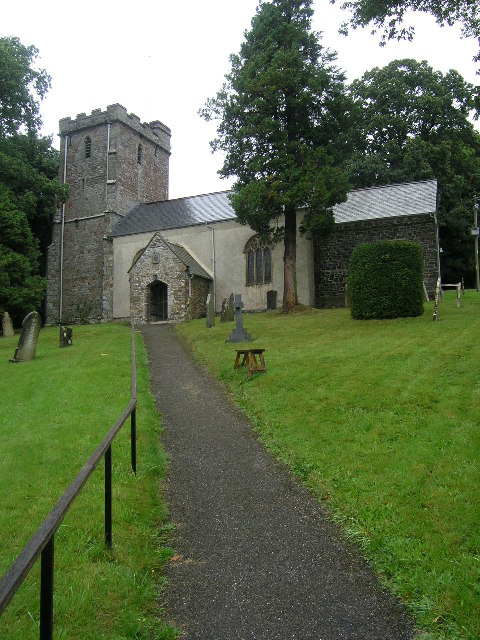
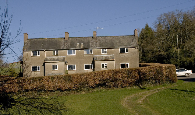
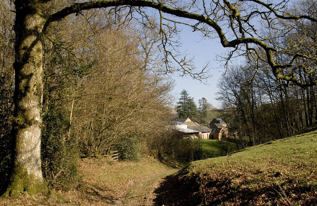
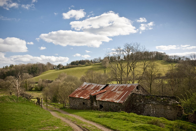
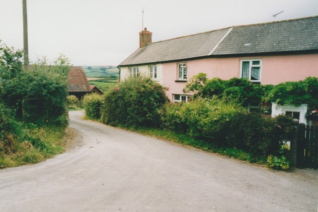
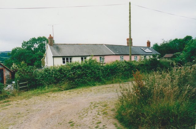
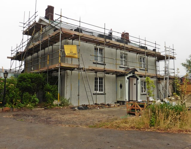
Allerpark Copse Images

Images are sourced within 2km of 51.01244/-3.5621774 or Grid Reference SS9024. Thanks to Geograph Open Source API. All images are credited.

Brushford: Knowle Farm
Brushford: between Nightcott and Upcott Looking south from the Brushford – Nightcott lane
Brushford: between Nightcott and Upcott
Looking south from the Brushford – Nightcott lane
Oakford: Red Deer House Previously Red Deer Farm, it stands by the old Bampton – South Molton turnpike, now the B3227, and offers bed and breakfast. Looking north-north-west
Oakford: Red Deer House
Previously Red Deer Farm, it stands by the old Bampton – South Molton turnpike, now the B3227, and offers bed and breakfast. Looking north-north-west
Brushford: by Trackford Moor On the access road to Lower Sowerhill. Looking south west
Brushford: by Trackford Moor
On the access road to Lower Sowerhill. Looking south west
Brushford: Rocks Farm Seen from the Oldways End-Exebridge Road. The outbuilding by the road once contained a waterwheel which powered farm machinery. The remains of a dry millpond exist to the right of this shot
Brushford: Rocks Farm
Seen from the Oldways End-Exebridge Road. The outbuilding by the road once contained a waterwheel which powered farm machinery. The remains of a dry millpond exist to the right of this shot
Brushford: Higher Upcott and Upcott Farm Seen from the Oldways End-Exebridge Road. Higher Upcott is the building to the left
Brushford: Higher Upcott and Upcott Farm
Seen from the Oldways End-Exebridge Road. Higher Upcott is the building to the left
Brushford:  Croft and Croft Knap Seen from the Oldways End-Exebridge Road
Brushford: Croft and Croft Knap
Seen from the Oldways End-Exebridge Road
BRUSHFORD, Somerset The church of St Nicholas
BRUSHFORD, Somerset
The church of St Nicholas
Brushford: yard by bridleway Near Hulverton Hill, looking south on a track from, Brushford to Brocks Bridge. Christmas Day 2005
Brushford: yard by bridleway
Near Hulverton Hill, looking south on a track from, Brushford to Brocks Bridge. Christmas Day 2005
Brushford: lane to Nightcott Looking west near a bridge over the Brockley River
Brushford: lane to Nightcott
Looking west near a bridge over the Brockley River
Oakford: Lower Highleigh Wood Public bridleway leading to Great Highleigh and the Exe valley. Looking north east near the edge of the wood
Oakford: Lower Highleigh Wood
Public bridleway leading to Great Highleigh and the Exe valley. Looking north east near the edge of the wood
Oakford: old track On the edge of East Tapps Wood, looking south east. The track, a public bridleway, links Hele Manor and Great Highleigh with East Loosemoor and Hutswell
Oakford: old track
On the edge of East Tapps Wood, looking south east. The track, a public bridleway, links Hele Manor and Great Highleigh with East Loosemoor and Hutswell
Farm cottages, Combe These utilitarian buildings are all that can be seen of the isolated community from the public path, apart from some sheds.  The path once went closer to the farmhouse but has now been diverted to the left of the beech hedge.
Farm cottages, Combe
These utilitarian buildings are all that can be seen of the isolated community from the public path, apart from some sheds. The path once went closer to the farmhouse but has now been diverted to the left of the beech hedge.
Combe Farm. After a muddy start at the end of Three Gates Lane the path improves and develops into this track.
Combe Farm.
After a muddy start at the end of Three Gates Lane the path improves and develops into this track.
Old Building What appears to be a derelict outbuilding  you pass as you walk on the signed public footpath around Hulverton Hill near Brushford
Old Building
What appears to be a derelict outbuilding you pass as you walk on the signed public footpath around Hulverton Hill near Brushford
West Knowle Cottages in West Knowle.
West Knowle
Cottages in West Knowle.
West Knowle Cottages in West Knowle.
West Knowle
Cottages in West Knowle.
Red Deer Farm
Red Deer Farm
Show me another place!

Allerpark Copse is located at Grid Ref: SS9024 (Lat: 51.01244, Lng: -3.5621774)

Administrative County: Somerset

District: Somerset West and Taunton

Police Authority: Avon and Somerset

What 3 Words

///steams.cluttered.confined. Near Dulverton, Somerset

Related Wikis

Briggins Moor

Briggins Moor is a 15.3 hectare biological Site of Special Scientific Interest in Somerset, notified in 1994. The site is south of Dulverton and close...

Combe, Dulverton

Combe is a historic estate in Somerset, England, situated between the town of Dulverton and the village of Brushford. == Descent == === Taunton Priory... ===

Brushford, Somerset

Brushford is a village and civil parish 2 miles (3.2 km) south of Dulverton and 12 miles (19 km) north of Tiverton in Devon, in the Somerset West and Taunton...

River Barle

The River Barle runs from the Chains on northern Exmoor, in Somerset, England to join the River Exe at Exebridge, Devon. The river and the Barle Valley...

Exebridge

Exebridge is a village that lies on the border between Devon and Somerset, England. It lies at the confluence of the Barle and Exe rivers. Exebridge is...

Barle Bridge

Barle Bridge is a five span stone arch bridge over the River Barle in Dulverton within the English county of Somerset, which is medieval in origin. It...

Dulverton Town Hall

Dulverton Town Hall is a municipal building in Fore Street in Dulverton, Somerset, England. The building, which is the meeting place of Dulverton Town...

Oakfordbridge

Oakfordbridge is a village in Devon, England. == References == The geographic coordinates are from the Ordnance Survey. == External links == Media related...

Nearby Amenities

Located within 500m of 51.01244,-3.5621774
Power: pole
Lat/Long: 51.0142761/-3.5673273
Power: pole
Lat/Long: 51.0142359/-3.5652925
Power: pole
Lat/Long: 51.0141934/-3.5635722
Power: pole
Lat/Long: 51.0141563/-3.5614747
Power: pole
Lat/Long: 51.0141294/-3.5595327
Power: pole
Lat/Long: 51.0140797/-3.557466
Power: pole
Lat/Long: 51.0140533/-3.5561022
Power: pole
Source: bing
Lat/Long: 51.0142632/-3.5661267
Power: pole
Source: bing
Lat/Long: 51.0122081/-3.5613091
Power: pole
Source: bing
Lat/Long: 51.0098845/-3.563726
Power: pole
Source: bing
Lat/Long: 51.0113238/-3.5615939
Power: pole
Source: bing
Lat/Long: 51.0109112/-3.5621219
Power: pole
Source: bing
Lat/Long: 51.0104928/-3.5626469
Power: pole
Source: bing
Lat/Long: 51.0103301/-3.5629332
Power: pole
Source: bing
Transformer: distribution
Lat/Long: 51.0097044/-3.5640616
Power: pole
Source: bing
Transformer: distribution
Lat/Long: 51.0146177/-3.5662891
Power: pole
Source: bing
Lat/Long: 51.0135572/-3.5659273
Power: pole
Source: bing
Lat/Long: 51.0132337/-3.5645573
Power: pole
Source: bing
Transformer: distribution
Lat/Long: 51.0140221/-3.5618002
Power: pole
Source: bing
Lat/Long: 51.0135282/-3.5613738
Power: pole
Source: bing
Lat/Long: 51.0131911/-3.5636521
Power: pole
Source: bing
Lat/Long: 51.0131282/-3.5622266
Power: pole
Source: bing
Lat/Long: 51.013072/-3.5610012
Power: pole
Source: bing
Lat/Long: 51.0129228/-3.5595573
Power: pole
Source: bing
Lat/Long: 51.0127475/-3.5579363
Power: pole
Source: bing
Lat/Long: 51.0125906/-3.5565015
Power: pole
Source: bing
Lat/Long: 51.0124521/-3.555173
The data included in this document is from www.openstreetmap.org. The data is made available under ODbL.

Have you been to Allerpark Copse?

Leave your review of Allerpark Copse below (or comments, questions and feedback).