Langridge Wood

Wood, Forest in Devon Mid Devon

England

Langridge Wood

Bampton : Oakfordbridge - Highleigh Mill A bridge across to Highleigh Mill, but it doesn't look passable today due to the River Exe. Debris is also forming on the bridge.
Bampton : Oakfordbridge - Highleigh Mill Credit: Lewis Clarke

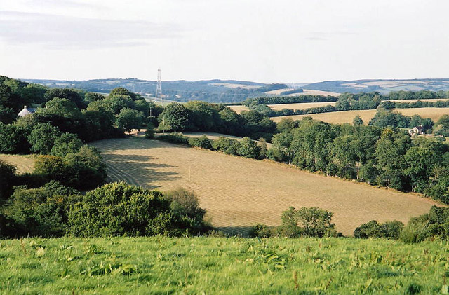
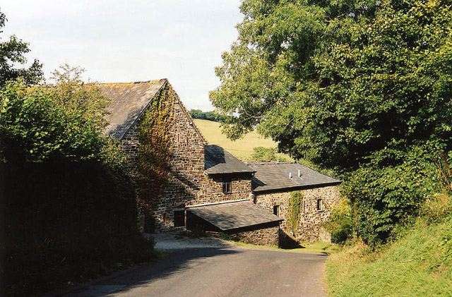
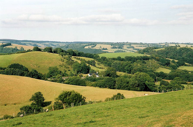
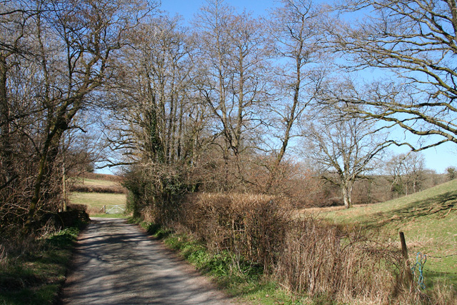
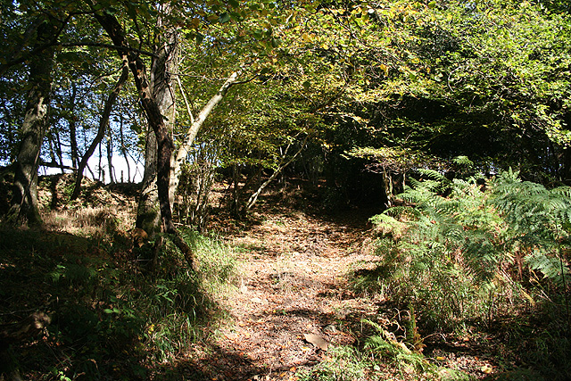
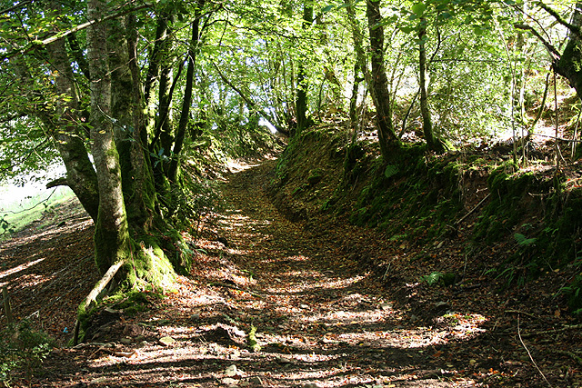
Langridge Wood is a picturesque woodland located in the county of Devon, England. Covering an area of approximately 100 acres, it is situated near the village of Langridge, offering visitors a tranquil and immersive experience in nature. The wood is primarily composed of broadleaf trees, including oak, beech, and ash, which create a dense canopy and provide a haven for a variety of wildlife.

The wood is intersected by a network of well-maintained footpaths, allowing visitors to explore its diverse terrain. A stroll through Langridge Wood reveals a rich tapestry of flora, with bluebells carpeting the forest floor in spring and vibrant autumnal colors painting the landscape in the fall. The wood is also home to several species of birds, such as woodpeckers and owls, making it a popular spot for birdwatching enthusiasts.

Langridge Wood is managed by a local conservation group, who work diligently to preserve its natural beauty and protect its ecosystem. The wood provides an important habitat for many native species, including small mammals like squirrels and hedgehogs, as well as a variety of insects and fungi.

Visitors to Langridge Wood can enjoy a range of activities, including walking, picnicking, and photography. The peaceful atmosphere and stunning scenery make it an ideal location for those seeking solace in nature or looking to reconnect with the great outdoors. With its accessibility and abundant natural wonders, Langridge Wood is a beloved destination for both locals and tourists alike.

If you have any feedback on the listing, please let us know in the comments section below.

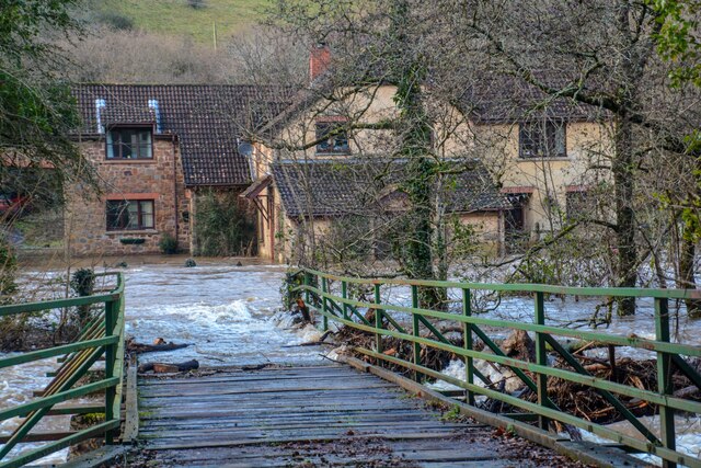
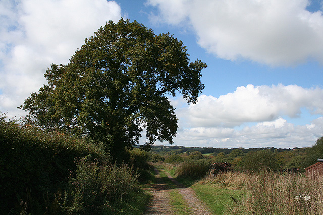
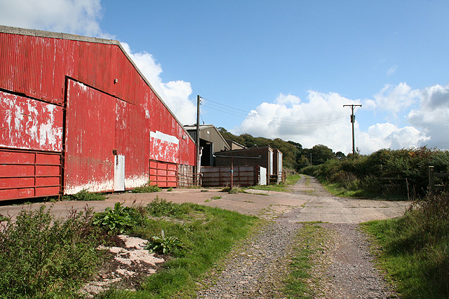
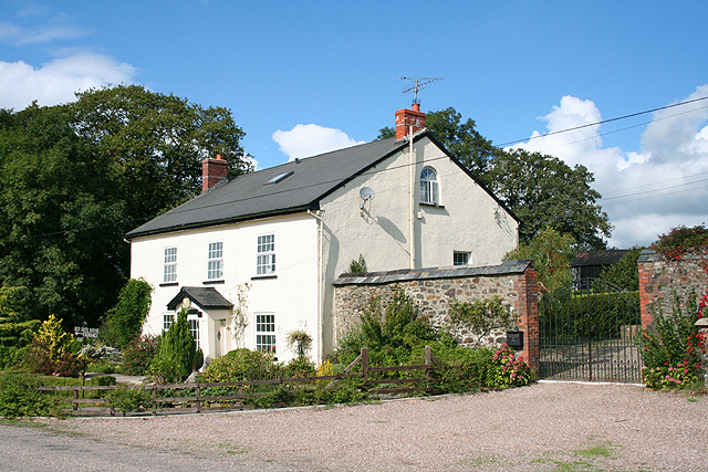
Langridge Wood Images

Images are sourced within 2km of 51.005024/-3.5599184 or Grid Reference SS9024. Thanks to Geograph Open Source API. All images are credited.

Bampton : Oakfordbridge - Highleigh Mill A bridge across to Highleigh Mill, but it doesn't look passable today due to the River Exe. Debris is also forming on the bridge.
Bampton : Oakfordbridge - Highleigh Mill
A bridge across to Highleigh Mill, but it doesn't look passable today due to the River Exe. Debris is also forming on the bridge.
Bampton : Oakfordbridge - A396 Looking along the A396 where water has flooded the road.
Bampton : Oakfordbridge - A396
Looking along the A396 where water has flooded the road.
Brushford: between Nightcott and Upcott Looking south from the Brushford – Nightcott lane
Brushford: between Nightcott and Upcott
Looking south from the Brushford – Nightcott lane
Oakford: near Ford Farm On a public footpath towards East Mildon. Looking west-north-west. It should be noted, perhaps, that the present day Ford Farm has been built near High Bolham and is not at the place shown on the 1940s Ordnance Survey map. The old building was being converted to a private house recently. The old farm had a remote barn which contained a water-powered threshing machine. By 2003 the waterwheel had gone but the course of the leat was still apparent
Oakford: near Ford Farm
On a public footpath towards East Mildon. Looking west-north-west. It should be noted, perhaps, that the present day Ford Farm has been built near High Bolham and is not at the place shown on the 1940s Ordnance Survey map. The old building was being converted to a private house recently. The old farm had a remote barn which contained a water-powered threshing machine. By 2003 the waterwheel had gone but the course of the leat was still apparent
Oakford: Ford Farm Barns by a track from Combe Water to High Bolham. Looking east-south-east
Oakford: Ford Farm
Barns by a track from Combe Water to High Bolham. Looking east-south-east
Oakford: Red Deer House Previously Red Deer Farm, it stands by the old Bampton – South Molton turnpike, now the B3227, and offers bed and breakfast. Looking north-north-west
Oakford: Red Deer House
Previously Red Deer Farm, it stands by the old Bampton – South Molton turnpike, now the B3227, and offers bed and breakfast. Looking north-north-west
Brushford: by Trackford Moor On the access road to Lower Sowerhill. Looking south west
Brushford: by Trackford Moor
On the access road to Lower Sowerhill. Looking south west
Oakford: towards East Tapps Farmland and woodland, seen from the lane near Hutswell. Evening light. Bentley, the historian of Oakford, writing in the early 1980s, noted that a sluice gate and a millpond survived at East Tapps: the farm clearly used water power in the 19th century. In the 18th or earlier centuries a windmill seems to have existed on the estate. Fields here were known as ‘Windmill’ and ‘Outer Windmill’ in 1839.
Oakford: towards East Tapps
Farmland and woodland, seen from the lane near Hutswell. Evening light. Bentley, the historian of Oakford, writing in the early 1980s, noted that a sluice gate and a millpond survived at East Tapps: the farm clearly used water power in the 19th century. In the 18th or earlier centuries a windmill seems to have existed on the estate. Fields here were known as ‘Windmill’ and ‘Outer Windmill’ in 1839.
Brushford: Rocks Farm Seen from the Oldways End-Exebridge Road. The outbuilding by the road once contained a waterwheel which powered farm machinery. The remains of a dry millpond exist to the right of this shot
Brushford: Rocks Farm
Seen from the Oldways End-Exebridge Road. The outbuilding by the road once contained a waterwheel which powered farm machinery. The remains of a dry millpond exist to the right of this shot
Brushford: Higher Upcott and Upcott Farm Seen from the Oldways End-Exebridge Road. Higher Upcott is the building to the left
Brushford: Higher Upcott and Upcott Farm
Seen from the Oldways End-Exebridge Road. Higher Upcott is the building to the left
Brushford:  Croft and Croft Knap Seen from the Oldways End-Exebridge Road
Brushford: Croft and Croft Knap
Seen from the Oldways End-Exebridge Road
Brushford: yard by bridleway Near Hulverton Hill, looking south on a track from, Brushford to Brocks Bridge. Christmas Day 2005
Brushford: yard by bridleway
Near Hulverton Hill, looking south on a track from, Brushford to Brocks Bridge. Christmas Day 2005
Gate and track Gate and track that leads from the A396 towards the hill top. This track is shown on older (1974) OS maps but not modern ones (getamap from OS).
Gate and track
Gate and track that leads from the A396 towards the hill top. This track is shown on older (1974) OS maps but not modern ones (getamap from OS).
Brushford: lane to Nightcott Looking west near a bridge over the Brockley River
Brushford: lane to Nightcott
Looking west near a bridge over the Brockley River
Oakford: Lower Highleigh Wood Public bridleway leading to Great Highleigh and the Exe valley. Looking north east near the edge of the wood
Oakford: Lower Highleigh Wood
Public bridleway leading to Great Highleigh and the Exe valley. Looking north east near the edge of the wood
Oakford: old track On the edge of East Tapps Wood, looking south east. The track, a public bridleway, links Hele Manor and Great Highleigh with East Loosemoor and Hutswell
Oakford: old track
On the edge of East Tapps Wood, looking south east. The track, a public bridleway, links Hele Manor and Great Highleigh with East Loosemoor and Hutswell
Old Building What appears to be a derelict outbuilding  you pass as you walk on the signed public footpath around Hulverton Hill near Brushford
Old Building
What appears to be a derelict outbuilding you pass as you walk on the signed public footpath around Hulverton Hill near Brushford
Turning for Westlake Farm
Show me another place!

Langridge Wood is located at Grid Ref: SS9024 (Lat: 51.005024, Lng: -3.5599184)

Administrative County: Devon

District: Mid Devon

Police Authority: Devon and Cornwall

What 3 Words

///ballooned.running.restrict. Near Dulverton, Somerset

Related Wikis

Briggins Moor

Briggins Moor is a 15.3 hectare biological Site of Special Scientific Interest in Somerset, notified in 1994. The site is south of Dulverton and close...

River Barle

The River Barle runs from the Chains on northern Exmoor, in Somerset, England to join the River Exe at Exebridge, Devon. The river and the Barle Valley...

Brushford, Somerset

Brushford is a village and civil parish 2 miles (3.2 km) south of Dulverton and 12 miles (19 km) north of Tiverton in Devon, in the Somerset West and Taunton...

Oakfordbridge

Oakfordbridge is a village in Devon, England. == References == The geographic coordinates are from the Ordnance Survey. == External links == Media related...

Oakford, Devon

Oakford is a village and civil parish in the Mid Devon district of Devon, England. It is located three miles (5 km) south west of Bampton and eight miles...

Combe, Dulverton

Combe is a historic estate in Somerset, England, situated between the town of Dulverton and the village of Brushford. == Descent == === Taunton Priory... ===

Exebridge

Exebridge is a village that lies on the border between Devon and Somerset, England. It lies at the confluence of the Barle and Exe rivers. Exebridge is...

Barle Bridge

Barle Bridge is a five span stone arch bridge over the River Barle in Dulverton within the English county of Somerset, which is medieval in origin. It...

Nearby Amenities

Located within 500m of 51.005024,-3.5599184
Power: tower
Lat/Long: 51.0072257/-3.5645064
Power: tower
Lat/Long: 51.0072738/-3.5591849
Power: tower
Lat/Long: 51.0050055/-3.5544213
The data included in this document is from www.openstreetmap.org. The data is made available under ODbL.

Have you been to Langridge Wood?

Leave your review of Langridge Wood below (or comments, questions and feedback).