Covert Plantation

Wood, Forest in Roxburghshire

Scotland

Covert Plantation

Barley field below the Eildon Hills, Melrose A field on The Annay beside the Tweed with Eildon Hill North (L) and Mid Hill (R). The houses are on the eastern fringe of Melrose.
Barley field below the Eildon Hills, Melrose Credit: Jim Barton

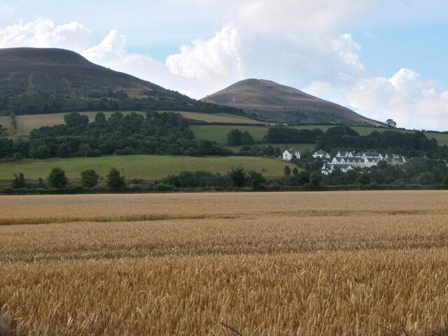
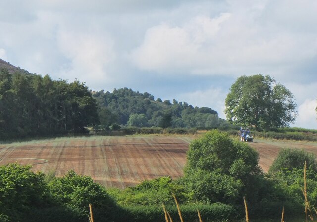
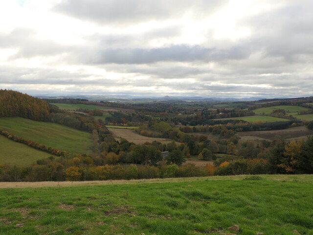
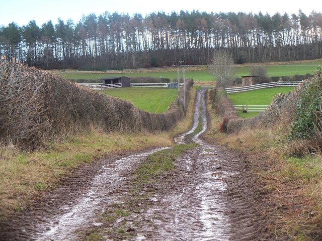
Covert Plantation is a picturesque woodland located in the heart of Roxburghshire, Scotland. With its verdant landscape and diverse flora, it is a haven for nature lovers and outdoor enthusiasts alike. Covering an expansive area of approximately 500 acres, this enchanting forest offers a serene and tranquil atmosphere, perfect for escaping the hustle and bustle of everyday life.

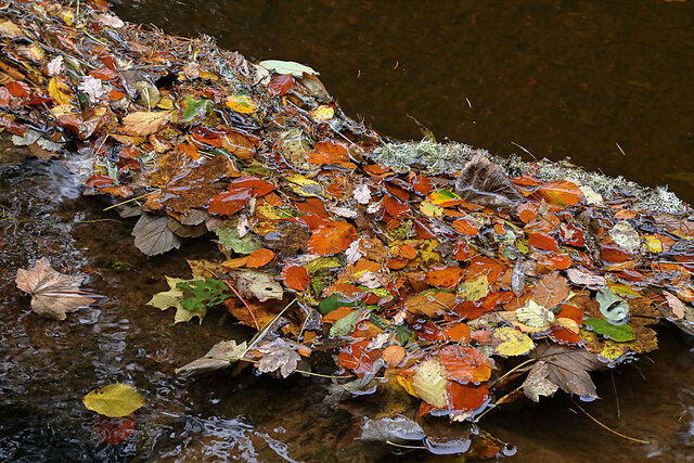
The plantation is primarily composed of native tree species, including oak, ash, beech, and birch, which create a stunning canopy overhead. The tall and majestic trees provide shade during the summer months and a riot of colors in autumn, making it an ideal destination for photographers and artists seeking inspiration.

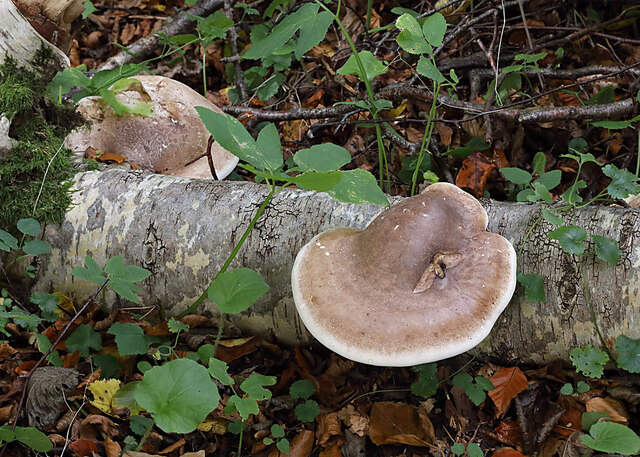
Covert Plantation is also home to a wide variety of wildlife. Visitors can spot numerous bird species, such as the elusive woodpeckers and charming songbirds. The forest floor teems with small mammals like squirrels and rabbits, while the occasional sighting of deer adds to the area's natural charm.

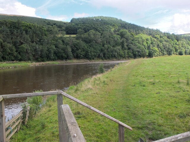
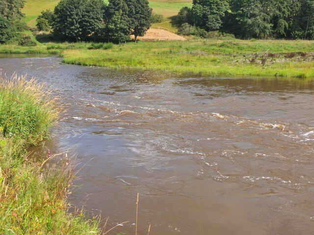
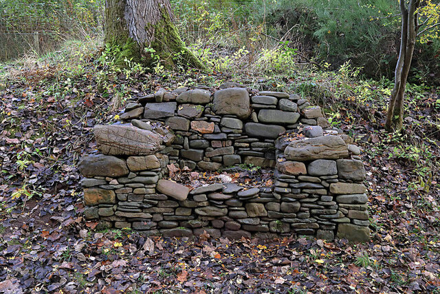
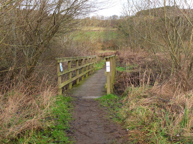
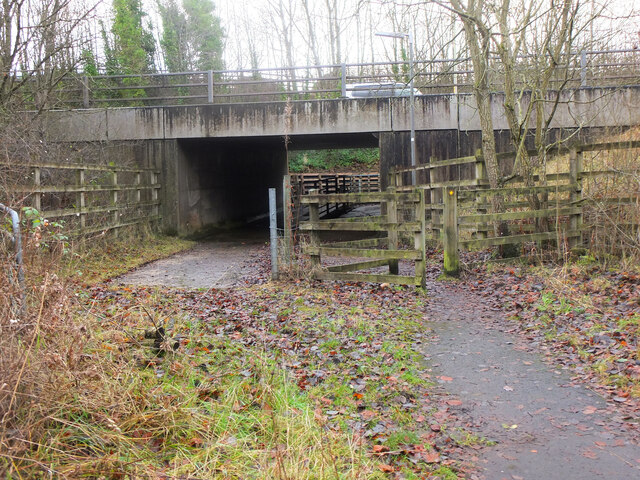
For those seeking outdoor activities, Covert Plantation offers several well-maintained trails that wind through the woodland, providing opportunities for hiking, jogging, and cycling. The trails cater to all levels of fitness, from leisurely strolls to more challenging routes. Along the paths, visitors can enjoy breathtaking views of the surrounding countryside and might even stumble upon hidden streams and ponds.

Covert Plantation is easily accessible, with ample parking facilities and picnic areas available for visitors. Whether one chooses to explore the forest's hidden gems or simply immerse oneself in the tranquility of nature, a visit to Covert Plantation promises an unforgettable experience for all.

If you have any feedback on the listing, please let us know in the comments section below.

Covert Plantation Images

Images are sourced within 2km of 55.609563/-2.6999972 or Grid Reference NT5635. Thanks to Geograph Open Source API. All images are credited.

Barley field below the Eildon Hills, Melrose A field on The Annay beside the Tweed with Eildon Hill North (L) and Mid Hill (R). The houses are on the eastern fringe of Melrose.
Barley field below the Eildon Hills, Melrose
A field on The Annay beside the Tweed with Eildon Hill North (L) and Mid Hill (R). The houses are on the eastern fringe of Melrose.
The Tweed east of Melrose The Tweed seen from an elevated stile on the riverside path to Newstead.
The Tweed east of Melrose
The Tweed seen from an elevated stile on the riverside path to Newstead.
Yesterday's rain, River Tweed Very heavy showers yesterday have increased the flow and coloured the water with suspended mud, here in a narrowing of the river near Newstead.
Yesterday's rain, River Tweed
Very heavy showers yesterday have increased the flow and coloured the water with suspended mud, here in a narrowing of the river near Newstead.
Main Street, Newstead A village close to the Trimontium Roman site east of Melrose.
Main Street, Newstead
A village close to the Trimontium Roman site east of Melrose.
Tractor laying a pipe The tractor was reversing around the field, unreeling a hosepipe from a drum held at the front, a skilled piece of driving. Presumably the pipe is for irrigation.
Tractor laying a pipe
The tractor was reversing around the field, unreeling a hosepipe from a drum held at the front, a skilled piece of driving. Presumably the pipe is for irrigation.
Melrose Abbey Pig playing a bagpipe, as a gargoyle, viewed under a flying buttress.
Melrose Abbey
Pig playing a bagpipe, as a gargoyle, viewed under a flying buttress.
Derelict weir on River Tweed A lade, just to the left of the image, carried water to the abbey some 500 m to the east.
Derelict weir on River Tweed
A lade, just to the left of the image, carried water to the abbey some 500 m to the east.
Melrose, Gattonside Suspension Footbridge Tolls had to be paid to cross the new bridge over the River Tweed, which joined the communities of Melrose and Gattonside. Constructed in 1826, it is a footbridge with iron-link suspension chains, iron rods as vertical suspenders and a wooden deck.
Melrose, Gattonside Suspension Footbridge
Tolls had to be paid to cross the new bridge over the River Tweed, which joined the communities of Melrose and Gattonside. Constructed in 1826, it is a footbridge with iron-link suspension chains, iron rods as vertical suspenders and a wooden deck.
Main Street, Newstead A bus is having difficulty negotiating the narrow road!
Main Street, Newstead
A bus is having difficulty negotiating the narrow road!
Bridge over Leader Water The river is soon to join the River Tweed.
Bridge over Leader Water
The river is soon to join the River Tweed.
Birch polypore fungus (Fomitopsis betulinus) These common bracket fungi were on a fallen birch tree by the Leader Water.
Birch polypore fungus (Fomitopsis betulinus)
These common bracket fungi were on a fallen birch tree by the Leader Water.
A stone bench seat by the Leader Water For a view of the stone seat taken in March 2013, see <a href="https://www.geograph.org.uk/photo/3374614">NT5735 : A drystane bench seat by the Leader Water</a>.
A stone bench seat by the Leader Water
For a view of the stone seat taken in March 2013, see NT5735 : A drystane bench seat by the Leader Water.
Autumn leaves on the Leader Water The leaves have been snagged up on a fallen tree trunk in the river.
Autumn leaves on the Leader Water
The leaves have been snagged up on a fallen tree trunk in the river.
View down Lauderdale From White Hill.
View down Lauderdale
From White Hill.
Footbridge near The Eddy A footbridge on the riverside path between Melrose and Newstead.
Footbridge near The Eddy
A footbridge on the riverside path between Melrose and Newstead.
Safe passage below the Melrose By-Pass An underpass with separate routes for pedestrians and livestock under the busy A6091 near Newstead.
Safe passage below the Melrose By-Pass
An underpass with separate routes for pedestrians and livestock under the busy A6091 near Newstead.
Track from Newstead A track joining the old road near the Rhymer's Stone and on the route of the Borders Abbeys Way.
Track from Newstead
A track joining the old road near the Rhymer's Stone and on the route of the Borders Abbeys Way.
A narrow path in Melrose The path connects High Road with Priorswalk.
A narrow path in Melrose
The path connects High Road with Priorswalk.
Show me another place!

Covert Plantation is located at Grid Ref: NT5635 (Lat: 55.609563, Lng: -2.6999972)

Unitary Authority: The Scottish Borders

Police Authority: The Lothians and Scottish Borders

What 3 Words

///double.sprayer.irrigated. Near Melrose, Scottish Borders

Related Wikis

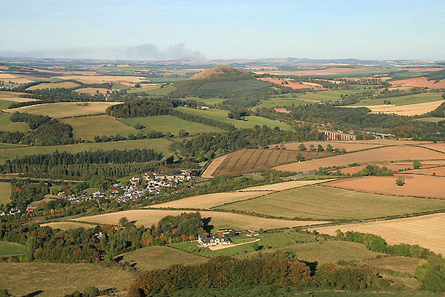
Trimontium (Newstead)

Trimontium was a Roman fort complex in Scotland. It is located at Newstead, near Melrose, in the Scottish Borders, in view of the three Eildon Hills which...
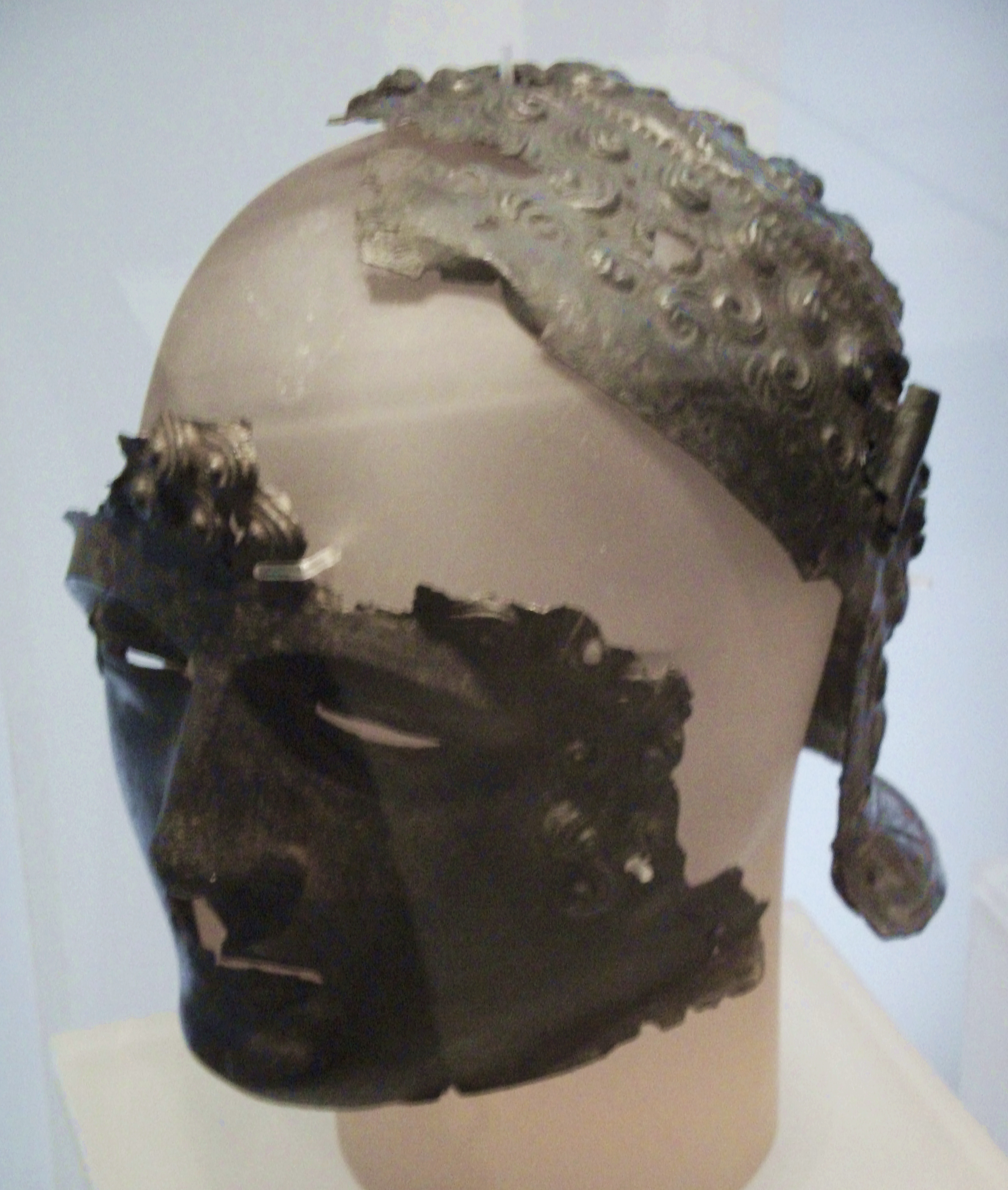
Newstead Helmet

The Newstead Helmet is an iron Roman cavalry helmet dating to 80–100 AD that was discovered at the site of a Roman fort in Newstead, near Melrose in Roxburghshire...

Newstead railway station (Scotland)

Newstead railway station or Bradshaw railway station, as it was referred to in early editions of the timetable, served the village of Newstead, Melrose...

Newstead, Scottish Borders

Newstead is a village in the Scottish Borders, about 1+1⁄4 miles (2 kilometres) east of Melrose. It has a population of approximately 260, according to...

Leaderfoot Viaduct

The Leaderfoot Viaduct, also known as the Drygrange Viaduct, is a railway viaduct over the River Tweed near Melrose in the Scottish Borders. == History... ==

Melrose Abbey

St Mary's Abbey, Melrose is a partly ruined monastery of the Cistercian order in Melrose, Roxburghshire, in the Scottish Borders. It was founded in 1136...

Drygrange Old Bridge

The Drygrange Old Bridge is a disused road bridge over the River Tweed near Melrose in the Scottish Borders. == History == It was built between 1776 and...

Gattonside

Gattonside is a small village in the Scottish Borders. It is located 1 kilometre (0.62 mi) north of Melrose, on the north side of the River Tweed. In 1143...

Nearby Amenities

Located within 500m of 55.609563,-2.6999972
Ele: 243
Natural: peak
Lat/Long: 55.6118108/-2.7042494
Kittyfield
Place: hamlet
Lat/Long: 55.6084577/-2.6965645
Power: pole
Lat/Long: 55.6120345/-2.7061278
Power: pole
Lat/Long: 55.6116534/-2.7031435
Power: pole
Lat/Long: 55.6114708/-2.7017653
Power: pole
Lat/Long: 55.6112811/-2.7003884
Power: pole
Lat/Long: 55.6110701/-2.6990013
Power: pole
Lat/Long: 55.610866/-2.6976397
Power: pole
Lat/Long: 55.610728/-2.6967464
Power: pole
Lat/Long: 55.6103471/-2.6943031
Power: pole
Lat/Long: 55.6101171/-2.6927888
Power: pole
Lat/Long: 55.6104756/-2.6951276
Power: pole
Lat/Long: 55.609831/-2.6955604
Power: pole
Lat/Long: 55.6089095/-2.6950666
Power: pole
Lat/Long: 55.6078989/-2.6945296
Power: pole
Lat/Long: 55.6072477/-2.6941708
The data included in this document is from www.openstreetmap.org. The data is made available under ODbL.

Have you been to Covert Plantation?

Leave your review of Covert Plantation below (or comments, questions and feedback).