Hill Plantation

Wood, Forest in Roxburghshire

Scotland

Hill Plantation

Barley field below the Eildon Hills, Melrose A field on The Annay beside the Tweed with Eildon Hill North (L) and Mid Hill (R). The houses are on the eastern fringe of Melrose.
Barley field below the Eildon Hills, Melrose Credit: Jim Barton

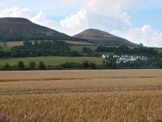
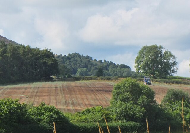
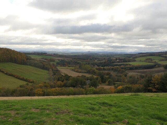
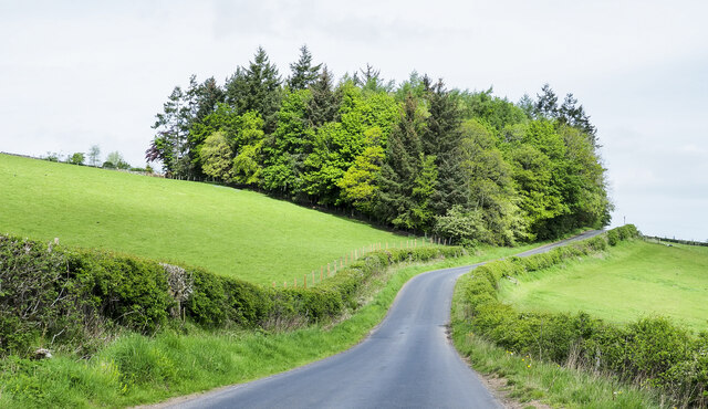
Hill Plantation, located in Roxburghshire, is a sprawling woodland area that spans over acres of picturesque landscape. Situated in the Scottish Borders, this plantation is renowned for its diverse range of trees and its rich history.

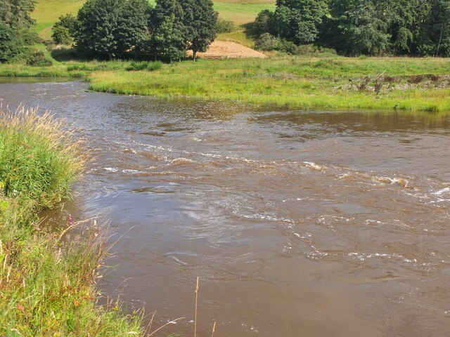
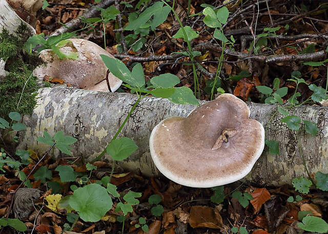
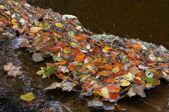
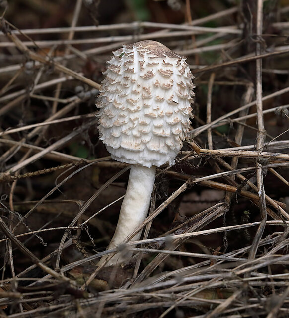
The plantation is primarily composed of native species such as oak, beech, and birch, which provide a stunning display of colors during autumn. Additionally, coniferous trees like pine and spruce can be found, creating a perfect habitat for various species of birds and mammals.

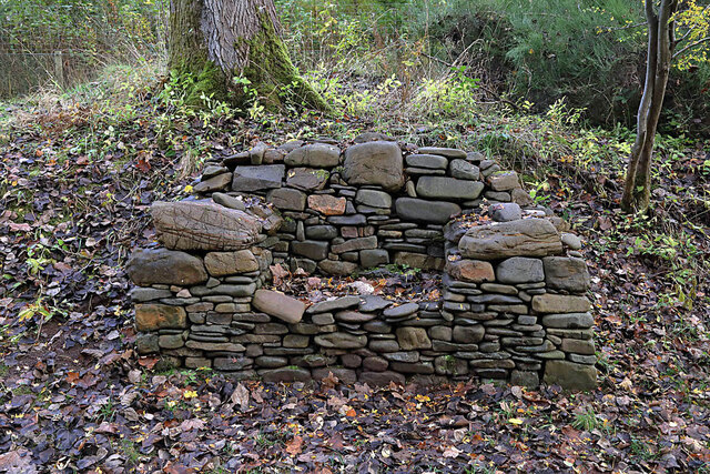
Hill Plantation has a long and fascinating history. It was originally part of a larger estate and was used for timber production during the 18th and 19th centuries. The remnants of old sawmills and timber yards can still be seen within the plantation, adding to its charm and historical significance.

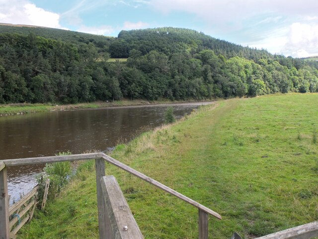
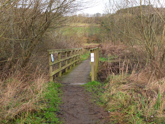
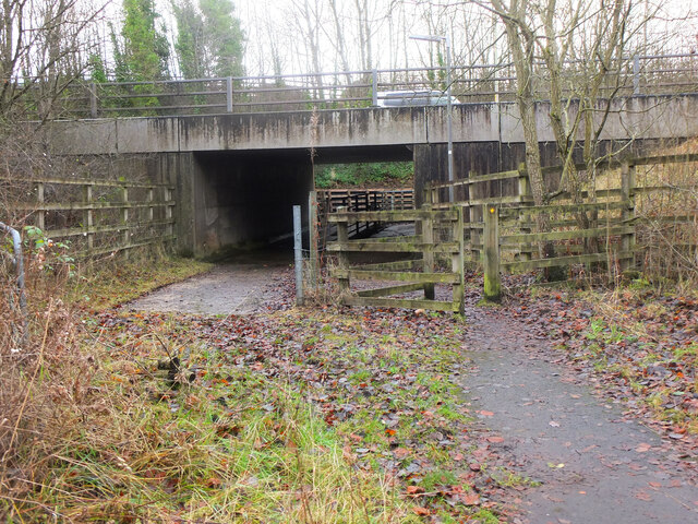
Today, the plantation serves as a popular destination for nature enthusiasts and outdoor enthusiasts alike. It offers a wide range of activities, from hiking and walking trails to birdwatching and wildlife spotting. The well-maintained paths provide easy access for visitors to explore the woodland and enjoy its beauty.

The plantation is also home to a variety of wildlife, including red squirrels, roe deer, and a plethora of bird species. The tranquil atmosphere and the abundance of flora and fauna make Hill Plantation a haven for nature lovers.

In conclusion, Hill Plantation in Roxburghshire is a stunning woodland area that offers a glimpse into Scotland's natural beauty and rich history. With its diverse range of trees, well-maintained trails, and abundant wildlife, it is an ideal destination for outdoor activities and nature appreciation.

If you have any feedback on the listing, please let us know in the comments section below.

Hill Plantation Images

Images are sourced within 2km of 55.614159/-2.694459 or Grid Reference NT5635. Thanks to Geograph Open Source API. All images are credited.

Barley field below the Eildon Hills, Melrose A field on The Annay beside the Tweed with Eildon Hill North (L) and Mid Hill (R). The houses are on the eastern fringe of Melrose.
Barley field below the Eildon Hills, Melrose
A field on The Annay beside the Tweed with Eildon Hill North (L) and Mid Hill (R). The houses are on the eastern fringe of Melrose.
The Tweed east of Melrose The Tweed seen from an elevated stile on the riverside path to Newstead.
The Tweed east of Melrose
The Tweed seen from an elevated stile on the riverside path to Newstead.
Yesterday's rain, River Tweed Very heavy showers yesterday have increased the flow and coloured the water with suspended mud, here in a narrowing of the river near Newstead.
Yesterday's rain, River Tweed
Very heavy showers yesterday have increased the flow and coloured the water with suspended mud, here in a narrowing of the river near Newstead.
Main Street, Newstead A village close to the Trimontium Roman site east of Melrose.
Main Street, Newstead
A village close to the Trimontium Roman site east of Melrose.
Tractor laying a pipe The tractor was reversing around the field, unreeling a hosepipe from a drum held at the front, a skilled piece of driving. Presumably the pipe is for irrigation.
Tractor laying a pipe
The tractor was reversing around the field, unreeling a hosepipe from a drum held at the front, a skilled piece of driving. Presumably the pipe is for irrigation.
Main Street, Newstead A bus is having difficulty negotiating the narrow road!
Main Street, Newstead
A bus is having difficulty negotiating the narrow road!
Bridge over Leader Water The river is soon to join the River Tweed.
Bridge over Leader Water
The river is soon to join the River Tweed.
Stubble field with cylindrical straw bales Eildon Hill North in the background.
Stubble field with cylindrical straw bales
Eildon Hill North in the background.
Birch polypore fungus (Fomitopsis betulinus) These common bracket fungi were on a fallen birch tree by the Leader Water.
Birch polypore fungus (Fomitopsis betulinus)
These common bracket fungi were on a fallen birch tree by the Leader Water.
A stone bench seat by the Leader Water For a view of the stone seat taken in March 2013, see <a href="https://www.geograph.org.uk/photo/3374614">NT5735 : A drystane bench seat by the Leader Water</a>.
A stone bench seat by the Leader Water
For a view of the stone seat taken in March 2013, see NT5735 : A drystane bench seat by the Leader Water.
Autumn leaves on the Leader Water The leaves have been snagged up on a fallen tree trunk in the river.
Autumn leaves on the Leader Water
The leaves have been snagged up on a fallen tree trunk in the river.
A shaggy parasol mushroom (Chlorophyllum rhacodes) This emerging mushroom was photographed in a coniferous wood near Redpath.
A shaggy parasol mushroom (Chlorophyllum rhacodes)
This emerging mushroom was photographed in a coniferous wood near Redpath.
View down Lauderdale From White Hill.
View down Lauderdale
From White Hill.
Footbridge near The Eddy A footbridge on the riverside path between Melrose and Newstead.
Footbridge near The Eddy
A footbridge on the riverside path between Melrose and Newstead.
Safe passage below the Melrose By-Pass An underpass with separate routes for pedestrians and livestock under the busy A6091 near Newstead.
Safe passage below the Melrose By-Pass
An underpass with separate routes for pedestrians and livestock under the busy A6091 near Newstead.
Leaderfoot Viaduct and the River Tweed This is surely one of the most elegant viaducts in the UK?  The slenderness of the pillars, combined with their tapering heights make this a beautiful structure.
Leaderfoot Viaduct and the River Tweed
This is surely one of the most elegant viaducts in the UK? The slenderness of the pillars, combined with their tapering heights make this a beautiful structure.
Leaderfoot Viaduct and the River Tweed This is surely one of the most elegant viaducts in the UK? The slenderness of the pillars, combined with their tapering heights make this a beautiful structure.
Leaderfoot Viaduct and the River Tweed
This is surely one of the most elegant viaducts in the UK? The slenderness of the pillars, combined with their tapering heights make this a beautiful structure.
Trees beside Anniesfield House The road passing the trees is above the A68 close to Earlston.
Trees beside Anniesfield House
The road passing the trees is above the A68 close to Earlston.
Show me another place!

Hill Plantation is located at Grid Ref: NT5635 (Lat: 55.614159, Lng: -2.694459)

Unitary Authority: The Scottish Borders

Police Authority: The Lothians and Scottish Borders

What 3 Words

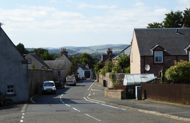
///confined.amazed.crusaders. Near Melrose, Scottish Borders

Related Wikis

St Andrew's College, Drygrange

St Andrew's College, Drygrange, located near Melrose, Scotland, was a Roman Catholic seminary founded in 1953 and closed in 1986. == History == === Foundation... ===
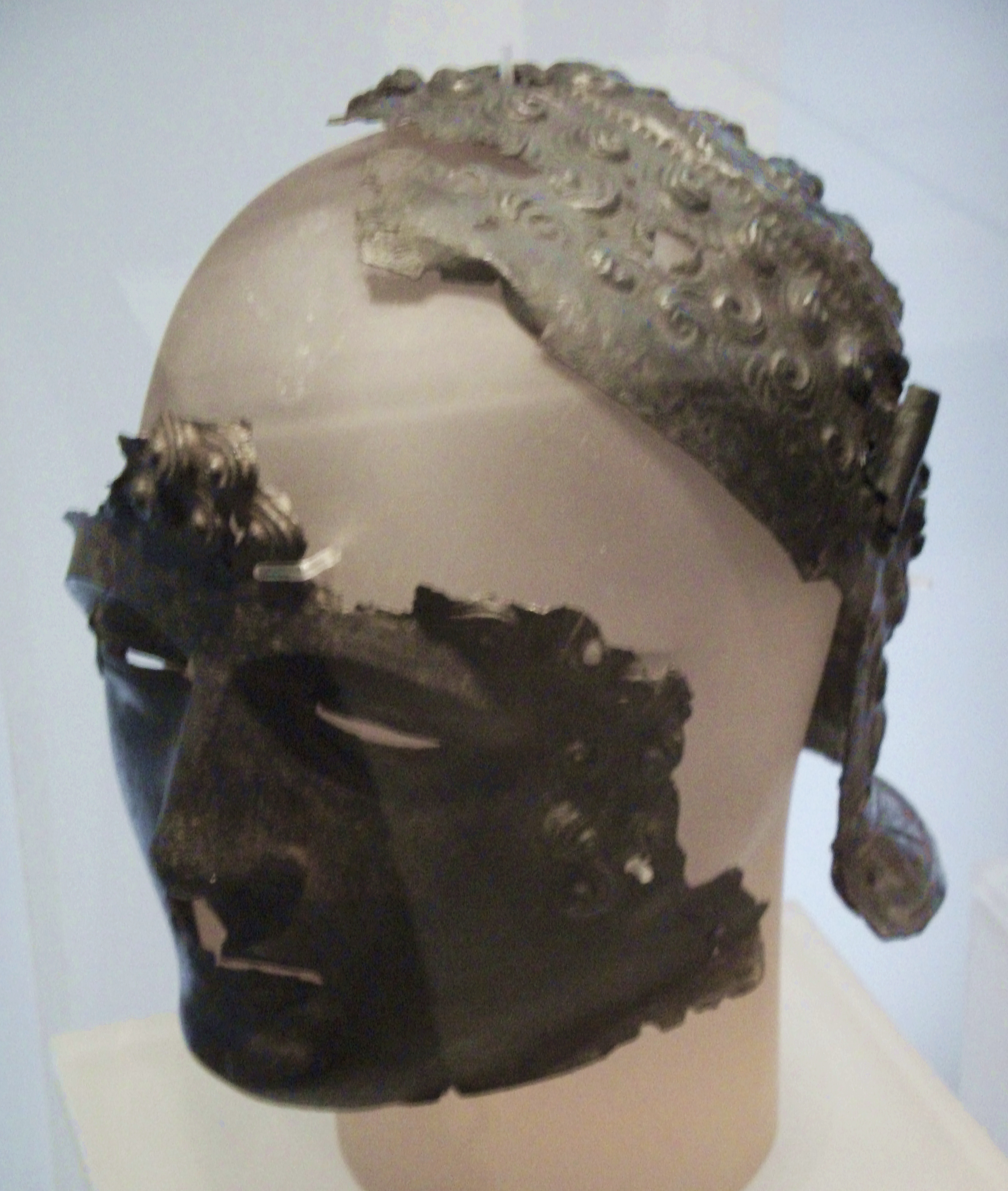
Newstead Helmet

The Newstead Helmet is an iron Roman cavalry helmet dating to 80–100 AD that was discovered at the site of a Roman fort in Newstead, near Melrose in Roxburghshire...
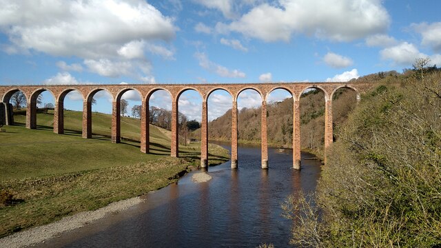
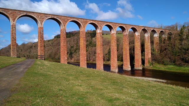
Leaderfoot Viaduct

The Leaderfoot Viaduct, also known as the Drygrange Viaduct, is a railway viaduct over the River Tweed near Melrose in the Scottish Borders. == History... ==

Trimontium (Newstead)

Trimontium was a Roman fort complex located at Newstead, near Melrose, in the Scottish Borders, in view of the three Eildon Hills which probably gave its...

Nearby Amenities

Located within 500m of 55.614159,-2.694459
Power: tower
Lat/Long: 55.6172794/-2.6889339
Power: tower
Lat/Long: 55.6175416/-2.6915886
Power: tower
Lat/Long: 55.6178006/-2.694211
Power: tower
Lat/Long: 55.6180393/-2.6966283
Power: pole
Lat/Long: 55.6112811/-2.7003884
Power: pole
Lat/Long: 55.6110701/-2.6990013
Power: pole
Lat/Long: 55.610866/-2.6976397
Power: pole
Lat/Long: 55.610728/-2.6967464
Power: pole
Lat/Long: 55.6103471/-2.6943031
Power: pole
Lat/Long: 55.6101171/-2.6927888
Power: pole
Lat/Long: 55.6104756/-2.6951276
Power: pole
Lat/Long: 55.609831/-2.6955604
The data included in this document is from www.openstreetmap.org. The data is made available under ODbL.

Have you been to Hill Plantation?

Leave your review of Hill Plantation below (or comments, questions and feedback).