Chadderton Fold

Settlement in Lancashire

England

Chadderton Fold

Tandle Hill Country Park
Tandle Hill Country Park Credit: Peter McDermott

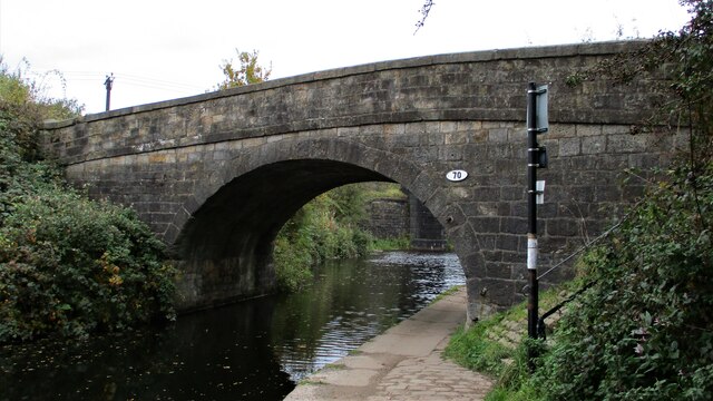
Chadderton Fold is a small village located in the metropolitan borough of Oldham, within the county of Lancashire, in the north-west of England. Situated approximately 6 miles northeast of Manchester city center, it is known for its picturesque countryside and historic charm.

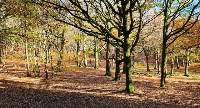
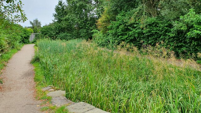
The village is surrounded by green fields, providing a tranquil setting for its residents. Chadderton Fold has a population of around 1,500 people, with a mix of young families and older generations. The community is tight-knit, with a friendly and welcoming atmosphere.

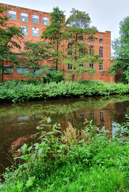
One of the notable features of Chadderton Fold is its rich history. The village dates back to the medieval period, and several old buildings and landmarks still stand, including the 17th-century Fold Chapel, which is now a Grade II listed building. The chapel is a popular tourist attraction and holds regular services for the local community.

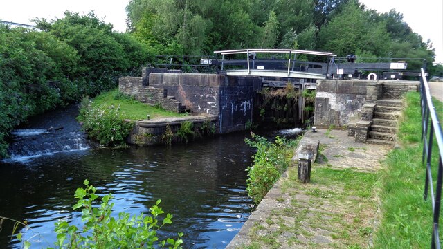
Chadderton Fold also offers various amenities for its residents. There is a local primary school, a convenience store, and a pub that serves as a gathering place for locals. For recreational activities, residents can enjoy the nearby Chadderton Hall Park, which features beautiful gardens, a lake, and walking paths.

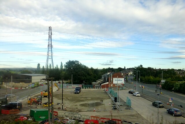
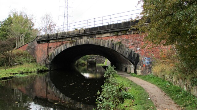
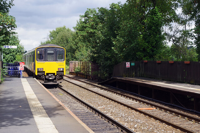
Transport links in Chadderton Fold are convenient, with regular bus services connecting the village to the nearby towns and cities. The M60 motorway is also easily accessible, providing quick access to Manchester and other major cities in the region.

In summary, Chadderton Fold is a charming village in Lancashire that offers a peaceful and scenic environment for its residents. With its rich history, friendly community, and convenient amenities, it is a desirable place to live for those seeking a rural lifestyle within close proximity to urban areas.

If you have any feedback on the listing, please let us know in the comments section below.

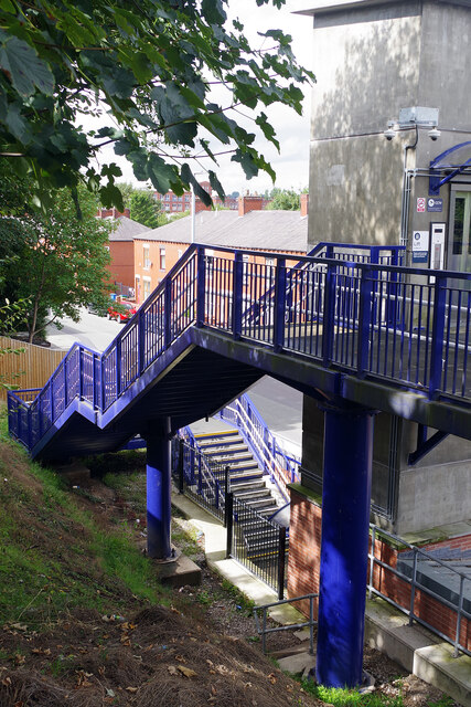
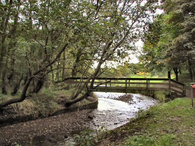
Chadderton Fold Images

Images are sourced within 2km of 53.556607/-2.156749 or Grid Reference SD8906. Thanks to Geograph Open Source API. All images are credited.

Tandle Hill Country Park
Cinder Hill Lane Approaching Head o' th' Heys on this high edged lane used by the Oldham Way trail
Cinder Hill Lane
Approaching Head o' th' Heys on this high edged lane used by the Oldham Way trail
Church of St Matthew
Works on Faulkenhurst Street Early OS maps show a Sunday School at this location and this works looks to have incorporated such a building
Works on Faulkenhurst Street
Early OS maps show a Sunday School at this location and this works looks to have incorporated such a building
Former Police Station In Victoria Street, very close to the other civic buildings of Chadderton, the Town Hall and the library
Former Police Station
In Victoria Street, very close to the other civic buildings of Chadderton, the Town Hall and the library
Chadderton Town Hall With the war memorial in front
Chadderton Town Hall
With the war memorial in front
Malta Mill Old cotton mill alongside the Rochdale Canal.
Malta Mill
Old cotton mill alongside the Rochdale Canal.
Disused Canal Branch Branch off the Rochdale Canal leading to Ferney Field Colliery.
Disused Canal Branch
Branch off the Rochdale Canal leading to Ferney Field Colliery.
Locks on the Rochdale Canal Limefield farmhouse seen on the left of view
Locks on the Rochdale Canal
Limefield farmhouse seen on the left of view
Middleton Road View from railway bridge at Mills Hill Station
Middleton Road
View from railway bridge at Mills Hill Station
Railway Overbridge, Slattocks Crossing the Rochdale Canal, with lock No.58 beyond. The bridge carries No.68b
Railway Overbridge, Slattocks
Crossing the Rochdale Canal, with lock No.58 beyond. The bridge carries No.68b
Scowcroft Lane Bridge Over the Rochdale Canal and carrying the No.70
Scowcroft Lane Bridge
Over the Rochdale Canal and carrying the No.70
River Irk View from the towpath on the Rochdale Canal Aqueduct
River Irk
View from the towpath on the Rochdale Canal Aqueduct
Rochdale Canal Lock No.64 Kay Lane lock
Rochdale Canal Lock No.64
Kay Lane lock
Old Railway Trackbed Now a cycleway and path off Ferney Field Road
Old Railway Trackbed
Now a cycleway and path off Ferney Field Road
Major Earth Remediation Works View from the old railway trackbed to Middleton Junction
Major Earth Remediation Works
View from the old railway trackbed to Middleton Junction
Mills Hill Station A class 150 unit operated by Northern departs Mills Hill near the end of its Clitheroe to Rochdale journey. Although a station did briefly exist on this site in the 19th century, the modern facility dates only from 1985.
Mills Hill Station
A class 150 unit operated by Northern departs Mills Hill near the end of its Clitheroe to Rochdale journey. Although a station did briefly exist on this site in the 19th century, the modern facility dates only from 1985.
Steps at Mills Hill Station Mills Hill station is relatively new having opened in 1985. To site it adjacent to Oldham Road it was necessary to install a set of 27 steps on this side of the railway. Fortunately a lift is also provided.
Steps at Mills Hill Station
Mills Hill station is relatively new having opened in 1985. To site it adjacent to Oldham Road it was necessary to install a set of 27 steps on this side of the railway. Fortunately a lift is also provided.
Show me another place!

Chadderton Fold is located at Grid Ref: SD8906 (Lat: 53.556607, Lng: -2.156749)

Unitary Authority: Oldham

Police Authority: Greater Manchester

What 3 Words

///trips.coats.dices. Near Royton, Manchester

Related Wikis

Chadderton Hall Park

Chadderton Hall Park is a park in Chadderton, in the Metropolitan Borough of Oldham, Greater Manchester, England. Its roots stretch back to the 13th century...

North Chadderton School

North Chadderton School is a mixed gender secondary school and sixth form, located in Chadderton, in the Metropolitan Borough of Oldham, Greater Manchester...

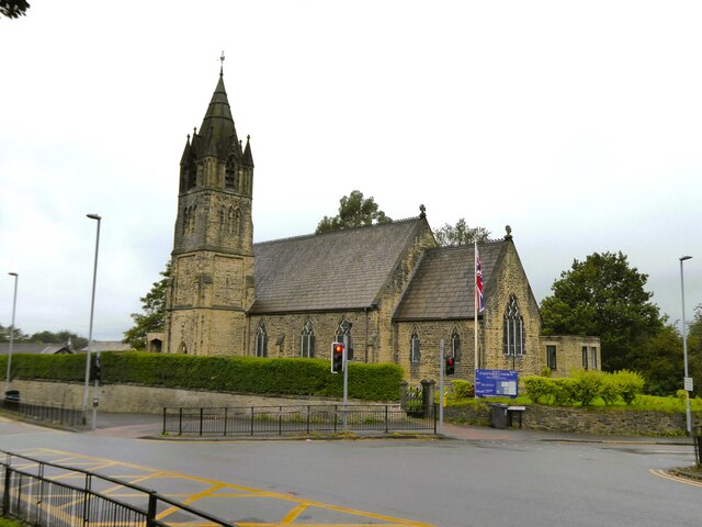
St Matthew's Church, Chadderton

The Parish Church of St. Matthew is the Church of England parish church for Chadderton in Greater Manchester, England. It forms part of the Diocese of...

Healds Green

Healds Green is a hamlet in the Metropolitan Borough of Oldham, Greater Manchester, England. It is in Chadderton's semi rural northern area, just to the...

Chadderton Park

Chadderton Park is a suburban area of Chadderton in the Metropolitan Borough of Oldham, Greater Manchester. It is located a little under one mile to the...

Nordens

Nordens is a suburban area of Chadderton in the Metropolitan Borough of Oldham, Greater Manchester.Lying in a valley archaically known as Hunt Clough,...

Mills Hill

Mills Hill is an industrial and residential area that lies on the common border of Middleton and Chadderton in Greater Manchester, England. It lies 1...

Mills Hill railway station

Mills Hill railway station is in the Mills Hill area of Middleton in the Metropolitan Borough of Rochdale, in Greater Manchester, England. The station...

Nearby Amenities

Located within 500m of 53.556607,-2.156749
Chadderton Fold
Is In: Chadderton, Oldham, Greater Manchester, England, UK
Place: suburb
Source: npe
Lat/Long: 53.5570138/-2.1600971
Bus Stop
North Chadderton Upper School
Bench: no
Bus: yes
Naptan AtcoCode: 1800ED07531
Naptan Bearing: SW
Naptan CommonName: North Chadderton Upper School
Naptan Indicator: School
Naptan Landmark: SCHOOL
Naptan NaptanCode: manamdja
Naptan PlusbusZoneRef: MNCRPIC
Naptan ShortCommonName: North Chadderton
Naptan Street: CHADD HALL ROAD
Naptan Verified: no
Network: TfGM
Public Transport: platform
Shelter: no
Source: naptan_import
Lat/Long: 53.5554462/-2.1536848
Bus Stop
North Chadderton Upper School
Bench: no
Bus: yes
Naptan AtcoCode: 1800ED07551
Naptan Bearing: SW
Naptan CommonName: North Chadderton Upper School
Naptan Indicator: School
Naptan Landmark: SCHOOL
Naptan NaptanCode: manamdjg
Naptan PlusbusZoneRef: MNCRPIC
Naptan ShortCommonName: North Chadderton
Naptan Street: CHADD HALL ROAD
Naptan Verified: no
Network: TfGM
Public Transport: platform
Shelter: no
Source: naptan_import
Lat/Long: 53.5555364/-2.1534888
Bus Stop
North Chadderton Upper School
Bus: yes
Naptan AtcoCode: 1800ED07561
Naptan Bearing: SW
Naptan CommonName: North Chadderton Upper School
Naptan Indicator: School
Naptan Landmark: SCHOOL
Naptan NaptanCode: manamdjm
Naptan PlusbusZoneRef: MNCRPIC
Naptan ShortCommonName: North Chadderton
Naptan Street: CHADD HALL ROAD
Naptan Verified: no
Network: TfGM
Public Transport: platform
Shelter: yes
Source: naptan_import
Lat/Long: 53.5553291/-2.153941
Bus Stop
Chadderton Hall Road/Bowling Green
Bus: yes
Naptan AtcoCode: 1800ED02301
Naptan Bearing: NE
Naptan CommonName: Chadderton Hall Road/Bowling Green
Naptan Indicator: Park
Naptan Landmark: BOWLING GREEN
Naptan NaptanCode: manajwdp
Naptan PlusbusZoneRef: MNCRPIC
Naptan ShortCommonName: Bowling Green
Naptan Street: CHADD HALL ROAD
Naptan Verified: no
Network: TfGM
Public Transport: platform
Source: naptan_import
Lat/Long: 53.5530116/-2.159608
Bus Stop
Chadderton Hall Road/Bowling Green
Bus: yes
Naptan AtcoCode: 1800ED02311
Naptan Bearing: W
Naptan CommonName: Chadderton Hall Road/Bowling Green
Naptan Indicator: Opp Bowling Grn
Naptan Landmark: OPP BOWLING GRN
Naptan NaptanCode: manajwdt
Naptan PlusbusZoneRef: MNCRPIC
Naptan ShortCommonName: Bowling Green
Naptan Street: CHADD HALL ROAD
Naptan Verified: no
Network: TfGM
Public Transport: platform
Source: naptan_import
Lat/Long: 53.5527594/-2.1599844
Bus Stop
Chadderton Park, Chadderton Hall Road / outside Chadderton Hall Park
Bus: yes
Naptan AtcoCode: 1800ED02321
Naptan Bearing: NE
Naptan CommonName: Chadderton Hall Road/Chadderton Hall Pk
Naptan Indicator: Park Lodge
Naptan Landmark: PARK LODGE
Naptan NaptanCode: manajwdw
Naptan PlusbusZoneRef: MNCRPIC
Naptan ShortCommonName: Park
Naptan Street: CHADD HALL ROAD
Naptan Verified: no
Network: TfGM
Operator: TfGM
Public Transport: platform
Source: naptan_import
Lat/Long: 53.5547788/-2.1554636
Bus Stop
Chadderton, Chadderton Hall Road / opposite Chadderton Hall Park
Bench: no
Bin: no
Bus: yes
Naptan AtcoCode: 1800ED02331
Naptan Bearing: SW
Naptan CommonName: Chadderton Hall Road/Chadderton Hall Pk
Naptan Indicator: O/s House 95
Naptan Landmark: HOUSE 95
Naptan NaptanCode: manajwga
Naptan PlusbusZoneRef: MNCRPIC
Naptan ShortCommonName: Park
Naptan Street: CHADD HALL ROAD
Naptan Verified: no
Network: TfGM
Operator: TfGM
Public Transport: platform
Shelter: no
Source: naptan_import
Lat/Long: 53.5549234/-2.1548301
Bus Stop
Chadderton, Chadderton Hall Road / outside North Chadderton School
Bus: yes
Naptan AtcoCode: 1800ED02341
Naptan Bearing: SW
Naptan CommonName: Chadderton Hall Road/North Chadderton Sc
Naptan Indicator: North Chad Sch
Naptan Landmark: SCHOOL
Naptan NaptanCode: manajwgd
Naptan PlusbusZoneRef: MNCRPIC
Naptan ShortCommonName: North Chadderton
Naptan Street: CHADD HALL ROAD
Naptan Verified: no
Network: TfGM
Operator: TfGM
Public Transport: platform
Source: naptan_import
Lat/Long: 53.5563025/-2.1518311
Bus Stop
Chadderton, Chadderton Hall Road / opposite Junior School
Bus: yes
Naptan AtcoCode: 1800ED02351
Naptan Bearing: NE
Naptan CommonName: Chadderton Hall Road/Junior School
Naptan Indicator: Church
Naptan Landmark: CHURCH
Naptan NaptanCode: manajwgj
Naptan PlusbusZoneRef: MNCRPIC
Naptan ShortCommonName: Junior School
Naptan Street: CHADD HALL ROAD
Naptan Verified: no
Network: TfGM
Operator: TfGM
Public Transport: platform
Source: naptan_import
Lat/Long: 53.5565364/-2.1516508
Turning Circle
Lat/Long: 53.553859/-2.1619317
Barrier: lift_gate
Bicycle: yes
Foot: yes
Horse: yes
Motor Vehicle: no
Lat/Long: 53.5536239/-2.1605733
Power: tower
Lat/Long: 53.5550819/-2.1557321
Power: tower
Lat/Long: 53.560483/-2.1589829
Power: tower
Lat/Long: 53.5581107/-2.1598466
Power: tower
Lat/Long: 53.5564123/-2.1575506
Cafe
Lat/Long: 53.5529654/-2.1602241
Pharmacy
Healthcare: pharmacy
Lat/Long: 53.5532269/-2.1546852
Shop: bakery
Lat/Long: 53.5531854/-2.154441
Shop: laundry
Lat/Long: 53.5531997/-2.1545322
Shop: hairdresser
Lat/Long: 53.5532428/-2.1547682
Co-op Food
Brand: Co-op Food
Brand Wikidata: Q3277439
Operator: The Co-operative Group
Operator Wikidata: Q117202
Shop: convenience
Website: https://www.coop.co.uk/store-finder/OL9-0RG/90-cathedral-road
Lat/Long: 53.5531663/-2.1543285
Pub
Church Inn
Lat/Long: 53.5570525/-2.1553048
Healds Green
Place: hamlet
Lat/Long: 53.5592506/-2.156356
Generator Method: photovoltaic
Generator Output Electricity: yes
Generator Source: solar
Generator Type: solar_photovoltaic_panel
Location: roof
Power: generator
Lat/Long: 53.5525072/-2.1590123
Generator Method: photovoltaic
Generator Output Electricity: yes
Generator Source: solar
Generator Type: solar_photovoltaic_panel
Location: roof
Power: generator
Lat/Long: 53.5526443/-2.1586502
Generator Method: photovoltaic
Generator Output Electricity: yes
Generator Source: solar
Generator Type: solar_photovoltaic_panel
Location: roof
Power: generator
Lat/Long: 53.5535828/-2.1543372
Generator Method: photovoltaic
Generator Output Electricity: yes
Generator Source: solar
Generator Type: solar_photovoltaic_panel
Location: roof
Power: generator
Lat/Long: 53.5530936/-2.153967
Generator Method: photovoltaic
Generator Output Electricity: yes
Generator Source: solar
Generator Type: solar_photovoltaic_panel
Location: roof
Power: generator
Lat/Long: 53.5540193/-2.1621432
Generator Method: photovoltaic
Generator Output Electricity: yes
Generator Source: solar
Generator Type: solar_photovoltaic_panel
Location: roof
Power: generator
Lat/Long: 53.5530919/-2.1523665
Turning Circle
Lat/Long: 53.5548139/-2.1501297
Bus Stop
Chadderton, SW-bound Cathedral Road
Bus: yes
Network: TfGM
Operator: TfGM
Public Transport: platform
Lat/Long: 53.5534728/-2.1516769
Bus Stop
Chadderton Park, westbound Cathedral Road
Bus: yes
Network: TfGM
Operator: TfGM
Public Transport: platform
Lat/Long: 53.5530719/-2.1547437
Bus Stop
Chadderton Park, eastbound Cathedral Road
Bus: yes
Network: TfGM
Operator: TfGM
Public Transport: platform
Lat/Long: 53.5530635/-2.1542599
Bus Stop
Chadderton, NE-bound Cathedral Road
Bus: yes
Naptan AtcoCode: 1800EDH3951
Network: TfGM
Operator: TfGM
Public Transport: platform
Lat/Long: 53.5535591/-2.1516873
Toilets
Access: yes
Male: yes
Toilets Disposal: flush
Wheelchair: yes
Lat/Long: 53.5528999/-2.1601694
The data included in this document is from www.openstreetmap.org. The data is made available under ODbL.

Have you been to Chadderton Fold?

Leave your review of Chadderton Fold below (or comments, questions and feedback).