Chesterhill Wood

Wood, Forest in Midlothian

Scotland

Chesterhill Wood

Lawfield Farm Sign Sign on public road for Lawfield Farm and Steading above Mayfield in Midlothian.
Lawfield Farm Sign Credit: Adam Ward

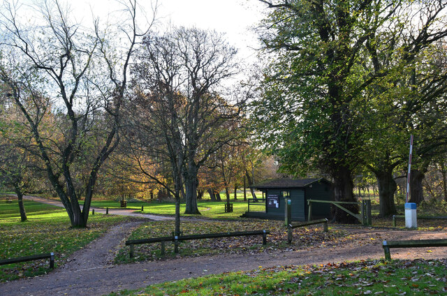
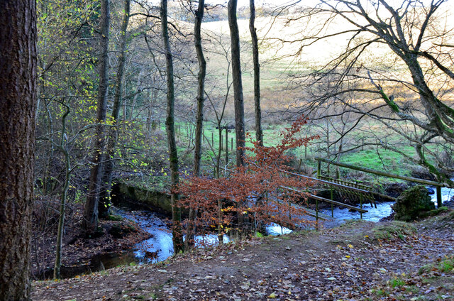
Chesterhill Wood is a picturesque forest located in Midlothian, Scotland. Spanning over a vast area, this woodland offers a serene and natural escape for visitors. With its rich biodiversity and stunning landscapes, it is a popular destination for nature enthusiasts, hikers, and photographers.

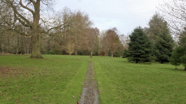
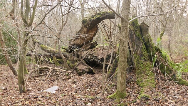
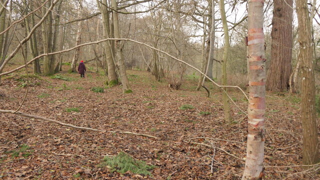
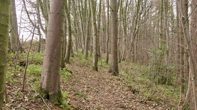
The wood is characterized by its dense canopy of towering trees, primarily consisting of oak, birch, and beech. These majestic trees provide a cool and shady environment, making it an ideal spot for a leisurely walk on a hot summer day. The forest floor is covered with an abundance of ferns, wildflowers, and mosses, adding to its enchanting atmosphere.

Chesterhill Wood is home to a wide array of wildlife, making it a haven for animal lovers. Visitors may catch a glimpse of red squirrels, roe deer, and various bird species, including woodpeckers and owls. The forest also supports a diverse ecosystem of insects, including butterflies, dragonflies, and beetles, which adds to its ecological importance.

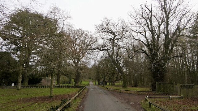
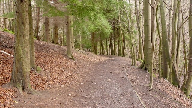
There are several well-maintained trails throughout the wood, offering different levels of difficulty for walkers and hikers. These paths wind through the forest, providing breathtaking views of the surrounding countryside and the nearby Pentland Hills. The wood is also intersected by a small river, which adds to the tranquility and charm of the area.

Overall, Chesterhill Wood is a natural treasure in Midlothian, offering visitors an opportunity to connect with nature and enjoy its beauty. Whether it's for a peaceful stroll, wildlife spotting, or simply immersing oneself in the peaceful ambiance, this forest is a must-visit destination for anyone seeking a respite from the hustle and bustle of daily life.

If you have any feedback on the listing, please let us know in the comments section below.

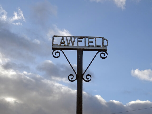
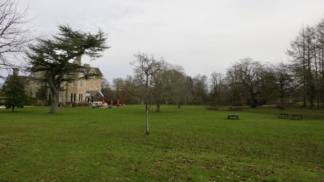
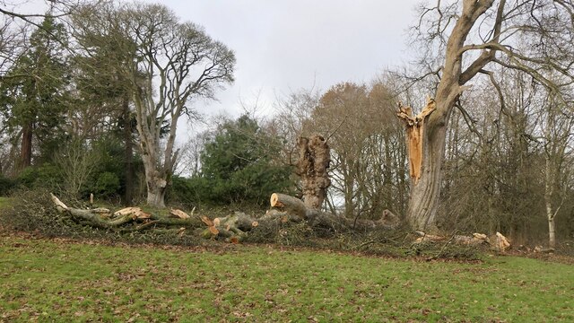
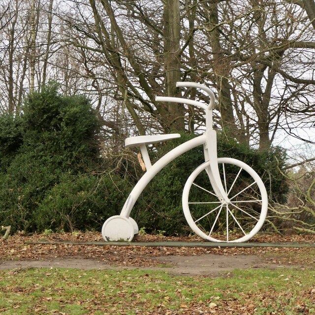
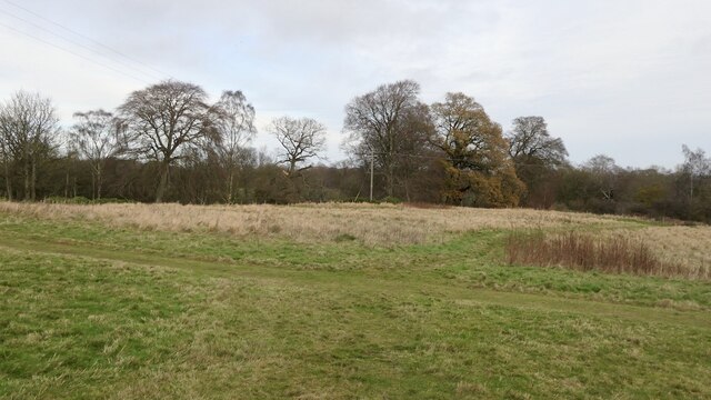
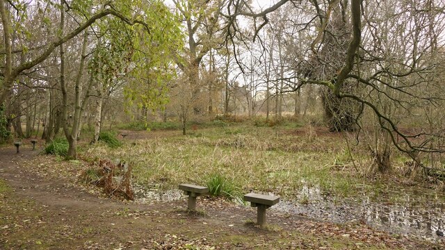
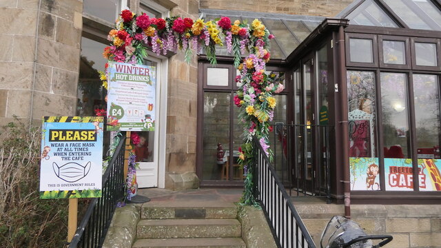
Chesterhill Wood Images

Images are sourced within 2km of 55.874256/-2.9987946 or Grid Reference NT3765. Thanks to Geograph Open Source API. All images are credited.

Lawfield Farm Sign Sign on public road for Lawfield Farm and Steading above Mayfield in Midlothian.
Lawfield Farm Sign
Sign on public road for Lawfield Farm and Steading above Mayfield in Midlothian.
The drive, Vogrie House
Railway, Vogrie Country Park
Vogrie House Notes on the history of this estate, now owned and run as a country park by Midlothian Council can be found here: <a href="https://www.geograph.org.uk/photo/2141929">NT3863 : Vogrie House</a>
Vogrie House
Notes on the history of this estate, now owned and run as a country park by Midlothian Council can be found here: NT3863 : Vogrie House
Storm damage, Vogrie Country Park After the northerly gales on 26th November 2021. There are a lot of aged trees here.
Storm damage, Vogrie Country Park
After the northerly gales on 26th November 2021. There are a lot of aged trees here.
Giant trike sculpture, Vogrie Country Park
Former field, Vogrie Now an open space in the country park.
Former field, Vogrie
Now an open space in the country park.
Pond, Vogrie Country Park
Fallen tree, Vogrie Country Park There is a lot of fallen dead wood at Vogrie which enhances the biodiversity of the woodlands.
Fallen tree, Vogrie Country Park
There is a lot of fallen dead wood at Vogrie which enhances the biodiversity of the woodlands.
Crow Wood, Vogrie
Crow Wood, Vogrie
Path, Vogrie Wood Descending to the Tyne Water, following the Vogrie Burn.
Path, Vogrie Wood
Descending to the Tyne Water, following the Vogrie Burn.
Tyne Water, Vogrie One of those rivers which is a tributary of a watercourse with a similar name. It flows into the River Tyne which gains much of its flow from the Humbie/Birnie/Colstoun Waters.
Tyne Water, Vogrie
One of those rivers which is a tributary of a watercourse with a similar name. It flows into the River Tyne which gains much of its flow from the Humbie/Birnie/Colstoun Waters.
Path, Vogrie Wood On the edge of the woodland, high above the Tyne Water.
Path, Vogrie Wood
On the edge of the woodland, high above the Tyne Water.
Cafe, Vogrie House
Cafe, Vogrie House
Drive to Vogrie House The grounds of the 19th century Vogrie House are now a Country Park, managed by Midlothian Council. The hut is an information point.
Drive to Vogrie House
The grounds of the 19th century Vogrie House are now a Country Park, managed by Midlothian Council. The hut is an information point.
Vogrie House The house dates from 1875, though Vogrie estate itself has a long history - see <span class="nowrap"><a title="https://www.thecastlesofscotland.co.uk/the-best-castles/feature-articles/vogrie-house/" rel="nofollow ugc noopener" href="https://www.thecastlesofscotland.co.uk/the-best-castles/feature-articles/vogrie-house/">Link</a><img style="margin-left:2px;" alt="External link" title="External link - shift click to open in new window" src="https://s1.geograph.org.uk/img/external.png" width="10" height="10"/></span>.

Now it is a home to the Vogrie Country Park ranger service and a cafe.
Vogrie House
The house dates from 1875, though Vogrie estate itself has a long history - see LinkExternal link. Now it is a home to the Vogrie Country Park ranger service and a cafe.
Ha-ha at Vogrie An 'invisible boundary' consisting of a wall and ditch, often built in parkland around a country house.
Ha-ha at Vogrie
An 'invisible boundary' consisting of a wall and ditch, often built in parkland around a country house.
Footbridge and confluence, Vogrie The confluence of the Vogrie Burn and the Tyne Water. The footbridge carries the path back to Vogrie House and meets a path continuing north to Ford.
Footbridge and confluence, Vogrie
The confluence of the Vogrie Burn and the Tyne Water. The footbridge carries the path back to Vogrie House and meets a path continuing north to Ford.
Show me another place!

Chesterhill Wood is located at Grid Ref: NT3765 (Lat: 55.874256, Lng: -2.9987946)

Unitary Authority: Midlothian

Police Authority: The Lothians and Scottish Borders

What 3 Words

///moods.altering.slopes. Near Mayfield, Midlothian

Related Wikis

Edgehead

Edgehead (also known as Chesterhill) is a village in Midlothian, Scotland. == Location == Edgehead is situated east of Dewartown and Mayfield, north-west...

Dewartown

Dewartown is a small hamlet in Midlothian, Scotland (near Pathhead and Mayfield). Its name relates to the Dewar family who owned the nearby Vogrie House...

Cranston, Midlothian

Cranston is a parish of Midlothian, Scotland, lying 4+1⁄4 miles (6.8 kilometres) south-east of Dalkeith. It is bounded by the parishes of Inveresk and...

Oxenfoord Castle

Oxenfoord Castle is a country house in Midlothian, Scotland. It is located 1 kilometre (0.62 mi) north of Pathhead, Midlothian, and 6 kilometres (3.7 mi...

D'Arcy, Midlothian

D'Arcy' is a hamlet in Midlothian, Scotland, located just south of Dalkeith near Edinburgh. It is ¼ mile east of Mayfield and lies within the Civil Parish...

Vogrie Country Park

Vogrie Country Park in Scotland is managed by Midlothian Council. It consists of a woodland estate surrounding the Victorian Vogrie House. It is located...

Vogrie House

Vogrie House forms the centrepiece of Vogrie Country Park in Midlothian. It was built for James Dewar and his family in 1876 by Andrew Heiton, the town...

Preston Hall, Midlothian

Preston Hall, or Prestonhall, is a late-18th-century mansion in Midlothian, to the south of Edinburgh, Scotland. It is located 1.5 kilometres (0.93 mi...

Nearby Amenities

Located within 500m of 55.874256,-2.9987946
Edgehead
Is In: Midlothian, Scotland
Place: hamlet
Population: 115
Wikidata: Q5337759
Lat/Long: 55.8750315/-3.0015862
Power: tower
Lat/Long: 55.8716025/-2.9931949
Post Box
Post Box Type: wall
Ref: EH37 51
Lat/Long: 55.8750642/-3.0016029
Give Way
Direction: backward
Lat/Long: 55.8763674/-3.0049836
Power: tower
Lat/Long: 55.8733083/-2.9956551
Power: tower
Lat/Long: 55.8751654/-2.9983932
Power: tower
Lat/Long: 55.8764829/-3.0003372
Traffic Calming: cushion
Lat/Long: 55.8718235/-2.9928615
Traffic Calming: cushion
Lat/Long: 55.8720304/-2.993507
Traffic Calming: cushion
Lat/Long: 55.8722515/-2.9941965
Traffic Calming: cushion
Lat/Long: 55.8724844/-2.9949326
Traffic Calming: cushion
Lat/Long: 55.8727001/-2.9956155
Material: wood
Power: pole
Lat/Long: 55.8727404/-2.9959088
Power: pole
Lat/Long: 55.8712987/-2.9961029
Power: pole
Lat/Long: 55.8705122/-2.9962477
Power: pole
Lat/Long: 55.8732227/-2.9958548
Power: pole
Lat/Long: 55.873055/-2.9949372
Power: pole
Lat/Long: 55.8727498/-2.9932396
Power: pole
Lat/Long: 55.8724406/-2.9915467
Man Made: tower
Tower Type: communication
Lat/Long: 55.8774355/-2.9962235
Power: pole
Lat/Long: 55.8720992/-2.9959951
Bus Stop
Main Street
Bus: yes
Local Ref: at 52
Naptan AtcoCode: 6280326930
Naptan Bearing: NW
Naptan CommonName: Main Street
Naptan Indicator: at 52
Naptan Landmark: -
Naptan NaptanCode: 64323638
Naptan Street: Edgehead Road
Naptan Verified: yes
Public Transport: platform
Ref: 6280326930
Source: NaPTAN
Lat/Long: 55.8736501/-2.9983816
Bus Stop
Chesterhill
Bus: yes
Local Ref: opp 21
Naptan AtcoCode: 6280326940
Naptan Bearing: NW
Naptan CommonName: Chesterhill
Naptan Indicator: opp 21
Naptan Landmark: -
Naptan NaptanCode: 64323636
Naptan Street: Edgehead Road
Naptan Verified: yes
Public Transport: platform
Ref: 6280326940
Source: NaPTAN
Lat/Long: 55.875362/-3.002808
Bus Stop
Chesterhill
Bus: yes
Local Ref: opp 28
Naptan AtcoCode: 6280300680
Naptan Bearing: SE
Naptan CommonName: Chesterhill
Naptan Indicator: opp 28
Naptan Landmark: Rose Cottage
Naptan NaptanCode: 64323635
Naptan Street: Edgehead Road
Naptan Verified: yes
Public Transport: platform
Ref: 6280300680
Source: NaPTAN
Lat/Long: 55.8753258/-3.002352
Bus Stop
Main Street
Bus: yes
Local Ref: opp 60
Naptan AtcoCode: 6280300690
Naptan Bearing: SE
Naptan CommonName: Main Street
Naptan Indicator: opp 60
Naptan Landmark: -
Naptan NaptanCode: 64323637
Naptan Street: Edgehead Road
Naptan Verified: yes
Public Transport: platform
Ref: 6280300690
Source: NaPTAN
Lat/Long: 55.8731535/-2.9968045
Public Bookcase
Book Exchange
Booth: K6
Disused Amenity: telephone
Man Made: telephone_box
Old Phone: +44 1875 320261
Public Bookcase Type: phone_box
Lat/Long: 55.8750568/-3.001636
Power: pole
Lat/Long: 55.8784303/-3.0014271
Power: pole
Lat/Long: 55.8776846/-3.0007207
Power: pole
Lat/Long: 55.8769389/-3.0000227
Power: pole
Lat/Long: 55.8766314/-2.9999081
Power: pole
Lat/Long: 55.8761849/-2.9997268
Power: pole
Lat/Long: 55.8755841/-2.9994788
Power: pole
Lat/Long: 55.8748126/-2.9991496
Power: pole
Lat/Long: 55.8742153/-2.9979473
Power: pole
Lat/Long: 55.8736203/-2.996695
Power: pole
Lat/Long: 55.8764351/-3.0013562
Power: pole
Lat/Long: 55.8759149/-3.002746
Power: pole
Lat/Long: 55.8763416/-3.0036358
Location Transition: yes
Power: pole
Transformer: distribution
Lat/Long: 55.8765601/-3.0041192
Power: pole
Lat/Long: 55.8756157/-3.0035482
Power: pole
Lat/Long: 55.8754882/-3.0044276
Power: pole
Lat/Long: 55.875037/-3.0050797
Power: pole
Lat/Long: 55.8735209/-2.9953646
Power: pole
Lat/Long: 55.874013/-2.9941894
Power: pole
Lat/Long: 55.8745017/-2.9930163
Power: pole
Lat/Long: 55.8750008/-2.9918536
Addr City: Edgehead
Addr Housenumber: 19
Addr Street: Elizabeth Dickson Gardens
Lat/Long: 55.8767364/-3.0052991
Addr City: Edgehead
Addr Housenumber: 7
Addr Street: Elizabeth Dickson Gardens
Lat/Long: 55.877054/-3.0048441
Addr City: Edgehead
Addr Housenumber: 6
Addr Street: Elizabeth Dickson Gardens
Lat/Long: 55.876981/-3.0047436
Addr City: Edgehead
Addr Housenumber: 5
Addr Street: Elizabeth Dickson Gardens
Lat/Long: 55.8765877/-3.0045357
Addr City: Edgehead
Addr Housenumber: 4
Addr Street: Elizabeth Dickson Gardens
Lat/Long: 55.8764186/-3.0048142
Addr City: Edgehead
Addr Housenumber: 3
Addr Street: Elizabeth Dickson Gardens
Lat/Long: 55.8762963/-3.0046167
Addr City: Edgehead
Addr Housenumber: 2
Addr Street: Elizabeth Dickson Gardens
Lat/Long: 55.8762325/-3.0044565
Addr City: Edgehead
Addr Housenumber: 1
Addr Street: Elizabeth Dickson Gardens
Lat/Long: 55.8761809/-3.0042823
The data included in this document is from www.openstreetmap.org. The data is made available under ODbL.

Have you been to Chesterhill Wood?

Leave your review of Chesterhill Wood below (or comments, questions and feedback).