Beech Clump

Wood, Forest in Midlothian

Scotland

Beech Clump

Lawfield Farm Sign Sign on public road for Lawfield Farm and Steading above Mayfield in Midlothian.
Lawfield Farm Sign Credit: Adam Ward

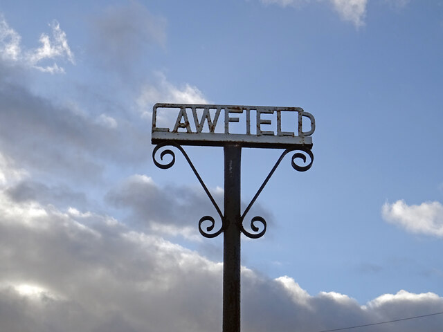
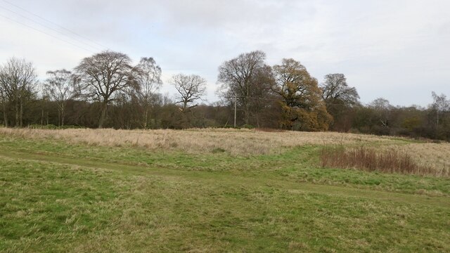
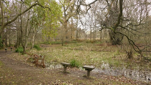
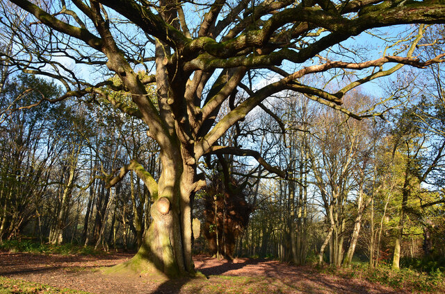
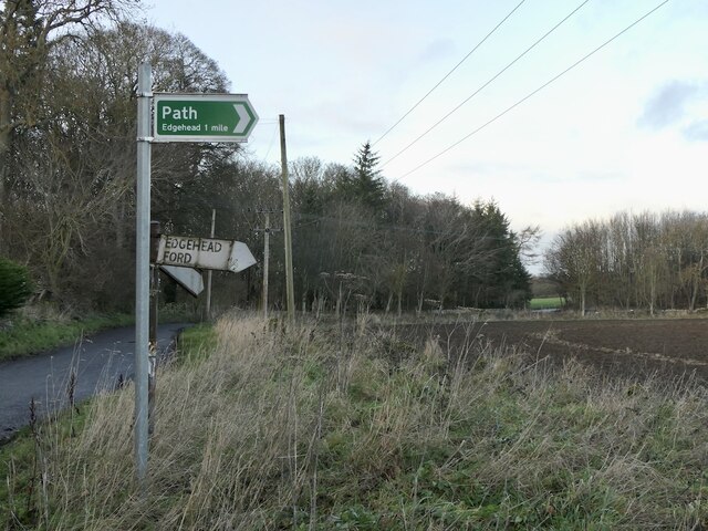
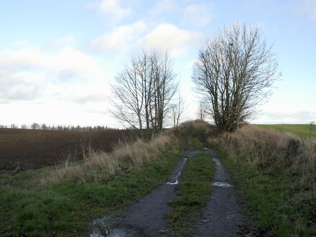
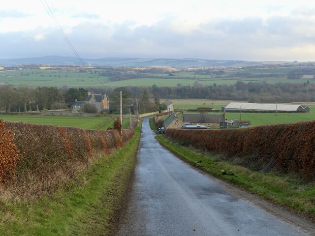
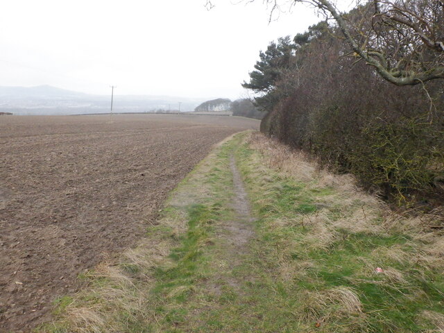
Beech Clump, located in Midlothian, is a picturesque wood or forest that is known for its abundant beech trees. The clump is situated in a rural area, surrounded by rolling hills and breathtaking natural beauty.

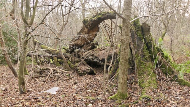
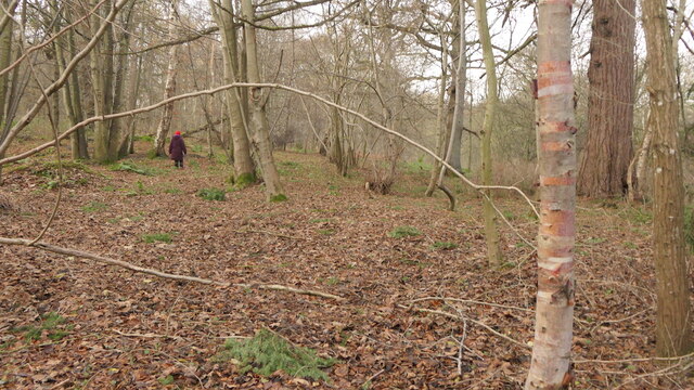
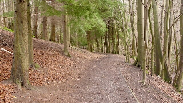
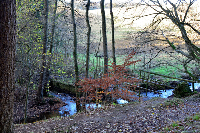
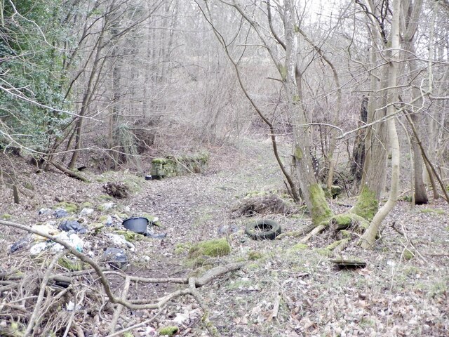
The forest covers a considerable area, providing a haven for a diverse range of wildlife. The tall and majestic beech trees dominate the landscape, creating a dense canopy that offers shade and shelter to numerous species of plants and animals. The forest floor is covered in a thick layer of fallen leaves, creating a vibrant carpet of golden hues during the autumn months.

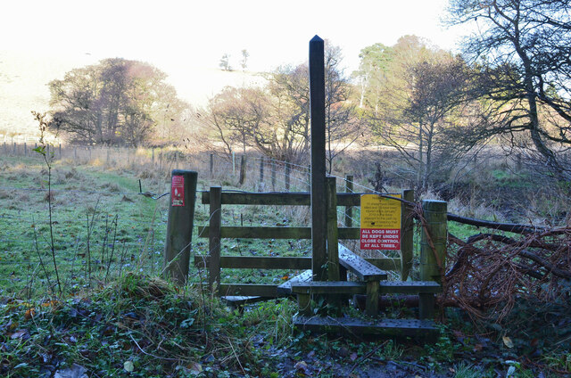
Beech Clump is a popular destination for nature enthusiasts and hikers, who are drawn to its tranquil atmosphere and scenic trails. The well-maintained paths wind through the forest, allowing visitors to explore the area at their own pace. Along the way, one can encounter various types of flora, including wildflowers, ferns, and mosses.

The forest is also home to a variety of wildlife, including deer, foxes, rabbits, and an array of bird species. Birdwatchers can spot woodpeckers, owls, and thrushes among the treetops, while lucky observers might catch a glimpse of a red squirrel darting through the branches.

Beech Clump is not only a haven for nature lovers but also serves as an important ecosystem, contributing to environmental sustainability and maintaining biodiversity in the Midlothian region. Its natural beauty and peaceful ambiance make it a cherished spot for both locals and visitors alike.

If you have any feedback on the listing, please let us know in the comments section below.

Beech Clump Images

Images are sourced within 2km of 55.876841/-2.9980299 or Grid Reference NT3765. Thanks to Geograph Open Source API. All images are credited.

Lawfield Farm Sign Sign on public road for Lawfield Farm and Steading above Mayfield in Midlothian.
Lawfield Farm Sign
Sign on public road for Lawfield Farm and Steading above Mayfield in Midlothian.
Former field, Vogrie Now an open space in the country park.
Former field, Vogrie
Now an open space in the country park.
Pond, Vogrie Country Park
Fallen tree, Vogrie Country Park There is a lot of fallen dead wood at Vogrie which enhances the biodiversity of the woodlands.
Fallen tree, Vogrie Country Park
There is a lot of fallen dead wood at Vogrie which enhances the biodiversity of the woodlands.
Crow Wood, Vogrie
Crow Wood, Vogrie
Path, Vogrie Wood Descending to the Tyne Water, following the Vogrie Burn.
Path, Vogrie Wood
Descending to the Tyne Water, following the Vogrie Burn.
Footbridge and confluence, Vogrie The confluence of the Vogrie Burn and the Tyne Water. The footbridge carries the path back to Vogrie House and meets a path continuing north to Ford.
Footbridge and confluence, Vogrie
The confluence of the Vogrie Burn and the Tyne Water. The footbridge carries the path back to Vogrie House and meets a path continuing north to Ford.
Stile and path to Ford A stile at the edge of Vogrie Country Park with a notice about sheep killed and injured by dogs in the fields here.
Stile and path to Ford
A stile at the edge of Vogrie Country Park with a notice about sheep killed and injured by dogs in the fields here.
Tree in Vogrie Country Park An impressive tree near the track to the west of the house.
Tree in Vogrie Country Park
An impressive tree near the track to the west of the house.
Edgehead from the air Windmill Wood is in the left foreground.
Edgehead from the air
Windmill Wood is in the left foreground.
Edgehead from the air Windmill Wood is in the left foreground.
Edgehead from the air
Windmill Wood is in the left foreground.
Beside the A6106 The old A68 descends towards Dalkeith. Here by the bypass it is possible that development could take place.
Beside the A6106
The old A68 descends towards Dalkeith. Here by the bypass it is possible that development could take place.
Signpost near D' Arcy House The implication that the rough track to Edgehead was once a motor road.  This was once a small oilfield.
Signpost near D' Arcy House
The implication that the rough track to Edgehead was once a motor road. This was once a small oilfield.
D' Arcy to Edgehead road Once the Midlothian oilfield, the road like the oilwell (1919-22) is defunct. Still part of the path network.
D' Arcy to Edgehead road
Once the Midlothian oilfield, the road like the oilwell (1919-22) is defunct. Still part of the path network.
Road, Southside
Road, Southside
Dewartown Once an estate village for Vogrie.
Dewartown
Once an estate village for Vogrie.
Old road alignment, Vogrie The B6732 used to cross the Vogrie Burn at a bend. Now overgrown and overrun with dumped rubbish.
Old road alignment, Vogrie
The B6732 used to cross the Vogrie Burn at a bend. Now overgrown and overrun with dumped rubbish.
Path beside Limekiln Wood It leads to Lawfield. There is a lot of litter in the wood on the right, probably blown in from nearby Mayfield.
Path beside Limekiln Wood
It leads to Lawfield. There is a lot of litter in the wood on the right, probably blown in from nearby Mayfield.
Show me another place!

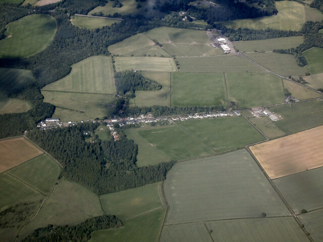
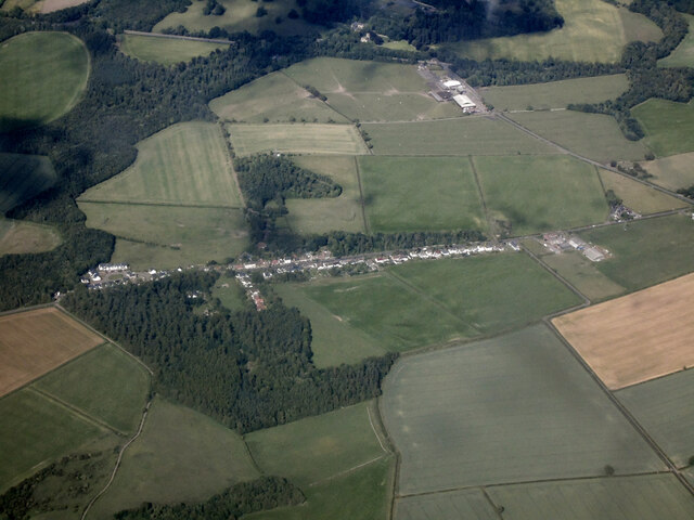
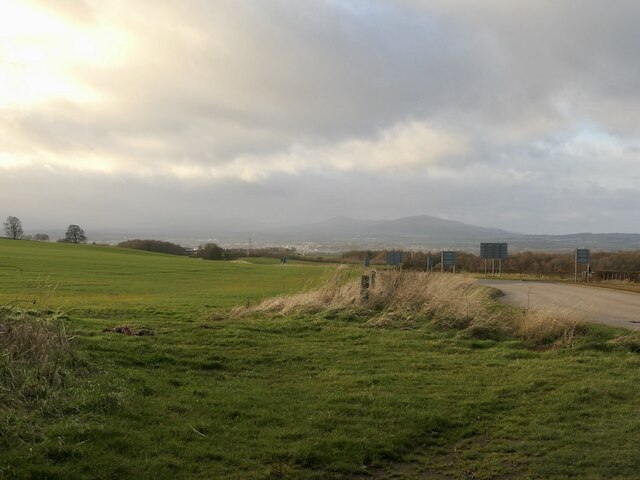
Beech Clump is located at Grid Ref: NT3765 (Lat: 55.876841, Lng: -2.9980299)

Unitary Authority: Midlothian

Police Authority: The Lothians and Scottish Borders

What 3 Words

///forkful.waving.outwards. Near Mayfield, Midlothian

Related Wikis

Edgehead

Edgehead (also known as Chesterhill) is a village in Midlothian, Scotland. == Location == Edgehead is situated east of Dewartown and Mayfield, north-west...

Cranston, Midlothian

Cranston is a parish of Midlothian, Scotland, lying 4+1⁄4 miles (6.8 kilometres) south-east of Dalkeith. It is bounded by the parishes of Inveresk and...

Oxenfoord Castle

Oxenfoord Castle is a country house in Midlothian, Scotland. It is located 1 kilometre (0.62 mi) north of Pathhead, Midlothian, and 6 kilometres (3.7 mi...

Dewartown

Dewartown is a small hamlet in Midlothian, Scotland (near Pathhead and Mayfield). Its name relates to the Dewar family who owned the nearby Vogrie House...

Nearby Amenities

Located within 500m of 55.876841,-2.9980299
Edgehead
Is In: Midlothian, Scotland
Place: hamlet
Population: 115
Wikidata: Q5337759
Lat/Long: 55.8750315/-3.0015862
Post Box
Post Box Type: wall
Ref: EH37 51
Lat/Long: 55.8750642/-3.0016029
Give Way
Direction: backward
Lat/Long: 55.8763674/-3.0049836
Power: tower
Lat/Long: 55.8733083/-2.9956551
Power: tower
Lat/Long: 55.8751654/-2.9983932
Power: tower
Lat/Long: 55.8764829/-3.0003372
Power: tower
Lat/Long: 55.8782402/-3.0029033
Power: tower
Lat/Long: 55.879297/-3.0044869
Power: pole
Lat/Long: 55.8805015/-3.0026575
Power: pole
Lat/Long: 55.8797102/-3.0023428
Power: pole
Lat/Long: 55.87911/-3.0020699
Traffic Calming: cushion
Lat/Long: 55.8727001/-2.9956155
Material: wood
Power: pole
Lat/Long: 55.8727404/-2.9959088
Power: pole
Lat/Long: 55.8732227/-2.9958548
Power: pole
Lat/Long: 55.873055/-2.9949372
Man Made: tower
Tower Type: communication
Lat/Long: 55.8774355/-2.9962235
Bus Stop
Main Street
Bus: yes
Local Ref: at 52
Naptan AtcoCode: 6280326930
Naptan Bearing: NW
Naptan CommonName: Main Street
Naptan Indicator: at 52
Naptan Landmark: -
Naptan NaptanCode: 64323638
Naptan Street: Edgehead Road
Naptan Verified: yes
Public Transport: platform
Ref: 6280326930
Source: NaPTAN
Lat/Long: 55.8736501/-2.9983816
Bus Stop
Chesterhill
Bus: yes
Local Ref: opp 21
Naptan AtcoCode: 6280326940
Naptan Bearing: NW
Naptan CommonName: Chesterhill
Naptan Indicator: opp 21
Naptan Landmark: -
Naptan NaptanCode: 64323636
Naptan Street: Edgehead Road
Naptan Verified: yes
Public Transport: platform
Ref: 6280326940
Source: NaPTAN
Lat/Long: 55.875362/-3.002808
Bus Stop
Chesterhill
Bus: yes
Local Ref: opp 28
Naptan AtcoCode: 6280300680
Naptan Bearing: SE
Naptan CommonName: Chesterhill
Naptan Indicator: opp 28
Naptan Landmark: Rose Cottage
Naptan NaptanCode: 64323635
Naptan Street: Edgehead Road
Naptan Verified: yes
Public Transport: platform
Ref: 6280300680
Source: NaPTAN
Lat/Long: 55.8753258/-3.002352
Bus Stop
Main Street
Bus: yes
Local Ref: opp 60
Naptan AtcoCode: 6280300690
Naptan Bearing: SE
Naptan CommonName: Main Street
Naptan Indicator: opp 60
Naptan Landmark: -
Naptan NaptanCode: 64323637
Naptan Street: Edgehead Road
Naptan Verified: yes
Public Transport: platform
Ref: 6280300690
Source: NaPTAN
Lat/Long: 55.8731535/-2.9968045
Public Bookcase
Book Exchange
Booth: K6
Disused Amenity: telephone
Man Made: telephone_box
Old Phone: +44 1875 320261
Public Bookcase Type: phone_box
Lat/Long: 55.8750568/-3.001636
Power: pole
Lat/Long: 55.8784303/-3.0014271
Power: pole
Lat/Long: 55.8776846/-3.0007207
Power: pole
Lat/Long: 55.8769389/-3.0000227
Power: pole
Lat/Long: 55.8766314/-2.9999081
Power: pole
Lat/Long: 55.8761849/-2.9997268
Power: pole
Lat/Long: 55.8755841/-2.9994788
Power: pole
Lat/Long: 55.8748126/-2.9991496
Power: pole
Lat/Long: 55.8742153/-2.9979473
Power: pole
Lat/Long: 55.8736203/-2.996695
Power: pole
Lat/Long: 55.8764351/-3.0013562
Power: pole
Lat/Long: 55.8759149/-3.002746
Power: pole
Lat/Long: 55.8763416/-3.0036358
Location Transition: yes
Power: pole
Transformer: distribution
Lat/Long: 55.8765601/-3.0041192
Power: pole
Lat/Long: 55.8756157/-3.0035482
Power: pole
Lat/Long: 55.8754882/-3.0044276
Power: pole
Lat/Long: 55.875037/-3.0050797
Power: pole
Lat/Long: 55.8735209/-2.9953646
Power: pole
Lat/Long: 55.874013/-2.9941894
Power: pole
Lat/Long: 55.8745017/-2.9930163
Power: pole
Lat/Long: 55.8750008/-2.9918536
Power: pole
Lat/Long: 55.8755034/-2.9905617
Addr City: Edgehead
Addr Housenumber: 19
Addr Street: Elizabeth Dickson Gardens
Lat/Long: 55.8767364/-3.0052991
Addr City: Edgehead
Addr Housenumber: 18
Addr Street: Elizabeth Dickson Gardens
Lat/Long: 55.8768062/-3.0055125
Addr City: Edgehead
Addr Housenumber: 17
Addr Street: Elizabeth Dickson Gardens
Lat/Long: 55.8768694/-3.0056749
Addr City: Edgehead
Addr Housenumber: 16
Addr Street: Elizabeth Dickson Gardens
Lat/Long: 55.8769255/-3.0058304
Addr City: Edgehead
Addr Housenumber: 15
Addr Street: Elizabeth Dickson Gardens
Lat/Long: 55.8769888/-3.0059946
Addr City: Edgehead
Addr Housenumber: 13
Addr Street: Elizabeth Dickson Gardens
Lat/Long: 55.8771672/-3.005973
Addr City: Edgehead
Addr Housenumber: 12
Addr Street: Elizabeth Dickson Gardens
Lat/Long: 55.8770987/-3.0055876
Addr City: Edgehead
Addr Housenumber: 11
Addr Street: Elizabeth Dickson Gardens
Lat/Long: 55.8771928/-3.0054691
Addr City: Edgehead
Addr Housenumber: 10
Addr Street: Elizabeth Dickson Gardens
Lat/Long: 55.8772683/-3.0053713
Addr City: Edgehead
Addr Housenumber: 9
Addr Street: Elizabeth Dickson Gardens
Lat/Long: 55.8772335/-3.0051246
Addr City: Edgehead
Addr Housenumber: 8
Addr Street: Elizabeth Dickson Gardens
Lat/Long: 55.8771476/-3.005023
Addr City: Edgehead
Addr Housenumber: 7
Addr Street: Elizabeth Dickson Gardens
Lat/Long: 55.877054/-3.0048441
Addr City: Edgehead
Addr Housenumber: 6
Addr Street: Elizabeth Dickson Gardens
Lat/Long: 55.876981/-3.0047436
Addr City: Edgehead
Addr Housenumber: 5
Addr Street: Elizabeth Dickson Gardens
Lat/Long: 55.8765877/-3.0045357
Addr City: Edgehead
Addr Housenumber: 4
Addr Street: Elizabeth Dickson Gardens
Lat/Long: 55.8764186/-3.0048142
Addr City: Edgehead
Addr Housenumber: 3
Addr Street: Elizabeth Dickson Gardens
Lat/Long: 55.8762963/-3.0046167
Addr City: Edgehead
Addr Housenumber: 2
Addr Street: Elizabeth Dickson Gardens
Lat/Long: 55.8762325/-3.0044565
Addr City: Edgehead
Addr Housenumber: 1
Addr Street: Elizabeth Dickson Gardens
Lat/Long: 55.8761809/-3.0042823
The data included in this document is from www.openstreetmap.org. The data is made available under ODbL.

Have you been to Beech Clump?

Leave your review of Beech Clump below (or comments, questions and feedback).