Fordel Bank Plantation

Wood, Forest in Midlothian

Scotland

Fordel Bank Plantation

Lawfield Farm Sign Sign on public road for Lawfield Farm and Steading above Mayfield in Midlothian.
Lawfield Farm Sign Credit: Adam Ward

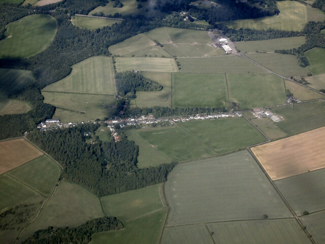
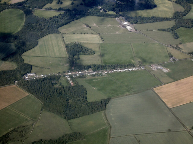
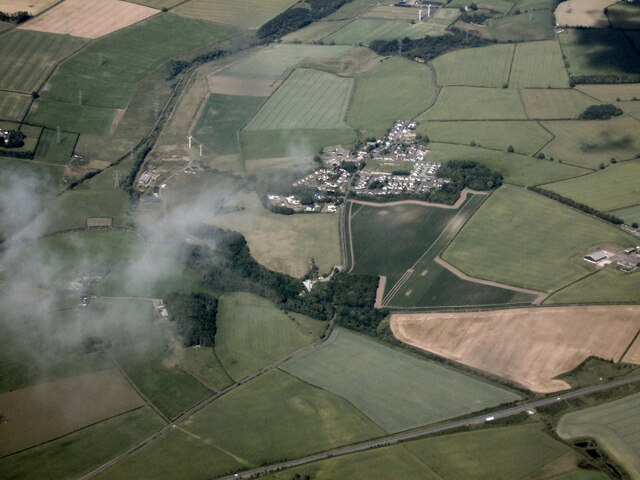
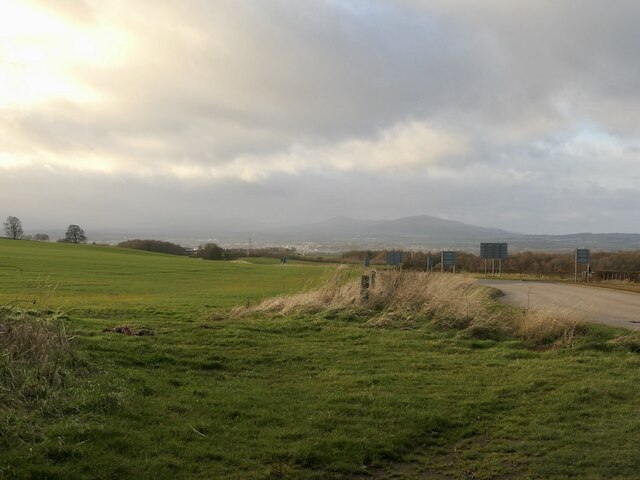
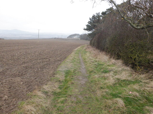
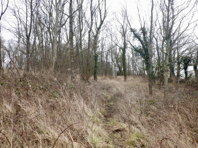
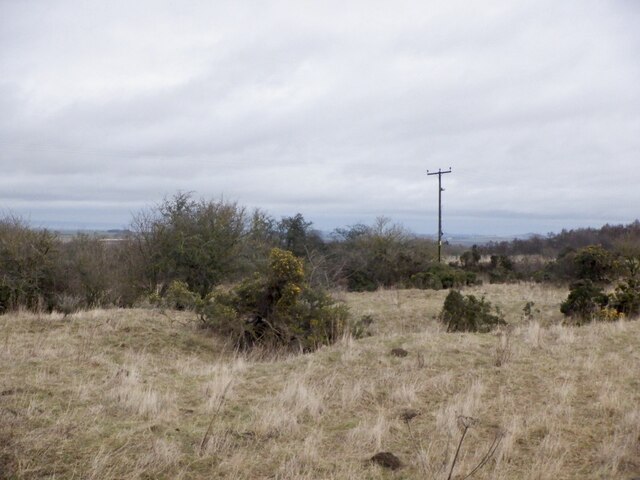
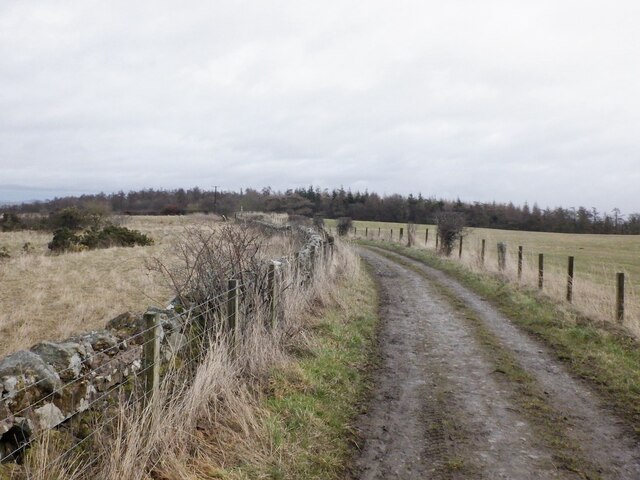
Fordel Bank Plantation is a picturesque woodland area located in Midlothian, Scotland. Covering an expansive area, the plantation is well-known for its diverse range of tree species and scenic beauty. Nestled amidst rolling hills and lush greenery, it offers a tranquil escape from the bustle of city life.

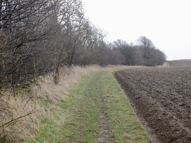
The plantation is primarily composed of mixed deciduous and coniferous trees, including oak, beech, pine, and spruce. This variety of tree species creates a vibrant and colorful landscape, especially during the autumn season when the leaves change into vibrant shades of red, orange, and yellow.

The woodland is home to a rich array of wildlife, including various species of birds, mammals, and insects. Visitors can often spot deer, foxes, rabbits, and squirrels roaming freely in their natural habitat. Birdwatchers will also be delighted to catch glimpses of different bird species, such as woodpeckers, owls, and buzzards.

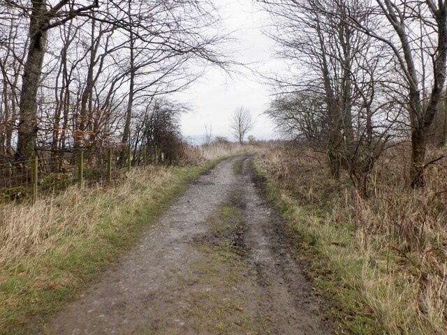
Fordel Bank Plantation offers numerous walking trails, inviting outdoor enthusiasts to explore its beauty. These trails wind through the woodland, allowing visitors to immerse themselves in the peaceful ambiance while enjoying the breathtaking views. The well-maintained paths make it accessible for all ages and fitness levels.

The plantation's convenient location, just a short drive from Midlothian, makes it a popular spot for locals and tourists alike. Whether it be for a leisurely stroll, a family picnic, or a nature photography expedition, Fordel Bank Plantation offers a serene and idyllic setting for all to enjoy.

If you have any feedback on the listing, please let us know in the comments section below.

Fordel Bank Plantation Images

Images are sourced within 2km of 55.886699/-2.9990183 or Grid Reference NT3766. Thanks to Geograph Open Source API. All images are credited.

Lawfield Farm Sign Sign on public road for Lawfield Farm and Steading above Mayfield in Midlothian.
Lawfield Farm Sign
Sign on public road for Lawfield Farm and Steading above Mayfield in Midlothian.
Edgehead from the air Windmill Wood is in the left foreground.
Edgehead from the air
Windmill Wood is in the left foreground.
Edgehead from the air Windmill Wood is in the left foreground.
Edgehead from the air
Windmill Wood is in the left foreground.
Cousland from the air The A68 Dalkeith Bypass road is in the foreground.
Cousland from the air
The A68 Dalkeith Bypass road is in the foreground.
Beside the A6106 The old A68 descends towards Dalkeith. Here by the bypass it is possible that development could take place.
Beside the A6106
The old A68 descends towards Dalkeith. Here by the bypass it is possible that development could take place.
Path beside Limekiln Wood It leads to Lawfield. There is a lot of litter in the wood on the right, probably blown in from nearby Mayfield.
Path beside Limekiln Wood
It leads to Lawfield. There is a lot of litter in the wood on the right, probably blown in from nearby Mayfield.
Path near D'Arcy Climbing beside Spy Law Wood towards the site of the oilwell.
Path near D'Arcy
Climbing beside Spy Law Wood towards the site of the oilwell.
D'Arcy to Edgehead road Passing Spy Law Wood
D'Arcy to Edgehead road
Passing Spy Law Wood
Spy Law Wood A former limestone quarry
Spy Law Wood
A former limestone quarry
Limestone quarry site, Edgehead Scrub on a 19th century quarry.
Limestone quarry site, Edgehead
Scrub on a 19th century quarry.
D'Arcy to Edgehead road
Windmill Wood The site of Edgehead Colliery with lots of earth features and suspicious depressions.
Windmill Wood
The site of Edgehead Colliery with lots of earth features and suspicious depressions.
Depression, Windmill Wood Site of a former colliery.
Depression, Windmill Wood
Site of a former colliery.
Site of Edgehill Colliery In Windmill Wood.
Site of Edgehill Colliery
In Windmill Wood.
Boulder in Windmill Wood
Edgehead
Edgehead
What should we call our cycle route? Struggling to find the connection between Covid-19 and safe passing of a bike - other than that there were a lot more bikes around as they were a perfect get out of lockdown free card.
A crossroads between Edgehead and Pathhead in Midlothian.
What should we call our cycle route?
Struggling to find the connection between Covid-19 and safe passing of a bike - other than that there were a lot more bikes around as they were a perfect get out of lockdown free card. A crossroads between Edgehead and Pathhead in Midlothian.
Lay-by on the A68 near Dalkeith
Show me another place!

Fordel Bank Plantation is located at Grid Ref: NT3766 (Lat: 55.886699, Lng: -2.9990183)

Unitary Authority: Midlothian

Police Authority: The Lothians and Scottish Borders

What 3 Words

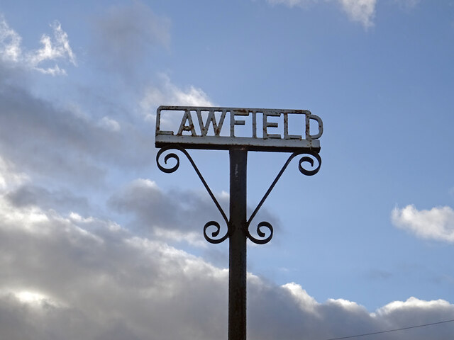
///vegetable.teaches.hills. Near Mayfield, Midlothian

Nearby Locations

Fordel Bank Plantation

Related Wikis

Cranston, Midlothian

Cranston is a parish of Midlothian, Scotland, lying 4+1⁄4 miles (6.8 kilometres) south-east of Dalkeith. It is bounded by the parishes of Inveresk and...

Edgehead

Edgehead (also known as Chesterhill) is a village in Midlothian, Scotland. == Location == Edgehead is situated east of Dewartown and Mayfield, north-west...

Oxenfoord Castle

Oxenfoord Castle is a country house in Midlothian, Scotland. It is located 1 kilometre (0.62 mi) north of Pathhead, Midlothian, and 6 kilometres (3.7 mi...

Preston Hall, Midlothian

Preston Hall, or Prestonhall, is a late-18th-century mansion in Midlothian, to the south of Edinburgh, Scotland. It is located 1.5 kilometres (0.93 mi...

Nearby Amenities

Located within 500m of 55.886699,-2.9990183
COUSLAND4
Disused Man Made: petroleum_well
Ref GB Decc: LH/05-14
Source: DECC
Lat/Long: 55.8875278/-3.0004722
COUSLANDG5
Disused: yes
Man Made: petroleum_well
Ref GB Decc: L33/01-6
Source: DECC
Lat/Long: 55.8851111/-2.9952778
COUSLANDG4
Disused Man Made: petroleum_well
Ref GB Decc: L33/01-4
Source: DECC
Lat/Long: 55.8908611/-2.9972222
Power: pole
Lat/Long: 55.8903462/-3.0035647
Power: pole
Lat/Long: 55.8896208/-3.004062
Power: pole
Lat/Long: 55.889516/-3.0040387
Power: pole
Lat/Long: 55.8885247/-3.0039429
Power: pole
Lat/Long: 55.8876529/-3.0038529
Power: pole
Lat/Long: 55.8867458/-3.0037715
Power: pole
Lat/Long: 55.8858586/-3.0036795
Power: pole
Lat/Long: 55.8849792/-3.0035946
Power: pole
Lat/Long: 55.8841052/-3.0035159
Power: pole
Lat/Long: 55.8831948/-3.0034326
Power: pole
Lat/Long: 55.8888571/-3.0023979
Power: pole
Lat/Long: 55.8891855/-3.000792
Power: pole
Lat/Long: 55.8895366/-2.9991293
Power: pole
Lat/Long: 55.8898398/-2.997625
Power: pole
Lat/Long: 55.8902957/-2.996751
The data included in this document is from www.openstreetmap.org. The data is made available under ODbL.

Have you been to Fordel Bank Plantation?

Leave your review of Fordel Bank Plantation below (or comments, questions and feedback).