Moss Wood

Wood, Forest in Stirlingshire

Scotland

Moss Wood

Minor road between Kingsburgh and Craigend Looking south-westward.
Minor road between Kingsburgh and Craigend Credit: Peter Wood

Moss Wood is a charming forest located in Stirlingshire, Scotland. Spread across a vast area, this woodland is known for its pristine beauty and diverse ecosystem. It is situated in close proximity to the village of Thornhill, making it easily accessible to visitors.

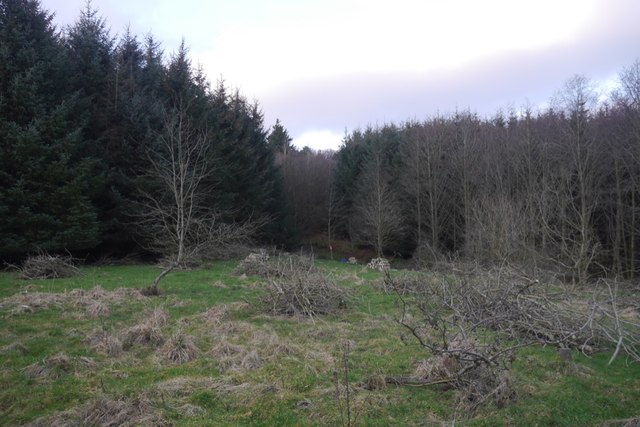
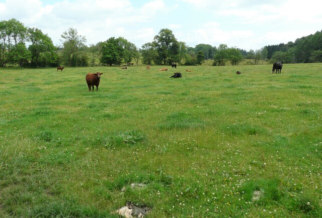
The woodland is predominantly composed of native Scottish trees, such as oak, birch, and rowan. These trees provide a lush and green canopy, creating a peaceful atmosphere for nature enthusiasts. Moss Wood is also home to a variety of wildlife, including deer, red squirrels, and numerous bird species. Birdwatchers often flock to this area to catch a glimpse of rare and migratory birds.

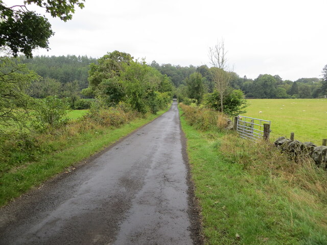
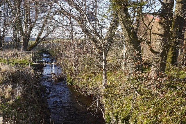
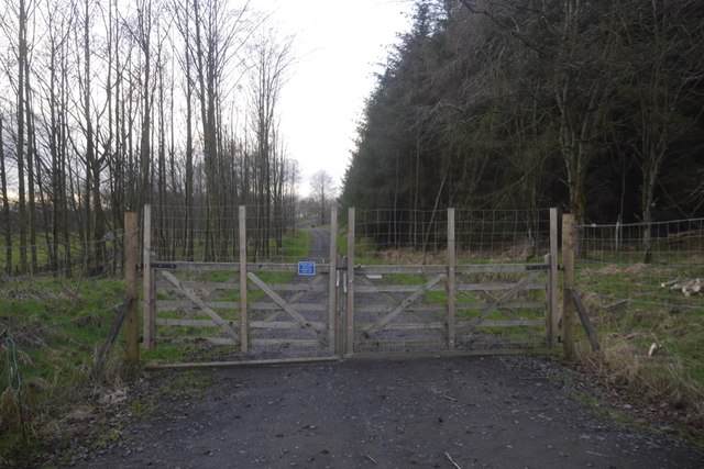
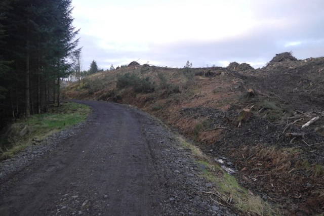
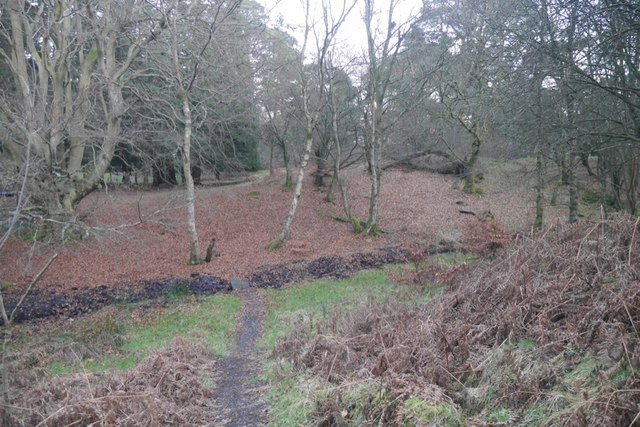
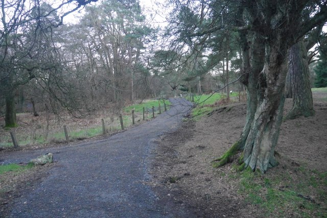
The forest offers a network of well-maintained walking trails, allowing visitors to explore its natural wonders. These paths wind through the woodland, offering breathtaking views of the surrounding landscape. The forest is also intersected by a small river, adding to its charm and providing a serene setting for picnickers.

Moss Wood is a popular destination for outdoor activities such as hiking, cycling, and wildlife spotting. In addition to its natural beauty, the forest holds historical significance, with remnants of ancient settlements and archaeological sites scattered throughout. This makes it an intriguing destination for history enthusiasts as well.

Overall, Moss Wood in Stirlingshire is a picturesque and ecologically rich woodland, inviting visitors to immerse themselves in nature and explore its many wonders.

If you have any feedback on the listing, please let us know in the comments section below.

Moss Wood Images

Images are sourced within 2km of 56.064207/-3.9125429 or Grid Reference NS8187. Thanks to Geograph Open Source API. All images are credited.

Minor road between Kingsburgh and Craigend Looking south-westward.
Minor road between Kingsburgh and Craigend
Looking south-westward.
Ordnance Survey Cut Mark with Rivet This mark can be found on top of the parapet wall of a road bridge near Auchenbowie.
The recorded details give a height of 79.35 metres above sea level.
For more detail see : <span class="nowrap"><a title="https://www.bench-marks.org.uk/bm179739" rel="nofollow ugc noopener" href="https://www.bench-marks.org.uk/bm179739">Link</a><img style="margin-left:2px;" alt="External link" title="External link - shift click to open in new window" src="https://s1.geograph.org.uk/img/external.png" width="10" height="10"/></span>
Ordnance Survey Cut Mark with Rivet
This mark can be found on top of the parapet wall of a road bridge near Auchenbowie. The recorded details give a height of 79.35 metres above sea level. For more detail see : LinkExternal link
Drainage, Auchenbowie A straightened out burn.
Drainage, Auchenbowie
A straightened out burn.
Road to Boards Quarry Now blocked off.
Road to Boards Quarry
Now blocked off.
New road, Barr Wood The road, which is new and not on the latest edition of the orienteering map runs up to a shelter at NS790867. It has been used to extract timber and services the scout camp without destroying the wild feel of the part of the camp most often used.
New road, Barr Wood
The road, which is new and not on the latest edition of the orienteering map runs up to a shelter at NS790867. It has been used to extract timber and services the scout camp without destroying the wild feel of the part of the camp most often used.
Barr Wood By the new road on the edge of the woodland. This is a small commercial plantation and does not appear to be used by the Scout camp.
Barr Wood
By the new road on the edge of the woodland. This is a small commercial plantation and does not appear to be used by the Scout camp.
New road and felled area, Barr Wood The road is of very recent construction.
New road and felled area, Barr Wood
The road is of very recent construction.
Barr Wood Much of the wood is used as a Scout camp, so best visited in Winter.
Barr Wood
Much of the wood is used as a Scout camp, so best visited in Winter.
Path, Barr Wood Newly upgraded path. The wood is used as a Scout camp.
Path, Barr Wood
Newly upgraded path. The wood is used as a Scout camp.
Closed caravan site, Auchenbowie
Field with cattle
Field with cattle
M80, northbound The M80 joins Glasgow to Stirling. It runs 25 miles from Glasgow to Bannockburn.
<span class="nowrap"><a title="https://www.sabre-roads.org.uk/wiki/index.php?title=M80" rel="nofollow ugc noopener" href="https://www.sabre-roads.org.uk/wiki/index.php?title=M80">Link</a><img style="margin-left:2px;" alt="External link" title="External link - shift click to open in new window" src="https://s1.geograph.org.uk/img/external.png" width="10" height="10"/></span>
M80, northbound
The M80 joins Glasgow to Stirling. It runs 25 miles from Glasgow to Bannockburn. LinkExternal link
Access bridge, M80 The M80 joins Glasgow to Stirling. It runs 25 miles from Glasgow to Bannockburn.
<span class="nowrap"><a title="https://www.sabre-roads.org.uk/wiki/index.php?title=M80" rel="nofollow ugc noopener" href="https://www.sabre-roads.org.uk/wiki/index.php?title=M80">Link</a><img style="margin-left:2px;" alt="External link" title="External link - shift click to open in new window" src="https://s1.geograph.org.uk/img/external.png" width="10" height="10"/></span>
Access bridge, M80
The M80 joins Glasgow to Stirling. It runs 25 miles from Glasgow to Bannockburn. LinkExternal link
Tourist information on M80 The M80 joins Glasgow to Stirling. It runs 25 miles from Glasgow to Bannockburn.
<span class="nowrap"><a title="https://www.sabre-roads.org.uk/wiki/index.php?title=M80" rel="nofollow ugc noopener" href="https://www.sabre-roads.org.uk/wiki/index.php?title=M80">Link</a><img style="margin-left:2px;" alt="External link" title="External link - shift click to open in new window" src="https://s1.geograph.org.uk/img/external.png" width="10" height="10"/></span>
Tourist information on M80
The M80 joins Glasgow to Stirling. It runs 25 miles from Glasgow to Bannockburn. LinkExternal link
M80, northbound The M80 joins Glasgow to Stirling. It runs 25 miles from Glasgow to Bannockburn.
<span class="nowrap"><a title="https://www.sabre-roads.org.uk/wiki/index.php?title=M80" rel="nofollow ugc noopener" href="https://www.sabre-roads.org.uk/wiki/index.php?title=M80">Link</a><img style="margin-left:2px;" alt="External link" title="External link - shift click to open in new window" src="https://s1.geograph.org.uk/img/external.png" width="10" height="10"/></span>
M80, northbound
The M80 joins Glasgow to Stirling. It runs 25 miles from Glasgow to Bannockburn. LinkExternal link
M80, northbound approaching J9 The M80 joins Glasgow to Stirling. It runs 25 miles from Glasgow to Bannockburn.
<span class="nowrap"><a title="https://www.sabre-roads.org.uk/wiki/index.php?title=M80" rel="nofollow ugc noopener" href="https://www.sabre-roads.org.uk/wiki/index.php?title=M80">Link</a><img style="margin-left:2px;" alt="External link" title="External link - shift click to open in new window" src="https://s1.geograph.org.uk/img/external.png" width="10" height="10"/></span>
M80, northbound approaching J9
The M80 joins Glasgow to Stirling. It runs 25 miles from Glasgow to Bannockburn. LinkExternal link
M80, northbound The M80 joins Glasgow to Stirling. It runs 25 miles from Glasgow to Bannockburn.
<span class="nowrap"><a title="https://www.sabre-roads.org.uk/wiki/index.php?title=M80" rel="nofollow ugc noopener" href="https://www.sabre-roads.org.uk/wiki/index.php?title=M80">Link</a><img style="margin-left:2px;" alt="External link" title="External link - shift click to open in new window" src="https://s1.geograph.org.uk/img/external.png" width="10" height="10"/></span>
M80, northbound
The M80 joins Glasgow to Stirling. It runs 25 miles from Glasgow to Bannockburn. LinkExternal link
BP filling station at Stirling Services
Show me another place!

Moss Wood is located at Grid Ref: NS8187 (Lat: 56.064207, Lng: -3.9125429)

Unitary Authority: Stirling

Police Authority: Forth Valley

What 3 Words

///mere.gambles.tricks. Near Plean, Stirling

Related Wikis

Battle of Sauchieburn

The Battle of Sauchieburn was fought on 11 June 1488, at the side of Sauchie Burn, a stream about two miles (3 km) south of Stirling, Scotland. The battle...

Auchenbowie House

Auchenbowie House is a laird's house (mansion) in Stirling, Scotland. The location is about 3.5 miles (5.6 km) south of Stirling, on minor road west of...
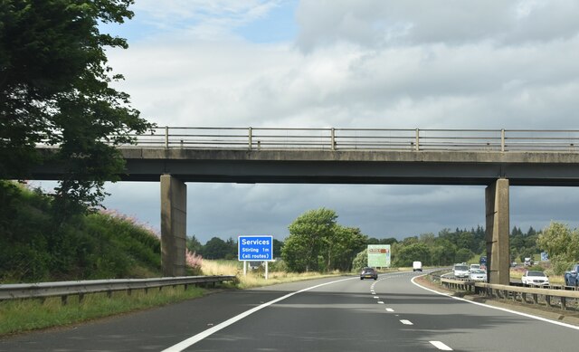
Stirling services

Stirling services is a motorway service station near Stirling, Scotland. The service station is located where the M9 motorway and M80 motorway join. It...

Bannockburn House

Bannockburn House is a property of historical significance in the town of Bannockburn. It is a Category A listed building. == History == Bannockburn House...

Plean

Plean is a village, in the Stirling council area of central Scotland, located on the main A9 road from Falkirk. At the 2001 census, Plean had a population...

Howietoun Fishery

Howietoun Fishery was created by Sir James Ramsay Gibson Maitland; it is a Victorian fish farm that specialised in the study of trout and salmon farming...

Plean railway station

Plean railway station served the village of Plean, Stirlingshire, Scotland from 1904 to 1956 on the Scottish Central Railway. == History == The station...

William Simpson's Home

The William Simpson's Home is a care home in Plean, Scotland. It provides care for members of the armed services who have developed mental health or alcohol...

Nearby Amenities

Located within 500m of 56.064207,-3.9125429
Entrance: main
Lat/Long: 56.06553/-3.9096944
Power: pole
Lat/Long: 56.0652149/-3.9047905
Power: pole
Lat/Long: 56.0655484/-3.906066
Power: pole
Lat/Long: 56.0656085/-3.9068464
Power: pole
Lat/Long: 56.0657151/-3.9075514
Battle of Sauchieburn (1488)
Historic: battlefield
Lat/Long: 56.0667164/-3.9168041
West Plean
Place: hamlet
Lat/Long: 56.0660651/-3.9066452
Power: pole
Lat/Long: 56.0654454/-3.9197901
Power: pole
Lat/Long: 56.0644862/-3.9192663
Power: pole
Lat/Long: 56.0639551/-3.9190107
Power: pole
Lat/Long: 56.0634205/-3.9182752
Power: pole
Lat/Long: 56.0627291/-3.9173679
Power: pole
Lat/Long: 56.0621208/-3.916559
Power: pole
Lat/Long: 56.0616119/-3.9155218
Power: pole
Lat/Long: 56.0610036/-3.9142457
Power: pole
Lat/Long: 56.0603496/-3.9127978
Power: pole
Lat/Long: 56.0599308/-3.911903
Power: pole
Lat/Long: 56.060373/-3.9142771
The data included in this document is from www.openstreetmap.org. The data is made available under ODbL.

Have you been to Moss Wood?

Leave your review of Moss Wood below (or comments, questions and feedback).