Pheasantry Wood

Wood, Forest in Stirlingshire

Scotland

Pheasantry Wood

New road, Barr Wood The road, which is new and not on the latest edition of the orienteering map runs up to a shelter at NS790867. It has been used to extract timber and services the scout camp without destroying the wild feel of the part of the camp most often used.
New road, Barr Wood Credit: Richard Webb

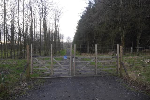
Pheasantry Wood is a beautiful forest located in Stirlingshire, Scotland. Covering an area of approximately 100 hectares, it is a popular destination for nature lovers and outdoor enthusiasts.

The wood is characterized by its diverse range of tree species, including oak, birch, and Scots pine. These trees create a lush and vibrant canopy, providing a habitat for a wide variety of wildlife. Visitors can expect to encounter various bird species such as pheasants, woodpeckers, and owls, as well as small mammals like squirrels and rabbits.

The forest is crisscrossed by well-maintained trails, allowing visitors to explore its natural wonders on foot. These trails lead to several points of interest, such as a picturesque pond and a tranquil river. Along the way, visitors can enjoy the peaceful ambiance of the wood, often hearing the soothing sounds of birds chirping and leaves rustling in the wind.

Pheasantry Wood is not only a haven for wildlife but also a cherished recreational spot for the local community. It offers opportunities for activities such as hiking, jogging, and picnicking. The forest also provides a serene setting for those seeking a peaceful escape from the hustle and bustle of daily life.

Managed by the local authorities, Pheasantry Wood is well-preserved and cared for. Its accessibility and natural beauty make it a beloved destination for both locals and tourists alike, attracting visitors throughout the year. Whether it's for a leisurely stroll, a family outing, or simply to immerse oneself in nature, Pheasantry Wood is a delightful place to visit in Stirlingshire.

If you have any feedback on the listing, please let us know in the comments section below.

Pheasantry Wood Images

Images are sourced within 2km of 56.062485/-3.9077351 or Grid Reference NS8187. Thanks to Geograph Open Source API. All images are credited.

New road, Barr Wood The road, which is new and not on the latest edition of the orienteering map runs up to a shelter at NS790867. It has been used to extract timber and services the scout camp without destroying the wild feel of the part of the camp most often used.
New road, Barr Wood
The road, which is new and not on the latest edition of the orienteering map runs up to a shelter at NS790867. It has been used to extract timber and services the scout camp without destroying the wild feel of the part of the camp most often used.
M80, northbound The M80 joins Glasgow to Stirling. It runs 25 miles from Glasgow to Bannockburn.
<span class="nowrap"><a title="https://www.sabre-roads.org.uk/wiki/index.php?title=M80" rel="nofollow ugc noopener" href="https://www.sabre-roads.org.uk/wiki/index.php?title=M80">Link</a><img style="margin-left:2px;" alt="External link" title="External link - shift click to open in new window" src="https://s1.geograph.org.uk/img/external.png" width="10" height="10"/></span>
M80, northbound
The M80 joins Glasgow to Stirling. It runs 25 miles from Glasgow to Bannockburn. LinkExternal link
Access bridge, M80 The M80 joins Glasgow to Stirling. It runs 25 miles from Glasgow to Bannockburn.
<span class="nowrap"><a title="https://www.sabre-roads.org.uk/wiki/index.php?title=M80" rel="nofollow ugc noopener" href="https://www.sabre-roads.org.uk/wiki/index.php?title=M80">Link</a><img style="margin-left:2px;" alt="External link" title="External link - shift click to open in new window" src="https://s1.geograph.org.uk/img/external.png" width="10" height="10"/></span>
Access bridge, M80
The M80 joins Glasgow to Stirling. It runs 25 miles from Glasgow to Bannockburn. LinkExternal link
Tourist information on M80 The M80 joins Glasgow to Stirling. It runs 25 miles from Glasgow to Bannockburn.
<span class="nowrap"><a title="https://www.sabre-roads.org.uk/wiki/index.php?title=M80" rel="nofollow ugc noopener" href="https://www.sabre-roads.org.uk/wiki/index.php?title=M80">Link</a><img style="margin-left:2px;" alt="External link" title="External link - shift click to open in new window" src="https://s1.geograph.org.uk/img/external.png" width="10" height="10"/></span>
Tourist information on M80
The M80 joins Glasgow to Stirling. It runs 25 miles from Glasgow to Bannockburn. LinkExternal link
M80, northbound The M80 joins Glasgow to Stirling. It runs 25 miles from Glasgow to Bannockburn.
<span class="nowrap"><a title="https://www.sabre-roads.org.uk/wiki/index.php?title=M80" rel="nofollow ugc noopener" href="https://www.sabre-roads.org.uk/wiki/index.php?title=M80">Link</a><img style="margin-left:2px;" alt="External link" title="External link - shift click to open in new window" src="https://s1.geograph.org.uk/img/external.png" width="10" height="10"/></span>
M80, northbound
The M80 joins Glasgow to Stirling. It runs 25 miles from Glasgow to Bannockburn. LinkExternal link
M80, northbound approaching J9 The M80 joins Glasgow to Stirling. It runs 25 miles from Glasgow to Bannockburn.
<span class="nowrap"><a title="https://www.sabre-roads.org.uk/wiki/index.php?title=M80" rel="nofollow ugc noopener" href="https://www.sabre-roads.org.uk/wiki/index.php?title=M80">Link</a><img style="margin-left:2px;" alt="External link" title="External link - shift click to open in new window" src="https://s1.geograph.org.uk/img/external.png" width="10" height="10"/></span>
M80, northbound approaching J9
The M80 joins Glasgow to Stirling. It runs 25 miles from Glasgow to Bannockburn. LinkExternal link
M80, northbound The M80 joins Glasgow to Stirling. It runs 25 miles from Glasgow to Bannockburn.
<span class="nowrap"><a title="https://www.sabre-roads.org.uk/wiki/index.php?title=M80" rel="nofollow ugc noopener" href="https://www.sabre-roads.org.uk/wiki/index.php?title=M80">Link</a><img style="margin-left:2px;" alt="External link" title="External link - shift click to open in new window" src="https://s1.geograph.org.uk/img/external.png" width="10" height="10"/></span>
M80, northbound
The M80 joins Glasgow to Stirling. It runs 25 miles from Glasgow to Bannockburn. LinkExternal link
BP filling station at Stirling Services
Ragged-robin near Stirling Services Close to the M80 and a short stroll from Stirling Services.
Ragged-robin near Stirling Services
Close to the M80 and a short stroll from Stirling Services.
Germander Speedwell near Stirling Services A surprising number of wildflowers were to be found behind Stirling Services.
Germander Speedwell near Stirling Services
A surprising number of wildflowers were to be found behind Stirling Services.
Post Box at Stirling Services FK7 214. Royal Mail list this box as 'Moto Service Station'.
Post Box at Stirling Services
FK7 214. Royal Mail list this box as 'Moto Service Station'.
View of Stirling Services
Minor road near Auchenbowie Wood Looking eastward. In the far distance a section of the M80 motorway can be seen.
Minor road near Auchenbowie Wood
Looking eastward. In the far distance a section of the M80 motorway can be seen.
Car park, Stirling Services
Small Burn, Plean
Small Burn, Plean
Barr Wood, boundary dyke They use big stones in these parts to build their dykes.
Barr Wood, boundary dyke
They use big stones in these parts to build their dykes.
Frosty field, Auchenbowie A view of the northern edge of Barr Wood.
Frosty field, Auchenbowie
A view of the northern edge of Barr Wood.
Car Park at Stirling Motorway Services These disabled parking bays are in the services which are located in the centre of the motorway junction of the M9, M80, A91 ande the A872. In the background is the Travelodge Hotel.
Car Park at Stirling Motorway Services
These disabled parking bays are in the services which are located in the centre of the motorway junction of the M9, M80, A91 ande the A872. In the background is the Travelodge Hotel.
Show me another place!

Pheasantry Wood is located at Grid Ref: NS8187 (Lat: 56.062485, Lng: -3.9077351)

Unitary Authority: Stirling

Police Authority: Forth Valley

What 3 Words

///routs.bucked.sector. Near Plean, Stirling

Related Wikis

Battle of Sauchieburn

The Battle of Sauchieburn was fought on 11 June 1488, at the side of Sauchie Burn, a stream about two miles (3 km) south of Stirling, Scotland. The battle...

Auchenbowie House

Auchenbowie House is a laird's house (mansion) in Stirling, Scotland. The location is about 3.5 miles (5.6 km) south of Stirling, on minor road west of...
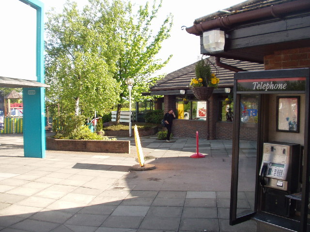
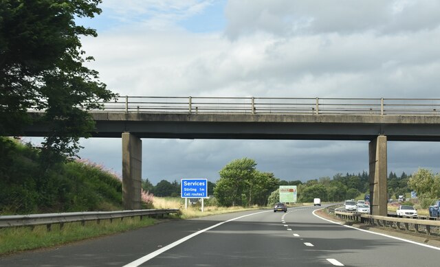
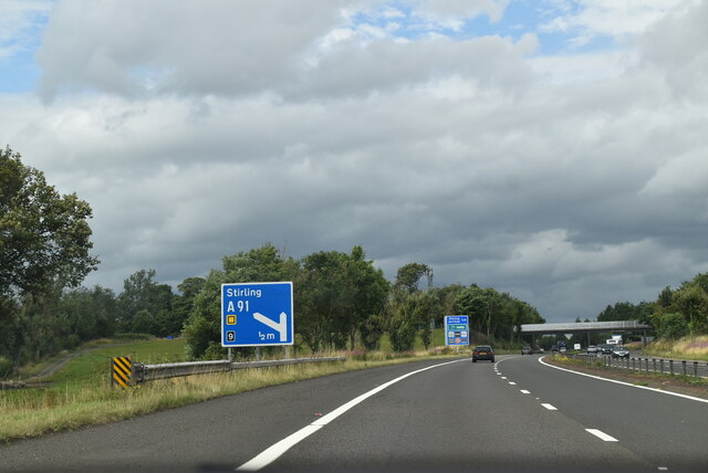
Stirling services

Stirling services is a motorway service station near Stirling, Scotland. The service station is located where the M9 motorway and M80 motorway join. It...

Bannockburn House

Bannockburn House is a property of historical significance in the town of Bannockburn. It is a Category A listed building. == History == Bannockburn House...

Plean

Plean is a village, in the Stirling council area of central Scotland, located on the main A9 road from Falkirk. At the 2001 census, Plean had a population...

William Simpson's Home

The William Simpson's Home is a care home in Plean, Scotland. It provides care for members of the armed services who have developed mental health or alcohol...

Plean railway station

Plean railway station served the village of Plean, Stirlingshire, Scotland from 1904 to 1956 on the Scottish Central Railway. == History == The station...

Tappoch Broch

Tappoch Broch, better known as Torwood Broch, is an iron-age broch located in a remote spot in dense woodland near Falkirk, Scotland. == History == Tappoch...

Nearby Amenities

Located within 500m of 56.062485,-3.9077351
Power: pole
Lat/Long: 56.0600826/-3.9011382
Power: pole
Lat/Long: 56.0604062/-3.9016309
Power: pole
Lat/Long: 56.0607725/-3.9021388
Power: pole
Lat/Long: 56.061143/-3.9026673
Power: pole
Lat/Long: 56.0615164/-3.903211
Power: pole
Lat/Long: 56.0618941/-3.9037547
Power: pole
Lat/Long: 56.0622974/-3.9043138
Power: pole
Lat/Long: 56.0626651/-3.9048448
Entrance: main
Lat/Long: 56.06553/-3.9096944
Power: pole
Lat/Long: 56.0632631/-3.9045403
Power: pole
Lat/Long: 56.0643736/-3.9007186
Power: pole
Lat/Long: 56.0649208/-3.9035984
Power: pole
Lat/Long: 56.0652149/-3.9047905
Power: pole
Lat/Long: 56.0655484/-3.906066
Power: pole
Lat/Long: 56.0656085/-3.9068464
Power: pole
Lat/Long: 56.0657151/-3.9075514
West Plean
Place: hamlet
Lat/Long: 56.0660651/-3.9066452
Power: pole
Lat/Long: 56.0616119/-3.9155218
Power: pole
Lat/Long: 56.0610036/-3.9142457
Power: pole
Lat/Long: 56.0603496/-3.9127978
Power: pole
Lat/Long: 56.0599308/-3.911903
Power: pole
Lat/Long: 56.0594031/-3.9107988
Power: pole
Lat/Long: 56.0589703/-3.9096589
Power: pole
Lat/Long: 56.0585678/-3.9085902
Power: pole
Lat/Long: 56.0580132/-3.9071653
Power: pole
Lat/Long: 56.060373/-3.9142771
Power: pole
Lat/Long: 56.0597822/-3.9141032
Power: pole
Lat/Long: 56.0646172/-3.9023836
Power: pole
Lat/Long: 56.0637083/-3.903799
Power: pole
Lat/Long: 56.0641715/-3.9030573
The data included in this document is from www.openstreetmap.org. The data is made available under ODbL.

Have you been to Pheasantry Wood?

Leave your review of Pheasantry Wood below (or comments, questions and feedback).