The Warren

Wood, Forest in Denbighshire

Wales

The Warren

Ordnance Survey Cut Mark This OS cut mark can be found on the wall of No25 Hightown Road. It marks a point 73.289m above mean sea level.
Ordnance Survey Cut Mark Credit: Adrian Dust

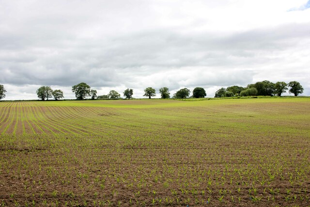
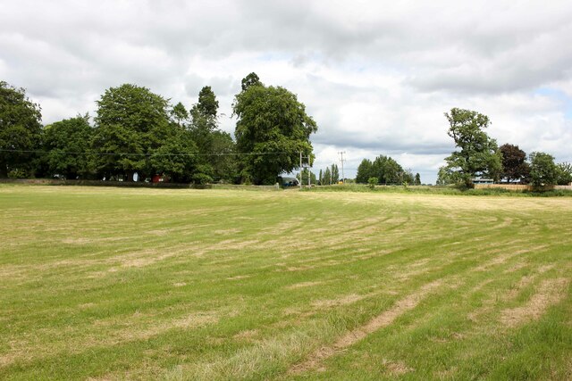
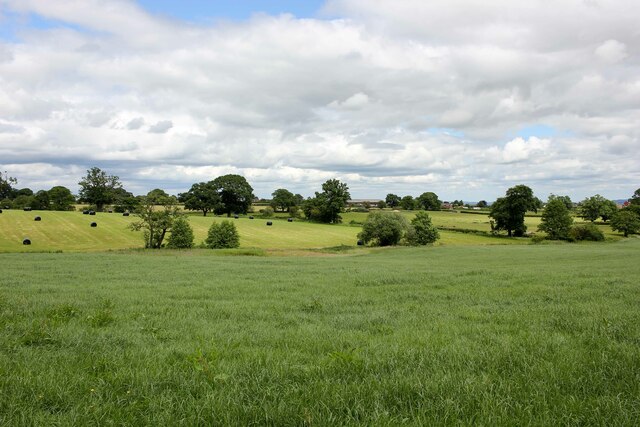
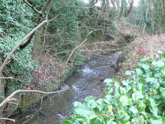
The Warren in Denbighshire, Wales, is a picturesque wood or forest located in the heart of the county. Spanning approximately 200 acres, it is a popular destination for nature enthusiasts and those seeking tranquility amidst beautiful surroundings.

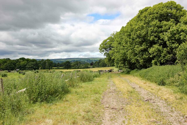
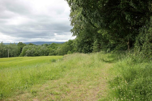
The Warren is characterized by its diverse range of tree species, including oak, birch, and beech, which provide a lush and verdant canopy throughout the area. The forest floor is carpeted with an array of wildflowers, adding bursts of color to the landscape during spring and summer months. The presence of various animal species, such as deer, rabbits, and birds, further enhances the natural charm of the wood.

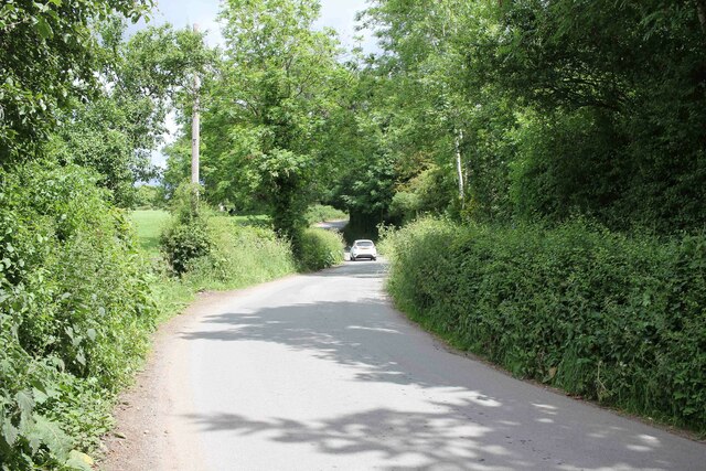
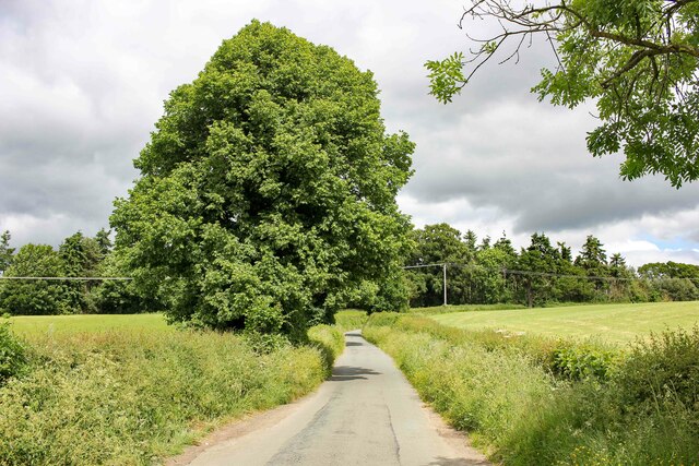
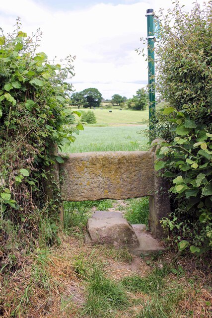
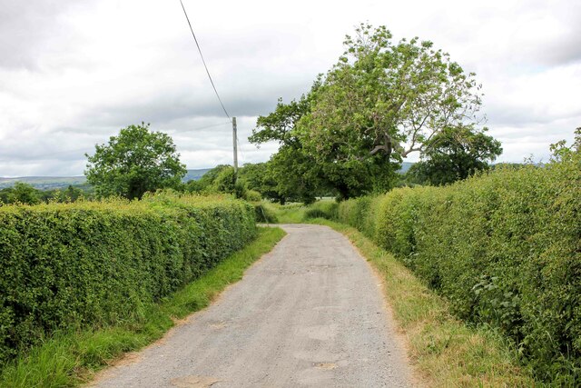
Visitors to The Warren can explore its numerous walking trails, which wind through the forest and offer breathtaking views of the surrounding countryside. These trails cater to all levels of fitness and provide an opportunity to immerse oneself in the peaceful ambiance of the wood. The wood is also home to a small pond, which attracts a variety of wildlife and offers a serene spot for reflection.

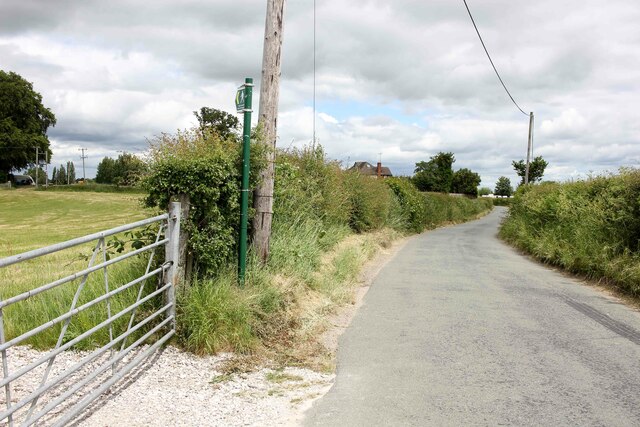
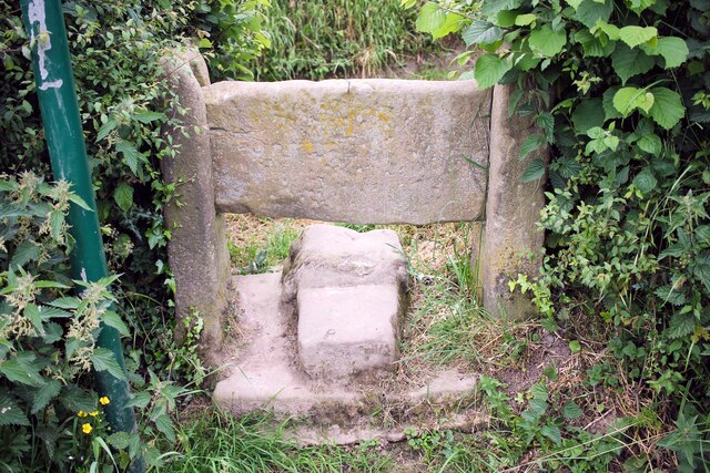
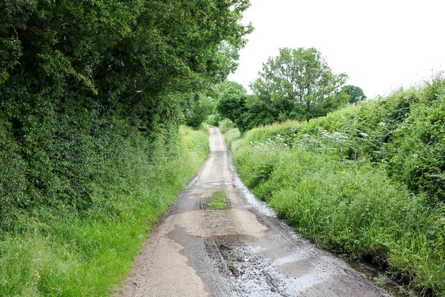
The Warren is managed by the local council, ensuring its preservation and upkeep for future generations to enjoy. The wood is easily accessible, with ample parking and well-maintained paths. Additionally, there are picnic areas and benches strategically placed throughout the wood, allowing visitors to relax and appreciate the natural beauty around them.

Whether for a leisurely stroll, birdwatching, or simply escaping the hustle and bustle of everyday life, The Warren offers a tranquil retreat amidst the idyllic Denbighshire countryside.

If you have any feedback on the listing, please let us know in the comments section below.
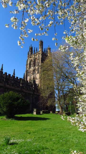
The Warren Images

Images are sourced within 2km of 53.027347/-2.9836767 or Grid Reference SJ3448. Thanks to Geograph Open Source API. All images are credited.

Ordnance Survey Cut Mark This OS cut mark can be found on the wall of No25 Hightown Road. It marks a point 73.289m above mean sea level.
Ordnance Survey Cut Mark
This OS cut mark can be found on the wall of No25 Hightown Road. It marks a point 73.289m above mean sea level.
Ordnance Survey Cut Mark This OS cut mark can be found on the outbuilding of Ael-y-bryn on Tenters Lane. It marks a point 86.194m above mean sea level.
Ordnance Survey Cut Mark
This OS cut mark can be found on the outbuilding of Ael-y-bryn on Tenters Lane. It marks a point 86.194m above mean sea level.
Wrexham - St Giles Church (tower)
Ffordd Sonlli (Sontley Road), Erddig Looking northeast along Ffordd Sonlli (Sontley Road) near Erddig Hall Lodge. The land on both sides of the lane belong to the National Trust Erddig Estate.
Ffordd Sonlli (Sontley Road), Erddig
Looking northeast along Ffordd Sonlli (Sontley Road) near Erddig Hall Lodge. The land on both sides of the lane belong to the National Trust Erddig Estate.
Footpath across Erddig Park Footpath heading west across Erddig Park from Sontley Road (Ffordd Sonlli).
Footpath across Erddig Park
Footpath heading west across Erddig Park from Sontley Road (Ffordd Sonlli).
View across Reynold's Grave View across the fields which according to the OS map has the odd name of Reynold's Grave.
View across Reynold's Grave
View across the fields which according to the OS map has the odd name of Reynold's Grave.
Marchwiel Hall Lane near Erddig Heading west along Marchwiel Hall Lane to the east of Erddig Hall.
Marchwiel Hall Lane near Erddig
Heading west along Marchwiel Hall Lane to the east of Erddig Hall.
Footpath near Marchwiel Hall A public footpath heading west towards New Sontley near Marchwiel Hall.
Footpath near Marchwiel Hall
A public footpath heading west towards New Sontley near Marchwiel Hall.
Marchwiel Hall Lodge Marchwiel Hall Lodge.
Marchwiel Hall Lodge
Marchwiel Hall Lodge.
Footpath across Bryn-y-Grog Farm A public footpath heading across Bryn-y-Grog Farm connecting Marchwiel Hall Lane and the A525.
Footpath across Bryn-y-Grog Farm
A public footpath heading across Bryn-y-Grog Farm connecting Marchwiel Hall Lane and the A525.
Marchwiel Hall Lane near Bryn-y-Grog Farm Marchwiel Hall Lane near Bryn-y-Grog Farm as it heads northeast towards the A525 near Marchwiel.
Marchwiel Hall Lane near Bryn-y-Grog Farm
Marchwiel Hall Lane near Bryn-y-Grog Farm as it heads northeast towards the A525 near Marchwiel.
L&D Brothers, Marchwiel L&D Brothers Garage next to the A525 on the outskirts of Marchwiel.
L&D Brothers, Marchwiel
L&D Brothers Garage next to the A525 on the outskirts of Marchwiel.
The A525 at Marchwiel The A525 at the junction with Marchwiel Hall Lane.
The A525 at Marchwiel
The A525 at the junction with Marchwiel Hall Lane.
Stile off Woodhouse Lane An old stone stile off Stonehouse Lane near Old Hall Farm.
Stile off Woodhouse Lane
An old stone stile off Stonehouse Lane near Old Hall Farm.
Towards Marchwiel A public footpath across the fields heading towards Marchwiel.
Towards Marchwiel
A public footpath across the fields heading towards Marchwiel.
Stile off Woodhouse Lane An old stone stile off Stonehouse Lane near Old Hall Farm.
Stile off Woodhouse Lane
An old stone stile off Stonehouse Lane near Old Hall Farm.
Woodhouse Lane Heading south along the narrow Woodhouse Lane towards Cock Bank.
Woodhouse Lane
Heading south along the narrow Woodhouse Lane towards Cock Bank.
Lane to Sontley Road Marked on the OS map as a short on-road cycle route this lane heads west towards Sontley Road.
Lane to Sontley Road
Marked on the OS map as a short on-road cycle route this lane heads west towards Sontley Road.
Show me another place!

The Warren is located at Grid Ref: SJ3448 (Lat: 53.027347, Lng: -2.9836767)

Unitary Authority: Wrexham

Police Authority: North Wales

What 3 Words

///settled.helpfully.gross. Near Marchwiel, Wrexham

Related Wikis

Marchwiel Hall

Marchwiel Hall is a Grade II listed building in the village of Marchwiel, Wrexham County Borough in North Wales. == History == Marchwiel Hall was a seat...

A525 road

The A525 is a major route from Rhyl in Wales to Newcastle-under-Lyme in England. The route passes near Denbigh, through Ruthin, through Wrexham and near...

River Gwenfro

The River Gwenfro (Welsh: Afon Gwenfro) is a small river in Wrexham County Borough, north Wales. It is a tributary of the Clywedog. The name Gwenfro is...

Hightown Barracks

Hightown Barracks is a military installation in Wrexham, Wales. == History == The barracks were built in the Fortress Gothic Revival Style and completed...

Hightown, Wrexham

Hightown is a suburban area of Wrexham, in Wrexham County Borough, Wales.The Wrexham and Ellesmere Railway used to have a station known as Hightown Halt...

St Joseph's Catholic and Anglican High School

St Joseph's Catholic and Anglican High School (Welsh: Ysgol Uwchradd Gatholig ac Anglicanaidd Sant Joseff) is a secondary school in Wrexham, Wales, located...

Hightown Halt railway station

Hightown Halt railway station was a station in Caia Park, Wrexham, Wales. The station was opened on 9 July 1923 and closed on 10 September 1962. ��2�...

Erddig

Erddig Hall (Welsh: Neuadd Erddig; or simply Erddig; Welsh pronunciation: [ˈɛrðɪɡ]) is a Grade-I listed National Trust property near Wrexham, North Wales...

Nearby Amenities

Located within 500m of 53.027347,-2.9836767
Power: tower
Lat/Long: 53.0246765/-2.9872736
Power: tower
Lat/Long: 53.0269094/-2.9835783
Power: tower
Lat/Long: 53.02887/-2.980229
Bryn-y-cabanau Wood
Name Cy: Coed Bryn-y-cabanau
Name En: Bryn-y-cabanau Wood
Natural: wood
Lat/Long: 53.030163/-2.983729
Bryn-y-cabanau Farm
Name Cy: Fferm Bryn-y-cabanau
Name En: Bryn-y-cabanau Farm
Place: farm
Lat/Long: 53.0307323/-2.9812373
Marchwiel Hall
Name Cy: Neuadd Marchwiail
Name En: Marchwiel Hall
Old Name: Marchweil Hall
Place: isolated_dwelling
Wikidata: Q6757046
Wikipedia: en:Marchwiel Hall
Lat/Long: 53.0250168/-2.978711
Mill Pool Covert
Name Cy: Cudd Pwll Melin
Name En: Mill Pool Covert
Natural: wood
Lat/Long: 53.0265335/-2.9844115
Mill House - Disued Corn Mill
Historic: Disued_Corn_Mill
Lat/Long: 53.0276292/-2.9845437
The Warren
Name Cy: Coed y Warren
Name En: The Warren
Natural: wood
Lat/Long: 53.024028/-2.983586
The data included in this document is from www.openstreetmap.org. The data is made available under ODbL.

Have you been to The Warren?

Leave your review of The Warren below (or comments, questions and feedback).