Bryn-y-cabanau Wood

Wood, Forest in Denbighshire

Wales

Bryn-y-cabanau Wood

Ordnance Survey Cut Mark This OS cut mark can be found on the wall of No25 Hightown Road. It marks a point 73.289m above mean sea level.
Ordnance Survey Cut Mark Credit: Adrian Dust

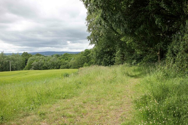
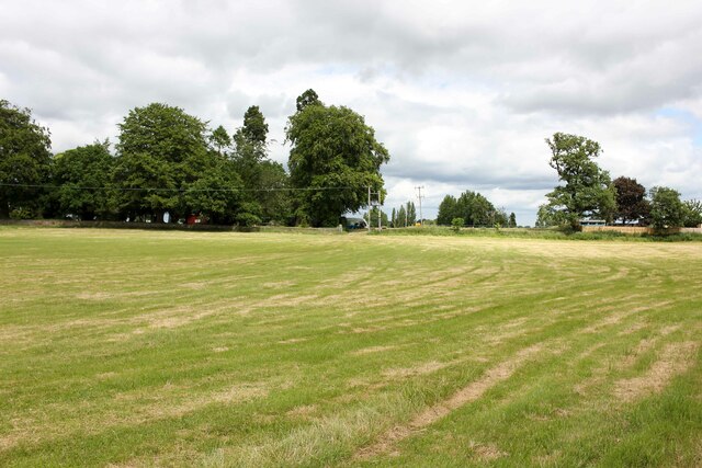
Bryn-y-cabanau Wood is a beautiful woodland located in Denbighshire, a county in the northeastern part of Wales, United Kingdom. Covering an area of approximately 150 acres, this forest is a haven for nature lovers and outdoor enthusiasts.

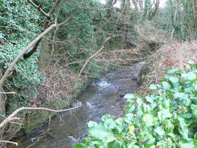
The woodland is characterized by its diverse range of trees, including oak, beech, birch, and coniferous species. The dense canopy created by these trees provides a cool and shaded environment, making it an ideal spot for leisurely walks and picnics during the summer months.

Bryn-y-cabanau Wood is also home to a variety of wildlife, making it a popular destination for birdwatchers and wildlife enthusiasts. Visitors may spot species such as woodpeckers, owls, and buzzards, as well as other small mammals like squirrels and rabbits.

There are several well-maintained trails throughout the woodland, allowing visitors to explore the area and take in the natural beauty at their own pace. These paths are suitable for both casual strollers and more experienced hikers, offering a range of difficulty levels.

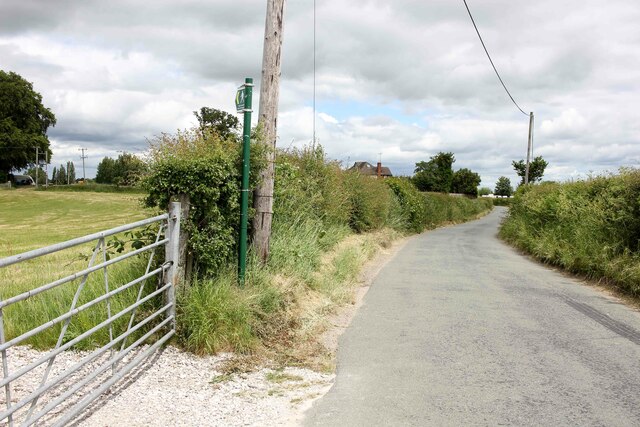
The wood is easily accessible, with a car park located nearby for visitors' convenience. It is also well-connected to the surrounding area, with several footpaths leading to nearby villages and attractions.

Overall, Bryn-y-cabanau Wood is a tranquil and idyllic forest, offering a peaceful escape from the hustle and bustle of everyday life. Whether you're seeking a leisurely stroll, a family picnic, or a chance to immerse yourself in nature, this woodland provides a truly enchanting experience.

If you have any feedback on the listing, please let us know in the comments section below.

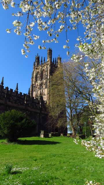
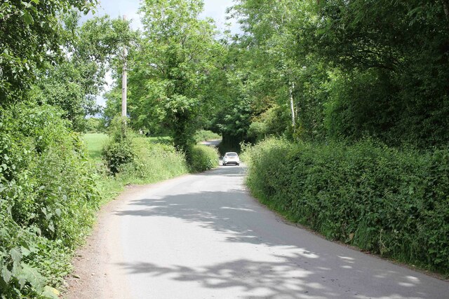
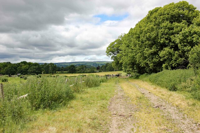
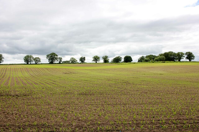
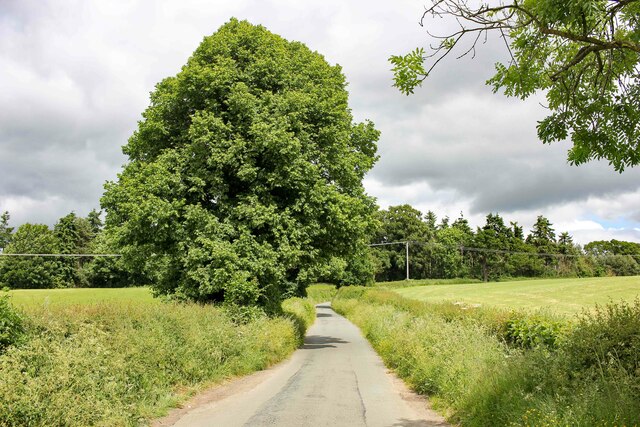
Bryn-y-cabanau Wood Images

Images are sourced within 2km of 53.032256/-2.9814324 or Grid Reference SJ3448. Thanks to Geograph Open Source API. All images are credited.

Ordnance Survey Cut Mark This OS cut mark can be found on the wall of No25 Hightown Road. It marks a point 73.289m above mean sea level.
Ordnance Survey Cut Mark
This OS cut mark can be found on the wall of No25 Hightown Road. It marks a point 73.289m above mean sea level.
Ordnance Survey Cut Mark This OS cut mark can be found on the north face of the Wynnstay Arms Hotel. It marks a point 80.330m above mean sea level.
Ordnance Survey Cut Mark
This OS cut mark can be found on the north face of the Wynnstay Arms Hotel. It marks a point 80.330m above mean sea level.
Ordnance Survey Cut Mark This OS cut mark can be found on the wall west side of Chester Road. It marks a point 84.725m above mean sea level.
Ordnance Survey Cut Mark
This OS cut mark can be found on the wall west side of Chester Road. It marks a point 84.725m above mean sea level.
Ordnance Survey Cut Mark This OS cut mark can be found on the Old Courts/Police Station building. It marks a point 86.786m above mean sea level.
Ordnance Survey Cut Mark
This OS cut mark can be found on the Old Courts/Police Station building. It marks a point 86.786m above mean sea level.
Ordnance Survey Cut Mark This OS cut mark can be found on No35 Hope Street. It marks a point 85.777m above mean sea level.
Ordnance Survey Cut Mark
This OS cut mark can be found on No35 Hope Street. It marks a point 85.777m above mean sea level.
Ordnance Survey Cut Mark This OS cut mark can be found on the outbuilding of Ael-y-bryn on Tenters Lane. It marks a point 86.194m above mean sea level.
Ordnance Survey Cut Mark
This OS cut mark can be found on the outbuilding of Ael-y-bryn on Tenters Lane. It marks a point 86.194m above mean sea level.
Wrexham Town Centre A deserted Regent Street and Hope Street at 8pm on a Sunday evening.
Wrexham Town Centre
A deserted Regent Street and Hope Street at 8pm on a Sunday evening.
View to St Giles Church from Hope Street
Wrexham - St Giles Church (tower)
Wrexham - Junction of Hope Street & Queen Street
Ffordd Sonlli (Sontley Road), Erddig Looking northeast along Ffordd Sonlli (Sontley Road) near Erddig Hall Lodge. The land on both sides of the lane belong to the National Trust Erddig Estate.
Ffordd Sonlli (Sontley Road), Erddig
Looking northeast along Ffordd Sonlli (Sontley Road) near Erddig Hall Lodge. The land on both sides of the lane belong to the National Trust Erddig Estate.
Footpath across Erddig Park Footpath heading west across Erddig Park from Sontley Road (Ffordd Sonlli).
Footpath across Erddig Park
Footpath heading west across Erddig Park from Sontley Road (Ffordd Sonlli).
View across Reynold's Grave View across the fields which according to the OS map has the odd name of Reynold's Grave.
View across Reynold's Grave
View across the fields which according to the OS map has the odd name of Reynold's Grave.
Marchwiel Hall Lane near Erddig Heading west along Marchwiel Hall Lane to the east of Erddig Hall.
Marchwiel Hall Lane near Erddig
Heading west along Marchwiel Hall Lane to the east of Erddig Hall.
Footpath near Marchwiel Hall A public footpath heading west towards New Sontley near Marchwiel Hall.
Footpath near Marchwiel Hall
A public footpath heading west towards New Sontley near Marchwiel Hall.
Marchwiel Hall Lodge Marchwiel Hall Lodge.
Marchwiel Hall Lodge
Marchwiel Hall Lodge.
Footpath across Bryn-y-Grog Farm A public footpath heading across Bryn-y-Grog Farm connecting Marchwiel Hall Lane and the A525.
Footpath across Bryn-y-Grog Farm
A public footpath heading across Bryn-y-Grog Farm connecting Marchwiel Hall Lane and the A525.
Marchwiel Hall Lane near Bryn-y-Grog Farm Marchwiel Hall Lane near Bryn-y-Grog Farm as it heads northeast towards the A525 near Marchwiel.
Marchwiel Hall Lane near Bryn-y-Grog Farm
Marchwiel Hall Lane near Bryn-y-Grog Farm as it heads northeast towards the A525 near Marchwiel.
Show me another place!

Bryn-y-cabanau Wood is located at Grid Ref: SJ3448 (Lat: 53.032256, Lng: -2.9814324)

Unitary Authority: Wrexham

Police Authority: North Wales

What 3 Words

///fussy.systems.hiked. Near Marchwiel, Wrexham

Related Wikis

A525 road

The A525 is a major route from Rhyl in Wales to Newcastle-under-Lyme in England. The route passes near Denbigh, through Ruthin, through Wrexham and near...

River Gwenfro

The River Gwenfro (Welsh: Afon Gwenfro) is a small river in Wrexham County Borough, north Wales. It is a tributary of the Clywedog. The name Gwenfro is...

Hightown Barracks

Hightown Barracks is a military installation in Wrexham, Wales. == History == The barracks were built in the Fortress Gothic Revival Style and completed...

Marchwiel Hall

Marchwiel Hall is a Grade II listed building in the village of Marchwiel, Wrexham County Borough in North Wales. == History == Marchwiel Hall was a seat...

Nearby Amenities

Located within 500m of 53.032256,-2.9814324
Luke OConnor House
Building: community_centre
Lat/Long: 53.0359856/-2.9818324
Turning Circle
Lat/Long: 53.034155/-2.9858774
Post Box
Lat/Long: 53.0353746/-2.984806
Recycling
Lat/Long: 53.0360862/-2.9778851
Power: tower
Lat/Long: 53.02887/-2.980229
Power: tower
Lat/Long: 53.0311056/-2.9764118
Direction: SW
Generator Method: photovoltaic
Generator Output Electricity: yes
Generator Solar Modules: 16
Generator Source: solar
Generator Type: solar_photovoltaic_panel
Location: roof
Power: generator
Lat/Long: 53.0348989/-2.9840037
Direction: SE
Generator Method: photovoltaic
Generator Output Electricity: yes
Generator Solar Modules: 20
Generator Source: solar
Generator Type: solar_photovoltaic_panel
Location: roof
Power: generator
Lat/Long: 53.0348889/-2.9834087
Direction: SSE
Generator Method: photovoltaic
Generator Output Electricity: yes
Generator Solar Modules: 7
Generator Source: solar
Generator Type: solar_photovoltaic_panel
Location: roof
Power: generator
Lat/Long: 53.0345479/-2.9853628
Direction: 105
Generator Method: photovoltaic
Generator Output Electricity: yes
Generator Solar Modules: 12
Generator Source: solar
Generator Type: solar_photovoltaic_panel
Location: roof
Power: generator
Lat/Long: 53.0352745/-2.9843302
Direction: 165
Generator Method: photovoltaic
Generator Output Electricity: yes
Generator Solar Modules: 7
Generator Source: solar
Generator Type: solar_photovoltaic_panel
Location: roof
Power: generator
Lat/Long: 53.0345966/-2.9850311
Direction: SSE
Generator Method: photovoltaic
Generator Output Electricity: yes
Generator Solar Modules: 7
Generator Source: solar
Generator Type: solar_photovoltaic_panel
Location: roof
Power: generator
Lat/Long: 53.0343041/-2.9849594
Direction: 165
Generator Method: photovoltaic
Generator Output Electricity: yes
Generator Solar Modules: 7
Generator Source: solar
Generator Type: solar_photovoltaic_panel
Location: roof
Power: generator
Lat/Long: 53.0343554/-2.9847188
Direction: SW
Generator Method: photovoltaic
Generator Output Electricity: yes
Generator Solar Modules: 12
Generator Source: solar
Generator Type: solar_photovoltaic_panel
Location: roof
Power: generator
Lat/Long: 53.0350411/-2.9841505
Direction: SE
Generator Method: photovoltaic
Generator Output Electricity: yes
Generator Solar Modules: 12
Generator Source: solar
Generator Type: solar_photovoltaic_panel
Location: roof
Power: generator
Lat/Long: 53.0348007/-2.9835838
Direction: SSE
Generator Method: photovoltaic
Generator Output Electricity: yes
Generator Solar Modules: 7
Generator Source: solar
Generator Type: solar_photovoltaic_panel
Location: roof
Power: generator
Lat/Long: 53.0342889/-2.9850248
Direction: 165
Generator Method: photovoltaic
Generator Output Electricity: yes
Generator Solar Modules: 7
Generator Source: solar
Generator Type: solar_photovoltaic_panel
Location: roof
Power: generator
Lat/Long: 53.0345839/-2.9851104
Direction: 105
Generator Method: photovoltaic
Generator Output Electricity: yes
Generator Solar Modules: 12
Generator Source: solar
Generator Type: solar_photovoltaic_panel
Location: roof
Power: generator
Lat/Long: 53.0353232/-2.9843101
Direction: 105
Generator Method: photovoltaic
Generator Output Electricity: yes
Generator Solar Modules: 12
Generator Source: solar
Generator Type: solar_photovoltaic_panel
Location: roof
Power: generator
Lat/Long: 53.0353706/-2.9842871
Direction: SE
Generator Method: photovoltaic
Generator Output Electricity: yes
Generator Solar Modules: 20
Generator Source: solar
Generator Type: solar_photovoltaic_panel
Location: roof
Power: generator
Lat/Long: 53.0349349/-2.9833317
Direction: SW
Generator Method: photovoltaic
Generator Output Electricity: yes
Generator Solar Modules: 12
Generator Source: solar
Generator Type: solar_photovoltaic_panel
Location: roof
Power: generator
Lat/Long: 53.0350786/-2.9842179
Direction: SE
Generator Method: photovoltaic
Generator Output Electricity: yes
Generator Solar Modules: 12
Generator Source: solar
Generator Type: solar_photovoltaic_panel
Location: roof
Power: generator
Lat/Long: 53.0347636/-2.9836484
Direction: SE
Generator Method: photovoltaic
Generator Output Electricity: yes
Generator Solar Modules: 7
Generator Source: solar
Generator Type: solar_photovoltaic_panel
Location: roof
Power: generator
Lat/Long: 53.0342051/-2.9852271
Direction: SW
Generator Method: photovoltaic
Generator Output Electricity: yes
Generator Solar Modules: 16
Generator Source: solar
Generator Type: solar_photovoltaic_panel
Location: roof
Power: generator
Lat/Long: 53.0349355/-2.9840619
Direction: 165
Generator Method: photovoltaic
Generator Output Electricity: yes
Generator Solar Modules: 7
Generator Source: solar
Generator Type: solar_photovoltaic_panel
Location: roof
Power: generator
Lat/Long: 53.0343714/-2.9846405
Direction: 105
Generator Method: photovoltaic
Generator Output Electricity: yes
Generator Solar Modules: 12
Generator Source: solar
Generator Type: solar_photovoltaic_panel
Location: roof
Power: generator
Lat/Long: 53.0352305/-2.984353
Bryn-y-cabanau Wood
Name Cy: Coed Bryn-y-cabanau
Name En: Bryn-y-cabanau Wood
Natural: wood
Lat/Long: 53.030163/-2.983729
Bryn-y-cabanau Farm
Name Cy: Fferm Bryn-y-cabanau
Name En: Bryn-y-cabanau Farm
Place: farm
Lat/Long: 53.0307323/-2.9812373
Lewis Wood
Name Cy: Coed Lewis
Name En: Lewis Wood
Natural: wood
Lat/Long: 53.031468/-2.9883107
Bryn-y-cabanau Wood
Name Cy: Coed Bryn-y-cabanau
Name En: Bryn-y-cabanau Wood
Natural: wood
Lat/Long: 53.0325127/-2.9805895
The data included in this document is from www.openstreetmap.org. The data is made available under ODbL.

Have you been to Bryn-y-cabanau Wood?

Leave your review of Bryn-y-cabanau Wood below (or comments, questions and feedback).