Lewis Wood
Wood, Forest in Denbighshire
Wales
Lewis Wood
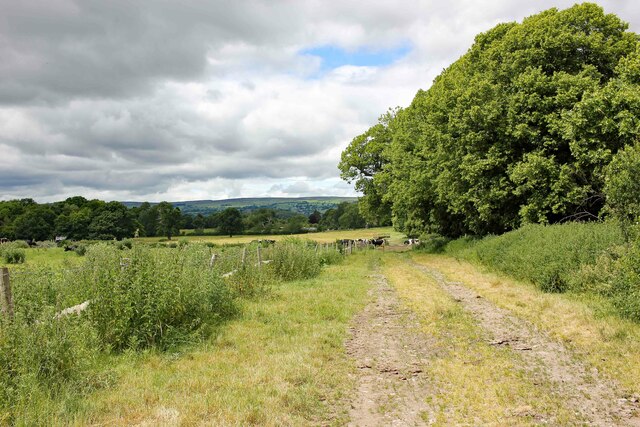
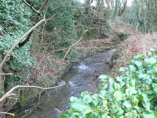
Lewis Wood is a picturesque forest located in Denbighshire, Wales. Covering an area of approximately 500 acres, it is renowned for its natural beauty and diverse flora and fauna. The forest is situated in the heart of the Clwydian Range and Dee Valley Area of Outstanding Natural Beauty, providing visitors with stunning views of the surrounding landscape.
Lewis Wood is predominantly made up of deciduous trees, including oak, beech, and birch, which create a lush and vibrant environment. The forest floor is covered in a carpet of wildflowers, making it a haven for wildlife and nature enthusiasts. Birdwatchers can spot a variety of species, including woodpeckers, redstarts, and buzzards, while lucky visitors may even catch a glimpse of elusive mammals such as badgers and foxes.
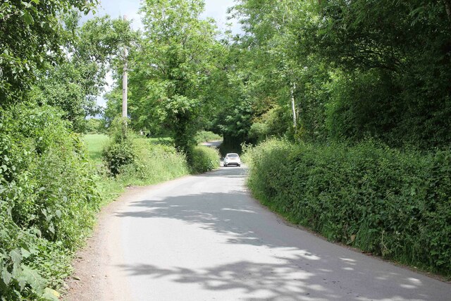
The forest offers a range of walking trails and paths, allowing visitors to explore its natural wonders at their own pace. These trails cater to different abilities and interests, with options for leisurely strolls or more challenging hikes. Interpretive signs and information boards are scattered throughout the forest, providing interesting facts about the local ecosystem and its conservation efforts.
Lewis Wood is not only a popular destination for nature lovers but also for outdoor enthusiasts. The forest is equipped with picnic areas and designated spots for camping, making it an ideal location for family outings or weekend getaways. Additionally, it serves as a gateway to other attractions in Denbighshire, including historic sites and charming villages.
Overall, Lewis Wood in Denbighshire offers a tranquil retreat for those seeking to immerse themselves in nature and explore the wonders of the Welsh countryside.
If you have any feedback on the listing, please let us know in the comments section below.
Lewis Wood Images
Images are sourced within 2km of 53.032737/-2.9851416 or Grid Reference SJ3448. Thanks to Geograph Open Source API. All images are credited.


Lewis Wood is located at Grid Ref: SJ3448 (Lat: 53.032737, Lng: -2.9851416)
Unitary Authority: Wrexham
Police Authority: North Wales
What 3 Words
///chugging.divorcing.petition. Near Wrexham
Nearby Locations
Related Wikis

Hightown Barracks
Hightown Barracks is a military installation in Wrexham, Wales. == History == The barracks were built in the Fortress Gothic Revival Style and completed...

A525 road
The A525 is a major route from Rhyl in Wales to Newcastle-under-Lyme in England. The route passes near Denbigh, through Ruthin, through Wrexham and near...
River Gwenfro
The River Gwenfro (Welsh: Afon Gwenfro) is a small river in Wrexham County Borough, north Wales. It is a tributary of the Clywedog. The name Gwenfro is...

Hightown, Wrexham
Hightown is a suburban area of Wrexham, in Wrexham County Borough, Wales.The Wrexham and Ellesmere Railway used to have a station known as Hightown Halt...

St Joseph's Catholic and Anglican High School
St Joseph's Catholic and Anglican High School (Welsh: Ysgol Uwchradd Gatholig ac Anglicanaidd Sant Joseff) is a secondary school in Wrexham, Wales, located...
Marchwiel Hall
Marchwiel Hall is a Grade II listed building in the village of Marchwiel, Wrexham County Borough in North Wales. == History == Marchwiel Hall was a seat...
Hightown Halt railway station
Hightown Halt railway station was a station in Caia Park, Wrexham, Wales. The station was opened on 9 July 1923 and closed on 10 September 1962. ��2�...
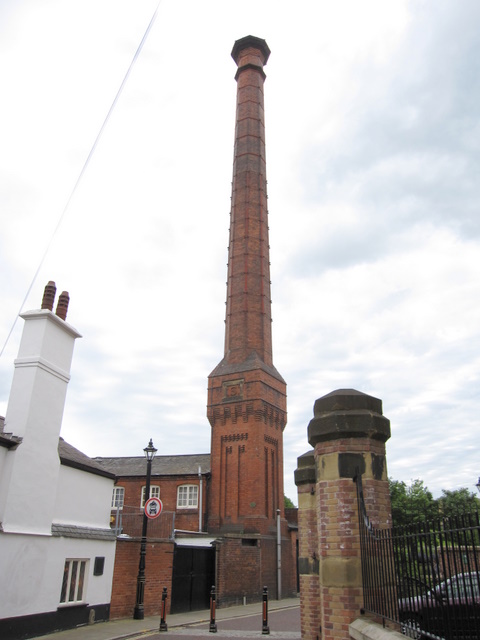
Soames Brewery Chimney
The Soames Brewery Chimney is a Grade II listed former brewery chimney in Wrexham city centre, North Wales. It later became known as the Border Breweries...
Nearby Amenities
Located within 500m of 53.032737,-2.9851416Have you been to Lewis Wood?
Leave your review of Lewis Wood below (or comments, questions and feedback).