Coedcraigddu

Wood, Forest in Glamorgan

Wales

Coedcraigddu

Ordnance Survey Rivet This damaged OS rivet can be found on the rock outcrop on Cefn Hirgoed. It marks a point 130.186m above mean sea level.
Ordnance Survey Rivet Credit: Adrian Dust

Coedcraigddu, located in Glamorgan, Wales, is a picturesque wood or forest that offers a serene and natural escape to visitors. Spread across a vast area, it is known for its diverse flora and fauna, making it a popular destination for nature enthusiasts and hikers.

The wood is characterized by its dense canopy of tall trees, including oak, beech, and conifers, which create a cool and shaded environment. The forest floor is covered in a thick carpet of moss and ferns, adding to its enchanting atmosphere. Coedcraigddu is also home to a variety of wildlife, such as deer, foxes, and a wide range of bird species, making it a paradise for birdwatchers.

The wood offers several walking trails that wind through its lush greenery, providing visitors with the opportunity to explore and discover its hidden treasures. These trails vary in length and difficulty, catering to both casual strollers and experienced hikers. Along the way, visitors can enjoy breathtaking views of the surrounding landscape and may even come across ancient ruins or archaeological sites.

Coedcraigddu provides a peaceful and tranquil setting, away from the hustle and bustle of city life. It is a perfect place for those seeking solace in nature or simply looking to unwind amidst its natural beauty. Whether it's a leisurely stroll or a more adventurous hike, Coedcraigddu offers an unforgettable experience for all who visit.

If you have any feedback on the listing, please let us know in the comments section below.

Coedcraigddu Images

Images are sourced within 2km of 51.522273/-3.5451011 or Grid Reference SS9281. Thanks to Geograph Open Source API. All images are credited.

Ordnance Survey Rivet This damaged OS rivet can be found on the rock outcrop on Cefn Hirgoed. It marks a point 130.186m above mean sea level.
Ordnance Survey Rivet
This damaged OS rivet can be found on the rock outcrop on Cefn Hirgoed. It marks a point 130.186m above mean sea level.
Ordnance Survey Cut Mark This OS cut mark can be found on the wall west side of the road. It marks a point 105.482m above mean sea level.
Ordnance Survey Cut Mark
This OS cut mark can be found on the wall west side of the road. It marks a point 105.482m above mean sea level.
Ordnance Survey Cut Mark This damaged and moved OS cut mark can be found on the gatepost of Glan Nant House. It marked a point 110.886m above mean sea level.
Ordnance Survey Cut Mark
This damaged and moved OS cut mark can be found on the gatepost of Glan Nant House. It marked a point 110.886m above mean sea level.
Ordnance Survey Cut Mark This OS cut mark can be found on the gatepost of Heol-y-llan. It marks a point 100.776m above mean sea level.
Ordnance Survey Cut Mark
This OS cut mark can be found on the gatepost of Heol-y-llan. It marks a point 100.776m above mean sea level.
Ordnance Survey Cut Mark This OS cut mark can be found on the wall at the rear of No1 Rhiw Las. It marks a point 78.003m above mean sea level.
Ordnance Survey Cut Mark
This OS cut mark can be found on the wall at the rear of No1 Rhiw Las. It marks a point 78.003m above mean sea level.
Stream by Ffordd Cadfan, Bridgend Seen at a new residential area in the north of Bridgend.
Stream by Ffordd Cadfan, Bridgend
Seen at a new residential area in the north of Bridgend.
A view of Parc Derwen, Bridgend A recently built residential district of Bridgend situated just to the east of Litchard. For an idea of how the area looked before it was built up see <a href="https://www.geograph.org.uk/photo/358803">SS9181 : Track To Farm Building</a>.
A view of Parc Derwen, Bridgend
A recently built residential district of Bridgend situated just to the east of Litchard. For an idea of how the area looked before it was built up see SS9181 : Track To Farm Building.
The A4061 at the eastern edge of Litchard The image shows some of the three kilometre or so stretch of dual carriageway between the centre of Bridgend and the M4 which lies at the southern end of the A4061. North of the M4 the road ceases to be a dual carriageway, and continues to Hirwaun via the Ogmore and Rhondda Fawr valleys.

Litchard lies just to the left (west) of the part of the road seen in the image, whereas Parc Derwen, a recently built residential area, lies just to the right.
The A4061 at the eastern edge of Litchard
The image shows some of the three kilometre or so stretch of dual carriageway between the centre of Bridgend and the M4 which lies at the southern end of the A4061. North of the M4 the road ceases to be a dual carriageway, and continues to Hirwaun via the Ogmore and Rhondda Fawr valleys. Litchard lies just to the left (west) of the part of the road seen in the image, whereas Parc Derwen, a recently built residential area, lies just to the right.
Cycle and pedestrian bridge by Ffordd Cadfan, Bridgend The bridge carries a path for cyclists and pedestrians over a stream. The latter can be seen in <a href="https://www.geograph.org.uk/photo/7358070">SS9180 : Stream by Ffordd Cadfan, Bridgend</a>.
Cycle and pedestrian bridge by Ffordd Cadfan, Bridgend
The bridge carries a path for cyclists and pedestrians over a stream. The latter can be seen in SS9180 : Stream by Ffordd Cadfan, Bridgend.
Rotary International Way (A4061) south of Litchard Rotary International Way is the name given to those parts of the dual carriageway on the A4061 in Bridgend which lie between the roundabout at the southern end of Coity Road in the centre of the town and the roundabout at the A road’s junction with West Plas Road at Litchard. It is about a mile long.

The image is a northward view in the direction of Litchard.
Rotary International Way (A4061) south of Litchard
Rotary International Way is the name given to those parts of the dual carriageway on the A4061 in Bridgend which lie between the roundabout at the southern end of Coity Road in the centre of the town and the roundabout at the A road’s junction with West Plas Road at Litchard. It is about a mile long. The image is a northward view in the direction of Litchard.
Cycle and pedestrian path at the southern edge of the playing fields in Litchard Eastward view in the direction of Parc Derwen and Coity on one of the cycle paths of an extensive network in the north of Bridgend.
Cycle and pedestrian path at the southern edge of the playing fields in Litchard
Eastward view in the direction of Parc Derwen and Coity on one of the cycle paths of an extensive network in the north of Bridgend.
Cycle and pedestrian bridge over the A4061, Bridgend The bridge - which is for cycles and pedestrians only - connects Parc Derwen and Litchard. It lies on the same path as the stretch seen in <a href="https://www.geograph.org.uk/photo/7362661">SS9181 : Cycle and pedestrian path at the southern edge of the playing fields in Litchard</a>.
Cycle and pedestrian bridge over the A4061, Bridgend
The bridge - which is for cycles and pedestrians only - connects Parc Derwen and Litchard. It lies on the same path as the stretch seen in SS9181 : Cycle and pedestrian path at the southern edge of the playing fields in Litchard.
Cycle and pedestrian bridge over the A4061, Bridgend (2) Looking towards Parc Derwen from the eastern edge of Litchard along the bridge seen in <a href="https://www.geograph.org.uk/photo/7364773">SS9181 : Cycle and pedestrian bridge over the A4061, Bridgend</a>.
Cycle and pedestrian bridge over the A4061, Bridgend (2)
Looking towards Parc Derwen from the eastern edge of Litchard along the bridge seen in SS9181 : Cycle and pedestrian bridge over the A4061, Bridgend.
Eastern approach to a bridge over the A4061, Bridgend The image shows the eastern approach to the bridge seen in <a href="https://www.geograph.org.uk/photo/7364773">SS9181 : Cycle and pedestrian bridge over the A4061, Bridgend</a>.  Prominent in it is the standard sign for a route for shared use by cycles and pedestrians only.
Eastern approach to a bridge over the A4061, Bridgend
The image shows the eastern approach to the bridge seen in SS9181 : Cycle and pedestrian bridge over the A4061, Bridgend. Prominent in it is the standard sign for a route for shared use by cycles and pedestrians only.
Playing field at Litchard The houses in the distance are on the opposite (west) side of the road Litchard Hill to the playing field.
Playing field at Litchard
The houses in the distance are on the opposite (west) side of the road Litchard Hill to the playing field.
Coed-y-Mwstwr Hotel The Coed-y-Mwstwr Hotel is a popular wedding venue, 4 star hotel & dining location just above the golf course. It began life in 1888 as a bustling family home to liberal MP Arthur John Williams and his wife, Rose.
Coed-y-Mwstwr Hotel
The Coed-y-Mwstwr Hotel is a popular wedding venue, 4 star hotel & dining location just above the golf course. It began life in 1888 as a bustling family home to liberal MP Arthur John Williams and his wife, Rose.
Coity Castle Coity Castle viewed from New Castle Bridgend, using quite a lot of zoom range on camera
Coity Castle
Coity Castle viewed from New Castle Bridgend, using quite a lot of zoom range on camera
Coedymwstwr A splendid Victorian mansion that is now a pleasant hotel. Used to be an approved school in the 1950's. Coedymwstwr is Welsh for murmuring trees. Aptly named.
Coedymwstwr
A splendid Victorian mansion that is now a pleasant hotel. Used to be an approved school in the 1950's. Coedymwstwr is Welsh for murmuring trees. Aptly named.
Show me another place!

Coedcraigddu is located at Grid Ref: SS9281 (Lat: 51.522273, Lng: -3.5451011)

Unitary Authority: Bridgend

Police Authority: South Wales

What 3 Words

///zips.ally.teeth. Near Coity, Bridgend

Related Wikis

Coity Higher

Coity Higher is a community in Bridgend County Borough, south Wales. It contains the north western suburbs of Bridgend which includes the villages of Litchard...

Coity

Coity is a village in Bridgend County Borough, south Wales, part of Bridgend town urban area. Coity is part of the community of Coity Higher and is notable...

Coity Castle

Coity Castle (Welsh: Castell Coety) in Glamorgan, Wales, is a Norman castle built by Sir Payn "the Demon" de Turberville (fl. 1126), one of the legendary...

St Mary's Church, Coity Higher

St Mary's Church is a Grade I listed church in Coity Higher, Bridgend County Borough, southern Wales. The church is dated mainly to the 14th century, though...

Brackla

Brackla (Welsh: Bracla) is a large housing estate and community in the east of Bridgend in Bridgend County Borough, Wales. Along with the communities of...
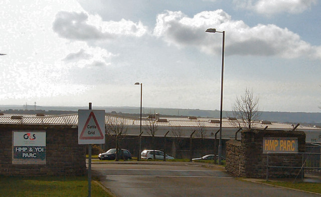
HM Prison Parc

HM Prison Parc (Welsh: Carchar Parc EF) is a Category B men's private prison and Young Offenders Institution in Bridgend, Mid Glamorgan, Wales. It is operated...

Parc Hospital

Parc Hospital (Welsh: Ysbyty Parc) was a mental health facility at Bridgend in Wales. == History == Parc Gwyllt Farm and Gelliau Farm were identified in...

Cefn Hirgoed

Cefn Hirgoed is a ridge in Bridgend county borough in South Wales. The ridge extends for about 5 km east from the village of Sarn just north of Bridgend...

Nearby Amenities

Located within 500m of 51.522273,-3.5451011
Power: tower
Lat/Long: 51.5195388/-3.5440433
Power: tower
Lat/Long: 51.5190215/-3.5494264
Crossing
Lat/Long: 51.5230709/-3.5474054
Celtic Cross World War 1 Monument
Historic: monument
Lat/Long: 51.5218597/-3.5522373
Post Box
Collection Times: Mo-Fr 09:00; Sa 07:00
Operator: Royal Mail
Post Box Mounting: stone_wall
Post Box Type: wall
Ref: CF35 84D
Royal Cypher: GR
Royal Cypher Wikidata: Q33102273
Lat/Long: 51.5246982/-3.5450448
Direction: 175
Generator Method: photovoltaic
Generator Output Electricity: yes
Generator Solar Modules: 10
Generator Source: solar
Generator Type: solar_photovoltaic_panel
Location: roof
Power: generator
Lat/Long: 51.5239164/-3.5462317
Direction: 145
Generator Method: photovoltaic
Generator Output Electricity: yes
Generator Solar Modules: 16
Generator Source: solar
Generator Type: solar_photovoltaic_panel
Location: roof
Power: generator
Lat/Long: 51.5232405/-3.5473311
Direction: 170
Generator Method: photovoltaic
Generator Output Electricity: yes
Generator Solar Modules: 16
Generator Source: solar
Generator Type: solar_photovoltaic_panel
Location: roof
Power: generator
Lat/Long: 51.52161/-3.550994
The data included in this document is from www.openstreetmap.org. The data is made available under ODbL.

Have you been to Coedcraigddu?

Leave your review of Coedcraigddu below (or comments, questions and feedback).