Coity Higher

Community in Glamorgan

Wales

Coity Higher

Motorway construction Start of Motorway construction, viewed from near the viaduct Sarn, towards junction 36 and Sarn services
Motorway construction Credit: Colin Prosser

Coity Higher is a community located in the county of Glamorgan in Wales. It is situated in the Bridgend County Borough and covers an area of approximately 14.82 square kilometers. The community is predominantly rural, with a few small settlements scattered throughout the area.

The main settlement in Coity Higher is the village of Coity, which is known for its historical significance. The village is home to Coity Castle, a medieval fortress that dates back to the 12th century. The castle is a popular tourist attraction and offers visitors a glimpse into the region's rich history.

Coity Higher is surrounded by beautiful countryside, with rolling hills and picturesque landscapes. The community is located near the Ogmore River, providing residents and visitors with opportunities for outdoor activities such as fishing and hiking.

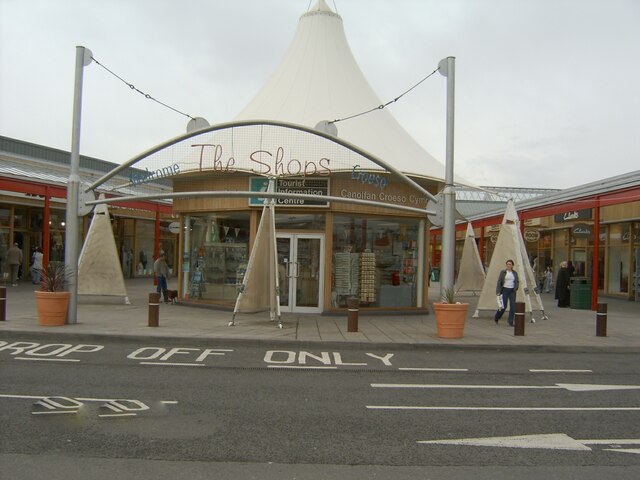
In terms of amenities, Coity Higher has a primary school, St. Mary's Church, and a few local businesses. However, most residents rely on nearby towns and villages for shopping, healthcare, and other services.

The community has a close-knit and friendly atmosphere, with a strong sense of community spirit. There are several community groups and organizations that organize events and activities to bring residents together.

Overall, Coity Higher offers a peaceful and idyllic rural setting, with a rich historical heritage and a strong sense of community. It is a desirable place to live for those seeking a quiet and picturesque lifestyle in the heart of Glamorgan.

If you have any feedback on the listing, please let us know in the comments section below.
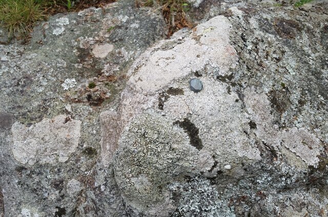
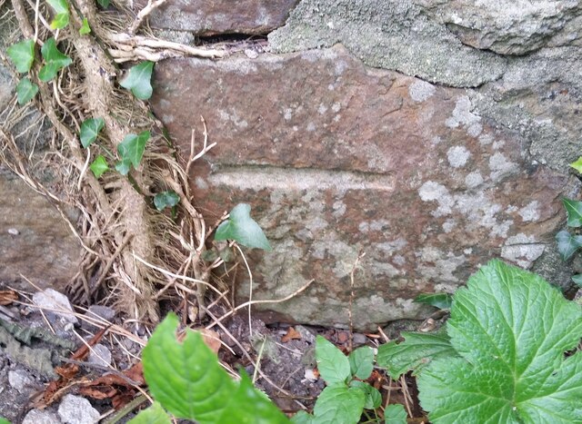
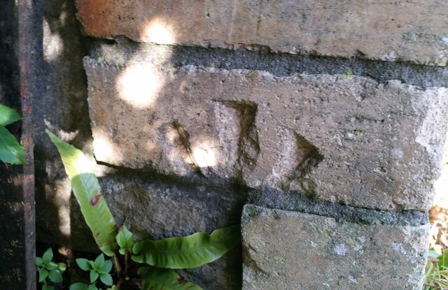
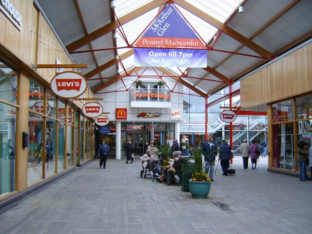
Coity Higher Images

Images are sourced within 2km of 51.524347/-3.554172 or Grid Reference SS9281. Thanks to Geograph Open Source API. All images are credited.

Motorway construction Start of Motorway construction, viewed from near the viaduct Sarn, towards junction 36 and Sarn services
Motorway construction
Start of Motorway construction, viewed from near the viaduct Sarn, towards junction 36 and Sarn services
Ordnance Survey Rivet This damaged OS rivet can be found on the rock outcrop on Cefn Hirgoed. It marks a point 130.186m above mean sea level.
Ordnance Survey Rivet
This damaged OS rivet can be found on the rock outcrop on Cefn Hirgoed. It marks a point 130.186m above mean sea level.
Ordnance Survey Cut Mark This OS cut mark can be found on the wall west side of the road. It marks a point 105.482m above mean sea level.
Ordnance Survey Cut Mark
This OS cut mark can be found on the wall west side of the road. It marks a point 105.482m above mean sea level.
Ordnance Survey Cut Mark This damaged and moved OS cut mark can be found on the gatepost of Glan Nant House. It marked a point 110.886m above mean sea level.
Ordnance Survey Cut Mark
This damaged and moved OS cut mark can be found on the gatepost of Glan Nant House. It marked a point 110.886m above mean sea level.
McArthur Glen McArthur Glen, shop outlet, Virgin XS store
McArthur Glen
McArthur Glen, shop outlet, Virgin XS store
McArthur Glen McArthur Glen, view towards the Foodcourt
McArthur Glen
McArthur Glen, view towards the Foodcourt
McArthur Glen McArthur Glen, the Foodcourt, note the fruit which hung from the ceiling, which has long gone
McArthur Glen
McArthur Glen, the Foodcourt, note the fruit which hung from the ceiling, which has long gone
McArthur Glen McArthur Glen, view from the Foodcourt entrance, down the shop mall
McArthur Glen
McArthur Glen, view from the Foodcourt entrance, down the shop mall
McArthur Glen Sainsbury's McArthur Glen, view of Sainsbury's
McArthur Glen Sainsbury's
McArthur Glen, view of Sainsbury's
McArthur Glen McArthur Glen, shop outlet, Donnay shop, it's now called Sports Direct
McArthur Glen
McArthur Glen, shop outlet, Donnay shop, it's now called Sports Direct
McArthur Glen McArthur Glen, the floor above the Foodcourt, Pizza Hut, was here at this date
McArthur Glen
McArthur Glen, the floor above the Foodcourt, Pizza Hut, was here at this date
McArthur Glen McArthur Glen, view off the footbridge alongside the Odeon Cinema, of the car park
McArthur Glen
McArthur Glen, view off the footbridge alongside the Odeon Cinema, of the car park
McArthur Glen McArthur Glen, shop outlet, Bookends, now known as The Works
McArthur Glen
McArthur Glen, shop outlet, Bookends, now known as The Works
McArthur Glen McArthur Glen, view off the footbridge of the Foodcourt, and restaurants upstairs
McArthur Glen
McArthur Glen, view off the footbridge of the Foodcourt, and restaurants upstairs
McArthur Glen McArthur Glen, shop outlet
McArthur Glen
McArthur Glen, shop outlet
McArthur Glen McArthur Glen, the Tourist Information Centre, and welcome to the Shops
McArthur Glen
McArthur Glen, the Tourist Information Centre, and welcome to the Shops
McArthur Glen McArthur Glen, shop outlet, Remington shop is now Whitard China shop
McArthur Glen
McArthur Glen, shop outlet, Remington shop is now Whitard China shop
McArthur Glen, Sainsbury McArthur Glen, car park, viewed from Sainsbury
McArthur Glen, Sainsbury
McArthur Glen, car park, viewed from Sainsbury
Show me another place!

Coity Higher is located at Grid Ref: SS9281 (Lat: 51.524347, Lng: -3.554172)

Unitary Authority: Bridgend

Police Authority: South Wales

Also known as: Coety Uchaf

What 3 Words

///point.jacket.path. Near Coity, Bridgend

Related Wikis

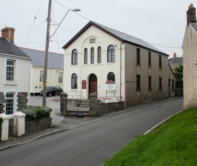
St Mary's Church, Coity Higher

St Mary's Church is a Grade I listed church in Coity Higher, Bridgend County Borough, southern Wales. The church is dated mainly to the 14th century, though...

Coity Castle

Coity Castle (Welsh: Castell Coety) in Glamorgan, Wales, is a Norman castle built by Sir Payn "the Demon" de Turberville (fl. 1126), one of the legendary...

Coity Higher

Coity Higher is a community in Bridgend County Borough, south Wales. It contains the north western suburbs of Bridgend which includes the villages of Litchard...

Coity

Coity is a village in Bridgend County Borough, south Wales, part of Bridgend town urban area. Coity is part of the community of Coity Higher and is notable...
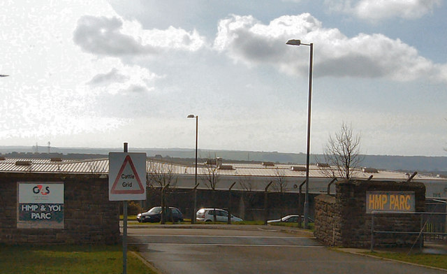
HM Prison Parc

HM Prison Parc (Welsh: Carchar Parc EF) is a Category B men's private prison and Young Offenders Institution in Bridgend, Mid Glamorgan, Wales. It is operated...

Parc Hospital

Parc Hospital (Welsh: Ysbyty Parc) was a mental health facility at Bridgend in Wales. == History == Parc Gwyllt Farm and Gelliau Farm were identified in...

Brackla

Brackla (Welsh: Bracla) is a large housing estate and community in the east of Bridgend in Bridgend County Borough, Wales. Along with the communities of...

Princess of Wales Hospital

The Princess of Wales Hospital (Welsh: Ysbyty Tywysoges Cymru) is a district general hospital in Bridgend, Wales. It is managed by Cwm Taf Morgannwg University...

Nearby Amenities

Located within 500m of 51.524347,-3.554172
Coity
Ele: 62.31
Name Cy: Coety
Name En: Coity
Place: village
Population: 2071
Wikidata: Q5141668
Wikipedia: en:Coity
Lat/Long: 51.5212979/-3.5539979
Turning Circle
Lat/Long: 51.5214243/-3.555798
Post Box
Collection Times: Mo-Fr 16:30; Sa 12:00
Operator: Royal Mail
Post Box Type: wall
Ref: CF35 187
Royal Cypher: EIIR
Royal Cypher Wikidata: Q33102113
Lat/Long: 51.5219821/-3.5550871
Access: no
Barrier: bollard
Bicycle: yes
Fixme: move bollard to relevant way node if not construction only
Foot: yes
Horse: yes
Lat/Long: 51.5285474/-3.5564662
Crossing
Lat/Long: 51.5230709/-3.5474054
Barrier: bollard
Bicycle: yes
Bus: yes
Foot: yes
Horse: yes
Motor Vehicle: no
Lat/Long: 51.5260191/-3.5559638
Crossing
Crossing: unmarked
Lat/Long: 51.5253656/-3.5603612
Coity Castle
Historic: castle
Lat/Long: 51.5220207/-3.553238
Celtic Cross World War 1 Monument
Historic: monument
Lat/Long: 51.5218597/-3.5522373
Barrier: yes
Lat/Long: 51.5274201/-3.5535694
Direction: 255
Generator Method: photovoltaic
Generator Output Electricity: yes
Generator Solar Modules: 4
Generator Source: solar
Generator Type: solar_photovoltaic_panel
Location: roof
Power: generator
Lat/Long: 51.5238546/-3.5607615
Direction: W
Generator Method: photovoltaic
Generator Output Electricity: yes
Generator Solar Modules: 6
Generator Source: solar
Generator Type: solar_photovoltaic_panel
Location: roof
Power: generator
Lat/Long: 51.5287737/-3.5554069
Direction: 145
Generator Method: photovoltaic
Generator Output Electricity: yes
Generator Solar Modules: 16
Generator Source: solar
Generator Type: solar_photovoltaic_panel
Location: roof
Power: generator
Lat/Long: 51.5232405/-3.5473311
Direction: 165
Generator Method: photovoltaic
Generator Output Electricity: yes
Generator Solar Modules: 10
Generator Source: solar
Generator Type: solar_photovoltaic_panel
Location: roof
Power: generator
Lat/Long: 51.5238501/-3.5606841
Direction: S
Generator Method: photovoltaic
Generator Output Electricity: yes
Generator Solar Modules: 8
Generator Source: solar
Generator Type: solar_photovoltaic_panel
Location: roof
Power: generator
Lat/Long: 51.5245462/-3.5608581
Direction: E
Generator Method: photovoltaic
Generator Output Electricity: yes
Generator Solar Modules: 6
Generator Source: solar
Generator Type: solar_photovoltaic_panel
Location: roof
Power: generator
Lat/Long: 51.5245656/-3.5607961
Direction: 235
Generator Method: photovoltaic
Generator Output Electricity: yes
Generator Solar Modules: 14
Generator Source: solar
Generator Type: solar_photovoltaic_panel
Location: roof
Power: generator
Lat/Long: 51.524507/-3.5603378
Direction: S
Generator Method: photovoltaic
Generator Output Electricity: yes
Generator Solar Modules: 16
Generator Source: solar
Generator Type: solar_photovoltaic_panel
Location: roof
Power: generator
Lat/Long: 51.5214122/-3.5587707
Direction: 165
Generator Method: photovoltaic
Generator Output Electricity: yes
Generator Solar Modules: 18
Generator Source: solar
Generator Type: solar_photovoltaic_panel
Location: roof
Power: generator
Lat/Long: 51.5222204/-3.5582943
Direction: 170
Generator Method: photovoltaic
Generator Output Electricity: yes
Generator Solar Modules: 16
Generator Source: solar
Generator Type: solar_photovoltaic_panel
Location: roof
Power: generator
Lat/Long: 51.5220284/-3.5560044
Direction: 170
Generator Method: photovoltaic
Generator Output Electricity: yes
Generator Solar Modules: 16
Generator Source: solar
Generator Type: solar_photovoltaic_panel
Location: roof
Power: generator
Lat/Long: 51.52161/-3.550994
Direction: WSW
Generator Method: photovoltaic
Generator Output Electricity: yes
Generator Solar Modules: 15
Generator Source: solar
Generator Type: solar_photovoltaic_panel
Location: roof
Power: generator
Lat/Long: 51.5278728/-3.5552828
Place Of Worship
Gilead Chapel
Wikidata: Q99450967
Lat/Long: 51.5225447/-3.5552905
The data included in this document is from www.openstreetmap.org. The data is made available under ODbL.

Have you been to Coity Higher?

Leave your review of Coity Higher below (or comments, questions and feedback).