Mirfield

Civil Parish in Yorkshire Kirklees

England

Mirfield

No Mooring sign by Greenwood Lock The reason for the ban on mooring at this point is that there is a major storm sewer outfall just below this concrete headwall. See <a href="https://www.geograph.org.uk/photo/5624446">SE2219 : River Calder downstream of Greenwood Lock </a>.
No Mooring sign by Greenwood Lock Credit: Stephen Craven

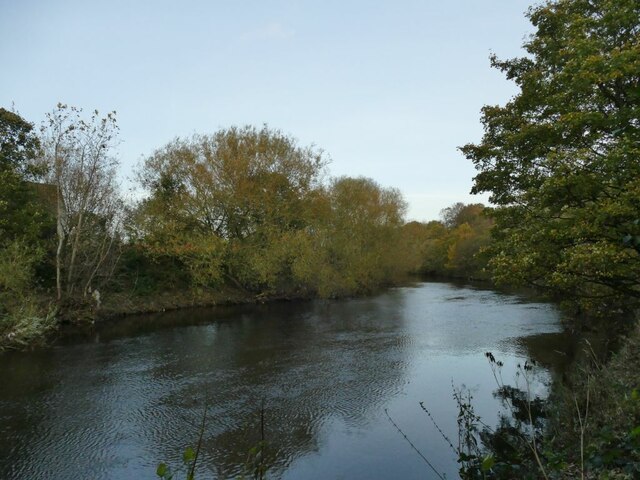
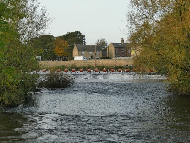
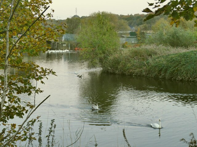
Mirfield is a civil parish located in the metropolitan borough of Kirklees, West Yorkshire, England. Situated on the banks of the River Calder, it is a small town with a population of around 20,000 people. Mirfield is conveniently positioned between the cities of Leeds and Huddersfield, making it an excellent commuting location for residents working in either city.

The town has a rich history, with its roots dating back to the medieval era. The historic St. Mary's Church, originally built in the 12th century, stands as a prominent landmark in the area. Mirfield has a strong sense of community and boasts a range of amenities including schools, shops, restaurants, and leisure facilities. The town is also home to a number of parks and green spaces, providing residents with plenty of opportunities for outdoor activities and recreation.

Mirfield is well-connected in terms of transportation, with regular train services running to Leeds, Huddersfield, and other nearby towns. The M62 motorway is easily accessible from the town, offering convenient road links to major cities across the country.

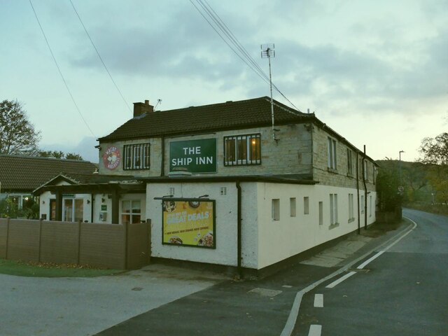
The local economy is diverse, with a mix of retail, services, and light industries. The town has a thriving arts and culture scene, hosting various events and festivals throughout the year. Mirfield is also known for its strong sporting traditions, with a range of sports clubs and facilities catering to different interests.

Overall, Mirfield offers a pleasant living environment with a combination of historical charm, modern amenities, and excellent transport links.

If you have any feedback on the listing, please let us know in the comments section below.
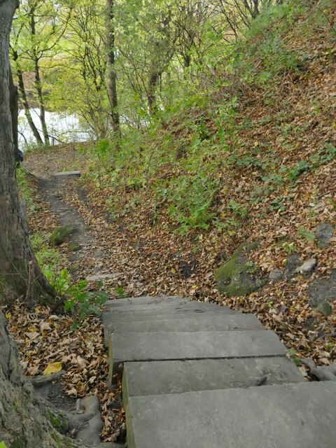
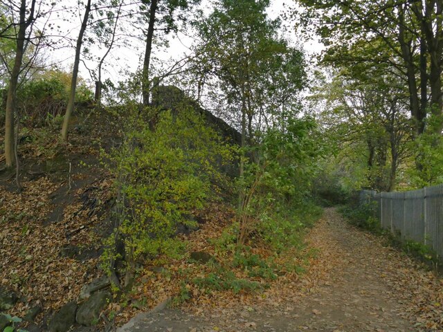
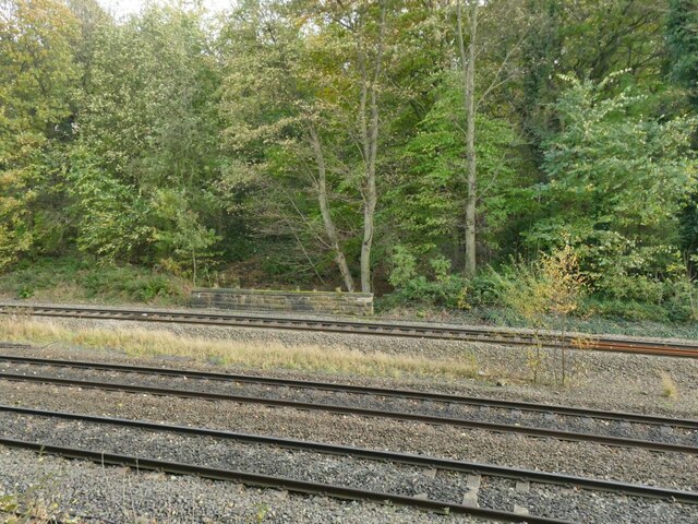
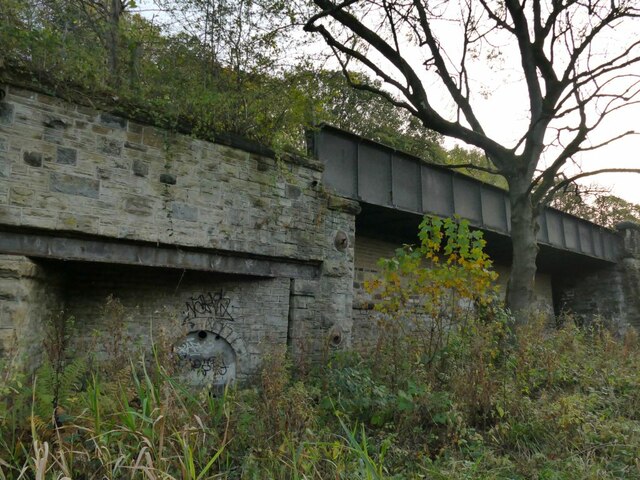
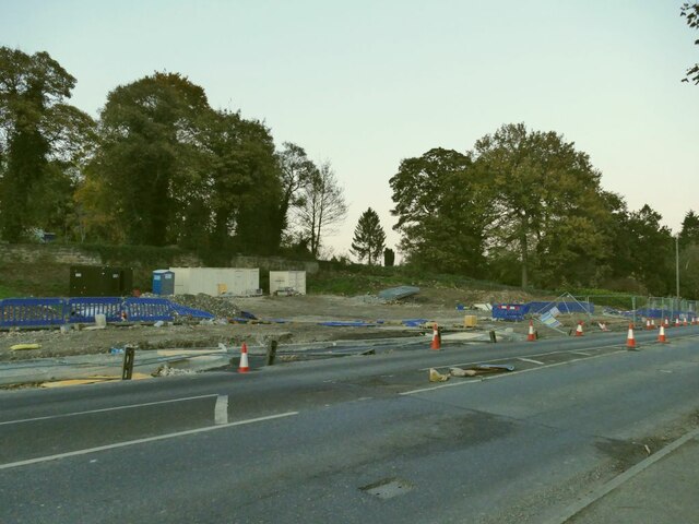
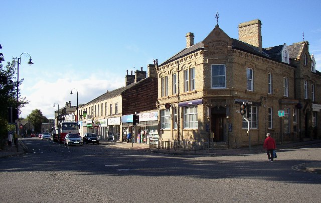
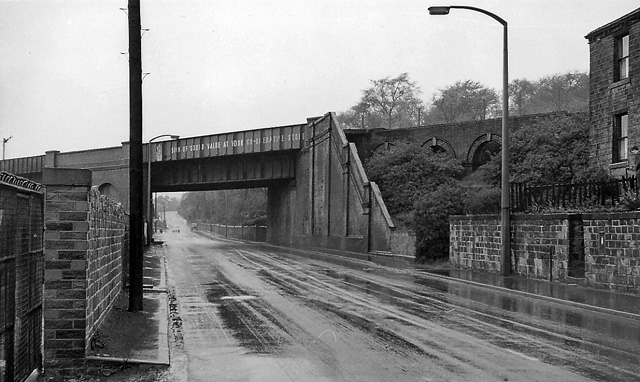
Mirfield Images

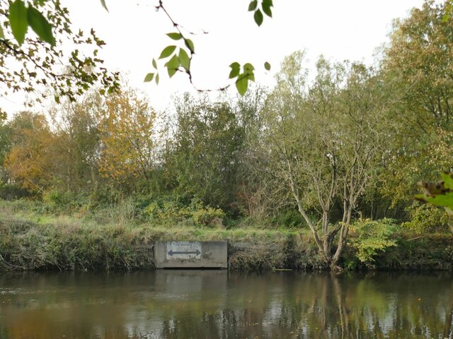
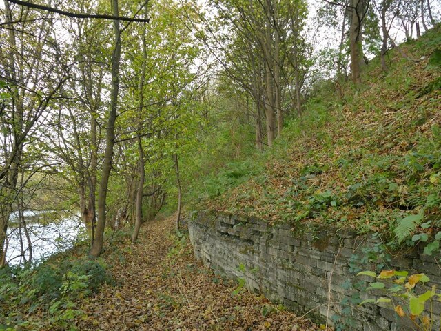
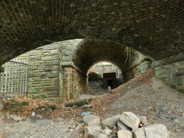
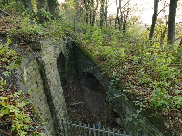
Images are sourced within 2km of 53.674435/-1.690023 or Grid Reference SE2019. Thanks to Geograph Open Source API. All images are credited.

No Mooring sign by Greenwood Lock The reason for the ban on mooring at this point is that there is a major storm sewer outfall just below this concrete headwall. See <a href="https://www.geograph.org.uk/photo/5624446">SE2219 : River Calder downstream of Greenwood Lock </a>.
No Mooring sign by Greenwood Lock
The reason for the ban on mooring at this point is that there is a major storm sewer outfall just below this concrete headwall. See SE2219 : River Calder downstream of Greenwood Lock .
Riverbank path opposite Greenwood Lock A public footpath on the south bank of the Calder.
Riverbank path opposite Greenwood Lock
A public footpath on the south bank of the Calder.
Double bridge near Lady Wood Bottom (1) The nearer bridge carried a vehicle track down to Greenwood Bridge on the river Calder (no longer extant). The further one carries the main Calder Valley railway line. There were old mineshafts in Lady Wood beyond the railway and I presume these bridges allowed coal to be brought down to the river for loading onto barges.  See <a href="https://www.geograph.org.uk/photo/4303022">SE2219 : Fenced off arch , Ravensthorpe</a> for the arch of this first bridge.
Double bridge near Lady Wood Bottom (1)
The nearer bridge carried a vehicle track down to Greenwood Bridge on the river Calder (no longer extant). The further one carries the main Calder Valley railway line. There were old mineshafts in Lady Wood beyond the railway and I presume these bridges allowed coal to be brought down to the river for loading onto barges. See SE2219 : Fenced off arch , Ravensthorpe for the arch of this first bridge.
Double bridge near Lady Wood Bottom (2) The right hand bridge carried a vehicle track, now totally overgrown, down to Greenwood Bridge on the river Calder (no longer extant). The left hand one carries the main Calder Valley railway line. There were old mineshafts in Lady Wood beyond the railway and I presume these bridges allowed coal to be brought down to the river for loading onto barges.  See <a href="https://www.geograph.org.uk/photo/4303022">SE2219 : Fenced off arch , Ravensthorpe</a> for the arch of the right hand bridge and <a href="https://www.geograph.org.uk/photo/7014310">SE2219 : Double bridge near Lady Wood Bottom (1)</a> for a view through them.
Double bridge near Lady Wood Bottom (2)
The right hand bridge carried a vehicle track, now totally overgrown, down to Greenwood Bridge on the river Calder (no longer extant). The left hand one carries the main Calder Valley railway line. There were old mineshafts in Lady Wood beyond the railway and I presume these bridges allowed coal to be brought down to the river for loading onto barges. See SE2219 : Fenced off arch , Ravensthorpe for the arch of the right hand bridge and SE2219 : Double bridge near Lady Wood Bottom (1) for a view through them.
Steps down to the river near Lady Wood Bottom The steps connect a bridleway running along the top of the railway embankment with the public footpath along the river bank.
Steps down to the river near Lady Wood Bottom
The steps connect a bridleway running along the top of the railway embankment with the public footpath along the river bank.
Bridleway alongside the railway The bridleway crosses the railway a little further on by means of a bridge.
Bridleway alongside the railway
The bridleway crosses the railway a little further on by means of a bridge.
Calder Valley railway tracks at Lady Wood Bottom There are currently three tracks here: there used to be four <a href="https://www.geograph.org.uk/photo/939052">SE2219 : The Calder Valley main line (1)</a> and plans to upgrade the Manchester-Leeds corridor will see a fourth track reinstated.
Calder Valley railway tracks at Lady Wood Bottom
There are currently three tracks here: there used to be four SE2219 : The Calder Valley main line (1) and plans to upgrade the Manchester-Leeds corridor will see a fourth track reinstated.
Retaining wall at Lady Wood Bottom The wall retains the railway embankment; the 1907 map shows three (presumably narrow gauge) railway tracks between the wall and the river bank, related to a nearby mine.
Retaining wall at Lady Wood Bottom
The wall retains the railway embankment; the 1907 map shows three (presumably narrow gauge) railway tracks between the wall and the river bank, related to a nearby mine.
Former mine entrance? Local contributor Humphrey Bolton describes the small arch within a wall to the left of the photo as a drainage adit <a href="https://www.geograph.org.uk/photo/1038394">SE2219 : Railway drainage heading, Hopton, Mirfield</a> and further to the right behind the tree is another one that may have been the actual mine entrance <a href="https://www.geograph.org.uk/photo/1038378">SE2219 : Partial bridge, Hopton, Mirfield</a> shown on the 1907 1:2500 map at SE22111961 with a single narrow gauge mineral line splitting into three tracks to a riverside wharf.
Former mine entrance?
Local contributor Humphrey Bolton describes the small arch within a wall to the left of the photo as a drainage adit SE2219 : Railway drainage heading, Hopton, Mirfield and further to the right behind the tree is another one that may have been the actual mine entrance SE2219 : Partial bridge, Hopton, Mirfield shown on the 1907 1:2500 map at SE22111961 with a single narrow gauge mineral line splitting into three tracks to a riverside wharf.
River Calder below Greenwood Weir The river is non-navigable at this point, being bypassed by Greenwood Cut.
River Calder below Greenwood Weir
The river is non-navigable at this point, being bypassed by Greenwood Cut.
Greenwood Weir from downstream The river is non-navigable at this point, being bypassed by Greenwood Cut. See <a href="https://www.geograph.org.uk/photo/6408992">SE2119 : River Calder Barrage, Mirfield</a> for a view of the full length of the weir from above.
Greenwood Weir from downstream
The river is non-navigable at this point, being bypassed by Greenwood Cut. See SE2119 : River Calder Barrage, Mirfield for a view of the full length of the weir from above.
Power line termination A pair of three-phase lines terminates near the river bank, suggesting that cable are laid under the river.
Power line termination
A pair of three-phase lines terminates near the river bank, suggesting that cable are laid under the river.
The Ship Inn at Shepley Bridge A Greene King house.
The Ship Inn at Shepley Bridge
A Greene King house.
Shepley Bridge - top A bridge carrying a road over the river Calder. Resurfacing seemed to be in progress.
Shepley Bridge - top
A bridge carrying a road over the river Calder. Resurfacing seemed to be in progress.
Shepley Bridge A bridge carrying a road over the river Calder. See <a href="https://www.geograph.org.uk/photo/2538522">SE2119 : Shepley Bridge</a> for a closer view of the structure.
Shepley Bridge
A bridge carrying a road over the river Calder. See SE2119 : Shepley Bridge for a closer view of the structure.
Swans on the Calder at Shepley Bridge The River Calder is a river in West Yorkshire.
The Calder rises on the eastern slopes of the Pennines flows through alternating countryside, former woollen-mill villages, and large and small towns before joining the River Aire near Castleford, 45 miles later.
The river's valley is generally known as the Calder Valley. The name Calderdale usually refers to the large urban and rural borough (centred on Halifax) through which the upper river flows. The lower reaches flow through the boroughs of Kirklees (based on Huddersfield) and Wakefield. However, the river does not flow through the centres of Halifax and Huddersfield, which are on the Calder's main tributaries, the River Hebble and River Colne respectively. The only large town centres through which the Calder flows are Brighouse, Mirfield, Dewsbury and Wakefield.
Swans on the Calder at Shepley Bridge
The River Calder is a river in West Yorkshire. The Calder rises on the eastern slopes of the Pennines flows through alternating countryside, former woollen-mill villages, and large and small towns before joining the River Aire near Castleford, 45 miles later. The river's valley is generally known as the Calder Valley. The name Calderdale usually refers to the large urban and rural borough (centred on Halifax) through which the upper river flows. The lower reaches flow through the boroughs of Kirklees (based on Huddersfield) and Wakefield. However, the river does not flow through the centres of Halifax and Huddersfield, which are on the Calder's main tributaries, the River Hebble and River Colne respectively. The only large town centres through which the Calder flows are Brighouse, Mirfield, Dewsbury and Wakefield.
Site of the Swan Inn at Shepley Bridge The pub was one of three inns shown in the area on the earliest OS map of 1855, named along with the Ship and the Bulls Head, both of which are still going concerns. The Swan was still open in 2008 <a href="https://www.geograph.org.uk/photo/903586">SE2119 : The Swan - Huddersfield Road, Ravensthorpe</a> but had been demolished by 2021. There were however actual swans on the river just across the road <a href="https://www.geograph.org.uk/photo/7014391">SE2119 : Swans on the Calder at Shepley Bridge</a>.
Site of the Swan Inn at Shepley Bridge
The pub was one of three inns shown in the area on the earliest OS map of 1855, named along with the Ship and the Bulls Head, both of which are still going concerns. The Swan was still open in 2008 SE2119 : The Swan - Huddersfield Road, Ravensthorpe but had been demolished by 2021. There were however actual swans on the river just across the road SE2119 : Swans on the Calder at Shepley Bridge.
Site of the Swan Inn car park The Swan was still open in 2008 <a href="https://www.geograph.org.uk/photo/903586">SE2119 : The Swan - Huddersfield Road, Ravensthorpe</a> but had been demolished by 2021 <a href="https://www.geograph.org.uk/photo/7014395">SE2119 : Site of the Swan Inn at Shepley Bridge</a>.
Site of the Swan Inn car park
The Swan was still open in 2008 SE2119 : The Swan - Huddersfield Road, Ravensthorpe but had been demolished by 2021 SE2119 : Site of the Swan Inn at Shepley Bridge.
Show me another place!

Mirfield is located at Grid Ref: SE2019 (Lat: 53.674435, Lng: -1.690023)

Division: West Riding

Administrative County: West Yorkshire

District: Kirklees

Police Authority: West Yorkshire

What 3 Words

///melts.enforced.fell. Near Mirfield, West Yorkshire

Related Wikis

Mirfield Show

Mirfield Show is an annual agricultural show held at the Huddersfield Road Showground in Mirfield, West Yorkshire, England on the third Sunday in August...

Mirfield railway station

Mirfield railway station serves the town of Mirfield in West Yorkshire, England. It lies on the Huddersfield Line and is managed by both Northern and Grand...
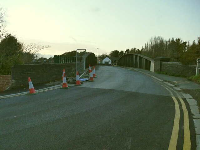
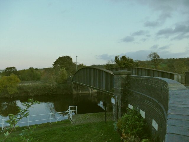
Ledgard Bridge

Ledgard Bridge crosses the River Calder in Mirfield, West Yorkshire, England. It was built in 1800 as a replacement for an earlier bridge in the same location...

Castle Hall Academy

Castle Hall Academy (formerly Castle Hall School before becoming an academy in 2011, and Castle Hall Academy before and after joining IMPACT in 2018) is...

Mirfield

Mirfield () is a town and civil parish in Kirklees, West Yorkshire, England. Historically part of the West Riding of Yorkshire, it is on the A644 road...

Holly Bank Trust

Hollybank was one of the first registered schools for disabled children to be built in the North of England. It is a registered charity and care home,...

St Mary's Church, Mirfield

St Mary's Church is the parish church of the town of Mirfield in West Yorkshire, England. The current building is a large Gothic Revival structure designed...

Battyeford railway station

Battyeford railway station served the village of Battyeford in West Yorkshire, England. == History == Built by the London and North Western Railway and...

Related Videos

Mirfield Family fun fair May 2021 in UK/Anywhere Walking Tour

Mirfield family fun fair May 2021 in UK/Anywhere Walking Tour Mirfield family fun fair 2021 is held in Mirfield Showground, West ...

Walking along a country lane making a field recording

A country lane walk in surround sound filmed on the Kirklees way near Briestfield. Filmed in 2K 30fps reduced to 1080p, ...

Nearby Amenities

Located within 500m of 53.674435,-1.690023
Mirfield
Place: town
Population: 18621
Wikidata: Q1301336
Lat/Long: 53.673216/-1.6946052
Traffic Signals
Crossing: traffic_signals
Crossing Ref: pelican
Kerb: flush
Tactile Paving: yes
Lat/Long: 53.6742822/-1.6960234
Bus Stop
Huddersfield Rd/Station Rd
Layby: yes
Local Ref: 45015145
Naptan AtcoCode: 450015145
Naptan Bearing: W
Naptan CommonName: Huddersfield Road Station Road
Naptan Crossing: Station Road
Naptan Indicator: Stop 45015145
Naptan Landmark: Tesco
Naptan PlusbusZoneRef: LEEDS
Naptan ShortCommonName: Huddersfield Rd M5
Naptan Street: Huddersfield Road
Note: name corrected
Ref: 45015145
Shelter: yes
Source: naptan_import;survey
Towards: Brighouse, Bradford, Cleckheaton, Halifax, Huddersfield, Kirkheaton
Lat/Long: 53.673962/-1.6924006
Traffic Signals
Crossing: traffic_signals
Crossing Ref: pelican
Lat/Long: 53.6740107/-1.6928114
Crossing
Crossing: uncontrolled
Crossing Ref: zebra
Lat/Long: 53.6737757/-1.6945154
Traffic Signals
Lat/Long: 53.673934/-1.6943819
Mirfield
Naptan AtcoCode: 9100MIRFILD
Network: National Rail
Network Website: https://www.nationalrail.co.uk/stations/mir/
Network Wikidata: Q26334
Note: checkme, the 1852-base mapping doesn't fit too well
Operator: Northern
Operator Website: https://www.northernrailway.co.uk/stations/mirfield
Operator Wikidata: Q85789775
Platforms: 3
Public Transport: station
Railway: station
Ref Crs: MIR
Source: NPE
Wikidata: Q2227447
Wikipedia: en:Mirfield railway station
Lat/Long: 53.6714301/-1.6928647
Mirfield
Public Transport: stop_position
Railway: stop
Train: yes
Lat/Long: 53.6710781/-1.6914609
Fire Station
Lat/Long: 53.6739311/-1.6910336
Post Box
Operator: Royal Mail
Post Box Design: type_k
Post Box Type: pillar
Ref: WF14 475
Royal Cypher: EIIR
Royal Cypher Wikidata: Q33102113
Lat/Long: 53.6736836/-1.694435
Bus Stop
Ing Grove Park Huddersfield Road
Check Date Shelter: 2024-03-29
Kerb: raised
Local Ref: 45015150
Naptan AtcoCode: 450015150
Naptan Bearing: SE
Naptan CommonName: Ing Grove Park Huddersfield Road
Naptan Crossing: Doctor Road
Naptan Indicator: Stop 45015150
Naptan Landmark: Ing Grove Park
Naptan PlusbusZoneRef: LEEDS
Naptan ShortCommonName: Doctor Lane
Naptan Street: Huddersfield Road
Naptan Verified: yes
Shelter: yes
Shop: yes
Source: naptan_import
Timetable: yes
Lat/Long: 53.675007/-1.6966328
Post Box
Operator: Royal Mail
Post Box Type: pillar
Ref: WF14 469
Royal Cypher: EIIR
Royal Cypher Wikidata: Q33102113
Lat/Long: 53.6738345/-1.6927023
Recycling
Recycling Cans: no
Recycling Clothes: yes
Recycling Glass: yes
Recycling Paper: yes
Recycling Shoes: yes
Recycling Textiles: yes
Lat/Long: 53.6732869/-1.6938276
Abandoned Amenity: bank
Old Name: Barclays
Lat/Long: 53.673965/-1.6913965
Bicycle Parking
Bicycle Parking: lockers
Capacity: 4
Lat/Long: 53.6734419/-1.6929791
Traffic Signals
Crossing: traffic_signals
Crossing Ref: pelican
Tactile Paving: yes
Lat/Long: 53.673992/-1.6931094
Pharmacy
Boots
Addr City: Mirfield
Addr Housenumber: 142
Addr Street: Huddersfield Road
Brand: Boots
Brand Wikidata: Q6123139
Brand Wikipedia: en:Boots UK
Dispensing: yes
Healthcare: pharmacy
Lat/Long: 53.6740505/-1.6936566
Abandoned Amenity: bank
Old Name: NatWest
Lat/Long: 53.6740714/-1.692995
Post Box
Operator: Royal Mail
Post Box Type: lamp
Ref: WF14 474
Lat/Long: 53.6783376/-1.692089
Bench
Backrest: yes
Lat/Long: 53.6726611/-1.6947993
Bench
Backrest: yes
Lat/Long: 53.6729768/-1.6958021
Bus Stop
Newgate / Huddersfield Road
Local Ref: 45017583
Naptan AtcoCode: 450017583
Naptan Bearing: NE
Naptan CommonName: Newgate Huddersfield Road
Naptan Crossing: Huddersfield Road
Naptan Indicator: Stop 45017583
Naptan PlusbusZoneRef: LEEDS
Naptan ShortCommonName: Huddersfield Road
Naptan Street: Newgate
Shelter: no
Source: naptan_import; survey
Towards: Dewsbury
Lat/Long: 53.6739214/-1.6965165
Bench
Backrest: yes
Lat/Long: 53.6727779/-1.695305
Waterway: lock_gate
Lat/Long: 53.6730599/-1.6962746
Waterway: lock_gate
Lat/Long: 53.6732818/-1.6969158
Turning Circle
Lat/Long: 53.6780556/-1.6857704
Turning Circle
Lat/Long: 53.6753812/-1.6925826
Leisure: playground
Lat/Long: 53.6779448/-1.6938076
Parking
Parking: surface
Lat/Long: 53.6734417/-1.6865408
Club House
Leisure: sports_centre
Sport: cricket
Lat/Long: 53.6737375/-1.6866287
Club House
Sport: cricket
Lat/Long: 53.6745536/-1.6869246
Parking
Parking: surface
Lat/Long: 53.674581/-1.6865455
Pub
Navigation Tavern
Addr City: Mirfield
Addr Country: GB
Addr Housenumber: 6
Addr Postcode: WF14 8NL
Addr Street: Station Road
Fhrs Id: 226727
Source Addr: FHRS Open Data
Lat/Long: 53.6721451/-1.6939542
Bus Stop
Knowl Road / St. Pauls Road
Local Ref: 45020617
Naptan AtcoCode: 450020617
Naptan Bearing: SE
Naptan CommonName: Knowl Road St Pauls Road
Naptan Crossing: St Pauls Road
Naptan Indicator: Stop 45020617
Naptan PlusbusZoneRef: LEEDS
Naptan ShortCommonName: St Pauls Road
Naptan Street: Knowl Road
Opposite: yes
Ref: 45020617
Shelter: yes
Source: naptan_import; survey
Timetable: no
Lat/Long: 53.6763768/-1.6925506
Barrier: bollard
Bicycle: yes
Foot: yes
Lat/Long: 53.6736275/-1.6936055
Fast Food
Mirfield Fisheries
Cuisine: fish_and_chips
Lat/Long: 53.6740635/-1.6959646
Bench
Backrest: no
Lat/Long: 53.6772901/-1.6938475
Crossing
Crossing Island: yes
Crossing Signals: no
Lat/Long: 53.6748419/-1.685689
Bench
Backrest: yes
Lat/Long: 53.6780422/-1.6926257
Home & Body
Shop: convenience
Lat/Long: 53.6740681/-1.6931855
Sue Ryder Care
Shop: charity
Lat/Long: 53.6740665/-1.6932808
Jackson's
Shop: shoes
Lat/Long: 53.6740676/-1.6933881
Mirfield Market
Shop: alcohol
Lat/Long: 53.6740572/-1.6939432
Hanson Opticians
Addr City: Mirfield
Addr Housenumber: 164
Addr Postcode: WF14 8AN
Addr Street: Huddersfield Road
Phone: +44 1924 495066
Shop: optician
Url: www.a-ka.co.uk
Lat/Long: 53.6740529/-1.6941003
Betfred
Brand: Betfred
Brand Wikidata: Q4897425
Brand Wikipedia: en:Betfred
Shop: bookmaker
Lat/Long: 53.6740498/-1.6941873
D. Aveyard
Addr City: Mirfield
Addr Housenumber: 170
Addr Postcode: WF14 8AN
Addr Street: Huddersfield Road
Shop: optician
Lat/Long: 53.6740498/-1.6943326
Kirkwood Hospice
Shop: charity
Lat/Long: 53.6740422/-1.6944276
to have & to hold
Phone: +44 1924 493037
Shop: wedding
Lat/Long: 53.6740412/-1.694903
Salon 84
Shop: hairdresser
Lat/Long: 53.6739992/-1.6949714
Flowers at180
Phone: +44 1924 493496
Shop: florist
Lat/Long: 53.6740083/-1.6950655
Fast Food
Kowloom
Cuisine: chinese
Phone: +44 1924 480006
Lat/Long: 53.6741408/-1.6953869
Fast Food
Pizza Island
Addr City: Mirfield
Addr Country: GB
Addr Housenumber: 186A
Addr Postcode: WF14 8AN
Addr Street: Huddersfield Road
Cuisine: pizza
Fhrs Id: 227055
Phone: +44 1924 491000
Source Addr: FHRS Open Data
Lat/Long: 53.6741573/-1.6954342
Cafe
Taylors Cafe
Addr City: Mirfield
Addr Country: GB
Addr Housenumber: 188
Addr Postcode: WF14 8AT
Addr Street: Huddersfield Road
Fhrs Id: 228481
Source Addr: FHRS Open Data
Lat/Long: 53.6741731/-1.6954771
Bargain Booze
Brand: Bargain Booze
Brand Wikidata: Q16971315
Brand Wikipedia: en:Bargain Booze
Shop: alcohol
Lat/Long: 53.6741908/-1.6955653
L.D. Smith Hardware
Phone: +44 1924 493191
Shop: doityourself
Lat/Long: 53.6742143/-1.6957243
Cafe
Ravello
Lat/Long: 53.6742659/-1.69582
Bus Stop
Huddersfield Road Parker Lane
Kerb: raised
Local Ref: 45015143
Naptan AtcoCode: 450015143
Naptan Bearing: W
Naptan CommonName: Huddersfield Road Parker Lane
Naptan Crossing: Parker Lane
Naptan Indicator: Stop 45015143
Naptan Landmark: Mirfield Memorial Recreational Ground
Naptan PlusbusZoneRef: LEEDS
Naptan ShortCommonName: Mirfield Rec Grnd
Naptan Street: Huddersfield Road
Naptan Verified: yes
Shelter: yes
Source: naptan_import
Timetable: yes
Lat/Long: 53.6747191/-1.6864071
Bus Stop
Huddersfield Road Parker Lane
Check Date Shelter: 2024-03-29
Kerb: raised
Local Ref: 45015144
Naptan AtcoCode: 450015144
Naptan Bearing: E
Naptan CommonName: Huddersfield Road Parker Lane
Naptan Crossing: Parker Lane
Naptan Indicator: Stop 45015144
Naptan Landmark: Mirfield Memorial Rectreational Ground
Naptan Notes: OSR taken place 181105
Naptan PlusbusZoneRef: LEEDS
Naptan ShortCommonName: Mirfield Rec Grnd
Naptan Street: Huddersfield Road
Naptan Verified: no
Shelter: yes
Source: naptan_import
Lat/Long: 53.6748332/-1.6863535
Bus Stop
Mirfield Huddersfield Rd
Bus: yes
Kerb: raised
Local Ref: 45015146
Naptan AtcoCode: 450015146
Naptan Bearing: E
Naptan CommonName: Huddersfield Road
Naptan Crossing: Queen Street
Naptan Indicator: Stop M5
Naptan Landmark: Co-op - Rubens Hairdressers
Naptan PlusbusZoneRef: LEEDS
Naptan ShortCommonName: Mirfield PO M5
Naptan Street: Huddersfield Road
Public Transport: platform
Ref: 45015146
Shelter: no
Source: naptan_import
Timetable: yes
Towards: Birstall, Dewsbury, Heckmondwike, Leeds, Wakefield, White Rose Centre
Lat/Long: 53.6739908/-1.6939629
Bus Stop
Huddersfield Road Ings Grove Park
Kerb: raised
Local Ref: 45015147
Naptan AtcoCode: 450015147
Naptan Bearing: NW
Naptan CommonName: Huddersfield Road Ings Grove Park
Naptan Crossing: Ing Grove Park
Naptan Indicator: Stop 45015147
Naptan PlusbusZoneRef: LEEDS
Naptan ShortCommonName: Ings Grove Park
Naptan Street: Huddersfield Road
Naptan Verified: yes
Ref: 45015156
Shelter: yes
Source: naptan_import
Lat/Long: 53.6747775/-1.6966729
Bus Stop
Ing Grove Park Huddersfield Road
Bench: yes
Bin: yes
Check Date Shelter: 2024-03-29
Kerb: raised
Local Ref: 45015148
Naptan AtcoCode: 450015148
Naptan Bearing: SE
Naptan CommonName: Ing Grove Park Huddersfield Road
Naptan Crossing: Doctor Lane
Naptan Indicator: Stop 45015148
Naptan PlusbusZoneRef: LEEDS
Naptan ShortCommonName: Doctor Lane
Naptan Street: Huddersfield Road
Naptan Verified: yes
Shelter: yes
Source: naptan_import
Timetable: yes
Lat/Long: 53.6753017/-1.6969659
Bus Stop
Knowl Road Town Hall Street
Local Ref: 45020616
Naptan AtcoCode: 450020616
Naptan Bearing: N
Naptan CommonName: Knowl Road Town Hall Street
Naptan Crossing: Town Hall Street
Naptan Indicator: Stop 45020616
Naptan PlusbusZoneRef: LEEDS
Naptan ShortCommonName: Town Hall Street
Naptan Street: Knowl Road
Naptan Verified: no
Shelter: no
Source: naptan_import
Lat/Long: 53.6746519/-1.6911755
Bus Stop
Knowl Road Doctor Lane
Local Ref: 45020618
Naptan AtcoCode: 450020618
Naptan Bearing: E
Naptan CommonName: Knowl Road Doctor Lane
Naptan Crossing: Doctor Lane
Naptan Indicator: Stop 45020618
Naptan PlusbusZoneRef: LEEDS
Naptan ShortCommonName: Doctor Lane
Naptan Street: Knowl Road
Naptan Verified: no
Shelter: no
Source: naptan_import
Lat/Long: 53.6773711/-1.6942109
Bus Stop
Newgate / Huddersfield Road
Local Ref: 45028095
Naptan AtcoCode: 450028095
Naptan Bearing: SW
Naptan CommonName: Newgate Huddersfield Road
Naptan Crossing: Huddersfield Road
Naptan Indicator: Stop 45028095
Naptan Landmark: Unknown
Naptan PlusbusZoneRef: LEEDS
Naptan ShortCommonName: Huddersfield Road
Naptan Street: Newgate
Shelter: no
Source: naptan_import; survey
Timetable: no
Towards: Huddersfield, Kirkheaton
Lat/Long: 53.6739205/-1.696374
Bus Stop
Knowl Road St Pauls Road
Local Ref: 45050977
Naptan AtcoCode: 450050977
Naptan Bearing: NW
Naptan BusStopType: CUS
Naptan CommonName: Knowl Road St Pauls Road
Naptan Crossing: St Pauls Road
Naptan Indicator: Stop 45050977
Naptan PlusbusZoneRef: LEEDS
Naptan ShortCommonName: St. Pauls Road
Naptan Street: Knowl Road
Physically Present: opposite
Source: naptan_import
Lat/Long: 53.6763155/-1.6926744
Mirfield Marina
Leisure: marina
Phone: +44 7854 235117
Seamark Harbour Category: marina
Seamark Type: harbour
Lat/Long: 53.6725016/-1.6949975
CR Interiors
Shop: curtain
Lat/Long: 53.6740241/-1.6958994
Addr Housenumber: 25
Lat/Long: 53.6729515/-1.6926708
Addr Housenumber: 23
Lat/Long: 53.6729996/-1.6926597
Forget Me Not Hospice
Shop: charity
Lat/Long: 53.6738631/-1.6925252
To Have and To Hold
Old Name: Blockbuster Video
Shop: wedding
Lat/Long: 53.6744219/-1.6913526
Social Club
Knowl Club
Lat/Long: 53.6754389/-1.6917635
Place Of Worship
The Salvation Army
Addr City: Mirfield
Addr Country: GB
Addr Housenumber: 106
Addr Postcode: WF14 8AF
Addr Street: Huddersfield Road
Denomination: salvation_army
Email: mirfield@salvationarmy.org.uk
Phone: 01924 491641
Religion: christian
Website: https://www.salvationarmy.org.uk/mirfield
Lat/Long: 53.6743053/-1.6913305
Aladdins' Cave
Shop: yes
Lat/Long: 53.67463/-1.691359
Pharmacy
Boots
Brand Wikidata: Q6123139
Dispensing: yes
Operator: Boots
Lat/Long: 53.6756332/-1.6970352
Bar
Lat/Long: 53.6740739/-1.6952749
Bench
Backrest: yes
Lat/Long: 53.6724641/-1.6883805
Mirfield Auto Spares
Industrial: scrap_yard
Landuse: industrial
Phone: +44 1924 499104
Website: mirfield-auto-spares.co.uk
Lat/Long: 53.6724924/-1.6906672
Noexit: yes
Lat/Long: 53.6725364/-1.6932882
Noexit: yes
Lat/Long: 53.6720996/-1.6932206
Doctors
Mirfield Health Center
Lat/Long: 53.6757043/-1.6967066
Post Office
Mirfield Post Office
Brand: Post Office
Brand Wikidata: Q1783168
Check Date: 2023-09-27
Operator: Co-op Food
Ref Pol Id: 15616
Source: local_knowledge
Lat/Long: 53.6732838/-1.694267
Post Box
Operator: Royal Mail
Post Box Type: lamp
Ref: WF14 215
Lat/Long: 53.6743355/-1.6844689
Grit Bin
Lat/Long: 53.6761719/-1.6833164
EarnshawKay
Addr City: Mirfield
Addr Housenumber: 108
Addr Postcode: WF14 8AF
Addr Street: Huddersfield Road
Office: estate_agent
Phone: +44 1924 497801
Lat/Long: 53.6741949/-1.69152
Lenscape
Shop: art
Lat/Long: 53.6741268/-1.6923122
Bar
Alexander's Bar & Kitchen
Addr City: Mirfield
Addr Country: GB
Addr Housenumber: 118
Addr Postcode: WF14 8AB
Addr Street: Huddersfield Road
Fhrs Id: 229056
Lat/Long: 53.6741676/-1.6920627
Wilcock & Co
Addr City: Mirfield
Addr Housenumber: 116
Addr Postcode: WF14 8AB
Addr Street: Huddersfield Road
Office: estate_agent
Lat/Long: 53.674175/-1.691961
Bramleys
Addr City: Mirfield
Addr Housenumber: 110
Addr Postcode: WF14 8AF
Addr Street: Huddersfield Road
Office: estate_agent
Phone: +44 1924 495334
Lat/Long: 53.6741852/-1.6916239
Infinity
Shop: beauty
Lat/Long: 53.6740073/-1.6946797
Cleckheaton Junction
Alt Name: Mirfield No 3 Junction
Historic Railway: junction
Railway: site
Lat/Long: 53.6709265/-1.6883835
Turning Circle
Lat/Long: 53.6781616/-1.6858722
Historic: memorial
Memorial: war_memorial
Lat/Long: 53.6752226/-1.6956387
Access: private
Barrier: chain
Lat/Long: 53.677051/-1.6957934
Crossing
Crossing: island
Lat/Long: 53.6776039/-1.6954078
Post Box
Operator: Royal Mail
Post Box Type: wall
Ref: WF14 171
Royal Cypher: GVIR
Royal Cypher Wikidata: Q33102169
Lat/Long: 53.6751675/-1.6967165
Generator Method: photovoltaic
Generator Output Electricity: yes
Generator Source: solar
Generator Type: solar_photovoltaic_panel
Location: roof
Power: generator
Lat/Long: 53.67633/-1.6836799
Generator Method: photovoltaic
Generator Output Electricity: yes
Generator Source: solar
Generator Type: solar_photovoltaic_panel
Location: roof
Power: generator
Lat/Long: 53.6763364/-1.6837389
Generator Method: photovoltaic
Generator Output Electricity: yes
Generator Source: solar
Generator Type: solar_photovoltaic_panel
Location: roof
Power: generator
Lat/Long: 53.67286/-1.6840608
Generator Method: photovoltaic
Generator Output Electricity: yes
Generator Source: solar
Generator Type: solar_photovoltaic_panel
Location: roof
Power: generator
Lat/Long: 53.6752226/-1.6833419
Generator Method: photovoltaic
Generator Output Electricity: yes
Generator Source: solar
Generator Type: solar_photovoltaic_panel
Location: roof
Power: generator
Lat/Long: 53.6752405/-1.6836222
Haighs Solicitors
Addr City: Mirfield
Addr Housenumber: 124
Addr Postcode: WF14 8AB
Addr Street: Huddersfield Road
Office: lawyer
Phone: +44 1924 489197
Lat/Long: 53.6741306/-1.692386
The Mirfield Emporium
Addr City: Mirfield
Addr Housenumber: 74
Addr Postcode: WF14 9NE
Addr Street: Huddersfield Road
Shop: gift
Lat/Long: 53.6738485/-1.6948863
Granthams
Addr City: Mirfield
Addr Housenumber: 73
Addr Postcode: WF14 8AN
Addr Street: Huddersfield Road
Shop: bakery
Lat/Long: 53.6738503/-1.6947938
K. S. Fox Jewellers
Addr City: Mirfield
Addr Housenumber: 81
Addr Postcode: WF14 8AT
Addr Street: Huddersfield Road
Shop: jewelry
Lat/Long: 53.673999/-1.6957998
Beauty Works
Addr City: Mirfield
Addr Housenumber: 85
Addr Postcode: WF14 8AT
Addr Street: Huddersfield Road
Shop: beauty
Lat/Long: 53.6740885/-1.696017
Chris Grant & Co
Addr City: Mirfield
Addr Housenumber: 87
Addr Postcode: WF14 8AT
Addr Street: Huddersfield Road
Office: accountant
Lat/Long: 53.6741177/-1.6960771
Cafe
Cafe 53
Addr City: Mirfield
Addr Housenumber: 53
Addr Postcode: WF14 8AB
Addr Street: Huddersfield Road
Lat/Long: 53.6738898/-1.6924478
Humanity First
Shop: yes
Lat/Long: 53.6738874/-1.6923746
Istanbul Barber
Shop: hairdresser
Lat/Long: 53.6738946/-1.6923032
Sue Bradley
Shop: florist
Lat/Long: 53.6740566/-1.6935977
DRA Legal
Office: lawyer
Lat/Long: 53.6740663/-1.6934926
Fabricate
Addr City: Mirfield
Addr Housenumber: 146
Addr Postcode: WF14 8AN
Addr Street: Huddersfield Road
Shop: fabric
Lat/Long: 53.6740566/-1.6937238
Rubens
Addr City: Mirfield
Addr Housenumber: 162
Addr Postcode: WF14 8AN
Addr Street: Huddersfield Road
Shop: hairdresser
Lat/Long: 53.6740635/-1.6940273
new u
Shop: hairdresser
Lat/Long: 53.674014/-1.6945429
Tivoli Travel
Shop: travel_agency
Lat/Long: 53.674014/-1.694608
Power: substation
Lat/Long: 53.6747517/-1.6912918
Mirfield
Public Transport: stop_position
Railway: stop
Train: yes
Lat/Long: 53.6714575/-1.6934269
Power: pole
Lat/Long: 53.6701628/-1.6895174
Power: pole
Lat/Long: 53.6702694/-1.6894551
Power: pole
Lat/Long: 53.6704339/-1.6884238
Power: pole
Lat/Long: 53.6702448/-1.6880912
Crossing
Crossing: unmarked
Crossing Island: yes
Tactile Paving: yes
Lat/Long: 53.6722666/-1.6925957
Parking
Parking: surface
Lat/Long: 53.6723642/-1.6866287
Parking
Parking: surface
Lat/Long: 53.6720066/-1.6876023
Mirfield
Public Transport: stop_position
Railway: stop
Train: yes
Lat/Long: 53.6716165/-1.6931095
Entrance: main
Lat/Long: 53.6714551/-1.6926856
Bicycle Parking
Bicycle Parking: stands
Covered: no
Lat/Long: 53.6737504/-1.6931933
Bicycle Parking
Access: yes
Bicycle Parking: post_hoop
Covered: no
Fee: no
Lat/Long: 53.6739204/-1.6925375
Bicycle Parking
Bicycle Parking: stands
Covered: no
Lat/Long: 53.6738044/-1.6946723
Bicycle Parking
Bicycle Parking: two-tier
Capacity: 40
Covered: yes
Fee: no
Lat/Long: 53.671034/-1.6921172
Defibrillator
Defibrillator Location En: sidewalk on the outside of Speights Lights
Emergency: defibrillator
Indoor: no
Note: Call 999 to unlock
Lat/Long: 53.6743534/-1.6962726
Location Transition: yes
Power: pole
Lat/Long: 53.6703915/-1.6916015
Power: pole
Lat/Long: 53.6702817/-1.6905935
Location Transition: yes
Power: pole
Lat/Long: 53.67052/-1.6915921
Power: pole
Lat/Long: 53.6703955/-1.6905278
Power: transformer
Lat/Long: 53.6705366/-1.691971
Power: transformer
Lat/Long: 53.6704532/-1.6919789
Whistling Kettle
Shop: tea
Lat/Long: 53.674075/-1.6930203
The data included in this document is from www.openstreetmap.org. The data is made available under ODbL.

Have you been to Mirfield?

Leave your review of Mirfield below (or comments, questions and feedback).