Minting

Civil Parish in Lincolnshire East Lindsey

England

Minting

Farm track near Gautby The footpath which on OS crosses the field on the right, according to local signage more sensibly follows this track.
Farm track near Gautby Credit: Jonathan Thacker

Minting is a civil parish located in the East Lindsey district of Lincolnshire, England. It is a small rural village situated approximately 8 miles north-west of the market town of Horncastle. The parish covers an area of about 9 square kilometers and has a population of around 150 people.

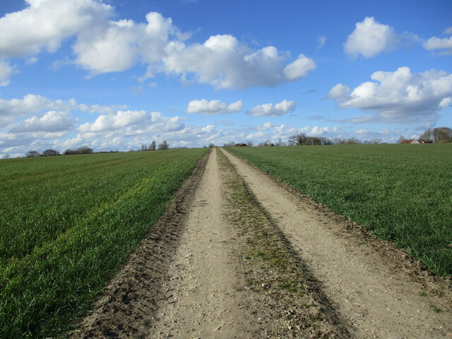
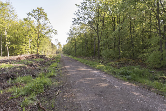
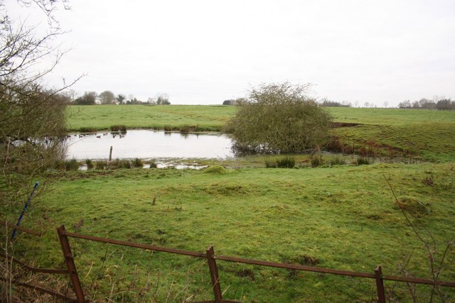
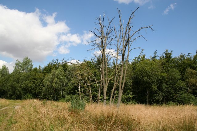
The village of Minting is characterized by its picturesque countryside setting, with rolling hills, green fields, and charming cottages. The area is known for its agricultural heritage, with farming being a significant industry in the region.

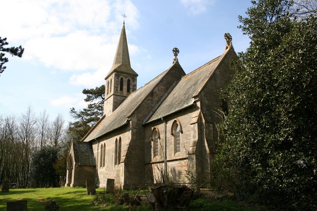
Historically, Minting was mentioned in the Domesday Book of 1086, and it has a rich history dating back centuries. The village features a number of noteworthy architectural landmarks, including St. Andrew's Church, which dates back to the 13th century. The church is an important focal point for the community and provides a glimpse into the area's historical significance.

In terms of amenities, Minting is a relatively quiet village with limited facilities. The nearest shops, schools, and healthcare services are located in nearby Horncastle. However, the village does have a community hall that serves as a hub for local gatherings and events.

Minting offers a peaceful and scenic environment, making it an attractive place for those seeking a tranquil rural lifestyle. It is well-connected to neighboring towns and cities via road links, providing residents with easy access to further amenities and employment opportunities.

If you have any feedback on the listing, please let us know in the comments section below.

Minting Images

Images are sourced within 2km of 53.249596/-0.239229 or Grid Reference TF1773. Thanks to Geograph Open Source API. All images are credited.

Farm track near Gautby The footpath which on OS crosses the field on the right, according to local signage more sensibly follows this track.
Farm track near Gautby
The footpath which on OS crosses the field on the right, according to local signage more sensibly follows this track.
Gautby: aerial 2022
Gautby: aerial 2022
Minting Benedictine Priory site: aerial 2022 A Benedictine priory, a cell of St Benoit-sur-Loire, founded before 1129 and granted by Ralph Earl of Chester. The earliest mention of a Prior is in 1213. The priory was dissolved in 1414.

The site of the alien priory of Minting, suppressed by 1403. The site was granted in 1421 to Mount Grace Priory, North Yorkshire, as a grange. The earthworks visible represent stock compounds, yards, ponds and the grange buildings within a small moat. A broad hollow way connects the moat to the village. 

See: <span class="nowrap"><a title="https://www.heritagegateway.org.uk/Gateway/Results_Single.aspx?uid=MLI43553&resourceID=1006" rel="nofollow ugc noopener" href="https://www.heritagegateway.org.uk/Gateway/Results_Single.aspx?uid=MLI43553&resourceID=1006">Link</a><img style="margin-left:2px;" alt="External link" title="External link - shift click to open in new window" src="https://s1.geograph.org.uk/img/external.png" width="10" height="10"/></span>
Minting Benedictine Priory site: aerial 2022
A Benedictine priory, a cell of St Benoit-sur-Loire, founded before 1129 and granted by Ralph Earl of Chester. The earliest mention of a Prior is in 1213. The priory was dissolved in 1414. The site of the alien priory of Minting, suppressed by 1403. The site was granted in 1421 to Mount Grace Priory, North Yorkshire, as a grange. The earthworks visible represent stock compounds, yards, ponds and the grange buildings within a small moat. A broad hollow way connects the moat to the village. See: LinkExternal link
Autumn sown field near Minting
Prepared field near Hatton Rather wet after several rainy days.
Prepared field near Hatton
Rather wet after several rainy days.
Uncultivated field near Minting
Lodge Lane near Minting
Track through Minting Wood Signs of forestry maintenance on the left.
Track through Minting Wood
Signs of forestry maintenance on the left.
All Saints' church, Gautby, Lincs. Georgian red brick of 1756, monuments to the Vyner family who owned Gautby Great Park, the house has gone but some buildings remain
All Saints' church, Gautby, Lincs.
Georgian red brick of 1756, monuments to the Vyner family who owned Gautby Great Park, the house has gone but some buildings remain
St.Andrew's church, Minting, Lincs. 1863 Victorian church
St.Andrew's church, Minting, Lincs.
1863 Victorian church
All Saints' church, Gautby
The New Midge Inn Closed, empty and for sale at Hatton cross roads
The New Midge Inn
Closed, empty and for sale at Hatton cross roads
Cow Lane View north along Cow Lane to West Farm
Cow Lane
View north along Cow Lane to West Farm
Lodge Lane junction The junction of Pinfold Lane with Lodge Lane in Minting
Lodge Lane junction
The junction of Pinfold Lane with Lodge Lane in Minting
Minting fingerpost Traditional fingerpost and postbox on Lodge Lane
Minting fingerpost
Traditional fingerpost and postbox on Lodge Lane
Footpath to Hatton Path from Lodge Lane in Minting
Footpath to Hatton
Path from Lodge Lane in Minting
Lodge Farm View from Minting Lane
Lodge Farm
View from Minting Lane
White House Farm
White House Farm
Show me another place!

Minting is located at Grid Ref: TF1773 (Lat: 53.249596, Lng: -0.239229)

Administrative County: Lincolnshire

District: East Lindsey

Police Authority: Lincolnshire

What 3 Words

///growl.faded.shapeless. Near Wragby, Lincolnshire

Nearby Locations

Larch Plantation Minting

Related Wikis

Minting Priory

Minting Priory was a priory in Minting, Lincolnshire, England. The priory for Benedictine monks was founded by Ranulf de Meschines, earl of Chester, to...

Minting

Minting is a village and civil parish in the East Lindsey district of Lincolnshire, England. The village is situated 1 mile (1.6 km) south from the A158...

Gautby

Gautby ( GAWT-bee) is a village in the East Lindsey district of Lincolnshire, England. The village is situated 6 miles (10 km) north-west from the town...

Hatton, Lincolnshire

Hatton is a small village and civil parish in the East Lindsey district of Lincolnshire, England. It is situated 3 miles (5 km) east of the town of Wragby...

Waddingworth

Waddingworth is a hamlet and civil parish in the East Lindsey district of Lincolnshire, England, and approximately 5 miles (8 km) north-west from the town...

Wispington

Wispington is a village in the civil parish of Edlington with Wispington, in East Lindsey, Lincolnshire, England. It is situated 2 miles (3 km) west from...

Hanby Hall

Hanby Hall is a Grade II* listed early 18th-century building in Alford, Lincolnshire. Hanby Hall was built by John Andrews. It is situated opposite St...

Langton by Wragby

Langton by Wragby is a small village and civil parish in the East Lindsey district of Lincolnshire, England. It lies approximately 1 mile (1.6 km) south...

Nearby Amenities

Located within 500m of 53.249596,-0.239229
Power: pole
Source: Bing
Lat/Long: 53.2537506/-0.2395038
Power: pole
Source: Bing
Lat/Long: 53.252612/-0.23878
Power: pole
Source: Bing
Lat/Long: 53.2481289/-0.2358926
Power: pole
Source: Bing
Lat/Long: 53.2506582/-0.237515
Power: pole
Source: Bing
Lat/Long: 53.2496737/-0.2368793
Power: pole
Source: Bing
Lat/Long: 53.2516452/-0.2381439
Power: pole
Source: Bing
Lat/Long: 53.2487549/-0.2363013
Power: pole
Source: Bing
Lat/Long: 53.2466661/-0.2352579
Highfield Farm
Historic Place: farm
Source: Bing
Lat/Long: 53.2481267/-0.2417105
Power: pole
Source: Bing
Lat/Long: 53.2474361/-0.235592
The data included in this document is from www.openstreetmap.org. The data is made available under ODbL.

Have you been to Minting?

Leave your review of Minting below (or comments, questions and feedback).