Miserden

Civil Parish in Gloucestershire Stroud

England

Miserden

Footpath near Whiteway
Footpath near Whiteway Credit: P Gaskell

Miserden is a small civil parish located in the county of Gloucestershire, England. Situated in the Cotswolds Area of Outstanding Natural Beauty, it covers an area of approximately 4.2 square miles. The village of Miserden is the main settlement within the parish and is known for its picturesque charm and historic buildings.

The village is home to around 200 residents and is surrounded by rolling hills and lush green countryside. It is characterized by traditional Cotswold stone houses and buildings, giving it a quintessential English village feel. The parish also includes the hamlets of Far Oakridge and The Camp.

One of the main attractions in Miserden is the Miserden Park Gardens, which cover an area of 850 acres. These stunning gardens date back to the 17th century and feature a variety of plants, trees, and flowers, including a renowned collection of magnolias and rhododendrons. The park also offers beautiful walks and trails for visitors to explore.

The parish has a rich history, and evidence of prehistoric settlements has been found in the area. The Grade I listed All Saints Church, located in the village, dates back to the 12th century and is a notable landmark in Miserden.

Miserden is located approximately 7 miles southeast of Stroud and is well-connected to surrounding towns and cities via the A419 road. It offers a peaceful and idyllic rural setting, making it a popular destination for those seeking a tranquil countryside retreat.

If you have any feedback on the listing, please let us know in the comments section below.
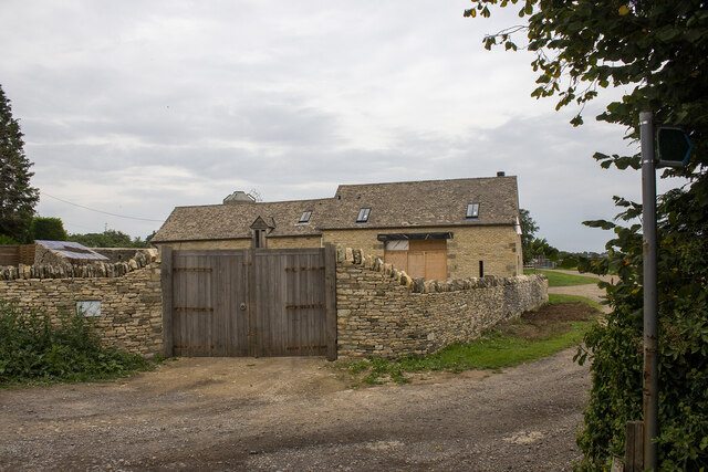
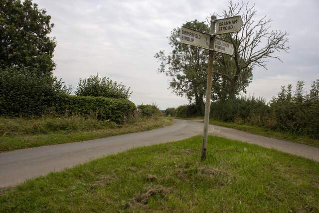
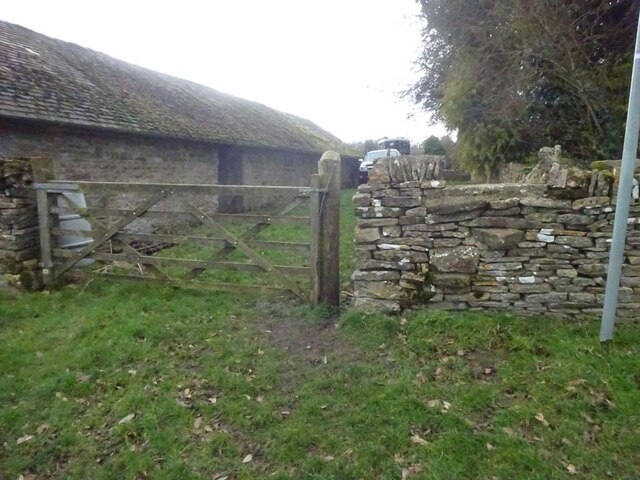
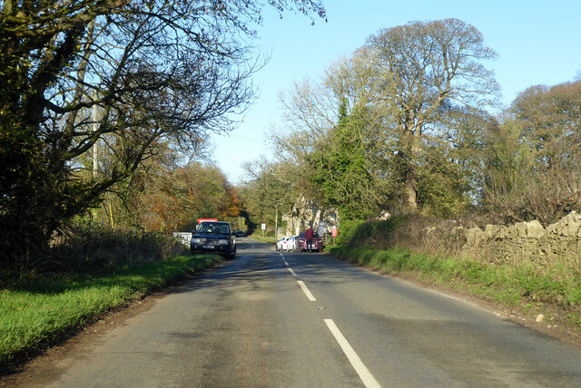
Miserden Images

Images are sourced within 2km of 51.788022/-2.109907 or Grid Reference SO9209. Thanks to Geograph Open Source API. All images are credited.

Footpath near Whiteway
Whiteway Village
Whiteway Village
Wateredge Farm Converted farm building at Wateredge Farm
Wateredge Farm
Converted farm building at Wateredge Farm
Crossroads and signpost
Stone Stile, Caudle Green Looking into a field at the junction of Gloucestershire footpaths MMN23 & BBR38 where the paths transition from woodland to a field sparsely populated with "meadow flowers". The soil in the field is heavily laden with stones. The view towards the woodland is <a href="https://www.geograph.org.uk/photo/7104960">SO9310 : Stone Stile, Caudle Green</a>.
Stone Stile, Caudle Green
Looking into a field at the junction of Gloucestershire footpaths MMN23 & BBR38 where the paths transition from woodland to a field sparsely populated with "meadow flowers". The soil in the field is heavily laden with stones. The view towards the woodland is SO9310 : Stone Stile, Caudle Green.
Stone Stile, Caudle Green Looking from a field at the junction of Gloucestershire footpaths MMN23 & BBR38 where the paths transition from woodland to a field sparsely populated with "meadow flowers". The soil in the field is heavily laden with stones. The view from the woodland is <a href="https://www.geograph.org.uk/photo/7104958">SO9310 : Stone Stile, Caudle Green</a>.
Stone Stile, Caudle Green
Looking from a field at the junction of Gloucestershire footpaths MMN23 & BBR38 where the paths transition from woodland to a field sparsely populated with "meadow flowers". The soil in the field is heavily laden with stones. The view from the woodland is SO9310 : Stone Stile, Caudle Green.
Stone Stile, Caudle Green Due South of the village green at the junction of Gloucestershire footpaths MMN23 & BBR25 in woodland. This point is also on the boundaries of: county constituency, civil parishes of Miserden and Brimsfield, and the county district. This is the view looking NE, the view SW is <a href="https://www.geograph.org.uk/photo/7104970">SO9410 : Stone Stile, Caudle Green</a>.
Stone Stile, Caudle Green
Due South of the village green at the junction of Gloucestershire footpaths MMN23 & BBR25 in woodland. This point is also on the boundaries of: county constituency, civil parishes of Miserden and Brimsfield, and the county district. This is the view looking NE, the view SW is SO9410 : Stone Stile, Caudle Green.
Stone Stile, Caudle Green Due South of the village green at the junction of Gloucestershire footpaths MMN23 & BBR25 in woodland. This point is also on the boundaries of: county constituency, civil parishes of Miserden and Brimsfield, and the county district. This is the view looking SW, the view NE is <a href="https://www.geograph.org.uk/photo/7104969">SO9410 : Stone Stile, Caudle Green</a>.
Stone Stile, Caudle Green
Due South of the village green at the junction of Gloucestershire footpaths MMN23 & BBR25 in woodland. This point is also on the boundaries of: county constituency, civil parishes of Miserden and Brimsfield, and the county district. This is the view looking SW, the view NE is SO9410 : Stone Stile, Caudle Green.
Stone Stile, Caudle Green From a small field into a grazing field at the SE corner of the garden walls of 'Calley House'. This is looking SW away from the village, the view towards the village is <a href="https://www.geograph.org.uk/photo/7104983">SO9410 : Stone Stile, Caudle Green</a>.
Stone Stile, Caudle Green
From a small field into a grazing field at the SE corner of the garden walls of 'Calley House'. This is looking SW away from the village, the view towards the village is SO9410 : Stone Stile, Caudle Green.
Stone Stile, Caudle Green From a small field in to a grazing field at the SE corner of the garden wals of 'Calley House'. This is looking NE towards the village, the view towards the larger field is <a href="https://www.geograph.org.uk/photo/7104981">SO9410 : Stone Stile, Caudle Green</a>.
Stone Stile, Caudle Green
From a small field in to a grazing field at the SE corner of the garden wals of 'Calley House'. This is looking NE towards the village, the view towards the larger field is SO9410 : Stone Stile, Caudle Green.
Stone Stile, Caudle Green A step Stile off the Southern side of the village green on Gloucestershire footpath BBR25. This is looking to the village green, the view from the green is <a href="https://www.geograph.org.uk/photo/7104992">SO9410 : Stone Stile, Caudle Green</a>.
Stone Stile, Caudle Green
A step Stile off the Southern side of the village green on Gloucestershire footpath BBR25. This is looking to the village green, the view from the green is SO9410 : Stone Stile, Caudle Green.
Stone Stile, Caudle Green A step Stile off the Southern side of the village green on Gloucestershire footpath BBR25. This is looking from the village green, the view toward the green is <a href="https://www.geograph.org.uk/photo/7104990">SO9410 : Stone Stile, Caudle Green</a>.
Stone Stile, Caudle Green
A step Stile off the Southern side of the village green on Gloucestershire footpath BBR25. This is looking from the village green, the view toward the green is SO9410 : Stone Stile, Caudle Green.
Stone stile north of Hazle Manor, Wishanger GS9268 Stone slab stile off Calf Way, the road Fostons Ash to Bisley Road. Off the east side of Calf Way and just north of Hazle Manor, Wishanger. On public right of way MMN17, Miserden parish.
Stone stile north of Hazle Manor, Wishanger GS9268
Stone slab stile off Calf Way, the road Fostons Ash to Bisley Road. Off the east side of Calf Way and just north of Hazle Manor, Wishanger. On public right of way MMN17, Miserden parish.
Stone stile north of Hazle Manor, Wishanger GS9268 Stone slab stile off Calf Way, the road Fostons Ash to Bisley Road. Off the east side of Calf Way and just north of Hazle Manor, Wishanger. On public right of way MMN17. Miserden parish
View from Calf Way
Stone stile north of Hazle Manor, Wishanger GS9268
Stone slab stile off Calf Way, the road Fostons Ash to Bisley Road. Off the east side of Calf Way and just north of Hazle Manor, Wishanger. On public right of way MMN17. Miserden parish View from Calf Way
Calf Way heading north Towards Birdlip.
Calf Way heading north
Towards Birdlip.
Calf Way heading north Towards Birdlip, joining the B4070 ahead.
Calf Way heading north
Towards Birdlip, joining the B4070 ahead.
Georgian Cotswold house An imposing mid-18th century Georgian house overlooking Caudle Green.  The house is Grade II listed, see: <span class="nowrap"><a title="https://historicengland.org.uk/listing/the-list/list-entry/1305600?section=official-list-entry" rel="nofollow ugc noopener" href="https://historicengland.org.uk/listing/the-list/list-entry/1305600?section=official-list-entry">Link</a><img style="margin-left:2px;" alt="External link" title="External link - shift click to open in new window" src="https://s1.geograph.org.uk/img/external.png" width="10" height="10"/></span>
Georgian Cotswold house
An imposing mid-18th century Georgian house overlooking Caudle Green. The house is Grade II listed, see: LinkExternal link
Houses on Caudle Green Cotswold Stone houses overlooking Caudle Green.
Houses on Caudle Green
Cotswold Stone houses overlooking Caudle Green.
Show me another place!

Miserden is located at Grid Ref: SO9209 (Lat: 51.788022, Lng: -2.109907)

Administrative County: Gloucestershire

District: Stroud

Police Authority: Gloucestershire

What 3 Words

///petulant.originals.shelf. Near Painswick, Gloucestershire

Nearby Locations

Miserden Wishanger

Related Wikis

Whiteway Colony

Whiteway Colony is a residential community in the Cotswolds in the parish of Miserden near Stroud, Gloucestershire, United Kingdom. The community was founded...

Miserden

Miserden is a village and civil parish in Stroud District, Gloucestershire, England, 4 miles north east of Stroud. The parish includes Whiteway Colony...

The Camp, Gloucestershire

The Camp is a hamlet in the south of Gloucestershire, approximately 10 miles south of Cheltenham and 5 miles north-east of Stroud. It is in the parish...

Brimpsfield

Brimpsfield is a village in Gloucestershire, England. The village is recorded in Domesday Book as Brimesfelde. Brimpsfield Castle was built in the village...

Miserden War Memorial

Miserden War Memorial is a First World War memorial in the village of Miserden, near Stroud, in Gloucestershire, south-western England. The memorial, designed...

Miserden Castle

Miserden Castle was a castle near the village of Miserden in Gloucestershire, England. The castle is a large motte and bailey Norman castle, built before...

Rough Bank, Miserden

Rough Bank, Miserden (grid reference SO907087) is a 9.2-hectare (23-acre) biological Site of Special Scientific Interest in Gloucestershire, notified in...

Church of St Mary the Virgin, Syde

The Anglican Church of St Mary the Virgin at Syde in the Cotswold District of Gloucestershire, England was built in the early 12th century. It is a grade...

Related Videos

Soak up the Serene Atmosphere of Rural ENGLAND on a Misty Morning

So, today we are out and about walking for a revisit in the Cotswold hamlet of Caudle Green in Gloucestershire, England. Caudle ...

A Blissful & Serene Walk at First Light Through a Cotswold village

So, today we are out and about walking in the Cotswold village of Miserden (pronounced Mizzer-Den). The village is a civil parish ...

Could this Really be the Perfect Cotswold Village | English Countryside

So, today we are out and about walking in the Cotswold hamlet of Caudle Green in Gloucestershire, England. Caudle Green is ...

A winter walk around my village of Whiteway in Stroud.

A walk around the village of Whiteway near Stroud. #cotswolds #stroud #countrywalks #gloucestershire #villagelife #village ...

Nearby Amenities

Located within 500m of 51.788022,-2.109907
The data included in this document is from www.openstreetmap.org. The data is made available under ODbL.

Have you been to Miserden?

Leave your review of Miserden below (or comments, questions and feedback).