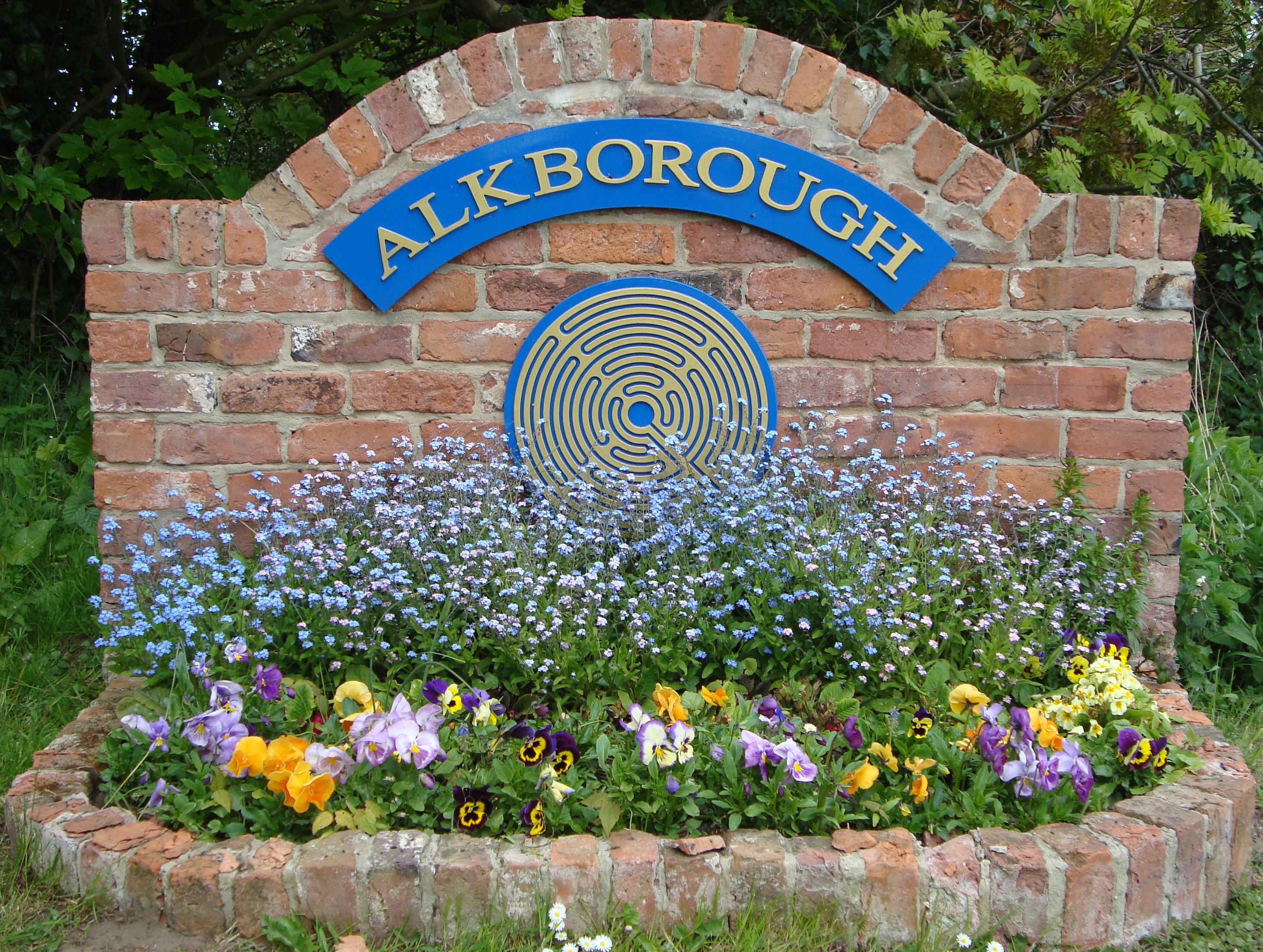
Alkborough

Civil Parish in Lincolnshire

England

Alkborough

Walcot Road A double line of pylons crosses over the road just ahead.
Walcot Road Credit: Marathon

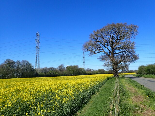
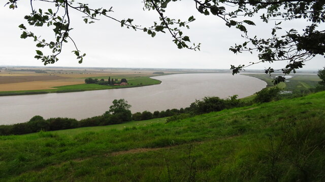
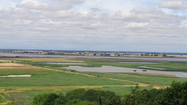
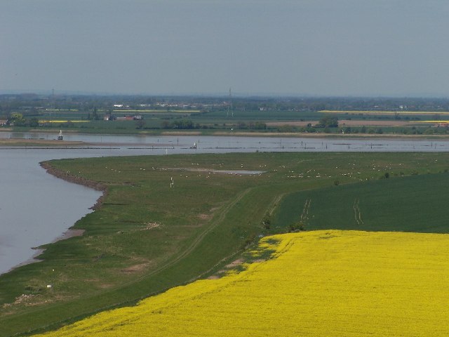
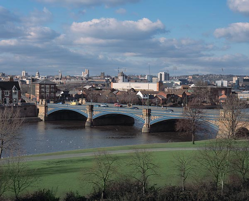
Alkborough is a civil parish located in the North Lincolnshire district of the county of Lincolnshire, England. It is situated on the southern bank of the River Humber, near the confluence of the River Trent and the River Ouse. The parish covers an area of approximately 8.5 square miles.

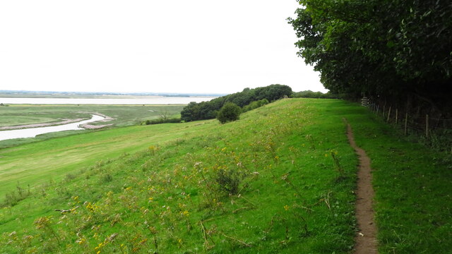
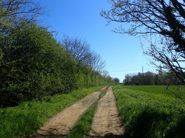
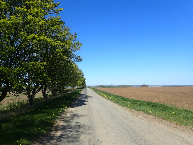
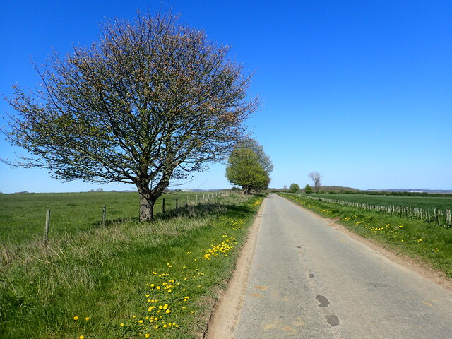
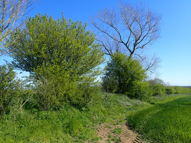
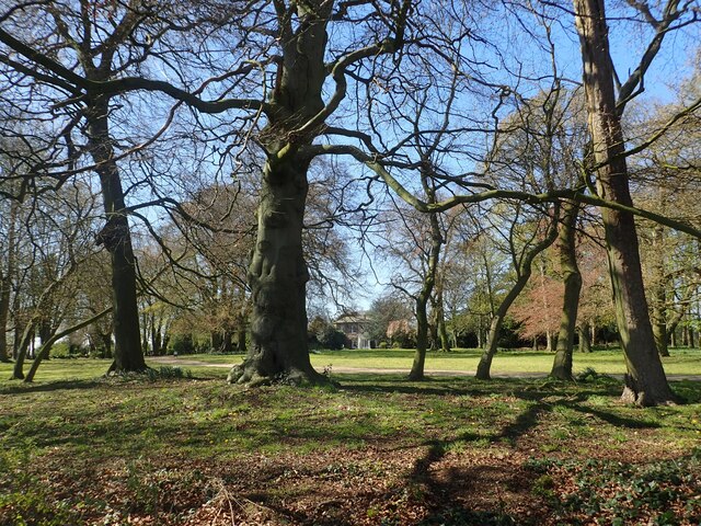
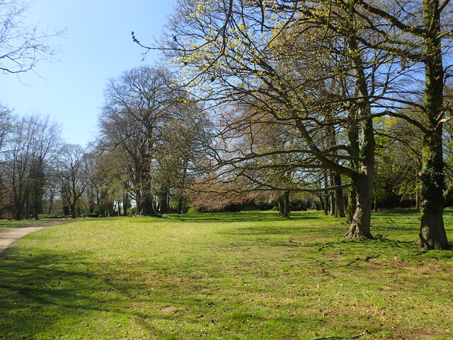
The village of Alkborough itself is small, with a population of around 400 residents. It is surrounded by open countryside, offering picturesque views of the Humber Estuary and the surrounding wetlands. The area is known for its rich wildlife and is a popular destination for birdwatchers and nature enthusiasts.

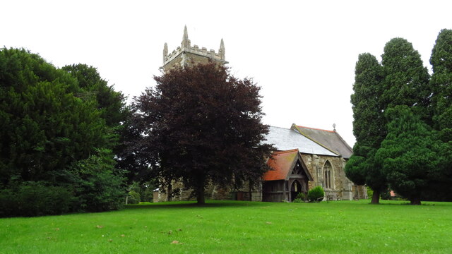
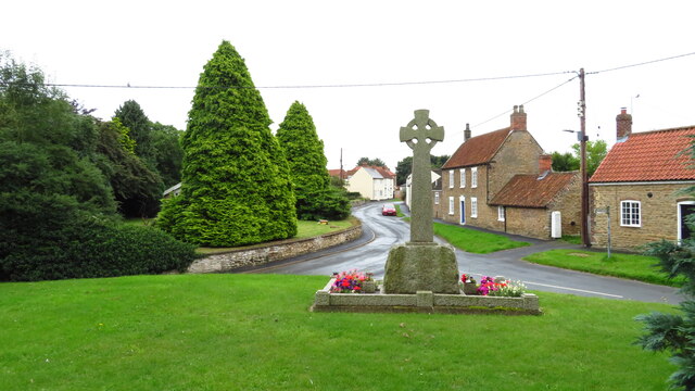
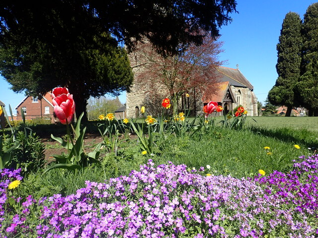
The village features a historic parish church, St. John the Baptist, which dates back to the 11th century. The church is a Grade I listed building and attracts visitors interested in its architecture and historical significance.

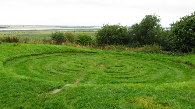
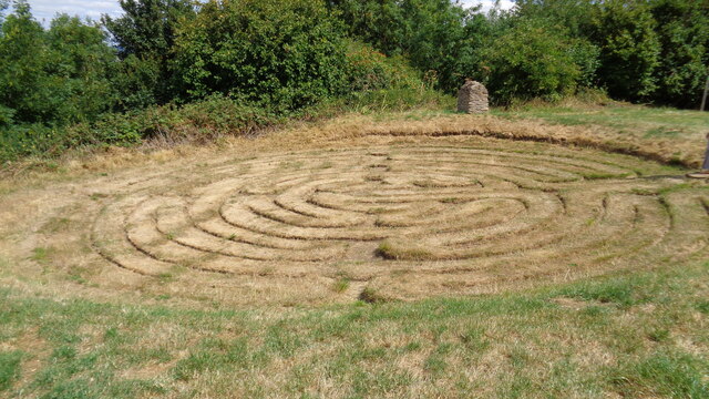
Alkborough is also home to the Alkborough Turf Maze, a unique ancient labyrinth carved into the ground. The maze, believed to date back to the medieval period, is a popular attraction for visitors.

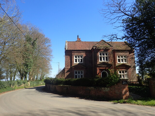
The village has limited amenities, with a local pub and a primary school serving the community. However, nearby towns such as Barton-upon-Humber and Scunthorpe offer a wider range of facilities, including shops, supermarkets, and healthcare services.

Overall, Alkborough offers a peaceful and idyllic setting for those seeking a rural escape, with its stunning natural surroundings and historical landmarks.

If you have any feedback on the listing, please let us know in the comments section below.

Alkborough Images

Images are sourced within 2km of 53.684174/-0.669556 or Grid Reference SE8721. Thanks to Geograph Open Source API. All images are credited.

Walcot Road A double line of pylons crosses over the road just ahead.
Walcot Road
A double line of pylons crosses over the road just ahead.
Island House & the River Trent from Hill Top Plantation near Walcot
Julian's Bower (Maze), Alkborough
Alkborough - Church of St John the Baptist
Alkborough - War Memorial
On path between Alkborough & Whitton
Julian's Bower turf cut maze
River Humber View from Alkborough with the confluence of the Trent and Ouse Rivers on the extreme left
River Humber
View from Alkborough with the confluence of the Trent and Ouse Rivers on the extreme left
Track off Walcot Road This track leads off Walcot Road, just south of Walcot.
Track off Walcot Road
This track leads off Walcot Road, just south of Walcot.
Walcot Old Hall Walcot Old Hall dates from the mid-17th century and is across the road from Walcot Hall which is mid-Georgian.
Walcot Old Hall
Walcot Old Hall dates from the mid-17th century and is across the road from Walcot Hall which is mid-Georgian.
St John Baptist Church, Alkborough The tower of the church is Anglo-Saxon while the upper part of the tower is Early English. The church was given to Spalding Priory in 1052. It is seen here from the corner of Church View and Church Side.
St John Baptist Church, Alkborough
The tower of the church is Anglo-Saxon while the upper part of the tower is Early English. The church was given to Spalding Priory in 1052. It is seen here from the corner of Church View and Church Side.
Whitton Road This is on the way out of Alkborough and heading towards the River Humber.
Whitton Road
This is on the way out of Alkborough and heading towards the River Humber.
Whitton Road This is north of Alkborough and heading towards the River Humber.
Whitton Road
This is north of Alkborough and heading towards the River Humber.
Ancient boundary This appears to be an ancient boundary feature and is in the form of a ditch and bank.
Ancient boundary
This appears to be an ancient boundary feature and is in the form of a ditch and bank.
Walcot Old Hall Walcot Old Hall dates from the mid-17th century and is across the road from Walcot Hall which is mid-Georgian. See also <a title="www.geograph.org.uk/photo/7468472" href="https://www.geograph.org.uk/photo/7468472">Link</a>
Walcot Old Hall
Walcot Old Hall dates from the mid-17th century and is across the road from Walcot Hall which is mid-Georgian. See also Link
Walcot Road Walcot Old Hall is on the right - see also <a title="www.geograph.org.uk/photo/7468472" href="https://www.geograph.org.uk/photo/7468472">Link</a>
Walcot Road
Walcot Old Hall is on the right - see also Link
Walcot Hall Walcot Hall was built in 1726 and is seen here from Walcot Road across its parkland. It is now a wedding venue - see <span class="nowrap"><a title="www.walcothallestate.co.uk" rel="nofollow ugc noopener" href="http://www.walcothallestate.co.uk">Link</a><img style="margin-left:2px;" alt="External link" title="External link - shift click to open in new window" src="https://s1.geograph.org.uk/img/external.png" width="10" height="10"/></span>  It is across the road from Walcot Old Hall - see <a title="www.geograph.org.uk/photo/7468472" href="https://www.geograph.org.uk/photo/7468472">Link</a>
Walcot Hall
Walcot Hall was built in 1726 and is seen here from Walcot Road across its parkland. It is now a wedding venue - see LinkExternal link It is across the road from Walcot Old Hall - see Link
The parkland of Walcot Hall Walcot Hall was built in 1726 and is seen here from Walcot Road across its parkland. It is now a wedding venue - see <span class="nowrap"><a title="www.walcothallestate.co.uk" rel="nofollow ugc noopener" href="http://www.walcothallestate.co.uk">Link</a><img style="margin-left:2px;" alt="External link" title="External link - shift click to open in new window" src="https://s1.geograph.org.uk/img/external.png" width="10" height="10"/></span>  It is across the road from Walcot Old Hall - see <a title="www.geograph.org.uk/photo/7468472" href="https://www.geograph.org.uk/photo/7468472">Link</a>
The parkland of Walcot Hall
Walcot Hall was built in 1726 and is seen here from Walcot Road across its parkland. It is now a wedding venue - see LinkExternal link It is across the road from Walcot Old Hall - see Link
Show me another place!

Alkborough is located at Grid Ref: SE8721 (Lat: 53.684174, Lng: -0.669556)

Unitary Authority: North Lincolnshire

Police Authority: Humberside

What 3 Words

///lines.gambles.encloses. Near Whitton, Lincolnshire

Related Wikis

Julian's Bower

Julian's Bower or Julian Bower is a name given to turf mazes in several different parts of England. Only one of this name still exists, at Alkborough in...

Alkborough

Alkborough is a parish of 471 people in 192 households (2021 census) in North Lincolnshire, England, located near the northern end of The Cliff range of...

Trent Falls

Trent Falls is the confluence of the River Ouse and the River Trent which forms the Humber between Lincolnshire and the East Riding of Yorkshire in England...

River Trent

The Trent is third in the list of longest rivers in the United Kingdom. Its source is in Staffordshire, on the southern edge of Biddulph Moor. It flows...
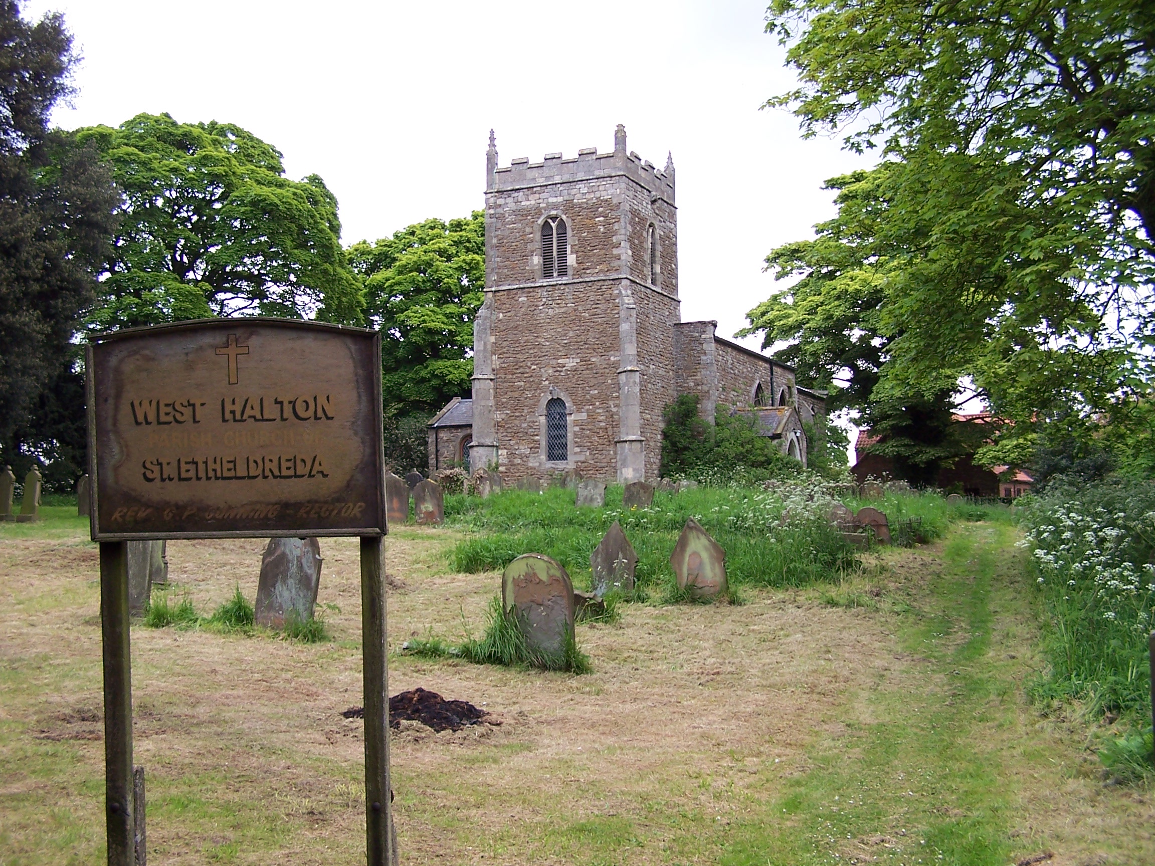
West Halton

West Halton is a village and civil parish in North Lincolnshire, England. It is situated 2.5 miles (4 km) north-west from Winterton, approximately 7 miles...

River Ouse, Yorkshire

The River Ouse ( OOZ) is a river in North Yorkshire, England. Hydrologically, the river is a continuation of the River Ure, and the combined length of...

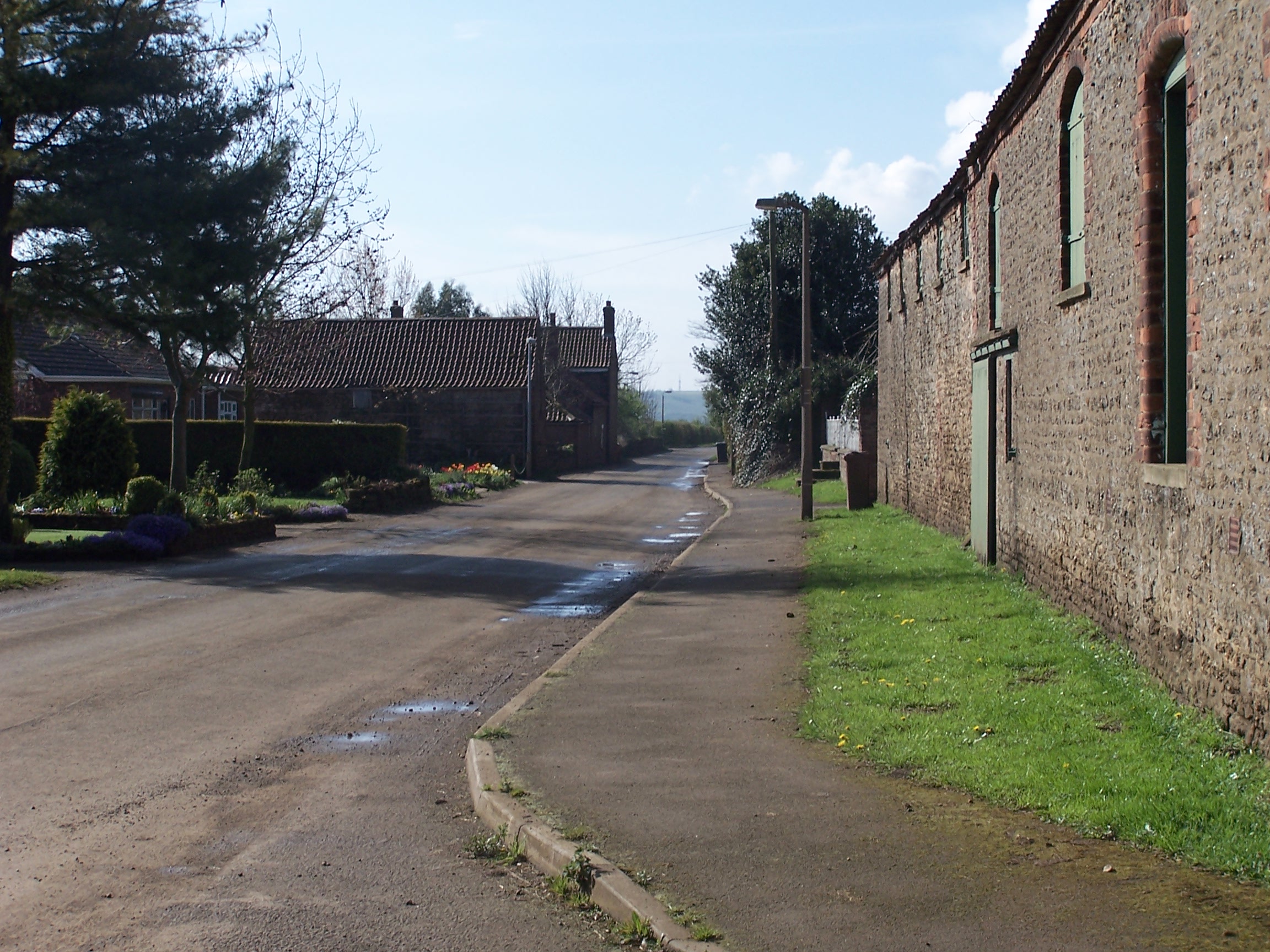
Coleby, North Lincolnshire

Coleby is a hamlet in the civil parish of West Halton in North Lincolnshire, England. It is situated approximately 7 miles (11 km) north from Scunthorpe...

Faxfleet

Faxfleet is a hamlet and former civil parish, now in the parish of Blacktoft, in the East Riding of Yorkshire, England. It is situated approximately 6...

Nearby Amenities

Located within 500m of 53.684174,-0.669556
Alkborough
Place: village
Source: NPE
Wikidata: Q989821
Lat/Long: 53.6847946/-0.6655823
Bus Stop
Cross Street
Naptan AtcoCode: 227000010001
Naptan Bearing: N
Naptan CommonName: Cross Street
Naptan Indicator: adj
Naptan Landmark: Cross Lane
Naptan NaptanCode: scuadad
Naptan Street: Front Street
Naptan Verified: no
Source: naptan_import
Lat/Long: 53.684341/-0.6655764
Cross Street
Naptan AtcoCode: 227000010002
Naptan Bearing: S
Naptan BusStopType: CUS
Naptan CommonName: Cross Street
Naptan Indicator: opp
Naptan NaptanCode: scuagad
Naptan Street: Front Street
Naptan Verified: no
Source: naptan_import
Lat/Long: 53.6842231/-0.6654892
Bus Stop
Hillcrest
Naptan AtcoCode: 227000010005
Naptan Bearing: N
Naptan CommonName: Hillcrest
Naptan Indicator: adj
Naptan Landmark: Hillcrest
Naptan NaptanCode: scumgjd
Naptan Street: West Halton Lane
Naptan Verified: no
Source: naptan_import
Lat/Long: 53.6816739/-0.6650095
Bus Stop
Hillcrest
Naptan AtcoCode: 227000010006
Naptan Bearing: S
Naptan CommonName: Hillcrest
Naptan Indicator: opp
Naptan Landmark: Hillcrest
Naptan NaptanCode: scumpjd
Naptan Street: West Halton Lane
Naptan Verified: no
Source: naptan_import
Lat/Long: 53.6817174/-0.664887
Parking
Alkborough Flats
Access: yes
Capacity: 6
Capacity Disabled: yes
Fee: no
Lat/Long: 53.6881011/-0.6703624
Cafe
The PaddocksTea Room
Addr City: Scunthorpe
Addr Housename: College Farm
Addr Postcode: DN15 9JN
Addr Street: Back Street
Addr Suburb: Alkborough
Fhrs Id: 213369
Source Addr: FHRS Open Data
Lat/Long: 53.6836829/-0.6678715
College Farm Caravan Park
Tourism: caravan_site
Lat/Long: 53.6831459/-0.6668426
Place Of Worship
Alkborough Methodist Chapel
Denomination: methodist
Religion: christian
Status: closed
Lat/Long: 53.6840704/-0.6659413
Post Box
Operator: Royal Mail
Post Box Type: lamp
Lat/Long: 53.6846226/-0.6660889
Disused: yes
Man Made: windmill
Lat/Long: 53.6827625/-0.6636589
Barrier: stile
Lat/Long: 53.6856401/-0.662751
Barrier: stile
Lat/Long: 53.6850198/-0.6632311
Pub
Coronation Club
Addr City: Scunthorpe
Addr Housename: Coronation Club
Addr Postcode: DN15 9JN
Addr Street: Back Street
Addr Suburb: Alkborough
Alt Name: Alkborough Club
Fhrs Id: 213296
Source Addr: FHRS Open Data
Lat/Long: 53.6849578/-0.6671377
Give Way
Lat/Long: 53.6858145/-0.6667
College Farm
Place: farm
Source: Bing
Lat/Long: 53.6832897/-0.667721
Holme Farm
Place: farm
Source: Bing
Lat/Long: 53.6847972/-0.6633481
Prospect Farm
Place: farm
Source: Bing
Lat/Long: 53.6872719/-0.6650452
Spring Gate Farm
Place: farm
Source: Bing
Lat/Long: 53.6855831/-0.6638159
Generator Method: photovoltaic
Generator Output Electricity: yes
Generator Source: solar
Generator Type: solar_photovoltaic_panel
Location: roof
Power: generator
Lat/Long: 53.6821656/-0.6654614
Generator Method: photovoltaic
Generator Output Electricity: yes
Generator Source: solar
Generator Type: solar_photovoltaic_panel
Location: roof
Power: generator
Lat/Long: 53.6821465/-0.6655419
Generator Method: photovoltaic
Generator Output Electricity: yes
Generator Source: solar
Generator Type: solar_photovoltaic_panel
Location: roof
Power: generator
Lat/Long: 53.6819527/-0.6659898
Generator Method: photovoltaic
Generator Output Electricity: yes
Generator Source: solar
Generator Type: solar_photovoltaic_panel
Location: roof
Power: generator
Lat/Long: 53.6817017/-0.6664994
Generator Method: photovoltaic
Generator Output Electricity: yes
Generator Source: solar
Generator Type: solar_photovoltaic_panel
Location: roof
Power: generator
Lat/Long: 53.6820369/-0.666258
Generator Method: photovoltaic
Generator Output Electricity: yes
Generator Source: solar
Generator Type: solar_photovoltaic_panel
Location: roof
Power: generator
Lat/Long: 53.6842529/-0.6666014
Generator Method: photovoltaic
Generator Output Electricity: yes
Generator Source: solar
Generator Type: solar_photovoltaic_panel
Location: roof
Power: generator
Lat/Long: 53.6830742/-0.6684977
Generator Method: photovoltaic
Generator Output Electricity: yes
Generator Source: solar
Generator Type: solar_photovoltaic_panel
Location: roof
Power: generator
Lat/Long: 53.6832124/-0.6682912
Generator Method: photovoltaic
Generator Output Electricity: yes
Generator Source: solar
Generator Type: solar_photovoltaic_panel
Location: roof
Power: generator
Lat/Long: 53.6834571/-0.668141
Generator Method: photovoltaic
Generator Output Electricity: yes
Generator Source: solar
Generator Type: solar_photovoltaic_panel
Location: roof
Power: generator
Lat/Long: 53.6833205/-0.6681946
Generator Method: photovoltaic
Generator Output Electricity: yes
Generator Source: solar
Generator Type: solar_photovoltaic_panel
Location: roof
Power: generator
Lat/Long: 53.6844467/-0.6648754
Bench
Colour: brown
Material: plastic
Seats: 3
Lat/Long: 53.6885184/-0.6706002
Bench
Lat/Long: 53.6885156/-0.6705876
Post Office
Alkborough Post Office
Addr City: Scunthorpe
Addr Country: GB
Addr Housename: Coronation Club
Addr Postcode: DN15 9JN
Addr Street: Back Street
Addr Village: Alkborough
Brand: Post Office
Brand Wikidata: Q1783168
Check Date: 2022-05-27
Check Date Opening Hours: 2022-05-27
Contact Website: https://www.postoffice.co.uk/branch-finder/0284726/alkborough
Opening Hours: Mo 14:00-16:30
Ref Pol Id: 179192
Lat/Long: 53.6849/-0.6672
The data included in this document is from www.openstreetmap.org. The data is made available under ODbL.

Have you been to Alkborough?

Leave your review of Alkborough below (or comments, questions and feedback).