Abbots Leigh

Civil Parish in Somerset

England

Abbots Leigh

Fish Pond This lake in Fish Pond Wood once provided fish for the divines of Bristol Cathedral.
Fish Pond Credit: Graeme Churchard

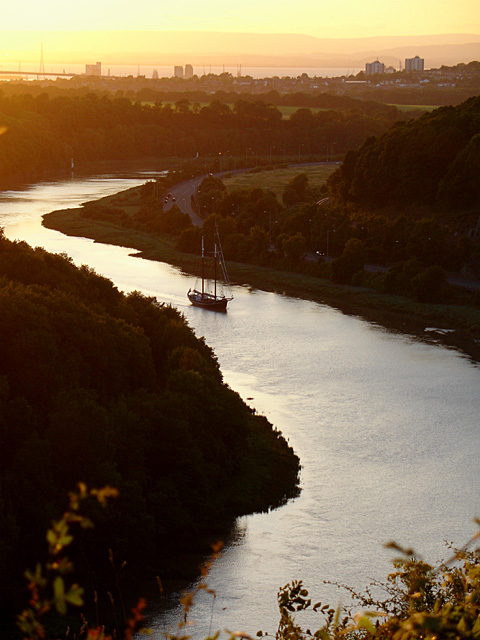
Abbots Leigh is a civil parish located in Somerset, England. Situated on the western outskirts of Bristol, it lies on the southern bank of the River Avon and is bordered by the parishes of Long Ashton, Easton-in-Gordano, and Pill.

The village of Abbots Leigh is known for its picturesque setting and tranquil atmosphere. It is predominantly a residential area, with a population of around 1,000 people. The parish is characterized by its charming cottages and historic buildings, many of which date back to the 18th and 19th centuries.

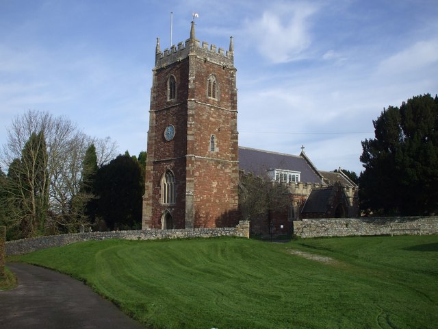
One of the notable landmarks in Abbots Leigh is St. Mary's Church, a Grade II listed building that stands at the heart of the village. This beautiful church features a striking tower and stained glass windows, adding to its architectural significance.

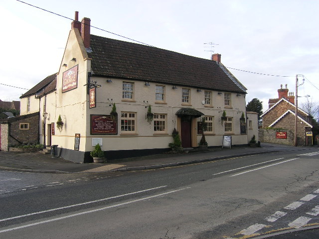
Abbots Leigh offers its residents a range of amenities, including a primary school, village hall, and a local pub. The village is well-connected to surrounding areas, with easy access to the M5 motorway and Bristol city center.

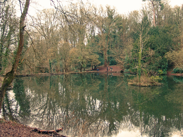
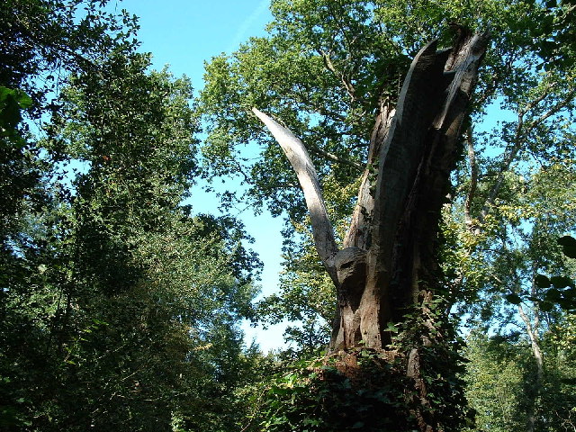
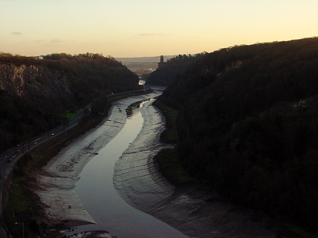
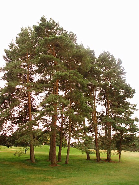
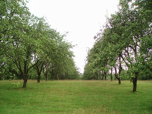
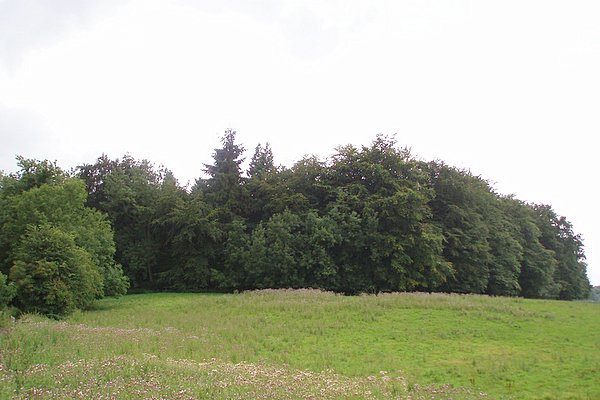
The natural beauty of Abbots Leigh is another highlight, with the nearby Leigh Woods providing ample opportunities for outdoor activities such as walking and cycling. The Avon Gorge, a designated Site of Special Scientific Interest, is also within close proximity, offering stunning views and a haven for wildlife enthusiasts.

Overall, Abbots Leigh is a charming and idyllic place to live, offering a peaceful retreat while still being conveniently located near urban amenities and natural attractions.

If you have any feedback on the listing, please let us know in the comments section below.

Abbots Leigh Images

Images are sourced within 2km of 51.46392/-2.661124 or Grid Reference ST5474. Thanks to Geograph Open Source API. All images are credited.

Fish Pond This lake in Fish Pond Wood once provided fish for the divines of Bristol Cathedral.
Fish Pond
This lake in Fish Pond Wood once provided fish for the divines of Bristol Cathedral.
Woodland sculpture In situ sculpture - Making use of the trees in Leigh Woods
Woodland sculpture
In situ sculpture - Making use of the trees in Leigh Woods
Western bank of the Avon, near Bristol Taken from Clifton Down, across the Avon Gorge, about 1.5km North of Clifton Suspension Bridge. Leigh woods, the Avon Cycle Way and a single track railway in view. The bridge goes over an entrance to an old quarry, now used as a rifle range.
Western bank of the Avon, near Bristol
Taken from Clifton Down, across the Avon Gorge, about 1.5km North of Clifton Suspension Bridge. Leigh woods, the Avon Cycle Way and a single track railway in view. The bridge goes over an entrance to an old quarry, now used as a rifle range.
Sea Mills Remains of old harbour
Sea Mills
Remains of old harbour
Ham Green Halt This halt was mainly built to serve the nearby hospital. The line is still open to serve Portbury Docks
Ham Green Halt
This halt was mainly built to serve the nearby hospital. The line is still open to serve Portbury Docks
Abbot's Leigh - The George
Abbot's Leigh Church
Remains of Roman Dwelling at Portus Abonae (Sea Mills) Portus Abonae was an ancient Roman Settlement at Sea Mills, where the Roman army would await embarkation for Caerleon, Wales.  The photo is apparently of remains of dwellings which formed part of a military fort in Claudian times.  It is taken between Roman Way and the Portway, facing due South.  Most commuters speeding down the Portway would never know it was there!
Remains of Roman Dwelling at Portus Abonae (Sea Mills)
Portus Abonae was an ancient Roman Settlement at Sea Mills, where the Roman army would await embarkation for Caerleon, Wales. The photo is apparently of remains of dwellings which formed part of a military fort in Claudian times. It is taken between Roman Way and the Portway, facing due South. Most commuters speeding down the Portway would never know it was there!
Tower Hirst by Durdham Downs This lovely house is on the edge of the Downs and overlooks the Avon Gorge. It was built about 1860.
Tower Hirst by Durdham Downs
This lovely house is on the edge of the Downs and overlooks the Avon Gorge. It was built about 1860.
View from the Viewing Point Where Durdham Downs meets the Avon Gorge is known as the Viewing Point and gives good views up the River Avon towards the Suspension Bridge (and in the opposite direction you can see the River Severn and Wales).
View from the Viewing Point
Where Durdham Downs meets the Avon Gorge is known as the Viewing Point and gives good views up the River Avon towards the Suspension Bridge (and in the opposite direction you can see the River Severn and Wales).
Sunset on Durdham Downs This photograph was obviously taken at the same moment as <a href="https://www.geograph.org.uk/photo/111102">ST5452 : X marks the spot ...</a> which about 22 km south of this spot at GR ST5452.
Sunset on Durdham Downs
This photograph was obviously taken at the same moment as ST5452 : X marks the spot ... which about 22 km south of this spot at GR ST5452.
Kite flying in Ashton Court Almost always guaranteed a breeze up here so it's a favourite with kite flyers, with both small and big kites, even on very cold days. The estate is owned by Bristol City Council.
Kite flying in Ashton Court
Almost always guaranteed a breeze up here so it's a favourite with kite flyers, with both small and big kites, even on very cold days. The estate is owned by Bristol City Council.
Ashton Court Beyond the people is Bristol seen in the distance (looking east). And just out of sight is part of the golf course.
Ashton Court
Beyond the people is Bristol seen in the distance (looking east). And just out of sight is part of the golf course.
Bristol International Kite Festival, Ashton Court Each September this part of Ashton Court is used for the Bristol International Kite Festival, which has been running for 20 years. The trees in the background run along Beggar Bush Lane.
Bristol International Kite Festival, Ashton Court
Each September this part of Ashton Court is used for the Bristol International Kite Festival, which has been running for 20 years. The trees in the background run along Beggar Bush Lane.
The Iris sailing up the Avon at high tide The Iris was on its way to the Bristol Harbour Festival, and had to wait for high tide to negotiate the river Avon. 
On the horizon is Avonmouth and the M5 bridge outlined by the sunset and beyond is Wales.
The Iris sailing up the Avon at high tide
The Iris was on its way to the Bristol Harbour Festival, and had to wait for high tide to negotiate the river Avon. On the horizon is Avonmouth and the M5 bridge outlined by the sunset and beyond is Wales.
Trees A stand of trees near the 12th green on the Bristol and Clifton golf course.
Trees
A stand of trees near the 12th green on the Bristol and Clifton golf course.
Yew Tree Plantation The name of the plantation doesn't match the type of tree.  Evidently Yew Tree Plantation has become an apple orchard.
Yew Tree Plantation
The name of the plantation doesn't match the type of tree. Evidently Yew Tree Plantation has become an apple orchard.
Round Hill Clump A relatively small plantation on top of a small hill.  Taken from a bridleway to the north.
Round Hill Clump
A relatively small plantation on top of a small hill. Taken from a bridleway to the north.
Show me another place!

Abbots Leigh is located at Grid Ref: ST5474 (Lat: 51.46392, Lng: -2.661124)

Unitary Authority: North Somerset

Police Authority: Avon and Somerset

What 3 Words

///drum.angle.curvy. Near Easton-in-Gordano, Somerset

Related Wikis

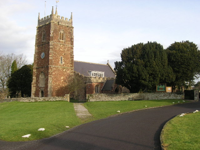
Holy Trinity Church, Abbots Leigh

Holy Trinity Church in Abbots Leigh within the English county of Somerset is a 15th-century Perpendicular Gothic building, restored and partially rebuilt...

Abbots Leigh

Abbots Leigh is a village and civil parish in North Somerset, England, about 3 miles (5 km) west of the centre of Bristol. == History == The original Middle...
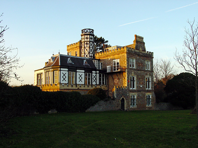
Leigh Court

Leigh Court is a country house which is a Grade II* listed building in Abbots Leigh, Somerset, England. The grounds and park are listed, Grade II, on the...

Leigh Woods National Nature Reserve

Leigh Woods is a 2-square-kilometre (0.77 sq mi) area of woodland on the south-west side of the Avon Gorge, close to the Clifton Suspension Bridge, within...

St Katherine's School

St Katherine's School is a co-educational secondary school and sixth form located in the English county of Somerset. Commonly known to be located in Pill...

Ham Green SSSI

Ham Green SSSI (grid reference ST539758) is a 1.1 hectare geological Site of Special Scientific Interest near the village of Ham Green, North Somerset...

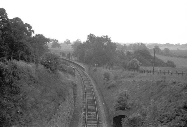
Ham Green Halt railway station

Ham Green Halt was a railway station near Bristol, England, on the Portishead Railway, opened in 1926 to serve Ham Green Hospital. == History == The station...

Portway, Bristol

The Portway is a major road in the City of Bristol. It is part of the A4 and connects Bristol City Centre to the Avonmouth Docks and the M5 motorway via...

Nearby Amenities

Located within 500m of 51.46392,-2.661124
Abbots Leigh
Is In: North Somerset, England, UK
Place: village
Postal Code: BS8 3
Wikidata: Q1933573
Lat/Long: 51.4608151/-2.6590097
Bus Stop
Sandy Lane
Bench: yes
Bin: no
Mapillary: 177122394295832
Naptan AtcoCode: 0190NSC31002
Naptan Bearing: SE
Naptan CommonName: Sandy Lane
Naptan Crossing: Sandy Lane
Naptan NaptanCode: wsmjdtp
Naptan Street: Pill Road
Naptan Verified: no
Public Transport: platform
Shelter: yes
Source: naptan_import
Survey Date: 2021-03-27
Lat/Long: 51.4618324/-2.6655348
Bus Stop
Sandy Lane
Bench: no
Bin: no
Mapillary: 964401601036128
Naptan AtcoCode: 0190NSC31003
Naptan Bearing: NW
Naptan CommonName: Sandy Lane
Naptan Crossing: Sandy Lane
Naptan NaptanCode: wsmjdtm
Naptan Street: Pill Road
Naptan Verified: no
Public Transport: platform
Shelter: no
Source: naptan_import
Survey Date: 2021-03-27
Lat/Long: 51.4618637/-2.6660423
Bus Stop
Church Road
Bench: no
Bin: no
Mapillary: 203914081393800
Naptan AtcoCode: 0190NSC31004
Naptan Bearing: SE
Naptan CommonName: Church Road
Naptan Crossing: Church Road
Naptan NaptanCode: wsmjgad
Naptan Street: Pill Road
Naptan Verified: no
Public Transport: platform
Shelter: yes
Source: naptan_import
Survey Date: 2021-03-27
Lat/Long: 51.4598152/-2.6597047
Bus Stop
Church Road
Bench: no
Bin: no
Bus: yes
Mapillary: 1515009648838541
Naptan AtcoCode: 0190NSC31005
Naptan Bearing: NW
Naptan CommonName: Church Road
Naptan Crossing: Manor Road
Naptan NaptanCode: wsmjdwt
Naptan Street: Pill Road
Naptan Verified: no
Public Transport: platform
Shelter: no
Source: naptan_import
Survey Date: 2021-03-27
Lat/Long: 51.4597207/-2.6598792
Traffic Signals
Button Operated: yes
Crossing: traffic_signals
Crossing Ref: puffin
Tactile Paving: yes
Lat/Long: 51.4600876/-2.6601837
Barrier: kissing_gate
Lat/Long: 51.4626458/-2.6566393
Barrier: kissing_gate
Lat/Long: 51.4629914/-2.6570557
Crossing
Crossing: unmarked
Crossing Island: no
Crossing Markings: no
Tactile Paving: yes
Lat/Long: 51.4603269/-2.66055
Grit Bin
Lat/Long: 51.4616994/-2.6656606
Barrier: cycle_barrier
Bicycle: yes
Foot: yes
Lat/Long: 51.463307/-2.6667807
Post Box
Post Box Type: lamp
Ref: BS8 107
Royal Cypher: EIIR
Royal Cypher Wikidata: Q33102113
Lat/Long: 51.4633083/-2.6670758
Waste Basket
Lat/Long: 51.4599412/-2.6598895
Post Box
Mapillary: 226899365436356
Post Box Type: lamp
Ref: BS8 606D
Royal Cypher: EIIR
Royal Cypher Wikidata: Q33102113
Source Position: Mapillary 2019-06-23
Survey Date: 2021-03-27
Lat/Long: 51.4599643/-2.6599227
Telephone
Defibrillator
Booth: K6
Covered: booth
Defibrillator Location: inside red phone box at junction of Pill Road and Church Road, Abbots Leigh
Emergency: defibrillator
Man Made: telephone_box
Lat/Long: 51.4605217/-2.6606028
Leigh Court Farm
FIXME: approximate
Place: farm
Lat/Long: 51.4671489/-2.6619208
Crossing
Crossing: uncontrolled
Crossing Ref: zebra
Lat/Long: 51.4659049/-2.6628757
Crossing
Crossing: uncontrolled
Crossing Ref: zebra
Lat/Long: 51.4661497/-2.6625568
Parking
Lat/Long: 51.4678707/-2.6589402
Ref Dove: 13048
Lat/Long: 51.4632723/-2.6574372
Entrance: yes
Lat/Long: 51.4606649/-2.6601428
Leisure: playground
Lat/Long: 51.4631336/-2.6567477
Toilets
Lat/Long: 51.4663686/-2.6618779
Toilets
Access: customers
Lat/Long: 51.4658614/-2.662354
The data included in this document is from www.openstreetmap.org. The data is made available under ODbL.

Have you been to Abbots Leigh?

Leave your review of Abbots Leigh below (or comments, questions and feedback).