Oak Wood

Wood, Forest in Somerset

England

Oak Wood

Clifton Downs - looking towards the water tower
Clifton Downs - looking towards the water tower Credit: John Phillips

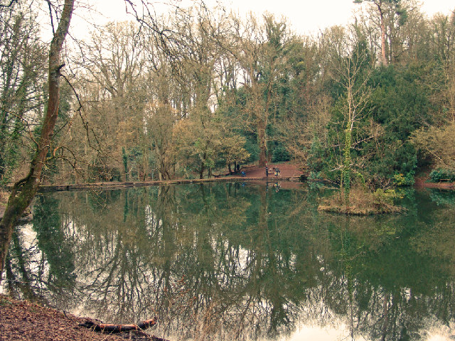
Oak Wood, Somerset is a picturesque forest located in the southwest of England. It covers an area of approximately 500 hectares and is renowned for its dense oak tree population, which gives the wood its name. This ancient woodland has a rich history dating back centuries and is a significant natural landmark in the region.

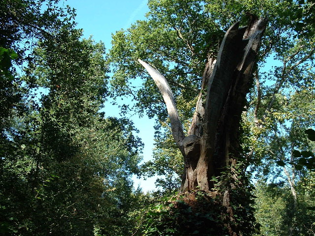
The wood is characterized by its tall and majestic oak trees, which dominate the landscape and create a dense canopy, providing shade and shelter for a variety of flora and fauna. The forest floor is carpeted with a diverse range of plant species, including bluebells, primroses, and wild garlic, creating a vibrant and colorful display during the spring months.

Oak Wood is not only visually stunning but also holds great ecological importance. It serves as a habitat for a wide range of wildlife, including deer, foxes, badgers, and numerous species of birds. The forest is a haven for birdwatchers and nature enthusiasts, who can observe species such as woodpeckers, owls, and warblers in their natural habitat.

The wood is a popular recreational destination for both locals and tourists. It offers various walking trails, allowing visitors to explore the serene surroundings and enjoy the tranquility of nature. There are also designated picnic areas and viewpoints that offer breathtaking vistas of the forest.

In addition to its natural beauty, Oak Wood is steeped in history and folklore. It has been mentioned in historical documents and is believed to have been used by ancient civilizations for various purposes. The wood retains an air of mystery and intrigue, adding to its allure.

Overall, Oak Wood, Somerset is a captivating destination that offers a blend of natural beauty, ecological significance, and historical charm. It is a must-visit location for nature lovers and those seeking a peaceful retreat in the heart of the English countryside.

If you have any feedback on the listing, please let us know in the comments section below.
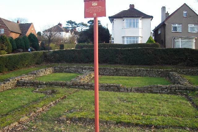
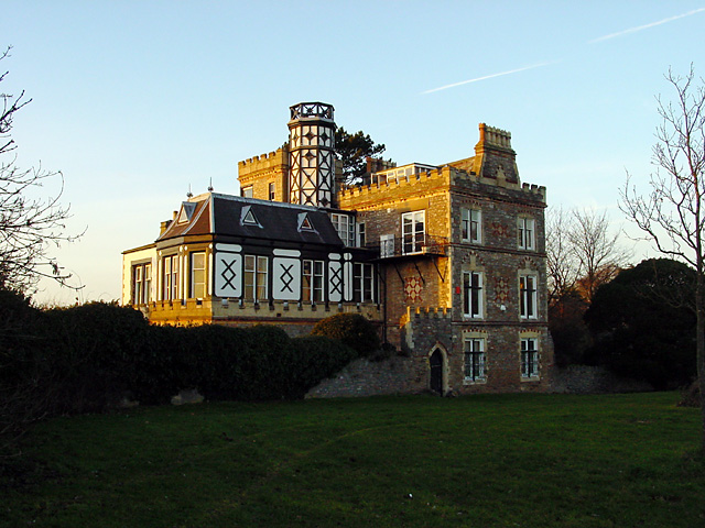
Oak Wood Images

Images are sourced within 2km of 51.470666/-2.6502342 or Grid Reference ST5474. Thanks to Geograph Open Source API. All images are credited.

Clifton Downs - looking towards the water tower
Fish Pond This lake in Fish Pond Wood once provided fish for the divines of Bristol Cathedral.
Fish Pond
This lake in Fish Pond Wood once provided fish for the divines of Bristol Cathedral.
Woodland sculpture In situ sculpture - Making use of the trees in Leigh Woods
Woodland sculpture
In situ sculpture - Making use of the trees in Leigh Woods
The Downs, looking towards Sneyd Park Clifton and Durdham Downs, owned jointly by the Society of Merchant Venturers and Bristol Corporation, but dedicated to the use and enjoyment of the citizens of Bristol in perpetuity.
The Downs, looking towards Sneyd Park
Clifton and Durdham Downs, owned jointly by the Society of Merchant Venturers and Bristol Corporation, but dedicated to the use and enjoyment of the citizens of Bristol in perpetuity.
Western bank of the Avon, near Bristol Taken from Clifton Down, across the Avon Gorge, about 1.5km North of Clifton Suspension Bridge. Leigh woods, the Avon Cycle Way and a single track railway in view. The bridge goes over an entrance to an old quarry, now used as a rifle range.
Western bank of the Avon, near Bristol
Taken from Clifton Down, across the Avon Gorge, about 1.5km North of Clifton Suspension Bridge. Leigh woods, the Avon Cycle Way and a single track railway in view. The bridge goes over an entrance to an old quarry, now used as a rifle range.
River Avon West of Shirehampton Park
River Avon East of Shirehampton Park
Sea Mills Remains of old harbour
Sea Mills
Remains of old harbour
Ham Green Halt This halt was mainly built to serve the nearby hospital. The line is still open to serve Portbury Docks
Ham Green Halt
This halt was mainly built to serve the nearby hospital. The line is still open to serve Portbury Docks
Abbot's Leigh - The George
Abbot's Leigh Church
Remains of Roman Dwelling at Portus Abonae (Sea Mills) Portus Abonae was an ancient Roman Settlement at Sea Mills, where the Roman army would await embarkation for Caerleon, Wales.  The photo is apparently of remains of dwellings which formed part of a military fort in Claudian times.  It is taken between Roman Way and the Portway, facing due South.  Most commuters speeding down the Portway would never know it was there!
Remains of Roman Dwelling at Portus Abonae (Sea Mills)
Portus Abonae was an ancient Roman Settlement at Sea Mills, where the Roman army would await embarkation for Caerleon, Wales. The photo is apparently of remains of dwellings which formed part of a military fort in Claudian times. It is taken between Roman Way and the Portway, facing due South. Most commuters speeding down the Portway would never know it was there!
Houses overlooking the Bristol Downs - Looking North
Tower Hirst by Durdham Downs This lovely house is on the edge of the Downs and overlooks the Avon Gorge. It was built about 1860.
Tower Hirst by Durdham Downs
This lovely house is on the edge of the Downs and overlooks the Avon Gorge. It was built about 1860.
View from the Viewing Point Where Durdham Downs meets the Avon Gorge is known as the Viewing Point and gives good views up the River Avon towards the Suspension Bridge (and in the opposite direction you can see the River Severn and Wales).
View from the Viewing Point
Where Durdham Downs meets the Avon Gorge is known as the Viewing Point and gives good views up the River Avon towards the Suspension Bridge (and in the opposite direction you can see the River Severn and Wales).
Course of Roman Road, Durdham Downs On the OS map is marked "Roman Road, course of", which appeared to run from the water tower in the trees. I'm not sure that there is any visible sign of the Roman Road.
Course of Roman Road, Durdham Downs
On the OS map is marked "Roman Road, course of", which appeared to run from the water tower in the trees. I'm not sure that there is any visible sign of the Roman Road.
Trees along Stoke Road and the Water Tower Looking along the line of trees plant by Stoke Road towards the Water Tower (in the adjacent square, GR ST571749) which was constructed in 1954 and has a capacity of 2.27 Megalitres.
Trees along Stoke Road and the Water Tower
Looking along the line of trees plant by Stoke Road towards the Water Tower (in the adjacent square, GR ST571749) which was constructed in 1954 and has a capacity of 2.27 Megalitres.
Sunset on Durdham Downs This photograph was obviously taken at the same moment as <a href="https://www.geograph.org.uk/photo/111102">ST5452 : X marks the spot ...</a> which about 22 km south of this spot at GR ST5452.
Sunset on Durdham Downs
This photograph was obviously taken at the same moment as ST5452 : X marks the spot ... which about 22 km south of this spot at GR ST5452.
Show me another place!

Oak Wood is located at Grid Ref: ST5474 (Lat: 51.470666, Lng: -2.6502342)

Unitary Authority: North Somerset

Police Authority: Avon and Somerset

What 3 Words

///dishes.chained.flight. Near Easton-in-Gordano, Somerset

Related Wikis

Leigh Court

Leigh Court is a country house which is a Grade II* listed building in Abbots Leigh, Somerset, England. The grounds and park are listed, Grade II, on the...

Portway, Bristol

The Portway is a major road in the City of Bristol. It is part of the A4 and connects Bristol City Centre to the Avonmouth Docks and the M5 motorway via...

Sneyd Park

Sneyd Park is a suburb of Bristol, England, lying on the western fringe of Clifton Down, adjacent to the Avon Gorge and the Sea Walls observation point...

Holy Trinity Church, Abbots Leigh

Holy Trinity Church in Abbots Leigh within the English county of Somerset is a 15th-century Perpendicular Gothic building, restored and partially rebuilt...

Sea Mills railway station

Sea Mills railway station is on the Severn Beach Line and serves the district of Sea Mills and nearby Westbury on Trym in Bristol, England. It is 6 miles...

Kingsweston (ward)

Kingsweston was a ward of the city of Bristol. The three districts in the ward wer Coombe Dingle, Lawrence Weston and Sea Mills. The ward takes its name...

River Trym

The River Trym is a short river, some 4.5 miles (7.2 km) in length, which rises in Filton, South Gloucestershire, England. The upper reaches are culverted...

Leigh Woods National Nature Reserve

Leigh Woods is a 2-square-kilometre (0.77 sq mi) area of woodland on the south-west side of the Avon Gorge, close to the Clifton Suspension Bridge, within...

Nearby Amenities

Located within 500m of 51.470666,-2.6502342
Man Made: tower
Operator: Orange
Tower Type: communication
Lat/Long: 51.4694102/-2.6501426
Grotto
Tourism: viewpoint
Lat/Long: 51.4748164/-2.6520831
Seamark Information: e column.
Seamark Light Character: Q
Seamark Light Colour: green
Seamark Light Group: 2
Seamark Light Height: 5
Seamark Light Period: 4
Seamark Light Range: 1
Seamark Light Reference: A 5521
Seamark Name: Leigh Woods Lower
Seamark Type: light_minor
Source: US NGA Pub. 114. 2011-05-26.
Lat/Long: 51.4716071/-2.6474928
Seamark Light Character: Fl
Seamark Light Colour: green
Seamark Light Height: 5
Seamark Light Period: 2
Seamark Light Range: 1
Seamark Light Reference: A 5522
Seamark Name: Leigh Woods Upper
Seamark Type: light_minor
Source: US NGA Pub. 114. 2011-05-26.
Lat/Long: 51.4699009/-2.6442978
Seamark Light Character: Fl
Seamark Light Colour: green
Seamark Light Height: 7
Seamark Light Period: 2
Seamark Light Range: 1
Seamark Light Reference: A 5520
Seamark Name: Miles Dock Upper
Seamark Type: light_minor
Source: US NGA Pub. 114. 2011-05-26.
Lat/Long: 51.47375/-2.6507333
Board Type: history
Check Date: 2023-02-19
Information: board
Tourism: information
Lat/Long: 51.4738979/-2.6513834
Barrier: stile
Material: stone
Step Count: 4
Stile: stepover
Lat/Long: 51.4732273/-2.6501736
Information: board
Tourism: information
Lat/Long: 51.4742219/-2.6466251
The Bristol Whales
Artist Name: Sue Lipscombe
Artwork Type: sculpture
Material: wood
Tourism: artwork
Lat/Long: 51.4726486/-2.64569
Ford: yes
Lat/Long: 51.4701756/-2.6547357
The data included in this document is from www.openstreetmap.org. The data is made available under ODbL.

Have you been to Oak Wood?

Leave your review of Oak Wood below (or comments, questions and feedback).