Wynds Point

Settlement in Herefordshire / Worcestershire

England

Wynds Point

Hancocks Lane Hancocks Lane in spring sunshine.
Hancocks Lane Credit: Philip Halling

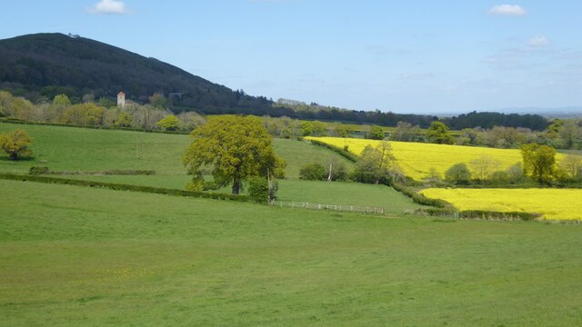
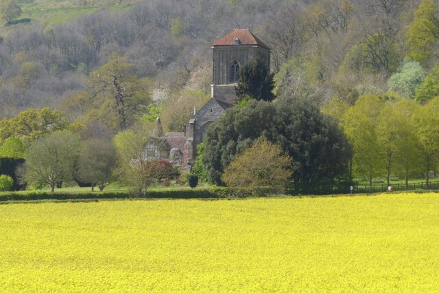
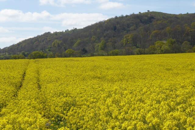
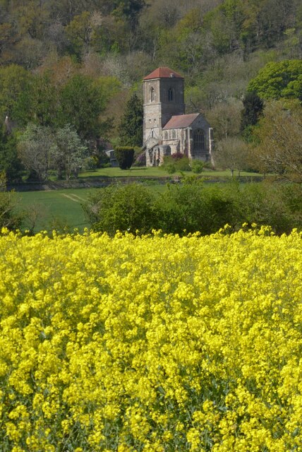
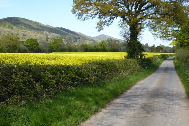
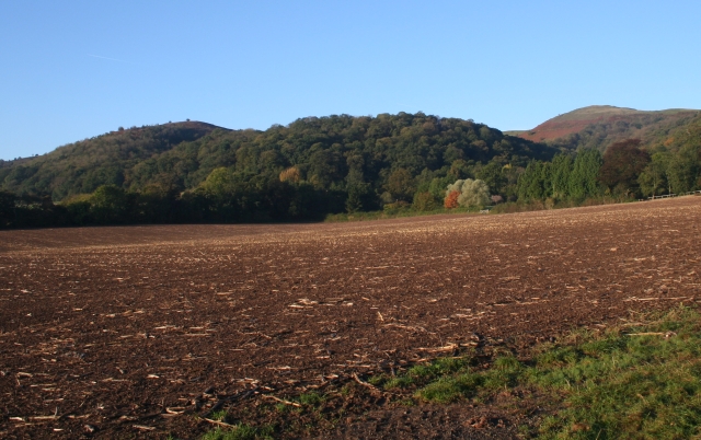
Wynds Point is a picturesque location situated on the border of Herefordshire and Worcestershire in England. Nestled within the beautiful Malvern Hills, it offers stunning views and a tranquil atmosphere, making it a popular destination for nature lovers and hikers.

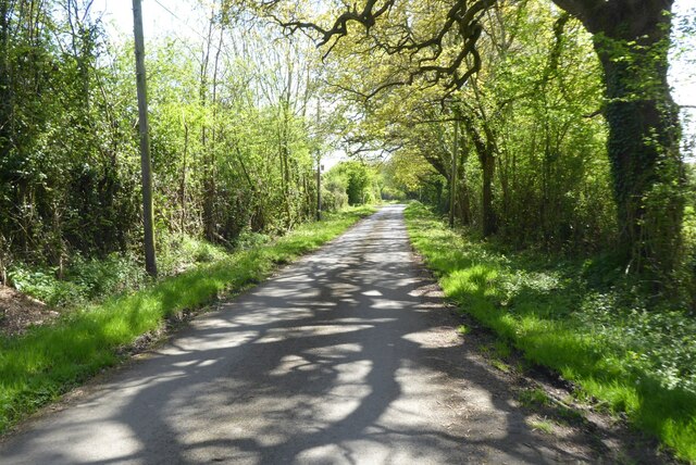
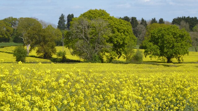
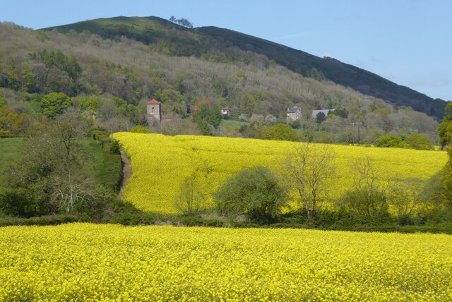
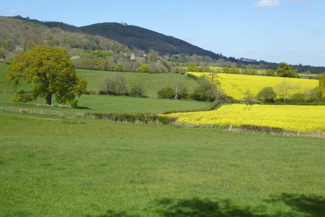
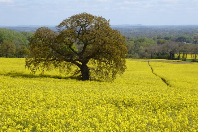
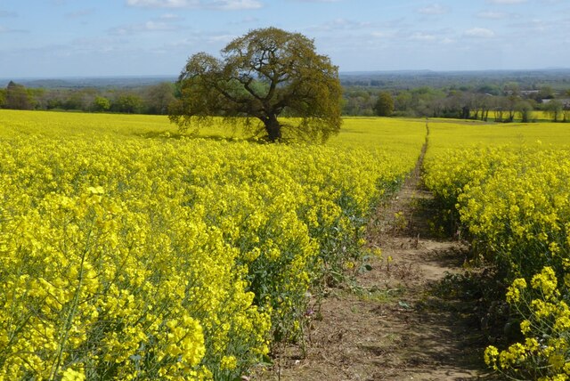
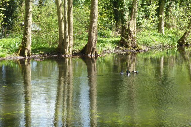
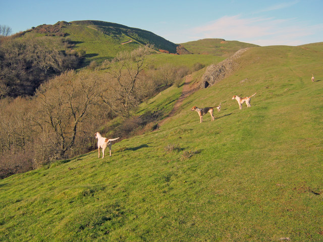
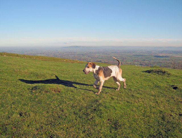
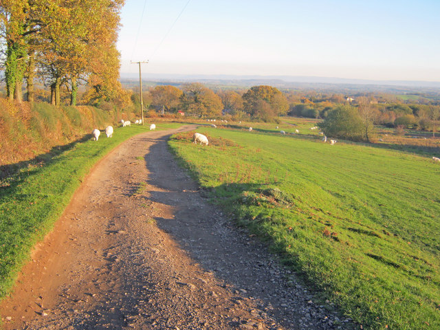
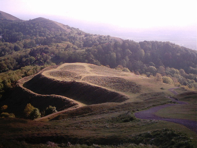
The area is known for its rolling hills, lush greenery, and diverse wildlife. Wynds Point is blessed with an abundance of walking and cycling trails, allowing visitors to explore the stunning countryside at their own pace. The Malvern Hills, designated as an Area of Outstanding Natural Beauty, provide a breathtaking backdrop for outdoor activities.

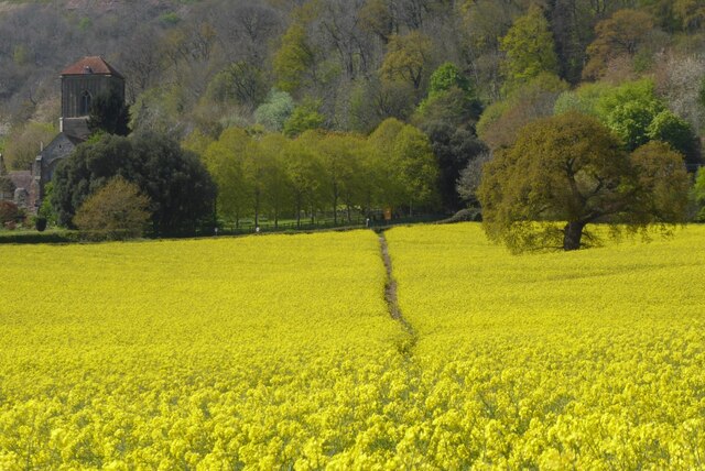
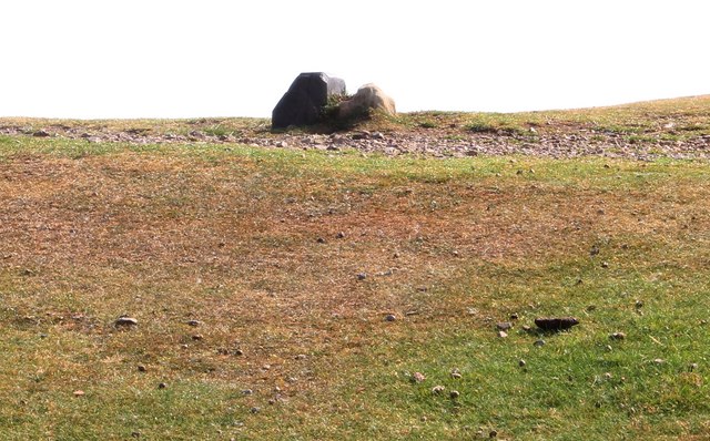
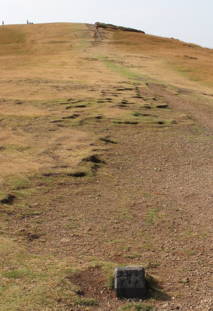
One of the main attractions of Wynds Point is the historic British Camp, an Iron Age hillfort that dates back to 2,500 years ago. This ancient site offers a glimpse into the region's rich history and provides visitors with the opportunity to learn about the area's past.

For those seeking a bit of relaxation, Wynds Point is home to several charming villages and towns nearby. These include Great Malvern, renowned for its Victorian architecture and famous water cure, as well as Ledbury, a medieval market town known for its black and white timbered buildings.

Additionally, Wynds Point boasts a thriving arts and culture scene, with numerous galleries and theaters showcasing local talent. The area also hosts various festivals and events throughout the year, attracting visitors from near and far.

Overall, Wynds Point is a hidden gem that offers a perfect blend of natural beauty, history, and cultural experiences. Whether you are an outdoor enthusiast, history buff, or simply in search of tranquility, this stunning location has something for everyone.

If you have any feedback on the listing, please let us know in the comments section below.

Wynds Point Images

Images are sourced within 2km of 52.057856/-2.3514509 or Grid Reference SO7640. Thanks to Geograph Open Source API. All images are credited.

Hancocks Lane Hancocks Lane in spring sunshine.
Hancocks Lane
Hancocks Lane in spring sunshine.
Trees and oil seed rape Trees surrounded by field of oil seed rape near Underhill Farm.
Trees and oil seed rape
Trees surrounded by field of oil seed rape near Underhill Farm.
Oil seed rape below the Malvern Hills The tower of Little Malvern Priory can be seen in the middle distance.
Oil seed rape below the Malvern Hills
The tower of Little Malvern Priory can be seen in the middle distance.
Farmland at Little Malvern The tower of Little Malvern Priory can be seen in the middle distance.
Farmland at Little Malvern
The tower of Little Malvern Priory can be seen in the middle distance.
Farmland at Little Malvern The tower of Little Malvern Priory is being highlighted by sunlight striking it.
Farmland at Little Malvern
The tower of Little Malvern Priory is being highlighted by sunlight striking it.
Oak tree in oil seed rape field Oak tree in oil seed rape field in Little Malvern.
Oak tree in oil seed rape field
Oak tree in oil seed rape field in Little Malvern.
Footpath in an oil seed rape field Footpath through a field of oil seed rape at Little Malvern.
Footpath in an oil seed rape field
Footpath through a field of oil seed rape at Little Malvern.
Oil seed rape at Little Malvern Footpath to Little Malvern Priory passing through a field of oil seed rape. The tower of Little Malvern Priory is on the left.
Oil seed rape at Little Malvern
Footpath to Little Malvern Priory passing through a field of oil seed rape. The tower of Little Malvern Priory is on the left.
View to Little Malvern Priory View across a field of oil seed rape to Little Malvern Priory.
View to Little Malvern Priory
View across a field of oil seed rape to Little Malvern Priory.
Oil seed rape field Oil seed rape field below the Malvern Hills at Little Malvern.
Oil seed rape field
Oil seed rape field below the Malvern Hills at Little Malvern.
Little Malvern Priory Little Malvern Priory viewed from Hancocks Lane.
Little Malvern Priory
Little Malvern Priory viewed from Hancocks Lane.
Hancocks Lane Hancocks Lane the Malvern Hills beyond the oil seed rape field on the left.
Hancocks Lane
Hancocks Lane the Malvern Hills beyond the oil seed rape field on the left.
Mallards on a pool Mallards on a pool near Little Malvern Court.
Mallards on a pool
Mallards on a pool near Little Malvern Court.
Hounds on Broad Down View north to the Herefordshire Beacon with Clutter's Cave just ahead. The Ledbury Hunt is scouring the Eastnor estate off to the left and these hounds have come up to the hilltop to check things out.
Hounds on Broad Down
View north to the Herefordshire Beacon with Clutter's Cave just ahead. The Ledbury Hunt is scouring the Eastnor estate off to the left and these hounds have come up to the hilltop to check things out.
Hound on Broad Down A member of the Ledbury Hunt pack bounds across the top of the down. Bredon Hill and the Cotswold escarpment in the distance to the east.
Hound on Broad Down
A member of the Ledbury Hunt pack bounds across the top of the down. Bredon Hill and the Cotswold escarpment in the distance to the east.
Track across Castlemorton Common Heading east towards Bowling Green.
Track across Castlemorton Common
Heading east towards Bowling Green.
Boundary Stones, British Camp, the Malvern Hills Two boundary markers: the right-hand one being a somewhat sunken stone and the other being a Malvern Hills Conservators' blue brick marker.
They are on the ridge of the Malvern hills in the saddle between Herefordshire Beacon and Millennium Hill. 
The iron-age hill fort known as British camp occupies both hill tops and these markers are close to the western gate to the fort.
Boundary Stones, British Camp, the Malvern Hills
Two boundary markers: the right-hand one being a somewhat sunken stone and the other being a Malvern Hills Conservators' blue brick marker. They are on the ridge of the Malvern hills in the saddle between Herefordshire Beacon and Millennium Hill. The iron-age hill fort known as British camp occupies both hill tops and these markers are close to the western gate to the fort.
Boundary marker, British Camp, Malvern The blue brick marker is bears the inscription MHC 159.
It was placed here by the Malvern Hills Conservators on the ridge of the hills in the saddle between Herefordshire Beacon and Millennium Hill.
The peak of the latter can be seen along the well worn ridge.
Just behind the marker and barely visible in this photo is a much older boundary stone in a somewhat sunken state.
If one looks carefully it is possible to see the levelled hut platforms of the iron-age town on the slopes of the hill side.
Boundary marker, British Camp, Malvern
The blue brick marker is bears the inscription MHC 159. It was placed here by the Malvern Hills Conservators on the ridge of the hills in the saddle between Herefordshire Beacon and Millennium Hill. The peak of the latter can be seen along the well worn ridge. Just behind the marker and barely visible in this photo is a much older boundary stone in a somewhat sunken state. If one looks carefully it is possible to see the levelled hut platforms of the iron-age town on the slopes of the hill side.
Show me another place!

Wynds Point is located at Grid Ref: SO7640 (Lat: 52.057856, Lng: -2.3514509)

Unitary Authority: County of Herefordshire

Police Authority: West Mercia

What 3 Words

///scariest.baker.aced. Near Ledbury, Herefordshire

Related Wikis

British Camp

British Camp is an Iron Age hill fort located at the top of Herefordshire Beacon in the Malvern Hills. The hill fort is protected as a Scheduled Ancient...

Herefordshire Beacon

The Herefordshire Beacon is one of the highest peaks of the Malvern Hills. It is surrounded by a British Iron Age hill fort earthwork known as British...

Tinkers Hill

Tinkers Hill is situated in the range of Malvern Hills that runs about 13 kilometres (8 mi) north-south along the Herefordshire-Worcestershire border....

Little Malvern

Little Malvern is a small village and civil parish in Worcestershire, England. It is situated on the lower slopes of the Malvern Hills, south of Malvern...

Nearby Amenities

Located within 500m of 52.057856,-2.3514509
Herefordshire Beacon
Ele: 338
Height: 1109 ft
Natural: peak
Wikidata: Q5738057
Wikipedia: en:Herefordshire Beacon
Lat/Long: 52.0582519/-2.3519084
Barrier: cattle_grid
Lat/Long: 52.0604589/-2.3468655
Bench
Lat/Long: 52.0559434/-2.3500372
Bench
Lat/Long: 52.0557593/-2.3498081
Bench
Lat/Long: 52.0604816/-2.3476405
Tourism: viewpoint
Lat/Long: 52.0605343/-2.3482843
Bench
Lat/Long: 52.0599169/-2.3472543
Bench
Lat/Long: 52.0585818/-2.3481126
Bench
Lat/Long: 52.057676/-2.3485404
Bench
Lat/Long: 52.056608/-2.3503871
Kiosk
Naptan AtcoCode: 2000G022304
Naptan Bearing: W
Naptan BusStopType: CUS
Naptan CommonName: Kiosk
Naptan Indicator: Opp
Naptan Landmark: Car Park
Naptan NaptanCode: wocdtmpa
Naptan Street: A449
Naptan Verified: no
Source: naptan_import
Lat/Long: 52.0615183/-2.3473199
Power: tower
Lat/Long: 52.0568962/-2.3585133
Millennium Hill
Ele: 327
Natural: peak
Lat/Long: 52.0546385/-2.3513625
Tourism: viewpoint
Lat/Long: 52.0598078/-2.3484794
Camp Hill Cottage
Power: pole
Transformer: distribution
Voltage Primary: 11000
Lat/Long: 52.0580436/-2.3549125
Power: pole
Lat/Long: 52.058639/-2.3549366
British Camp West
Location Transition: yes
Power: pole
Transformer: distribution
Voltage Primary: 11000
Lat/Long: 52.059264/-2.3545007
Power: pole
Lat/Long: 52.0600127/-2.3571246
Location Transition: yes
Power: pole
Lat/Long: 52.0592945/-2.3568396
Bench
Backrest: yes
Capacity: 3
Material: wood
Lat/Long: 52.0609761/-2.34761
The data included in this document is from www.openstreetmap.org. The data is made available under ODbL.

Have you been to Wynds Point?

Leave your review of Wynds Point below (or comments, questions and feedback).