Wynford Eagle

Settlement in Dorset

England

Wynford Eagle

View south from Maiden Newton This was one of the latest spring snowfalls I can remember.  I even saw Swallows flying around the snowy landscape!
View south from Maiden Newton Credit: Bob Ford

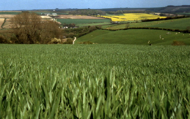
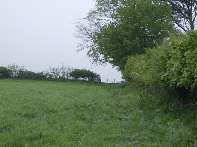
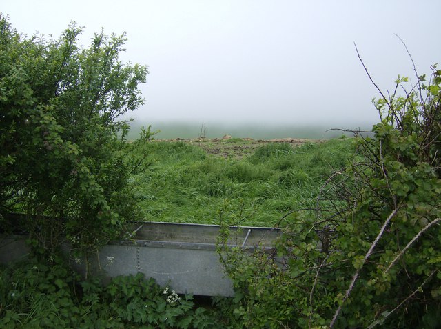
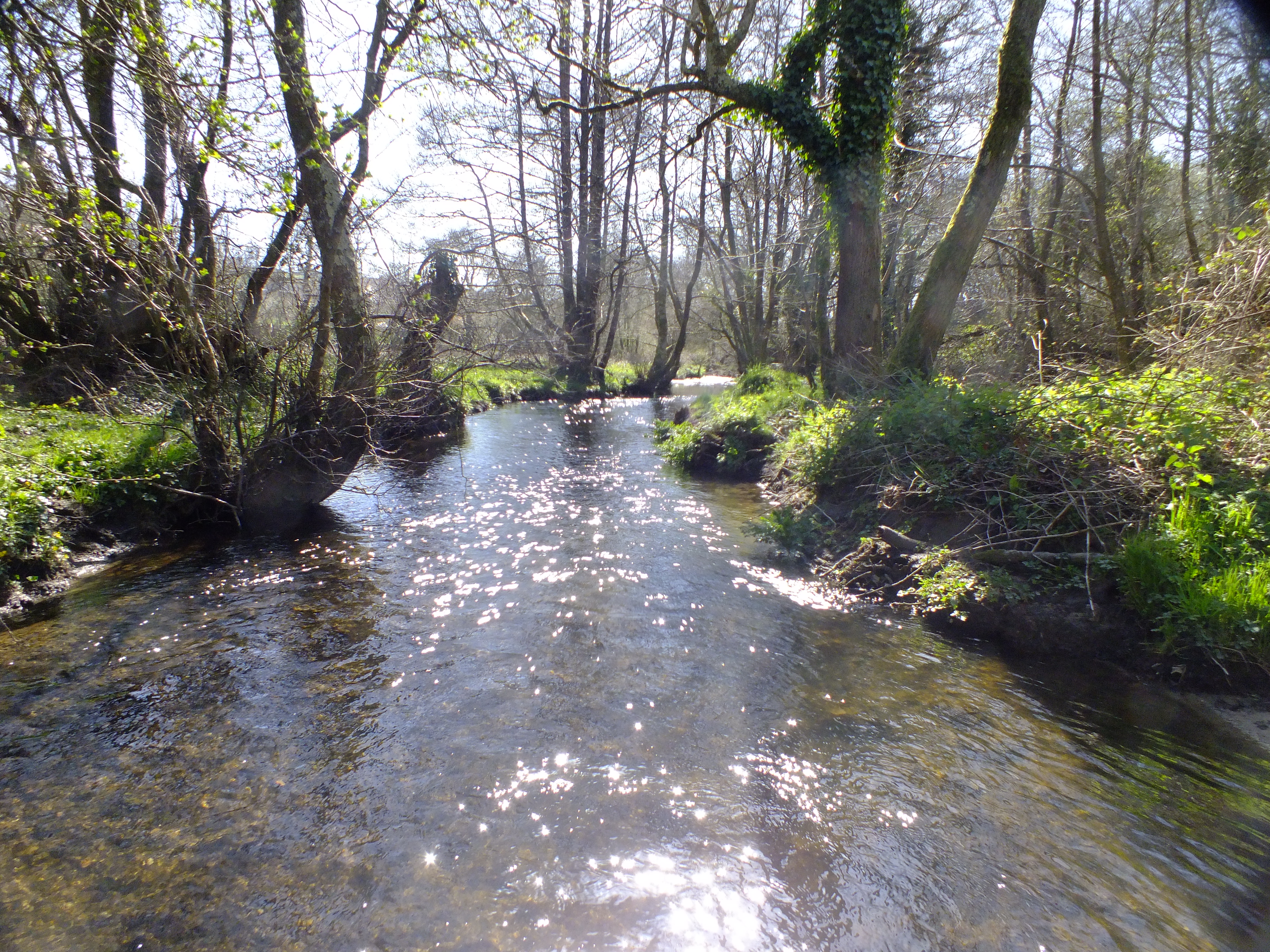
Wynford Eagle is a small village located in the county of Dorset, England. Situated in the West Dorset district, it is nestled in the picturesque countryside, surrounded by rolling hills and scenic landscapes. The village is located approximately 3 miles southeast of the town of Maiden Newton and 5 miles northwest of the county town of Dorchester.

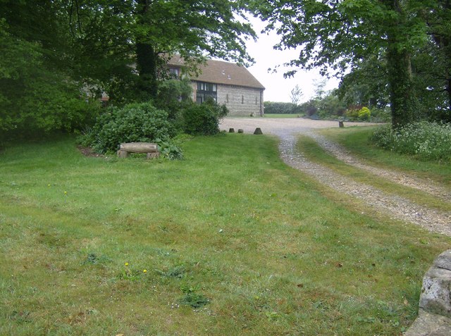
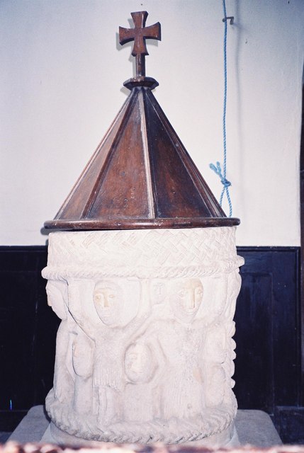
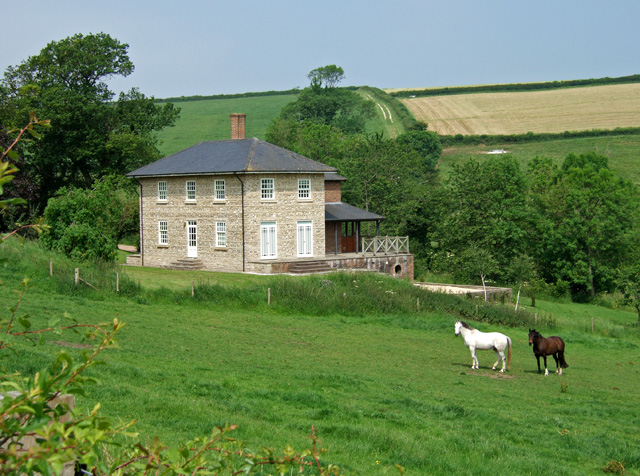
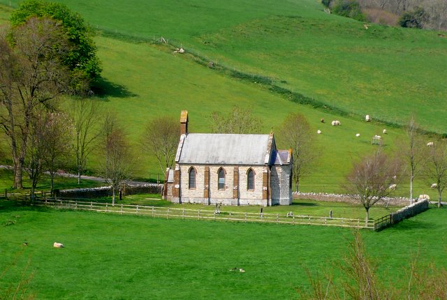
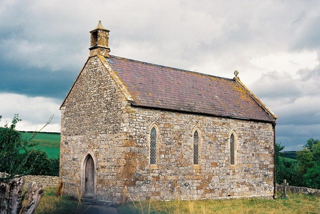
With a population of around 200 residents, Wynford Eagle offers a peaceful and tranquil setting for those seeking a rural escape. The village is known for its charming thatched cottages, which add to its quintessentially English character. The village also features a number of historic buildings, including the Grade II listed Wynford Eagle House and the 13th-century St. Lawrence Church.

Despite its small size, Wynford Eagle has a strong sense of community, with various local events and gatherings taking place throughout the year. The village is home to a village hall, which serves as a focal point for social activities and community meetings.

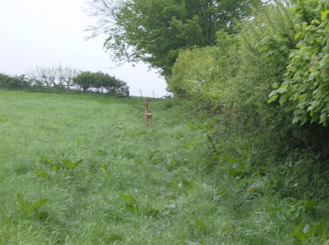
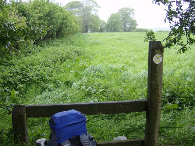
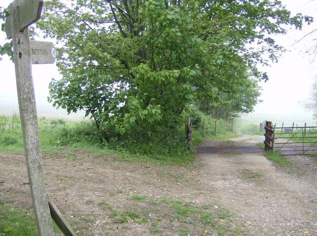
The surrounding area offers plenty of opportunities for outdoor enthusiasts, with numerous walking and cycling routes to explore. Just a short distance away is Eggardon Hill, an Iron Age hillfort, which provides breathtaking views of the countryside.

In terms of amenities, Wynford Eagle has limited facilities, with no shops or pubs within the village itself. However, nearby towns and villages offer a range of services, ensuring that residents have access to essential amenities.

If you have any feedback on the listing, please let us know in the comments section below.

Wynford Eagle Images

Images are sourced within 2km of 50.761866/-2.5911576 or Grid Reference SY5895. Thanks to Geograph Open Source API. All images are credited.

View south from Maiden Newton This was one of the latest spring snowfalls I can remember.  I even saw Swallows flying around the snowy landscape!
View south from Maiden Newton
This was one of the latest spring snowfalls I can remember. I even saw Swallows flying around the snowy landscape!
An Eagle at Wynford Eagle Wynford Eagle is a creepy sort of place and this eagle poised on an impressive house doesn't help.
An Eagle at Wynford Eagle
Wynford Eagle is a creepy sort of place and this eagle poised on an impressive house doesn't help.
Wheat field above Cruxton looking north
Wheat field above Cruxton
looking north
Lane from Cruxton to Frome Vauchurch To get out of Cruxton (a cul-de-sac except to walkers and cyclists) you have to go along this road which cuts through the extreme north-eastern corner of the square.  High hedges prevent anything being seen other than this small section of road within the square.
Lane from Cruxton to Frome Vauchurch
To get out of Cruxton (a cul-de-sac except to walkers and cyclists) you have to go along this road which cuts through the extreme north-eastern corner of the square. High hedges prevent anything being seen other than this small section of road within the square.
Signpost at SY599948 Dorset County footpath signposts have the grid reference marked on them.  Useful to confirm where you are, in this case easy to position on Geograph at SY599948.
Signpost at SY599948
Dorset County footpath signposts have the grid reference marked on them. Useful to confirm where you are, in this case easy to position on Geograph at SY599948.
Bridge Across River Frome This utilitarian bridge carries a minor road from Frome Vauchurch to Maiden Newton across the River Frome.
Bridge Across River Frome
This utilitarian bridge carries a minor road from Frome Vauchurch to Maiden Newton across the River Frome.
Deer on the Macmillan Way As I was heading into the strong south-westerly wind these deer lying in the long grass had not heard me coming.  Nor had I seen them until I was about 20 feet away as only their heads were showing.  Then all action - me getting the camera out, them running.  On the Macmillan Way above Cruxton.
Deer on the Macmillan Way
As I was heading into the strong south-westerly wind these deer lying in the long grass had not heard me coming. Nor had I seen them until I was about 20 feet away as only their heads were showing. Then all action - me getting the camera out, them running. On the Macmillan Way above Cruxton.
Water trough above Cruxton A wet and misty day hides all the extensive views from the top of the climb out of Cruxton.  So instead all one can see are the immediate things; hedgerows, water troughs, the remains of some animal feed.
Water trough above Cruxton
A wet and misty day hides all the extensive views from the top of the climb out of Cruxton. So instead all one can see are the immediate things; hedgerows, water troughs, the remains of some animal feed.
Deer on the Macmillan Way After the previous picture, one deer had already bolted.  This one was still weighing up its options, before choosing to follow the first one, directly through the hedge on the right.
Deer on the Macmillan Way
After the previous picture, one deer had already bolted. This one was still weighing up its options, before choosing to follow the first one, directly through the hedge on the right.
Tea stop in the rain Walking through the long pasture grass was not pleasant in the rain and the strong south-westerly wind.  This stile in the field corner provided some protection for a tea stop.
Tea stop in the rain
Walking through the long pasture grass was not pleasant in the rain and the strong south-westerly wind. This stile in the field corner provided some protection for a tea stop.
View from SY599948 The signpost helpfully displays a grid reference on the other side.  This would be a view in better weather.  Choice of paths here.
View from SY599948
The signpost helpfully displays a grid reference on the other side. This would be a view in better weather. Choice of paths here.
Notton Hill Barn Now converted into a private residence.
Notton Hill Barn
Now converted into a private residence.
Frome Vauchurch: parish church of St. Francis of Assisi Another well-hidden, tiny Dorset church – it is basically Norman, with a Victorian chancel added. For its diminutive size, it has a rather large churchyard. The roof was replaced in 1879.

See also <a href="https://www.geograph.org.uk/photo/506089">SY5997 : Frome Vauchurch church: interior</a>
Frome Vauchurch: parish church of St. Francis of Assisi
Another well-hidden, tiny Dorset church – it is basically Norman, with a Victorian chancel added. For its diminutive size, it has a rather large churchyard. The roof was replaced in 1879. See also SY5997 : Frome Vauchurch church: interior
Toller Fratrum: parish church of St. Basil The lovely and interesting little church in the tiny parish of Toller Fratrum.
Toller Fratrum: parish church of St. Basil
The lovely and interesting little church in the tiny parish of Toller Fratrum.
Twelfth century font The font, with its odd figures, in Toller Fratrum church.
Twelfth century font
The font, with its odd figures, in Toller Fratrum church.
Manor Farmhouse Wynford Eagle This is the manor house that was rebuilt in 1630 by William Sydenham (date on the porch), and which has remained unaltered ever since. Grade II* listed. The northings line (96000) of the grid reference was verified by GPS, and found to literally cross the entrance gate threshold, from where this photo was taken.
Manor Farmhouse Wynford Eagle
This is the manor house that was rebuilt in 1630 by William Sydenham (date on the porch), and which has remained unaltered ever since. Grade II* listed. The northings line (96000) of the grid reference was verified by GPS, and found to literally cross the entrance gate threshold, from where this photo was taken.
Manor Farm - Wynford Eagle
House on the road southwest of Wynford Eagle
Show me another place!

Wynford Eagle is located at Grid Ref: SY5895 (Lat: 50.761866, Lng: -2.5911576)

Unitary Authority: Dorset

Police Authority: Dorset

What 3 Words

///greyhound.dozen.slyly. Near Maiden Newton, Dorset
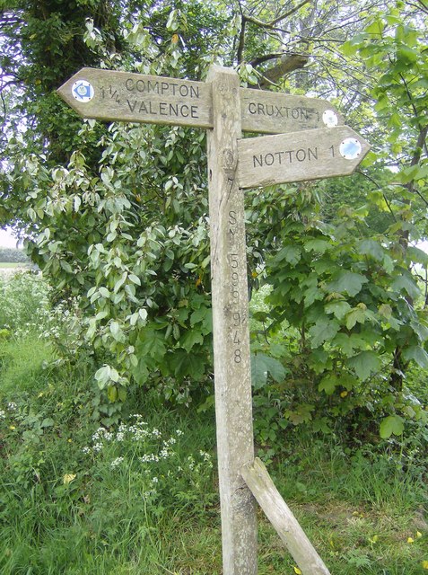
Related Wikis

Wynford Eagle

Wynford Eagle is a hamlet and small parish in Dorset, England, situated approximately 1.5 miles (2.4 km) southwest of Maiden Newton and 7.5 miles (12.1...

Toller Fratrum

Toller Fratrum () is a very small village and civil parish in Dorset, England, near Maiden Newton, anciently in Tollerford Hundred. The name is taken from...

Tollerford Hundred

Tollerford Hundred was a hundred in the county of Dorset, England, containing the following parishes: Chilfrome East Chelborough Evershot Frome St Quintin...

Cruxton

Cruxton is a hamlet in the English county of Dorset. It lies eight miles north-west of the county town of Dorchester, and one mile south-east of the village...

Frome Vauchurch

Frome Vauchurch is a parish in the county of Dorset in southern England, situated approximately 7 miles (11 km) northwest of the county town Dorchester...

St Francis' Church, Frome Vauchurch

St Francis' Church is a Church of England church in Frome Vauchurch, Dorset, England. It has 12th-century origins, with a major rebuild in the 17th-century...

River Hooke

The River Hooke is a small river in the county of Dorset in southern England. It runs from its source at Toller Whelme through the villages and hamlets...

Maiden Newton

Maiden Newton is a village and civil parish in the county of Dorset in south-west England. It lies within the Dorset Council administrative area, about...

Nearby Amenities

Located within 500m of 50.761866,-2.5911576
Wynford Eagle
Is In: Dorset, England, UK
Place: village
Lat/Long: 50.7613276/-2.5936641
Barrier: stile
Foot: yes
Lat/Long: 50.7592098/-2.5967268
Post Box
Post Box Mounting: brick_pillar
Post Box Type: wall
Ref: DT2 26
Royal Cypher: EVIIR
Royal Cypher Wikidata: Q33102324
Lat/Long: 50.7619224/-2.5910819
Direction: SSW
Generator Method: photovoltaic
Generator Output Electricity: yes
Generator Solar Modules: 17
Generator Source: solar
Generator Type: solar_photovoltaic_panel
Location: roof
Power: generator
Lat/Long: 50.7621056/-2.5966124
The data included in this document is from www.openstreetmap.org. The data is made available under ODbL.

Have you been to Wynford Eagle?

Leave your review of Wynford Eagle below (or comments, questions and feedback).