Tyneham

Settlement in Dorset

England

Tyneham

Boat in Warbarrow Bay
Boat in Warbarrow Bay Credit: Basher Eyre

Tyneham is a small village located in Dorset, England. Situated on the Isle of Purbeck, Tyneham is known for its rich history and well-preserved rural charm. The village is nestled in a valley, surrounded by rolling hills and fertile farmland.

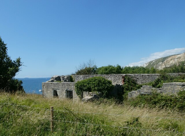
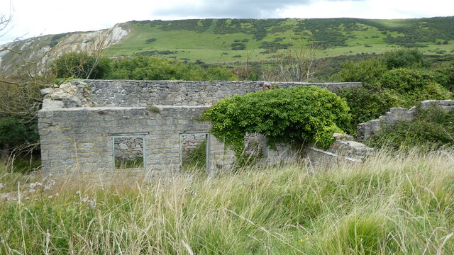
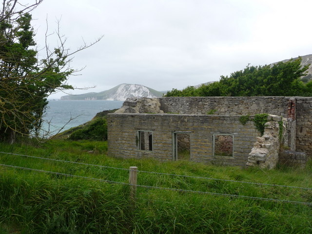
Tyneham's history dates back centuries, with evidence of settlements from the Iron Age. However, it gained prominence during World War II when the entire village was evacuated for military purposes. The residents were forced to leave in 1943, and the village became a training ground for British forces. Despite promises that the villagers could return after the war, Tyneham was never fully re-inhabited, and it remains an abandoned village to this day.

Today, Tyneham is a popular tourist destination due to its unique atmosphere and historical significance. Visitors can explore the deserted village and learn about its past through the Tyneham Village Museum, which displays artifacts and tells the story of the village and its former residents.

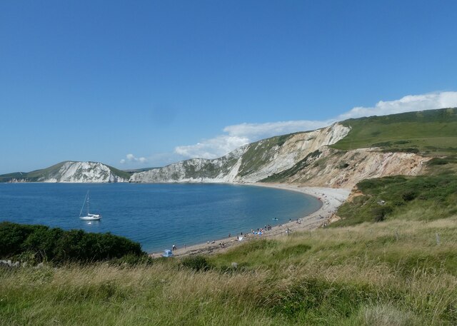
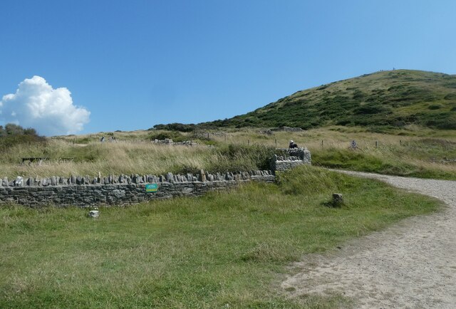
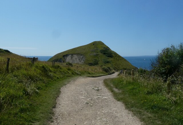
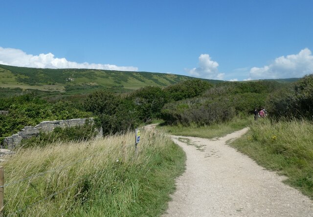
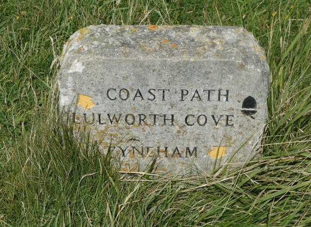
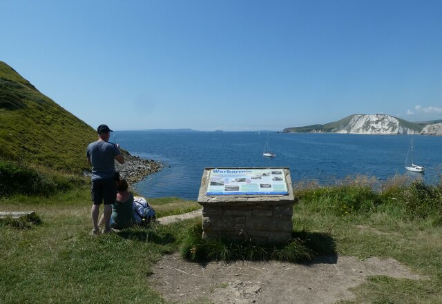
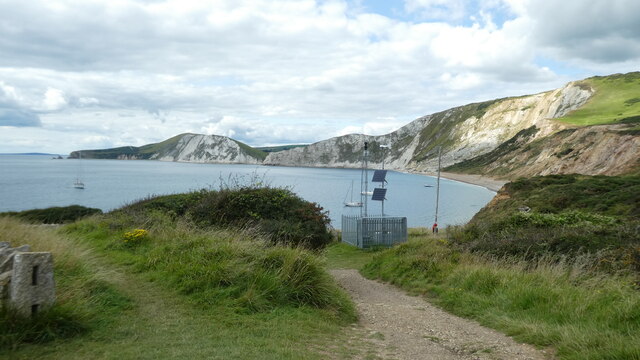
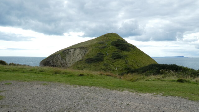
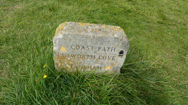
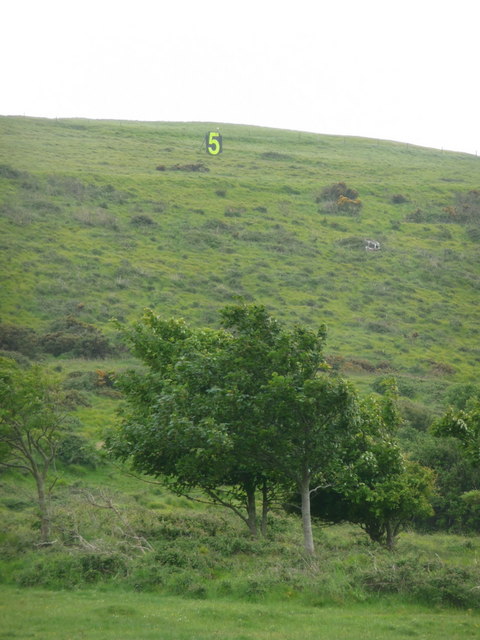
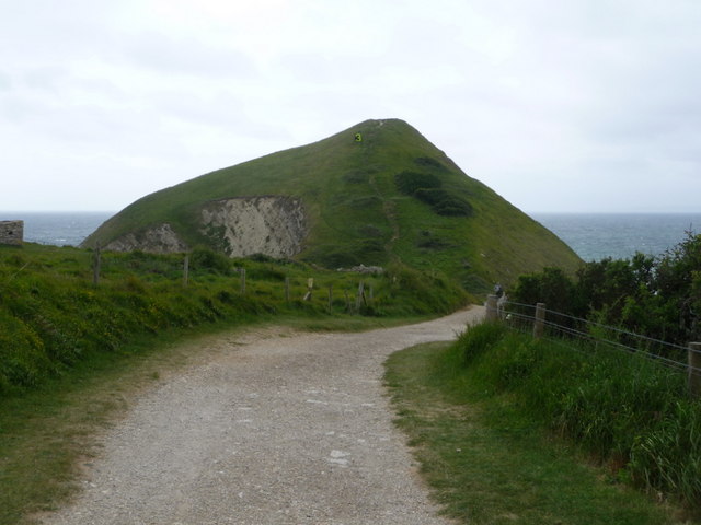
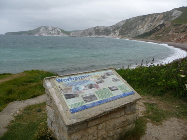
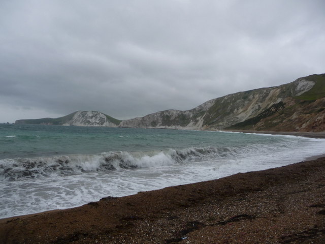
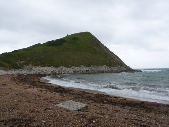
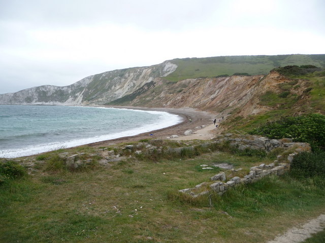
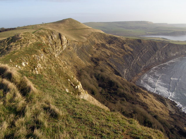
The surrounding area offers stunning natural beauty, with scenic walks and hikes available for outdoor enthusiasts. The nearby Tyneham Cap, a cliff overlooking the village, provides breathtaking views of the coastline and the English Channel.

Tyneham is a reminder of a bygone era and serves as a poignant memorial to the villagers who were displaced during the war. Its tranquil setting, combined with its historical importance, makes it an intriguing destination for history buffs and nature lovers alike.

If you have any feedback on the listing, please let us know in the comments section below.

Tyneham Images

Images are sourced within 2km of 50.622633/-2.1684393 or Grid Reference SY8880. Thanks to Geograph Open Source API. All images are credited.

Boat in Warbarrow Bay
Start of the path back from Worbarrow Bay to Tyneham
All that remains of Hope Cottages
Looking back to Worbarrow Tout
Path branch at Worbarrow Bay The left is the Hardy Way <span class="nowrap"><a title="https://www.ldwa.org.uk/ldp/members/show_path.php?path_name=Hardy+Way" rel="nofollow ugc noopener" href="https://www.ldwa.org.uk/ldp/members/show_path.php?path_name=Hardy+Way">Link</a><img style="margin-left:2px;" alt="External link" title="External link - shift click to open in new window" src="https://s1.geograph.org.uk/img/external.png" width="10" height="10"/></span> and the right the South West Coast Path <span class="nowrap"><a title="https://www.nationaltrail.co.uk/en_GB/trails/south-west-coast-path/" rel="nofollow ugc noopener" href="https://www.nationaltrail.co.uk/en_GB/trails/south-west-coast-path/">Link</a><img style="margin-left:2px;" alt="External link" title="External link - shift click to open in new window" src="https://s1.geograph.org.uk/img/external.png" width="10" height="10"/></span>
Path branch at Worbarrow Bay
The left is the Hardy Way LinkExternal link and the right the South West Coast Path LinkExternal link
Path marker at Worbarrow Bay
Information board at Worbarrow Bay
Tyneham Lulworth Cove Tyneham Lulworth Cove view
Tyneham Lulworth Cove
Tyneham Lulworth Cove view
Worbarrow building Worbarrow, what remains of the building
Worbarrow building
Worbarrow, what remains of the building
Worbarrow Tout Warbarrow Tout view
Worbarrow Tout
Warbarrow Tout view
Coastal path sign Lulworth Cove Tyneham Coastal path sign Lulworth Cove Tyneham
Coastal path sign Lulworth Cove Tyneham
Tyneham: a ‘5’ on the firing range One of a series of large figures displayed along the slopes of Tyneham, which are targets of the military firing range.
Tyneham: a ‘5’ on the firing range
One of a series of large figures displayed along the slopes of Tyneham, which are targets of the military firing range.
Tyneham: ruined cottage and bay view Looking across Worbarrow Bay towards Bindon Hill, beyond one of the ruined cottages of Tyneham village.
Tyneham: ruined cottage and bay view
Looking across Worbarrow Bay towards Bindon Hill, beyond one of the ruined cottages of Tyneham village.
Tyneham: approaching Worbarrow Tout The path from Tyneham village approaches the coast and in front of us is Worbarrow Tout, a large lump jutting out into the sea.
Tyneham: approaching Worbarrow Tout
The path from Tyneham village approaches the coast and in front of us is Worbarrow Tout, a large lump jutting out into the sea.
Tyneham: Worbarrow information board A display gives information on the geology, flora and fauna of the area and also the history of the village, now long forgotten after the Coastguard station closed in 1911. This was some 30 years before the village of Tyneham, just up the valley, became deserted under very different circumstances.
Tyneham: Worbarrow information board
A display gives information on the geology, flora and fauna of the area and also the history of the village, now long forgotten after the Coastguard station closed in 1911. This was some 30 years before the village of Tyneham, just up the valley, became deserted under very different circumstances.
Tyneham: waves on Worbarrow Bay A windy day on this exposed bit of coast, and the waves are big and impressive as we look along the edge of Worbarrow Bay towards the slopes of Bindon Hill in the background.
Tyneham: waves on Worbarrow Bay
A windy day on this exposed bit of coast, and the waves are big and impressive as we look along the edge of Worbarrow Bay towards the slopes of Bindon Hill in the background.
Tyneham: Worbarrow Bay and Tout A cloudy day at this attractive seaside spot.
Tyneham: Worbarrow Bay and Tout
A cloudy day at this attractive seaside spot.
Tyneham: ruins of cottage on Worbarrow Bay After the closure of the coastguard station at Worbarrow Bay in 1911 had heralded the demise of the village, the requisitoning of the whole of Tyneham parish in 1943 finished it off completely. All the houses in the two villages are in ruins today, such as this one, right above the bay.
Tyneham: ruins of cottage on Worbarrow Bay
After the closure of the coastguard station at Worbarrow Bay in 1911 had heralded the demise of the village, the requisitoning of the whole of Tyneham parish in 1943 finished it off completely. All the houses in the two villages are in ruins today, such as this one, right above the bay.
Show me another place!

Tyneham is located at Grid Ref: SY8880 (Lat: 50.622633, Lng: -2.1684393)

Unitary Authority: Dorset

Police Authority: Dorset

What 3 Words

///query.procures.tight. Near Wool, Dorset

Related Wikis

Tyneham

Tyneham is a ghost village abandoned in 1943 and former civil parish, now in the parish of Steeple with Tyneham, in the Dorset district, in the south of...

St Mary's Church, Tyneham

St Mary's Church is a former Church of England parish church in Tyneham, Dorset, England. The church, which is a Grade II listed building, has 13th-century...

Gad Cliff

Gad Cliff is a south-facing cliff face, immediately to the east of Worbarrow Tout and Pondfield Cove, on the south coast of the Isle of Purbeck in Dorset...

Povington Priory

Povington Priory was a Benedictine priory in Tyneham, Dorset, England. It was established as an alien priory of the Abbey of Bec. This term could mean...

Povington Hill

Povington Hill, at 198 metres (650 ft) high, is one of the highest points on the chain of the Purbeck Hills in south Dorset on the southern coast of England...

Tyneham Cap

Tyneham Cap is a prominent, grassy knoll, 167 metres (548 ft) high, on the South West Coast Path in Dorset, England. It rises above Brandy Bay and has...

Brandy Bay, Dorset

Brandy Bay is a small secluded southwest-facing bay, with an oil shale and shingle beach immediately below Gad Cliff and Tyneham Cap, to the east of Worbarrow...

Pondfield Cove

Pondfield Cove is a small, secluded, south-facing cove immediately to the east of Worbarrow Tout and west of Gad Cliff on the south coast of the Isle of...

Nearby Amenities

Located within 500m of 50.622633,-2.1684393
Toilets
Check Date: 2023-07-22
Fee: no
Source Amenity: survey
Wheelchair: yes
Lat/Long: 50.6205658/-2.1678208
Telephone
Booth: K1
Check Date: 2023-07-22
Colour: white and red
Covered: booth
Lat/Long: 50.6226298/-2.1686598
The data included in this document is from www.openstreetmap.org. The data is made available under ODbL.

Have you been to Tyneham?

Leave your review of Tyneham below (or comments, questions and feedback).