Tyne Dock

Settlement in Durham

England

Tyne Dock

The old market hall in South Shields What a wonderful town this is. A town of contrasts, with a range of historic buildings and modern, contemporary ones too and around every corner a story, something new to learn or see and all populated with the very best people.
The old market hall in South Shields Credit: Jeremy Bolwell

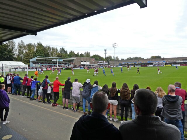
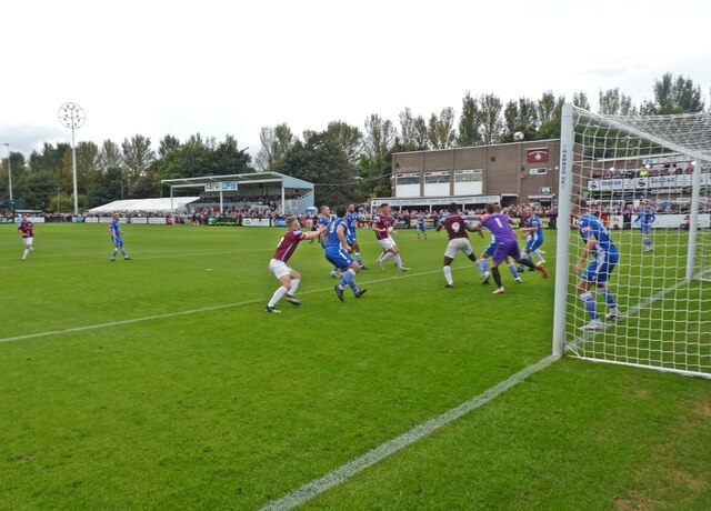
Tyne Dock is a small area located in South Tyneside, Durham, England. Situated on the southern bank of the River Tyne, it is part of the wider town of South Shields. Tyne Dock is historically significant as a key industrial and shipping area.

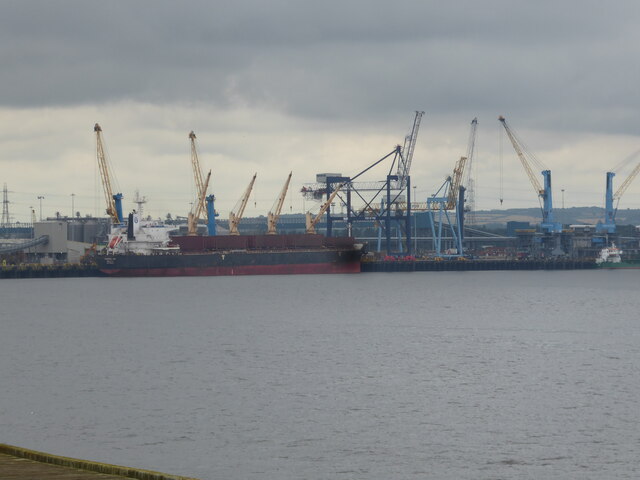
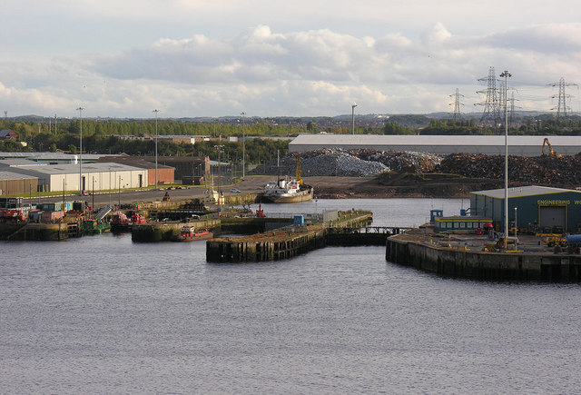
The area derives its name from the dock that was constructed in the mid-19th century during the peak of the coal mining industry. The dock played a vital role in facilitating the export of coal from the nearby collieries, and later became an important hub for shipbuilding and engineering industries.

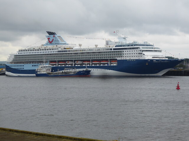
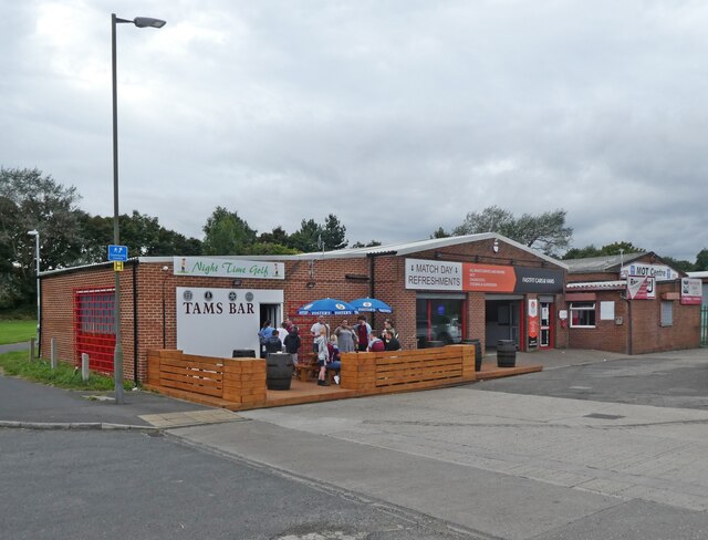
Today, Tyne Dock is primarily known for its commercial and industrial activities. The area is home to several businesses, including warehouses, factories, and depots, which contribute to the local economy. Additionally, Tyne Dock is a significant transport hub, with a railway station providing connections to nearby cities and towns.

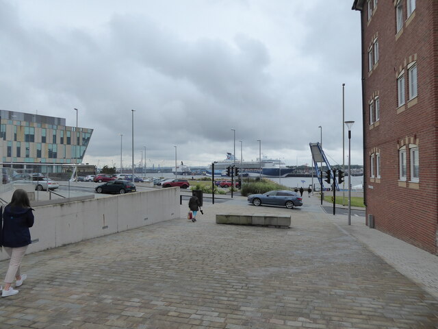
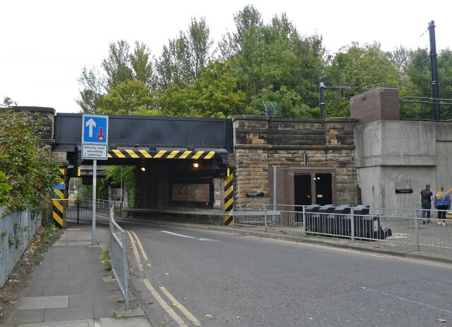
The landscape of Tyne Dock is characterized by its mix of industrial buildings, residential areas, and green spaces. The surrounding neighborhoods consist of a mix of housing types, ranging from traditional terraced houses to modern apartment complexes.

In terms of amenities, Tyne Dock offers a range of services to its residents and visitors. There are local shops, supermarkets, and restaurants catering to various tastes. The area also benefits from its proximity to the coast, with beautiful beaches and the South Shields promenade just a short distance away.

Overall, Tyne Dock retains its historical industrial character while adapting to modern times. With its close-knit community and convenient location, it continues to be an important and vibrant part of Durham's landscape.

If you have any feedback on the listing, please let us know in the comments section below.

Tyne Dock Images

Images are sourced within 2km of 54.981254/-1.448704 or Grid Reference NZ3565. Thanks to Geograph Open Source API. All images are credited.

The old market hall in South Shields What a wonderful town this is. A town of contrasts, with a range of historic buildings and modern, contemporary ones too and around every corner a story, something new to learn or see and all populated with the very best people.
The old market hall in South Shields
What a wonderful town this is. A town of contrasts, with a range of historic buildings and modern, contemporary ones too and around every corner a story, something new to learn or see and all populated with the very best people.
Scene at South Shields The sea is always ever present in South Shields, in one way or another.
Scene at South Shields
The sea is always ever present in South Shields, in one way or another.
Scene at Shields Harbour, South Shields Huge ships and many cranes - lots to see.
Scene at Shields Harbour, South Shields
Huge ships and many cranes - lots to see.
Cruise ship moored on the River Tyne The Marella Explorer 2 in Tui livery.
Cruise ship moored on the River Tyne
The Marella Explorer 2 in Tui livery.
Cranes on the skyline and moored ships on the Tyne viewed from South Shields Too much for my brain to take in. The scale bamboozles me, the depth of history is tangible here. Overload. It is all I can do to photograph it, I certainly cannot process it. What beauty.
Cranes on the skyline and moored ships on the Tyne viewed from South Shields
Too much for my brain to take in. The scale bamboozles me, the depth of history is tangible here. Overload. It is all I can do to photograph it, I certainly cannot process it. What beauty.
A BT building in South Shields Yes, I know.
A BT building in South Shields
Yes, I know.
New stand at the 1st Cloud Arena Home of South Shields FC.
New stand at the 1st Cloud Arena
Home of South Shields FC.
Warrington take a free kick This Northern Premier League fixture ended South Shields 3 Warrington Town 2.
Warrington take a free kick
This Northern Premier League fixture ended South Shields 3 Warrington Town 2.
Spot the ball This Northern Premier League fixture ended South Shields 3 Warrington Town 2.
Spot the ball
This Northern Premier League fixture ended South Shields 3 Warrington Town 2.
Tams Bar A handy pre-match drinking spot for supporters of South Shields FC.
Tams Bar
A handy pre-match drinking spot for supporters of South Shields FC.
Railway bridge near Bede Station
Bede Metro Station
Bede Metro Station
Foundation stone We think we’ve discovered the foundation stone of an old 1800 bridge that crossed the Newcastle to South Shields train line.  We had been told about the bridge historically leading to a farm (Lake House Farm), Jarrow.  Unfortunately, the bridge was knocked down in the 1960s to make way for a road during the building of the Tyne tunnel.
Foundation stone
We think we’ve discovered the foundation stone of an old 1800 bridge that crossed the Newcastle to South Shields train line. We had been told about the bridge historically leading to a farm (Lake House Farm), Jarrow. Unfortunately, the bridge was knocked down in the 1960s to make way for a road during the building of the Tyne tunnel.
Royal Quays Convenience Store You would be forgiven for thinking that this grocery store is closed. Or ruined. But in fact it is open for business.
Royal Quays Convenience Store
You would be forgiven for thinking that this grocery store is closed. Or ruined. But in fact it is open for business.
Area of reflection These stone blocks, fixed to the ground, are supposed to be an area to reflect and contemplate on the impact of the coronavirus pandemic.
Area of reflection
These stone blocks, fixed to the ground, are supposed to be an area to reflect and contemplate on the impact of the coronavirus pandemic.
Hill in Coble Dene Park I liked the contrast between the bright blue sky and the saturated green meadow on this clear October day.
Hill in Coble Dene Park
I liked the contrast between the bright blue sky and the saturated green meadow on this clear October day.
Ruins of Jarrow Monastery The twentieth century intrudes in the background.
Ruins of Jarrow Monastery
The twentieth century intrudes in the background.
South Shields ferry terminal The other ferry, 'Pride of the Tyne', is moored nearby. From left to right: Ferry Approach, flats dating from 2004; the National Centre for the Written Word, an arts and cultural centre opened in 2016; and One Harton Quay, an office block dating from 2011 and occupied by BT.
South Shields ferry terminal
The other ferry, 'Pride of the Tyne', is moored nearby. From left to right: Ferry Approach, flats dating from 2004; the National Centre for the Written Word, an arts and cultural centre opened in 2016; and One Harton Quay, an office block dating from 2011 and occupied by BT.
Show me another place!

Tyne Dock is located at Grid Ref: NZ3565 (Lat: 54.981254, Lng: -1.448704)

Unitary Authority: South Tyneside

Police Authority: Northumbria

What 3 Words

///oldest.linen.racks. Near South Shields, Tyne & Wear

Nearby Locations

Tyne Dock

Related Wikis

Tyne Dock

Tyne Dock is a neighbourhood within the town of South Shields, Tyne and Wear, on the south bank of the River Tyne. It takes its name from the large dock...

Jarrow (UK Parliament constituency)

Jarrow is a constituency represented in the House of Commons of the UK Parliament since 2019 by Kate Osborne of the Labour Party.The seat was created in...

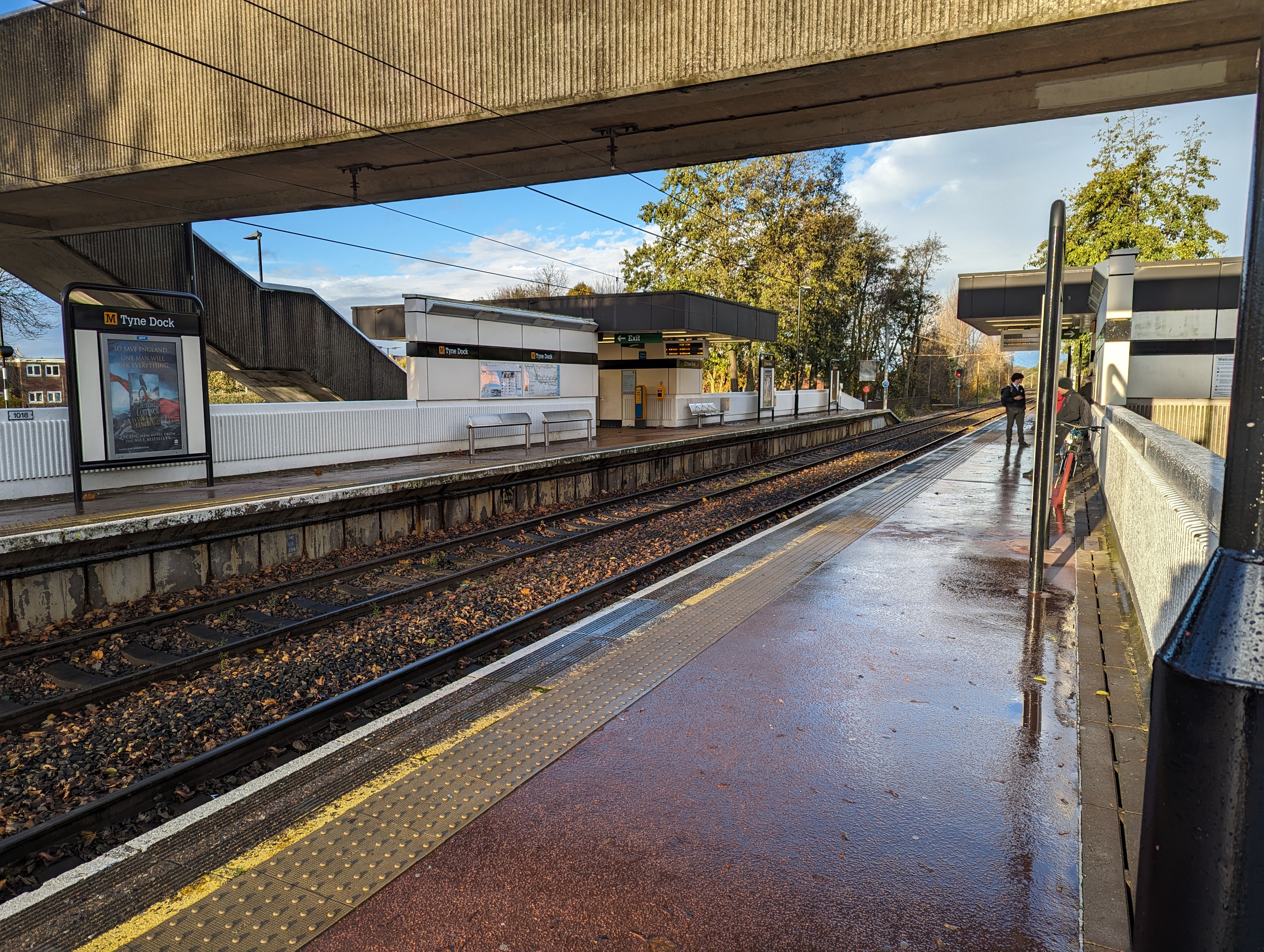
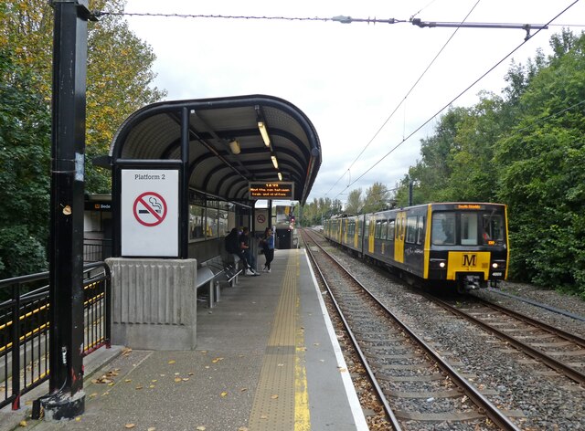
Tyne Dock Metro station

Tyne Dock is a Tyne and Wear Metro station, serving South Tyneside Hospital and the suburb of Tyne Dock, South Tyneside in Tyne and Wear, England. It joined...

John Readhead & Sons

John Readhead & Sons was a shipyard on the River Tyne in South Shields, Tyne and Wear, England founded in 1865. == History == John Readhead and John Softley...

Nearby Amenities

Located within 500m of 54.981254,-1.448704
Crossing
Crossing: marked
Tactile Paving: yes
Lat/Long: 54.980713/-1.4413004
Bus Stop
JARROW ROAD-TYNE DOCK OFFICES-NE/B
Bench: yes
Bus: yes
Local Ref: N
Naptan AtcoCode: 410000017190
Naptan Bearing: N
Naptan CommonName: JARROW ROAD-TYNE DOCK OFFICES-NE/B
Naptan Indicator: N
Naptan Landmark: OUTSIDE TYNE DOCK OFFICES 80M NORTH JARROW ROAD
Naptan NaptanCode: twrdmtam
Naptan Street: JARROW ROAD
Naptan Verified: no
Public Transport: platform
Shelter: yes
Source: naptan_import
Lat/Long: 54.9769148/-1.4496992
Bus Stop
TYNE DOCK (M)
Bus: yes
Local Ref: S
Naptan AtcoCode: 410000017044
Naptan Bearing: S
Naptan CommonName: TYNE DOCK (M)
Naptan Indicator: S
Naptan Landmark: OPPOSITE THE CAR WASH
Naptan NaptanCode: twrdmgdp
Naptan Street: HUDSON STREET
Naptan Verified: no
Public Transport: platform
Shelter: yes
Source: naptan_import
Lat/Long: 54.9777205/-1.4450634
Bus Stop
SOUTH ELDON STREET-BARNES ROAD-N/B
Bench: no
Local Ref: N
Naptan AtcoCode: 410000042959
Naptan Bearing: N
Naptan CommonName: SOUTH ELDON STREET-BARNES ROAD-N/B
Naptan Indicator: N
Naptan Landmark: OUTSIDE THE CAPTAINS ROW JUNCTION
Naptan NaptanCode: twrgmjtj
Naptan Street: SOUTH ELDON STREET
Naptan Verified: no
Shelter: no
Source: naptan_import
Lat/Long: 54.9829974/-1.4415216
Bus Stop
Tyne Dock
Bench: no
Bin: no
Bus: yes
Departures Board: timetable
Local Ref: F
Naptan AtcoCode: 410000042001
Naptan Bearing: E
Naptan CommonName: TYNE DOCK (M)
Naptan Indicator: E
Naptan Landmark: OPPOSITE DOCK STREET AND THE DOCK PUBLIC HOUSE
Naptan NaptanCode: twrgmamp
Naptan Street: SLAKE TERRACE
Naptan Verified: no
Passenger Information Display: no
Public Transport: platform
Shelter: yes
Source: naptan_import
Lat/Long: 54.978782/-1.4453063
Bus Stop
Tyne Dock
Bus: yes
Departures Board: timetable
Local Ref: G
Naptan AtcoCode: 410000042022
Naptan Bearing: W
Naptan Indicator: W-Bound
Naptan Landmark: Outside Dock Street And The Dock Public House
Naptan NaptanCode: twrgmapt
Naptan Street: Slake Terrace
Naptan Verified: no
Public Transport: platform
Shelter: yes
Source: naptan_import
Lat/Long: 54.9787787/-1.4445645
Bus Stop
TEMPLE TOWN-SOUTH ELDON STREET-N/B
Bench: no
Bus: yes
Covered: no
Local Ref: N
Naptan AtcoCode: 410000042023
Naptan Bearing: N
Naptan CommonName: TEMPLE TOWN-SOUTH ELDON STREET-N/B
Naptan Indicator: N
Naptan Landmark: OPPOSITE PUBLIC HOUSE
Naptan NaptanCode: twrgmapw
Naptan Street: TEMPLE TOWN
Naptan Verified: no
Public Transport: platform
Shelter: no
Source: naptan_import
Lat/Long: 54.9802113/-1.4447987
Bus Stop
TEMPLE TOWN-DEVONSHIRE STREET-N/B
Local Ref: N
Naptan AtcoCode: 410000042024
Naptan Bearing: N
Naptan CommonName: TEMPLE TOWN-DEVONSHIRE STREET-N/B
Naptan Indicator: N
Naptan Landmark: OPPOSITE DEVONSHIRE STREET JUNCTION
Naptan NaptanCode: twrgmata
Naptan Street: TEMPLE TOWN
Naptan Verified: no
Source: naptan_import
Lat/Long: 54.9815342/-1.4458078
Bus Stop
TEMPLE TOWN-MITRE PLACE-S/B
Bench: no
Bus: yes
Local Ref: S
Naptan AtcoCode: 410000042036
Naptan Bearing: S
Naptan CommonName: TEMPLE TOWN-MITRE PLACE-S/B
Naptan Indicator: S
Naptan Landmark: OPPOSITE TIMBER YARD
Naptan NaptanCode: twrgmawg
Naptan Street: TEMPLE TOWN
Naptan Verified: no
Public Transport: platform
Shelter: no
Source: naptan_import
Lat/Long: 54.9823165/-1.4459064
Bus Stop
TEMPLE TOWN-SOUTH ELDON STREET-S/B
Bench: no
Covered: no
Local Ref: NW
Naptan AtcoCode: 410000042037
Naptan Bearing: NW
Naptan CommonName: TEMPLE TOWN-SOUTH ELDON STREET-S/B
Naptan Indicator: NW
Naptan Landmark: OUTSIDE PUBLIC HOUSE
Naptan NaptanCode: twrgmawj
Naptan Street: TEMPLE TOWN
Naptan Verified: no
Shelter: no
Source: naptan_import
Lat/Long: 54.9803127/-1.4447565
Bus Stop
South Eldon Street-Devonshire Street
Bench: no
Bus: yes
Departures Board: timetable
Local Ref: N
Naptan AtcoCode: 410000042044
Naptan Bearing: NE
Naptan Indicator: NE-Bound
Naptan Landmark: Opposite St Mary's Court For The Elderly
Naptan NaptanCode: twrgmdam
Naptan Street: South Eldon Street
Naptan Verified: no
Public Transport: platform
Shelter: yes
Source: naptan_import
Lat/Long: 54.9813333/-1.4431229
Bus Stop
South Eldon Street
Bus: yes
Departures Board: timetable
Local Ref: S
Naptan AtcoCode: 410000042059
Naptan Bearing: S
Naptan CommonName: SOUTH ELDON STREET-DEAN ROAD-S/B
Naptan Indicator: S
Naptan Landmark: OUTSIDE ST MARY'S COURT FOR THE ELDERLY
Naptan NaptanCode: twrgmdjd
Naptan Street: SOUTH ELDON STREET
Naptan Verified: no
Public Transport: platform
Shelter: yes
Source: naptan_import
Lat/Long: 54.981091/-1.4432044
Traffic Signals
Crossing: traffic_signals
Crossing Ref: toucan
Traffic Signals: cyclist_crossing
Lat/Long: 54.9787563/-1.4450979
Railway: switch
Lat/Long: 54.9790453/-1.4555339
Railway: switch
Lat/Long: 54.9807442/-1.4564236
Railway: switch
Lat/Long: 54.9792654/-1.4556926
Railway: switch
Lat/Long: 54.9792875/-1.4556254
Railway: switch
Lat/Long: 54.9795295/-1.4557172
Crossing
Crossing: marked
Tactile Paving: yes
Lat/Long: 54.9798428/-1.4443674
Eden Memorials
Addr City: South Shields
Addr Street: Hudson Street
Shop: yes
Lat/Long: 54.9781385/-1.4460788
Harle Peel Bottled Gas
Shop: yes
Lat/Long: 54.9780942/-1.4460178
Place Of Worship
Kingdom Hall of Jehovah's Witnesses
Addr City: South Shields
Addr Street: South Eldon Street
Religion: christian
Lat/Long: 54.9815117/-1.4435592
Fast Food
Arman Spice
Addr City: South Shields
Addr Street: South Eldon Street
Cuisine: indian
Delivery: yes
Drive Through: no
Phone: +44 191 456 9888
Takeaway: only
Wheelchair: limited
Lat/Long: 54.9807267/-1.4439603
Fast Food
Tandoori Eastenders
Addr City: South Shields
Addr Street: South Eldon Street
Cuisine: indian
Delivery: yes
Drive Through: no
Phone: +44 191 427 1585
Takeaway: only
Wheelchair: limited
Lat/Long: 54.9804853/-1.4442357
Tyne Dock News
Addr City: South Shields
Addr Street: South Eldon Street
Shop: newsagent
Wheelchair: yes
Lat/Long: 54.980413/-1.4443211
Wheelchair: yes
Lat/Long: 54.9801585/-1.4444074
Community Centre
The CustomSpace
Addr City: South Shields
Addr Street: The Captains Row
Lat/Long: 54.9833595/-1.4432413
Riverview Car Sales
Addr City: South Shields
Addr Street: Temple Town
Shop: car
Lat/Long: 54.9848483/-1.4459949
A S Auto Services
Addr City: South Shields
Addr Street: Temple Town
Shop: car_repair
Lat/Long: 54.9843817/-1.4448809
Crossing
Crossing: traffic_signals
Crossing Ref: toucan
Lat/Long: 54.9786277/-1.4461833
Crossing
Crossing: traffic_signals
Crossing Ref: toucan
Lat/Long: 54.9786073/-1.4463373
Traffic Signals
Button Operated: yes
Crossing: traffic_signals
Crossing Ref: toucan
Tactile Paving: yes
Traffic Signals: cyclist_crossing
Lat/Long: 54.9786903/-1.4449268
Barrier: yes
Lat/Long: 54.9820583/-1.4475019
Generator Method: photovoltaic
Generator Orientation: 190
Generator Output Electricity: yes
Generator Solar Modules: 8
Generator Source: solar
Generator Type: solar_photovoltaic_panel
Location: roof
Power: generator
Lat/Long: 54.9836218/-1.4420974
Generator Method: photovoltaic
Generator Orientation: 110
Generator Output Electricity: yes
Generator Solar Modules: 8
Generator Source: solar
Generator Type: solar_photovoltaic_panel
Location: roof
Power: generator
Lat/Long: 54.9832146/-1.4423897
Generator Method: photovoltaic
Generator Orientation: 290
Generator Output Electricity: yes
Generator Solar Modules: 8
Generator Source: solar
Generator Type: solar_photovoltaic_panel
Location: roof
Power: generator
Lat/Long: 54.9832285/-1.4424434
Generator Method: photovoltaic
Generator Orientation: 110
Generator Output Electricity: yes
Generator Solar Modules: 8
Generator Source: solar
Generator Type: solar_photovoltaic_panel
Location: roof
Power: generator
Lat/Long: 54.9830823/-1.442143
Generator Method: photovoltaic
Generator Orientation: 110
Generator Output Electricity: yes
Generator Solar Modules: 8
Generator Source: solar
Generator Type: solar_photovoltaic_panel
Location: roof
Power: generator
Lat/Long: 54.9828283/-1.4423924
Generator Method: photovoltaic
Generator Orientation: 290
Generator Output Electricity: yes
Generator Solar Modules: 8
Generator Source: solar
Generator Type: solar_photovoltaic_panel
Location: roof
Power: generator
Lat/Long: 54.9830946/-1.4422073
Generator Method: photovoltaic
Generator Orientation: 290
Generator Output Electricity: yes
Generator Solar Modules: 10
Generator Source: solar
Generator Type: solar_photovoltaic_panel
Location: roof
Power: generator
Lat/Long: 54.9828545/-1.4424434
Railway: switch
Lat/Long: 54.9796099/-1.4558591
Railway: switch
Lat/Long: 54.980325/-1.4562983
Railway: switch
Lat/Long: 54.9812098/-1.4561967
Ncn Milepost: rowe
Sustrans Ref: MP1103
Lat/Long: 54.977609/-1.4485055
Traffic Signals
Traffic Signals: signal
Lat/Long: 54.9781735/-1.4470219
Crossing
Crossing: marked
Crossing Markings: yes
Tactile Paving: yes
Lat/Long: 54.9806435/-1.4414349
Crossing
Crossing: marked
Crossing Island: yes
Crossing Markings: yes
Tactile Paving: yes
Lat/Long: 54.9800742/-1.4443002
Crossing
Crossing: marked
Tactile Paving: yes
Lat/Long: 54.9798481/-1.4442873
Crossing
Crossing: uncontrolled
Crossing Markings: yes
Lat/Long: 54.9799741/-1.4441687
Police
Security
Lat/Long: 54.9788591/-1.4463614
Bus: yes
Bus Bay: left
Public Transport: stop_position
Lat/Long: 54.9787094/-1.4452268
Artwork Type: sculpture
Material: steel
Tourism: artwork
Lat/Long: 54.9783957/-1.4478582
St Hilda Junction
Historic Railway: junction
Railway: site
Lat/Long: 54.9834597/-1.4438579
Tyne Dock
Railway: yard
Lat/Long: 54.9818286/-1.4564607
Camera Mount: pole
Camera Type: panning
Man Made: surveillance
Surveillance Type: camera
Lat/Long: 54.9774925/-1.4446131
Camera Mount: pole
Camera Type: panning
Man Made: surveillance
Surveillance Type: camera
Lat/Long: 54.9783171/-1.4456844
The data included in this document is from www.openstreetmap.org. The data is made available under ODbL.

Have you been to Tyne Dock?

Leave your review of Tyne Dock below (or comments, questions and feedback).