Spring Hill

Settlement in Lancashire

England

Spring Hill

Derker Mills, Oldham
Derker Mills, Oldham Credit: Simon Harmsworth

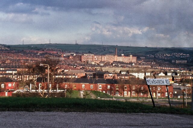
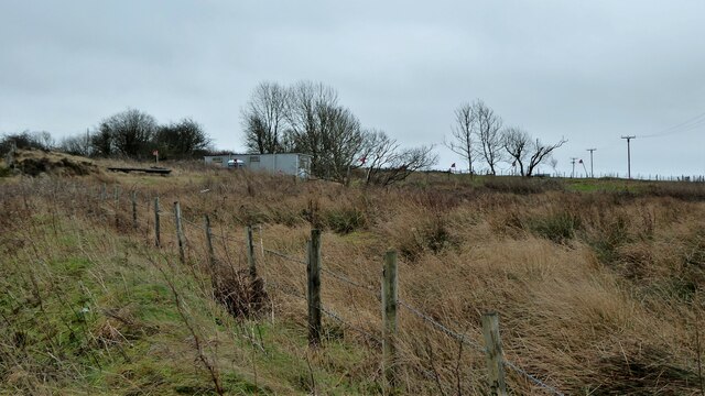
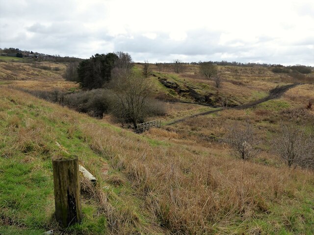
Spring Hill is a small village located in the county of Lancashire, England. Situated in the West Pennine Moors, it offers picturesque views of rolling hills and tranquil countryside. The village is part of the borough of Chorley and is surrounded by other charming rural communities.

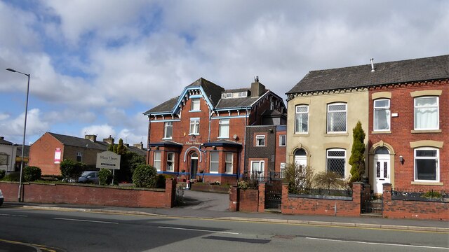
With a population of around 2,500, Spring Hill is known for its tight-knit community and friendly atmosphere. The village boasts a range of amenities, including a primary school, a post office, and a community center. The residents take pride in maintaining a clean and tidy environment, evident by the well-maintained houses and gardens that line the streets.

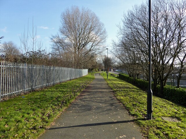
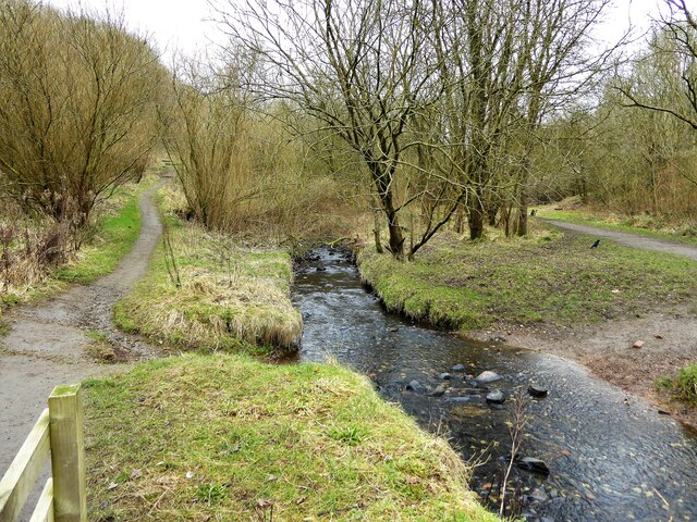
Nature lovers are drawn to Spring Hill due to its proximity to stunning landscapes and outdoor activities. The village is surrounded by beautiful walking trails, offering opportunities to explore the moors and enjoy the fresh air. Additionally, nearby reservoirs provide opportunities for fishing and bird-watching.

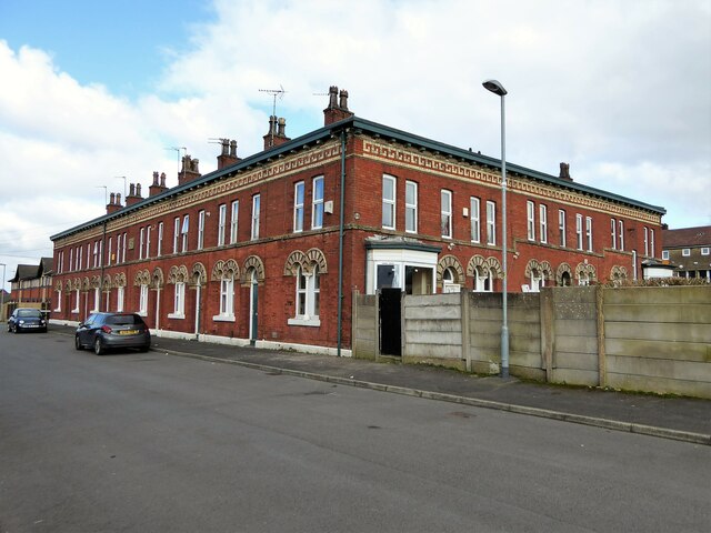
Spring Hill has a rich history, with some buildings dating back to the 17th century. The village maintains its traditional charm, with stone cottages and quaint architecture. The local pub, The Spring Inn, is a popular gathering spot for locals and visitors alike, offering a warm and welcoming atmosphere.

Overall, Spring Hill is a peaceful and idyllic village, perfect for those seeking a serene lifestyle amidst the beauty of the Lancashire countryside.

If you have any feedback on the listing, please let us know in the comments section below.
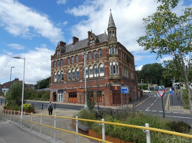
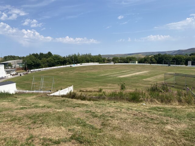
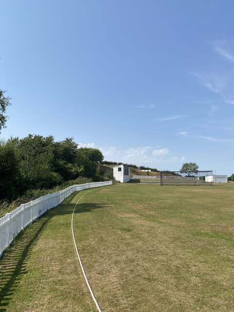
Spring Hill Images

Images are sourced within 2km of 53.54925/-2.079205 or Grid Reference SD9405. Thanks to Geograph Open Source API. All images are credited.

Derker Mills, Oldham
Oldham Mumps Tram Stop 
A railway line from Manchester to Oldham was opened in 1847. In 1863 the line was extended to Rochdale. Railway operations ended on 3 October 2009, and the Oldham Loop Line was closed for conversion to Matrolink. The line was completely rebuilt, with all of the former infrastructure, including the former stations and station buildings demolished, and replaced, and overhead wiring added. The line was re-opened in phases: Tram services started on 13 June 2012 between Manchester and Oldham Mumps: As a temporary measure, until the town centre line was completed, the former railway line through Oldham Mumps was retained, and a temporary tram stop constructed in place of the former railway station. A permanent stop called Oldham Mumps was later opened on the town centre line in a different location. Services were extended to Shaw and Crompton on 16 December 2012, and to Rochdale Railway Station on 28 February 2013. The Oldham town centre line opened on 27 January 2014, allowing the section of former railway line, and temporary stop at Oldham Mumps to be permanently closed. The Rochdale town centre line opened on 31 March 2014.
Oldham Mumps Tram Stop
A railway line from Manchester to Oldham was opened in 1847. In 1863 the line was extended to Rochdale. Railway operations ended on 3 October 2009, and the Oldham Loop Line was closed for conversion to Matrolink. The line was completely rebuilt, with all of the former infrastructure, including the former stations and station buildings demolished, and replaced, and overhead wiring added. The line was re-opened in phases: Tram services started on 13 June 2012 between Manchester and Oldham Mumps: As a temporary measure, until the town centre line was completed, the former railway line through Oldham Mumps was retained, and a temporary tram stop constructed in place of the former railway station. A permanent stop called Oldham Mumps was later opened on the town centre line in a different location. Services were extended to Shaw and Crompton on 16 December 2012, and to Rochdale Railway Station on 28 February 2013. The Oldham town centre line opened on 27 January 2014, allowing the section of former railway line, and temporary stop at Oldham Mumps to be permanently closed. The Rochdale town centre line opened on 31 March 2014.
Former NatWest bank 
The Grade II listed former bank <span class="nowrap"><a title="https://historicengland.org.uk/listing/the-list/list-entry/1201682?section=official-list-entry" rel="nofollow ugc noopener" href="https://historicengland.org.uk/listing/the-list/list-entry/1201682?section=official-list-entry">Link</a><img style="margin-left:2px;" alt="External link" title="External link - shift click to open in new window" src="https://s1.geograph.org.uk/img/external.png" width="10" height="10"/></span> at Mumps dates from 1902. The bank, originally the Manchester and County, was created by renowned Manchester architects Mills & Murgatroyd. It featured a unique baroque copper-crowned tower and a polished red granite base. Inside, the banking hall housed a 50ft mahogany counter. The bank was taken over by NatWest in 1970. In 1995 it was closed when NatWest merged their Mumps and Yorkshire Street branches. It was put on the market for £170,000. Plans the following year to turn the building into a pub fell through. Several later refurbishment plans have also failed. The building is a focal point within the bus/metrolink tram interchange.
Former NatWest bank
The Grade II listed former bank LinkExternal link at Mumps dates from 1902. The bank, originally the Manchester and County, was created by renowned Manchester architects Mills & Murgatroyd. It featured a unique baroque copper-crowned tower and a polished red granite base. Inside, the banking hall housed a 50ft mahogany counter. The bank was taken over by NatWest in 1970. In 1995 it was closed when NatWest merged their Mumps and Yorkshire Street branches. It was put on the market for £170,000. Plans the following year to turn the building into a pub fell through. Several later refurbishment plans have also failed. The building is a focal point within the bus/metrolink tram interchange.
Mumps transport interchange 
Next to the Metrolink tram stop at Mumps are several bus stops. On the left is  the Grade II listed former NatWest bank <span class="nowrap"><a title="https://historicengland.org.uk/listing/the-list/list-entry/1201682?section=official-list-entry" rel="nofollow ugc noopener" href="https://historicengland.org.uk/listing/the-list/list-entry/1201682?section=official-list-entry">Link</a><img style="margin-left:2px;" alt="External link" title="External link - shift click to open in new window" src="https://s1.geograph.org.uk/img/external.png" width="10" height="10"/></span> <a href="https://www.geograph.org.uk/photo/7263233">SD9305 : Former NatWest bank</a>.
Mumps transport interchange
Next to the Metrolink tram stop at Mumps are several bus stops. On the left is the Grade II listed former NatWest bank LinkExternal link SD9305 : Former NatWest bank.
17-21 Mumps 
Only the ground floor of this three storey building are currently occupied. Before becoming Frango's this was Fusion 21. Before that the right hand portion had been Kava and the left hand portion  the site office for Westshield. Before Westshield that part had been The Hair Lounge. Around 2012 the right hand side was called  Langham House. In 2009 the building was home to a photography studio Xpressions. All the adjoining buildings towards Yorkshire Street were demolished around 2016. There are plans to convert the upper storeys into apartments.
17-21 Mumps
Only the ground floor of this three storey building are currently occupied. Before becoming Frango's this was Fusion 21. Before that the right hand portion had been Kava and the left hand portion the site office for Westshield. Before Westshield that part had been The Hair Lounge. Around 2012 the right hand side was called Langham House. In 2009 the building was home to a photography studio Xpressions. All the adjoining buildings towards Yorkshire Street were demolished around 2016. There are plans to convert the upper storeys into apartments.
Cricket Pitch
Cricket Pitch
Slack Hall Trig Point Flush Bracket S2785
Cricket Pitch
Cricket Pitch
Warning flags flying Around Highmoor Clay pigeon Club viewed from Whitegates Lane
Warning flags flying
Around Highmoor Clay pigeon Club viewed from Whitegates Lane
Cycle path following route of former railway The path goes from Oldham to Grotton following the Oldham to Greenfield railway line. Much of the route is on infill such as here looking east from Glodwick Road, Oldham
Cycle path following route of former railway
The path goes from Oldham to Grotton following the Oldham to Greenfield railway line. Much of the route is on infill such as here looking east from Glodwick Road, Oldham
Cycle route following line of former railway This view across Cranbrook Street just off the path shows the route is on the top of infill, since only the bridge parapet is visible of the former railway bridge. The path is on the  former Oldham to Greenfield line.
Cycle route following line of former railway
This view across Cranbrook Street just off the path shows the route is on the top of infill, since only the bridge parapet is visible of the former railway bridge. The path is on the former Oldham to Greenfield line.
Cycle path following route of former railway The path is approaching the former railway bridge at St. John Street which is one of the few not infilled on the route. The path runs from Oldham to Grotton along the former line to Greenfield.
Cycle path following route of former railway
The path is approaching the former railway bridge at St. John Street which is one of the few not infilled on the route. The path runs from Oldham to Grotton along the former line to Greenfield.
Former Bank A listed building at Mumps
Former Bank
A listed building at Mumps
River Medlock at Lees View on the Medlock Valley Way from a footbridge
River Medlock at Lees
View on the Medlock Valley Way from a footbridge
Block of historic houses, Albert Mount Block of houses with internal courtyard, dated to 1862, viewed from Bartlemore Street, Derker.
Block of historic houses, Albert Mount
Block of houses with internal courtyard, dated to 1862, viewed from Bartlemore Street, Derker.
Rocky outcrop in Hodge Clough Most of the tracks around the clough have been eroded (by off road motor bikes) as seen on the track leading away from the footbridge.
Rocky outcrop in Hodge Clough
Most of the tracks around the clough have been eroded (by off road motor bikes) as seen on the track leading away from the footbridge.
Moor Haven Care Home One of several former large villas on Ripponden Road, Watersheddings, converted to residential care homes
Moor Haven Care Home
One of several former large villas on Ripponden Road, Watersheddings, converted to residential care homes
Former Oldham Equitable Co-operative Building At the junction of Huddersfield and Ripponden Roads. A listed building now used by various businesses
Former Oldham Equitable Co-operative Building
At the junction of Huddersfield and Ripponden Roads. A listed building now used by various businesses
Show me another place!

Spring Hill is located at Grid Ref: SD9405 (Lat: 53.54925, Lng: -2.079205)

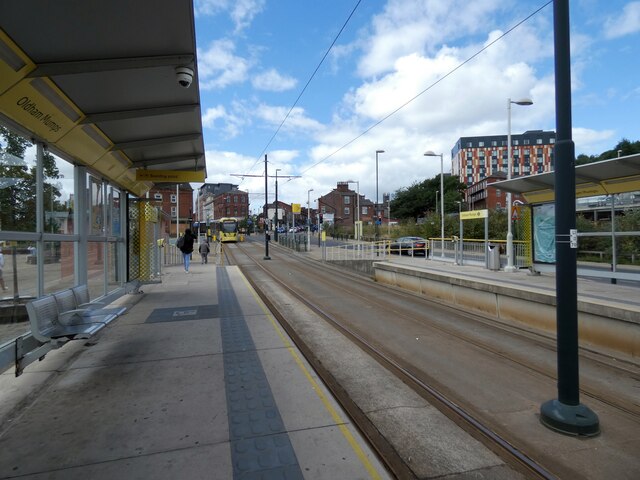
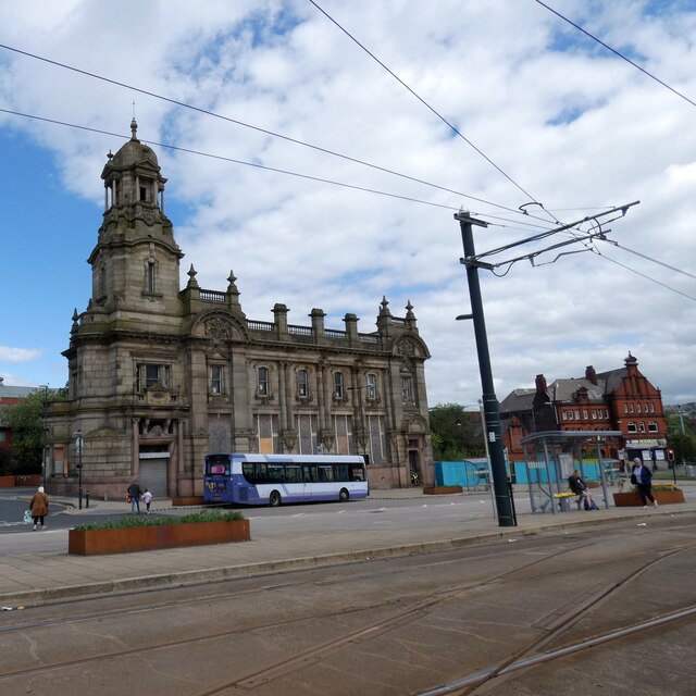
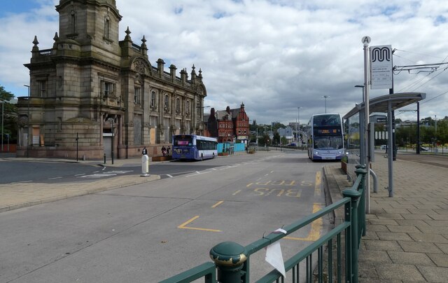
Unitary Authority: Oldham

Police Authority: Greater Manchester

What 3 Words

///dozen.fuzzy.retire. Near Shaw, Manchester

Related Wikis

Orme Mill, Waterhead

Orme Mill, Waterhead is a cotton spinning mill in Waterhead, Oldham, Greater Manchester, England. It was built in 1908. It was taken over by the Lancashire...

Greenacres, Greater Manchester

Greenacres , archaically Greenacres Moor, is an area of Oldham, in Greater Manchester, England. It lies on the west side of the River Medlock opposite...

Waterhead, Greater Manchester

Waterhead (or archaically, Waterhead Mill), is an area of Oldham, and an electoral ward of the Metropolitan Borough of Oldham, in Greater Manchester, England...

Majestic Mill, Waterhead

Majestic Mill, Waterhead is a cotton spinning mill in Waterhead, Oldham, Greater Manchester. It was built in 1903. It was taken over by the Lancashire...

Nearby Amenities

Located within 500m of 53.54925,-2.079205
Watersheddings
Is In: Oldham, Greater Manchester, England, UK
Place: suburb
Source: npe and landsat
Lat/Long: 53.5529603/-2.0815191
Pub
The Carrion Crow
Addr City: Oldham
Addr Housename: The Carrion Crow
Addr Housenumber: 271
Addr Postcode: OL4 2RJ
Addr Street: Huddersfield Road
Brand: Marston's
Brand Wikidata: Q6773982
Website: https://www.carrioncrowoldham.co.uk/
Lat/Long: 53.5482024/-2.0860977
Pub
Farmers Boy
Addr City: Oldham
Addr Housenumber: 250-252
Addr Postcode: OL4 2RB
Addr Street: Huddersfield Road
Fhrs Id: 78545
Fixme Addr2: 250-252 Huddersfield Road A62
Source Addr: FHRS Open Data
Lat/Long: 53.5481282/-2.0853167
Pub
Plough Inn
Lat/Long: 53.5491275/-2.0811444
Fuel
Shell
Addr Postcode: OL4 2HN
Brand: Shell
Brand Wikidata: Q110716465
Phone: +44 161 628 1910
Ref Navads: NVDS353_10019242
Website: https://find.shell.com/gb/fuel/10019242-two-counties-service-station
Lat/Long: 53.5494531/-2.0791321
Pub
Shepherds Boy
Lat/Long: 53.5494399/-2.0727085
Cafe
Village Cafe
Lat/Long: 53.5493825/-2.0723437
Waterhead
Place: locality
Lat/Long: 53.5503294/-2.0720779
Bus Stop
Top of Moor, Greenacres Road / opposite Cotton Tree Close
Bus: yes
Naptan AtcoCode: 1800ED07821
Naptan Bearing: SW
Naptan CommonName: Greenacres Road/Cotton Tree Close
Naptan Indicator: O/s House 2
Naptan Landmark: GREENACRE LODGE
Naptan NaptanCode: mantgjma
Naptan PlusbusZoneRef: MNCRPIC
Naptan ShortCommonName: Cotton Tree Close
Naptan Street: GREENACRES ROAD
Naptan Verified: no
Network: TfGM
Operator: TfGM
Public Transport: platform
Source: naptan_import
Lat/Long: 53.5472686/-2.0770162
Bus Stop
Bardsley Street/Cobden Street
Bus: yes
Naptan AtcoCode: 1800ED14491
Naptan Bearing: W
Naptan CommonName: Bardsley Street/Cobden Street
Naptan Indicator: Daisy Hill Court
Naptan Landmark: DAISY HILL CRT
Naptan NaptanCode: mantpajp
Naptan Notes: New Stop
Naptan ShortCommonName: Cobden Street
Naptan Street: BARDSLEY STREET
Naptan Verified: no
Network: TfGM
Public Transport: platform
Source: naptan_import
Lat/Long: 53.550447/-2.0763057
Bus Stop
Greenacres, Greenacres Road / outside Greenacres Cemetery
Bus: yes
Naptan AtcoCode: 1800ED19031
Naptan Bearing: W
Naptan CommonName: Greenacres Road/Greenacres Cemetery
Naptan Indicator: Cemetery
Naptan Landmark: CEMETERY
Naptan NaptanCode: manapwap
Naptan PlusbusZoneRef: MNCRPIC
Naptan ShortCommonName: Cemetery
Naptan Street: GREENACRES ROAD
Naptan Verified: no
Network: TfGM
Operator: TfGM
Public Transport: platform
Source: naptan_import
Lat/Long: 53.5454761/-2.0827327
Bus Stop
Greenacres, Greenacres Road / opposite Greenacres Cemetery
Bus: yes
Naptan AtcoCode: 1800ED19041
Naptan Bearing: E
Naptan CommonName: Greenacres Road/Greenacres Cemetery
Naptan Indicator: Green Acres Pub
Naptan Landmark: GREEN ACRES PUB
Naptan NaptanCode: manapwat
Naptan PlusbusZoneRef: MNCRPIC
Naptan ShortCommonName: Cemetery
Naptan Street: GREENACRES ROAD
Naptan Verified: no
Network: TfGM
Operator: TfGM
Public Transport: platform
Source: naptan_import
Lat/Long: 53.5459083/-2.0816771
Bus Stop
Top of Moor, Greenacres Road / opposite Sycamore Avenue
Bus: yes
Naptan AtcoCode: 1800ED19051
Naptan Bearing: W
Naptan CommonName: Greenacres Road/Sycamore Avenue
Naptan Indicator: O/s House 246
Naptan Landmark: HOUSE 246
Naptan NaptanCode: manapwaw
Naptan PlusbusZoneRef: MNCRPIC
Naptan ShortCommonName: Sycamore Avenue
Naptan Street: GREENACRES ROAD
Naptan Verified: no
Network: TfGM
Operator: TfGM
Public Transport: platform
Shelter: yes
Source: naptan_import
Lat/Long: 53.5464837/-2.0790587
Bus Stop
Top of Moor, Greenacres Road / near Sycamore Avenue
Bus: yes
Naptan AtcoCode: 1800ED19061
Naptan Bearing: E
Naptan CommonName: Greenacres Road/Sycamore Avenue
Naptan Indicator: O/s House 327
Naptan Landmark: HOUSE 327
Naptan NaptanCode: manapwda
Naptan PlusbusZoneRef: MNCRPIC
Naptan ShortCommonName: Sycamore Avenue
Naptan Street: GREENACRES ROAD
Naptan Verified: no
Network: TfGM
Operator: TfGM
Public Transport: platform
Source: naptan_import
Lat/Long: 53.546548/-2.0793391
Bus Stop
Top of Moor, Greenacres Road / near Cotton Tree Close
Bus: yes
Naptan AtcoCode: 1800ED11011
Naptan Bearing: NE
Naptan CommonName: Greenacres Road/Cotton Tree Close
Naptan Indicator: O/s House 2
Naptan Landmark: HOUSE 2
Naptan NaptanCode: manampap
Naptan PlusbusZoneRef: MNCRPIC
Naptan ShortCommonName: Cotton Tree Close
Naptan Street: GREENACRES ROAD
Naptan Verified: no
Network: TfGM
Operator: TfGM
Public Transport: platform
Source: naptan_import
Lat/Long: 53.5473225/-2.0771672
Bus Stop
Waterhead, Greenacres Road / opposite Bulls Head
Bus: yes
Naptan AtcoCode: 1800ED11111
Naptan Bearing: W
Naptan CommonName: Greenacres Road/Bulls Head
Naptan Indicator: Mill
Naptan Landmark: MILL
Naptan NaptanCode: manampda
Naptan PlusbusZoneRef: MNCRPIC
Naptan ShortCommonName: Bulls Head
Naptan Street: GREENACRES ROAD
Naptan Verified: no
Network: TfGM
Operator: TfGM
Public Transport: platform
Source: naptan_import
Lat/Long: 53.5482415/-2.0735377
Bus Stop
Waterhead, Greenacres Road / outside Bulls Head
Bus: yes
Naptan AtcoCode: 1800ED11121
Naptan Bearing: E
Naptan CommonName: Greenacres Road/Bulls Head
Naptan Indicator: Bulls Head Pub
Naptan Landmark: BULL'S HEAD P/H
Naptan NaptanCode: manampdg
Naptan Notes: INDICATOR AMENDED
Naptan PlusbusZoneRef: MNCRPIC
Naptan ShortCommonName: Bulls Head
Naptan Street: GREENACRES ROAD
Naptan Verified: no
Network: TfGM
Operator: TfGM
Public Transport: platform
Source: naptan_import
Lat/Long: 53.5484126/-2.0732602
Bus Stop
Waterhead, Huddersfield Road / near Church Street East
Bus: yes
Naptan AtcoCode: 1800ED12011
Naptan Bearing: E
Naptan CommonName: Huddersfield Road/Waterhead
Naptan Indicator: Public Toilet
Naptan Landmark: HOUSE 491
Naptan NaptanCode: manamptm
Naptan PlusbusZoneRef: MNCRPIC
Naptan ShortCommonName: Waterhead
Naptan Street: Huddersfield Road
Naptan Verified: no
Network: TfGM
Operator: TfGM
Public Transport: platform
Source: naptan_import
Lat/Long: 53.5497335/-2.073836
Bus Stop
Waterhead, Huddersfield Road / near Sharples Hall Street
Bus: yes
Naptan AtcoCode: 1800ED30561
Naptan Bearing: E
Naptan CommonName: Huddersfield Road/Sharples Hall Street
Naptan Indicator: O/s House 397
Naptan Landmark: HOUSE 391
Naptan NaptanCode: manatmpa
Naptan Notes: LOCATION AMENDED
Naptan PlusbusZoneRef: MNCRPIC
Naptan ShortCommonName: Sharples Hall Str
Naptan Street: Huddersfield Road
Naptan Verified: no
Network: TfGM
Operator: TfGM
Public Transport: platform
Source: naptan_import
Lat/Long: 53.5490092/-2.0818491
Bus Stop
Waterhead, Huddersfield Road / opposite Sharples Hall Street
Bus: yes
Naptan AtcoCode: 1800ED30571
Naptan Bearing: W
Naptan CommonName: Huddersfield Road/Sharples Hall Street
Naptan Indicator: Opp House 389
Naptan Landmark: HOUSE 387
Naptan NaptanCode: manatmpd
Naptan PlusbusZoneRef: MNCRPIC
Naptan ShortCommonName: Sharples Hall Str
Naptan Street: Huddersfield Road
Naptan Verified: no
Network: TfGM
Operator: TfGM
Public Transport: platform
Source: naptan_import
Lat/Long: 53.5488564/-2.0818639
Bus Stop
Waterhead, Huddersfield Road / near Heywood Street
Bus: yes
Naptan AtcoCode: 1800ED30581
Naptan Bearing: W
Naptan CommonName: Huddersfield Road/Heywood Street
Naptan Indicator: Springhill Crt
Naptan Landmark: SPRINGHILL CRT
Naptan NaptanCode: manatmpg
Naptan PlusbusZoneRef: MNCRPIC
Naptan ShortCommonName: Heywood Street
Naptan Street: Huddersfield Road
Naptan Verified: no
Network: TfGM
Operator: TfGM
Public Transport: platform
Source: naptan_import
Lat/Long: 53.5493626/-2.0776086
Bus Stop
Waterhead, Huddersfield Road / near Cobden Street
Bus: yes
Naptan AtcoCode: 1800ED30591
Naptan Bearing: E
Naptan CommonName: Huddersfield Road/Cobden Street
Naptan Indicator: Coach & Horses
Naptan Landmark: FLATS
Naptan NaptanCode: manatmpj
Naptan Notes: STOP MOVED
Naptan PlusbusZoneRef: MNCRPIC
Naptan ShortCommonName: Cobden Street
Naptan Street: Huddersfield Road
Naptan Verified: no
Network: TfGM
Operator: TfGM
Public Transport: platform
Source: naptan_import
Lat/Long: 53.5496512/-2.0760998
Bus Stop
Waterhead, Huddersfield Road / at Waterhead Terminus
Bus: yes
Naptan AtcoCode: 1800ED30601
Naptan Bearing: S
Naptan CommonName: Culvert Street/Waterhead Terminus
Naptan Indicator: Os Pub
Naptan Landmark: SCHOOL
Naptan NaptanCode: manatmpt
Naptan PlusbusZoneRef: MNCRPIC
Naptan ShortCommonName: Waterhead Terminu
Naptan Street: Huddersfield Road
Naptan Verified: no
Network: TfGM
Operator: TfGM
Public Transport: platform
Shelter: yes
Source: naptan_import
Lat/Long: 53.5495741/-2.0717059
Bus Stop
Waterhead, Huddersfield Road / opposite Church Street East
Bus: yes
Naptan AtcoCode: 1800ED30611
Naptan Bearing: W
Naptan CommonName: Huddersfield Road/Waterhead
Naptan Indicator: Os House 566
Naptan Landmark: FLATS
Naptan NaptanCode: manatmpw
Naptan Notes: LOCATION AMENDED
Naptan PlusbusZoneRef: MNCRPIC
Naptan ShortCommonName: Waterhead
Naptan Street: Huddersfield Road
Naptan Verified: no
Network: TfGM
Operator: TfGM
Public Transport: platform
Source: naptan_import
Lat/Long: 53.549581/-2.0733679
Barrier: bollard
Bicycle: yes
Foot: yes
Horse: yes
Lat/Long: 53.5511115/-2.0818067
Noexit: yes
Lat/Long: 53.5449904/-2.0782154
Noexit: yes
Lat/Long: 53.5495811/-2.0866738
Turning Circle
Lat/Long: 53.5522193/-2.0818725
Noexit: yes
Lat/Long: 53.5484741/-2.085889
Noexit: yes
Lat/Long: 53.5490163/-2.0848008
Mini Roundabout
Direction: clockwise
Lat/Long: 53.545668/-2.0821278
Noexit: yes
Lat/Long: 53.545818/-2.0815491
Generator Method: photovoltaic
Generator Output Electricity: yes
Generator Source: solar
Generator Type: solar_photovoltaic_panel
Location: roof
Power: generator
Lat/Long: 53.5482301/-2.0827592
Generator Method: photovoltaic
Generator Output Electricity: yes
Generator Source: solar
Generator Type: solar_photovoltaic_panel
Location: roof
Power: generator
Lat/Long: 53.5517932/-2.0808426
Generator Method: photovoltaic
Generator Output Electricity: yes
Generator Source: solar
Generator Type: solar_photovoltaic_panel
Location: roof
Power: generator
Lat/Long: 53.5520609/-2.080274
Generator Method: photovoltaic
Generator Output Electricity: yes
Generator Source: solar
Generator Type: solar_photovoltaic_panel
Location: roof
Power: generator
Lat/Long: 53.552711/-2.0791287
Generator Method: photovoltaic
Generator Output Electricity: yes
Generator Source: solar
Generator Type: solar_photovoltaic_panel
Location: roof
Power: generator
Lat/Long: 53.5534886/-2.080502
Generator Method: photovoltaic
Generator Output Electricity: yes
Generator Source: solar
Generator Type: solar_photovoltaic_panel
Location: roof
Power: generator
Lat/Long: 53.5536782/-2.0796142
Generator Method: photovoltaic
Generator Output Electricity: yes
Generator Source: solar
Generator Type: solar_photovoltaic_panel
Location: roof
Power: generator
Lat/Long: 53.5531763/-2.0760522
Generator Method: photovoltaic
Generator Output Electricity: yes
Generator Source: solar
Generator Type: solar_photovoltaic_panel
Location: roof
Power: generator
Lat/Long: 53.5531859/-2.0761166
Generator Method: photovoltaic
Generator Output Electricity: yes
Generator Source: solar
Generator Type: solar_photovoltaic_panel
Location: roof
Power: generator
Lat/Long: 53.5529054/-2.0759959
Generator Method: photovoltaic
Generator Output Electricity: yes
Generator Source: solar
Generator Type: solar_photovoltaic_panel
Location: roof
Power: generator
Lat/Long: 53.5528735/-2.0757062
Generator Method: photovoltaic
Generator Output Electricity: yes
Generator Source: solar
Generator Type: solar_photovoltaic_panel
Location: roof
Power: generator
Lat/Long: 53.5528974/-2.0759235
Generator Method: photovoltaic
Generator Output Electricity: yes
Generator Source: solar
Generator Type: solar_photovoltaic_panel
Location: roof
Power: generator
Lat/Long: 53.5528895/-2.0758671
Generator Method: photovoltaic
Generator Output Electricity: yes
Generator Source: solar
Generator Type: solar_photovoltaic_panel
Location: roof
Power: generator
Lat/Long: 53.5528767/-2.0757786
Noexit: yes
Lat/Long: 53.5487984/-2.084147
Barrier: bollard
Motor Vehicle: no
Lat/Long: 53.5484969/-2.083665
Historic: memorial
Lat/Long: 53.5493121/-2.0767439
Generator Method: photovoltaic
Generator Output Electricity: yes
Generator Source: solar
Generator Type: solar_photovoltaic_panel
Power: generator
Lat/Long: 53.5517167/-2.0747388
Generator Method: photovoltaic
Generator Output Electricity: yes
Generator Source: solar
Generator Type: solar_photovoltaic_panel
Power: generator
Lat/Long: 53.5516756/-2.0753242
Generator Method: photovoltaic
Generator Output Electricity: yes
Generator Source: solar
Generator Type: solar_photovoltaic_panel
Power: generator
Lat/Long: 53.5514292/-2.074877
Generator Method: photovoltaic
Generator Output Electricity: yes
Generator Source: solar
Generator Type: solar_photovoltaic_panel
Power: generator
Lat/Long: 53.5511611/-2.0743912
Generator Method: photovoltaic
Generator Output Electricity: yes
Generator Source: solar
Generator Type: solar_photovoltaic_panel
Power: generator
Lat/Long: 53.5511793/-2.0741534
Generator Method: photovoltaic
Generator Output Electricity: yes
Generator Source: solar
Generator Type: solar_photovoltaic_panel
Power: generator
Lat/Long: 53.5511889/-2.0740538
Generator Method: photovoltaic
Generator Output Electricity: yes
Generator Source: solar
Generator Type: solar_photovoltaic_panel
Power: generator
Lat/Long: 53.551166/-2.0743322
Generator Method: photovoltaic
Generator Output Electricity: yes
Generator Source: solar
Generator Type: solar_photovoltaic_panel
Power: generator
Lat/Long: 53.5522082/-2.0753974
Generator Method: photovoltaic
Generator Output Electricity: yes
Generator Source: solar
Generator Type: solar_photovoltaic_panel
Power: generator
Lat/Long: 53.5522686/-2.0747672
Generator Method: photovoltaic
Generator Output Electricity: yes
Generator Source: solar
Generator Type: solar_photovoltaic_panel
Power: generator
Lat/Long: 53.5530052/-2.0775745
Generator Method: photovoltaic
Generator Output Electricity: yes
Generator Source: solar
Generator Type: solar_photovoltaic_panel
Power: generator
Lat/Long: 53.5513399/-2.0769626
Generator Method: photovoltaic
Generator Output Electricity: yes
Generator Source: solar
Generator Type: solar_photovoltaic_panel
Power: generator
Lat/Long: 53.5514003/-2.0764788
Generator Method: photovoltaic
Generator Output Electricity: yes
Generator Source: solar
Generator Type: solar_photovoltaic_panel
Power: generator
Lat/Long: 53.5512457/-2.0759828
Generator Method: photovoltaic
Generator Output Electricity: yes
Generator Source: solar
Generator Type: solar_photovoltaic_panel
Power: generator
Lat/Long: 53.5510017/-2.0772045
Generator Method: photovoltaic
Generator Output Electricity: yes
Generator Source: solar
Generator Type: solar_photovoltaic_panel
Power: generator
Lat/Long: 53.5509945/-2.0773061
Generator Method: photovoltaic
Generator Output Electricity: yes
Generator Source: solar
Generator Type: solar_photovoltaic_panel
Power: generator
Lat/Long: 53.5510054/-2.0780481
Crossing
Crossing: traffic_signals
Crossing Island: yes
Crossing Ref: toucan
Tactile Paving: yes
Lat/Long: 53.5481536/-2.0857924
Crossing
Crossing: unmarked
Crossing Island: yes
Tactile Paving: no
Lat/Long: 53.5480387/-2.0863431
Traffic Signals
Traffic Signals: crossing
Traffic Signals Direction: forward
Lat/Long: 53.5481676/-2.0857196
Traffic Signals
Traffic Signals: crossing
Traffic Signals Direction: backward
Lat/Long: 53.5481393/-2.0858618
Crossing
Crossing: unmarked
Crossing Island: no
Tactile Paving: no
Lat/Long: 53.5481366/-2.0862562
Noexit: yes
Lat/Long: 53.5483033/-2.0841757
Crossing
Crossing: unmarked
Crossing Island: no
Tactile Paving: yes
Lat/Long: 53.5480027/-2.0859533
Traffic Calming: cushion
Lat/Long: 53.545523/-2.0826802
Barrier: bollard
Lat/Long: 53.5460003/-2.0829415
Noexit: yes
Lat/Long: 53.5452879/-2.0823871
Crossing
Crossing: uncontrolled
Crossing Island: no
Lat/Long: 53.5497148/-2.0725465
Traffic Calming: hump
Lat/Long: 53.5491682/-2.0862754
Addr City: Oldham
Addr Housenumber: 170
Addr Postcode: OL4 2RH
Addr Street: Littlemoor Lane
Lat/Long: 53.5484978/-2.0866399
Addr City: Oldham
Addr Housenumber: 172
Addr Postcode: OL4 2RH
Addr Street: Littlemoor Lane
Lat/Long: 53.548463/-2.0866164
Addr City: Oldham
Addr Housenumber: 174
Addr Postcode: OL4 2RH
Addr Street: Littlemoor Lane
Lat/Long: 53.548425/-2.086591
Addr City: Oldham
Addr Housenumber: 176
Addr Postcode: OL4 2RH
Addr Street: Littlemoor Lane
Lat/Long: 53.5483869/-2.0865686
Addr City: Oldham
Addr Housenumber: 178
Addr Postcode: OL4 2RH
Addr Street: Littlemoor Lane
Lat/Long: 53.5483428/-2.0865442
Addr City: Oldham
Addr Housenumber: 180
Addr Postcode: OL4 2RH
Addr Street: Littlemoor Lane
Lat/Long: 53.5483018/-2.0865198
Addr City: Oldham
Addr Housenumber: 182
Addr Postcode: OL4 2RH
Addr Street: Littlemoor Lane
Lat/Long: 53.5485079/-2.0866032
Addr City: Oldham
Addr Housenumber: 184
Addr Postcode: OL4 2RH
Addr Street: Littlemoor Lane
Lat/Long: 53.5484731/-2.0865797
Addr City: Oldham
Addr Housenumber: 186
Addr Postcode: OL4 2RH
Addr Street: Littlemoor Lane
Lat/Long: 53.548435/-2.0865543
Addr City: Oldham
Addr Housenumber: 188
Addr Postcode: OL4 2RH
Addr Street: Littlemoor Lane
Lat/Long: 53.548397/-2.086532
Addr City: Oldham
Addr Housenumber: 190
Addr Postcode: OL4 2RH
Addr Street: Littlemoor Lane
Lat/Long: 53.5483529/-2.0865076
Addr City: Oldham
Addr Housenumber: 192
Addr Postcode: OL4 2RH
Addr Street: Littlemoor Lane
Lat/Long: 53.5483118/-2.0864832
Addr City: Oldham
Addr Housenumber: 196
Addr Postcode: OL4 2RH
Addr Street: Littlemoor Lane
Lat/Long: 53.5485188/-2.0865626
Addr City: Oldham
Addr Housenumber: 198
Addr Postcode: OL4 2RH
Addr Street: Littlemoor Lane
Lat/Long: 53.5484839/-2.0865391
Addr City: Oldham
Addr Housenumber: 200
Addr Postcode: OL4 2RH
Addr Street: Littlemoor Lane
Lat/Long: 53.5484459/-2.0865137
Addr City: Oldham
Addr Housenumber: 202
Addr Postcode: OL4 2RH
Addr Street: Littlemoor Lane
Lat/Long: 53.5484079/-2.0864913
Addr City: Oldham
Addr Housenumber: 204
Addr Postcode: OL4 2RH
Addr Street: Littlemoor Lane
Lat/Long: 53.5483638/-2.0864669
Addr City: Oldham
Addr Housenumber: 206
Addr Postcode: OL4 2RH
Addr Street: Littlemoor Lane
Lat/Long: 53.5483227/-2.0864425
Addr City: Oldham
Addr Housenumber: 194
Addr Postcode: OL4 2RH
Addr Street: Littlemoor Lane
Lat/Long: 53.5482734/-2.0864578
Addr City: Oldham
Addr Housenumber: 208
Addr Postcode: OL4 2RH
Addr Street: Littlemoor Lane
Lat/Long: 53.5482825/-2.0864212
Clinic
Springfield House Medical Centre
Addr City: Oldham
Addr Housename: Springfield House Medical Centre
Addr Housenumber: 275
Addr Postcode: OL4 2RJ
Addr Street: Huddersfield Road
Healthcare: clinic
Operator: NHS
Operator Type: public
Operator Wikidata: Q918396
Lat/Long: 53.5482847/-2.0858435
Traffic Calming: island
Lat/Long: 53.5483624/-2.0847853
Traffic Calming: hump
Lat/Long: 53.5497141/-2.0858351
Addr City: Oldham
Addr Housenumber: 23
Addr Postcode: OL4 2RS
Addr Street: Shrewsbury Street
Lat/Long: 53.5491793/-2.08676
Addr City: Oldham
Addr Housenumber: 25
Addr Postcode: OL4 2RS
Addr Street: Shrewsbury Street
Lat/Long: 53.5491537/-2.0866644
Addr City: Oldham
Addr Housenumber: 27
Addr Postcode: OL4 2RS
Addr Street: Shrewsbury Street
Lat/Long: 53.5491317/-2.0865666
Noexit: yes
Lat/Long: 53.5494866/-2.0857057
Noexit: yes
Lat/Long: 53.5491828/-2.0847974
Addr City: Oldham
Addr Housenumber: 49
Addr Postcode: OL4 2RR
Addr Street: Littlemoor Lane
Lat/Long: 53.5493583/-2.0863799
Addr City: Oldham
Addr Housenumber: 51
Addr Postcode: OL4 2RR
Addr Street: Littlemoor Lane
Lat/Long: 53.5493835/-2.0864723
Addr City: Oldham
Addr Housenumber: 53
Addr Postcode: OL4 2RR
Addr Street: Littlemoor Lane
Lat/Long: 53.5494091/-2.0865686
Addr City: Oldham
Addr Housenumber: 55
Addr Postcode: OL4 2RR
Addr Street: Littlemoor Lane
Lat/Long: 53.5494343/-2.0866665
Addr City: Oldham
Addr Housenumber: 57
Addr Postcode: OL4 2RR
Addr Street: Littlemoor Lane
Lat/Long: 53.5494581/-2.086765
Traffic Calming: island
Lat/Long: 53.548605/-2.0835772
Traffic Calming: island
Lat/Long: 53.5488324/-2.0824279
Addr City: Oldham
Addr Housenumber: 83
Addr Postcode: OL4 2RR
Addr Street: Littlemoor Lane
Lat/Long: 53.5496898/-2.0865758
Addr City: Oldham
Addr Housenumber: 85
Addr Postcode: OL4 2RR
Addr Street: Littlemoor Lane
Lat/Long: 53.5496642/-2.0864795
Addr City: Oldham
Addr Housenumber: 87
Addr Postcode: OL4 2RR
Addr Street: Littlemoor Lane
Lat/Long: 53.5496381/-2.0863917
Addr City: Oldham
Addr Housenumber: 89
Addr Postcode: OL4 2RR
Addr Street: Littlemoor Lane
Lat/Long: 53.5496143/-2.0862993
Addr City: Oldham
Addr Housenumber: 91
Addr Postcode: OL4 2RR
Addr Street: Littlemoor Lane
Lat/Long: 53.5495869/-2.0861976
Entrance: main
Wheelchair: yes
Lat/Long: 53.550172/-2.0719753
Addr City: Oldham
Addr Housenumber: 15
Addr Postcode: OL4 2RP
Addr Street: Talbot Close
Lat/Long: 53.5499963/-2.0866185
Addr City: Oldham
Addr Housenumber: 11
Addr Postcode: OL4 2RP
Addr Street: Talbot Close
Lat/Long: 53.5499714/-2.0865181
Addr City: Oldham
Addr Housenumber: 9
Addr Postcode: OL4 2RP
Addr Street: Talbot Close
Lat/Long: 53.5499415/-2.0864224
Addr City: Oldham
Addr Housenumber: 7
Addr Postcode: OL4 2RP
Addr Street: Talbot Close
Lat/Long: 53.5499187/-2.0863255
Addr City: Oldham
Addr Housenumber: 5
Addr Postcode: OL4 2RP
Addr Street: Talbot Close
Lat/Long: 53.5498874/-2.0862274
Addr City: Oldham
Addr Housenumber: 3
Addr Postcode: OL4 2RP
Addr Street: Talbot Close
Lat/Long: 53.5498604/-2.0861282
Addr City: Oldham
Addr Housenumber: 1
Addr Postcode: OL4 2RP
Addr Street: Talbot Close
Lat/Long: 53.5498326/-2.0860324
Noexit: yes
Lat/Long: 53.550062/-2.0847182
Traffic Calming: hump
Lat/Long: 53.5503196/-2.0854876
Addr City: Oldham
Addr Housenumber: 36
Addr Postcode: OL4 2RP
Addr Street: Talbot Close
Lat/Long: 53.5502381/-2.0864569
Addr City: Oldham
Addr Housenumber: 32
Addr Postcode: OL4 2RP
Addr Street: Talbot Close
Lat/Long: 53.5502218/-2.0864613
Addr City: Oldham
Addr Housenumber: 28
Addr Postcode: OL4 2RP
Addr Street: Talbot Close
Lat/Long: 53.5502021/-2.0864636
Addr City: Oldham
Addr Housenumber: 26
Addr Postcode: OL4 2RP
Addr Street: Talbot Close
Lat/Long: 53.5501914/-2.0863329
Addr City: Oldham
Addr Housenumber: 30
Addr Postcode: OL4 2RP
Addr Street: Talbot Close
Lat/Long: 53.5502111/-2.0863306
Addr City: Oldham
Addr Housenumber: 34
Addr Postcode: OL4 2RP
Addr Street: Talbot Close
Lat/Long: 53.5502274/-2.0863262
Addr City: Oldham
Addr Housenumber: 16
Addr Postcode: OL4 2RP
Addr Street: Talbot Close
Lat/Long: 53.5501818/-2.086202
Addr City: Oldham
Addr Housenumber: 20
Addr Postcode: OL4 2RP
Addr Street: Talbot Close
Lat/Long: 53.5502015/-2.0861997
Addr City: Oldham
Addr Housenumber: 24
Addr Postcode: OL4 2RP
Addr Street: Talbot Close
Lat/Long: 53.5502178/-2.0861953
Addr City: Oldham
Addr Housenumber: 14
Addr Postcode: OL4 2RP
Addr Street: Talbot Close
Lat/Long: 53.5501731/-2.0860841
Addr City: Oldham
Addr Housenumber: 18
Addr Postcode: OL4 2RP
Addr Street: Talbot Close
Lat/Long: 53.5501928/-2.0860818
Addr City: Oldham
Addr Housenumber: 22
Addr Postcode: OL4 2RP
Addr Street: Talbot Close
Lat/Long: 53.5502091/-2.0860774
Addr City: Oldham
Addr Housenumber: 4
Addr Postcode: OL4 2RP
Addr Street: Talbot Close
Lat/Long: 53.5501603/-2.0859747
Addr City: Oldham
Addr Housenumber: 8
Addr Postcode: OL4 2RP
Addr Street: Talbot Close
Lat/Long: 53.5501799/-2.0859724
Addr City: Oldham
Addr Housenumber: 12
Addr Postcode: OL4 2RP
Addr Street: Talbot Close
Lat/Long: 53.5501963/-2.085968
Addr City: Oldham
Addr Housenumber: 2
Addr Postcode: OL4 2RP
Addr Street: Talbot Close
Lat/Long: 53.5501479/-2.0858376
Addr City: Oldham
Addr Housenumber: 6
Addr Postcode: OL4 2RP
Addr Street: Talbot Close
Lat/Long: 53.5501676/-2.0858353
Addr City: Oldham
Addr Housenumber: 10
Addr Postcode: OL4 2RP
Addr Street: Talbot Close
Lat/Long: 53.5501839/-2.0858309
Traffic Calming: hump
Lat/Long: 53.5505731/-2.0861389
Traffic Calming: hump
Lat/Long: 53.5509245/-2.0856897
Addr City: Oldham
Addr Housenumber: 6
Addr Postcode: OL4 2SA
Addr Street: Zealand Street
Lat/Long: 53.5504803/-2.0864474
Addr City: Oldham
Addr Housenumber: 8
Addr Postcode: OL4 2SA
Addr Street: Zealand Street
Lat/Long: 53.5504823/-2.0863745
Addr City: Oldham
Addr Housenumber: 10
Addr Postcode: OL4 2SA
Addr Street: Zealand Street
Lat/Long: 53.5504837/-2.0862998
Addr City: Oldham
Addr Housenumber: 12
Addr Postcode: OL4 2SA
Addr Street: Zealand Street
Lat/Long: 53.5504858/-2.0862279
Addr City: Oldham
Addr Housenumber: 14
Addr Postcode: OL4 2SA
Addr Street: Zealand Street
Lat/Long: 53.5504865/-2.0861608
Addr City: Oldham
Addr Housenumber: 16
Addr Postcode: OL4 2SA
Addr Street: Zealand Street
Lat/Long: 53.5504886/-2.0860855
Addr City: Oldham
Addr Housenumber: 18
Addr Postcode: OL4 2SA
Addr Street: Zealand Street
Lat/Long: 53.5504879/-2.0860114
Waterhead
Place: suburb
Lat/Long: 53.5495084/-2.0745675
Noexit: yes
Lat/Long: 53.5479012/-2.0854768
Addr City: Oldham
Addr Housenumber: 248
Addr Postcode: OL4 2RB
Addr Street: Huddersfield Road
Lat/Long: 53.5481122/-2.0854462
Fast Food
Happy Family
Addr City: Oldham
Addr Housenumber: 246
Addr Postcode: OL4 2RB
Addr Street: Huddersfield Road
Cuisine: chinese
Lat/Long: 53.5480956/-2.0855169
Dentist
Jackson's Dental Care
Addr City: Oldham
Addr Housenumber: 244
Addr Postcode: OL4 2RB
Addr Street: Huddersfield Road
Healthcare: dentist
Lat/Long: 53.5480839/-2.0855729
Pharmacy
Well Pharmacy
Addr City: Oldham
Addr Housenumber: 242
Addr Postcode: OL4 2RB
Addr Street: Huddersfield Road
Brand: Well Pharmacy
Brand Wikidata: Q7726524
Healthcare: pharmacy
Lat/Long: 53.5480696/-2.0856319
Asda
Addr City: Oldham
Addr Country: GB
Addr Housename: Asda Stores Ltd
Addr Postcode: OL4 2RB
Addr Street: Huddersfield Road
Brand: Asda
Brand Wikidata: Q297410
Brand Wikipedia: en:Asda
Contact Website: https://storelocator.asda.com/north-west/oldham/huddersfield-road
Fhrs Id: 118545
Operator: Asda Stores Ltd
Shop: supermarket
Lat/Long: 53.5482024/-2.0843414
Noexit: yes
Lat/Long: 53.5482334/-2.0836722
Noexit: yes
Lat/Long: 53.5479652/-2.0842881
Entrance: main
Lat/Long: 53.5482167/-2.0843771
Noexit: yes
Lat/Long: 53.5478135/-2.0839249
Noexit: yes
Lat/Long: 53.5516119/-2.0855447
Give Way
Direction: forward
Lat/Long: 53.5482109/-2.0858755
Give Way
Direction: backward
Lat/Long: 53.548114/-2.0861859
Give Way
Direction: forward
Lat/Long: 53.5478568/-2.085773
The data included in this document is from www.openstreetmap.org. The data is made available under ODbL.

Have you been to Spring Hill?

Leave your review of Spring Hill below (or comments, questions and feedback).