Top of Moor

Settlement in Lancashire

England

Top of Moor

A672 Ripponden Road at Collett Street
A672 Ripponden Road at Collett Street Credit: Colin Pyle

Top of Moor is a small village located in the county of Lancashire, England. Situated on the outskirts of the town of Burnley, it is nestled amidst picturesque rolling hills and offers stunning panoramic views of the surrounding countryside. The village is known for its tranquil and idyllic setting, making it a popular destination for nature enthusiasts and those seeking a peaceful retreat.

Despite its small size, Top of Moor has a close-knit and friendly community. The village is predominantly residential, with a scattering of quaint cottages and houses, each exuding a traditional charm. The residents take pride in maintaining the village's rustic character and preserving its heritage.

One of the notable attractions in Top of Moor is its proximity to the expansive moorland that stretches across the region. This vast expanse of open countryside provides ample opportunities for outdoor activities such as hiking, birdwatching, and cycling. The moorland is also home to a diverse range of flora and fauna, adding to its natural beauty.

The village is well-served by a range of amenities, including a local pub and a convenience store, ensuring that residents have easy access to basic necessities. For more extensive shopping and entertainment options, the bustling town of Burnley is just a short drive away.

In conclusion, Top of Moor in Lancashire offers a tranquil and scenic escape from the hustle and bustle of urban life. Its natural beauty, close community, and proximity to amenities make it an attractive place to live or visit for those who appreciate the charm of a rural village.

If you have any feedback on the listing, please let us know in the comments section below.
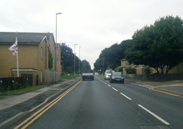
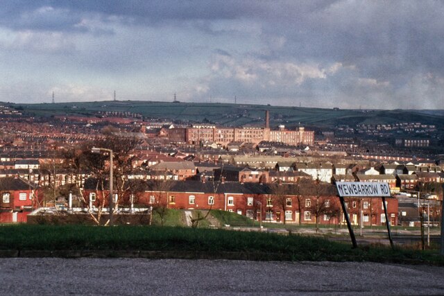
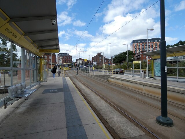
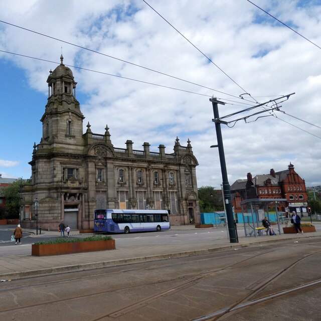
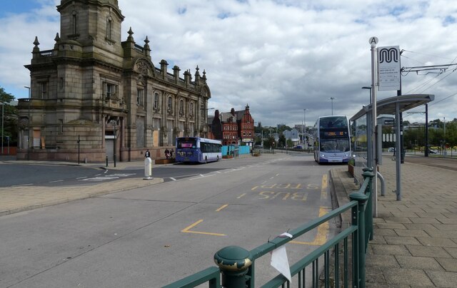
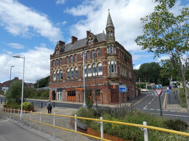
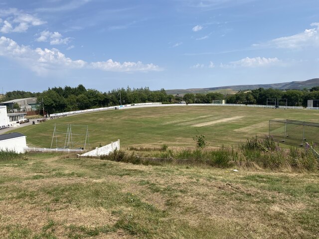
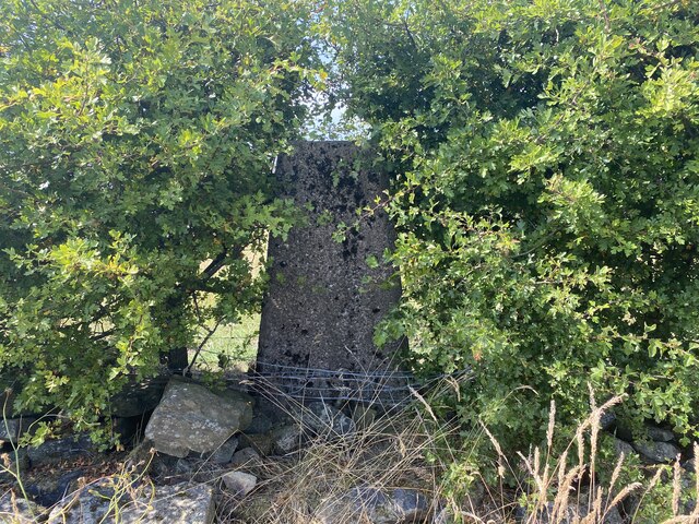
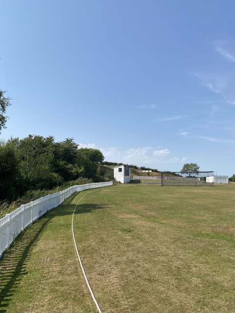
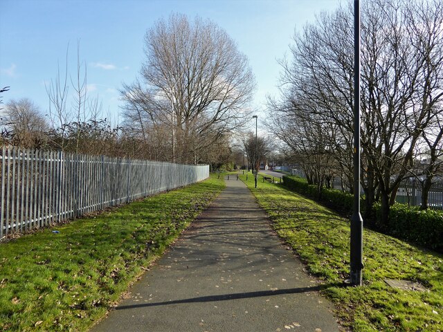
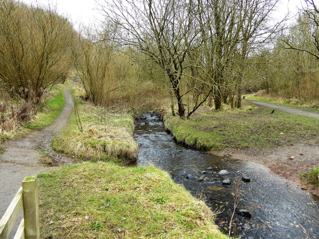
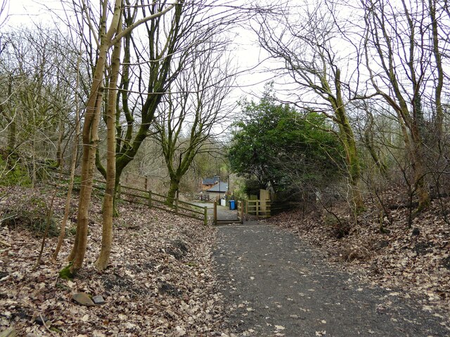
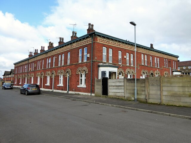
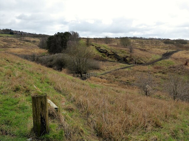
Top of Moor Images

Images are sourced within 2km of 53.546236/-2.0805807 or Grid Reference SD9405. Thanks to Geograph Open Source API. All images are credited.

A672 Ripponden Road at Collett Street
Egerton Street at Bridgewater Street, Mumps
Derker Mills, Oldham
Oldham Mumps Tram Stop 
A railway line from Manchester to Oldham was opened in 1847. In 1863 the line was extended to Rochdale. Railway operations ended on 3 October 2009, and the Oldham Loop Line was closed for conversion to Matrolink. The line was completely rebuilt, with all of the former infrastructure, including the former stations and station buildings demolished, and replaced, and overhead wiring added. The line was re-opened in phases: Tram services started on 13 June 2012 between Manchester and Oldham Mumps: As a temporary measure, until the town centre line was completed, the former railway line through Oldham Mumps was retained, and a temporary tram stop constructed in place of the former railway station. A permanent stop called Oldham Mumps was later opened on the town centre line in a different location. Services were extended to Shaw and Crompton on 16 December 2012, and to Rochdale Railway Station on 28 February 2013. The Oldham town centre line opened on 27 January 2014, allowing the section of former railway line, and temporary stop at Oldham Mumps to be permanently closed. The Rochdale town centre line opened on 31 March 2014.
Oldham Mumps Tram Stop
A railway line from Manchester to Oldham was opened in 1847. In 1863 the line was extended to Rochdale. Railway operations ended on 3 October 2009, and the Oldham Loop Line was closed for conversion to Matrolink. The line was completely rebuilt, with all of the former infrastructure, including the former stations and station buildings demolished, and replaced, and overhead wiring added. The line was re-opened in phases: Tram services started on 13 June 2012 between Manchester and Oldham Mumps: As a temporary measure, until the town centre line was completed, the former railway line through Oldham Mumps was retained, and a temporary tram stop constructed in place of the former railway station. A permanent stop called Oldham Mumps was later opened on the town centre line in a different location. Services were extended to Shaw and Crompton on 16 December 2012, and to Rochdale Railway Station on 28 February 2013. The Oldham town centre line opened on 27 January 2014, allowing the section of former railway line, and temporary stop at Oldham Mumps to be permanently closed. The Rochdale town centre line opened on 31 March 2014.
Former NatWest bank 
The Grade II listed former bank <span class="nowrap"><a title="https://historicengland.org.uk/listing/the-list/list-entry/1201682?section=official-list-entry" rel="nofollow ugc noopener" href="https://historicengland.org.uk/listing/the-list/list-entry/1201682?section=official-list-entry">Link</a><img style="margin-left:2px;" alt="External link" title="External link - shift click to open in new window" src="https://s1.geograph.org.uk/img/external.png" width="10" height="10"/></span> at Mumps dates from 1902. The bank, originally the Manchester and County, was created by renowned Manchester architects Mills & Murgatroyd. It featured a unique baroque copper-crowned tower and a polished red granite base. Inside, the banking hall housed a 50ft mahogany counter. The bank was taken over by NatWest in 1970. In 1995 it was closed when NatWest merged their Mumps and Yorkshire Street branches. It was put on the market for £170,000. Plans the following year to turn the building into a pub fell through. Several later refurbishment plans have also failed. The building is a focal point within the bus/metrolink tram interchange.
Former NatWest bank
The Grade II listed former bank LinkExternal link at Mumps dates from 1902. The bank, originally the Manchester and County, was created by renowned Manchester architects Mills & Murgatroyd. It featured a unique baroque copper-crowned tower and a polished red granite base. Inside, the banking hall housed a 50ft mahogany counter. The bank was taken over by NatWest in 1970. In 1995 it was closed when NatWest merged their Mumps and Yorkshire Street branches. It was put on the market for £170,000. Plans the following year to turn the building into a pub fell through. Several later refurbishment plans have also failed. The building is a focal point within the bus/metrolink tram interchange.
Mumps transport interchange 
Next to the Metrolink tram stop at Mumps are several bus stops. On the left is  the Grade II listed former NatWest bank <span class="nowrap"><a title="https://historicengland.org.uk/listing/the-list/list-entry/1201682?section=official-list-entry" rel="nofollow ugc noopener" href="https://historicengland.org.uk/listing/the-list/list-entry/1201682?section=official-list-entry">Link</a><img style="margin-left:2px;" alt="External link" title="External link - shift click to open in new window" src="https://s1.geograph.org.uk/img/external.png" width="10" height="10"/></span> <a href="https://www.geograph.org.uk/photo/7263233">SD9305 : Former NatWest bank</a>.
Mumps transport interchange
Next to the Metrolink tram stop at Mumps are several bus stops. On the left is the Grade II listed former NatWest bank LinkExternal link SD9305 : Former NatWest bank.
17-21 Mumps 
Only the ground floor of this three storey building are currently occupied. Before becoming Frango's this was Fusion 21. Before that the right hand portion had been Kava and the left hand portion  the site office for Westshield. Before Westshield that part had been The Hair Lounge. Around 2012 the right hand side was called  Langham House. In 2009 the building was home to a photography studio Xpressions. All the adjoining buildings towards Yorkshire Street were demolished around 2016. There are plans to convert the upper storeys into apartments.
17-21 Mumps
Only the ground floor of this three storey building are currently occupied. Before becoming Frango's this was Fusion 21. Before that the right hand portion had been Kava and the left hand portion the site office for Westshield. Before Westshield that part had been The Hair Lounge. Around 2012 the right hand side was called Langham House. In 2009 the building was home to a photography studio Xpressions. All the adjoining buildings towards Yorkshire Street were demolished around 2016. There are plans to convert the upper storeys into apartments.
Cricket Pitch
Cricket Pitch
Slack Hall Trig Point Flush Bracket S2785
Cricket Pitch
Cricket Pitch
Cycle path following route of former railway The path goes from Oldham to Grotton following the Oldham to Greenfield railway line. Much of the route is on infill such as here looking east from Glodwick Road, Oldham
Cycle path following route of former railway
The path goes from Oldham to Grotton following the Oldham to Greenfield railway line. Much of the route is on infill such as here looking east from Glodwick Road, Oldham
Cycle route following line of former railway This view across Cranbrook Street just off the path shows the route is on the top of infill, since only the bridge parapet is visible of the former railway bridge. The path is on the  former Oldham to Greenfield line.
Cycle route following line of former railway
This view across Cranbrook Street just off the path shows the route is on the top of infill, since only the bridge parapet is visible of the former railway bridge. The path is on the former Oldham to Greenfield line.
Cycle path following route of former railway The path is approaching the former railway bridge at St. John Street which is one of the few not infilled on the route. The path runs from Oldham to Grotton along the former line to Greenfield.
Cycle path following route of former railway
The path is approaching the former railway bridge at St. John Street which is one of the few not infilled on the route. The path runs from Oldham to Grotton along the former line to Greenfield.
Former Bank A listed building at Mumps
Former Bank
A listed building at Mumps
River Medlock at Lees View on the Medlock Valley Way from a footbridge
River Medlock at Lees
View on the Medlock Valley Way from a footbridge
The end of the cycle path View towards Old Mill Lane at Grotton. The cycle path has followed the route of the former Oldham to Greenfield railway but deviates here to join Old Mill Lane.
The end of the cycle path
View towards Old Mill Lane at Grotton. The cycle path has followed the route of the former Oldham to Greenfield railway but deviates here to join Old Mill Lane.
Block of historic houses, Albert Mount Block of houses with internal courtyard, dated to 1862, viewed from Bartlemore Street, Derker.
Block of historic houses, Albert Mount
Block of houses with internal courtyard, dated to 1862, viewed from Bartlemore Street, Derker.
Rocky outcrop in Hodge Clough Most of the tracks around the clough have been eroded (by off road motor bikes) as seen on the track leading away from the footbridge.
Rocky outcrop in Hodge Clough
Most of the tracks around the clough have been eroded (by off road motor bikes) as seen on the track leading away from the footbridge.
Show me another place!

Top of Moor is located at Grid Ref: SD9405 (Lat: 53.546236, Lng: -2.0805807)

Unitary Authority: Oldham

Police Authority: Greater Manchester

What 3 Words

///flats.covers.just. Near Shaw, Manchester

Related Wikis

Greenacres, Greater Manchester

Greenacres , archaically Greenacres Moor, is an area of Oldham, in Greater Manchester, England. It lies on the west side of the River Medlock opposite...

Waterhead, Greater Manchester

Waterhead (or archaically, Waterhead Mill), is an area of Oldham, and an electoral ward of the Metropolitan Borough of Oldham, in Greater Manchester, England...

Orme Mill, Waterhead

Orme Mill, Waterhead is a cotton spinning mill in Waterhead, Oldham, Greater Manchester, England. It was built in 1908. It was taken over by the Lancashire...

Majestic Mill, Waterhead

Majestic Mill, Waterhead is a cotton spinning mill in Waterhead, Oldham, Greater Manchester. It was built in 1903. It was taken over by the Lancashire...

Waterhead Academy

Waterhead Academy is a coeducational secondary school with academy status located in Oldham, Greater Manchester, England. The academy was taken out of...

Crossbank

Crossbank is an area of Lees, a village in the Metropolitan Borough of Oldham, Greater Manchester, England. Historically a part of Lancashire, the name...

Salem Moravian Church

Salem Moravian Church was founded in Oldham, Lancashire, England in 1825 by John Lees. Br Lees, who lived in the Clarksfield area of Oldham, was associated...

Asa Lees

Asa Lees was a firm of textile machine manufacturers in Oldham, Lancashire. Their headquarters was the Soho Iron Works, Greenacres. It was second only...

Nearby Amenities

Located within 500m of 53.546236,-2.0805807
Pub
The Carrion Crow
Addr City: Oldham
Addr Housename: The Carrion Crow
Addr Housenumber: 271
Addr Postcode: OL4 2RJ
Addr Street: Huddersfield Road
Brand: Marston's
Brand Wikidata: Q6773982
Website: https://www.carrioncrowoldham.co.uk/
Lat/Long: 53.5482024/-2.0860977
Pub
Farmers Boy
Addr City: Oldham
Addr Housenumber: 250-252
Addr Postcode: OL4 2RB
Addr Street: Huddersfield Road
Fhrs Id: 78545
Fixme Addr2: 250-252 Huddersfield Road A62
Source Addr: FHRS Open Data
Lat/Long: 53.5481282/-2.0853167
Pub
Plough Inn
Lat/Long: 53.5491275/-2.0811444
Fuel
Shell
Addr Postcode: OL4 2HN
Brand: Shell
Brand Wikidata: Q110716465
Phone: +44 161 628 1910
Ref Navads: NVDS353_10019242
Website: https://find.shell.com/gb/fuel/10019242-two-counties-service-station
Lat/Long: 53.5494531/-2.0791321
Bus Stop
Greenacres, Greenacres Road / near Windermere Walk
Bus: yes
Naptan AtcoCode: 1800ED03081
Naptan Bearing: E
Naptan CommonName: Greenacres Road/Windermere Walk
Naptan Indicator: O/s Flats
Naptan Landmark: FLATS
Naptan NaptanCode: manajwpt
Naptan PlusbusZoneRef: MNCRPIC
Naptan ShortCommonName: Windermere Walk
Naptan Street: GREENACRES ROAD
Naptan Verified: no
Network: TfGM
Operator: TfGM
Public Transport: platform
Source: naptan_import
Lat/Long: 53.5452594/-2.0840754
Bus Stop
Top of Moor, Greenacres Road / opposite Cotton Tree Close
Bus: yes
Naptan AtcoCode: 1800ED07821
Naptan Bearing: SW
Naptan CommonName: Greenacres Road/Cotton Tree Close
Naptan Indicator: O/s House 2
Naptan Landmark: GREENACRE LODGE
Naptan NaptanCode: mantgjma
Naptan PlusbusZoneRef: MNCRPIC
Naptan ShortCommonName: Cotton Tree Close
Naptan Street: GREENACRES ROAD
Naptan Verified: no
Network: TfGM
Operator: TfGM
Public Transport: platform
Source: naptan_import
Lat/Long: 53.5472686/-2.0770162
Bus Stop
Greenacres, Greenacres Road / opposite Dunkerley Street
Bus: yes
Naptan AtcoCode: 1800ED19021
Naptan Bearing: W
Naptan CommonName: Greenacres Road/Dunkerley Street
Naptan Indicator: O/s Playground
Naptan Landmark: PLAYGROUND
Naptan NaptanCode: manapwam
Naptan PlusbusZoneRef: MNCRPIC
Naptan ShortCommonName: Dunkerley Street
Naptan Street: GREENACRES ROAD
Naptan Verified: no
Network: TfGM
Operator: TfGM
Public Transport: platform
Source: naptan_import
Lat/Long: 53.544718/-2.0870625
Bus Stop
Greenacres, Greenacres Road / outside Greenacres Cemetery
Bus: yes
Naptan AtcoCode: 1800ED19031
Naptan Bearing: W
Naptan CommonName: Greenacres Road/Greenacres Cemetery
Naptan Indicator: Cemetery
Naptan Landmark: CEMETERY
Naptan NaptanCode: manapwap
Naptan PlusbusZoneRef: MNCRPIC
Naptan ShortCommonName: Cemetery
Naptan Street: GREENACRES ROAD
Naptan Verified: no
Network: TfGM
Operator: TfGM
Public Transport: platform
Source: naptan_import
Lat/Long: 53.5454761/-2.0827327
Bus Stop
Greenacres, Greenacres Road / opposite Greenacres Cemetery
Bus: yes
Naptan AtcoCode: 1800ED19041
Naptan Bearing: E
Naptan CommonName: Greenacres Road/Greenacres Cemetery
Naptan Indicator: Green Acres Pub
Naptan Landmark: GREEN ACRES PUB
Naptan NaptanCode: manapwat
Naptan PlusbusZoneRef: MNCRPIC
Naptan ShortCommonName: Cemetery
Naptan Street: GREENACRES ROAD
Naptan Verified: no
Network: TfGM
Operator: TfGM
Public Transport: platform
Source: naptan_import
Lat/Long: 53.5459083/-2.0816771
Bus Stop
Top of Moor, Greenacres Road / opposite Sycamore Avenue
Bus: yes
Naptan AtcoCode: 1800ED19051
Naptan Bearing: W
Naptan CommonName: Greenacres Road/Sycamore Avenue
Naptan Indicator: O/s House 246
Naptan Landmark: HOUSE 246
Naptan NaptanCode: manapwaw
Naptan PlusbusZoneRef: MNCRPIC
Naptan ShortCommonName: Sycamore Avenue
Naptan Street: GREENACRES ROAD
Naptan Verified: no
Network: TfGM
Operator: TfGM
Public Transport: platform
Shelter: yes
Source: naptan_import
Lat/Long: 53.5464837/-2.0790587
Bus Stop
Top of Moor, Greenacres Road / near Sycamore Avenue
Bus: yes
Naptan AtcoCode: 1800ED19061
Naptan Bearing: E
Naptan CommonName: Greenacres Road/Sycamore Avenue
Naptan Indicator: O/s House 327
Naptan Landmark: HOUSE 327
Naptan NaptanCode: manapwda
Naptan PlusbusZoneRef: MNCRPIC
Naptan ShortCommonName: Sycamore Avenue
Naptan Street: GREENACRES ROAD
Naptan Verified: no
Network: TfGM
Operator: TfGM
Public Transport: platform
Source: naptan_import
Lat/Long: 53.546548/-2.0793391
Bus Stop
Top of Moor, Greenacres Road / near Cotton Tree Close
Bus: yes
Naptan AtcoCode: 1800ED11011
Naptan Bearing: NE
Naptan CommonName: Greenacres Road/Cotton Tree Close
Naptan Indicator: O/s House 2
Naptan Landmark: HOUSE 2
Naptan NaptanCode: manampap
Naptan PlusbusZoneRef: MNCRPIC
Naptan ShortCommonName: Cotton Tree Close
Naptan Street: GREENACRES ROAD
Naptan Verified: no
Network: TfGM
Operator: TfGM
Public Transport: platform
Source: naptan_import
Lat/Long: 53.5473225/-2.0771672
Bus Stop
Greenacres, Huddersfield Road / Spring Street (Stop E)
Bus: yes
Local Ref: E
Naptan AtcoCode: 1800ED30541
Naptan Bearing: E
Naptan CommonName: Huddersfield Road/Spring Street (E)
Naptan Indicator: Stop E
Naptan Landmark: OS FLATS 1-69
Naptan NaptanCode: manatmjt
Naptan PlusbusZoneRef: MNCRPIC
Naptan ShortCommonName: Spring Street
Naptan Street: Huddersfield Road
Naptan Verified: no
Network: TfGM
Operator: TfGM
Public Transport: platform
Ref: E
Shelter: yes
Source: naptan_import
Lat/Long: 53.5479427/-2.0872969
Bus Stop
Greenacres, Huddersfield Road / Spring Street (Stop F)
Bus: yes
Local Ref: F
Naptan AtcoCode: 1800ED30551
Naptan Bearing: W
Naptan CommonName: Huddersfield Road/Spring Street (F)
Naptan Indicator: Stop F
Naptan Landmark: NR OPEN LAND
Naptan NaptanCode: manatmjw
Naptan PlusbusZoneRef: MNCRPIC
Naptan ShortCommonName: Spring Street
Naptan Street: Huddersfield Road
Naptan Verified: no
Network: TfGM
Operator: TfGM
Public Transport: platform
Ref: F
Shelter: yes
Source: naptan_import
Lat/Long: 53.5479153/-2.0866507
Bus Stop
Waterhead, Huddersfield Road / near Sharples Hall Street
Bus: yes
Naptan AtcoCode: 1800ED30561
Naptan Bearing: E
Naptan CommonName: Huddersfield Road/Sharples Hall Street
Naptan Indicator: O/s House 397
Naptan Landmark: HOUSE 391
Naptan NaptanCode: manatmpa
Naptan Notes: LOCATION AMENDED
Naptan PlusbusZoneRef: MNCRPIC
Naptan ShortCommonName: Sharples Hall Str
Naptan Street: Huddersfield Road
Naptan Verified: no
Network: TfGM
Operator: TfGM
Public Transport: platform
Source: naptan_import
Lat/Long: 53.5490092/-2.0818491
Bus Stop
Waterhead, Huddersfield Road / opposite Sharples Hall Street
Bus: yes
Naptan AtcoCode: 1800ED30571
Naptan Bearing: W
Naptan CommonName: Huddersfield Road/Sharples Hall Street
Naptan Indicator: Opp House 389
Naptan Landmark: HOUSE 387
Naptan NaptanCode: manatmpd
Naptan PlusbusZoneRef: MNCRPIC
Naptan ShortCommonName: Sharples Hall Str
Naptan Street: Huddersfield Road
Naptan Verified: no
Network: TfGM
Operator: TfGM
Public Transport: platform
Source: naptan_import
Lat/Long: 53.5488564/-2.0818639
Bus Stop
Waterhead, Huddersfield Road / near Heywood Street
Bus: yes
Naptan AtcoCode: 1800ED30581
Naptan Bearing: W
Naptan CommonName: Huddersfield Road/Heywood Street
Naptan Indicator: Springhill Crt
Naptan Landmark: SPRINGHILL CRT
Naptan NaptanCode: manatmpg
Naptan PlusbusZoneRef: MNCRPIC
Naptan ShortCommonName: Heywood Street
Naptan Street: Huddersfield Road
Naptan Verified: no
Network: TfGM
Operator: TfGM
Public Transport: platform
Source: naptan_import
Lat/Long: 53.5493626/-2.0776086
Bus Stop
Waterhead, Huddersfield Road / near Cobden Street
Bus: yes
Naptan AtcoCode: 1800ED30591
Naptan Bearing: E
Naptan CommonName: Huddersfield Road/Cobden Street
Naptan Indicator: Coach & Horses
Naptan Landmark: FLATS
Naptan NaptanCode: manatmpj
Naptan Notes: STOP MOVED
Naptan PlusbusZoneRef: MNCRPIC
Naptan ShortCommonName: Cobden Street
Naptan Street: Huddersfield Road
Naptan Verified: no
Network: TfGM
Operator: TfGM
Public Transport: platform
Source: naptan_import
Lat/Long: 53.5496512/-2.0760998
Traffic Calming: cushion
Lat/Long: 53.5452855/-2.0836485
Traffic Calming: table
Lat/Long: 53.5447116/-2.0876164
Noexit: yes
Lat/Long: 53.5449904/-2.0782154
Traffic Calming: hump
Lat/Long: 53.5486537/-2.0868638
Barrier: bollard
Lat/Long: 53.5459108/-2.0869751
Noexit: yes
Lat/Long: 53.5484741/-2.085889
Turning Circle
Lat/Long: 53.5450224/-2.0873418
Noexit: yes
Lat/Long: 53.5490163/-2.0848008
Mini Roundabout
Direction: clockwise
Lat/Long: 53.545668/-2.0821278
Turning Circle
Lat/Long: 53.5447566/-2.0775345
Noexit: yes
Lat/Long: 53.54458/-2.0788744
Noexit: yes
Lat/Long: 53.545818/-2.0815491
Generator Method: photovoltaic
Generator Output Electricity: yes
Generator Source: solar
Generator Type: solar_photovoltaic_panel
Location: roof
Power: generator
Lat/Long: 53.5470192/-2.0879962
Generator Method: photovoltaic
Generator Output Electricity: yes
Generator Source: solar
Generator Type: solar_photovoltaic_panel
Location: roof
Power: generator
Lat/Long: 53.5482301/-2.0827592
Noexit: yes
Lat/Long: 53.5487984/-2.084147
Noexit: yes
Lat/Long: 53.5482736/-2.0866179
Barrier: bollard
Motor Vehicle: no
Lat/Long: 53.5484969/-2.083665
Historic: memorial
Lat/Long: 53.5493121/-2.0767439
Barrier: bollard
Lat/Long: 53.5452149/-2.0869744
Crossing
Crossing: traffic_signals
Crossing Island: yes
Crossing Ref: toucan
Tactile Paving: yes
Lat/Long: 53.5481536/-2.0857924
Crossing
Crossing: unmarked
Crossing Island: yes
Tactile Paving: yes
Lat/Long: 53.5477837/-2.0876713
Crossing
Crossing: unmarked
Crossing Island: yes
Tactile Paving: no
Lat/Long: 53.5480387/-2.0863431
Traffic Signals
Traffic Signals: crossing
Traffic Signals Direction: forward
Lat/Long: 53.5481676/-2.0857196
Traffic Signals
Traffic Signals: crossing
Traffic Signals Direction: backward
Lat/Long: 53.5481393/-2.0858618
Crossing
Crossing: unmarked
Crossing Island: no
Tactile Paving: no
Lat/Long: 53.5481366/-2.0862562
Noexit: yes
Lat/Long: 53.5483033/-2.0841757
Crossing
Crossing: unmarked
Crossing Island: no
Tactile Paving: yes
Lat/Long: 53.5480027/-2.0859533
Noexit: yes
Lat/Long: 53.5452707/-2.0859504
Noexit: yes
Lat/Long: 53.5450707/-2.0865081
Traffic Calming: cushion
Lat/Long: 53.5448378/-2.0863913
Traffic Calming: table
Lat/Long: 53.5449677/-2.0854391
Traffic Calming: cushion
Lat/Long: 53.545112/-2.0846006
Traffic Calming: cushion
Lat/Long: 53.545523/-2.0826802
Barrier: bollard
Lat/Long: 53.5460003/-2.0829415
Noexit: yes
Lat/Long: 53.5447367/-2.0782572
Noexit: yes
Lat/Long: 53.5452879/-2.0823871
Traffic Calming: hump
Lat/Long: 53.5491682/-2.0862754
Noexit: yes
Lat/Long: 53.5482268/-2.0868435
Addr City: Oldham
Addr Housenumber: 274
Addr Postcode: OL4 2RH
Addr Street: Littlemoor Lane
Lat/Long: 53.5480051/-2.0874665
Addr City: Oldham
Addr Housenumber: 270
Addr Postcode: OL4 2RH
Addr Street: Littlemoor Lane
Lat/Long: 53.5480496/-2.0874908
Addr City: Oldham
Addr Housenumber: 268
Addr Postcode: OL4 2RH
Addr Street: Littlemoor Lane
Lat/Long: 53.5480996/-2.0874722
Addr City: Oldham
Addr Housenumber: 272
Addr Postcode: OL4 2RH
Addr Street: Littlemoor Lane
Lat/Long: 53.548056/-2.0874497
Addr City: Oldham
Addr Housenumber: 276
Addr Postcode: OL4 2RH
Addr Street: Littlemoor Lane
Lat/Long: 53.5480117/-2.0874301
Noexit: yes
Lat/Long: 53.5480725/-2.0870158
Addr City: Oldham
Addr Housenumber: 236
Addr Postcode: OL4 2RH
Addr Street: Littlemoor Lane
Lat/Long: 53.5483823/-2.0871927
Addr City: Oldham
Addr Housenumber: 222
Addr Postcode: OL4 2RH
Addr Street: Littlemoor Lane
Lat/Long: 53.5483888/-2.0871642
Addr City: Oldham
Addr Housenumber: 210
Addr Postcode: OL4 2RH
Addr Street: Littlemoor Lane
Lat/Long: 53.5483938/-2.0871303
Addr City: Oldham
Addr Housenumber: 238
Addr Postcode: OL4 2RH
Addr Street: Littlemoor Lane
Lat/Long: 53.5483487/-2.0871723
Addr City: Oldham
Addr Housenumber: 224
Addr Postcode: OL4 2RH
Addr Street: Littlemoor Lane
Lat/Long: 53.5483551/-2.0871438
Addr City: Oldham
Addr Housenumber: 212
Addr Postcode: OL4 2RH
Addr Street: Littlemoor Lane
Lat/Long: 53.5483611/-2.087113
Addr City: Oldham
Addr Housenumber: 240
Addr Postcode: OL4 2RH
Addr Street: Littlemoor Lane
Lat/Long: 53.5483062/-2.0871454
Addr City: Oldham
Addr Housenumber: 226
Addr Postcode: OL4 2RH
Addr Street: Littlemoor Lane
Lat/Long: 53.5483126/-2.0871169
Addr City: Oldham
Addr Housenumber: 214
Addr Postcode: OL4 2RH
Addr Street: Littlemoor Lane
Lat/Long: 53.5483185/-2.0870861
Addr City: Oldham
Addr Housenumber: 242
Addr Postcode: OL4 2RH
Addr Street: Littlemoor Lane
Lat/Long: 53.548265/-2.0871184
Addr City: Oldham
Addr Housenumber: 228
Addr Postcode: OL4 2RH
Addr Street: Littlemoor Lane
Lat/Long: 53.5482714/-2.0870899
Addr City: Oldham
Addr Housenumber: 216
Addr Postcode: OL4 2RH
Addr Street: Littlemoor Lane
Lat/Long: 53.5482778/-2.0870618
Addr City: Oldham
Addr Housenumber: 244
Addr Postcode: OL4 2RH
Addr Street: Littlemoor Lane
Lat/Long: 53.5482256/-2.0870976
Addr City: Oldham
Addr Housenumber: 230
Addr Postcode: OL4 2RH
Addr Street: Littlemoor Lane
Lat/Long: 53.548232/-2.0870691
Addr City: Oldham
Addr Housenumber: 218
Addr Postcode: OL4 2RH
Addr Street: Littlemoor Lane
Lat/Long: 53.548238/-2.0870383
Addr City: Oldham
Addr Housenumber: 246
Addr Postcode: OL4 2RH
Addr Street: Littlemoor Lane
Lat/Long: 53.548184/-2.0870714
Addr City: Oldham
Addr Housenumber: 232
Addr Postcode: OL4 2RH
Addr Street: Littlemoor Lane
Lat/Long: 53.5481904/-2.0870429
Addr City: Oldham
Addr Housenumber: 220
Addr Postcode: OL4 2RH
Addr Street: Littlemoor Lane
Lat/Long: 53.5481963/-2.0870121
Addr City: Oldham
Addr Housenumber: 248
Addr Postcode: OL4 2RH
Addr Street: Littlemoor Lane
Lat/Long: 53.548151/-2.0870514
Addr City: Oldham
Addr Housenumber: 234
Addr Postcode: OL4 2RH
Addr Street: Littlemoor Lane
Lat/Long: 53.5481574/-2.0870229
Addr City: Oldham
Addr Housenumber: 250
Addr Postcode: OL4 2RH
Addr Street: Littlemoor Lane
Lat/Long: 53.5481073/-2.0870283
Addr City: Oldham
Addr Housenumber: 170
Addr Postcode: OL4 2RH
Addr Street: Littlemoor Lane
Lat/Long: 53.5484978/-2.0866399
Addr City: Oldham
Addr Housenumber: 172
Addr Postcode: OL4 2RH
Addr Street: Littlemoor Lane
Lat/Long: 53.548463/-2.0866164
Addr City: Oldham
Addr Housenumber: 174
Addr Postcode: OL4 2RH
Addr Street: Littlemoor Lane
Lat/Long: 53.548425/-2.086591
Addr City: Oldham
Addr Housenumber: 176
Addr Postcode: OL4 2RH
Addr Street: Littlemoor Lane
Lat/Long: 53.5483869/-2.0865686
Addr City: Oldham
Addr Housenumber: 178
Addr Postcode: OL4 2RH
Addr Street: Littlemoor Lane
Lat/Long: 53.5483428/-2.0865442
Addr City: Oldham
Addr Housenumber: 180
Addr Postcode: OL4 2RH
Addr Street: Littlemoor Lane
Lat/Long: 53.5483018/-2.0865198
Addr City: Oldham
Addr Housenumber: 182
Addr Postcode: OL4 2RH
Addr Street: Littlemoor Lane
Lat/Long: 53.5485079/-2.0866032
Addr City: Oldham
Addr Housenumber: 184
Addr Postcode: OL4 2RH
Addr Street: Littlemoor Lane
Lat/Long: 53.5484731/-2.0865797
Addr City: Oldham
Addr Housenumber: 186
Addr Postcode: OL4 2RH
Addr Street: Littlemoor Lane
Lat/Long: 53.548435/-2.0865543
Addr City: Oldham
Addr Housenumber: 188
Addr Postcode: OL4 2RH
Addr Street: Littlemoor Lane
Lat/Long: 53.548397/-2.086532
Addr City: Oldham
Addr Housenumber: 190
Addr Postcode: OL4 2RH
Addr Street: Littlemoor Lane
Lat/Long: 53.5483529/-2.0865076
Addr City: Oldham
Addr Housenumber: 192
Addr Postcode: OL4 2RH
Addr Street: Littlemoor Lane
Lat/Long: 53.5483118/-2.0864832
Addr City: Oldham
Addr Housenumber: 196
Addr Postcode: OL4 2RH
Addr Street: Littlemoor Lane
Lat/Long: 53.5485188/-2.0865626
Addr City: Oldham
Addr Housenumber: 198
Addr Postcode: OL4 2RH
Addr Street: Littlemoor Lane
Lat/Long: 53.5484839/-2.0865391
Addr City: Oldham
Addr Housenumber: 200
Addr Postcode: OL4 2RH
Addr Street: Littlemoor Lane
Lat/Long: 53.5484459/-2.0865137
Addr City: Oldham
Addr Housenumber: 202
Addr Postcode: OL4 2RH
Addr Street: Littlemoor Lane
Lat/Long: 53.5484079/-2.0864913
Addr City: Oldham
Addr Housenumber: 204
Addr Postcode: OL4 2RH
Addr Street: Littlemoor Lane
Lat/Long: 53.5483638/-2.0864669
Addr City: Oldham
Addr Housenumber: 206
Addr Postcode: OL4 2RH
Addr Street: Littlemoor Lane
Lat/Long: 53.5483227/-2.0864425
Addr City: Oldham
Addr Housenumber: 194
Addr Postcode: OL4 2RH
Addr Street: Littlemoor Lane
Lat/Long: 53.5482734/-2.0864578
Addr City: Oldham
Addr Housenumber: 208
Addr Postcode: OL4 2RH
Addr Street: Littlemoor Lane
Lat/Long: 53.5482825/-2.0864212
Clinic
Springfield House Medical Centre
Addr City: Oldham
Addr Housename: Springfield House Medical Centre
Addr Housenumber: 275
Addr Postcode: OL4 2RJ
Addr Street: Huddersfield Road
Healthcare: clinic
Operator: NHS
Operator Type: public
Operator Wikidata: Q918396
Lat/Long: 53.5482847/-2.0858435
Traffic Calming: island
Lat/Long: 53.5483624/-2.0847853
Noexit: yes
Lat/Long: 53.5469235/-2.088014
Noexit: yes
Lat/Long: 53.5471531/-2.0873275
Noexit: yes
Lat/Long: 53.5471628/-2.08728
Community Centre
Neon Hub
Addr City: Oldham
Addr Postcode: OL4 2DQ
Addr Street: Holt Street
Website: http://neonoldham.co.uk/
Lat/Long: 53.5470252/-2.0880235
Noexit: yes
Lat/Long: 53.5473011/-2.0870191
Addr City: Oldham
Addr Housenumber: 18
Addr Postcode: OL4 2DH
Addr Street: Mevagissey Walk
Lat/Long: 53.5472654/-2.0879364
Addr City: Oldham
Addr Housenumber: 19
Addr Postcode: OL4 2DH
Addr Street: Mevagissey Walk
Lat/Long: 53.547278/-2.0879019
Addr City: Oldham
Addr Housenumber: 21
Addr Postcode: OL4 2DH
Addr Street: Mevagissey Walk
Lat/Long: 53.547309/-2.0878244
Addr City: Oldham
Addr Housenumber: 20
Addr Postcode: OL4 2DH
Addr Street: Mevagissey Walk
Lat/Long: 53.5472964/-2.0878589
Addr City: Oldham
Addr Housenumber: 23
Addr Postcode: OL4 2DH
Addr Street: Mevagissey Walk
Lat/Long: 53.5473448/-2.0877324
Addr City: Oldham
Addr Housenumber: 22
Addr Postcode: OL4 2DH
Addr Street: Mevagissey Walk
Lat/Long: 53.5473322/-2.0877669
Addr City: Oldham
Addr Housenumber: 25
Addr Postcode: OL4 2DH
Addr Street: Mevagissey Walk
Lat/Long: 53.5473768/-2.0876563
Addr City: Oldham
Addr Housenumber: 24
Addr Postcode: OL4 2DH
Addr Street: Mevagissey Walk
Lat/Long: 53.5473642/-2.0876908
Addr City: Oldham
Addr Housenumber: 27
Addr Postcode: OL4 2DH
Addr Street: Mevagissey Walk
Lat/Long: 53.547482/-2.0875984
Addr City: Oldham
Addr Housenumber: 26
Addr Postcode: OL4 2DH
Addr Street: Mevagissey Walk
Lat/Long: 53.5474567/-2.0875709
Addr City: Oldham
Addr Housenumber: 28
Addr Postcode: OL4 2DH
Addr Street: Mevagissey Walk
Lat/Long: 53.5475051/-2.0876289
Addr City: Oldham
Addr Housenumber: 29
Addr Postcode: OL4 2DH
Addr Street: Mevagissey Walk
Lat/Long: 53.5475303/-2.0876563
Addr City: Oldham
Addr Housenumber: 30
Addr Postcode: OL4 2DH
Addr Street: Mevagissey Walk
Lat/Long: 53.5475593/-2.0876961
Addr City: Oldham
Addr Housenumber: 31
Addr Postcode: OL4 2DH
Addr Street: Mevagissey Walk
Lat/Long: 53.5475845/-2.0877236
Noexit: yes
Lat/Long: 53.5494866/-2.0857057
Noexit: yes
Lat/Long: 53.5491828/-2.0847974
Noexit: yes
Lat/Long: 53.5448774/-2.0873636
Noexit: yes
Lat/Long: 53.5452853/-2.087333
Noexit: yes
Lat/Long: 53.5454588/-2.087684
Noexit: yes
Lat/Long: 53.5456415/-2.0872453
Addr City: Oldham
Addr Housenumber: 8
Addr Postcode: OL4 2AZ
Addr Street: Milk Street
Lat/Long: 53.5453793/-2.0879725
Addr City: Oldham
Addr Housenumber: 6
Addr Postcode: OL4 2AZ
Addr Street: Milk Street
Lat/Long: 53.5454011/-2.0879993
Addr City: Oldham
Addr Housenumber: 10
Addr Postcode: OL4 2AZ
Addr Street: Milk Street
Lat/Long: 53.5453529/-2.0879443
Addr City: Oldham
Addr Housenumber: 12
Addr Postcode: OL4 2AZ
Addr Street: Milk Street
Lat/Long: 53.5453311/-2.0879175
Traffic Calming: island
Lat/Long: 53.548605/-2.0835772
Traffic Calming: island
Lat/Long: 53.5488324/-2.0824279
Addr City: Oldham
Addr Housename: Bedford Mill
Addr Postcode: OL4 2DQ
Addr Street: Holt Street
Lat/Long: 53.5465294/-2.0878236
Addr City: Oldham
Addr Housenumber: 41
Addr Postcode: OL4 2BA
Addr Street: Mortar Street
Lat/Long: 53.5453339/-2.0878254
Addr City: Oldham
Addr Housenumber: 39
Addr Postcode: OL4 2BA
Addr Street: Mortar Street
Lat/Long: 53.545312/-2.0878033
Addr City: Oldham
Addr Housenumber: 37
Addr Postcode: OL4 2BA
Addr Street: Mortar Street
Lat/Long: 53.5452867/-2.0877707
Addr City: Oldham
Addr Housenumber: 35
Addr Postcode: OL4 2BA
Addr Street: Mortar Street
Lat/Long: 53.5452648/-2.0877486
Addr City: Oldham
Addr Housenumber: 33
Addr Postcode: OL4 2BA
Addr Street: Mortar Street
Lat/Long: 53.5452353/-2.0877325
Addr City: Oldham
Addr Housenumber: 31
Addr Postcode: OL4 2BA
Addr Street: Mortar Street
Lat/Long: 53.5452134/-2.0877104
Addr City: Oldham
Addr Housenumber: 29
Addr Postcode: OL4 2BA
Addr Street: Mortar Street
Lat/Long: 53.5451879/-2.0876775
Addr City: Oldham
Addr Housenumber: 27
Addr Postcode: OL4 2BA
Addr Street: Mortar Street
Lat/Long: 53.545166/-2.0876554
Addr City: Oldham
Addr Housenumber: 25
Addr Postcode: OL4 2BA
Addr Street: Mortar Street
Lat/Long: 53.5450888/-2.0874803
Addr City: Oldham
Addr Housenumber: 23
Addr Postcode: OL4 2BA
Addr Street: Mortar Street
Lat/Long: 53.5450761/-2.0875176
Addr City: Oldham
Addr Housenumber: 21
Addr Postcode: OL4 2BA
Addr Street: Mortar Street
Lat/Long: 53.545034/-2.0876035
Addr City: Oldham
Addr Housenumber: 19
Addr Postcode: OL4 2BA
Addr Street: Mortar Street
Lat/Long: 53.5450121/-2.0875813
Addr City: Oldham
Addr Housenumber: 17
Addr Postcode: OL4 2BA
Addr Street: Mortar Street
Lat/Long: 53.5449893/-2.087553
Addr City: Oldham
Addr Housenumber: 15
Addr Postcode: OL4 2BA
Addr Street: Mortar Street
Lat/Long: 53.5449674/-2.0875309
Addr City: Oldham
Addr Housenumber: 11
Addr Postcode: OL4 2BA
Addr Street: Mortar Street
Lat/Long: 53.5449357/-2.0875141
Addr City: Oldham
Addr Housenumber: 9
Addr Postcode: OL4 2BA
Addr Street: Mortar Street
Lat/Long: 53.5449138/-2.087492
Addr City: Oldham
Addr Housenumber: 7
Addr Postcode: OL4 2BA
Addr Street: Mortar Street
Lat/Long: 53.5448837/-2.0874619
Addr City: Oldham
Addr Housenumber: 5
Addr Postcode: OL4 2BA
Addr Street: Mortar Street
Lat/Long: 53.5448618/-2.0874398
Addr City: Oldham
Addr Housenumber: 3
Addr Postcode: OL4 2BA
Addr Street: Mortar Street
Lat/Long: 53.5448927/-2.0873359
Addr City: Oldham
Addr Housenumber: 1
Addr Postcode: OL4 2BA
Addr Street: Mortar Street
Lat/Long: 53.5449053/-2.0872986
Noexit: yes
Lat/Long: 53.5449429/-2.0866215
Place Of Worship
Elim Fountain of Hope
Addr City: Oldham
Addr Housename: Elim Fountain of Hope
Addr Postcode: OL4 2AB
Addr Street: Greenacres Road
Denomination: pentecostal
Religion: christian
Website: https://elimfoh.org.uk/
Lat/Long: 53.5450255/-2.0867919
Noexit: yes
Lat/Long: 53.5461671/-2.0871854
Noexit: yes
Lat/Long: 53.5460194/-2.0874832
Just Motors UK
Addr City: Oldham
Addr Postcode: OL4 2BW
Addr Street: Cedar Street
Second Hand: only
Shop: car
Lat/Long: 53.5460137/-2.0870616
Traffic Calming: chicane
Lat/Long: 53.5442843/-2.0773254
Addr City: Oldham
Addr Housenumber: 1
Addr Postcode: OL4 2DH
Addr Street: Mevagissey Walk
Lat/Long: 53.5472613/-2.0874767
Addr City: Oldham
Addr Housenumber: 2
Addr Postcode: OL4 2DH
Addr Street: Mevagissey Walk
Lat/Long: 53.5472499/-2.0875047
Addr City: Oldham
Addr Housenumber: 4
Addr Postcode: OL4 2DH
Addr Street: Mevagissey Walk
Lat/Long: 53.5472206/-2.0876208
Addr City: Oldham
Addr Housenumber: 3
Addr Postcode: OL4 2DH
Addr Street: Mevagissey Walk
Lat/Long: 53.547232/-2.0875928
Addr City: Oldham
Addr Housenumber: 6
Addr Postcode: OL4 2DH
Addr Street: Mevagissey Walk
Lat/Long: 53.5471866/-2.0877032
Addr City: Oldham
Addr Housenumber: 5
Addr Postcode: OL4 2DH
Addr Street: Mevagissey Walk
Lat/Long: 53.547198/-2.0876751
Addr City: Oldham
Addr Housenumber: 7
Addr Postcode: OL4 2DH
Addr Street: Mevagissey Walk
Lat/Long: 53.5471523/-2.0877936
Addr City: Oldham
Addr Housenumber: 8
Addr Postcode: OL4 2DH
Addr Street: Mevagissey Walk
Lat/Long: 53.5471637/-2.0877656
Noexit: yes
Lat/Long: 53.5471729/-2.0872215
Addr City: Oldham
Addr Flats: 1-41
Addr Housename: Trevarrick Court
Addr Postcode: OL4 2BB
Addr Street: Greenwood Street
Lat/Long: 53.5477544/-2.086531
Noexit: yes
Lat/Long: 53.5479012/-2.0854768
Addr City: Oldham
Addr Housenumber: 248
Addr Postcode: OL4 2RB
Addr Street: Huddersfield Road
Lat/Long: 53.5481122/-2.0854462
Fast Food
Happy Family
Addr City: Oldham
Addr Housenumber: 246
Addr Postcode: OL4 2RB
Addr Street: Huddersfield Road
Cuisine: chinese
Lat/Long: 53.5480956/-2.0855169
Dentist
Jackson's Dental Care
Addr City: Oldham
Addr Housenumber: 244
Addr Postcode: OL4 2RB
Addr Street: Huddersfield Road
Healthcare: dentist
Lat/Long: 53.5480839/-2.0855729
Pharmacy
Well Pharmacy
Addr City: Oldham
Addr Housenumber: 242
Addr Postcode: OL4 2RB
Addr Street: Huddersfield Road
Brand: Well Pharmacy
Brand Wikidata: Q7726524
Healthcare: pharmacy
Lat/Long: 53.5480696/-2.0856319
Asda
Addr City: Oldham
Addr Country: GB
Addr Housename: Asda Stores Ltd
Addr Postcode: OL4 2RB
Addr Street: Huddersfield Road
Brand: Asda
Brand Wikidata: Q297410
Brand Wikipedia: en:Asda
Contact Website: https://storelocator.asda.com/north-west/oldham/huddersfield-road
Fhrs Id: 118545
Operator: Asda Stores Ltd
Shop: supermarket
Lat/Long: 53.5482024/-2.0843414
Noexit: yes
Lat/Long: 53.5482334/-2.0836722
Noexit: yes
Lat/Long: 53.5479652/-2.0842881
Entrance: main
Lat/Long: 53.5482167/-2.0843771
Noexit: yes
Lat/Long: 53.5478135/-2.0839249
Give Way
Direction: forward
Lat/Long: 53.5482109/-2.0858755
Give Way
Direction: backward
Lat/Long: 53.548114/-2.0861859
Give Way
Direction: forward
Lat/Long: 53.5478568/-2.085773
The data included in this document is from www.openstreetmap.org. The data is made available under ODbL.

Have you been to Top of Moor?

Leave your review of Top of Moor below (or comments, questions and feedback).