Spring Gardens

Settlement in Shropshire

England

Spring Gardens

Frankwell carpark flood defences 'Demountable' flood barriers are becoming the norm for a number of towns along the River Severn in recent years - these ones in Shrewsbury consist of interlocking aluminium girders slotted into removable uprights, with a waterproof seal at each end where the whole affair butts up to the blockwork pillars. They have successfully held out against the floods from early 2024's Storm Henk, which in conjunction with several days of rain in the Welsh hills, resulted in a flood peak on the river a couple of days ago of nearly 4.7m, which is roughly where the level was when <a href="https://www.geograph.org.uk/photo/7682828">SJ4912 : High water at the English Bridge, Shrewsbury</a> was taken. There's still plenty of water just offshot to the right in Frankwell carpark on the other side of the barriers, and also on the nearby playing fields <a href="https://www.geograph.org.uk/photo/7684744">SJ4912 : Frankwell carpark and playing field under water</a>
Frankwell carpark flood defences Credit: Richard Law

Spring Gardens is a serene village located in the county of Shropshire, England. Situated approximately 5 miles northeast of the town of Telford, it is nestled within the picturesque landscape of the West Midlands region. The village is characterized by its idyllic countryside setting, providing a peaceful retreat from the hustle and bustle of urban life.

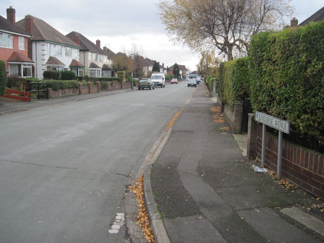
The village is known for its charming residential properties, mainly consisting of traditional English cottages with beautifully manicured gardens. The surrounding countryside offers breathtaking views, with rolling hills and lush green fields stretching as far as the eye can see. Spring Gardens is a popular destination for nature enthusiasts, walkers, and cyclists who are drawn to its tranquil atmosphere and abundance of scenic trails.

Although relatively small in size, the village boasts a close-knit community with a friendly and welcoming atmosphere. Residents can enjoy the convenience of a local pub, which serves as a social hub for the village, providing a place for locals to gather and unwind. Additionally, the nearby town of Telford offers a range of amenities including shops, supermarkets, and recreational facilities.

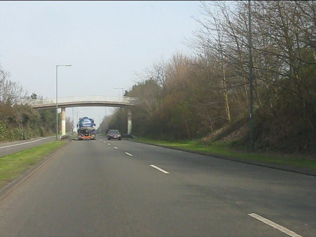
Spring Gardens is well-connected to the wider region, with good transport links to neighboring towns and cities. The village benefits from its proximity to major road networks, allowing for easy access to surrounding areas. Additionally, Telford Central railway station provides regular train services, connecting residents to destinations across the country.

In conclusion, Spring Gardens is a charming village that offers a peaceful countryside lifestyle within reach of urban conveniences. Its scenic beauty, tight-knit community, and convenient location make it an appealing place to reside or visit.

If you have any feedback on the listing, please let us know in the comments section below.

Spring Gardens Images

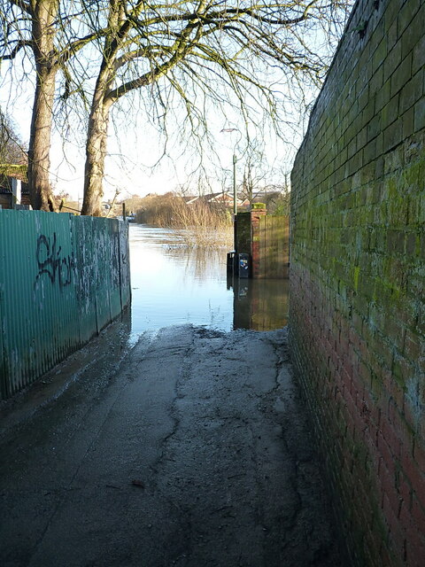
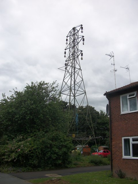
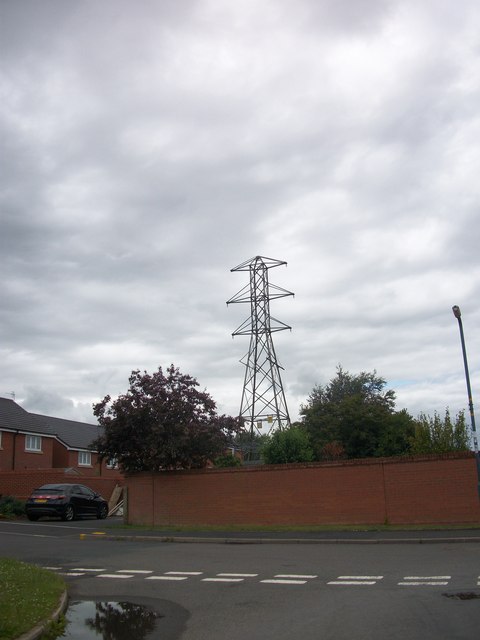
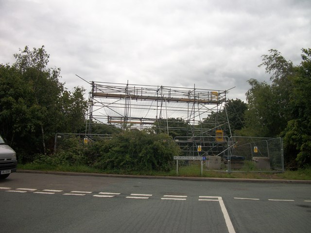
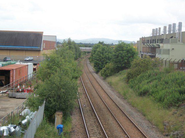
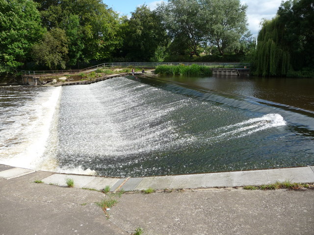
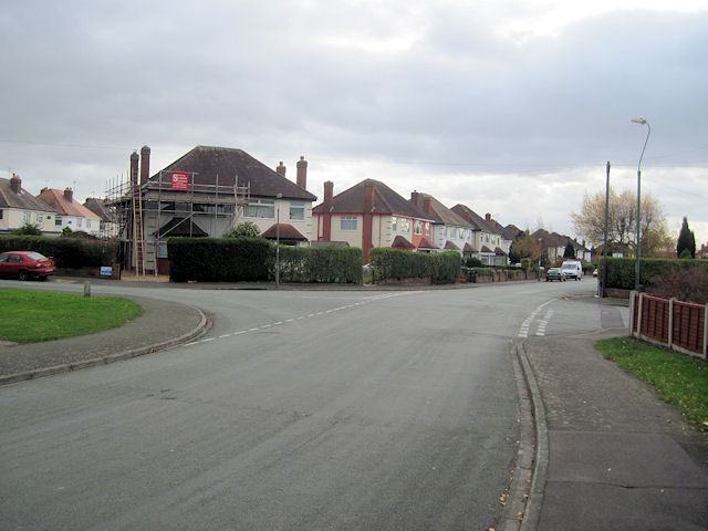
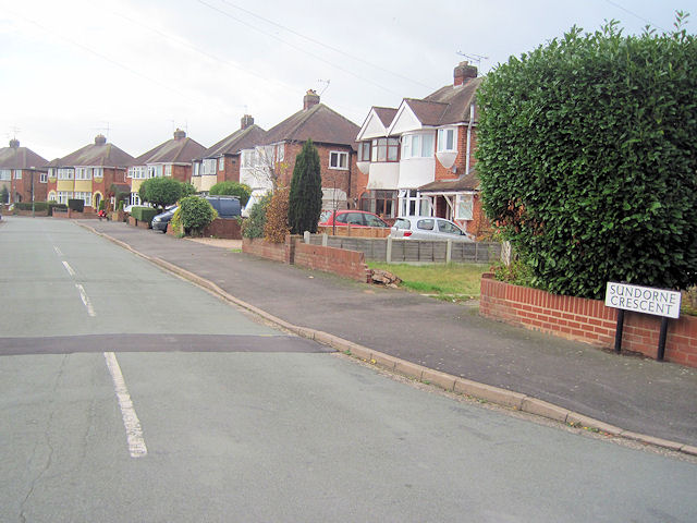
Images are sourced within 2km of 52.721313/-2.74025 or Grid Reference SJ5014. Thanks to Geograph Open Source API. All images are credited.

Frankwell carpark flood defences 'Demountable' flood barriers are becoming the norm for a number of towns along the River Severn in recent years - these ones in Shrewsbury consist of interlocking aluminium girders slotted into removable uprights, with a waterproof seal at each end where the whole affair butts up to the blockwork pillars. They have successfully held out against the floods from early 2024's Storm Henk, which in conjunction with several days of rain in the Welsh hills, resulted in a flood peak on the river a couple of days ago of nearly 4.7m, which is roughly where the level was when <a href="https://www.geograph.org.uk/photo/7682828">SJ4912 : High water at the English Bridge, Shrewsbury</a> was taken. There's still plenty of water just offshot to the right in Frankwell carpark on the other side of the barriers, and also on the nearby playing fields <a href="https://www.geograph.org.uk/photo/7684744">SJ4912 : Frankwell carpark and playing field under water</a>
Frankwell carpark flood defences
'Demountable' flood barriers are becoming the norm for a number of towns along the River Severn in recent years - these ones in Shrewsbury consist of interlocking aluminium girders slotted into removable uprights, with a waterproof seal at each end where the whole affair butts up to the blockwork pillars. They have successfully held out against the floods from early 2024's Storm Henk, which in conjunction with several days of rain in the Welsh hills, resulted in a flood peak on the river a couple of days ago of nearly 4.7m, which is roughly where the level was when SJ4912 : High water at the English Bridge, Shrewsbury was taken. There's still plenty of water just offshot to the right in Frankwell carpark on the other side of the barriers, and also on the nearby playing fields SJ4912 : Frankwell carpark and playing field under water
Frankwell flood defences 'Demountable' flood barriers are becoming the norm for a number of towns along the River Severn in recent years - these ones in Shrewsbury consist of interlocking aluminium girders slotted into removable uprights, with a waterproof seal at each end where the whole affair butts up to blockwork pillars or other more permanent structures. They have successfully held out against the floods from early 2024's Storm Henk, which in conjunction with several days of rain in the Welsh hills, resulted in a flood peak on the river a couple of days ago of nearly 4.7m <a href="https://www.geograph.org.uk/photo/7682828">SJ4912 : High water at the English Bridge, Shrewsbury</a>
Frankwell flood defences
'Demountable' flood barriers are becoming the norm for a number of towns along the River Severn in recent years - these ones in Shrewsbury consist of interlocking aluminium girders slotted into removable uprights, with a waterproof seal at each end where the whole affair butts up to blockwork pillars or other more permanent structures. They have successfully held out against the floods from early 2024's Storm Henk, which in conjunction with several days of rain in the Welsh hills, resulted in a flood peak on the river a couple of days ago of nearly 4.7m SJ4912 : High water at the English Bridge, Shrewsbury
Frankwell carpark and playing field under water The levels have dropped slightly more than 1m since the peak a couple of days ago, but the playing fields are still submerged, and part of Frankwell carpark on the left is yet to drain off.
Frankwell carpark and playing field under water
The levels have dropped slightly more than 1m since the peak a couple of days ago, but the playing fields are still submerged, and part of Frankwell carpark on the left is yet to drain off.
Water Lane demonstrates its nomenclature Taken a few days after <a href="https://www.geograph.org.uk/photo/7682355">SJ4812 : River Severn in flood in Shrewsbury</a>, and with the Welsh Bridge gauge still giving level of about 3.5m (and falling), this is about as far as you could sensibly walk down Water Lane in Frankwell without a pair of wellies or waders. A day or so earlier, and I'd have been knee deep at this point.
Water Lane demonstrates its nomenclature
Taken a few days after SJ4812 : River Severn in flood in Shrewsbury, and with the Welsh Bridge gauge still giving level of about 3.5m (and falling), this is about as far as you could sensibly walk down Water Lane in Frankwell without a pair of wellies or waders. A day or so earlier, and I'd have been knee deep at this point.
Disused electricity pylon
Electricity Substation Now out of use
Electricity Substation
Now out of use
Removing the Overhead Cables At last the overhead cables have been removed from over these houses
Removing the Overhead Cables
At last the overhead cables have been removed from over these houses
Now out of use pylon
Removing the Overhead Cables
Old animal food storage
Crewe to Shrewsbury Line
Weir on the River Severn in Shrewsbury A splendid weir on a summer's day.
Weir on the River Severn in Shrewsbury
A splendid weir on a summer's day.
The Sentinel in Morrisons Supermarket Morrisons Supermarket was built on part of the site of the Sentinel Waggon Works and this piece of marquetry was installed in the cafe to commemorate this.

Unfortunately part of the work has now been obscured by some of the cafe equipment.
The Sentinel in Morrisons Supermarket
Morrisons Supermarket was built on part of the site of the Sentinel Waggon Works and this piece of marquetry was installed in the cafe to commemorate this. Unfortunately part of the work has now been obscured by some of the cafe equipment.
Sundorne Avenue towards Sundorne Crescent Looking south the road junction here is where Sundorne Crescent crosses Sundorne Avenue
Sundorne Avenue towards Sundorne Crescent
Looking south the road junction here is where Sundorne Crescent crosses Sundorne Avenue
Sundorne Crescent from Sundorne Avenue This is the west arm of the crescent
Sundorne Crescent from Sundorne Avenue
This is the west arm of the crescent
Sundorne Avenue looking south From Sundorne Crescent junction
Sundorne Avenue looking south
From Sundorne Crescent junction
Bage Way - Abbey Foregate bridge
Bage Way - Dark Lane footbridge
Show me another place!

Spring Gardens is located at Grid Ref: SJ5014 (Lat: 52.721313, Lng: -2.74025)

Unitary Authority: Shropshire

Police Authority: West Mercia

What 3 Words

///crowds.cares.export. Near Shrewsbury, Shropshire

Related Wikis

Ditherington Flax Mill

Ditherington Flax Mill (promoted as the Shrewsbury Flaxmill Maltings), a flax mill located in Ditherington, a suburb of Shrewsbury, England, is the first...

Underdale, Shrewsbury

Underdale is a district of the town of Shrewsbury, county town of Shropshire, England. It is situated between the suburbs of Monkmoor and Castlefields...

Ditherington

Ditherington is a suburb of the town of Shrewsbury, the county town of Shropshire, England. It is the fourth most deprived ward in the Shropshire unitary...

Heathgates

Heathgates is a small suburb and the name of a notable roundabout in Shrewsbury, England; it is also the name for a short stretch of the A5191 road leading...

Nearby Amenities

Located within 500m of 52.721313,-2.74025
Post Box
Brand: Royal Mail
Brand Wikidata: Q638098
Collection Times: Mo-Fr 09:00; Sa 07:00
Mapillary: 153781620049467
Operator: Royal Mail
Operator Wikidata: Q638098
Post Box Type: pillar
Postal Code: SY1
Ref: SY1 436
Royal Cypher: EIIR
Survey Date: 2020-07-13
Lat/Long: 52.7178712/-2.7405665
Barrier: cycle_barrier
Bicycle: dismount
Cycle Barrier: double
Foot: designated
Horse: yes
Motor Vehicle: no
Lat/Long: 52.7224566/-2.7353794
Power: substation
Ref: G.P.O. Ditherington S/S 01407
Source: survey
Lat/Long: 52.7224395/-2.7367127
Traffic Signals
Lat/Long: 52.7252817/-2.7375598
Mini Roundabout
Source: Bing Aerial
Lat/Long: 52.7200101/-2.7420392
Bus Stop
Bus: yes
Departures Board: no
Public Transport: platform
Shelter: no
Lat/Long: 52.7192941/-2.7428756
Bus Stop
Bench: no
Bin: no
Bus: yes
Mapillary: 772670136638461
Public Transport: platform
Shelter: no
Survey Date: 2020-07-13
Lat/Long: 52.7204382/-2.7416076
Turning Circle
Lat/Long: 52.723868/-2.739821
Pub
The Compasses Inn
Addr City: Shrewsbury
Addr Country: GB
Addr Housenumber: 45
Addr Postcode: SY1 4DE
Addr Street: Long Row
Fhrs Authority: Shropshire
Fhrs Id: 188812
Fhrs Local Authority Id: 34780
Lat/Long: 52.7254405/-2.7400089
Traffic Signals
Crossing: traffic_signals
Crossing Ref: toucan
Traffic Signals: pedestrian_crossing
Traffic Signals Direction: both
Lat/Long: 52.7228601/-2.7393195
Post Box
Operator: Royal Mail
Operator Wikidata: Q638098
Post Box Type: wall
Ref: SY1 128
Lat/Long: 52.7238434/-2.7387962
Barrier: bollard
Motor Vehicle: no
Lat/Long: 52.7251475/-2.73961
Bus Stop
Bus: yes
Public Transport: platform
Shelter: no
Lat/Long: 52.7249487/-2.7379426
Bus Stop
Comet Drive
Bin: yes
Bus: yes
Covered: yes
Public Transport: platform
Lat/Long: 52.7230926/-2.7390409
Bus Stop
The Coach
Bench: no
Bin: no
Bus: yes
Mapillary: 303322847956808
Public Transport: platform
Shelter: no
Survey Date: 2022-03-23
Lat/Long: 52.7225878/-2.7396006
Bus Stop
Bench: yes
Bin: yes
Bus: yes
Naptan AtcoCode: 3500B420401
Naptan NaptanCode: shrdadtm
Public Transport: platform
Shelter: yes
Tactile Paving: no
Lat/Long: 52.7246336/-2.7379748
Ditherington
Place: suburb
Wikidata: Q5283659
Wikipedia: en:Ditherington
Lat/Long: 52.7235211/-2.7394832
Spring Gardens
Place: locality
Lat/Long: 52.7203875/-2.7423072
Atm
RBS
Brand: RBS
Brand Wikidata: Q160126
Brand Wikipedia: en:Royal Bank of Scotland
Fee: no
Official Name: Royal Bank of Scotland
Operator: RBS
Operator Wikidata: Q160126
Lat/Long: 52.7228133/-2.7391159
Post Box
Operator: Royal Mail
Operator Wikidata: Q638098
Ref: SY1 23
Lat/Long: 52.718898/-2.7437309
Turning Circle
Lat/Long: 52.7228194/-2.7426615
Railway: switch
Lat/Long: 52.7228871/-2.7433916
Building: yes
Power: substation
Ref: Spring Gardens S/S 01610
Substation: minor_distribution
Lat/Long: 52.7206161/-2.7403548
Turning Circle
Lat/Long: 52.7179589/-2.7419264
Crossing
Bicycle: yes
Crossing: traffic_signals
Crossing Island: no
Crossing Ref: toucan
Tactile Paving: yes
Lat/Long: 52.7242066/-2.7345622
Cycleway: asl
Direction: backward
Lat/Long: 52.7253546/-2.7378038
Sun City
Lat/Long: 52.7226636/-2.739214
Shop: hairdresser
Lat/Long: 52.7227063/-2.7391967
Fast Food
Pepes Piri Piri
Addr City: Shrewsbury
Addr Country: GB
Addr Housenumber: 36
Addr Postcode: SY1 4AU
Addr Street: Ditherington Road
Fhrs Authority: Shropshire
Fhrs Id: 1641028
Fhrs Local Authority Id: 23/00547/COMM
Lat/Long: 52.7243057/-2.7379875
Fast Food
Pizza Hut Delivery
Addr City: Shrewsbury
Addr Country: GB
Addr Housenumber: 34b
Addr Postcode: SY1 4AU
Addr Street: Ditherington Road
Brand: Pizza Hut Delivery
Brand Wikidata: Q107293079
Brand Wikipedia: en:Pizza Hut
Cuisine: pizza
Delivery: yes
Fhrs Authority: Shropshire
Fhrs Id: 665916
Fhrs Local Authority Id: 202251
Takeaway: only
Lat/Long: 52.7242538/-2.7380252
Atm
RBS
Brand: RBS
Brand Wikidata: Q160126
Brand Wikipedia: en:Royal Bank of Scotland
Official Name: Royal Bank of Scotland
Operator: RBS
Operator Wikidata: Q160126
Lat/Long: 52.7243527/-2.7384881
Fast Food
Pisces
Addr City: Shrewsbury
Addr Housenumber: 36A
Addr Postcode: SY1 4AU
Addr Street: Ditherington Road
Cuisine: fish_and_chips
Fhrs Authority: Shropshire
Fhrs Id: 1655184
Fhrs Local Authority Id: 23/00649/COMM
Source Addr: FHRS Open Data
Lat/Long: 52.7243584/-2.7379479
Barrier: cycle_barrier
Bicycle: dismount
Cycle Barrier: double
Cycle Barrier Installation: fixed
Foot: yes
Horse: no
Lat/Long: 52.7209557/-2.7405956
Barrier: bollard
Foot: yes
Motor Vehicle: no
Lat/Long: 52.7229348/-2.7464186
Shrewsbury Ramblers Walk 3 Trail Marker
Information: guidepost
Tourism: information
Lat/Long: 52.7225909/-2.746222
Loans2Go
Shop: money_lender
Source: mapillary
Website: https://loans2go.co.uk/locations/shrewsbury-loans-2-go/
Lat/Long: 52.7243623/-2.7386181
Barrier: bollard
Bicycle: yes
Foot: yes
Motor Vehicle: no
Lat/Long: 52.7212573/-2.7445757
Barrier: bollard
Bicycle: yes
Foot: yes
Motor Vehicle: no
Lat/Long: 52.7213199/-2.7446413
Railway: switch
Lat/Long: 52.7197032/-2.7456126
Generator Method: photovoltaic
Generator Output Electricity: yes
Generator Source: solar
Generator Type: solar_photovoltaic_panel
Location: roof
Power: generator
Lat/Long: 52.7253524/-2.7405095
Generator Method: photovoltaic
Generator Output Electricity: yes
Generator Source: solar
Generator Type: solar_photovoltaic_panel
Location: roof
Power: generator
Lat/Long: 52.7253557/-2.743409
Generator Method: photovoltaic
Generator Output Electricity: yes
Generator Source: solar
Generator Type: solar_photovoltaic_panel
Location: roof
Power: generator
Lat/Long: 52.7231723/-2.7380526
Generator Method: photovoltaic
Generator Output Electricity: yes
Generator Source: solar
Generator Type: solar_photovoltaic_panel
Location: roof
Power: generator
Lat/Long: 52.723864/-2.7367589
Turning Circle
Lat/Long: 52.7221163/-2.7403849
Bench
Backrest: yes
Seats: 2
Lat/Long: 52.7204325/-2.7400187
Waste Basket
Waste: trash
Lat/Long: 52.7204123/-2.7400322
Barrier: cycle_barrier
Bicycle: dismount
Cycle Barrier: double
Foot: designated
Motor Vehicle: private
Lat/Long: 52.7224158/-2.7355955
Barrier: cycle_barrier
Bicycle: dismount
Foot: designated
Horse: no
Motor Vehicle: no
Lat/Long: 52.7249808/-2.7425478
Bicycle Parking
Access: private
Bicycle Parking: stands
Covered: no
Fee: no
Lat/Long: 52.7249722/-2.7431904
Crossing
Crossing: marked
Crossing Island: no
Crossing Markings: surface
Tactile Paving: yes
Traffic Calming: table
Lat/Long: 52.7249345/-2.742748
Barrier: bollard
Bicycle: designated
Foot: designated
Horse: yes
Motor Vehicle: no
Lat/Long: 52.724738/-2.7417987
Crossing
Crossing: marked
Crossing Island: no
Crossing Markings: yes
Crossing Ref: zebra
Kerb: flush
Tactile Paving: yes
Lat/Long: 52.7190049/-2.743446
Crossing
Crossing: unmarked
Crossing Island: no
Crossing Markings: no
Kerb: flush
Tactile Paving: yes
Lat/Long: 52.719938/-2.742129
Give Way
Direction: forward
Lat/Long: 52.7228876/-2.7360197
Give Way
Direction: backward
Lat/Long: 52.723124/-2.7356792
Crossing
Crossing: marked
Crossing Island: no
Crossing Markings: yes
Crossing Ref: puffin
Tactile Paving: yes
Lat/Long: 52.7253396/-2.7377535
Crossing
Crossing: marked
Crossing Island: no
Crossing Markings: yes
Crossing Ref: puffin
Tactile Paving: yes
Lat/Long: 52.7251192/-2.737686
Cycleway: asl
Direction: backward
Lat/Long: 52.7251036/-2.737698
Cycleway: asl
Direction: forward
Lat/Long: 52.725305/-2.7375384
Barrier: bollard
Material: metal
Motor Vehicle: no
Lat/Long: 52.7193955/-2.7426714
Crossing
Crossing: marked
Crossing Island: no
Crossing Markings: yes
Crossing Ref: zebra
Tactile Paving: yes
Lat/Long: 52.7196702/-2.7425052
The Maltings Hair & Beauty Salon
Addr City: Shrewsbury
Addr Housenumber: 92
Addr Postcode: SY1 2HA
Addr Street: St Michael's Street
Shop: hairdresser
Website: https://www.maltingshairandbeauty.com/
Lat/Long: 52.7188793/-2.7438716
Crossing
Crossing: unmarked
Crossing Markings: no
Kerb: flush
Lat/Long: 52.7189634/-2.7437936
Barrier: bollard
Lat/Long: 52.7190169/-2.7437085
Man Made: charge_point
Lat/Long: 52.72024/-2.744441
Man Made: charge_point
Lat/Long: 52.7202471/-2.7445013
Man Made: charge_point
Lat/Long: 52.7202532/-2.7445414
Man Made: charge_point
Lat/Long: 52.7202572/-2.7445799
Give Way
Direction: backward
Lat/Long: 52.7188729/-2.7372932
The data included in this document is from www.openstreetmap.org. The data is made available under ODbL.

Have you been to Spring Gardens?

Leave your review of Spring Gardens below (or comments, questions and feedback).