Mount Pleasant

Settlement in Shropshire

England

Mount Pleasant

Disused electricity pylon
Disused electricity pylon Credit: Mr M Evison

Mount Pleasant is a small village located in the county of Shropshire, England. Situated in the West Midlands region, it is nestled in the picturesque countryside, offering residents and visitors a peaceful and idyllic setting. The village is located approximately 7 miles north of Shrewsbury, the county town of Shropshire.

With a population of around 500 people, Mount Pleasant maintains a close-knit community atmosphere. The village is characterized by its charming and traditional English architecture, with many historic buildings and cottages dotting the landscape. The surrounding countryside offers breathtaking views and a tranquil environment, making it a popular destination for those seeking a rural retreat.

Despite its small size, Mount Pleasant boasts a range of amenities and services for its residents. These include a local primary school, a village hall, a post office, and a convenience store. In addition, the village is well-connected to neighboring towns and cities through a reliable public transportation system, providing easy access to a wider range of amenities and facilities.

For outdoor enthusiasts, Mount Pleasant offers plenty of opportunities for exploration and recreation. The surrounding countryside is crisscrossed with footpaths and bridleways, allowing residents and visitors to enjoy scenic walks, hikes, and horse rides. The nearby Shropshire Hills Area of Outstanding Natural Beauty provides further opportunities for outdoor activities, such as cycling, birdwatching, and nature photography.

In conclusion, Mount Pleasant is a charming village in Shropshire, offering a peaceful and picturesque setting for its residents. With its close-knit community, traditional architecture, and access to beautiful countryside, it is a delightful place to live or visit.

If you have any feedback on the listing, please let us know in the comments section below.

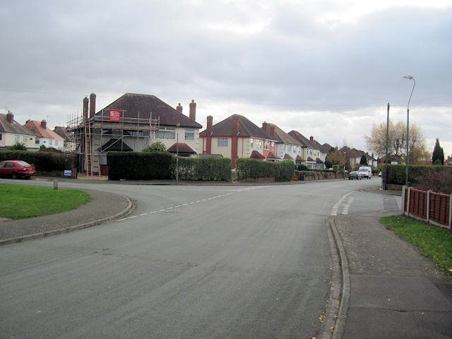
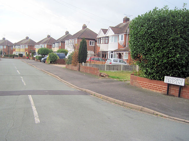
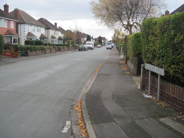
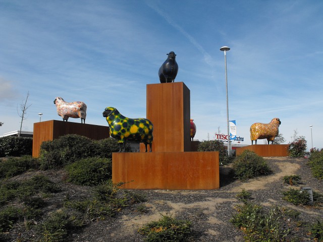
Mount Pleasant Images

Images are sourced within 2km of 52.727839/-2.7411051 or Grid Reference SJ5014. Thanks to Geograph Open Source API. All images are credited.

Disused electricity pylon
Electricity Substation Now out of use
Electricity Substation
Now out of use
Removing the Overhead Cables At last the overhead cables have been removed from over these houses
Removing the Overhead Cables
At last the overhead cables have been removed from over these houses
Now out of use pylon
Removing the Overhead Cables
Old animal food storage
Crewe to Shrewsbury Line
Weir on the River Severn in Shrewsbury A splendid weir on a summer's day.
Weir on the River Severn in Shrewsbury
A splendid weir on a summer's day.
The Sentinel in Morrisons Supermarket Morrisons Supermarket was built on part of the site of the Sentinel Waggon Works and this piece of marquetry was installed in the cafe to commemorate this.

Unfortunately part of the work has now been obscured by some of the cafe equipment.
The Sentinel in Morrisons Supermarket
Morrisons Supermarket was built on part of the site of the Sentinel Waggon Works and this piece of marquetry was installed in the cafe to commemorate this. Unfortunately part of the work has now been obscured by some of the cafe equipment.
Sundorne Avenue towards Sundorne Crescent Looking south the road junction here is where Sundorne Crescent crosses Sundorne Avenue
Sundorne Avenue towards Sundorne Crescent
Looking south the road junction here is where Sundorne Crescent crosses Sundorne Avenue
Sundorne Crescent from Sundorne Avenue This is the west arm of the crescent
Sundorne Crescent from Sundorne Avenue
This is the west arm of the crescent
Sundorne Avenue looking south From Sundorne Crescent junction
Sundorne Avenue looking south
From Sundorne Crescent junction
The Tesco sheep Sited on the southern corner of Tesco Extra car park at the junction of Harlescott Lane and Battlefield Road. Other roads meeting at this traffic-light controlled junction are Featherbed Lane and Whitchurch Road.
I think these multi-coloured fibreglass sheep are rather fun and I'm pleased to see they have the right sort of 'haircut' to be Shropshires.
The Tesco sheep
Sited on the southern corner of Tesco Extra car park at the junction of Harlescott Lane and Battlefield Road. Other roads meeting at this traffic-light controlled junction are Featherbed Lane and Whitchurch Road. I think these multi-coloured fibreglass sheep are rather fun and I'm pleased to see they have the right sort of 'haircut' to be Shropshires.
The Tesco sheep, Harlescott Sited on the southern corner of Tesco Extra car park at the junction of Harlescott Lane and Battlefield Road. Other roads meeting at this traffic-light controlled junction are Featherbed Lane and Whitchurch Road.
I think these multi-coloured fibreglass sheep are rather fun and I'm pleased to see they have the right sort of 'haircut' to be Shropshires.
The Tesco sheep, Harlescott
Sited on the southern corner of Tesco Extra car park at the junction of Harlescott Lane and Battlefield Road. Other roads meeting at this traffic-light controlled junction are Featherbed Lane and Whitchurch Road. I think these multi-coloured fibreglass sheep are rather fun and I'm pleased to see they have the right sort of 'haircut' to be Shropshires.
View down Featherbed Lane From the Tesco sheep, Harlescott.
View down Featherbed Lane
From the Tesco sheep, Harlescott.
Tesco sheep, Harlescott With the Tesco carpark in the background.
Tesco sheep, Harlescott
With the Tesco carpark in the background.
Clive Road, Monksmoor
Northern end of Clive Road
Show me another place!

Mount Pleasant is located at Grid Ref: SJ5014 (Lat: 52.727839, Lng: -2.7411051)

Unitary Authority: Shropshire

Police Authority: West Mercia

What 3 Words

///emerge.salsa.stews. Near Shrewsbury, Shropshire

Related Wikis

BBC Radio Shropshire

BBC Radio Shropshire is the BBC's local radio station serving Shropshire. It broadcasts on FM, DAB, digital TV and via BBC Sounds from studios on Boscobel...

Heathgates

Heathgates is a small suburb and the name of a notable roundabout in Shrewsbury, England; it is also the name for a short stretch of the A5191 road leading...

Ditherington

Ditherington is a suburb of the town of Shrewsbury, the county town of Shropshire, England. It is the fourth most deprived ward in the Shropshire unitary...

Sentinel Waggon Works

Sentinel Waggon Works Ltd was a British company based in Shrewsbury, Shropshire that made steam-powered lorries (steam wagons), railway locomotives, and...

Nearby Amenities

Located within 500m of 52.727839,-2.7411051
Traffic Signals
Lat/Long: 52.7252817/-2.7375598
Pub
The Heathgates
Addr City: Shrewsbury
Addr Country: GB
Addr Housenumber: 2
Addr Postcode: SY1 4DW
Addr Street: Whitchurch Road
Fhrs Authority: Shropshire
Fhrs Id: 1278120
Fhrs Local Authority Id: 20/00631/COMM
Lat/Long: 52.7268574/-2.7351912
Mini Roundabout
Direction: clockwise
Lat/Long: 52.7287805/-2.7342923
Turning Circle
Lat/Long: 52.7269597/-2.7391339
Turning Circle
Lat/Long: 52.7262827/-2.7380163
Post Box
Post Box Type: pillar
Ref: SY1 583
Lat/Long: 52.726491/-2.7386637
Telephone
Booth: KX100
Covered: booth
Lat/Long: 52.7261482/-2.7381843
Recycling
Lat/Long: 52.7289357/-2.7348802
Turning Circle
Lat/Long: 52.723868/-2.739821
Crossing
Crossing: traffic_signals
Crossing Island: no
Crossing Ref: puffin
Tactile Paving: yes
Lat/Long: 52.7268149/-2.739443
Pub
The Compasses Inn
Addr City: Shrewsbury
Addr Country: GB
Addr Housenumber: 45
Addr Postcode: SY1 4DE
Addr Street: Long Row
Fhrs Authority: Shropshire
Fhrs Id: 188812
Fhrs Local Authority Id: 34780
Lat/Long: 52.7254405/-2.7400089
Post Box
Brand: Royal Mail
Brand Wikidata: Q638098
Operator: Royal Mail
Operator Wikidata: Q638098
Post Box Type: pillar
Ref: SY1 756
Lat/Long: 52.7299312/-2.742908
Post Box
Operator: Royal Mail
Operator Wikidata: Q638098
Post Box Type: wall
Ref: SY1 128
Lat/Long: 52.7238434/-2.7387962
Telephone
Booth: KX100
Covered: booth
Lat/Long: 52.7298305/-2.7428886
Barrier: bollard
Motor Vehicle: no
Lat/Long: 52.7251475/-2.73961
Bus Stop
Bus: yes
Public Transport: platform
Shelter: no
Lat/Long: 52.7249487/-2.7379426
Bus Stop
Bus: yes
Public Transport: platform
Lat/Long: 52.7259251/-2.7380556
Bus Stop
Bus: yes
Public Transport: platform
Lat/Long: 52.727209/-2.7405533
Bus Stop
Bus: yes
Public Transport: platform
Lat/Long: 52.729361/-2.7426647
Bus Stop
Bus: yes
Naptan AtcoCode: 3500B074204
Naptan NaptanCode: shragptg
Public Transport: platform
Lat/Long: 52.7301718/-2.742639
Bus Stop
Bench: yes
Bin: yes
Bus: yes
Naptan AtcoCode: 3500B420401
Naptan NaptanCode: shrdadtm
Public Transport: platform
Shelter: yes
Tactile Paving: no
Lat/Long: 52.7246336/-2.7379748
Ditherington
Place: suburb
Wikidata: Q5283659
Wikipedia: en:Ditherington
Lat/Long: 52.7235211/-2.7394832
Atm
NatWest
Brand: NatWest
Brand Wikidata: Q2740021
Brand Wikipedia: en:NatWest
Operator: NatWest
Operator Wikidata: Q2740021
Lat/Long: 52.7286247/-2.7361561
Atm
Lloyds Bank
Brand: Lloyds Bank
Brand Wikidata: Q1152847
Brand Wikipedia: en:Lloyds Bank
Operator: Lloyds Bank
Operator Wikidata: Q1152847
Lat/Long: 52.7286483/-2.7362088
Atm
Barclays
Brand: Barclays
Brand Wikidata: Q245343
Brand Wikipedia: en:Barclays
Operator: Barclays
Operator Wikidata: Q245343
Lat/Long: 52.7286365/-2.7361825
Bus Stop
Heathgates
Bin: yes
Bus: yes
Covered: yes
Public Transport: platform
Shelter: yes
Lat/Long: 52.7266064/-2.7346837
Bus Stop
Heathgates
Bench: no
Bus: yes
Covered: no
Departures Board: yes
Pole: yes
Public Transport: platform
Shelter: no
Lat/Long: 52.7266933/-2.7347132
Bus Stop
Bus: yes
Public Transport: platform
Lat/Long: 52.7270994/-2.7356729
Bus Stop
Heathgates, Whitchurch Road
Bench: yes
Bin: yes
Bus: yes
Mapillary: 683726925753437
Naptan AtcoCode: 3500B113100
Naptan NaptanCode: shrajtwd
Public Transport: platform
Shelter: yes
Survey Date: 2020-06-12
Tactile Paving: no
Lat/Long: 52.7271252/-2.7352907
Mount Pleasant
Place: suburb
Lat/Long: 52.7278767/-2.7429648
Heathgates
Place: locality
Wikidata: Q5694288
Wikipedia: en:Heathgates
Lat/Long: 52.7257053/-2.7347047
Crossing
Crossing: uncontrolled
Crossing Island: no
Crossing Markings: zebra
Lat/Long: 52.7281637/-2.7352824
Crossing
Crossing: unmarked
Crossing Island: yes
Crossing Markings: no
Tactile Paving: yes
Lat/Long: 52.7278084/-2.7345359
Crossing
Crossing: uncontrolled
Crossing Island: no
Crossing Markings: zebra
Lat/Long: 52.7279531/-2.7348505
Crossing
Crossing: uncontrolled
Crossing Island: no
Crossing Markings: zebra
Lat/Long: 52.7281901/-2.7361711
Crossing
Crossing: uncontrolled
Crossing Island: no
Crossing Markings: zebra
Lat/Long: 52.7282971/-2.7360347
Crossing
Crossing: uncontrolled
Crossing Island: no
Crossing Markings: zebra
Lat/Long: 52.7283723/-2.7357129
Crossing
Crossing: uncontrolled
Crossing Island: no
Crossing Markings: zebra
Lat/Long: 52.7284108/-2.7358945
Cycleway: asl
Direction: backward
Lat/Long: 52.7253546/-2.7378038
Crossing
Crossing: unmarked
Crossing Island: no
Crossing Markings: no
Tactile Paving: yes
Lat/Long: 52.7262996/-2.7356442
Crossing
Crossing: unmarked
Crossing Island: no
Crossing Markings: no
Kerb: lowered
Tactile Paving: yes
Lat/Long: 52.7263189/-2.7354908
Barrier: kerb
Kerb: flush
Tactile Paving: yes
Lat/Long: 52.7263219/-2.7355786
Barrier: kerb
Kerb: flush
Tactile Paving: yes
Lat/Long: 52.7263228/-2.7355193
Crossing
Crossing: unmarked
Crossing Markings: no
Kerb: lowered
Tactile Paving: yes
Lat/Long: 52.726595/-2.7352277
Crossing
Crossing: unmarked
Crossing Markings: no
Kerb: lowered
Tactile Paving: yes
Lat/Long: 52.7266587/-2.7352182
Building: residential
Lat/Long: 52.7259896/-2.7373738
Your Coop Food
Addr City: Shrewsbury
Addr Country: GB
Addr Housenumber: 97-99
Addr Postcode: SY1 3EL
Addr Street: Mount Pleasant Road
Brand: Your Coop Food
Brand Wikidata: Q121084548
Fhrs Authority: Shropshire
Fhrs Id: 127082
Fhrs Local Authority Id: 56163
Opening Hours: Mo-Su 07:00-22:00
Operator: Midcounties Co-operative
Operator Wikidata: Q6841138
Phone: +44 1743 354276
Shop: convenience
Website: https://www.coop.co.uk/store-finder/SY1-3EL/99-mount-pleasant-road
Lat/Long: 52.7300957/-2.7430063
Pharmacy
Well Pharmacy
Brand: Well Pharmacy
Brand Wikidata: Q7726524
Dispensing: yes
Healthcare: pharmacy
Website: https://finder.well.co.uk/store/shrewsbury-mount-pleasant-road
Lat/Long: 52.7301677/-2.7430167
Fast Food
Peking Garden
Addr City: Shrewsbury
Addr Country: GB
Addr Housenumber: 89
Addr Postcode: SY1 3EL
Addr Street: Mount Pleasant Road
Cuisine: chinese
Fhrs Authority: Shropshire
Fhrs Id: 125909
Fhrs Local Authority Id: 54542
Lat/Long: 52.7299413/-2.742984
Fast Food
Snax Fish Bar
Addr City: Shrewsbury
Addr Country: GB
Addr Housenumber: 93
Addr Postcode: SY1 3EL
Addr Street: Mount Pleasant Road
Cuisine: fish_and_chips
Fhrs Authority: Shropshire
Fhrs Id: 1023008
Fhrs Local Authority Id: 17/00535/COMM
Lat/Long: 52.7300057/-2.7429933
Fast Food
Pepes Piri Piri
Addr City: Shrewsbury
Addr Country: GB
Addr Housenumber: 36
Addr Postcode: SY1 4AU
Addr Street: Ditherington Road
Fhrs Authority: Shropshire
Fhrs Id: 1641028
Fhrs Local Authority Id: 23/00547/COMM
Lat/Long: 52.7243057/-2.7379875
Fast Food
Pizza Hut Delivery
Addr City: Shrewsbury
Addr Country: GB
Addr Housenumber: 34b
Addr Postcode: SY1 4AU
Addr Street: Ditherington Road
Brand: Pizza Hut Delivery
Brand Wikidata: Q107293079
Brand Wikipedia: en:Pizza Hut
Cuisine: pizza
Delivery: yes
Fhrs Authority: Shropshire
Fhrs Id: 665916
Fhrs Local Authority Id: 202251
Takeaway: only
Lat/Long: 52.7242538/-2.7380252
Atm
RBS
Brand: RBS
Brand Wikidata: Q160126
Brand Wikipedia: en:Royal Bank of Scotland
Official Name: Royal Bank of Scotland
Operator: RBS
Operator Wikidata: Q160126
Lat/Long: 52.7243527/-2.7384881
Fast Food
Pisces
Addr City: Shrewsbury
Addr Housenumber: 36A
Addr Postcode: SY1 4AU
Addr Street: Ditherington Road
Cuisine: fish_and_chips
Fhrs Authority: Shropshire
Fhrs Id: 1655184
Fhrs Local Authority Id: 23/00649/COMM
Source Addr: FHRS Open Data
Lat/Long: 52.7243584/-2.7379479
Barrier: kerb
Kerb: flush
Tactile Paving: yes
Lat/Long: 52.7285253/-2.7338546
Parcel Locker
Brand: InPost
Brand Wikidata: Q3182097
Operator: InPost
Parcel Mail In: yes
Parcel Pickup: yes
Ref: UKSHR28967
Lat/Long: 52.7285225/-2.7359999
Parcel Locker
Brand: Amazon Hub
Brand Wikidata: Q100274430
Operator: Amazon
Ref: freya
Lat/Long: 52.7285455/-2.7355866
Loans2Go
Shop: money_lender
Source: mapillary
Website: https://loans2go.co.uk/locations/shrewsbury-loans-2-go/
Lat/Long: 52.7243623/-2.7386181
Crossing
Crossing: unmarked
Crossing Markings: no
Lat/Long: 52.7265406/-2.7362238
Crossing
Crossing: unmarked
Crossing Markings: no
Lat/Long: 52.7265084/-2.7361621
Crossing
Crossing: unmarked
Crossing Markings: no
Lat/Long: 52.7264107/-2.736046
Crossing
Crossing: unmarked
Crossing Island: no
Crossing Markings: no
Tactile Paving: yes
Lat/Long: 52.7264487/-2.7364575
Crossing
Crossing: unmarked
Crossing Island: no
Crossing Markings: no
Tactile Paving: yes
Lat/Long: 52.726926/-2.7355829
Crossing
Crossing: unmarked
Crossing Island: no
Crossing Markings: no
Tactile Paving: yes
Lat/Long: 52.7269382/-2.7356958
Crossing
Crossing: unmarked
Crossing Island: no
Crossing Markings: no
Tactile Paving: yes
Lat/Long: 52.7263164/-2.7361823
Generator Method: photovoltaic
Generator Output Electricity: yes
Generator Source: solar
Generator Type: solar_photovoltaic_panel
Location: roof
Power: generator
Lat/Long: 52.7253524/-2.7405095
Generator Method: photovoltaic
Generator Output Electricity: yes
Generator Source: solar
Generator Type: solar_photovoltaic_panel
Location: roof
Power: generator
Lat/Long: 52.7264197/-2.7390987
Generator Method: photovoltaic
Generator Output Electricity: yes
Generator Source: solar
Generator Type: solar_photovoltaic_panel
Location: roof
Power: generator
Lat/Long: 52.7262146/-2.7394634
Generator Method: photovoltaic
Generator Output Electricity: yes
Generator Source: solar
Generator Type: solar_photovoltaic_panel
Location: roof
Power: generator
Lat/Long: 52.7262751/-2.7392891
Generator Method: photovoltaic
Generator Output Electricity: yes
Generator Source: solar
Generator Type: solar_photovoltaic_panel
Location: roof
Power: generator
Lat/Long: 52.728736/-2.7416736
Generator Method: photovoltaic
Generator Output Electricity: yes
Generator Source: solar
Generator Type: solar_photovoltaic_panel
Location: roof
Power: generator
Lat/Long: 52.7284355/-2.7413785
Generator Method: photovoltaic
Generator Output Electricity: yes
Generator Source: solar
Generator Type: solar_photovoltaic_panel
Location: roof
Power: generator
Lat/Long: 52.7282081/-2.7411854
Generator Method: photovoltaic
Generator Output Electricity: yes
Generator Source: solar
Generator Type: solar_photovoltaic_panel
Location: roof
Power: generator
Lat/Long: 52.7278199/-2.7408072
Generator Method: photovoltaic
Generator Output Electricity: yes
Generator Source: solar
Generator Type: solar_photovoltaic_panel
Location: roof
Power: generator
Lat/Long: 52.7276493/-2.7406222
Generator Method: photovoltaic
Generator Output Electricity: yes
Generator Source: solar
Generator Type: solar_photovoltaic_panel
Location: roof
Power: generator
Lat/Long: 52.7271994/-2.7398846
Generator Method: photovoltaic
Generator Output Electricity: yes
Generator Source: solar
Generator Type: solar_photovoltaic_panel
Location: roof
Power: generator
Lat/Long: 52.7266958/-2.7405927
Generator Method: photovoltaic
Generator Output Electricity: yes
Generator Source: solar
Generator Type: solar_photovoltaic_panel
Location: roof
Power: generator
Lat/Long: 52.725856/-2.7404907
Generator Method: photovoltaic
Generator Output Electricity: yes
Generator Source: solar
Generator Type: solar_photovoltaic_panel
Location: roof
Power: generator
Lat/Long: 52.7260623/-2.7414349
Generator Method: photovoltaic
Generator Output Electricity: yes
Generator Source: solar
Generator Type: solar_photovoltaic_panel
Location: roof
Power: generator
Lat/Long: 52.7261906/-2.7424756
Generator Method: photovoltaic
Generator Output Electricity: yes
Generator Source: solar
Generator Type: solar_photovoltaic_panel
Location: roof
Power: generator
Lat/Long: 52.7262345/-2.7419177
Generator Method: photovoltaic
Generator Output Electricity: yes
Generator Source: solar
Generator Type: solar_photovoltaic_panel
Location: roof
Power: generator
Lat/Long: 52.7264911/-2.7420357
Generator Method: photovoltaic
Generator Output Electricity: yes
Generator Source: solar
Generator Type: solar_photovoltaic_panel
Location: roof
Power: generator
Lat/Long: 52.7265025/-2.7423039
Generator Method: photovoltaic
Generator Output Electricity: yes
Generator Source: solar
Generator Type: solar_photovoltaic_panel
Location: roof
Power: generator
Lat/Long: 52.7268745/-2.742261
Generator Method: photovoltaic
Generator Output Electricity: yes
Generator Source: solar
Generator Type: solar_photovoltaic_panel
Location: roof
Power: generator
Lat/Long: 52.726777/-2.742556
Generator Method: photovoltaic
Generator Output Electricity: yes
Generator Source: solar
Generator Type: solar_photovoltaic_panel
Location: roof
Power: generator
Lat/Long: 52.7279189/-2.741451
Generator Method: photovoltaic
Generator Output Electricity: yes
Generator Source: solar
Generator Type: solar_photovoltaic_panel
Location: roof
Power: generator
Lat/Long: 52.7283445/-2.7422985
Generator Method: photovoltaic
Generator Output Electricity: yes
Generator Source: solar
Generator Type: solar_photovoltaic_panel
Location: roof
Power: generator
Lat/Long: 52.7282016/-2.7421913
Generator Method: photovoltaic
Generator Output Electricity: yes
Generator Source: solar
Generator Type: solar_photovoltaic_panel
Location: roof
Power: generator
Lat/Long: 52.7285216/-2.7420169
Generator Method: photovoltaic
Generator Output Electricity: yes
Generator Source: solar
Generator Type: solar_photovoltaic_panel
Location: roof
Power: generator
Lat/Long: 52.7284858/-2.7424166
Generator Method: photovoltaic
Generator Output Electricity: yes
Generator Source: solar
Generator Type: solar_photovoltaic_panel
Location: roof
Power: generator
Lat/Long: 52.7283023/-2.7427438
Generator Method: photovoltaic
Generator Output Electricity: yes
Generator Source: solar
Generator Type: solar_photovoltaic_panel
Location: roof
Power: generator
Lat/Long: 52.728455/-2.7428538
Generator Method: photovoltaic
Generator Output Electricity: yes
Generator Source: solar
Generator Type: solar_photovoltaic_panel
Location: roof
Power: generator
Lat/Long: 52.7288546/-2.7448574
Generator Method: photovoltaic
Generator Output Electricity: yes
Generator Source: solar
Generator Type: solar_photovoltaic_panel
Location: roof
Power: generator
Lat/Long: 52.7291632/-2.7444497
Generator Method: photovoltaic
Generator Output Electricity: yes
Generator Source: solar
Generator Type: solar_photovoltaic_panel
Location: roof
Power: generator
Lat/Long: 52.7288611/-2.7441546
Generator Method: photovoltaic
Generator Output Electricity: yes
Generator Source: solar
Generator Type: solar_photovoltaic_panel
Location: roof
Power: generator
Lat/Long: 52.7288221/-2.7436155
Generator Method: photovoltaic
Generator Output Electricity: yes
Generator Source: solar
Generator Type: solar_photovoltaic_panel
Location: roof
Power: generator
Lat/Long: 52.7289829/-2.7419391
Generator Method: photovoltaic
Generator Output Electricity: yes
Generator Source: solar
Generator Type: solar_photovoltaic_panel
Location: roof
Power: generator
Lat/Long: 52.7291551/-2.7426097
Generator Method: photovoltaic
Generator Output Electricity: yes
Generator Source: solar
Generator Type: solar_photovoltaic_panel
Location: roof
Power: generator
Lat/Long: 52.7292769/-2.7428564
Generator Method: photovoltaic
Generator Output Electricity: yes
Generator Source: solar
Generator Type: solar_photovoltaic_panel
Location: roof
Power: generator
Lat/Long: 52.7313462/-2.7445811
Generator Method: photovoltaic
Generator Output Electricity: yes
Generator Source: solar
Generator Type: solar_photovoltaic_panel
Location: roof
Power: generator
Lat/Long: 52.7315703/-2.7438274
Generator Method: photovoltaic
Generator Output Electricity: yes
Generator Source: solar
Generator Type: solar_photovoltaic_panel
Location: roof
Power: generator
Lat/Long: 52.7307907/-2.743012
Generator Method: photovoltaic
Generator Output Electricity: yes
Generator Source: solar
Generator Type: solar_photovoltaic_panel
Location: roof
Power: generator
Lat/Long: 52.7295952/-2.7452543
Generator Method: photovoltaic
Generator Output Electricity: yes
Generator Source: solar
Generator Type: solar_photovoltaic_panel
Location: roof
Power: generator
Lat/Long: 52.729644/-2.7453107
Generator Method: photovoltaic
Generator Output Electricity: yes
Generator Source: solar
Generator Type: solar_photovoltaic_panel
Location: roof
Power: generator
Lat/Long: 52.730245/-2.7449244
Generator Method: photovoltaic
Generator Output Electricity: yes
Generator Source: solar
Generator Type: solar_photovoltaic_panel
Location: roof
Power: generator
Lat/Long: 52.7314306/-2.7455467
Generator Method: photovoltaic
Generator Output Electricity: yes
Generator Source: solar
Generator Type: solar_photovoltaic_panel
Location: roof
Power: generator
Lat/Long: 52.725895/-2.7433071
Generator Method: photovoltaic
Generator Output Electricity: yes
Generator Source: solar
Generator Type: solar_photovoltaic_panel
Location: roof
Power: generator
Lat/Long: 52.7254856/-2.7431703
Generator Method: photovoltaic
Generator Output Electricity: yes
Generator Source: solar
Generator Type: solar_photovoltaic_panel
Location: roof
Power: generator
Lat/Long: 52.7253557/-2.743409
Turning Circle
Turning Circle: circle
Lat/Long: 52.7271673/-2.7337983
Bicycle Parking
Access: yes
Bicycle Parking: stands
Covered: yes
Fee: no
Lat/Long: 52.7287342/-2.7361757
Barrier: cycle_barrier
Bicycle: dismount
Cycle Barrier: double
Foot: yes
Horse: no
Motor Vehicle: no
Overlap: 0.3
Wheelchair: limited
Lat/Long: 52.7278615/-2.73465
Crossing
Crossing: uncontrolled
Crossing Markings: zebra
Lat/Long: 52.7291807/-2.7341818
Bicycle Parking
Access: yes
Bicycle Parking: wall_loops
Capacity: 10
Covered: no
Fee: no
Lat/Long: 52.7287587/-2.7354112
Post Box
Collection Times: Mo-Fr 16:30; Sa 11:00; Su off
Drive Through: no
Indoor: yes
Note: In foyer of Morrisons
Operator: Royal Mail
Operator Wikidata: Q638098
Post Box Design: indoor_pillar
Post Box Type: pillar
Ref: SY1 421
Royal Cypher: EIIR
Royal Cypher Wikidata: Q33102113
Lat/Long: 52.7285065/-2.7359087
Barrier: cycle_barrier
Bicycle: dismount
Foot: designated
Horse: no
Motor Vehicle: no
Lat/Long: 52.7249808/-2.7425478
Bicycle Parking
Access: private
Bicycle Parking: stands
Covered: no
Fee: no
Lat/Long: 52.7249722/-2.7431904
Crossing
Crossing: marked
Crossing Island: no
Crossing Markings: surface
Tactile Paving: yes
Traffic Calming: table
Lat/Long: 52.7249345/-2.742748
Barrier: bollard
Bicycle: designated
Foot: designated
Horse: yes
Motor Vehicle: no
Lat/Long: 52.724738/-2.7417987
Crossing
Crossing: marked
Crossing Island: no
Crossing Markings: yes
Crossing Ref: puffin
Tactile Paving: yes
Lat/Long: 52.7253396/-2.7377535
Crossing
Crossing: marked
Crossing Island: no
Crossing Markings: yes
Crossing Ref: puffin
Tactile Paving: yes
Lat/Long: 52.7251192/-2.737686
Cycleway: asl
Direction: backward
Lat/Long: 52.7251036/-2.737698
Cycleway: asl
Direction: forward
Lat/Long: 52.725305/-2.7375384
Crossing
Crossing: unmarked
Crossing Island: no
Crossing Markings: no
Tactile Paving: yes
Lat/Long: 52.7271191/-2.7400855
Barrier: kerb
Kerb: flush
Tactile Paving: yes
Lat/Long: 52.7267857/-2.7394787
Barrier: kerb
Kerb: flush
Tactile Paving: yes
Lat/Long: 52.7268396/-2.739414
Give Way
Direction: forward
Lat/Long: 52.7270896/-2.7379867
Give Way
Direction: forward
Lat/Long: 52.7269385/-2.737484
Give Way
Lat/Long: 52.7266882/-2.7361255
Barrier: kerb
Kerb: raised
Lat/Long: 52.7280044/-2.7481478
Barrier: kerb
Kerb: flush
Lat/Long: 52.7263747/-2.7360123
Barrier: kerb
Kerb: flush
Lat/Long: 52.7265575/-2.7362579
Barrier: kerb
Kerb: flush
Lat/Long: 52.7264306/-2.7360632
Barrier: kerb
Kerb: flush
Lat/Long: 52.7264695/-2.7361126
Barrier: kerb
Kerb: flush
Lat/Long: 52.7265245/-2.736193
Barrier: kerb
Kerb: flush
Tactile Paving: yes
Lat/Long: 52.7262793/-2.735716
Barrier: kerb
Kerb: flush
Tactile Paving: yes
Lat/Long: 52.7263158/-2.7354403
Barrier: kerb
Kerb: flush
Tactile Paving: yes
Lat/Long: 52.7265466/-2.7352022
Barrier: kerb
Kerb: flush
Tactile Paving: yes
Lat/Long: 52.726701/-2.7351919
Barrier: kerb
Kerb: flush
Tactile Paving: yes
Lat/Long: 52.7266384/-2.7352304
Barrier: kerb
Kerb: flush
Tactile Paving: yes
Lat/Long: 52.7266149/-2.7352344
Barrier: kerb
Kerb: flush
Tactile Paving: yes
Lat/Long: 52.7269762/-2.7357614
Barrier: kerb
Kerb: flush
Tactile Paving: yes
Lat/Long: 52.7269324/-2.7356677
Barrier: kerb
Kerb: flush
Tactile Paving: yes
Lat/Long: 52.7269271/-2.7354856
Barrier: kerb
Kerb: flush
Tactile Paving: yes
Lat/Long: 52.7269267/-2.7356076
Crossing
Crossing: unmarked
Crossing Island: no
Crossing Markings: no
Tactile Paving: yes
Lat/Long: 52.727875/-2.741012
Crossing
Crossing: uncontrolled
Crossing Markings: zebra
Lat/Long: 52.7290913/-2.7342038
Crossing
Crossing: uncontrolled
Crossing Markings: zebra
Lat/Long: 52.7298672/-2.7355859
Bus Stop
Bus: yes
Public Transport: platform
Shelter: yes
Lat/Long: 52.7261061/-2.7477192
Crossing
Crossing: unmarked
Crossing Island: no
Crossing Markings: no
Tactile Paving: yes
Lat/Long: 52.7261843/-2.7476331
Give Way
Direction: backward
Lat/Long: 52.728111/-2.7340593
Crossing
Crossing: unmarked
Crossing Markings: no
Lat/Long: 52.7284439/-2.7337477
Barrier: kerb
Kerb: flush
Tactile Paving: yes
Lat/Long: 52.7284842/-2.7338429
The data included in this document is from www.openstreetmap.org. The data is made available under ODbL.

Have you been to Mount Pleasant?

Leave your review of Mount Pleasant below (or comments, questions and feedback).