Spring Bank

Settlement in Cumberland Allerdale

England

Spring Bank

Path up Barrow The path climbs the northern spur. The ridge continues to Stile End and Outerside (catching the sun on the right).
Path up Barrow Credit: Ian Taylor

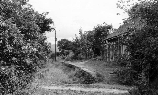
Spring Bank is a small village located in Cumberland, England. It is situated in the northern part of the county, close to the Scottish border. The village is known for its picturesque countryside and charming rural atmosphere.

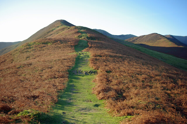
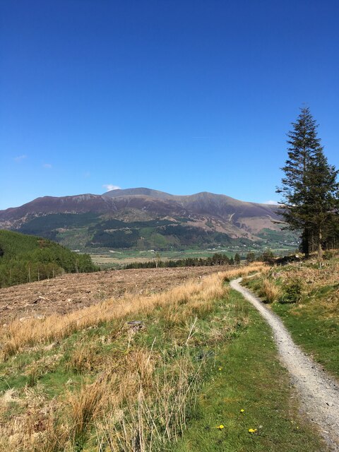
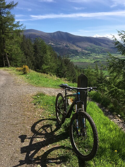
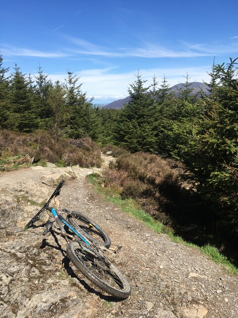
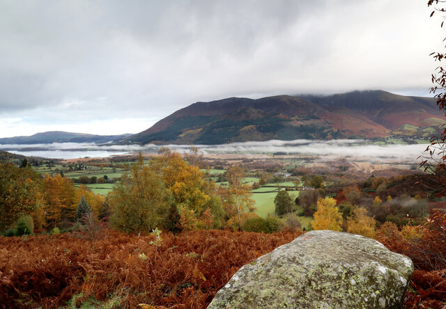
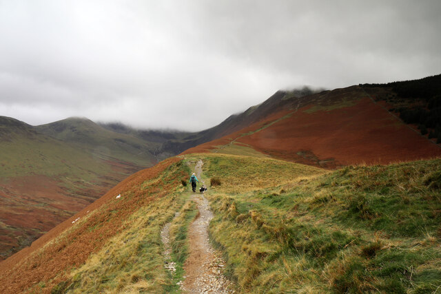
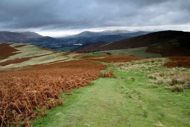
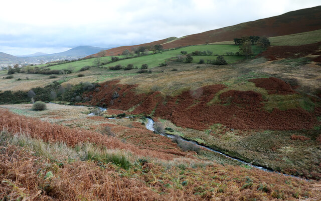
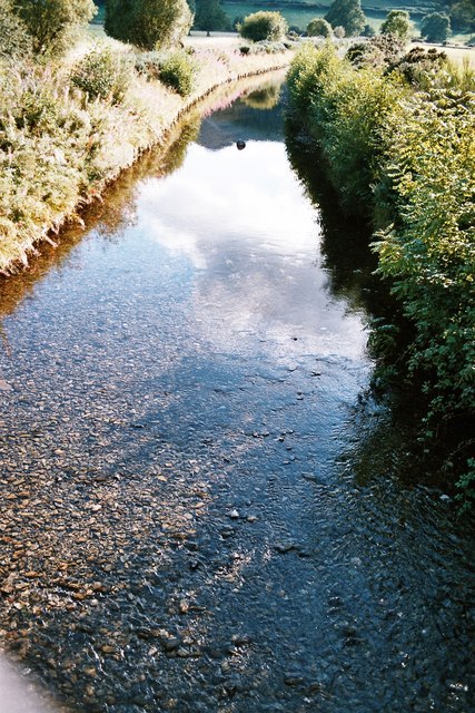
Much of Spring Bank's landscape is characterized by rolling hills, lush green fields, and meandering streams. The village is surrounded by a mix of farmland and woodland, providing residents and visitors with ample opportunities for outdoor activities such as hiking, cycling, and wildlife spotting.

The village itself is small, with a population of around 500 people. It has a close-knit community, where neighbors often know each other and come together for local events and celebrations. The architecture of the village is predominantly traditional, with stone cottages and houses lining the streets. There is also a small village green, where residents can gather and enjoy the peaceful surroundings.

Spring Bank has limited amenities, with a few shops and a local pub providing essential services and a place for socializing. For more extensive shopping and entertainment options, residents often travel to nearby towns and cities.

Overall, Spring Bank offers a tranquil and idyllic setting for those seeking a quiet rural lifestyle. Its natural beauty and sense of community make it an attractive place to live or visit for those who appreciate the charm of the English countryside.

If you have any feedback on the listing, please let us know in the comments section below.
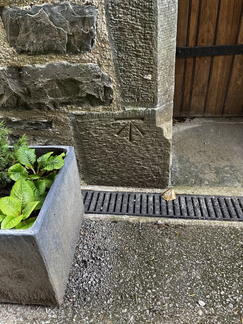
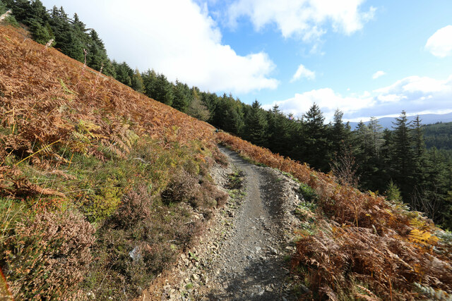
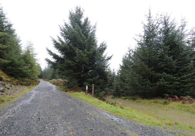
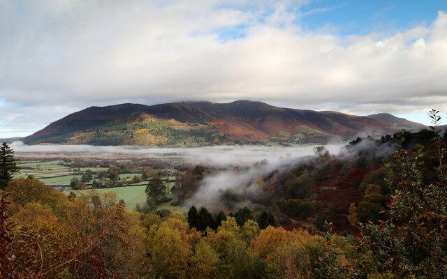
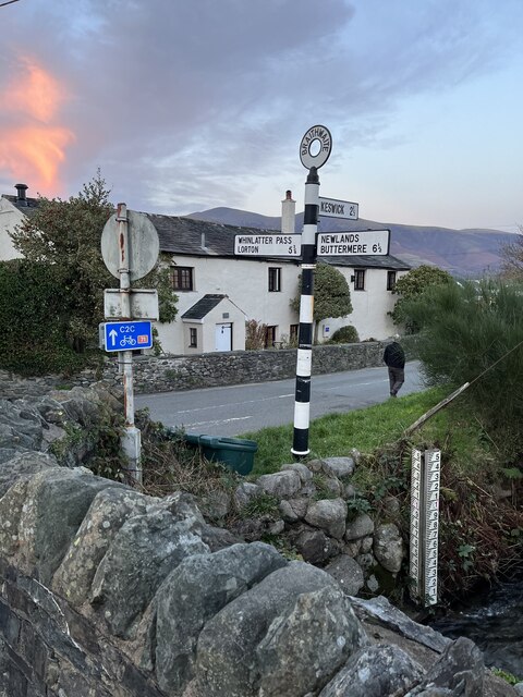
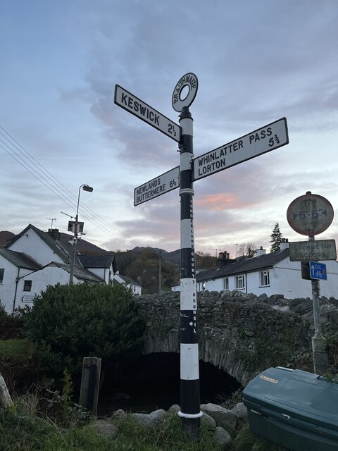
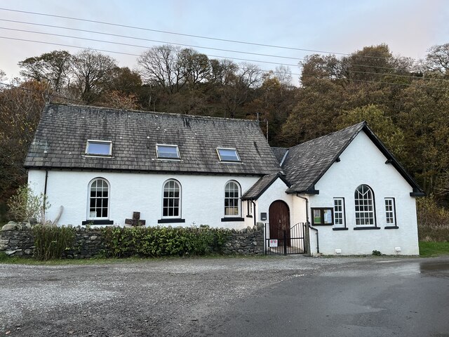
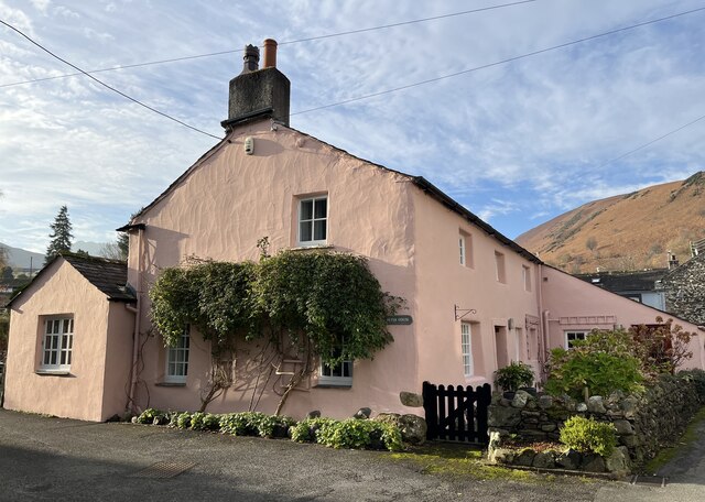
Spring Bank Images

Images are sourced within 2km of 54.605121/-3.2090288 or Grid Reference NY2224. Thanks to Geograph Open Source API. All images are credited.

Path up Barrow The path climbs the northern spur. The ridge continues to Stile End and Outerside (catching the sun on the right).
Path up Barrow
The path climbs the northern spur. The ridge continues to Stile End and Outerside (catching the sun on the right).
Mountain bike track, Whinlatter
Mountain bike track, Hospital Plantation, Whinlatter Forest Park
Benchmark on Thornthwaite Chapel, Thornwaite Benchmark description <span class="nowrap"><a title="https://www.bench-marks.org.uk/bm123734" rel="nofollow ugc noopener" href="https://www.bench-marks.org.uk/bm123734">Link</a><img style="margin-left:2px;" alt="External link" title="External link - shift click to open in new window" src="https://s1.geograph.org.uk/img/external.png" width="10" height="10"/></span>
Benchmark on Thornthwaite Chapel, Thornwaite
Benchmark description LinkExternal link
North Loop bike trail coming out of Whinlatter forest onto the open fell This mountain bike trail is supposed to be for bikes only and one-way, downhill. However signposting and trail marking is not all it could be, and we found ourselves walking uphill from a grassy forest ride onto the trail and were not prepared to lose a load of height to find our way back to a more suitable route. Fortunately, walkers are up and about earlier than bikers and we had the trail to ourselves until it rejoined the main forestry track. No bikes or riders were harmed by us or the dog... nor vice versa.
North Loop bike trail coming out of Whinlatter forest onto the open fell
This mountain bike trail is supposed to be for bikes only and one-way, downhill. However signposting and trail marking is not all it could be, and we found ourselves walking uphill from a grassy forest ride onto the trail and were not prepared to lose a load of height to find our way back to a more suitable route. Fortunately, walkers are up and about earlier than bikers and we had the trail to ourselves until it rejoined the main forestry track. No bikes or riders were harmed by us or the dog... nor vice versa.
Track junction in Beckstones Plantation
Radiation fog clings to the slopes of Braithwaite How A cold night has filled the valleys with radiation fog, with the peaks and higher slopes initially clear of the roiling mists. An increasing northwesterly wind is starting to move the air, and is bringing clouds to the tops, limiting the sunlight reaching the valleys. Where the trees slow the breeze, fog lingers on the slopes of Braithwaite How. Across the valley, Skiddaw is just losing its summit view - one had to be out early to get sun on the tops today !
Radiation fog clings to the slopes of Braithwaite How
A cold night has filled the valleys with radiation fog, with the peaks and higher slopes initially clear of the roiling mists. An increasing northwesterly wind is starting to move the air, and is bringing clouds to the tops, limiting the sunlight reaching the valleys. Where the trees slow the breeze, fog lingers on the slopes of Braithwaite How. Across the valley, Skiddaw is just losing its summit view - one had to be out early to get sun on the tops today !
Boulder among the bracken, Kinn The underlying solid geology of Kinn is the Kirkstile Formation of laminated mudstones and siltstones of Arenig (Ordovician) age, but the boulder doesn't seem to match that description and is likely to be a glacial erratic, brought by ice sheets from elsewhere. The rounded shape supports that conclusion. There is no bedrock showing here, and the rock sits on a slope heavily infested with bracken, above scattered woodland showing autumn colours. The view across the rapidly clearing morning radiation fog is towards Skiddaw and Bassenthwaite (one of those very rare things in the Lake District - a lake - as opposed to a water or a mere).
Boulder among the bracken, Kinn
The underlying solid geology of Kinn is the Kirkstile Formation of laminated mudstones and siltstones of Arenig (Ordovician) age, but the boulder doesn't seem to match that description and is likely to be a glacial erratic, brought by ice sheets from elsewhere. The rounded shape supports that conclusion. There is no bedrock showing here, and the rock sits on a slope heavily infested with bracken, above scattered woodland showing autumn colours. The view across the rapidly clearing morning radiation fog is towards Skiddaw and Bassenthwaite (one of those very rare things in the Lake District - a lake - as opposed to a water or a mere).
Ascending Kinn towards Grisedale Pike After a steep pull from the road, the path to Grisedale Pike ascends more gently for a while up Kinn, as the morning sun disappears behind increasing amounts of cloud formed by a stiff northwesterly breeze. This is hardly unexpected in the Lakes in November, but an hour earlier the tops had been clear above a thermal inversion causing fog in the valley and we'd hoped for better views at least early in the walk. The forecast predicted an hour with rain in the middle of the day, so we counted ourselves fortunate that that didn't materialise.
Ascending Kinn towards Grisedale Pike
After a steep pull from the road, the path to Grisedale Pike ascends more gently for a while up Kinn, as the morning sun disappears behind increasing amounts of cloud formed by a stiff northwesterly breeze. This is hardly unexpected in the Lakes in November, but an hour earlier the tops had been clear above a thermal inversion causing fog in the valley and we'd hoped for better views at least early in the walk. The forecast predicted an hour with rain in the middle of the day, so we counted ourselves fortunate that that didn't materialise.
Looking back down Kinn Kinn forms the normal route of ascent of Grisedale Pike from the northeast near Braithwaite and steepens into Sleet How at about the point where this photograph was taken. There's about 400m of ascent to go, the majority of it now steep, so photography is always a good excuse to avoid starting the day's hard work...
Looking back down Kinn
Kinn forms the normal route of ascent of Grisedale Pike from the northeast near Braithwaite and steepens into Sleet How at about the point where this photograph was taken. There's about 400m of ascent to go, the majority of it now steep, so photography is always a good excuse to avoid starting the day's hard work...
Sleet How climbs towards Grisedale Pike After an initial steep pull from Kinn, the path up Sleet How eases off for a while before the longer climb to the summit of Grisedale Pike. The latter lies immediately above the steep section without any of the demoralising false summits that beset some of these hills. An increasing northwesterly was bringing cloud to the tops, but at this point, blue sky and patches of sunshine had appeared, fueling hopes of a summit view. Alas, it wasn't to be, but at least the approach provided good scenery.
Sleet How climbs towards Grisedale Pike
After an initial steep pull from Kinn, the path up Sleet How eases off for a while before the longer climb to the summit of Grisedale Pike. The latter lies immediately above the steep section without any of the demoralising false summits that beset some of these hills. An increasing northwesterly was bringing cloud to the tops, but at this point, blue sky and patches of sunshine had appeared, fueling hopes of a summit view. Alas, it wasn't to be, but at least the approach provided good scenery.
Rocks outcrop on Sleet How The ridge of Kinn and Sleet How is entirely formed from the laminated mudstones and siltstones of the Kirkstile Formation of Arenig (Ordovician) age. As the path steepens, this starts to appear in frequent outcrops such as this one. The strata dip quite steeply to the left of the photograph, towards a syncline whose axis runs parallel to the ridge and about forty metres below at this point. A corresponding anticline lies off to the right, again with a SW-NE axis. The rock has taken something of a polish from decades of walkers' boots and some of the slightly scrambly bits higher up can be a little on the slippery side, although skulkers' routes exist almost everywhere, and the scree is compacted to a decent trod.
Rocks outcrop on Sleet How
The ridge of Kinn and Sleet How is entirely formed from the laminated mudstones and siltstones of the Kirkstile Formation of Arenig (Ordovician) age. As the path steepens, this starts to appear in frequent outcrops such as this one. The strata dip quite steeply to the left of the photograph, towards a syncline whose axis runs parallel to the ridge and about forty metres below at this point. A corresponding anticline lies off to the right, again with a SW-NE axis. The rock has taken something of a polish from decades of walkers' boots and some of the slightly scrambly bits higher up can be a little on the slippery side, although skulkers' routes exist almost everywhere, and the scree is compacted to a decent trod.
Meanders in Coledale Beck Whilst it looks pleasant enough, pollution from the Force Crag mines further up the valley is a significant issue in the beck and whilst there is some rediation in the form of settlement ponds, no effort seems to be being made to entirely remove the ugly workings and tackle the cause of the pollution at source, let alone at the original mine owners' expense as would be proper.
Meanders in Coledale Beck
Whilst it looks pleasant enough, pollution from the Force Crag mines further up the valley is a significant issue in the beck and whilst there is some rediation in the form of settlement ponds, no effort seems to be being made to entirely remove the ugly workings and tackle the cause of the pollution at source, let alone at the original mine owners' expense as would be proper.
Traditional Cast Iron Fingerpost at Braithwaite Situated in the little village of Braithwaite by the Coledale Beck. A water level marker can also be seen. Braithwaite is only 2.5 miles from Keswick.
Traditional Cast Iron Fingerpost at Braithwaite
Situated in the little village of Braithwaite by the Coledale Beck. A water level marker can also be seen. Braithwaite is only 2.5 miles from Keswick.
Traditional old Iron Signpost at Braithwaite Old signpost beside the Coledale Beck.
Traditional old Iron Signpost at Braithwaite
Old signpost beside the Coledale Beck.
Methodist Chapel at Braithwaite
A Pretty Pink Cottage A very attractive pink house named Peter House in Braithwaite, Cumbria.
A Pretty Pink Cottage
A very attractive pink house named Peter House in Braithwaite, Cumbria.
Show me another place!

Spring Bank is located at Grid Ref: NY2224 (Lat: 54.605121, Lng: -3.2090288)

Administrative County: Cumbria

District: Allerdale

Police Authority: Cumbria

What 3 Words

///after.surprises.violin. Near Keswick, Cumbria

Related Wikis

Braithwaite

Braithwaite is a village in the northern Lake District, in Cumbria, England. Historically in Cumberland, it lies just to the west of Keswick and to the...

Braithwaite railway station

Braithwaite railway station was situated on the Cockermouth, Keswick and Penrith Railway between Penrith and Cockermouth in Cumbria, England. The station...

Thornthwaite

Thornthwaite is a village in Cumbria, England. Historically in Cumberland, it is just off the A66 road, south of Bassenthwaite Lake and within the Lake...

Coledale Beck

Coledale Beck is a minor river running through Cumbria in England. == Course == The beck rises north east of Eel Crag, where Pudding Beck meets Birkthwaite...
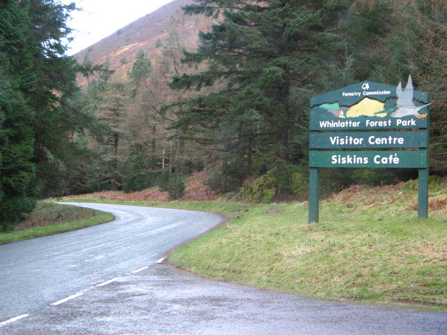
Chapel Beck

Chapel Beck is a minor river in the county of Cumbria in England. The beck rises in the Whinlatter Forest in the Lake District at the confluence of Grisedale...

Barrow (Lake District)

Barrow is small fell in the English Lake District in the county of Cumbria which reaches a height of 455 metres (1,494 feet). It is in the Newlands Valley...

Grisedale Pike

Grisedale Pike is a fell in the Lake District, Cumbria, England, situated 4+1⁄2 miles (7 kilometres) west of the town of Keswick in the north-western sector...

Whinlatter Pass

The Whinlatter Pass is a mountain pass in the Lake District in Cumbria, England. It is located on the B5292 road linking Braithwaite, to the west of Keswick...

Nearby Amenities

Located within 500m of 54.605121,-3.2090288
Hiking: yes
Information: guidepost
Source: GPS survey
Tourism: information
Lat/Long: 54.6059906/-3.2089802
57
Hiking: yes
Information: guidepost
Source: GPS survey
Tourism: information
Lat/Long: 54.604894/-3.2103264
51
Hiking: yes
Information: guidepost
Source: GPS survey
Tourism: information
Lat/Long: 54.6067504/-3.2118539
49 Masmill Oaks
Hiking: yes
Information: guidepost
Source: GPS survey
Tourism: information
Lat/Long: 54.6059197/-3.2122971
Leisure: picnic_table
Material: stone
Lat/Long: 54.6047853/-3.2124243
Heavy Sides
Place: locality
Lat/Long: 54.6027627/-3.2070987
Whinlatter Allotment
Place: locality
Lat/Long: 54.606168/-3.2081361
Grit Bin
Lat/Long: 54.6079464/-3.2088807
The data included in this document is from www.openstreetmap.org. The data is made available under ODbL.

Have you been to Spring Bank?

Leave your review of Spring Bank below (or comments, questions and feedback).