South Perrott

Settlement in Dorset

England

South Perrott

Cedrics, The White Swan, Misterton Sells cider and the award-winning Somerset cider and apple cake (which I can testify is truly delicious).
Cedrics, The White Swan, Misterton Credit: Trevor Harris

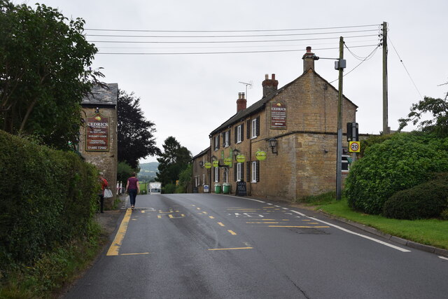
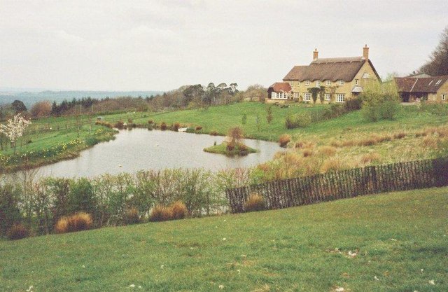
South Perrott is a small village located in the county of Dorset, England. Situated in the picturesque West Dorset district, it lies approximately 6 miles northwest of the market town of Beaminster and 12 miles south of Yeovil, Somerset. The village is nestled in a rural landscape, surrounded by rolling hills and scattered farmlands.

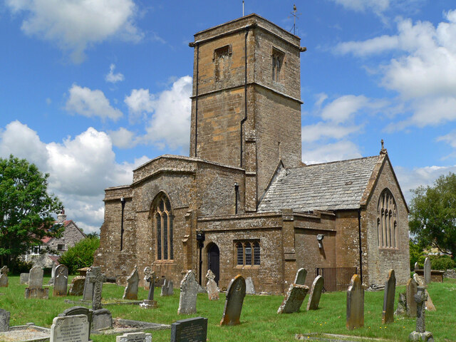
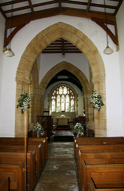
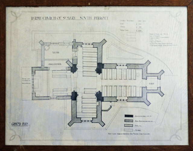
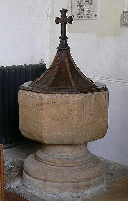
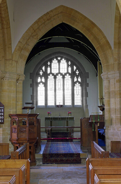
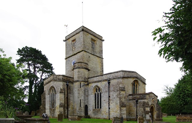
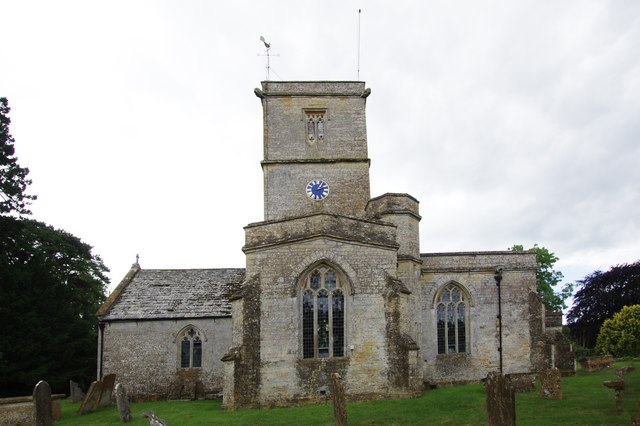
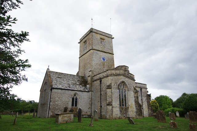
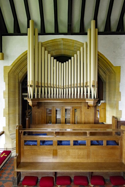
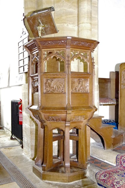
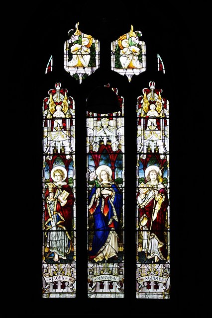
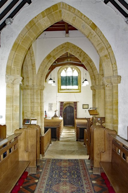
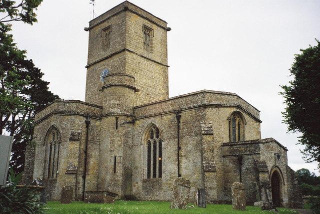
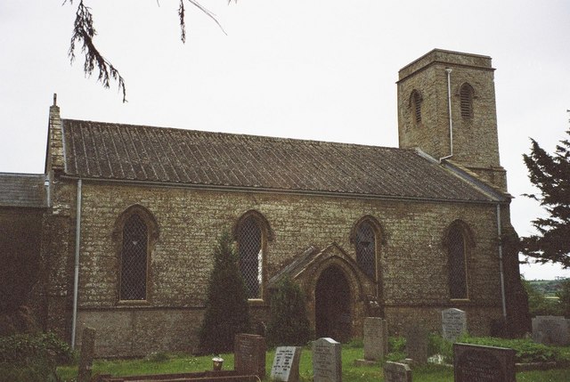
South Perrott is renowned for its charming and idyllic character. Its quaint thatched-roof cottages, ancient stone buildings, and vibrant flower gardens create a picturesque scene that attracts visitors from near and far. The village is also home to the Grade I listed Church of St. Mary, a historic building dating back to the 13th century, offering a glimpse into the rich heritage of the area.

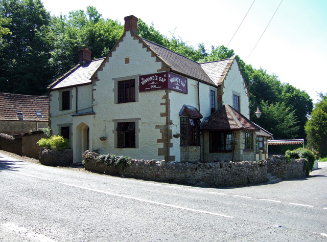
Despite its small size, South Perrott boasts a strong sense of community. The village features a local pub, The Chetnole Inn, which serves as a meeting place for residents and visitors alike. Additionally, the village hall hosts various social events and activities throughout the year, fostering a sense of togetherness.

Surrounding South Perrott, there are ample opportunities for outdoor enthusiasts to explore the beautiful countryside. The nearby countryside offers scenic walking and cycling routes, with the Dorset Area of Outstanding Natural Beauty just a short distance away.

In conclusion, South Perrott is a charming and picturesque village in Dorset, known for its quaint architecture, strong sense of community, and access to the stunning surrounding countryside. It offers a peaceful retreat for those seeking a rural escape in the heart of England's countryside.

If you have any feedback on the listing, please let us know in the comments section below.

South Perrott Images

Images are sourced within 2km of 50.859019/-2.7498382 or Grid Reference ST4706. Thanks to Geograph Open Source API. All images are credited.

Cedrics, The White Swan, Misterton Sells cider and the award-winning Somerset cider and apple cake (which I can testify is truly delicious).
Cedrics, The White Swan, Misterton
Sells cider and the award-winning Somerset cider and apple cake (which I can testify is truly delicious).
Old direction sign at the crossroads of the A356 and A3066 Has had a lick of paint since this photo was submitted <a href="https://www.geograph.org.uk/photo/6056439">ST4607 : Old Direction Sign - Signpost by the A356, Turnpike Cross, Misterton</a> and the arms re-arranged.
Old direction sign at the crossroads of the A356 and A3066
Has had a lick of paint since this photo was submitted ST4607 : Old Direction Sign - Signpost by the A356, Turnpike Cross, Misterton and the arms re-arranged.
St. Mary's, South Perrott, Dorset
St. Mary's, South Perrott, Dorset The Nave
St. Mary's, South Perrott, Dorset
The Nave
St. Mary's, South Perrott, Dorset Floor plan
St. Mary's, South Perrott, Dorset
Floor plan
St. Mary's, South Perrott, Dorset
St. Mary's, South Perrott, Dorset Previously taken in 2009.
St. Mary's, South Perrott, Dorset
Previously taken in 2009.
St Mary's Church, South Perrott, Dorset
St Mary's Church, South Perrott, Dorset The Church organ.
St Mary's Church, South Perrott, Dorset
The Church organ.
St Mary's Church, South Perrott, Dorset The Pulpit.
St Mary's Church, South Perrott, Dorset
The Pulpit.
St Mary's Church, South Perrott, Dorset The South Transept window.
St Mary's Church, South Perrott, Dorset
The South Transept window.
St Mary's Church, South Perrott, Dorset Westward view of the Nave.
St Mary's Church, South Perrott, Dorset
Westward view of the Nave.
Chedington: Winyard’s Gap war memorial On the hill at Chedington, the traffic whizzes past below you on the A356.
Chedington: Winyard’s Gap war memorial
On the hill at Chedington, the traffic whizzes past below you on the A356.
South Perrott: parish church of St. Mary
Chedington: pond and cottage Location on map is approximate.
Chedington: pond and cottage
Location on map is approximate.
Winyards Gap Inn
Winyards Gap Inn
Show me another place!

South Perrott is located at Grid Ref: ST4706 (Lat: 50.859019, Lng: -2.7498382)

Unitary Authority: Dorset

Police Authority: Dorset

What 3 Words

///resonates.recall.honeybees. Near Crewkerne, Somerset

Related Wikis

South Perrott

South Perrott is a village and civil parish in northwest Dorset, England, 2 miles (3.2 km) southeast of Crewkerne. In 2012 the estimated population of...

St Mary's Church, Mosterton

St Mary's Church is a Church of England parish church in Mosterton, Dorset, England. The church was designed by Edmund Pearce and built in 1832–33 to replace...

Mosterton

Mosterton is a village and civil parish in Dorset, England, situated approximately 3 miles (4.8 km) north of Beaminster. In the 2011 census the parish...

Chedington

Chedington is a small village and civil parish in west Dorset, England, situated near the A356 road 4 miles (6.4 km) southeast of Crewkerne in Somerset...

Nearby Amenities

Located within 500m of 50.859019,-2.7498382
South Perrott
Is In: Dorset,England,UK
Place: village
Wikidata: Q2194251
Wikipedia: en:South Perrott
Lat/Long: 50.8579221/-2.7503366
Direction: 170
Generator Method: photovoltaic
Generator Output Electricity: yes
Generator Solar Modules: 6
Generator Source: solar
Generator Type: solar_photovoltaic_panel
Location: roof
Power: generator
Lat/Long: 50.8577989/-2.7445097
Direction: 185
Generator Method: photovoltaic
Generator Output Electricity: yes
Generator Solar Modules: 6
Generator Source: solar
Generator Type: solar_photovoltaic_panel
Location: roof
Power: generator
Lat/Long: 50.8566503/-2.7487362
Direction: 185
Generator Method: photovoltaic
Generator Output Electricity: yes
Generator Solar Modules: 8
Generator Source: solar
Generator Type: solar_photovoltaic_panel
Location: roof
Power: generator
Lat/Long: 50.8566522/-2.7488337
Direction: SSW
Generator Method: photovoltaic
Generator Output Electricity: yes
Generator Solar Modules: 12
Generator Source: solar
Generator Type: solar_photovoltaic_panel
Location: roof
Power: generator
Lat/Long: 50.8569329/-2.7480324
Direction: 185
Generator Method: photovoltaic
Generator Output Electricity: yes
Generator Solar Modules: 16
Generator Source: solar
Generator Type: solar_photovoltaic_panel
Location: roof
Power: generator
Lat/Long: 50.8591126/-2.7506577
Direction: 195
Generator Method: photovoltaic
Generator Output Electricity: yes
Generator Solar Modules: 14
Generator Source: solar
Generator Type: solar_photovoltaic_panel
Location: roof
Power: generator
Lat/Long: 50.8572791/-2.7483952
Defibrillator
Defibrillator Location: outside South Perrott Village Hall
Emergency: defibrillator
Indoor: no
Lat/Long: 50.8586016/-2.7498078
Telephone
Booth: K6
Covered: booth
Lat/Long: 50.8582233/-2.7510176
Post Box
Post Box Type: lamp
Royal Cypher: EIIR
Lat/Long: 50.8582651/-2.7511178
Advertising: board
Lat/Long: 50.8582933/-2.7512
Bench
Lat/Long: 50.8582809/-2.7512912
Entrance: main
Lat/Long: 50.8571036/-2.7515989
The data included in this document is from www.openstreetmap.org. The data is made available under ODbL.

Have you been to South Perrott?

Leave your review of South Perrott below (or comments, questions and feedback).