Simon Stone

Settlement in Yorkshire Richmondshire

England

Simon Stone

Stone House Manor Grade II listed. Listing number 1167238.
1908. By architect Percy Morley Horder of London, for Hugh Arden Crallan (1867- 1929).
Stone House Manor Credit: Andrew Abbott

Simon Stone is a small village located in the county of Yorkshire, England. Situated in the district of Ryedale, it is positioned approximately 5 miles northeast of the market town of Pickering. The village is nestled amidst picturesque countryside and boasts a tranquil and serene atmosphere that attracts visitors seeking a peaceful retreat from the bustle of urban life.

Simon Stone is renowned for its rich historical heritage, with evidence of human activity dating back to the prehistoric era. The village is particularly famous for its ancient stone circle, known as the Simon Stone Circle, which is believed to have been erected during the Bronze Age. This archaeological site is a source of fascination for historians and draws inquisitive tourists from far and wide.

The village itself is relatively small, with a population of around 200 residents. It exudes a charming rustic charm, characterized by traditional stone-built cottages and quaint narrow streets. The local community is close-knit and friendly, offering a warm welcome to visitors.

The surrounding countryside provides ample opportunities for outdoor activities such as hiking, cycling, and birdwatching. The nearby North York Moors National Park offers breathtaking scenic vistas and diverse wildlife, making it a paradise for nature enthusiasts.

Simon Stone's location also grants easy access to nearby attractions, including the historic city of York and the stunning Yorkshire coastline. With its blend of history, natural beauty, and peaceful ambiance, Simon Stone is a hidden gem in Yorkshire, providing an ideal destination for those seeking a tranquil getaway.

If you have any feedback on the listing, please let us know in the comments section below.
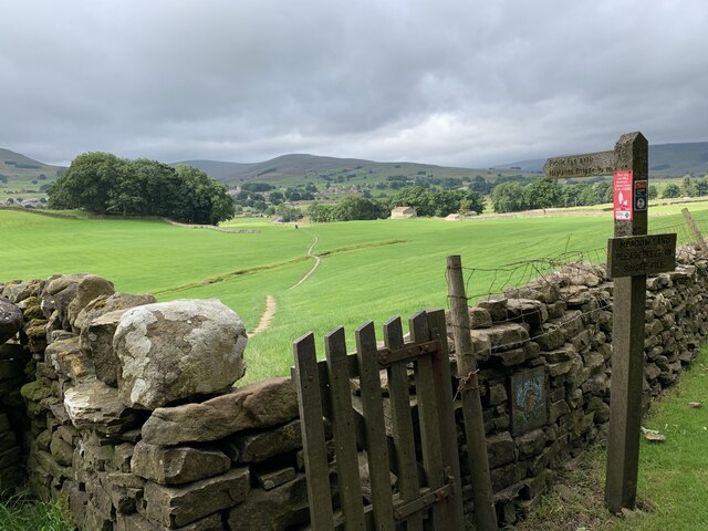
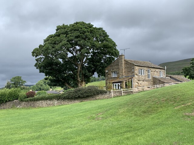
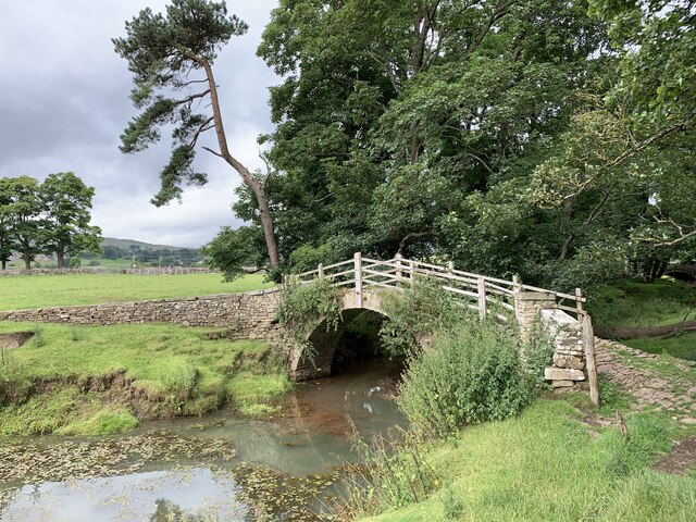
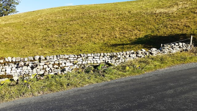
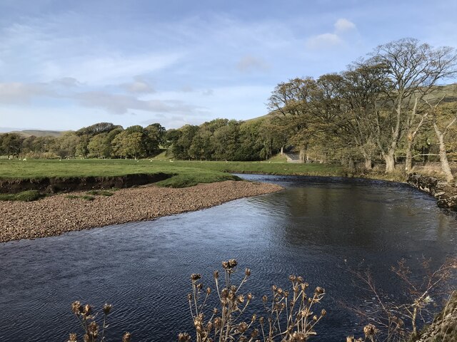
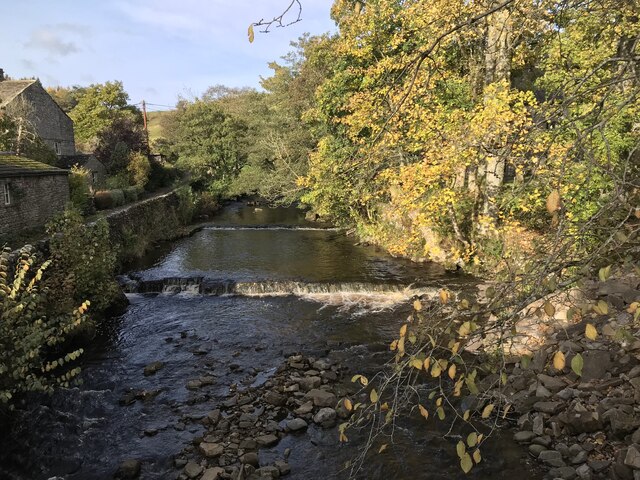
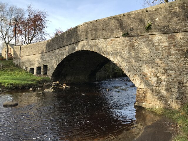
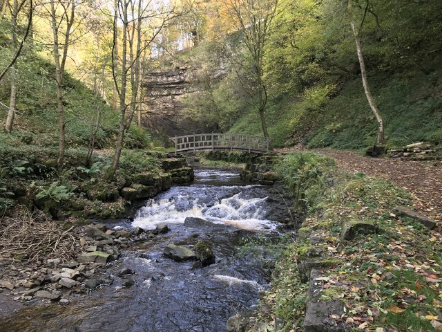
Simon Stone Images

Images are sourced within 2km of 54.318934/-2.195975 or Grid Reference SD8791. Thanks to Geograph Open Source API. All images are credited.

Stone House Manor Grade II listed. Listing number 1167238.
1908. By architect Percy Morley Horder of London, for Hugh Arden Crallan (1867- 1929).
Stone House Manor
Grade II listed. Listing number 1167238. 1908. By architect Percy Morley Horder of London, for Hugh Arden Crallan (1867- 1929).
Footpath to Haylands Bridge Above Hawes.
Footpath to Haylands Bridge
Above Hawes.
The Cow Pasture Barn Hawes, North Yorkshire.
The Cow Pasture Barn
Hawes, North Yorkshire.
Footbridge over the stream Near the River Ure.
Footbridge over the stream
Near the River Ure.
Dry stone wall on north side of road into Hardraw from the west Ordnance Survey documents indicate that a benchmark levelled at 232.477m above Newlyn Datum was verified in 1954 on a stone at the base of the wall
Dry stone wall on north side of road into Hardraw from the west
Ordnance Survey documents indicate that a benchmark levelled at 232.477m above Newlyn Datum was verified in 1954 on a stone at the base of the wall
Hardraw Force
Hardraw Force
Hardraw Force
Hardraw Force
River Ure
River Ure
River Ure
River Ure
River Ure
River Ure
Hardraw Beck
Hardraw Beck
Hardraw Bridge
Hardraw Bridge
Hardraw Beck
Hardraw Beck
Hardraw Force
Hardraw Force
Hardraw Force
Hardraw Force
The Pennine Way near Bluebell Hill
The Pennine Way near Hollin Hill
The Pennine Way near Hardraw
Show me another place!

Simon Stone is located at Grid Ref: SD8791 (Lat: 54.318934, Lng: -2.195975)

Division: North Riding

Administrative County: North Yorkshire

District: Richmondshire

Police Authority: North Yorkshire

What 3 Words

///licks.richest.mammals. Near Kirkby Stephen, Cumbria

Related Wikis

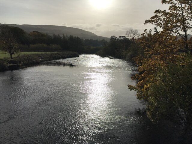
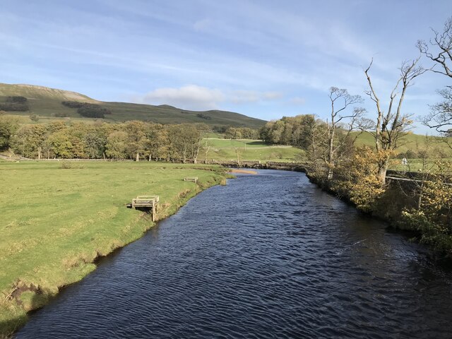
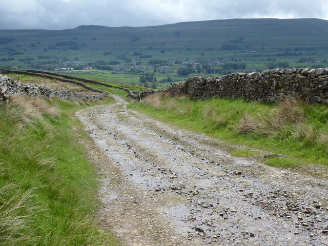
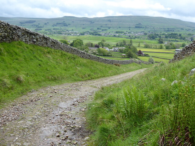
Simonstone, North Yorkshire

Simonstone is a hamlet near Hawes and Hardraw Force within the Yorkshire Dales in North Yorkshire, England. == References ==
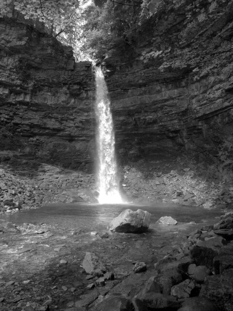
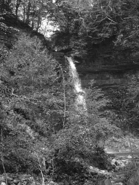
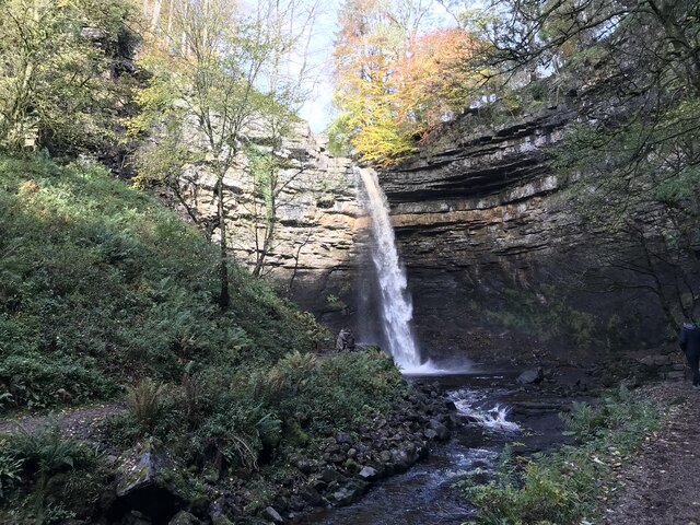
Hardraw Force

Hardraw Force (OS grid ref: SD869917) is a waterfall on Hardraw Beck in Hardraw Scar, a wooded ravine just outside the hamlet of Hardraw, 0.9 miles (1...

St Mary and St John's Church, Hardraw

St Mary and St John's Church, Hardraw (also Hardrow) is a Grade II listed parish church in the Church of England: 181  in Hardraw, North Yorkshire. �...
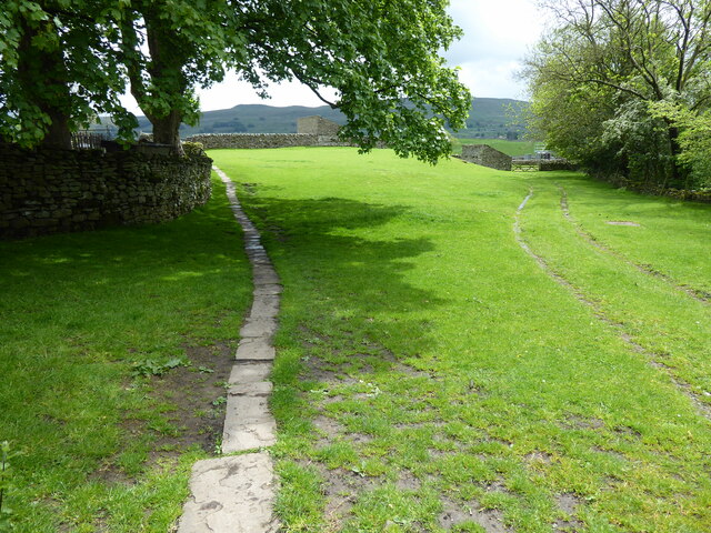
Hardraw

Hardraw is a hamlet near Hawes within the Yorkshire Dales in North Yorkshire, England. It takes its name from the nearby Hardraw Force waterfall. The old...

Nearby Amenities

Located within 500m of 54.318934,-2.195975
Fixme: stile, gate or entramce?
Lat/Long: 54.3174346/-2.2003266
Hardraw Force
Tourism: attraction
Waterway: waterfall
Wikidata: Q3355636
Wikipedia: en:Hardraw Force
Lat/Long: 54.3198038/-2.2019924
Barrier: stile
Material: stone
Source: survey;gps
Stile: squeezer
Lat/Long: 54.3185447/-2.2019605
Fixme: stile, gate or entramce?
Lat/Long: 54.3204376/-2.2009161
Simonstone
Place: hamlet
Wikidata: Q9337078
Lat/Long: 54.3195955/-2.1983478
Telephone
Booth: K6
Covered: booth
Lat/Long: 54.3197727/-2.1992797
Barrier: stile
Lat/Long: 54.3187242/-2.1974023
Fixme: Continues south
Lat/Long: 54.3203989/-2.2018153
Fixme: stile, gate or entramce?
Lat/Long: 54.3187761/-2.2003465
Entrance: yes
Lat/Long: 54.3165219/-2.1897044
Waterway: waterfall
Lat/Long: 54.3213902/-2.2020048
Designation: public_footpath
Lat/Long: 54.320755/-2.2021346
Barrier: stile
Lat/Long: 54.3222233/-2.1946692
Barrier: stile
Lat/Long: 54.3179529/-2.202447
Fixme: stile, gate or entramce?
Lat/Long: 54.3173467/-2.2014554
Fixme: stile, gate or entramce?
Lat/Long: 54.3207813/-2.2020673
Power: pole
Lat/Long: 54.3182505/-2.1948718
Power: pole
Lat/Long: 54.3189756/-2.1962283
Power: pole
Lat/Long: 54.3195282/-2.1972777
Power: pole
Lat/Long: 54.3201708/-2.1984954
Power: pole
Lat/Long: 54.3185524/-2.2031651
Power: pole
Lat/Long: 54.3186917/-2.2020493
Power: pole
Lat/Long: 54.3208075/-2.1989299
Power: pole
Lat/Long: 54.3204258/-2.1993685
Power: pole
Lat/Long: 54.3200449/-2.1998325
Power: pole
Lat/Long: 54.3193612/-2.2009456
Power: pole
Lat/Long: 54.3190327/-2.2015089
Power: pole
Lat/Long: 54.3176661/-2.1926133
Power: pole
Lat/Long: 54.317505/-2.1914358
Power: pole
Lat/Long: 54.3172985/-2.1899043
Power: pole
Lat/Long: 54.3191614/-2.1982004
Power: pole
Lat/Long: 54.319416/-2.1982393
Bench
Backrest: yes
Material: wood
Tourism: artwork
Lat/Long: 54.3179475/-2.2024975
Simonstone Hall Hotel
Addr City: Hawes
Addr Housename: Simonstone Hall Hotel
Addr Postcode: DL8 3LY
Phone: +44 1969 667255
Tourism: hotel
Website: https://simonstonehall.com/
Lat/Long: 54.3192861/-2.1990775
Post Box
Post Box Type: wall
Ref: DL8 45
Royal Cypher: GR
Royal Cypher Wikidata: Q33102273
Lat/Long: 54.3188987/-2.1976101
Fixme: stile, gate or entramce?
Lat/Long: 54.3205379/-2.1995603
Power: pole
Lat/Long: 54.3212408/-2.1994588
Power: pole
Lat/Long: 54.3214998/-2.199785
Power: pole
Lat/Long: 54.3221409/-2.2006482
The data included in this document is from www.openstreetmap.org. The data is made available under ODbL.

Have you been to Simon Stone?

Leave your review of Simon Stone below (or comments, questions and feedback).