Rotherham

Settlement in Yorkshire

England

Rotherham

Iccles Locks View from the Iccles road bridge across the Sheffield and South Yorkshire Navigation canal.
Iccles Locks Credit: Ryk Rak

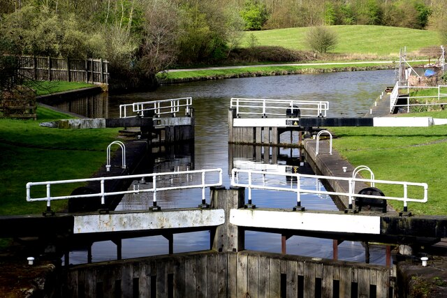
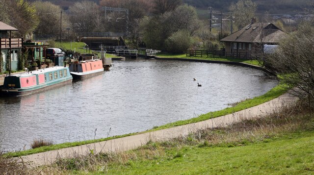
Rotherham is a town situated in South Yorkshire, England. It is located on the banks of the River Don, about 10 miles northeast of Sheffield. With a population of around 260,000, it is one of the largest towns in the region. Rotherham has a rich industrial heritage, particularly in coal mining and steel production, which were key economic activities in the area during the 19th and 20th centuries.

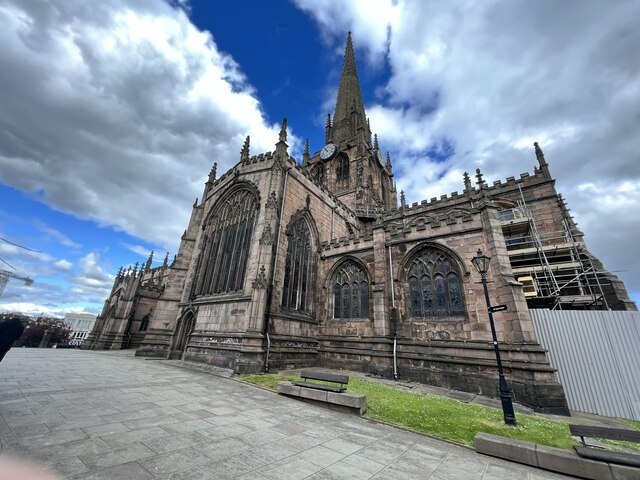
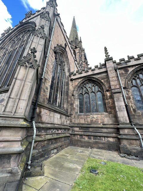
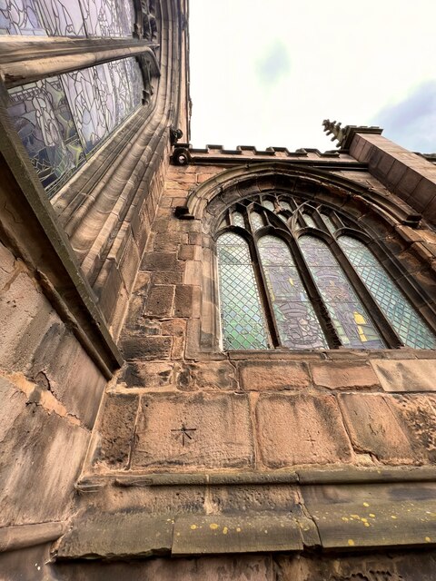
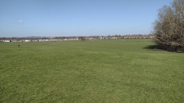
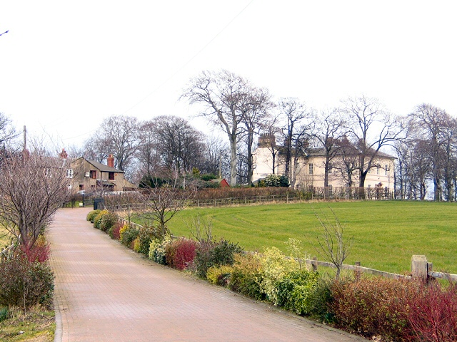
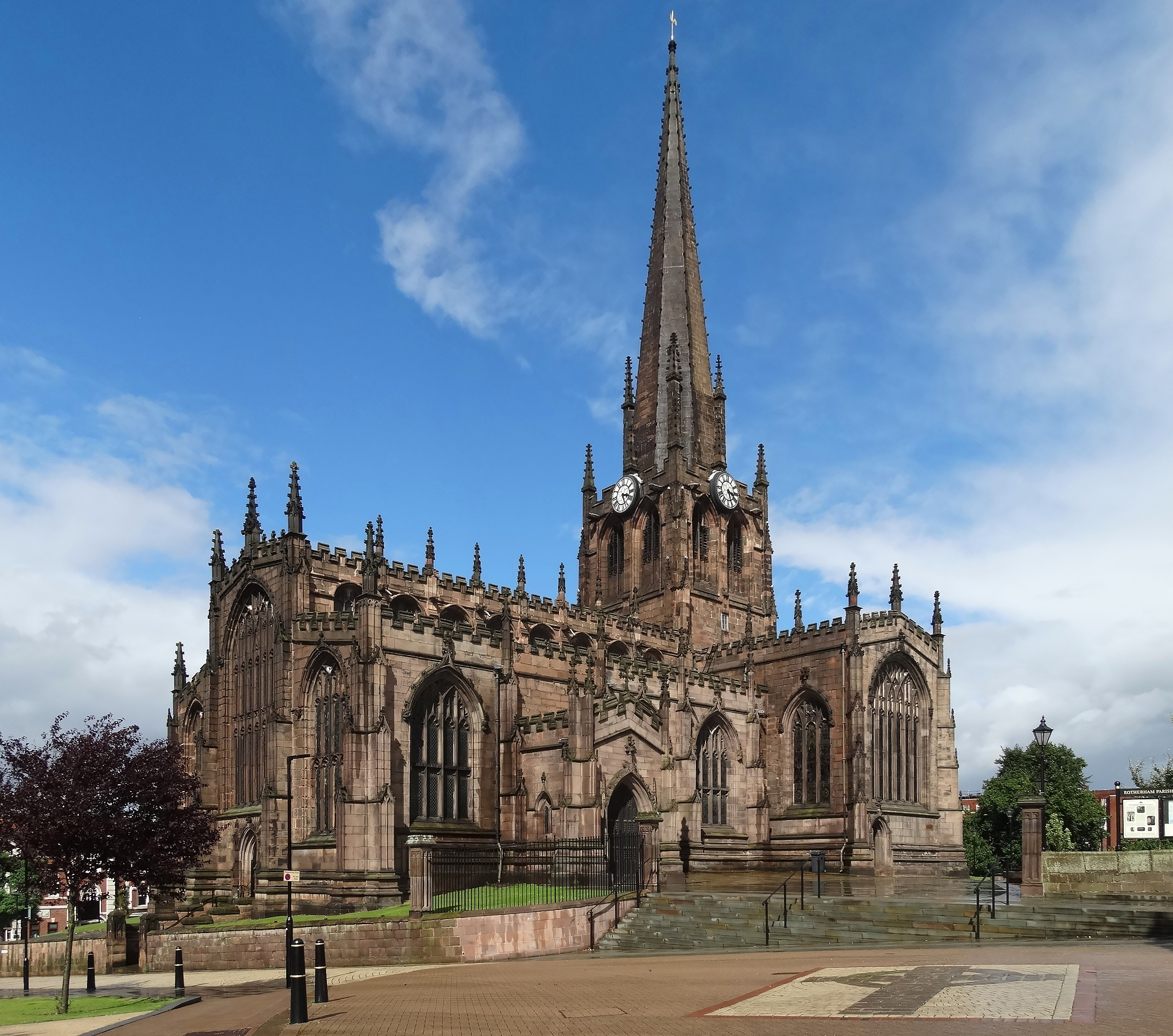
The town is known for its historical landmarks, including the imposing Rotherham Minster, a medieval church that dates back to the 15th century. Another notable landmark is Clifton Park, a large public park that offers a range of recreational facilities such as sports fields, a museum, and a boating lake.

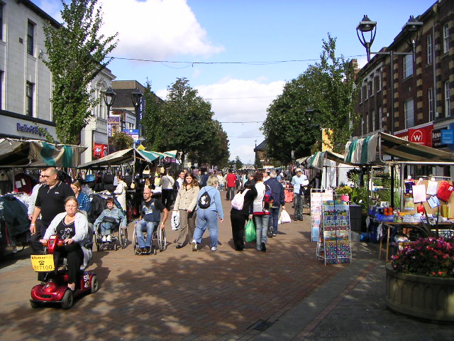
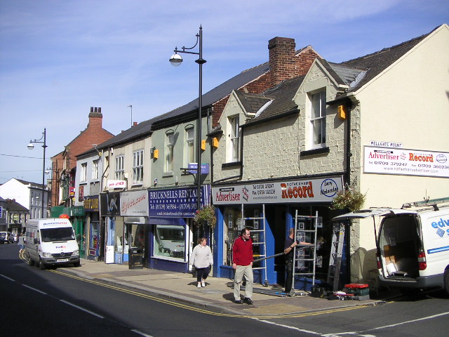
Rotherham also boasts a vibrant cultural scene, with various art galleries, theaters, and music venues. The town center features a mix of modern shopping centers and traditional markets, offering a diverse retail experience. Additionally, Rotherham hosts several annual events, including the Rotherham Show, a popular agricultural show that attracts visitors from across the region.

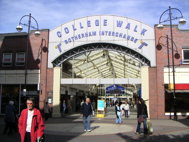
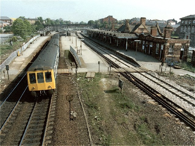
The town benefits from good transport links, with the M1 motorway passing nearby and several railway stations providing connections to major cities like Sheffield, Leeds, and Manchester. Rotherham also has a well-developed public transportation system, including bus services that cater to both local and regional travel.

Overall, Rotherham offers a blend of historical charm, cultural attractions, and convenient amenities, making it an appealing place to live or visit in Yorkshire.

If you have any feedback on the listing, please let us know in the comments section below.

Rotherham Images

Images are sourced within 2km of 53.430709/-1.354731 or Grid Reference SK4292. Thanks to Geograph Open Source API. All images are credited.

Iccles Locks View from the Iccles road bridge across the Sheffield and South Yorkshire Navigation canal.
Iccles Locks
View from the Iccles road bridge across the Sheffield and South Yorkshire Navigation canal.
Iccles canal basin Canal basin next to the Iccles locks (seen in the background)
Iccles canal basin
Canal basin next to the Iccles locks (seen in the background)
All Saints Church - (Rotherham Minster) - Church Street - Rotherham (a) All Saints Church (Rotherham Minster) in Rotherham
All Saints Church - (Rotherham Minster) - Church Street - Rotherham (a)
All Saints Church (Rotherham Minster) in Rotherham
PA Bolt - All Saints Church - (Rotherham Minster) - Rotherham (a) PA Bolt nestled in the corner on the South Face of the Minster.
PA Bolt - All Saints Church - (Rotherham Minster) - Rotherham (a)
PA Bolt nestled in the corner on the South Face of the Minster.
PA Bolt - All Saints Church - (Rotherham Minster) - Rotherham (b) PA Bolt nestled in the corner on the South Face of the Minster.
PA Bolt - All Saints Church - (Rotherham Minster) - Rotherham (b)
PA Bolt nestled in the corner on the South Face of the Minster.
PA Bolt - All Saints Church - (Rotherham Minster) - Rotherham (c) PA Bolt nestled in the corner on the South Face of the Minster. Lovely benchmark on a superb Church
PA Bolt - All Saints Church - (Rotherham Minster) - Rotherham (c)
PA Bolt nestled in the corner on the South Face of the Minster. Lovely benchmark on a superb Church
Paths on the edge of Herringthorpe Playing Field Paths on the edge of Herringthorpe Playing Field looking to houses on Broom Road
Paths on the edge of Herringthorpe Playing Field
Paths on the edge of Herringthorpe Playing Field looking to houses on Broom Road
Herringthorpe Playing Fields Herringthorpe Playing Fields looking to Badsley Moor Lane
Herringthorpe Playing Fields
Herringthorpe Playing Fields looking to Badsley Moor Lane
Cycling Weathervane This weathervane takes the form of a cyclist, which is very apt as it is on top of a cycle shop. The building is an ex-fire station, which explains the tower.
Cycling Weathervane
This weathervane takes the form of a cyclist, which is very apt as it is on top of a cycle shop. The building is an ex-fire station, which explains the tower.
Retail World This is Retail World Shopping Centre at Parkgate.
It was built on the site of a former slag reduction works.
Retail World
This is Retail World Shopping Centre at Parkgate. It was built on the site of a former slag reduction works.
Effingham Street, Rotherham Looking north down Effingham Street, Rotherham. The scene shows the street market which is held every Tuesday.
Effingham Street, Rotherham
Looking north down Effingham Street, Rotherham. The scene shows the street market which is held every Tuesday.
Norfolk Street, Rotherham View of Norfolk Street, looking south-east. The council offices of Norfolk House can be seen on the left, and Rotherham Central Library and Arts Centre is on the right.
Norfolk Street, Rotherham
View of Norfolk Street, looking south-east. The council offices of Norfolk House can be seen on the left, and Rotherham Central Library and Arts Centre is on the right.
Rotherham Interchange Rotherham Interchange, viewed from the junction of Frederick Street and Howard Street.
Rotherham Interchange
Rotherham Interchange, viewed from the junction of Frederick Street and Howard Street.
Wellgate, Rotherham Wellgate, looking north-west towards Rotherham town centre.
Wellgate, Rotherham
Wellgate, looking north-west towards Rotherham town centre.
Railway Station (former), Rotherham Masborough The former Rotherham Masborough Station. The photograph was taken on the last day of operation. Units 53012/54003/53646 & 53601 are heading for Sheffield.
An excellent shot by Ben Brooksbank that was taken on 23 August 1963 - <a title="https://www.geograph.org.uk/photo/2058915" href="https://www.geograph.org.uk/photo/2058915">Link</a>
Railway Station (former), Rotherham Masborough
The former Rotherham Masborough Station. The photograph was taken on the last day of operation. Units 53012/54003/53646 & 53601 are heading for Sheffield. An excellent shot by Ben Brooksbank that was taken on 23 August 1963 - Link
Barbot Hall Impressive country houses at Barbot Hall on the B6089 south of Greasbrough
Barbot Hall
Impressive country houses at Barbot Hall on the B6089 south of Greasbrough
Boston Castle - Rotherham The castle, built in 1775, was a hunting lodge owned by the Earl of Effingham. The Earl marked his objection to the harsh British treatment of the American colonies, by naming the lodge Boston Castle (after Boston, Massachusetts, the scene of the Boston Tea Party of 1775). He also banned tea drinking at the castle! The building has suffered badly from vandalism and is currently derelict. It stands on a hillside with fine views over the valley of the Rivers Don and Rother.
Boston Castle - Rotherham
The castle, built in 1775, was a hunting lodge owned by the Earl of Effingham. The Earl marked his objection to the harsh British treatment of the American colonies, by naming the lodge Boston Castle (after Boston, Massachusetts, the scene of the Boston Tea Party of 1775). He also banned tea drinking at the castle! The building has suffered badly from vandalism and is currently derelict. It stands on a hillside with fine views over the valley of the Rivers Don and Rother.
Old  Sandstone Quarry in Boston Park Set into the face of this old sandstone quarry, is the 17th century doorway from a demolished Rotherham town building that incorporated the remains of the medieval College of Jesus founded by Thomas Rotherham in 1483 (centre of picture). The sandstone, known as Rotherham or Mexborough Red Rock, was extensively quarried in the area and is evident in many buildings in the town.
Old Sandstone Quarry in Boston Park
Set into the face of this old sandstone quarry, is the 17th century doorway from a demolished Rotherham town building that incorporated the remains of the medieval College of Jesus founded by Thomas Rotherham in 1483 (centre of picture). The sandstone, known as Rotherham or Mexborough Red Rock, was extensively quarried in the area and is evident in many buildings in the town.
Show me another place!

Rotherham is located at Grid Ref: SK4292 (Lat: 53.430709, Lng: -1.354731)

Division: West Riding

Unitary Authority: Rotherham

Police Authority: South Yorkshire

What 3 Words

///wipes.pasta.hungry. Near Rotherham, South Yorkshire

Related Wikis

Metropolitan Borough of Rotherham

The Metropolitan Borough of Rotherham is a metropolitan borough of South Yorkshire, England. It is named after its main settlement of Rotherham. The wider...

Rotherham Minster

The Minster Church of All Saints or Rotherham Minster is the Anglican minster church of Rotherham, South Yorkshire, England. The Minster is a prominent...

Kiveton Park Rural District

Kiveton Park was a rural district in the West Riding of Yorkshire from 1894 to 1974. It was formed under the Local Government Act 1894 from that part of...

Rother Valley (UK Parliament constituency)

Rother Valley is a constituency represented in the House of Commons of the UK Parliament by Alexander Stafford, a member of the Conservative Party. �...

Nearby Amenities

Located within 500m of 53.430709,-1.354731
Telephone
Booth: InLink
Operator: BT
Lat/Long: 53.4303808/-1.3567126
Telephone
Booth: KXPlus
Covered: booth
Lat/Long: 53.4319592/-1.3555543
Telephone
Booth: InLink
Operator: BT
Lat/Long: 53.4324383/-1.3549591
Telephone
Booth: ST6
Operator: BT
Lat/Long: 53.4333333/-1.3550092
Traffic Signals
Crossing: traffic_signals
Odbl: clean
Lat/Long: 53.4307066/-1.3547675
Corporation Street/Upper Millgate
Bus: yes
Public Transport: stop_position
Lat/Long: 53.4306541/-1.3577199
Traffic Signals
Lat/Long: 53.4321409/-1.3481893
Waterway: lock_gate
Lat/Long: 53.4305896/-1.3605089
Waterway: lock_gate
Lat/Long: 53.4307809/-1.3606676
Give Way
Lat/Long: 53.4349909/-1.3527068
Crossing
Crossing: traffic_signals
Crossing Ref: pelican
Lat/Long: 53.4294017/-1.3575988
Rotherham Central
Public Transport: stop_position
Railway: stop
Train: yes
Lat/Long: 53.4316411/-1.3610671
A5
Bus: yes
Public Transport: stop_position
Lat/Long: 53.4333963/-1.3569547
B7
Bus: yes
Public Transport: stop_position
Lat/Long: 53.4337238/-1.356487
Traffic Signals
Lat/Long: 53.4298555/-1.3571495
Traffic Signals
Crossing: traffic_signals
Lat/Long: 53.4308035/-1.3541113
Rotherham
Place: town
Population: 117262
Wikidata: Q217039
Wikipedia: en:Rotherham
Lat/Long: 53.4310417/-1.355187
Barrier: bollard
Bicycle: yes
Foot: yes
Lat/Long: 53.428007/-1.3489544
Barrier: lift_gate
Bicycle: yes
Foot: yes
Motorcar: yes
Motorcycle: yes
Lat/Long: 53.4306379/-1.3516299
Barrier: lift_gate
Bicycle: yes
Foot: yes
Motorcar: yes
Motorcycle: yes
Lat/Long: 53.4306881/-1.3518899
Wellgate/Quarry Hill
Bus: yes
Public Transport: stop_position
Lat/Long: 53.4294874/-1.3539006
Crossing
Crossing: zebra
Lat/Long: 53.4338267/-1.3493507
Bus Stop
A1
Bus: yes
Local Ref: A1
Naptan AtcoCode: 370010070
Naptan CommonName: Rotherham Interchange
Naptan Indicator: A1
Naptan Landmark: A1
Naptan PlusbusZoneRef: ROTHCEN
Naptan Street: Rotherham Bus Station
Naptan Verified: no
Public Transport: platform
Source: naptan_import
Lat/Long: 53.4329185/-1.3575542
Bus Stop
A2
Bus: yes
Local Ref: A2
Naptan AtcoCode: 370010071
Naptan CommonName: Rotherham Interchange
Naptan Indicator: A2
Naptan Landmark: A2
Naptan PlusbusZoneRef: ROTHCEN
Naptan Street: Rotherham Bus Station
Naptan Verified: no
Public Transport: platform
Source: naptan_import
Lat/Long: 53.4330741/-1.357485
Bus Stop
A3
Bus: yes
Local Ref: A3
Naptan AtcoCode: 370010072
Naptan CommonName: Rotherham Interchange
Naptan Indicator: A3
Naptan Landmark: A3
Naptan PlusbusZoneRef: ROTHCEN
Naptan Street: Rotherham Bus Station
Naptan Verified: no
Public Transport: platform
Source: naptan_import
Lat/Long: 53.4332209/-1.3573522
Bus Stop
A4
Bus: yes
Local Ref: A4
Naptan AtcoCode: 370010073
Naptan CommonName: Rotherham Interchange
Naptan Indicator: A4
Naptan Landmark: A4
Naptan PlusbusZoneRef: ROTHCEN
Naptan Street: Rotherham Bus Station
Naptan Verified: no
Public Transport: platform
Source: naptan_import
Lat/Long: 53.4333404/-1.3572028
Bus Stop
A5
Bus: yes
Local Ref: A5
Naptan AtcoCode: 370010074
Naptan CommonName: Rotherham Interchange
Naptan Indicator: A5
Naptan Landmark: A5
Naptan PlusbusZoneRef: ROTHCEN
Naptan Street: Rotherham Bus Station
Naptan Verified: no
Public Transport: platform
Source: naptan_import
Lat/Long: 53.4334471/-1.3569904
Bus Stop
A6
Bus: yes
Local Ref: A6
Naptan AtcoCode: 370010075
Naptan CommonName: Rotherham Interchange
Naptan Indicator: A6
Naptan Landmark: A6
Naptan PlusbusZoneRef: ROTHCEN
Naptan Street: Rotherham Bus Station
Naptan Verified: no
Public Transport: platform
Source: naptan_import
Lat/Long: 53.4335532/-1.3566577
Bus Stop
A7
Bus: yes
Local Ref: A7
Naptan AtcoCode: 370010076
Naptan CommonName: Rotherham Interchange
Naptan Indicator: A7
Naptan Landmark: A7
Naptan PlusbusZoneRef: ROTHCEN
Naptan Street: Rotherham Bus Station
Naptan Verified: no
Public Transport: platform
Source: naptan_import
Lat/Long: 53.4336595/-1.3563701
Bus Stop
A8
Bus: yes
Local Ref: A8
Naptan AtcoCode: 370010077
Naptan CommonName: Rotherham Interchange
Naptan Indicator: A8
Naptan Landmark: A8
Naptan PlusbusZoneRef: ROTHCEN
Naptan Street: Rotherham Bus Station
Naptan Verified: no
Public Transport: platform
Source: naptan_import
Lat/Long: 53.4337568/-1.3560826
Bus Stop
B1
Bus: yes
Local Ref: B1
Naptan AtcoCode: 370010078
Naptan CommonName: Rotherham Interchange
Naptan Indicator: B1
Naptan Landmark: B1
Naptan PlusbusZoneRef: ROTHCEN
Naptan Street: Rotherham Bus Station
Naptan Verified: no
Public Transport: platform
Source: naptan_import
Lat/Long: 53.4329603/-1.3576315
Bus Stop
B2
Bus: yes
Local Ref: B2
Naptan AtcoCode: 370010079
Naptan CommonName: Rotherham Interchange
Naptan Indicator: B2
Naptan Landmark: B2
Naptan PlusbusZoneRef: ROTHCEN
Naptan Street: Rotherham Bus Station
Naptan Verified: no
Public Transport: platform
Source: naptan_import
Lat/Long: 53.433134/-1.3575293
Bus Stop
B3
Bus: yes
Local Ref: B3
Naptan AtcoCode: 370010080
Naptan CommonName: Rotherham Interchange
Naptan Indicator: B3
Naptan Landmark: B3
Naptan PlusbusZoneRef: ROTHCEN
Naptan Street: Rotherham Bus Station
Naptan Verified: no
Public Transport: platform
Source: naptan_import
Lat/Long: 53.4332573/-1.3574176
Bus Stop
B4
Bus: yes
Local Ref: B4
Naptan AtcoCode: 370010081
Naptan CommonName: Rotherham Interchange
Naptan Indicator: B4
Naptan Landmark: B4
Naptan PlusbusZoneRef: ROTHCEN
Naptan Street: Rotherham Bus Station
Naptan Verified: no
Public Transport: platform
Source: naptan_import
Lat/Long: 53.4333748/-1.357261
Bus Stop
B5
Bus: yes
Local Ref: B5
Naptan AtcoCode: 370010082
Naptan CommonName: Rotherham Interchange
Naptan Indicator: B5
Naptan Landmark: B5
Naptan PlusbusZoneRef: ROTHCEN
Naptan Street: Rotherham Bus Station
Naptan Verified: no
Public Transport: platform
Source: naptan_import
Lat/Long: 53.433488/-1.3570481
Bus Stop
B6
Bus: yes
Local Ref: B6
Naptan AtcoCode: 370010083
Naptan CommonName: Rotherham Interchange
Naptan Indicator: B6
Naptan Landmark: B6
Naptan PlusbusZoneRef: ROTHCEN
Naptan Street: Rotherham Bus Station
Naptan Verified: no
Public Transport: platform
Source: naptan_import
Lat/Long: 53.4335797/-1.356784
Bus Stop
B7
Bus: yes
Local Ref: B7
Naptan AtcoCode: 370010084
Naptan CommonName: Rotherham Interchange
Naptan Indicator: B7
Naptan Landmark: B7
Naptan PlusbusZoneRef: ROTHCEN
Naptan Street: Rotherham Bus Station
Naptan Verified: no
Public Transport: platform
Source: naptan_import
Lat/Long: 53.4336831/-1.3564612
Bus Stop
C1
Bus: yes
Local Ref: C1
Naptan AtcoCode: 370010085
Naptan CommonName: Rotherham Interchange
Naptan Indicator: C1
Naptan Landmark: C1
Naptan PlusbusZoneRef: ROTHCEN
Naptan Street: Rotherham Bus Station
Naptan Verified: no
Public Transport: platform
Source: naptan_import
Lat/Long: 53.4340265/-1.3561233
Bus Stop
C2
Bus: yes
Local Ref: C2
Naptan AtcoCode: 370010086
Naptan CommonName: Rotherham Interchange
Naptan Indicator: C2
Naptan Landmark: C2
Naptan PlusbusZoneRef: ROTHCEN
Naptan Street: Rotherham Bus Station
Naptan Verified: no
Public Transport: platform
Source: naptan_import
Lat/Long: 53.4340693/-1.3560084
Bus Stop
C3
Bus: yes
Local Ref: C3
Naptan AtcoCode: 370010087
Naptan CommonName: Rotherham Interchange
Naptan Indicator: C3
Naptan Landmark: C3
Naptan PlusbusZoneRef: ROTHCEN
Naptan Street: Rotherham Bus Station
Naptan Verified: no
Public Transport: platform
Source: naptan_import
Lat/Long: 53.434112/-1.3558741
Bus Stop
C4
Bus: yes
Local Ref: C4
Naptan AtcoCode: 370010088
Naptan CommonName: Rotherham Interchange
Naptan Indicator: C4
Naptan Landmark: C4
Naptan PlusbusZoneRef: ROTHCEN
Naptan Street: Rotherham Bus Station
Naptan Verified: no
Public Transport: platform
Source: naptan_import
Lat/Long: 53.4341578/-1.3557472
Bus Stop
A9
Bus: yes
Local Ref: A9
Naptan AtcoCode: 370010160
Naptan CommonName: Rotherham Interchange
Naptan Indicator: A9
Naptan Landmark: A9
Naptan PlusbusZoneRef: ROTHCEN
Naptan Street: Rotherham Bus Station
Naptan Verified: no
Public Transport: platform
Source: naptan_import
Lat/Long: 53.4338543/-1.3558252
Bus Stop
A10
Bus: yes
Local Ref: A10
Naptan AtcoCode: 370010161
Naptan CommonName: Rotherham Interchange
Naptan Indicator: A10
Naptan Landmark: A10
Naptan PlusbusZoneRef: ROTHCEN
Naptan Street: Rotherham Bus Station
Naptan Verified: no
Public Transport: platform
Source: naptan_import
Lat/Long: 53.4339251/-1.3556134
Bus Stop
B8
Bus: yes
Local Ref: B8
Naptan AtcoCode: 370010162
Naptan CommonName: Rotherham Interchange
Naptan Indicator: B8
Naptan Landmark: B8
Naptan PlusbusZoneRef: ROTHCEN
Naptan Street: Rotherham Bus Station
Naptan Verified: no
Public Transport: platform
Source: naptan_import
Lat/Long: 53.4337761/-1.3561948
Bus Stop
B9
Bus: yes
Local Ref: B9
Naptan AtcoCode: 370010163
Naptan CommonName: Rotherham Interchange
Naptan Indicator: B9
Naptan Landmark: B9
Naptan PlusbusZoneRef: ROTHCEN
Naptan Street: Rotherham Bus Station
Naptan Verified: no
Public Transport: platform
Source: naptan_import
Lat/Long: 53.4338959/-1.3558615
Bus Stop
B10
Bus: yes
Local Ref: B10
Naptan AtcoCode: 370010164
Naptan CommonName: Rotherham Interchange
Naptan Indicator: B10
Naptan Landmark: B10
Naptan PlusbusZoneRef: ROTHCEN
Naptan Street: Rotherham Bus Station
Naptan Verified: no
Public Transport: platform
Source: naptan_import
Lat/Long: 53.4339666/-1.3556807
Bus Stop
Wellgate/Albion Road
Alt Name: Wellgate/Albion Road
Bus: yes
Naptan AltCommonName: Wellgate/Albion Road
Naptan AtcoCode: 370030835
Naptan Bearing: SE
Naptan CommonName: Wellgate/Albion Road
Naptan Indicator: 30835
Naptan Landmark: CANNON LINCOLN
Naptan PlusbusZoneRef: ROTHCEN
Naptan Street: Wellgate
Naptan Verified: no
Public Transport: platform
Source: naptan_import
Lat/Long: 53.4289305/-1.3530148
Bus Stop
Wellgate/Hollowgate
Bus: yes
Naptan AtcoCode: 370030836
Naptan Bearing: NW
Naptan CommonName: Wellgate/Hollowgate
Naptan Indicator: 30836
Naptan Landmark: HENLEYS OF ROTHERHAM
Naptan PlusbusZoneRef: ROTHCEN
Naptan Street: Wellgate
Naptan Verified: no
Public Transport: platform
Source: naptan_import
Lat/Long: 53.4280186/-1.3514794
Bus Stop
Clifton Lane/Clifton Park Museum
Alt Name: Clifton Lane/Clifton Park Museum
Bus: yes
Naptan AltCommonName: Clifton Lane/Clifton Park Museum
Naptan AtcoCode: 370030464
Naptan Bearing: N
Naptan CommonName: Clifton Lane/Clifton Park Museum
Naptan Indicator: 30464
Naptan Landmark: Clifton Park Museum
Naptan PlusbusZoneRef: ROTHCEN
Naptan Street: Clifton Lane
Naptan Verified: no
Public Transport: platform
Source: naptan_import
Lat/Long: 53.4295314/-1.3476879
Bus Stop
Wharncliffe Street/Percy Street
Alt Name: Wharncliffe Street/Percy Street
Bus: yes
Naptan AltCommonName: Wharncliffe Street/Percy Street
Naptan AtcoCode: 370030465
Naptan Bearing: NW
Naptan CommonName: Wharncliffe Street/Percy Street
Naptan Indicator: 30465
Naptan Landmark: Civil Theatre
Naptan PlusbusZoneRef: ROTHCEN
Naptan Street: Wharncliffe Street
Naptan Verified: no
Public Transport: platform
Source: naptan_import
Lat/Long: 53.4317246/-1.3509657
Bus Stop
Howard Street/Doncaster Gate
Alt Name: Howard Street/Doncaster Gate
Bus: yes
Naptan AltCommonName: Howard Street/Doncaster Gate
Naptan AtcoCode: 370030466
Naptan Bearing: NE
Naptan CommonName: Howard Street/Doncaster Gate
Naptan Indicator: 30466
Naptan Landmark: ROTHERHAM TECH
Naptan PlusbusZoneRef: ROTHCEN
Naptan Street: Howard Street
Naptan Verified: no
Public Transport: platform
Source: naptan_import
Lat/Long: 53.4315293/-1.3541405
Bus Stop
Doncaster Gate/Percy Street
Alt Name: Doncaster Gate/Percy Street
Bus: yes
Naptan AltCommonName: Doncaster Gate/Percy Street
Naptan AtcoCode: 370030467
Naptan Bearing: N
Naptan CommonName: Doncaster Gate/Percy Street
Naptan Indicator: 30467
Naptan Landmark: OUTSIDE HOSPITAL
Naptan PlusbusZoneRef: ROTHCEN
Naptan Street: Doncaster Gate
Naptan Verified: no
Public Transport: platform
Source: naptan_import
Lat/Long: 53.4307357/-1.3526063
Bus Stop
Wellgate/Quarry Hill
Alt Name: Wellgate/Quarry Hill
Bus: yes
Naptan AltCommonName: Wellgate/Quarry Hill
Naptan AtcoCode: 370030468
Naptan Bearing: N
Naptan CommonName: Wellgate/Quarry Hill
Naptan Indicator: 30468
Naptan Landmark: S Light No 7/Post Office
Naptan PlusbusZoneRef: ROTHCEN
Naptan Street: Wellgate
Naptan Verified: no
Public Transport: platform
Source: naptan_import
Lat/Long: 53.4294577/-1.3539652
Bus Stop
Greasbrough Road/Bridge Street
Alt Name: Greasbrough Road/Bridge Street
Naptan AltCommonName: Greasbrough Road/Bridge Street
Naptan AtcoCode: 370030483
Naptan Bearing: N
Naptan CommonName: Greasbrough Road/Bridge Street
Naptan Indicator: 30483
Naptan Landmark: NELLIE DEANS PUB
Naptan PlusbusZoneRef: ROTHCEN
Naptan Street: Greasbrough Road
Naptan Verified: no
Source: naptan_import
Lat/Long: 53.4327922/-1.3588969
Bus Stop
College Road/Bridge Street
Alt Name: College Road/Bridge Street
Bus: yes
Naptan AltCommonName: College Road/Bridge Street
Naptan AtcoCode: 370030489
Naptan Bearing: N
Naptan CommonName: College Road/Bridge Street
Naptan Indicator: 30489
Naptan Landmark: I.F.S. ROTHERHAM
Naptan PlusbusZoneRef: ROTHCEN
Naptan Street: College Road
Naptan Verified: no
Public Transport: platform
Source: naptan_import
Lat/Long: 53.4324052/-1.3612544
Bus Stop
Wellgate/Doncaster Gate
Bus: yes
Naptan AtcoCode: 370030490
Naptan Bearing: N
Naptan CommonName: Wellgate/Doncaster Gate
Naptan Indicator: 30490
Naptan Landmark: T.S.B. BANK
Naptan PlusbusZoneRef: ROTHCEN
Naptan Street: Wellgate
Naptan Verified: no
Public Transport: platform
Source: naptan_import
Lat/Long: 53.4302892/-1.3544378
Bus Stop
Corporation St/Chantry Bridge
Alt Name: Corporation St/Chantry Bridge
Bus: yes
Fixme: Does this still exist? Marked delted in stops.csv
Naptan AltCommonName: Corporation St/Chantry Bridge
Naptan AtcoCode: 370030491
Naptan Bearing: N
Naptan CommonName: Corporation St/Chantry Bridge
Naptan Indicator: 30491
Naptan Landmark: Turf Tavern
Naptan PlusbusZoneRef: ROTHCEN
Naptan Street: Corporation Street
Naptan Verified: no
Public Transport: platform
Source: naptan_import
Lat/Long: 53.4315409/-1.3580688
Bus Stop
Westgate/Main Street
Alt Name: Westgate/Main Street
Bus: yes
Naptan AltCommonName: Westgate/Main Street
Naptan AtcoCode: 370030493
Naptan Bearing: N
Naptan CommonName: Westgate/Main Street
Naptan Indicator: 30493
Naptan Landmark: T.M. BENNETTS
Naptan PlusbusZoneRef: ROTHCEN
Naptan Street: Westgate
Naptan Verified: no
Public Transport: platform
Source: naptan_import
Lat/Long: 53.428446/-1.3577232
Bus Stop
Westgate/Unity Place
Alt Name: Westgate/Unity Place
Bus: yes
Naptan AltCommonName: Westgate/Unity Place
Naptan AtcoCode: 370030494
Naptan Bearing: S
Naptan CommonName: Westgate/Unity Place
Naptan Indicator: 30494
Naptan Landmark: ROYAL MAIL
Naptan PlusbusZoneRef: ROTHCEN
Naptan Street: Westgate
Naptan Verified: no
Public Transport: platform
Source: naptan_import
Lat/Long: 53.4289817/-1.3573739
Bus Stop
Moorgate Street/Ship Hill
Alt Name: Moorgate Street/Ship Hill
Bus: yes
Naptan AltCommonName: Moorgate Street/Ship Hill
Naptan AtcoCode: 370030495
Naptan Bearing: N
Naptan CommonName: Moorgate Street/Ship Hill
Naptan Indicator: 30495
Naptan Landmark: Rotherham Town Hall
Naptan PlusbusZoneRef: ROTHCEN
Naptan Street: Moorgate Street
Naptan Verified: no
Public Transport: platform
Source: naptan_import
Lat/Long: 53.4287595/-1.3561732
Bus Stop
College Road/Masborough Street
Alt Name: College Road/Masborough Street
Bus: yes
Naptan AltCommonName: College Road/Masborough Street
Naptan AtcoCode: 370031310
Naptan Bearing: N
Naptan CommonName: College Road/Masborough Street
Naptan Indicator: 31310
Naptan Landmark: 31310
Naptan PlusbusZoneRef: ROTHCEN
Naptan Street: College Road
Naptan Verified: no
Public Transport: platform
Source: naptan_import
Lat/Long: 53.4322824/-1.3612625
Bus Stop
Doncaster Road/St Anns Road
Naptan AtcoCode: 370031031
Naptan Bearing: SW
Naptan CommonName: Doncaster Road/St Anns Road
Naptan Indicator: 31031
Naptan Landmark: CLIFTON PARK
Naptan PlusbusZoneRef: ROTHCEN
Naptan Street: Doncaster Road
Naptan Verified: no
Source: naptan_import
Lat/Long: 53.4320604/-1.3482512
Bus Stop
Wharncliffe Street
Alt Name: Wharncliffe Street
Bus: yes
Naptan AltCommonName: Wharncliffe Street
Naptan AtcoCode: 370031036
Naptan Bearing: SE
Naptan CommonName: Wharncliffe Street
Naptan Indicator: 31036
Naptan Landmark: COLLEGE
Naptan PlusbusZoneRef: ROTHCEN
Naptan Street: Wharncliffe Street
Naptan Verified: no
Public Transport: platform
Source: naptan_import
Lat/Long: 53.4326304/-1.3522313
Bus Stop
Corporation Street
Alt Name: Corporation Street
Bus: yes
Fixme: Does this stop still exist? Marked deleted in stops.csv
Naptan AltCommonName: Corporation Street
Naptan AtcoCode: 370031188
Naptan Bearing: N
Naptan CommonName: Corporation Street
Naptan Indicator: 31188
Naptan Landmark: 31188
Naptan PlusbusZoneRef: ROTHCEN
Naptan Street: Corporation Street
Naptan Verified: no
Public Transport: platform
Source: naptan_import
Lat/Long: 53.4302326/-1.357641
Bus Stop
Corporation Street/Market Street
Bus: yes
Naptan AtcoCode: 370035761
Naptan Bearing: N
Naptan CommonName: Corporation Street/Market Street
Naptan Indicator: 35761
Naptan Landmark: 35761
Naptan PlusbusZoneRef: ROTHCEN
Naptan Street: Corporation Street
Naptan Verified: no
Public Transport: platform
Source: naptan_import
Lat/Long: 53.430912/-1.357895
Bus Stop
Corporation Street/Upper Millgate
Bus: yes
Naptan AtcoCode: 370035762
Naptan Bearing: SE
Naptan CommonName: Corporation Street/Upper Millgate
Naptan Indicator: 35762
Naptan Landmark: 35762
Naptan PlusbusZoneRef: ROTHCEN
Naptan Street: Corporation Street
Naptan Verified: no
Public Transport: platform
Source: naptan_import
Lat/Long: 53.4306559/-1.3576367
Bus Stop
Wharncliffe Street/Nelson Street
Bus: yes
Naptan AtcoCode: 370035321
Naptan Bearing: SE
Naptan CommonName: Wharncliffe Street/Nelson Street
Naptan Indicator: 35321
Naptan Landmark: COLLEGE
Naptan PlusbusZoneRef: ROTHCEN
Naptan Street: Wharncliffe Street
Naptan Verified: no
Public Transport: platform
Source: naptan_import
Lat/Long: 53.4318964/-1.3507609
Bus Station
Rotherham Interchange
Bus: yes
Naptan AtcoCode: 370070004
Naptan Bearing: N
Naptan BusStopType: CUS
Naptan CommonName: Rotherham Interchange
Naptan Indicator: 70004
Naptan Landmark: 70004
Naptan PlusbusZoneRef: ROTHCEN
Naptan Street: Rotherham Interchange
Naptan Verified: no
Public Transport: station
Source: naptan_import
Lat/Long: 53.4335543/-1.3568684
Barrier: entrance
Bicycle: yes
Foot: yes
Motorcar: yes
Motorcycle: yes
Lat/Long: 53.4317048/-1.3513355
Cycleway: asl
Source: Bing
Lat/Long: 53.4311839/-1.3504117
Barrier: entrance
Bicycle: yes
Foot: yes
Motorcar: yes
Lat/Long: 53.432911/-1.3604507
Bicycle Parking
Capacity: 6
Lat/Long: 53.4308069/-1.3548094
Bicycle Parking
Capacity: 6
Lat/Long: 53.4287239/-1.3555625
Bicycle Parking
Capacity: 6
Lat/Long: 53.4333358/-1.3548437
Barrier: lift_gate
Source: Bing;survey
Lat/Long: 53.4299548/-1.3603759
Traffic Signals
Source: Bing
Lat/Long: 53.4335867/-1.3591936
Barrier: lift_gate
Bicycle: yes
Foot: yes
Lat/Long: 53.4344998/-1.3582191
Barrier: lift_gate
Bicycle: yes
Foot: yes
Lat/Long: 53.43439/-1.35782
Rotherham Visitor Centre
Tourism: information
Lat/Long: 53.4303927/-1.3562803
Telephone
Booth: InLink
Operator: BT
Lat/Long: 53.4322881/-1.3572734
Old Name: Poundland
Shop: vacant
Lat/Long: 53.4324715/-1.3548547
Bank
Halifax
Brand: Halifax
Brand Wikidata: Q3310164
Brand Wikipedia: en:Halifax (bank)
Lat/Long: 53.4324034/-1.3547102
Fones Activ
Addr City: Rotherham
Addr Housenumber: 89
Addr Postcode: S60 2NE
Addr Street: Wellgate
Shop: mobile_phone
Lat/Long: 53.42867/-1.3523759
Pharmacy
Lloyds Pharmacy
Addr City: Rotherham
Addr Postcode: S65 1DA
Addr Street: Doncaster Gate
Brand: Lloyds Pharmacy
Brand Wikidata: Q6662870
Brand Wikipedia: en:LloydsPharmacy
Dispensing: yes
Healthcare: pharmacy
Source Addr Postcode: code-point_open
Lat/Long: 53.4300046/-1.3523538
Traffic Signals
Crossing: no
Lat/Long: 53.4346299/-1.3543952
A4
Bus: yes
Public Transport: stop_position
Lat/Long: 53.4332926/-1.3571448
College Road/Masborough Street
Bus: yes
Public Transport: stop_position
Lat/Long: 53.4323497/-1.3612816
Traffic Signals
Crossing: no
Source: survey
Lat/Long: 53.4346038/-1.355175
Cycleway: asl
Source: Bing
Lat/Long: 53.4311741/-1.349981
Cycleway: asl
Source: Bing
Lat/Long: 53.4314409/-1.3503163
Cycleway: asl
Source: Bing
Lat/Long: 53.4314003/-1.3498556
Moorgate Street/Ship Hill
Bus: yes
Public Transport: stop_position
Lat/Long: 53.4287823/-1.356063
Rotherham Central
Network: Supertram
Operator: Stagecoach
Public Transport: stop_position
Railway: tram_stop
Tram: yes
Lat/Long: 53.4310271/-1.3615429
Rotherham Central
Public Transport: stop_position
Railway: stop
Train: yes
Lat/Long: 53.4318591/-1.3609358
Cycleway: asl
Direction: forward
Lat/Long: 53.4278781/-1.3510396
Traffic Signals
Traffic Signals: signal
Traffic Signals Direction: forward
Lat/Long: 53.4275608/-1.3545052
Mini Roundabout
Lat/Long: 53.430299/-1.3512712
Taxi
Source: Bing;survey
Lat/Long: 53.433344/-1.3553437
Recycling
Lat/Long: 53.4302735/-1.3595482
Barrier: lift_gate
Lat/Long: 53.4297578/-1.3602514
Cafe
Cafe @ Riverside
Lat/Long: 53.4288899/-1.3602919
Parking Entrance
Lat/Long: 53.4336084/-1.3570979
Traffic Signals
Traffic Signals: signal
Traffic Signals Direction: forward
Lat/Long: 53.4340825/-1.3547957
Traffic Signals
Traffic Signals: signal
Traffic Signals Direction: forward
Lat/Long: 53.4344178/-1.3551421
Traffic Signals
Traffic Signals: signal
Traffic Signals Direction: forward
Lat/Long: 53.4344645/-1.3550556
Barrier: fence
Lat/Long: 53.4336367/-1.359683
Rotherham Central
Naptan AtcoCode: 9100ROTHCEN
Network: National Rail
Network Website: https://www.nationalrail.co.uk/stations/rmc/
Network Wikidata: Q26334
Operator: Northern Rail
Operator Website: https://www.northernrailway.co.uk/stations/rotherham-central
Operator Wikidata: Q85789775
Public Transport: station
Railway: station
Ref Crs: RMC
Source: Wikipedia
Wheelchair: yes
Wikidata: Q2025773
Wikipedia: en:Rotherham Central station
Lat/Long: 53.4316986/-1.3610462
Traffic Signals
Traffic Signals: signal
Traffic Signals Direction: forward
Lat/Long: 53.4339644/-1.3545424
Turning Circle
Lat/Long: 53.4266764/-1.3573195
Crossing
Crossing: traffic_signals
Crossing Ref: toucan
Lat/Long: 53.4336438/-1.3540776
Turning Circle
Lat/Long: 53.4279625/-1.3490691
Traffic Signals
Lat/Long: 53.4313003/-1.3501232
Atm
Lat/Long: 53.4322883/-1.3572008
Bench
Lat/Long: 53.4314365/-1.35608
Bench
Lat/Long: 53.4313823/-1.3560693
Bench
Lat/Long: 53.431491/-1.3562919
Bench
Lat/Long: 53.4314111/-1.356072
Post Box
Collection Times: Mo-Fr 16:30; Sa 11:30
Post Box Type: pillar
Ref: S60 13
Royal Cypher: EIIR
Royal Cypher Wikidata: Q33102113
Lat/Long: 53.4321157/-1.3552967
Bench
Lat/Long: 53.4314782/-1.3564958
Toilets
Lat/Long: 53.4312319/-1.3564071
Telephone
Booth: KXPlus
Covered: booth
Lat/Long: 53.4333189/-1.355463
Clock
Lat/Long: 53.4333797/-1.354827
Post Box
Collection Times: Mo-Fr 09:00; Sa 07:00
Post Box Type: pillar
Ref: S60 232
Royal Cypher: GR
Royal Cypher Wikidata: Q33102273
Lat/Long: 53.4311361/-1.3573188
Telephone
Booth: KXPlus
Covered: booth
Lat/Long: 53.4306374/-1.3552484
Post Box
Collection Times: Mo-Fr 09:00; Sa 07:00
Post Box Type: pillar
Ref: S65 268D
Royal Cypher: EIIR
Royal Cypher Wikidata: Q33102113
Lat/Long: 53.4308564/-1.3550821
By customer services counter. Available when shop open.
Defibrillator
Access: customers
Check Date: 2023-03-09
Defibrillator Location: By customer services counter. Available when shop open.
Emergency: defibrillator
Indoor: yes
Level: 1
Lat/Long: 53.4338989/-1.3538644
Defibrillator
Access: yes
Check Date: 2023-03-09
Defibrillator Location: On outside wall of public toilets in All Saints Square
Emergency: defibrillator
Indoor: no
Opening Hours: 24/7
Lat/Long: 53.4312815/-1.3562809
Post Box
Collection Times: Mo-Fr 17:00; Sa 12:00
Note: restriction on slots to prevent anything thicker than a thin letter being posted in
Post Box Apertures: 2
Post Box Design: type_c
Post Box Type: pillar
Ref: S60 2;S60 29
Royal Cypher: EIIR
Royal Cypher Wikidata: Q33102113
Lat/Long: 53.4324991/-1.3574878
Bench
Lat/Long: 53.4314846/-1.3563992
Post Box
Collection Times: Mo-Fr 18:00; Sa 12:00
Indoor: yes
Location: bottom of ramp to Tesco
Operator: Postbox TV
Ref: S65 502
Lat/Long: 53.433632/-1.3535506
Entrance: yes
Lat/Long: 53.4292098/-1.3579442
Post Box
Collection Times: Mo-Fr 18:30; Sa 12:15
Post Box Type: meter
Ref: S60 288P
Royal Cypher: no
Lat/Long: 53.4292165/-1.3580181
Crossing
Crossing: zebra
Lat/Long: 53.4294184/-1.3589865
Post Box
Collection Times: Mo-Fr 19:30; Sa 11:30
Post Box Design: type_g
Post Box Type: pillar
Ref: S60 2779
Royal Cypher: EIIR
Royal Cypher Wikidata: Q33102113
Lat/Long: 53.4292164/-1.357987
Post Box
Collection Times: Mo-Fr 19:30; Sa 11:30
Post Box Type: pillar
Ref: S60 277
Royal Cypher: EIIR
Royal Cypher Wikidata: Q33102113
Lat/Long: 53.4292156/-1.358046
Crossing
Lat/Long: 53.4276333/-1.3579447
Disused Office: travel_agent
Old Name: W. Gordon & Sons
Lat/Long: 53.4314939/-1.3577576
Shop: vacant
Lat/Long: 53.4314403/-1.3577436
Shop: vacant
Lat/Long: 53.4313742/-1.3577261
Fast Food
Favorite
Addr City: Rotherham
Addr Housenumber: 10
Addr Postcode: S60 1PF
Addr Street: Upper Millgate
Cuisine: chicken
Old Name: Heronvape Coffee Lounge
Lat/Long: 53.4313207/-1.357705
Traffic Signals
Traffic Signals: signal
Traffic Signals Direction: forward
Lat/Long: 53.4338113/-1.3546198
Traffic Signals
Traffic Signals: signal
Traffic Signals Direction: forward
Lat/Long: 53.433958/-1.3550506
Noexit: yes
Lat/Long: 53.4315184/-1.3603507
Bicycle Parking
Bicycle Parking: lockers
Capacity: 3
Covered: yes
Source: survey
Lat/Long: 53.4289949/-1.3548991
Bicycle Parking
Bicycle Parking: stands
Covered: yes
Fee: no
Lat/Long: 53.4320817/-1.36054
Barrier: bollard
Source: survey
Lat/Long: 53.4300458/-1.3574218
Post Box
Brand: Royal Mail
Brand Wikidata: Q638098
Collection Times: Mo-Fr 09:00; Sa 07:00
Comment: VR box but no cypher.
Operator: Royal Mail
Operator Wikidata: Q638098
Post Box Type: pillar
Ref: S60 6
Royal Cypher: no
Source: gps survey
Lat/Long: 53.4266504/-1.3537632
Give Way
Lat/Long: 53.4276626/-1.3509864
Cycleway: asl
Lat/Long: 53.4276686/-1.3507691
Traffic Signals
Traffic Signals: signal
Lat/Long: 53.4276596/-1.3507216
Post Box
Collection Times: Mo-Fr 17:00; Sa 12:00
Post Box Type: pillar
Ref: S60 1
Royal Cypher: EIIR
Royal Cypher Wikidata: Q33102113
Lat/Long: 53.4293325/-1.3536017
Post Box
Collection Times: Mo-Fr 18:30; Sa 11:00
Post Box Apertures: 2
Post Box Type: pillar
Ref: S60 188;S60 189
Royal Cypher: GR
Royal Cypher Wikidata: Q33102273
Lat/Long: 53.4287018/-1.3554707
Post Box
Collection Times: Mo-Fr 09:00; Sa 07:00
Post Box Type: pillar
Ref: S65 8
Royal Cypher: EIIR
Royal Cypher Wikidata: Q33102113
Lat/Long: 53.4320383/-1.3515358
Post Box
Collection Times: Mo-Fr 09:00; Sa 07:00
Post Box Type: pillar
Ref: S65 22
Royal Cypher: GR
Royal Cypher Wikidata: Q33102273
Lat/Long: 53.433552/-1.3492445
Cafe
Churchills Cafe Bistro
Lat/Long: 53.4312292/-1.3565378
Toilets
Fee: yes
Lat/Long: 53.4334256/-1.3565445
Post Box
Collection Times: Mo-Fr 17:00; Sa 12:00
Post Box Type: pillar
Ref: S60 465
Royal Cypher: EIIR
Royal Cypher Wikidata: Q33102113
Lat/Long: 53.4333224/-1.3565437
Cafe
Fitzwilliam And Hughes
Lat/Long: 53.4323333/-1.3603233
Speed Camera
Direction: 80
Maxspeed: 30 mph
Lat/Long: 53.4321288/-1.3482582
Rotherham Central
Public Transport: stop_position
Railway: tram_stop
Tram: yes
Lat/Long: 53.4310198/-1.3615052
Bar
Central Snooker Club
Addr City: Rotherham
Addr Housenumber: 2
Addr Postcode: S60 1PP
Addr Street: High Street
Fhrs Id: 462014
Leisure: sports_centre
Sport: snooker
Lat/Long: 53.4306993/-1.3552792
Bicycle Parking
Bicycle Parking: stands
Capacity: 8
Covered: no
Lat/Long: 53.431908/-1.3570613
Bicycle Parking
Bicycle Parking: stands
Capacity: 6
Covered: no
Operator: Rotherham Council
Lat/Long: 53.4302253/-1.3567555
Defibrillator
Access: yes
Check Date: 2023-03-09
Defibrillator Location: On outside wall. Available 24/7.
Emergency: defibrillator
Indoor: no
Opening Hours: 24/7
Lat/Long: 53.4288389/-1.3555052
College Road/Bridge Street
Bus: yes
Public Transport: stop_position
Lat/Long: 53.432353/-1.3612448
Bus Stop
Main Street/The Statutes
Bus: yes
Naptan AtcoCode: 370035956
Naptan NaptanCode: 37035956
Public Transport: platform
Lat/Long: 53.429529/-1.3610522
Bus Stop
Main Street/New York Way
Bus: yes
Naptan AtcoCode: 370036037
Naptan NaptanCode: 37036037
Public Transport: platform
Lat/Long: 53.4294499/-1.3616718
Main Street/The Statutes
Bus: yes
Public Transport: stop_position
Lat/Long: 53.4294717/-1.3610602
Main Street/New York Way
Bus: yes
Public Transport: stop_position
Lat/Long: 53.4294974/-1.3616724
Corporation Street/Market Street
Bus: yes
Public Transport: stop_position
Lat/Long: 53.4309215/-1.3578226
Westgate/Main Street
Bus: yes
Public Transport: stop_position
Lat/Long: 53.4284399/-1.3576507
Westgate/Unity Place
Bus: yes
Public Transport: stop_position
Lat/Long: 53.4289985/-1.3574471
Defibrillator
Access: yes
Check Date: 2023-03-09
Defibrillator Location: On outside wall. Available 24/7.
Emergency: defibrillator
Indoor: no
Opening Hours: 24/7
Lat/Long: 53.4295857/-1.3609067
Wellgate/Hollowgate
Bus: yes
Public Transport: stop_position
Lat/Long: 53.4280784/-1.3514174
Wellgate/Albion Road
Bus: yes
Public Transport: stop_position
Lat/Long: 53.4289072/-1.3530809
Wellgate/Doncaster Gate
Bus: yes
Public Transport: stop_position
Lat/Long: 53.430282/-1.3545186
Doncaster Gate/Percy Street
Bus: yes
Public Transport: stop_position
Lat/Long: 53.4307715/-1.3526095
Wharncliffe Street/Percy Street
Bus: yes
Public Transport: stop_position
Lat/Long: 53.4318025/-1.3508297
Wharncliffe Street/Nelson Street
Bus: yes
Public Transport: stop_position
Lat/Long: 53.4318442/-1.3508878
Clifton Lane/Clifton Park Museum
Bus: yes
Public Transport: stop_position
Lat/Long: 53.4294985/-1.347772
A1
Bus: yes
Public Transport: stop_position
Lat/Long: 53.4329151/-1.3574507
A2
Bus: yes
Public Transport: stop_position
Lat/Long: 53.4330567/-1.357387
A3
Bus: yes
Public Transport: stop_position
Lat/Long: 53.4331893/-1.3572724
A6
Bus: yes
Public Transport: stop_position
Lat/Long: 53.4335055/-1.356626
A7
Bus: yes
Public Transport: stop_position
Lat/Long: 53.4336049/-1.3563265
A8
Bus: yes
Public Transport: stop_position
Lat/Long: 53.4336988/-1.3560439
A9
Bus: yes
Public Transport: stop_position
Lat/Long: 53.4337885/-1.355776
A10
Bus: yes
Public Transport: stop_position
Lat/Long: 53.433861/-1.3555621
B1
Bus: yes
Public Transport: stop_position
Lat/Long: 53.4329748/-1.3577233
B3
Bus: yes
Public Transport: stop_position
Lat/Long: 53.4332843/-1.3574846
B2
Bus: yes
Public Transport: stop_position
Lat/Long: 53.4331576/-1.3576013
B4
Bus: yes
Public Transport: stop_position
Lat/Long: 53.4334086/-1.3573038
B5
Bus: yes
Public Transport: stop_position
Lat/Long: 53.4335199/-1.3570692
B6
Bus: yes
Public Transport: stop_position
Lat/Long: 53.4336131/-1.3568135
B8
Bus: yes
Public Transport: stop_position
Lat/Long: 53.4338142/-1.3562251
B9
Bus: yes
Public Transport: stop_position
Lat/Long: 53.4339305/-1.355888
Wharncliffe Street
Bus: yes
Public Transport: stop_position
Lat/Long: 53.4326835/-1.3521795
B10
Bus: yes
Public Transport: stop_position
Lat/Long: 53.4339948/-1.3557018
C1
Bus: yes
Public Transport: stop_position
Lat/Long: 53.434043/-1.3561396
C2
Bus: yes
Public Transport: stop_position
Lat/Long: 53.4340856/-1.3560268
C3
Bus: yes
Public Transport: stop_position
Lat/Long: 53.4341355/-1.3558948
C4
Bus: yes
Public Transport: stop_position
Lat/Long: 53.4341818/-1.3557723
Traffic Signals
Traffic Signals: signal
Traffic Signals Direction: forward
Lat/Long: 53.4276693/-1.354835
Traffic Signals
Traffic Signals: signal
Traffic Signals Direction: forward
Lat/Long: 53.427691/-1.3544949
Crossing
Crossing: zebra
Lat/Long: 53.4285906/-1.3528327
Traffic Signals
Traffic Signals: signal
Traffic Signals Direction: forward
Lat/Long: 53.4340378/-1.3576067
Bicycle Parking
Access: yes
Bicycle Parking: stands
Capacity: 6
Covered: no
Fee: no
Operator: Rotherham Council
Operator Type: public
Lat/Long: 53.4286873/-1.3556398
Motorcycle Parking
Capacity: 2
Covered: no
Lat/Long: 53.4321077/-1.3581773
Bicycle Parking
Bicycle Parking: lockers
Capacity: 3
Lat/Long: 53.4320639/-1.3581808
Bicycle Parking
Access: yes
Bicycle Parking: stands
Capacity: 8
Covered: no
Fee: no
Lat/Long: 53.4291587/-1.3605442
Bicycle Parking
Bicycle Parking: stands
Capacity: 6
Operator: Rotherham Council
Operator Type: public
Lat/Long: 53.4310247/-1.3552622
Bicycle Parking
Bicycle Parking: stands
Capacity: 8
Covered: no
Fee: no
Operator: Rotherham Council
Operator Type: public
Lat/Long: 53.4318578/-1.357041
Bicycle Parking
Bicycle Parking: stands
Capacity: 12
Covered: yes
Fee: no
Operator: Tesco
Operator Type: private
Lat/Long: 53.4338795/-1.3542614
Bicycle Parking
Access: yes
Bicycle Parking: stands
Capacity: 6
Covered: no
Fee: no
Operator: Rotherham Council
Operator Type: public
Lat/Long: 53.4327189/-1.3579101
Barrier: bollard
Lat/Long: 53.4329653/-1.3510423
Crossing
Crossing: marked
Crossing Island: yes
Tactile Paving: yes
Lat/Long: 53.4323904/-1.3608855
Street Lamp
Lat/Long: 53.433392/-1.3601114
Rotherham Westgate
Historic Railway: station
Railway: site
Wikidata: Q7370443
Wikipedia: en:Rotherham Westgate railway station
Lat/Long: 53.4291025/-1.3584034
Camera Mount: pole
Camera Type: dome
Man Made: surveillance
Surveillance: public
Surveillance Type: camera
Surveillance Zone: town
Lat/Long: 53.4342827/-1.357313
Atm
NatWest
Brand: NatWest
Brand Wikidata: Q2740021
Brand Wikipedia: en:NatWest
Operator: NatWest
Operator Wikidata: Q2740021
Lat/Long: 53.4324446/-1.3555215
Crossing
Crossing: traffic_signals
Lat/Long: 53.4276839/-1.3545096
Traffic Signals
Traffic Signals: signal
Traffic Signals Direction: forward
Lat/Long: 53.4340706/-1.357792
Crossing
Lat/Long: 53.4334196/-1.3582548
Direction: 140
Man Made: surveillance
Surveillance: public
Surveillance Type: ALPR
Surveillance Zone: traffic
Lat/Long: 53.4308657/-1.3496549
Restaurant
Neelagiree
Addr City: Rotherham
Addr Housenumber: 4
Addr Postcode: S60 1AN
Addr Street: Westgate
Cuisine: indian
Lat/Long: 53.4294448/-1.3571099
Fast Food
Chilliz
Cuisine: pizza;burger;kebab;chicken
Lat/Long: 53.4294927/-1.3570049
Traffic Signals
Traffic Signals: signal
Lat/Long: 53.4263783/-1.3534862
Traffic Signals
Traffic Signals: signal
Lat/Long: 53.426301/-1.3539325
Cycleway: asl
Lat/Long: 53.426312/-1.3538914
Cycleway: asl
Direction: backward
Lat/Long: 53.4264779/-1.3536641
Traffic Signals
Traffic Signals: signal
Traffic Signals Direction: backward
Lat/Long: 53.426506/-1.353676
Traffic Signals
Traffic Signals: signal
Traffic Signals Direction: forward
Lat/Long: 53.4278971/-1.3510765
Cycleway: asl
Direction: forward
Lat/Long: 53.4277204/-1.3506777
Traffic Signals
Traffic Signals: signal
Traffic Signals Direction: forward
Lat/Long: 53.4277064/-1.3506365
Traffic Signals
Traffic Signals: signal
Traffic Signals Direction: backward
Lat/Long: 53.4276879/-1.3510559
Cycleway: asl
Direction: backward
Lat/Long: 53.4277083/-1.3510262
Defibrillator
Access: yes
Defibrillator Location: Outside wall of Civic Theatre.
Emergency: defibrillator
Indoor: no
Lat/Long: 53.431011/-1.3515009
Defibrillator
Access: yes
Defibrillator Location: On the outside wall of the station. Next to the Amazon pick up box.
Emergency: defibrillator
Indoor: no
Lat/Long: 53.4321209/-1.3605305
Defibrillator
Access: yes
Defibrillator Location: In the shopping mall next to the postbox.
Emergency: defibrillator
Indoor: yes
Lat/Long: 53.4333289/-1.3565163
Building: entrance
Lat/Long: 53.4335452/-1.3535629
Noexit: yes
Lat/Long: 53.4310703/-1.3606575
Atm
Brand: Santander
Brand Wikidata: Q7420065
Operator: Santander
Operator Wikidata: Q7420065
Lat/Long: 53.4319219/-1.3552998
Atm
Brand: Santander
Brand Wikidata: Q7420065
Operator: Santander
Operator Wikidata: Q7420065
Lat/Long: 53.431963/-1.3552809
Atm
Brand: HSBC UK
Brand Wikidata: Q64767453
Operator: HSBC UK
Operator Wikidata: Q64767453
Lat/Long: 53.4309633/-1.3549167
Thai Chadaa
Addr City: Rotherham
Addr Housenumber: 71
Addr Postcode: S60 2LZ
Addr Street: Wellgate
Level: 0
Shop: massage
Lat/Long: 53.4290024/-1.3530026
Moo Lab
Addr City: Rotherham
Addr Housenumber: 73
Addr Postcode: S60 2LZ
Addr Street: Wellgate
Level: 0
Shop: confectionery
Lat/Long: 53.428978/-1.3529448
RB's
Addr City: Rotherham
Addr Housenumber: 75
Addr Postcode: S60 2LZ
Addr Street: Wellgate
Level: 0
Shop: hairdresser
Lat/Long: 53.4289366/-1.3528976
Sew Easy
Addr City: Rotherham
Addr Housenumber: 56
Addr Postcode: S60 2LR
Addr Street: Wellgate
Level: 0
Shop: tailor
Lat/Long: 53.4290598/-1.3535106
Mannin News & Wine
Addr City: Rotherham
Addr Housenumber: 58
Addr Postcode: S60 2LR
Addr Street: Wellgate
Level: 0
Shop: newsagent
Lat/Long: 53.4289942/-1.3534079
Doctors
Chrysalis
Addr City: Rotherham
Addr Housenumber: 60
Addr Postcode: S60 2LR
Addr Street: Wellgate
Healthcare: doctor
Healthcare Speciality: dermatology
Level: 0
Lat/Long: 53.4289564/-1.3533565
Madheads
Addr City: Rotherham
Addr Housenumber: 62
Addr Postcode: S60 2LR
Addr Street: Wellgate
Level: 0
Shop: hairdresser
Lat/Long: 53.428875/-1.3532374
Fast Food
Zaika
Addr City: Rotherham
Addr Housenumber: 66
Addr Postcode: S60 2LR
Addr Street: Wellgate
Cuisine: kebab
Level: 0
Lat/Long: 53.4287666/-1.3530923
Hamza
Addr City: Rotherham
Addr Housenumber: 95
Addr Postcode: S60 2NE
Addr Street: Wellgate
Shop: jewelry
Lat/Long: 53.428599/-1.3522119
UK Financial Services
Addr City: Rotherham
Addr Housenumber: 91
Addr Postcode: S60 2NE
Addr Street: Wellgate
Office: insurance
Lat/Long: 53.4286418/-1.3523002
Barrier: height_restrictor
Maxheight: 6'6"
Lat/Long: 53.433546/-1.3582099
Cafe
Noshys Lounge
Addr City: Rotherham
Addr Housenumber: 8
Addr Postcode: S60 1PF
Addr Street: Upper Millgate
Lat/Long: 53.431328/-1.3576306
Morrisons Daily
Addr City: Rotherham
Addr Housenumber: 6
Addr Postcode: S60 1PF
Addr Street: Upper Millgate
Brand: Morrisons Daily
Brand Wikidata: Q99752411
Shop: convenience
Lat/Long: 53.4313361/-1.3575329
The data included in this document is from www.openstreetmap.org. The data is made available under ODbL.

Have you been to Rotherham?

Leave your review of Rotherham below (or comments, questions and feedback).