Rotherhithe

Settlement in Surrey

England

Rotherhithe

Downings Road Moorings, Bermondsey
Downings Road Moorings, Bermondsey Credit: Ian Taylor

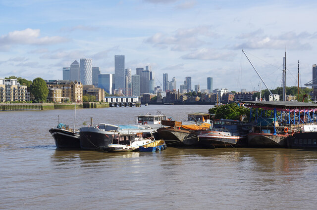
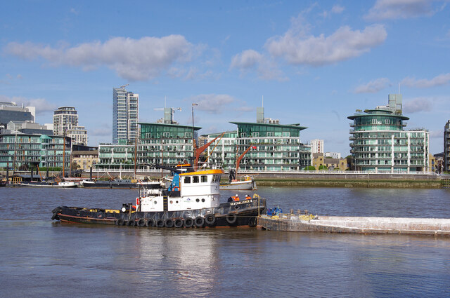
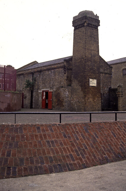
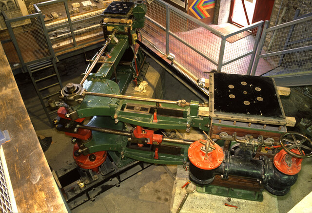
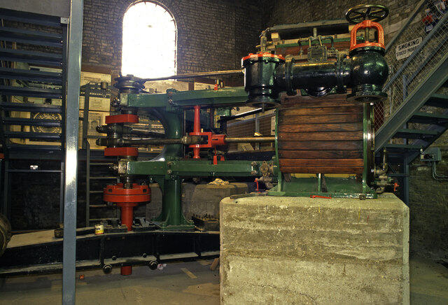
Rotherhithe is a historic area located in the London Borough of Southwark, England. Situated on the southern bank of the River Thames, it is part of the larger district of Surrey Docks. With a rich maritime heritage, Rotherhithe has transformed over the years from a bustling port to a vibrant residential area.

The area is well-known for its historical significance as the departure point for the Mayflower ship, which carried the Pilgrims to America in 1620. The Mayflower Pub, a prominent landmark in Rotherhithe, stands as a reminder of this important chapter in history.

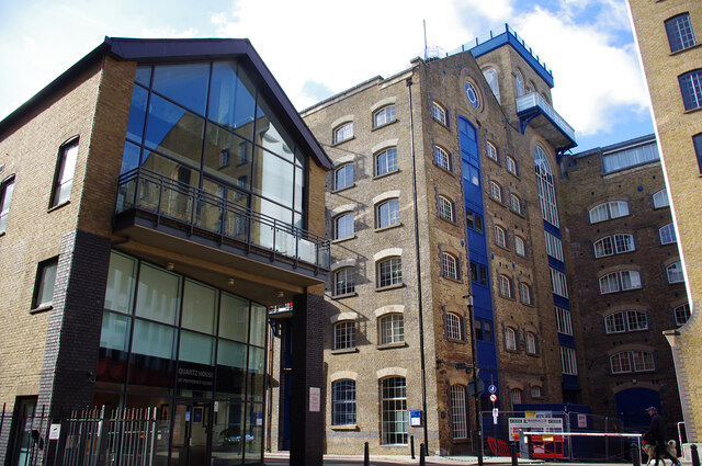
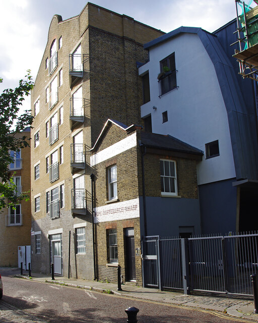
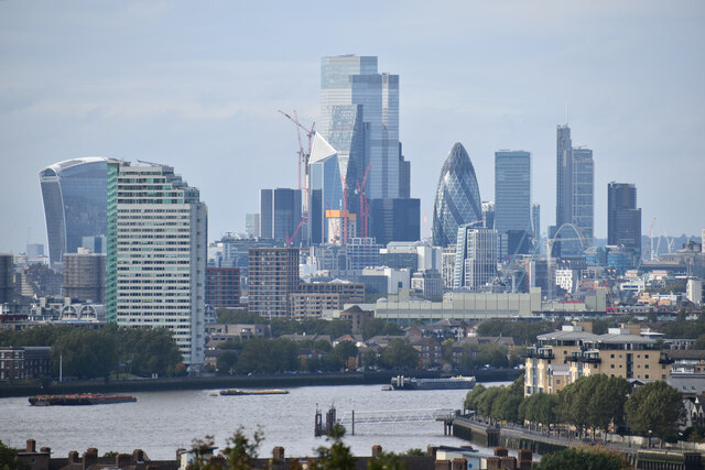
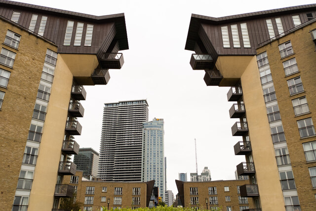
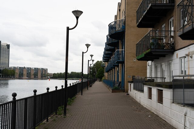
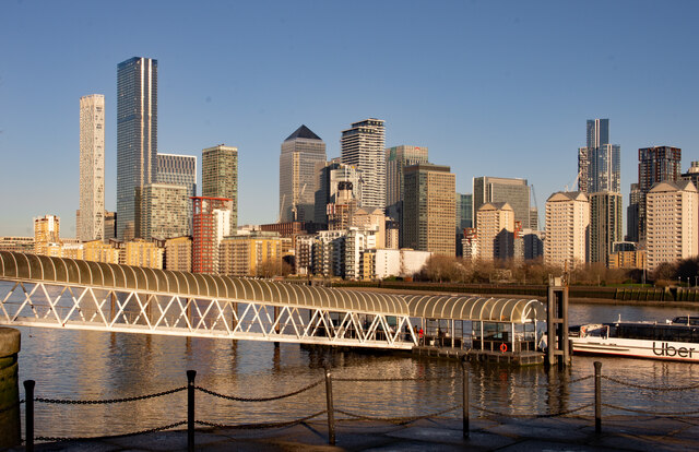
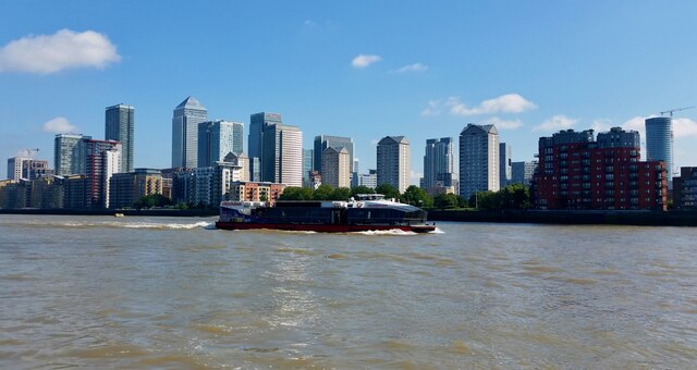
Rotherhithe boasts a mix of architectural styles, with a blend of old warehouses, Georgian townhouses, and modern developments. The waterfront area is particularly picturesque, offering stunning views of the Thames and Canary Wharf. The area also features the Rotherhithe Tunnel, a road tunnel that connects Rotherhithe to Limehouse in East London.

Residents and visitors to Rotherhithe can enjoy a range of amenities, including shops, restaurants, and pubs. The area is also home to several parks and green spaces, such as Southwark Park, which offers recreational facilities and hosts various events throughout the year.

Transportation in Rotherhithe is well-served, with Rotherhithe Overground station providing convenient access to central London and other parts of the city. Additionally, the Thames Clipper riverboat service offers an alternative mode of transport, allowing commuters to travel along the river.

Overall, Rotherhithe is a vibrant and historically significant area, offering a mix of cultural landmarks, scenic views, and modern amenities.

If you have any feedback on the listing, please let us know in the comments section below.

Rotherhithe Images

Images are sourced within 2km of 51.49762/-0.044309 or Grid Reference TQ3579. Thanks to Geograph Open Source API. All images are credited.
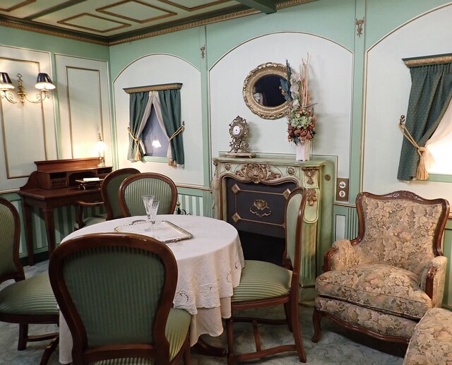
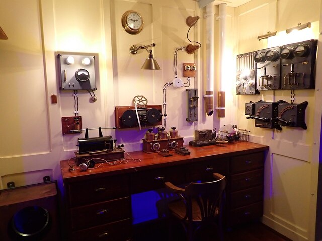
Downings Road Moorings, Bermondsey
Providence Square, Bermondsey Quartz House (left) and St Saviour's Mills.
Providence Square, Bermondsey
Quartz House (left) and St Saviour's Mills.
Tug with barge The tug Sea Challenge II is moored at Chambers Wharf. It appears that its barges are being loaded with spoil from the Thames Tideway Tunnel project.
A 25km combined sewer is being bored from Acton to Abbey Mills Pumping Station. The main tunnel is 7.2m diameter. It will increase the capacity of the sewage system, collecting existing local combined sewer overflows before they discharge into the Thames.
At Chambers Wharf, a vertical shaft was dug to lower a tunnel boring machine and drive the main tunnel eastwards. A connection from Greenwich will enter the main tunnel here.
Tug with barge
The tug Sea Challenge II is moored at Chambers Wharf. It appears that its barges are being loaded with spoil from the Thames Tideway Tunnel project. A 25km combined sewer is being bored from Acton to Abbey Mills Pumping Station. The main tunnel is 7.2m diameter. It will increase the capacity of the sewage system, collecting existing local combined sewer overflows before they discharge into the Thames. At Chambers Wharf, a vertical shaft was dug to lower a tunnel boring machine and drive the main tunnel eastwards. A connection from Greenwich will enter the main tunnel here.
Hope (Sufference) Wharf See <a href="https://www.geograph.org.uk/photo/2717769">TQ3579 : Hope (Sufferance) Wharf, St. Marychurch Street, SE16</a> for a wider view and  more information.
Hope (Sufference) Wharf
See TQ3579 : Hope (Sufferance) Wharf, St. Marychurch Street, SE16 for a wider view and more information.
River Thames and City of London Classic London view from Greenwich Park.
River Thames and City of London
Classic London view from Greenwich Park.
Old Boundary Marker on Grove Street, Deptford Turnpike Terminus Marker against the brick wall of 1-8 The Colonnade on the east side of the B206 Grove Street, Deptford SE8. 
Inscribed
1855
THIS LAND
IS
PART OF THE
BERMONDSEY
ROTHERHITHE
AND
DEPTFORD
TURNPIKE
ROADS

Milestone Society National ID: KE_BSt
Old Boundary Marker on Grove Street, Deptford
Turnpike Terminus Marker against the brick wall of 1-8 The Colonnade on the east side of the B206 Grove Street, Deptford SE8. Inscribed 1855 THIS LAND IS PART OF THE BERMONDSEY ROTHERHITHE AND DEPTFORD TURNPIKE ROADS Milestone Society National ID: KE_BSt
The Pierpoint and Waterman buildings on the Isle of Dogs, with the Novotel Canary Wharf in the background
Footpath and apartments on the south side of Millwall Outer Dock
Brunel pump house, Rotherhithe A museum of Marc Brunel's Thames tunnel alongside one of the original shafts. It then housed a J & G Rennie pumping engine from Chatham that was later removed. Since then a steel chimney has been fixed to the top of the brick base to recapitulate the station's original appearance. Pity the engine was removed.
Brunel pump house, Rotherhithe
A museum of Marc Brunel's Thames tunnel alongside one of the original shafts. It then housed a J & G Rennie pumping engine from Chatham that was later removed. Since then a steel chimney has been fixed to the top of the brick base to recapitulate the station's original appearance. Pity the engine was removed.
Brunel pump house, Rotherhithe This building and the adjoining shaft were used in the construction and drainage of Marc Brunel's Thames Tunnel - the world's first underwater tunnel. In the 1980s the museum housed here included this steam engine from Chatham Docks. It was a compound Vee engine that drove a vertical axis pump. It was built by the famous firm of J & G Rennie of London in 1885. Its slide valve cylinders were 20" & 32" x 20". It was later removed to Preston Services near Canterbury. In my experience in the UK, this is a unique survivor.
Brunel pump house, Rotherhithe
This building and the adjoining shaft were used in the construction and drainage of Marc Brunel's Thames Tunnel - the world's first underwater tunnel. In the 1980s the museum housed here included this steam engine from Chatham Docks. It was a compound Vee engine that drove a vertical axis pump. It was built by the famous firm of J & G Rennie of London in 1885. Its slide valve cylinders were 20" & 32" x 20". It was later removed to Preston Services near Canterbury. In my experience in the UK, this is a unique survivor.
Brunel pump house, Rotherhithe - steam engine This building and the adjoining shaft were used in the construction and drainage of Marc Brunel's Thames Tunnel - the world's first underwater tunnel. In the 1980s the museum housed here included this steam engine from Chatham Docks. It was a compound Vee engine that drove a vertical axis pump. It was built by the famous firm of J & G Rennie of London in 1885. Its slide valve cylinders were 20" & 32" x 20". It was later removed to Preston Services near Canterbury. In my experience in the UK this is a unique survivor.
Brunel pump house, Rotherhithe - steam engine
This building and the adjoining shaft were used in the construction and drainage of Marc Brunel's Thames Tunnel - the world's first underwater tunnel. In the 1980s the museum housed here included this steam engine from Chatham Docks. It was a compound Vee engine that drove a vertical axis pump. It was built by the famous firm of J & G Rennie of London in 1885. Its slide valve cylinders were 20" & 32" x 20". It was later removed to Preston Services near Canterbury. In my experience in the UK this is a unique survivor.
Canada Water Canada Water is a freshwater lake extending to about 4 acres (1.6ha) in the district of Rotherhithe (in the borough of Southwark) in southeast London. It is the only freshwater lake in the Docklands area and is a wildlife refuge. It is a remnant of the former Canada Dock, but is now supplied with water from a borehole rather than being connected to the river.
See Wikipedia article here <span class="nowrap"><a title="https://en.wikipedia.org/wiki/Canada_Water" rel="nofollow ugc noopener" href="https://en.wikipedia.org/wiki/Canada_Water">Link</a><img style="margin-left:2px;" alt="External link" title="External link - shift click to open in new window" src="https://s1.geograph.org.uk/img/external.png" width="10" height="10"/></span> for more information.
Canada Water
Canada Water is a freshwater lake extending to about 4 acres (1.6ha) in the district of Rotherhithe (in the borough of Southwark) in southeast London. It is the only freshwater lake in the Docklands area and is a wildlife refuge. It is a remnant of the former Canada Dock, but is now supplied with water from a borehole rather than being connected to the river. See Wikipedia article here LinkExternal link for more information.
Titanic Exhibition - Corridor A mock-up of one of the corridors on the Titanic at the exhibition currently being held at Canada Water. [2022 link] <span class="nowrap"><a title="https://titanicexhibitionlondon.com" rel="nofollow ugc noopener" href="https://titanicexhibitionlondon.com">Link</a><img style="margin-left:2px;" alt="External link" title="External link - shift click to open in new window" src="https://s1.geograph.org.uk/img/external.png" width="10" height="10"/></span>
Titanic Exhibition - Corridor
A mock-up of one of the corridors on the Titanic at the exhibition currently being held at Canada Water. [2022 link] LinkExternal link
Titanic Exhibition - Trompe l'oeil staircase This (actually flat) trompe l'oeil staircase is a representation of the grand staircase on the ill-fated Titanic. Part of the current Titanic Exhibition at Canada Water.
Titanic Exhibition - Trompe l'oeil staircase
This (actually flat) trompe l'oeil staircase is a representation of the grand staircase on the ill-fated Titanic. Part of the current Titanic Exhibition at Canada Water.
Titanic Exhibition - Recreation of an onboard drawing room This is one of several 'tableau' at the Titanic Exhibition. This one representing a First Class drawing room on the ship.
Titanic Exhibition - Recreation of an onboard drawing room
This is one of several 'tableau' at the Titanic Exhibition. This one representing a First Class drawing room on the ship.
Titanic Exhibition - Recreation of Wireless Room This is a recreation of the Wireless Room onboard the ill-fated Titanic, from where senior wireless officer John "Jack" Phillips tapped out the CQD and SOS distress signals, while junior wireless operator Harold Bride communicated with the bridge. Phillips went down with the Titanic on 15th April 1912, but Bride survived having been picked up by the Carpathia; he died in 1956.
Titanic Exhibition - Recreation of Wireless Room
This is a recreation of the Wireless Room onboard the ill-fated Titanic, from where senior wireless officer John "Jack" Phillips tapped out the CQD and SOS distress signals, while junior wireless operator Harold Bride communicated with the bridge. Phillips went down with the Titanic on 15th April 1912, but Bride survived having been picked up by the Carpathia; he died in 1956.
Canary Wharf View from Greenland Dock.
Canary Wharf
View from Greenland Dock.
River bus on the Thames The River Thames rises at Thames Head in Gloucestershire on the slopes of the Cotswolds and flows generally eastward to its mouth near Southend in Essex. At 215 miles long it is one of the longest rivers in Britain, and the longest entirely within England. It is one of the most important rivers in Britain. <span class="nowrap"><a title="http://en.wikipedia.org/wiki/River_Thames" rel="nofollow ugc noopener" href="http://en.wikipedia.org/wiki/River_Thames">Link</a><img style="margin-left:2px;" alt="External link" title="External link - shift click to open in new window" src="https://s1.geograph.org.uk/img/external.png" width="10" height="10"/></span>
River bus on the Thames
The River Thames rises at Thames Head in Gloucestershire on the slopes of the Cotswolds and flows generally eastward to its mouth near Southend in Essex. At 215 miles long it is one of the longest rivers in Britain, and the longest entirely within England. It is one of the most important rivers in Britain. LinkExternal link
Show me another place!

Rotherhithe is located at Grid Ref: TQ3579 (Lat: 51.49762, Lng: -0.044309)

Unitary Authority: Southwark

Police Authority: Metropolitan

What 3 Words

///faced.boats.usual. Near Canary Wharf, London

Related Wikis

Printworks (London)

Printworks was a nightclub and events venue in Rotherhithe, South London, located in the former Harmsworth Quays printing plant, which printed newspapers...

Rotherhithe

Rotherhithe ( RODH-ər-hydhe) is a district of south-east London, England, and part of the London Borough of Southwark. It is on a peninsula on the south...

Canada Water

Canada Water is an area of the Docklands in south-east London. It is named after a freshwater lake and wildlife refuge. Canada Water tube, Overground and...

Canada Water bus station

Canada Water bus station serves the Surrey Quays area of the London Borough of Southwark, London, England. The station is owned and maintained by Transport...

Canada Water station

Canada Water is a London Underground and London Overground station located in Canada Water, in south London, England. It takes its name from Canada Water...

Greenland Dock

Greenland Dock is the oldest of London's riverside wet docks, located in Rotherhithe in the area of the city now known as Docklands. It used to be part...

Poetry School

Poetry School is a national arts organisation, registered charity and adult education centre providing creative writing tuition, with teaching centres...

Surrey Quays railway station

Surrey Quays is a station on the East London Line of the London Overground. It is located in Rotherhithe, part of London Borough of Southwark; it is in...

Nearby Amenities

Located within 500m of 51.49762,-0.044309
Canada Street
Bus: yes
Local Ref: W
Public Transport: stop_position
Lat/Long: 51.4985074/-0.0465659
Kerb: raised
Lat/Long: 51.5010566/-0.0450219
Rotherhithe
Is In: Southwark, London
Place: suburb
Wikidata: Q2886632
Wikipedia: en:Rotherhithe
Lat/Long: 51.5002908/-0.0436321
Barrier: bollard
Bollard: removable
Lat/Long: 51.499585/-0.0410477
Barrier: bollard
Bollard: fixed
Lat/Long: 51.5001937/-0.0482705
Tactile Paving: yes
Lat/Long: 51.5002602/-0.045463
Crossing
Bicycle: yes
Crossing: unmarked
Crossing Island: no
Crossing Markings: no
Tactile Paving: yes
Lat/Long: 51.4999333/-0.047641
Mini Roundabout
Direction: clockwise
Lat/Long: 51.4952757/-0.0454856
Ref GB Tflcid: RWG078399
Traffic Calming: hump
Lat/Long: 51.496585/-0.0418222
Barrier: bollard
Bollard: fixed
Lat/Long: 51.4979684/-0.0462043
Crossing
Crossing: uncontrolled
Crossing Island: no
Lat/Long: 51.4938927/-0.0467445
Surrey Quays Leisure Park
Bus: yes
Local Ref: F
Public Transport: stop_position
Lat/Long: 51.4956984/-0.0459063
Mini Roundabout
Direction: clockwise
Lat/Long: 51.4949154/-0.0443924
Tactile Paving: yes
Lat/Long: 51.4992913/-0.0500344
Ref GB Tflcid: RWG078870
Traffic Calming: hump
Lat/Long: 51.5018493/-0.0447561
Pub
The Moby Dick
Addr City: London
Addr Housenumber: 6
Addr Postcode: SE16 7PL
Addr Street: Russell Place
Brand: Fuller's
Brand Wikidata: Q5253950
Check Date: 2023-09-10
Fhrs Id: 364236
Operator: Fuller's
Source Addr: FHRS Open Data
Toilets: yes
Toilets Access: customers
Website: https://www.mobydickgreenlanddock.co.uk/
Lat/Long: 51.4954636/-0.0395511
The Specialist
Created By: Potlatch 0.7b
Shop: dry_cleaning
Lat/Long: 51.495753/-0.0391581
Crighton News
Addr City: London
Addr Housenumber: 8
Addr Postcode: SE16 7PL
Addr Street: Russell Place
Fhrs Id: 363677
Shop: convenience
Source Addr: FHRS Open Data
Lat/Long: 51.4957263/-0.0393555
Onega Gate
Bus: yes
Public Transport: stop_position
Lat/Long: 51.4967482/-0.0390322
Stave Hill
Ele: 9
Man Made: hill
Tourism: viewpoint
Wikidata: Q7604796
Wikipedia: en:Stave Hill
Lat/Long: 51.5010897/-0.0404578
Post Box
Collection Times: Mo-Fr 17:30; Sa 12:00; Su off
Drive Through: no
Operator: Royal Mail
Operator Wikidata: Q638098
Post Box Design: type_k
Post Box Type: pillar
Ref: SE16 9
Royal Cypher: EIIR
Royal Cypher Wikidata: Q33102113
Source: survey
Lat/Long: 51.5015082/-0.0436956
Car Sharing
Capacity: 1
Operator: Streetcar
Source: WebSite
Lat/Long: 51.500007/-0.047293
Crossing
Crossing: uncontrolled
Crossing Island: no
Tactile Paving: yes
Lat/Long: 51.4937413/-0.0475303
Surrey Quays Shopping Centre
Bus: yes
Local Ref: J
Public Transport: stop_position
Lat/Long: 51.4939282/-0.046312
Post Box
Collection Times: Mo-Fr 17:30; Sa 12:00; Su off
Drive Through: no
Fixme: collection Plate shows ref "N13 6" on 20/05/21
Operator: Royal Mail
Operator Wikidata: Q638098
Post Box Design: type_a
Post Box Type: pillar
Ref: SE16 22
Royal Cypher: GVIR
Royal Cypher Wikidata: Q33102169
Source: survey
Lat/Long: 51.4959136/-0.0419829
Bus Stop
Canada Water Bus Station
Bus: yes
Local Ref: A
Naptan AtcoCode: 490000037A
Naptan Bearing: N
Naptan CommonName: Canada Water Bus Station
Naptan Indicator: Stop A
Public Transport: platform
Ref: 54675
Shelter: yes
Wheelchair: yes
Lat/Long: 51.4984067/-0.0501637
Bus Stop
Canada Water Bus Station
Bus: yes
Local Ref: B2
Naptan AtcoCode: 490000037S
Naptan Bearing: S
Naptan CommonName: Canada Water Bus Station
Naptan Indicator: Stop B2
Public Transport: platform
Ref: 77739
Wheelchair: yes
Lat/Long: 51.4979208/-0.0499973
Bus Stop
Surrey Quays Station
Bench: yes
Bin: yes
Bus: yes
Local Ref: L
Naptan AtcoCode: 490000229L
Naptan Bearing: N
Naptan CommonName: Surrey Quays
Naptan Indicator: Stop L
Public Transport: platform
Ref: 52763
Shelter: yes
Lat/Long: 51.4934155/-0.0460184
Bus Stop
Canada Water Bus Station
Bus: yes
Local Ref: B1
Naptan AtcoCode: 490004733B
Naptan Bearing: N
Naptan CommonName: Canada Water Bus Station
Naptan Indicator: Stop B1
Public Transport: platform
Ref: 50307
Shelter: yes
Wheelchair: yes
Lat/Long: 51.4981495/-0.0501716
Bus Stop
Canada Water Bus Station
Bus: yes
Local Ref: C
Naptan AtcoCode: 490004733C
Naptan Bearing: N
Naptan CommonName: Canada Water Bus Station
Naptan Indicator: C
Public Transport: platform
Ref: 48366
Wheelchair: yes
Lat/Long: 51.4977629/-0.0498646
Bus Stop
Canada Water Bus Station
Bus: yes
Local Ref: D
Naptan AtcoCode: 490004733D
Naptan Bearing: N
Naptan CommonName: Canada Water Bus Station
Naptan Indicator: D
Public Transport: platform
Ref: 58185
Wheelchair: yes
Lat/Long: 51.4981678/-0.0499572
Bus Stop
Brunswick Quay
Bus: yes
Naptan AtcoCode: 490004531E
Naptan Bearing: N
Naptan CommonName: Brunswick Quay
Naptan Street: REDRIFF ROAD
Public Transport: platform
Ref: 74050
Lat/Long: 51.4959487/-0.0422332
Bus Stop
Onega Gate
Bus: yes
Naptan AtcoCode: 490010596E
Naptan Bearing: N
Naptan CommonName: Onega Way
Naptan Street: REDRIFF ROAD
Public Transport: platform
Ref: 52042
Lat/Long: 51.4966633/-0.0393713
Bus Stop
Onega Gate
Bus: yes
Naptan AtcoCode: 490010596W
Naptan Bearing: N
Naptan CommonName: Onega Way
Naptan Street: REDRIFF ROAD
Public Transport: platform
Ref: 50855
Lat/Long: 51.4967007/-0.0389833
Bus Stop
Brunswick Quay
Bus: yes
Naptan AtcoCode: 490011302W
Naptan Bearing: N
Naptan CommonName: Quebec Way
Naptan Street: REDRIFF ROAD
Public Transport: platform
Ref: 56573
Lat/Long: 51.4954969/-0.0431054
Bus Stop
Surrey Quays Leisure Park
Bus: yes
Local Ref: F
Naptan AtcoCode: 490013040F
Naptan Bearing: N
Naptan CommonName: Surrey Quays Leisure Park
Naptan Indicator: F
Naptan Street: SURREY QUAYS ROAD
Public Transport: platform
Ref: 56398
Lat/Long: 51.4956776/-0.04598
Bus Stop
Surrey Quays Leisure Park
Bus: yes
Local Ref: G
Naptan AtcoCode: 490013040G
Naptan Bearing: S
Naptan CommonName: Surrey Quays Leisure Park
Naptan Indicator: G
Naptan Street: SURREY QUAYS ROAD
Public Transport: platform
Ref: 49533
Lat/Long: 51.4955847/-0.0457415
Bus Stop
Surrey Quays Shopping Centre
Bus: yes
Local Ref: H
Naptan AtcoCode: 490013042H
Naptan Bearing: E
Naptan CommonName: Surrey Quays Shopping Centre
Naptan Indicator: H
Naptan Street: DEAL PORTERS WAY
Public Transport: platform
Ref: 49171
Shelter: yes
Tactile Paving: yes
Lat/Long: 51.4939323/-0.046925
Bus Stop
Surrey Quays Shopping Centre
Bus: yes
Local Ref: J
Naptan AtcoCode: 490013042J
Naptan Bearing: E
Naptan CommonName: Surrey Quays Shopping Centre
Naptan Indicator: J
Naptan Street: DEAL PORTERS WAY
Public Transport: platform
Ref: 53864
Shelter: yes
Tactile Paving: yes
Lat/Long: 51.4940192/-0.0463085
Bus Stop
Surrey Quays Shopping Centre
Bench: yes
Bin: yes
Bus: yes
Lit: yes
Local Ref: K
Naptan AtcoCode: 490013042K
Naptan Bearing: E
Naptan CommonName: Surrey Quays Shopping Centre
Naptan Indicator: K
Naptan Street: DEAL PORTERS WAY
Public Transport: platform
Ref: 51732
Shelter: yes
Tactile Paving: yes
Lat/Long: 51.4940096/-0.0458607
Bus Stop
Canada Street
Bench: yes
Bin: yes
Bus: yes
Lit: yes
Local Ref: U
Naptan AtcoCode: 490015602N
Naptan Bearing: N
Naptan CommonName: Canada Street
Naptan Indicator: Stop U
Naptan Street: SURREY QUAYS ROAD
Public Transport: platform
Ref: 52753
Shelter: yes
Tactile Paving: no
Lat/Long: 51.4973805/-0.0457729
Bus Stop
Canada Street
Bench: yes
Bin: yes
Bus: yes
Lit: yes
Local Ref: W
Naptan AtcoCode: 490015602S
Naptan Bearing: S
Naptan CommonName: Canada Street
Naptan Indicator: Stop W
Public Transport: platform
Ref: 76543
Shelter: yes
Tactile Paving: no
Lat/Long: 51.4984603/-0.0464401
Crossing
Crossing: marked
Crossing Island: no
Tactile Paving: yes
Lat/Long: 51.4985224/-0.050181
Curve Geometry: yes
Lat/Long: 51.4978905/-0.0509003
Noexit: yes
Lat/Long: 51.501069/-0.0460063
Surrey Quays
Public Transport: stop_position
Railway: stop
Ref: 1
Train: yes
Lat/Long: 51.4938462/-0.0481307
Bicycle Parking
Bicycle Parking: stands
Capacity: 24
Covered: no
Mapillary: 209472327469064
Survey Date: 2020-01-02
Lat/Long: 51.4978732/-0.0495043
Atm
Lat/Long: 51.49526/-0.04429
Telephone
Booth: KX100
Covered: booth
Lat/Long: 51.4950323/-0.0443257
Tavistock Tower
Lat/Long: 51.4952351/-0.0393012
Addr Housename: Yew House
Lat/Long: 51.4990706/-0.0473496
Addr Housename: Cedar House
Lat/Long: 51.4989371/-0.0471029
Addr Housename: Sycamore House
Lat/Long: 51.4993111/-0.0467488
Addr Housename: Cypress House
Lat/Long: 51.4992852/-0.0479164
Addr Housename: Poplar House
Lat/Long: 51.4996183/-0.0474891
Addr Housename: Spruce House
Lat/Long: 51.4991441/-0.0479182
Addr Housename: Rowan House
Lat/Long: 51.4991374/-0.0475964
Addr Housename: Fairway Court
Lat/Long: 51.5002127/-0.0477037
Addr Housename: Harold Court
Lat/Long: 51.5003931/-0.0482187
Addr Housename: Career Court
Lat/Long: 51.50056/-0.047296
Noexit: yes
Lat/Long: 51.499878/-0.0415498
Barrier: bollard
Bollard: removable
Lat/Long: 51.499996/-0.0420844
Canada Water
Layer: -3
Level: -3
Network: London Underground
Network Wikidata: Q20075
Operator: London Underground
Operator Wikidata: Q20075
Public Transport: stop_position
Railway: stop
Ref: 1
Subway: yes
Lat/Long: 51.4978792/-0.0493373
Ref GB Tflcid: RWG079363
Traffic Calming: hump
Lat/Long: 51.4999053/-0.0493639
New Look
Brand: New Look
Brand Wikidata: Q12063852
Brand Wikipedia: en:New Look (company)
Shop: clothes
Wheelchair: yes
Lat/Long: 51.4951984/-0.0466799
Yours Clothing
Brand: Yours Clothing
Brand Wikidata: Q84163322
Clothes: women
Level: 0
Second Hand: no
Shop: clothes
Wheelchair: yes
Lat/Long: 51.4950595/-0.046603
Pharmacy
Boots
Brand: Boots
Brand Wikidata: Q6123139
Brand Wikipedia: en:Boots UK
Healthcare: pharmacy
Level: 0
Opening Hours: Mo-Sa 09:00-19:00; Su 11:00-17:00
Website: https://www.boots.com/stores/819-london-surrey-quays-se16-7ll
Wheelchair: yes
Lat/Long: 51.494974/-0.04656
Sports Direct
Brand: Sports Direct
Brand Wikidata: Q7579661
Brand Wikipedia: en:SportsDirect.com
Shop: sports
Wheelchair: yes
Lat/Long: 51.4951277/-0.0466436
JD Sports
Brand: JD Sports
Brand Wikidata: Q6108019
Brand Wikipedia: en:JD Sports
Shop: sports
Wheelchair: yes
Lat/Long: 51.4956922/-0.0468755
Holland & Barrett
Addr City: London
Addr Housename: Surrey Quays Shopping Centr
Addr Postcode: SE16 7LL
Addr Street: Redriff Road
Addr Unit: 25
Brand: Holland & Barrett
Brand Wikidata: Q5880870
Brand Wikipedia: en:Holland & Barrett
Fhrs Id: 467728
Shop: health_food
Source Addr: FHRS Open Data
Lat/Long: 51.4954411/-0.0466876
Pharmacy
Superdrug
Brand: Superdrug
Brand Wikidata: Q7643261
Brand Wikipedia: en:Superdrug
Contact Website: https://www.superdrug.com/store/surrey-quays
Healthcare: pharmacy
Level: 0
Wheelchair: yes
Lat/Long: 51.4957253/-0.0471675
River Island
Brand: River Island
Brand Wikidata: Q2670328
Brand Wikipedia: en:River Island
Contact Website: https://www.riverisland.com/how-can-we-help/find-a-store/surrey-quays
Shop: clothes
Wheelchair: yes
Lat/Long: 51.4952655/-0.0467157
Crossing
Button Operated: yes
Crossing: traffic_signals
Crossing Ref: pelican
Kerb: lowered
Tactile Paving: yes
Traffic Signals Sound: yes
Traffic Signals Vibration: yes
Lat/Long: 51.4982528/-0.0461987
Surrey Quays Shopping Centre
Bus: yes
Local Ref: H
Public Transport: stop_position
Lat/Long: 51.4938575/-0.0468969
Surrey Quays Shopping Centre
Bus: yes
Local Ref: K
Public Transport: stop_position
Lat/Long: 51.4939328/-0.0459654
Surrey Quays Station
Bus: yes
Local Ref: L
Public Transport: stop_position
Lat/Long: 51.4934677/-0.0460543
Crossing
Crossing: unmarked
Crossing Island: yes
Crossing Markings: no
Tactile Paving: yes
Lat/Long: 51.4949865/-0.0445493
Canada Water
Layer: -2
Level: -2
Network: London Overground
Public Transport: stop_position
Railway: stop
Ref: 4
Subway: no
Train: yes
Lat/Long: 51.4980112/-0.0500405
Canada Water
Layer: -2
Level: -2
Network: London Overground
Public Transport: stop_position
Railway: stop
Ref: 3
Subway: no
Train: yes
Lat/Long: 51.4979293/-0.0499525
Crossing
Bicycle: yes
Crossing: uncontrolled
Crossing Island: no
Crossing Ref: zebra
Tactile Paving: yes
Traffic Calming: table
Lat/Long: 51.4983093/-0.0493084
Crossing
Crossing Island: no
Tactile Paving: yes
Lat/Long: 51.4981585/-0.0495341
Bicycle Parking
Bicycle Parking: stands
Capacity: 44
Check Date Capacity: 2023-04-22
Covered: yes
Lat/Long: 51.4988317/-0.0503152
Tactile Paving: yes
Lat/Long: 51.4990926/-0.0502458
Canada Water
Entrance: yes
Entrance Marker Subway: yes
Level: 0
Railway: subway_entrance
Wheelchair: yes
Lat/Long: 51.497645/-0.0493391
Canada Water
Entrance: yes
Entrance Marker Subway: yes
Level: 0
Railway: subway_entrance
Wheelchair: no
Lat/Long: 51.4985157/-0.0493461
Crossing
Button Operated: yes
Crossing: traffic_signals
Crossing Island: yes
Kerb: lowered
Tactile Paving: yes
Traffic Signals Sound: no
Lat/Long: 51.4976342/-0.0496051
Street Lamp
Lat/Long: 51.4959462/-0.048904
Street Lamp
Lat/Long: 51.4944282/-0.0476246
Street Lamp
Lat/Long: 51.494649/-0.04725
Street Lamp
Lat/Long: 51.4947426/-0.047301
Street Lamp
Lat/Long: 51.4946641/-0.0471776
Street Lamp
Lat/Long: 51.4947575/-0.0472259
Crossing
Crossing: marked
Crossing Markings: yes
Tactile Paving: yes
Lat/Long: 51.4956831/-0.0479379
Street Lamp
Lat/Long: 51.495362/-0.0485652
Crossing
Button Operated: yes
Crossing: traffic_signals
Crossing Ref: pelican
Traffic Signals Sound: no
Lat/Long: 51.4976252/-0.0498229
Crossing
Crossing: uncontrolled
Crossing Island: no
Crossing Ref: zebra
Lat/Long: 51.4951317/-0.0439124
Ref GB Tflcid: RWG078429
Traffic Calming: cushion
Lat/Long: 51.4995811/-0.0480487
Traffic Signals
Crossing: no
Traffic Signals Direction: forward
Lat/Long: 51.4982472/-0.0458718
Post Box
Collection Times: Mo-Fr 18:00; Sa 12:00
Drive Through: no
Operator: Royal Mail
Operator Wikidata: Q638098
Post Box Apertures: 2
Post Box Design: type_c
Post Box Type: pillar
Ref: SE16 18;SE16 118
Royal Cypher: EIIR
Royal Cypher Wikidata: Q33102113
Source: survey
Lat/Long: 51.4939892/-0.0467366
Canada Water Bus Station
Bus: yes
Local Ref: D
Public Transport: stop_position
Lat/Long: 51.4982124/-0.0499105
Canada Water Bus Station
Bus: yes
Local Ref: A
Public Transport: stop_position
Lat/Long: 51.4984311/-0.0500856
Canada Water Bus Station
Bus: yes
Local Ref: B1
Public Transport: stop_position
Lat/Long: 51.4981411/-0.0502651
Canada Water Bus Station
Bus: yes
Local Ref: B2
Public Transport: stop_position
Lat/Long: 51.4978992/-0.0500738
Canada Water Bus Station
Bus: yes
Local Ref: C
Public Transport: stop_position
Lat/Long: 51.4977488/-0.0499549
Barrier: cycle_barrier
Lat/Long: 51.4956643/-0.0396623
Barrier: cycle_barrier
Lat/Long: 51.4957641/-0.0390773
Restaurant
Canada water cafe
Addr City: London
Addr Housenumber: 40
Addr Postcode: SE16 7DX
Addr Street: Surrey Quays Road
Cuisine: pizza
Diet Vegetarian: only
Fhrs Id: 1036890
Indoor Seating: yes
Opening Hours: Mo-Fr 07:00-10:30; Sa 08:30-22:30; Su 08:30-21:00
Outdoor Seating: yes
Smoking: outside
Source Addr: FHRS Open Data
Takeaway: yes
Toilets Wheelchair: no
Website: http://www.canadawatercafe.com/
Wheelchair: yes
Lat/Long: 51.4987758/-0.0491319
Canada Water
Place: quarter
Lat/Long: 51.4972278/-0.0505388
Canada Street
Bus: yes
Local Ref: U
Public Transport: stop_position
Lat/Long: 51.4973733/-0.0457209
Crossing
Button Operated: yes
Crossing: traffic_signals
Crossing Ref: pelican
Kerb: lowered
Tactile Paving: yes
Traffic Signals Sound: yes
Traffic Signals Vibration: yes
Lat/Long: 51.4981905/-0.0459537
Barrier: bollard
Lat/Long: 51.4956674/-0.0499215
Barrier: bollard
Bollard: removable
Lat/Long: 51.5001356/-0.0493177
Bank
Halifax
Addr City: London
Addr Housenumber: 28
Addr Postcode: SE16 7LL
Addr Street: Redriff Road
Addr Substreet: Surrey Quays Shopping Centre
Brand: Halifax
Brand Wikidata: Q3310164
Brand Wikipedia: en:Halifax (bank)
Level: 0
Opening Hours: Mo-Fr 09:30-17:00; Sa 9:30-15:30
Phone: +44 20 7200 9234
Website: https://branches.halifax.co.uk/london/28-29-surrey-quays-shopping-ct
Wheelchair: yes
Lat/Long: 51.495839/-0.0475755
The Range
Addr City: London
Addr Postcode: SE16 7LL
Addr Street: Redriff Road
Addr Substreet: Surrey Quays Shopping Centre
Brand: The Range
Brand Wikidata: Q7759409
Check Date: 2024-05-18
Description: Chain retailer selling home, garden and leisure products, including furniture and kitchen equipment.
Disused Shop: houseware
Level: 0
Opening Hours: Mo-Sa 09:00-19:00; Su 11:00-17:00
Phone: +44 20 7237 1811
Website: https://www.therange.co.uk/stores/surrey-quays
Wheelchair: yes
Lat/Long: 51.4960013/-0.0471534
Canada Water
Layer: -3
Level: -3
Network: London Underground
Network Wikidata: Q20075
Operator: London Underground
Operator Wikidata: Q20075
Public Transport: stop_position
Railway: stop
Ref: 2
Subway: yes
Lat/Long: 51.4980343/-0.0493666
Level: -3
Lat/Long: 51.4979635/-0.0490308
Level: -3
Lat/Long: 51.4980026/-0.0490392
Level: -2
Lat/Long: 51.4979435/-0.0492691
Level: -2
Lat/Long: 51.4979827/-0.0492776
Level: -2
Lat/Long: 51.4979485/-0.0497616
Level: -3
Lat/Long: 51.4979701/-0.049498
Level: -2.7
Lat/Long: 51.4979647/-0.049562
Level: -2.7
Lat/Long: 51.4979617/-0.049598
Level: -2.3
Lat/Long: 51.4979564/-0.0496616
Level: -2.3
Lat/Long: 51.4979535/-0.0496973
Level: -3
Lat/Long: 51.4979226/-0.0494877
Level: -2.7
Lat/Long: 51.4979173/-0.0495517
Level: -2.7
Lat/Long: 51.4979143/-0.0495877
Level: -2.3
Lat/Long: 51.497909/-0.0496514
Level: -2.3
Lat/Long: 51.497906/-0.0496871
Level: -3
Lat/Long: 51.4978883/-0.0499745
Level: -2
Lat/Long: 51.4978682/-0.0502147
Level: -3
Lat/Long: 51.4979277/-0.049983
Level: -2
Lat/Long: 51.4979076/-0.0502232
Level: -2
Lat/Long: 51.4979006/-0.0497512
Elevator
Indoor: yes
Level: -2;-1
Wheelchair: yes
Lat/Long: 51.4977734/-0.0500916
Elevator
Indoor: yes
Level: -3;-2;-1
Wheelchair: yes
Lat/Long: 51.4979331/-0.04964
Level: -1.8
Lat/Long: 51.4981464/-0.0503217
Level: -2
Lat/Long: 51.498164/-0.05033
Level: -1.8
Lat/Long: 51.4981241/-0.0503112
Level: -1.5
Lat/Long: 51.4980827/-0.0502916
Level: -1.5
Lat/Long: 51.4980657/-0.0502836
Level: -1.1
Lat/Long: 51.4980246/-0.0502641
Level: -1.1
Lat/Long: 51.4980005/-0.0502527
Level: -1
Lat/Long: 51.4979931/-0.0502492
Level: -2
Lat/Long: 51.4981317/-0.0502622
Level: -2
Lat/Long: 51.4981377/-0.0502305
Level: -1
Lat/Long: 51.4979934/-0.0501924
Level: -1
Lat/Long: 51.4979996/-0.0501608
Level: -1.7
Lat/Long: 51.4980261/-0.0495601
Level: -1.7
Lat/Long: 51.4980225/-0.0496025
Level: -1.3
Lat/Long: 51.4980183/-0.0496533
Level: -1.3
Lat/Long: 51.4980147/-0.0496956
Level: -2
Lat/Long: 51.4980307/-0.0495054
Level: -1
Lat/Long: 51.4980103/-0.0497488
Level: -1
Lat/Long: 51.4979539/-0.0497235
Level: -2
Lat/Long: 51.4979733/-0.0494924
Level: -1
Lat/Long: 51.4978997/-0.0497118
Level: -2
Lat/Long: 51.4979191/-0.0494807
Proposed Highway: crossing
Lat/Long: 51.4973172/-0.0497194
Crossing
Crossing: traffic_signals
Crossing Island: no
Tactile Paving: yes
Lat/Long: 51.4973519/-0.0500969
Level: -1
Lat/Long: 51.4983173/-0.0494552
Level: -0.7
Lat/Long: 51.4983481/-0.0494382
Level: -0.7
Lat/Long: 51.4983739/-0.0494239
Level: -0.3
Lat/Long: 51.4984045/-0.049407
Level: -0.3
Lat/Long: 51.4984297/-0.0493931
Level: -0.3
Lat/Long: 51.4976793/-0.0493284
Level: -0.3
Lat/Long: 51.4977057/-0.0493202
Level: -0.7
Lat/Long: 51.49774/-0.0493095
Level: -0.7
Lat/Long: 51.4977661/-0.0493014
Level: -1
Lat/Long: 51.4977949/-0.0492925
Canada Water
Entrance: yes
Entrance Marker Subway: yes
Level: 0
Railway: subway_entrance
Ref: A
Wheelchair: yes
Lat/Long: 51.4980531/-0.0498934
Level: -1
Lat/Long: 51.4980538/-0.0495784
Level: -0.7
Lat/Long: 51.4980502/-0.0496248
Level: -0.7
Lat/Long: 51.4980469/-0.0496677
Level: -0.3
Lat/Long: 51.4980438/-0.0497088
Level: -0.3
Lat/Long: 51.4980404/-0.0497527
Elevator
Indoor: yes
Level: -1;0
Wheelchair: yes
Lat/Long: 51.4980784/-0.0497102
Bench
Start Date: 2018
Lat/Long: 51.5005197/-0.0389187
Canada Water
Fare Zone: 2
Line: Jubilee
Naptan AtcoCode: 9100CNDAW
Network: London Underground;London Overground
Network Website: https://www.nationalrail.co.uk/stations/zcw/
Network Wikidata: Q26334
Platforms: station
Public Transport: station
Public Transport Version: 2
Railway: station
Ref Crs: ZCW
Station: subway
Subway: yes
Toilets Wheelchair: yes
Train: yes
Wheelchair: yes
Wheelchair Description: Overground platforms Step-free to train. Jubilee: Step-free access street to train.
Wikidata: Q800610
Wikipedia: en:Canada Water station
Lat/Long: 51.4979299/-0.0498405
Bicycle Parking
Bicycle Parking: stands
Capacity: 12
Covered: no
Lat/Long: 51.4983042/-0.0494855
Bicycle Parking
Bicycle Parking: stands
Capacity: 12
Covered: no
Lat/Long: 51.4982796/-0.0494979
Bicycle Parking
Bicycle Parking: stands
Capacity: 26
Covered: no
Lat/Long: 51.4980932/-0.0492867
Bicycle Parking
Bicycle Parking: stands
Capacity: 14
Covered: no
Lat/Long: 51.4981106/-0.0494668
Surrey Quays Leisure Park
Bus: yes
Local Ref: G
Public Transport: stop_position
Lat/Long: 51.4955546/-0.0458136
Brunswick Quay
Bus: yes
Public Transport: stop_position
Lat/Long: 51.4955501/-0.0431847
Brunswick Quay
Bus: yes
Public Transport: stop_position
Lat/Long: 51.4959171/-0.0422094
Onega Gate
Bus: yes
Public Transport: stop_position
Lat/Long: 51.4966275/-0.0393192
Disused Shop: yes
Lat/Long: 51.4982904/-0.0487883
Bicycle Parking
Bicycle Parking: stands
Capacity: 12
Covered: no
Lat/Long: 51.4984798/-0.0492305
Bar
Leadbellys
Addr City: London
Addr Postcode: SE16 7AQ
Addr Street: Deal Porter Square
Addr Unit: Unit C Montreal House
Alt Name: Leadbelly's Bar & Kitchen
Email: info@leadbellysbar.co.uk
Fhrs Id: 948368
Phone: +44 20 3404 9550
Source Addr: FHRS Open Data
Website: https://www.leadbellysbar.co.uk/
Wheelchair: yes
Lat/Long: 51.498233/-0.0486053
Kinleigh Folkard & Hayward
Check Date: 2024-05-06
Shop: estate_agent
Lat/Long: 51.498356/-0.0489882
Cafe
Barista Coffee House
Level: -1
Wheelchair: yes
Lat/Long: 51.4977805/-0.0495376
Waste Basket
Lat/Long: 51.5012902/-0.0409258
relief map
Artist Name: Michael Rizzello
Artwork Type: sculpture
Material: bronze
Source: survey
Tourism: artwork
Lat/Long: 51.5011183/-0.0404564
Check Date: 2023-08-07
Leisure: pitch
Sport: table_tennis
Lat/Long: 51.5004575/-0.0486341
Expat Explore Tours
Addr City: London
Addr Housename: Dock Offices
Addr Postcode: SE16 2XU
Addr Street: Surrey Quays Road
Addr Unit: Unit 9
Office: company
Website: https://expatexplore.com/
Lat/Long: 51.4968415/-0.0509465
Crossing
Crossing: unmarked
Crossing Markings: no
Lat/Long: 51.4977217/-0.0372591
Nisa Local
Brand: Nisa Local
Brand Wikidata: Q16999069
Brand Wikipedia: en:Nisa (retailer)
Shop: convenience
Wheelchair: yes
Lat/Long: 51.4963258/-0.0408822
Cafe
Mouse Tail Coffee Stories
Addr City: London
Addr Postcode: SE16 7AP
Addr Street: Deal Porters Way
Cuisine: coffee_shop
Indoor Seating: yes
Internet Access: wlan
Internet Access Fee: no
Outdoor Seating: yes
Phone: +44 7552 961118
Wheelchair: yes
Lat/Long: 51.4977782/-0.0479989
Parking Entrance
Decathlon Car Park
Access: customers
Fee: no
Level: -1
Maxheight: 6'2"
Maxstay: 4 hours
Operator: Decathlon
Parking: underground
Lat/Long: 51.4980524/-0.0463683
Crossing
Crossing: unmarked
Crossing Island: no
Crossing Markings: no
Lat/Long: 51.499706/-0.0445683
Barrier: bollard
Bollard: fixed
Lat/Long: 51.4997315/-0.0444072
Barrier: bollard
Bollard: fixed
Lat/Long: 51.5001218/-0.0488818
Barrier: bollard
Bollard: removable
Lat/Long: 51.4999713/-0.0491392
Barrier: bollard
Bollard: removable
Lat/Long: 51.5002757/-0.0450844
Yes
Barrier: bollard
Bollard: removable
Emergency: yes
Lat/Long: 51.4998381/-0.0491074
Barrier: bollard
Bollard: removable
Lat/Long: 51.4999869/-0.0437666
Bicycle Rental
Canada Water Station
Bicycle Rental: docking_station
Brand: Santander Cycles
Brand Wikidata: Q807961
Capacity: 35
Local: Rotherhithe
Network: tfl_cycle_hire
Official Name: Canada Water Station, Rotherhithe
Official Ref: 844
Operator: Serco
Operator Wikidata: Q499104
Source: https://planning.southwark.gov.uk/online-applications/files/9AFFEE898BCBAB83B2FBBD1E36E002F7/pdf/20_AP_0157-GENERAL_ARRANGEMENT_PLAN-834516.pdf
Lat/Long: 51.4984711/-0.0490974
Bicycle Parking
Access: yes
Bicycle Parking: stands
Capacity: 8
Covered: no
Fee: no
Lat/Long: 51.5012752/-0.0409017
Bench
Backrest: yes
Colour: black
Material: steel
Seats: 8
Lat/Long: 51.4998018/-0.03959
Bicycle Parking
Access: yes
Bicycle Parking: stands
Capacity: 12
Covered: no
Fee: no
Lat/Long: 51.4959452/-0.0444227
Bicycle Parking
Access: yes
Bicycle Parking: stands
Capacity: 7
Covered: no
Fee: no
Lat/Long: 51.4957604/-0.0450935
Bench
Backrest: yes
Colour: black
Material: steel
Seats: 4
Lat/Long: 51.4953305/-0.038301
Bench
Backrest: yes
Colour: black
Material: steel
Seats: 4
Lat/Long: 51.4951364/-0.0392947
Bench
Backrest: yes
Colour: black
Material: steel
Seats: 4
Lat/Long: 51.4952041/-0.038962
Bicycle Parking
Access: yes
Bicycle Parking: stands
Capacity: 58
Covered: no
Fee: no
Lat/Long: 51.4947031/-0.0472426
Tactile Paving: yes
Lat/Long: 51.4999228/-0.0441651
Traffic Calming: bump
Lat/Long: 51.4953325/-0.0494357
Barrier: height_restrictor
Maxheight: 6'2"
Lat/Long: 51.4980654/-0.0463238
Crossing
Button Operated: yes
Crossing: traffic_signals
Crossing Ref: pelican
Kerb: lowered
Tactile Paving: yes
Traffic Signals Sound: yes
Traffic Signals Vibration: yes
Lat/Long: 51.4981287/-0.046271
Crossing
Button Operated: yes
Crossing: traffic_signals
Crossing Ref: pelican
Kerb: lowered
Tactile Paving: yes
Traffic Signals Sound: yes
Traffic Signals Vibration: yes
Lat/Long: 51.4980398/-0.0460817
Traffic Signals
Crossing: no
Traffic Signals Direction: forward
Lat/Long: 51.4983056/-0.0462782
Traffic Signals
Crossing: no
Traffic Signals Direction: forward
Lat/Long: 51.4979741/-0.046023
Traffic Signals
Traffic Signals Direction: forward
Lat/Long: 51.4981055/-0.0462931
Barrier: bollard
Lat/Long: 51.4956461/-0.0498714
Bicycle Parking
Decathlon Bicycle Parking
Access: customers
Capacity: 12
Covered: yes
Operator: Decathlon
Lat/Long: 51.4976797/-0.0474581
Bicycle Parking
Bicycle Parking: stands
Capacity: 10
Covered: no
Lat/Long: 51.4977385/-0.0470507
Bicycle Parking
Bicycle Parking: stands
Capacity: 10
Covered: no
Lat/Long: 51.4977913/-0.0468893
Bicycle Parking
Bicycle Parking: stands
Capacity: 10
Covered: no
Lat/Long: 51.4978985/-0.0465116
Bicycle Parking
Bicycle Parking: stands
Capacity: 10
Covered: no
Lat/Long: 51.4979595/-0.0463373
Barrier: bollard
Lat/Long: 51.4989904/-0.0392087
Barrier: cycle_barrier
Bicycle: yes
Cycle Barrier: double
Cycle Barrier Installation: fixed
Lat/Long: 51.4993612/-0.0412371
Barrier: bollard
Bollard: removable
Material: metal
Lat/Long: 51.4990181/-0.0396269
Barrier: bollard
Bollard: removable
Lat/Long: 51.4992797/-0.0412655
Barrier: bollard
Bollard: removable
Lat/Long: 51.4991873/-0.0400829
Barrier: bollard
Lat/Long: 51.4991506/-0.0399889
Barrier: bollard
Bollard: removable
Lat/Long: 51.4994057/-0.0411949
Barrier: bollard
Bollard: removable
Lat/Long: 51.4992752/-0.0403973
Barrier: bollard
Bollard: removable
Lat/Long: 51.499282/-0.0405343
Barrier: bollard
Bollard: removable
Lat/Long: 51.4996356/-0.0411342
Bicycle Parking
Bicycle Parking: stands
Capacity: 6
Lat/Long: 51.4952597/-0.0406482
Life Ring
Emergency: life_ring
Lat/Long: 51.4941937/-0.0443071
Life Ring
Emergency: life_ring
Lat/Long: 51.4946121/-0.0434409
Life Ring
Emergency: life_ring
Lat/Long: 51.494748/-0.0428052
Life Ring
Emergency: life_ring
Lat/Long: 51.494872/-0.0421768
Life Ring
Emergency: life_ring
Lat/Long: 51.495039/-0.0413316
Life Ring
Emergency: life_ring
Lat/Long: 51.4936188/-0.0440064
Barrier: bollard
Bollard: removable
Lat/Long: 51.5000496/-0.0421535
Bicycle Parking
Bicycle Parking: stands
Capacity: 6
Covered: no
Lat/Long: 51.4967062/-0.0513355
Generator Method: photovoltaic
Generator Output Electricity: yes
Generator Source: solar
Generator Type: solar_photovoltaic_panel
Location: roof
Power: generator
Lat/Long: 51.4984044/-0.0404611
Generator Method: photovoltaic
Generator Output Electricity: yes
Generator Source: solar
Generator Type: solar_photovoltaic_panel
Location: roof
Power: generator
Lat/Long: 51.4983627/-0.0409667
Generator Method: photovoltaic
Generator Output Electricity: yes
Generator Source: solar
Generator Type: solar_photovoltaic_panel
Location: roof
Power: generator
Lat/Long: 51.498432/-0.0407481
Generator Method: photovoltaic
Generator Output Electricity: yes
Generator Source: solar
Generator Type: solar_photovoltaic_panel
Location: roof
Power: generator
Lat/Long: 51.4987183/-0.0412846
Generator Method: photovoltaic
Generator Output Electricity: yes
Generator Source: solar
Generator Type: solar_photovoltaic_panel
Location: roof
Power: generator
Lat/Long: 51.4984553/-0.0414978
Generator Method: photovoltaic
Generator Output Electricity: yes
Generator Source: solar
Generator Type: solar_photovoltaic_panel
Location: roof
Power: generator
Lat/Long: 51.4980053/-0.041023
Generator Method: photovoltaic
Generator Output Electricity: yes
Generator Source: solar
Generator Type: solar_photovoltaic_panel
Location: roof
Power: generator
Lat/Long: 51.4975136/-0.0410418
Generator Method: photovoltaic
Generator Output Electricity: yes
Generator Source: solar
Generator Type: solar_photovoltaic_panel
Location: roof
Power: generator
Lat/Long: 51.4971395/-0.0409023
Generator Method: photovoltaic
Generator Output Electricity: yes
Generator Source: solar
Generator Type: solar_photovoltaic_panel
Location: roof
Power: generator
Lat/Long: 51.4967747/-0.0409359
Generator Method: photovoltaic
Generator Output Electricity: yes
Generator Source: solar
Generator Type: solar_photovoltaic_panel
Location: roof
Power: generator
Lat/Long: 51.4964123/-0.0409265
Generator Method: photovoltaic
Generator Output Electricity: yes
Generator Source: solar
Generator Type: solar_photovoltaic_panel
Location: roof
Power: generator
Lat/Long: 51.4964349/-0.0406824
Give Way
Direction: backward
Lat/Long: 51.4974645/-0.0414628
Give Way
Direction: backward
Traffic Sign: GB:1003A
Lat/Long: 51.4965646/-0.0412356
Crossing
Button Operated: yes
Crossing: traffic_signals
Crossing Ref: pelican
Kerb: lowered
Tactile Paving: yes
Traffic Signals Sound: yes
Traffic Signals Vibration: yes
Lat/Long: 51.4982411/-0.04603
Crossing
Button Operated: yes
Crossing: traffic_signals
Crossing Ref: pelican
Kerb: lowered
Tactile Paving: yes
Traffic Signals Sound: yes
Traffic Signals Vibration: yes
Lat/Long: 51.498075/-0.0462111
Crossing
Button Operated: yes
Crossing: traffic_signals
Crossing Ref: pelican
Kerb: lowered
Tactile Paving: yes
Traffic Signals Sound: yes
Traffic Signals Vibration: yes
Lat/Long: 51.4980639/-0.0459998
Crossing
Button Operated: yes
Crossing: traffic_signals
Crossing Ref: pelican
Kerb: lowered
Tactile Paving: yes
Traffic Signals Sound: yes
Traffic Signals Vibration: yes
Lat/Long: 51.4982149/-0.0462708
Cycleway: asl
Direction: forward
Lat/Long: 51.4982154/-0.0459175
Cycleway: asl
Direction: forward
Lat/Long: 51.4982745/-0.0462334
Cycleway: asl
Direction: forward
Lat/Long: 51.49801/-0.0460552
Turning Circle
Lat/Long: 51.4975502/-0.0473114
Barrier: bollard
Bollard: removable
Lat/Long: 51.4999365/-0.0442927
Barrier: bollard
Bicycle: yes
Foot: yes
Motor Vehicle: no
Lat/Long: 51.4953742/-0.0395646
Entrance: main
Lat/Long: 51.4997062/-0.0438866
Decathlon
Addr City: London
Addr Housenumber: 9
Addr Postcode: SE16 7FU
Addr Street: Maritime Street
Branch: Surrey Quays
Brand: Decathlon
Brand Wikidata: Q509349
Brand Wikipedia: en:Decathlon Group
Check Date: 2024-03-16
Payment American Express: no
Payment Cash: yes
Payment Mastercard: yes
Payment Visa: yes
Payment Visa Debit: yes
Shop: sports
Sport: cycling;bicycle;fitness;football;hiking
Lat/Long: 51.4977514/-0.0473629
Give Way
Direction: backward
Lat/Long: 51.4995336/-0.04466
Crossing
Crossing: unmarked
Crossing Markings: no
Tactile Paving: no
Lat/Long: 51.4977263/-0.046752
Bicycle Parking
Access: private
Bicycle Parking: shed
Capacity: 6
Operator: cyclehoop
Ref: Bikelocker 597
Lat/Long: 51.4979824/-0.0508708
Bicycle Parking
Access: private
Bicycle Parking: shed
Capacity: 6
Operator: cyclehoop
Ref: Bikehangar 713
Lat/Long: 51.4980206/-0.0508416
Bicycle Parking
Access: private
Bicycle Parking: shed
Capacity: 6
Operator: cyclehoop
Ref: Bikehangar 1742
Lat/Long: 51.4956555/-0.038432
Bicycle Parking
Access: yes
Bicycle Parking: stands
Capacity: 16
Covered: no
Fee: no
Lat/Long: 51.4957894/-0.0477811
Poundland
Brand: Poundland
Brand Wikidata: Q1434528
Brand Wikipedia: en:Poundland
Shop: variety_store
Lat/Long: 51.4950253/-0.0469206
Toilets
Access: permissive
Fee: no
Level: 0
Lat/Long: 51.4959615/-0.0467574
Bicycle Parking
Access: yes
Bicycle Parking: stands
Capacity: 86
Covered: no
Fee: no
Lat/Long: 51.4973073/-0.0495994
Crossing
Crossing: uncontrolled
Crossing Island: no
Crossing Markings: zebra
Lat/Long: 51.4937362/-0.0470036
Crossing
Crossing: marked
Crossing Island: no
Crossing Markings: yes
Lat/Long: 51.49536/-0.0494624
Crossing
Crossing: uncontrolled
Crossing Island: no
Crossing Ref: zebra
Lat/Long: 51.4955473/-0.0489389
Give Way
Direction: forward
Lat/Long: 51.4955705/-0.0479242
Barrier: bollard
Lat/Long: 51.4954977/-0.0488992
Traffic Signals
Traffic Signals Direction: backward
Lat/Long: 51.4972987/-0.0496972
Traffic Signals
Traffic Signals Direction: forward
Lat/Long: 51.4976585/-0.049853
Traffic Signals
Traffic Signals Direction: backward
Lat/Long: 51.4976713/-0.0495778
Traffic Signals
Traffic Signals Direction: forward
Lat/Long: 51.4973419/-0.0501345
Barrier: bollard
Lat/Long: 51.49622/-0.0482591
Atm
Brand: Bank of Scotland
Brand Wikidata: Q627381
Operator: Bank of Scotland
Operator Wikidata: Q627381
Lat/Long: 51.4940903/-0.0467207
Atm
Brand: Bank of Scotland
Brand Wikidata: Q627381
Operator: Bank of Scotland
Operator Wikidata: Q627381
Lat/Long: 51.4940808/-0.0467138
Traffic Calming: hump
Lat/Long: 51.499708/-0.0501719
Tactile Paving: yes
Lat/Long: 51.4953441/-0.0495036
Tactile Paving: yes
Lat/Long: 51.4953731/-0.0494287
Barrier: swing_gate
Bicycle: yes
Foot: yes
Locked: no
Material: metal
Motor Vehicle: no
Wheelchair: yes
Lat/Long: 51.4950688/-0.0438257
Canada Water Studios
Leisure: fitness_centre
Sport: yoga;fitness
Website: https://www.canadawaterstudios.com/
Lat/Long: 51.4989942/-0.0486022
Dentist
Canada Water Dental Health
Healthcare: dentist
Website: https://www.canadawaterdental.co.uk/
Lat/Long: 51.4986106/-0.0477841
Operator: UK Power Networks
Operator Wikidata: Q7864927
Power: substation
Ref: 94311
Lat/Long: 51.4995669/-0.0488136
Operator: UK Power Networks
Operator Wikidata: Q7864927
Power: substation
Ref: 94287
Lat/Long: 51.4986897/-0.0484679
Operator: UK Power Networks
Operator Wikidata: Q7864927
Power: substation
Ref: 94243
Lat/Long: 51.4986647/-0.0485645
Maple Quays Residents Gym
Access: private
Leisure: fitness_centre
Lat/Long: 51.4985294/-0.048881
Childcare
Little Me Day Nursery
Branch: Canada Water
Website: https://littlemedaynurseries.co.uk/
Lat/Long: 51.4988325/-0.0467701
Tactile Paving: yes
Lat/Long: 51.499843/-0.0493236
Tactile Paving: yes
Lat/Long: 51.4994359/-0.0498473
Barrier: bollard
Bollard: fixed
Lat/Long: 51.4990812/-0.0502515
Barrier: bollard
Bollard: fixed
Lat/Long: 51.499973/-0.0477318
Barrier: bollard
Bollard: removable
Lat/Long: 51.4998863/-0.0475364
Barrier: bollard
Bollard: removable
Lat/Long: 51.4994295/-0.046517
Tactile Paving: yes
Lat/Long: 51.4998692/-0.0442703
Barrier: bollard
Bollard: removable
Lat/Long: 51.499975/-0.0438405
Barrier: bollard
Bollard: removable
Lat/Long: 51.4999727/-0.0420341
Barrier: bollard
Bollard: removable
Lat/Long: 51.4999218/-0.0441709
Barrier: bollard
Bollard: removable
Lat/Long: 51.4998726/-0.0442669
Tactile Paving: yes
Lat/Long: 51.5002451/-0.0454126
Tactile Paving: yes
Lat/Long: 51.4995401/-0.0462897
Barrier: bollard
Bollard: removable
Lat/Long: 51.4998614/-0.0474798
Atm
Currency GBP: yes
Drive Through: no
Level: 0
Opening Hours: 24/7
Operator: Sainsbury's
Wheelchair: yes
Lat/Long: 51.4984171/-0.0495609
Bicycle Repair Station
Covered: yes
Fee: no
Indoor: yes
Level: 0
Service Bicycle Ebike: yes
Service Bicycle Parts: yes
Service Bicycle Pump: yes
Service Bicycle Rental: no
Service Bicycle Repair: yes
Service Bicycle Retail: yes
Service Bicycle Tools: yes
Lat/Long: 51.4977332/-0.04755
Cafe
Level: 1
Lat/Long: 51.4976755/-0.047354
Toilets
Access: customers
Changing Table: yes
Female: yes
Level: -1
Male: yes
Toilets Handwashing: yes
Lat/Long: 51.4976268/-0.0474897
Entrance: yes
Lat/Long: 51.4976363/-0.0475327
Surrey Docks Fire
Historic: memorial
Memorial: plaque
Openplaques Id: 5142
Lat/Long: 51.4969213/-0.0510079
Bicycle Parking
Bicycle Parking: stands
Capacity: 6
Covered: no
Fee: no
Lat/Long: 51.4990259/-0.0451285
Ref GB Tflcid: RWG078433
Traffic Calming: cushion
Lat/Long: 51.5003736/-0.0471127
Ref GB Tflcid: RWG079364
Traffic Calming: hump
Lat/Long: 51.4998035/-0.0494455
Ref GB Tflcid: RWG079273
Traffic Calming: hump
Lat/Long: 51.4934061/-0.0449172
Ref GB Tflcid: RWG079365
Traffic Calming: hump
Lat/Long: 51.4999137/-0.0498343
Ref GB Tflcid: RWG079274
Traffic Calming: hump
Lat/Long: 51.4933196/-0.0448381
Ref GB Tflcid: RWG078401
Traffic Calming: hump
Lat/Long: 51.4964196/-0.0424345
Bicycle Parking
Bicycle Parking: stands
Capacity: 20
Covered: yes
Ref GB Tflcid: RWG080885
Lat/Long: 51.4975926/-0.0488843
Bicycle Parking
Bicycle Parking: stands
Capacity: 18
Covered: no
Ref GB Tflcid: RWG080884
Lat/Long: 51.4978514/-0.0484922
Bicycle Parking
Bicycle Parking: stands
Capacity: 4
Covered: no
Ref GB Tflcid: RWG107855
Lat/Long: 51.4998586/-0.0490532
Bicycle Parking
Bicycle Parking: stands
Capacity: 4
Covered: no
Ref GB Tflcid: RWG107856
Lat/Long: 51.4996888/-0.0487738
Bicycle Parking
Bicycle Parking: stands
Capacity: 2
Covered: no
Ref GB Tflcid: RWG107857
Lat/Long: 51.4996609/-0.0487276
Bicycle Parking
Bicycle Parking: stands
Capacity: 8
Covered: no
Ref GB Tflcid: RWG999746
Lat/Long: 51.4988262/-0.0487622
Bicycle Parking
Bicycle Parking: stands
Capacity: 4
Ref GB Tflcid: RWG081044
Lat/Long: 51.4966422/-0.0504494
Bicycle Parking
Access: private
Bicycle Lock: bring_own
Bicycle Parking: lockers
Capacity: 3
Ref GB Tflcid: RWG081843
Lat/Long: 51.5006831/-0.0495278
Bicycle Parking
Bicycle Parking: wall_loops
Capacity: 2
Ref GB Tflcid: RWG999731
Lat/Long: 51.4963489/-0.0428824
Bicycle Parking
Bicycle Parking: wall_loops
Capacity: 5
Ref GB Tflcid: RWG999730
Lat/Long: 51.4962098/-0.0433915
Bicycle Parking
Bicycle Parking: wall_loops
Capacity: 3
Ref GB Tflcid: RWG999747
Lat/Long: 51.4962785/-0.0430875
Atm
Level: 0
Operator: Tesco
Lat/Long: 51.4945858/-0.0470272
Crossing
Crossing: marked
Crossing Markings: yes
Tactile Paving: yes
Lat/Long: 51.4958191/-0.0485374
Crossing
Crossing: marked
Crossing Markings: yes
Lat/Long: 51.4960034/-0.0481136
Give Way
Direction: backward
Lat/Long: 51.4957971/-0.0486383
Barrier: bollard
Lat/Long: 51.4960141/-0.0480684
Barrier: bollard
Lat/Long: 51.4960492/-0.0479208
Building: service
Operator: UK Power Networks
Operator Wikidata: Q7864927
Power: substation
Substation: minor_distribution
Lat/Long: 51.4958197/-0.0396067
Building: service
Operator: UK Power Networks
Operator Wikidata: Q7864927
Power: substation
Substation: minor_distribution
Lat/Long: 51.496377/-0.0407059
Building: service
Operator: UK Power Networks
Operator Wikidata: Q7864927
Power: substation
Ref: 99538
Substation: minor_distribution
Lat/Long: 51.4964457/-0.0403346
Operator: UK Power Networks
Operator Wikidata: Q7864927
Power: substation
Ref: 94443
Lat/Long: 51.4964494/-0.0403045
Operator: UK Power Networks
Operator Wikidata: Q7864927
Power: substation
Ref: 93639
Substation: minor_distribution
Lat/Long: 51.5009718/-0.043604
Vodafone
Brand: Vodafone
Brand Wikidata: Q122141
Level: 0
Shop: mobile_phone
Lat/Long: 51.4949565/-0.0468896
Fast Food
Burger King
Addr City: London
Addr Housename: Surrey Quays Shopping Centre
Addr Postcode: SE16 7LL
Addr Street: Redriff Road
Addr Unit: 45
Brand: Burger King
Brand Wikidata: Q177054
Cuisine: burger
Fhrs Id: 1515613
Indoor Seating: yes
Level: 1
Outdoor Seating: no
Source Addr: FHRS Open Data
Takeaway: yes
Lat/Long: 51.4953712/-0.0473018
Supercuts
Brand: Supercuts
Brand Wikidata: Q7643239
Shop: hairdresser
Lat/Long: 51.495871/-0.0473789
O2
Brand: O2
Brand Wikidata: Q1759255
Disused Shop: mobile_phone
Level: 0
Lat/Long: 51.4955831/-0.0468209
discovery planet
Leisure: indoor_play
Level: 1
Lat/Long: 51.49551/-0.0471473
Game
Brand: Game
Brand Wikidata: Q5519813
Level: 0
Shop: video_games
Lat/Long: 51.4956512/-0.0471256
EE
Brand: EE
Brand Wikidata: Q5322942
Level: 0
Shop: mobile_phone
Lat/Long: 51.4955247/-0.0467356
Boots Opticians
Brand: Boots Opticians
Brand Wikidata: Q4944037
Level: 1
Shop: optician
Short Name: Boots
Lat/Long: 51.4952344/-0.0469089
Bank
Santander
Brand: Santander
Brand Wikidata: Q7420065
Level: 1
Lat/Long: 51.4952847/-0.0467509
Clarks
Brand: Clarks
Brand Wikidata: Q1095857
Level: 0
Shop: shoes
Lat/Long: 51.4957616/-0.0469075
Classic Dry Cleaners
Level: 0
Shop: dry_cleaning
Lat/Long: 51.4947782/-0.0466163
Vintage Noir
Disused Shop: clothes
Level: 0
Lat/Long: 51.4958462/-0.046868
The Body Shop
Brand: The Body Shop
Brand Wikidata: Q837851
Disused Shop: cosmetics
Level: 0
Lat/Long: 51.4956349/-0.0468394
pocket geek tech repair
Craft: electronics_repair
Level: 0
Lat/Long: 51.4949038/-0.046866
Winkworth
Brand: Winkworth
Brand Wikidata: Q8025502
Level: 1
Office: estate_agent
Lat/Long: 51.4953046/-0.0472645
Nipa's Beauty
Level: 1
Shop: beauty
Lat/Long: 51.495245/-0.047218
Specsavers
Brand: Specsavers
Brand Wikidata: Q2000610
Level: 0
Shop: optician
Lat/Long: 51.4952144/-0.0469866
Card Factory
Brand: Card Factory
Brand Wikidata: Q5038192
Level: 0
Shop: gift
Lat/Long: 51.4953572/-0.0472195
Toilets
Access: permissive
Level: 1
Lat/Long: 51.4953893/-0.0466952
H.Samuel
Brand: H.Samuel
Brand Wikidata: Q5628558
Level: 0
Shop: jewelry
Lat/Long: 51.4951338/-0.0469686
The Perfume Shop
Brand: The Perfume Shop
Brand Wikidata: Q7756719
Level: 0
Shop: perfumery
Lat/Long: 51.4952414/-0.0471013
Cafe
Starbucks
Brand: Starbucks
Brand Wikidata: Q37158
Cuisine: coffee_shop
Level: 0
Official Name: Starbucks Coffee
Opening Hours: Mo-Sa 08:00-19:00; Su 10:30-17:00
Takeaway: yes
Website: https://www.starbucks.com/store-locator/store/2843/surrey-quays-shopping-ctr-gr-13-15-surrey-quays-unit-b-london-eng-se-16-7-ll-gb
Lat/Long: 51.4949021/-0.0465209
Traffic Signals
Traffic Signals Direction: forward
Lat/Long: 51.4939027/-0.045573
Traffic Signals
Traffic Signals Direction: backward
Lat/Long: 51.4939968/-0.0451615
Traffic Signals
Traffic Signals Direction: backward
Lat/Long: 51.4937455/-0.0452151
Traffic Signals
Traffic Signals Direction: forward
Lat/Long: 51.493632/-0.0456891
Bicycle: yes
Information: guidepost
Tourism: information
Lat/Long: 51.4989696/-0.0391495
Crossing
Crossing: unmarked
Crossing Island: yes
Crossing Markings: no
Tactile Paving: yes
Lat/Long: 51.4963546/-0.041156
Generator Method: photovoltaic
Generator Output Electricity: yes
Generator Source: solar
Generator Type: solar_photovoltaic_panel
Location: roof
Power: generator
Lat/Long: 51.4961942/-0.0390887
Generator Method: photovoltaic
Generator Output Electricity: yes
Generator Source: solar
Generator Type: solar_photovoltaic_panel
Location: roof
Power: generator
Lat/Long: 51.4962057/-0.039005
Fountain
Lat/Long: 51.4967374/-0.0380242
Generator Method: photovoltaic
Generator Output Electricity: yes
Generator Source: solar
Generator Type: solar_photovoltaic_panel
Location: roof
Power: generator
Lat/Long: 51.4973814/-0.0371433
Entrance: main
Lat/Long: 51.5013211/-0.0439399
Entrance: main
Lat/Long: 51.5012896/-0.0442109
The Arch Climbing Wall Surrey Quays
Addr City: London
Addr Housename: Surrey Quays Shopping Centre
Addr Postcode: SE16 7LL
Climbing Boulder: yes
Climbing Sport: no
Climbing Toprope: no
Fee: yes
Leisure: sports_centre
Opening Hours: Mo-Fr 06:30-22:00; Sa-Su 09:00-21:00
Operator: Inner Ape Ltd
Operator Type: private_for_profit
Payment Cash: no
Payment Contactless: yes
Payment Credit Cards: yes
Payment Debit Cards: yes
Payment Others: no
Sport: climbing
Website: https://www.archclimbingwall.com/surrey-quays-centre
Lat/Long: 51.4955073/-0.0472809
Barrier: bollard
Bollard: rising
Motor Vehicle: no
Lat/Long: 51.4978476/-0.0463665
Bicycle Parking
Lat/Long: 51.4933199/-0.0446873
Entrance: yes
Lat/Long: 51.4939057/-0.0445106
Entrance: yes
Lat/Long: 51.4937862/-0.044342
Entrance: yes
Lat/Long: 51.4936478/-0.044272
Entrance: yes
Lat/Long: 51.493517/-0.0442058
Entrance: yes
Lat/Long: 51.4933721/-0.0441325
Historical landmarks at Greenland Dock
Board Type: history
Information: board
Tourism: information
Lat/Long: 51.4938069/-0.0406593
Barrier: bollard
Material: stone
Lat/Long: 51.4989947/-0.0393105
Barrier: bollard
Material: stone
Lat/Long: 51.4990006/-0.0395534
Railway: subway_entrance
Lat/Long: 51.4975917/-0.0494571
Public Bookcase
Little Free Library
Brand: Little Free Library
Brand Wikidata: Q6650101
Lat/Long: 51.4958726/-0.0468953
Crossing
Crossing: unmarked
Crossing Island: yes
Crossing Markings: no
Tactile Paving: yes
Lat/Long: 51.4961458/-0.0413709
Crossing
Crossing: traffic_signals
Crossing Island: yes
Lat/Long: 51.4936564/-0.0456344
Crossing
Crossing: traffic_signals
Crossing Island: yes
Lat/Long: 51.4937648/-0.0452603
Crossing
Crossing: traffic_signals
Crossing Island: yes
Lat/Long: 51.4939636/-0.0452015
Crossing
Crossing: traffic_signals
Crossing Island: yes
Lat/Long: 51.4938762/-0.045514
Building: service
Operator: UK Power Networks
Operator Wikidata: Q7864927
Power: substation
Ref: 93493
Substation: minor_distribution
Lat/Long: 51.4981132/-0.0506972
Building: service
Operator: UK Power Networks
Operator Wikidata: Q7864927
Power: substation
Ref: 93466
Substation: minor_distribution
Lat/Long: 51.497439/-0.0508139
Barrier: bollard
Lat/Long: 51.4975261/-0.0515337
Barrier: bollard
Lat/Long: 51.4975307/-0.051506
Barrier: bollard
Lat/Long: 51.4975373/-0.0514913
Barrier: bollard
Lat/Long: 51.4975644/-0.0514935
Barrier: bollard
Lat/Long: 51.4975731/-0.0514758
Direction: both
Traffic Calming: choked_island
Lat/Long: 51.4994129/-0.0443351
Defibrillator
Access: yes
Check Date: 2024-04-20
Defibrillator Location: Wall mounted past ticket barriers
Emergency: defibrillator
Indoor: yes
Level: -1
Lat/Long: 51.4977042/-0.0499748
Restaurant
Feel Greek
Addr City: London
Addr Housename: Surrey Quays Shopping Centre
Addr Postcode: SE16 7LL
Contact Facebook: https://www.facebook.com/FEELGREEKLTD/
Cuisine: greek
Takeaway: only
Lat/Long: 51.49473/-0.0473461
Kindergarten
Galaxy Explorers
Addr City: London
Addr Housename: Claremont House
Addr Housenumber: 24
Addr Postcode: SE16 7LF
Addr Street: Quebec Way
Contact Facebook: https://www.facebook.com/galaxyexplorersdn/
Contact Instagram: https://www.instagram.com/galaxyexplorersdn/
Email: contact@galaxy-explorers.co.uk
Phone: +442034884742
Website: https://www.galaxy-explorers.co.uk
Lat/Long: 51.4988365/-0.0424158
Cafe
Crux Coffee
Cuisine: coffee_shop
Lat/Long: 51.4946269/-0.0472958
Addr Housenumber: 37
Building: yes
Lat/Long: 51.4934254/-0.0417145
The data included in this document is from www.openstreetmap.org. The data is made available under ODbL.

Have you been to Rotherhithe?

Leave your review of Rotherhithe below (or comments, questions and feedback).