Percy Main

Settlement in Northumberland

England

Percy Main

Aldi, Howdon
Aldi, Howdon Credit: Roger Cornfoot

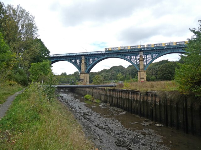
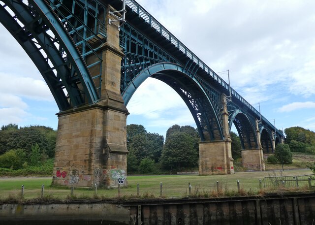
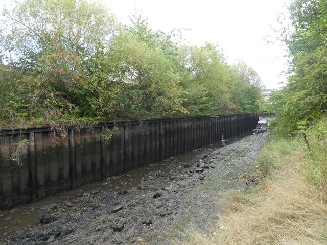
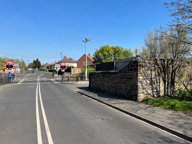
Percy Main is a small village located in the county of Northumberland, in the northeast of England. Situated on the northern bank of the River Tyne, it is part of the larger urban area of North Shields and is approximately 8 miles east of the city of Newcastle upon Tyne.

The village of Percy Main has a rich industrial history, primarily linked to coal mining and shipbuilding. In the 19th and early 20th centuries, it was a thriving mining community, with several collieries operating in the area. The coal mined here played a significant role in fueling the industrial revolution.

However, following the decline of the coal mining industry in the mid-20th century, Percy Main experienced a period of economic hardship. Many of the collieries closed down, leading to high unemployment rates and a decline in the village's population.

In recent years, Percy Main has undergone regeneration efforts, with new housing developments and investments in local amenities. The village retains some of its historical charm, with a few older buildings still standing, including St. John's Church, which was built in 1871.

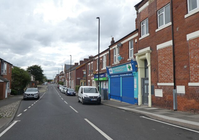
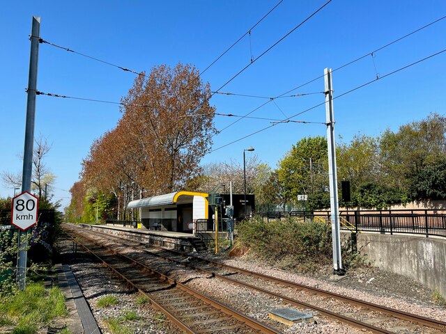
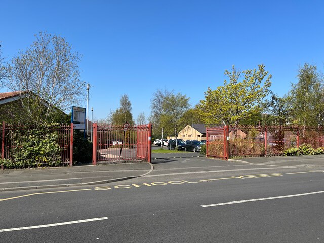
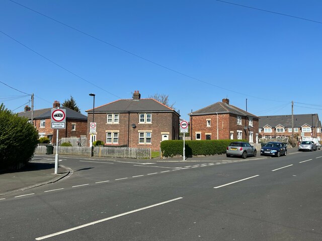
Today, Percy Main is a residential area with a mix of housing types, including both traditional terraced houses and modern developments. It benefits from its proximity to the nearby town of North Shields, offering residents access to a range of services, shops, and schools. The village also provides good transportation links, with a nearby metro station and regular bus services connecting it to other areas in the region.

If you have any feedback on the listing, please let us know in the comments section below.
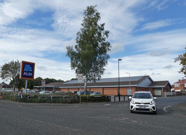
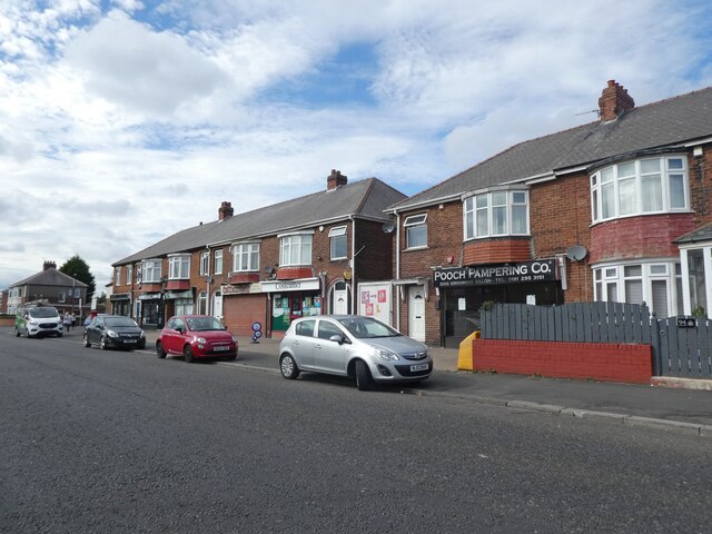
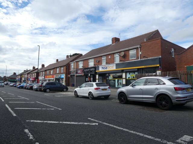
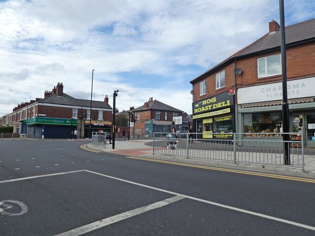
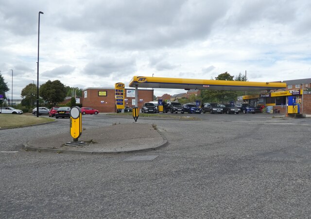
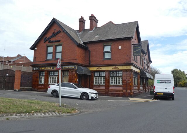
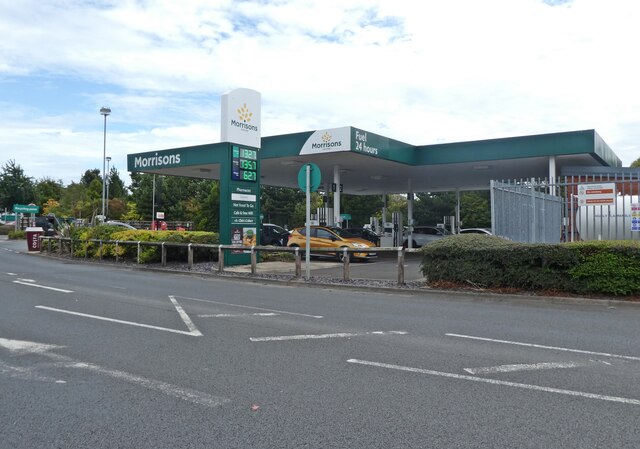
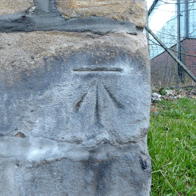
Percy Main Images

Images are sourced within 2km of 54.996041/-1.480232 or Grid Reference NZ3366. Thanks to Geograph Open Source API. All images are credited.

Aldi, Howdon
Aldi, Howdon
Parade of shops on Tynemouth Road
Junction with Churchill Street
An eastbound Metro train crosses Willington Viaduct
Willington Viaduct
Willington Viaduct
Wallsend Burn
Wallsend Burn
Terraced houses on Bewicke Road
Bewicke Road
Bewicke Road
Jet Service Station, Willington Quay Cars can be seen queuing for fuel in 'panic' mode, during the petrol 'crisis' of September 2021.
Jet Service Station, Willington Quay
Cars can be seen queuing for fuel in 'panic' mode, during the petrol 'crisis' of September 2021.
Sambucca Restaurant Formerly the Duke of Wellington: <a href="https://www.geograph.org.uk/photo/104175">NZ3366 : The Duke of Wellington</a>
Sambucca Restaurant
Formerly the Duke of Wellington: NZ3366 : The Duke of Wellington
Petrol station at Morrisons
Benchmark, Howdon Lane, Goods Yard Wall Detail of the Ordnance Survey cut benchmark on the corner of the former railway goods yard wall near Howdon Level Crossing and Metro Station.  The benchmark marks a height of 32.0985m above sea level (Ordnance Datum Newlyn) last verified in 1962 (location photograph <a href="https://www.geograph.org.uk/photo/7160078">NZ3266 : Howdon Lane</a>).
Benchmark, Howdon Lane, Goods Yard Wall
Detail of the Ordnance Survey cut benchmark on the corner of the former railway goods yard wall near Howdon Level Crossing and Metro Station. The benchmark marks a height of 32.0985m above sea level (Ordnance Datum Newlyn) last verified in 1962 (location photograph NZ3266 : Howdon Lane).
Howdon Lane Howdon Lane near Howdon Station and the level crossing over the Tyne and Wear Metro.
The stone wall on the right was formerly that of the railway goods yard. Facing the road on the nearest corner of the stone wall is an Ordnance Survey cut benchmark (photograph <a href="https://www.geograph.org.uk/photo/7095155">NZ3266 : Benchmark, Howdon Lane, Goods Yard Wall</a>).
Howdon Lane
Howdon Lane near Howdon Station and the level crossing over the Tyne and Wear Metro. The stone wall on the right was formerly that of the railway goods yard. Facing the road on the nearest corner of the stone wall is an Ordnance Survey cut benchmark (photograph NZ3266 : Benchmark, Howdon Lane, Goods Yard Wall).
Howdon Station The Tyne and Wear Metro platforms at Howdon Station are staggered either side of the level crossing over Howdon Lane.  This platform, to the west of the level crossing serves trains heading eastbound to the coast on the track designated the ‘In Loop’.  The ‘Out Loop’ track on what is essentially a circular part of the network is that nearest the camera and carries trains bound for Newcastle and the St James terminus.
Howdon Station
The Tyne and Wear Metro platforms at Howdon Station are staggered either side of the level crossing over Howdon Lane. This platform, to the west of the level crossing serves trains heading eastbound to the coast on the track designated the ‘In Loop’. The ‘Out Loop’ track on what is essentially a circular part of the network is that nearest the camera and carries trains bound for Newcastle and the St James terminus.
Howdon Children's Centre entrance gates The Children’s Centre provides help and advice on child and family health, parenting, training, managing money and employment.  It  also provides free activities for the whole family, aimed at giving families opportunities to have fun together and to develop skills for school, work and life.
Howdon Children's Centre entrance gates
The Children’s Centre provides help and advice on child and family health, parenting, training, managing money and employment. It also provides free activities for the whole family, aimed at giving families opportunities to have fun together and to develop skills for school, work and life.
Junction of Hazelwood Terrace and Howdon Lane
Cyclist  tunnel under the Tyne The twin cyclist and pedestrian tunnels under the Tyne linking Jarrow and Wallsend was opened in 1951. After more than half a century of neglect it was closed for minor repairs in 2013. The minor repairs turned into major refurbishment and the work was not completed and the tunnels not reopened until 2019. This image predates the closure and refurbishment.
Cyclist tunnel under the Tyne
The twin cyclist and pedestrian tunnels under the Tyne linking Jarrow and Wallsend was opened in 1951. After more than half a century of neglect it was closed for minor repairs in 2013. The minor repairs turned into major refurbishment and the work was not completed and the tunnels not reopened until 2019. This image predates the closure and refurbishment.
Show me another place!

Percy Main is located at Grid Ref: NZ3366 (Lat: 54.996041, Lng: -1.480232)

Unitary Authority: North Tyneside

Police Authority: Northumbria

What 3 Words

///robot.ozone.owls. Near Jarrow, Tyne & Wear

Related Wikis

Howdon depot

Howdon depot is a light rail facility used by the Tyne and Wear Metro in Howdon, Tyne and Wear, England. The depot was built as a satellite depot of South...

Percy Main

Percy Main is a small village absorbed into North Shields, North East England. Historically in Northumberland, it is now part of Tyne and Wear. == History... ==

Meadow Well

Meadow Well, also known as Meadowell or the Ridges, is a district of North Shields, North East England. Historically in Northumberland, it is now part...

Percy Main Metro station

Percy Main is a Tyne and Wear Metro station, serving the suburb of Percy Main, North Tyneside in Tyne and Wear, England. It joined the network on 14 November...

Percy Main Amateurs F.C.

Percy Main Amateurs Football Club is a football club based in Percy Main in Tyne and Wear, England. They are currently members of the Northern Alliance...

Howdon Metro station

Howdon is a Tyne and Wear Metro station, serving the suburb of Howdon, North Tyneside in Tyne and Wear, England. It joined the network on 14 November 1982...

Tyne Tunnel

The Tyne Tunnel is the name given to two 2-lane vehicular toll tunnels under the River Tyne in North East England. Originally opened in 1967 and expanded...

Willington Quay railway station

Willington Quay was a railway station on the Riverside Branch, which ran between Byker and Willington Quay. The station served Willington Quay in North...

Related Videos

One bright sunny day in the UK.

Taking advantage of the nice bright day which is very seldom to occur here in the UK.

Nearby Amenities

Located within 500m of 54.996041,-1.480232
Motorway Junction
Howdon Interchange
Lat/Long: 54.9974293/-1.4850474
Crossing
Crossing: traffic_signals
Mapillary: 262969765317493
Survey Date: 2019-08-22
Tactile Paving: yes
Lat/Long: 55.0002754/-1.4808096
Traffic Calming: cushion
Lat/Long: 54.998717/-1.4744568
Bus: yes
Public Transport: stop_position
Lat/Long: 54.9951923/-1.4792473
Crossing
Lat/Long: 54.9949147/-1.4812064
Crossing
Crossing: traffic_signals
Lat/Long: 54.994952/-1.4814114
Recycling
North Tyneside Household Waste Recycling Centre
Addr City: North Shields
Addr Postcode: NE29 7SH
Addr Street: Wallsend Road
Opening Hours: Mo-Su 07:30-20:00
Operator: SUEZ
Operator Type: private
Owner: North Tyneside Council
Ownership: municipal
Recycling Batteries: yes
Recycling Bicycles: yes
Recycling Books: yes
Recycling Cans: yes
Recycling Car Batteries: yes
Recycling Cardboard: yes
Recycling Cds: yes
Recycling Clothes: yes
Recycling Electrical Items: yes
Recycling Engine Oil: yes
Recycling Fluorescent Tubes: yes
Recycling Furniture: yes
Recycling Garden Waste: yes
Recycling Gas Bottles: yes
Recycling Glass: yes
Recycling Glass Bottles: yes
Recycling Green Waste: yes
Recycling Mobile Phones: yes
Recycling Paper: yes
Recycling Pet: yes
Recycling Plasterboard: yes
Recycling Plastic: yes
Recycling Plastic Bottles: yes
Recycling Residual Waste: yes
Recycling Rubble: yes
Recycling Scrap Metal: yes
Recycling Sheet Metal: yes
Recycling Small Appliances: yes
Recycling Small Electrical Appliances: yes
Recycling Tv Monitor: yes
Recycling Tyres: yes
Recycling White Goods: yes
Recycling Wood: yes
Recycling Type: centre
Reservation: mandatory
Website: https://my.northtyneside.gov.uk/category/82/household-waste-recycling-centretip
Lat/Long: 54.9994365/-1.48182
Bus Stop
Percy Main Primary School
Local Ref: S
Naptan AtcoCode: 410000000042
Naptan Bearing: S
Naptan CommonName: Percy Main Primary School
Naptan Indicator: S
Naptan Landmark: PERCY MAIN PRIMARY SCHOOL
Naptan NaptanCode: twrgtmwm
Naptan Street: NELSON TERRACE
Naptan Verified: no
Source: naptan_import
Lat/Long: 54.996394/-1.4741035
Bus Stop
WALLSEND ROAD-HIGH FLATWORTH-W/B
Bus: yes
Local Ref: W
Naptan AtcoCode: 410000010043
Naptan Bearing: W
Naptan CommonName: WALLSEND ROAD-HIGH FLATWORTH-W/B
Naptan Indicator: W
Naptan Landmark: JUNCTION WITH A19
Naptan NaptanCode: twraptdp
Naptan Street: WALLSEND ROAD
Naptan Verified: no
Public Transport: platform
Source: naptan_import
Lat/Long: 55.000281/-1.4827247
Bus Stop
HOWDON ROAD-MITFORD STREET-N/B
Bench: yes
Bin: no
Bus: yes
Local Ref: N
Naptan AtcoCode: 410000010066
Naptan Bearing: N
Naptan CommonName: HOWDON ROAD-MITFORD STREET-N/B
Naptan Indicator: N
Naptan Landmark: NORTH OF MITFORD STREET
Naptan NaptanCode: twraptmg
Naptan Street: HOWDON ROAD
Naptan Verified: no
Public Transport: platform
Shelter: yes
Source: naptan_import
Lat/Long: 54.9928921/-1.482257
Bus Stop
Howdon Road
Bench: yes
Bus: yes
Departures Board: timetable
Local Ref: E
Naptan AtcoCode: 410000010068
Naptan Bearing: E
Naptan Indicator: E-Bound
Naptan Landmark: East Of Percy Main Primary School
Naptan NaptanCode: twraptmj
Naptan Street: Howdon Road
Naptan Verified: no
Public Transport: platform
Shelter: yes
Source: naptan_import
Lat/Long: 54.9956105/-1.473126
Bus Stop
Howdon Road
Bench: yes
Bin: no
Bus: yes
Departures Board: timetable
Local Ref: W
Naptan AtcoCode: 410000010075
Naptan Bearing: W
Naptan Indicator: W-Bound
Naptan Landmark: South Of Percy Main Primary School
Naptan NaptanCode: twraptpj
Naptan Street: Howdon Road
Naptan Verified: no
Public Transport: platform
Shelter: yes
Source: naptan_import
Lat/Long: 54.9951584/-1.4753426
Bus Stop
HOWDON ROAD-INGOE STREET-S/B
Bench: yes
Bin: yes
Bus: yes
Local Ref: S
Naptan AtcoCode: 410000010076
Naptan Bearing: S
Naptan CommonName: HOWDON ROAD-INGOE STREET-S/B
Naptan Indicator: S
Naptan Landmark: NORTH OF INGOE STREET
Naptan NaptanCode: twraptpm
Naptan Street: HOWDON ROAD
Naptan Verified: no
Public Transport: platform
Shelter: yes
Source: naptan_import
Lat/Long: 54.9928789/-1.4820504
Bus Stop
Nelson Terrace
Bench: no
Bus: yes
Local Ref: N
Naptan AtcoCode: 410000010192
Naptan Bearing: N
Naptan Indicator: N-Bound
Naptan Landmark: Outside Percy Main Primary School
Naptan NaptanCode: twratawd
Naptan Street: Nelson Terrace
Naptan Verified: no
Public Transport: platform
Shelter: yes
Source: naptan_import
Lat/Long: 54.9958394/-1.473992
Bus Stop
PERCY MAIN (M)
Bench: no
Bin: no
Bus: yes
Local Ref: E
Naptan AtcoCode: 410000010193
Naptan Bearing: E
Naptan CommonName: PERCY MAIN (M)
Naptan Indicator: E
Naptan Landmark: OUTSIDE ST JOHNS CHURCH
Naptan NaptanCode: twratawg
Naptan Street: ST JOHNS TERRACE
Naptan Verified: no
Public Transport: platform
Shelter: yes
Source: naptan_import
Lat/Long: 54.9978154/-1.4735804
Bus Stop
Percy Main
Bench: yes
Bus: yes
Departures Board: timetable
Local Ref: B
Naptan AtcoCode: 410000010195
Naptan Bearing: S
Naptan Indicator: S-Bound
Naptan Landmark: Opposite Percy Main Primary School
Naptan NaptanCode: twratawm
Naptan Street: Nelson Terrace
Naptan Verified: no
Public Transport: platform
Ref: B
Shelter: yes
Source: naptan_import
Lat/Long: 54.9970809/-1.4741371
Railway: switch
Lat/Long: 54.9984727/-1.4779316
Railway: buffer_stop
Lat/Long: 54.9956603/-1.4787099
Power: tower
Lat/Long: 54.9929415/-1.4761962
Crossing
Crossing: unmarked
Lat/Long: 54.9953442/-1.4748537
Crossing
Crossing: traffic_signals
Lat/Long: 55.0002211/-1.4809949
Barrier: lift_gate
Bicycle: no
Bus: yes
Foot: no
Lift Gate Type: double
Lat/Long: 54.9950283/-1.4822166
Crossing
Lat/Long: 54.9955083/-1.4819732
Power: tower
Lat/Long: 54.9955241/-1.4792088
Power: tower
Lat/Long: 54.9982628/-1.4786268
Crossing
Crossing: traffic_signals
Crossing Ref: toucan
Tactile Paving: yes
Lat/Long: 54.9951972/-1.4782161
Traffic Signals
Crossing: traffic_signals
Crossing Ref: toucan
Traffic Signals: pedestrian_crossing
Traffic Signals Direction: both
Lat/Long: 54.9952925/-1.4783173
Barrier: block
Lat/Long: 54.9948894/-1.4737883
Bus: yes
Bus Bay: right
Public Transport: stop_position
Lat/Long: 54.9929348/-1.4821531
Railway: switch
Lat/Long: 54.9970763/-1.4783265
Traffic Calming: cushion
Lat/Long: 54.9980954/-1.4743645
Post Box
Drive Through: no
Operator: Royal Mail
Operator Wikidata: Q638098
Post Box Type: pillar
Ref: NE28 124
Lat/Long: 54.9924071/-1.4823944
Waste Basket
Lat/Long: 54.9983644/-1.4743126
Post Box
Ref: NE29 47
Lat/Long: 54.9989441/-1.4744076
Post Office
Percy Post Office
Addr City: North Shields
Addr Street: Burdon Street
Lat/Long: 54.9989563/-1.4742997
Percy Main
Internet Access: no
Internet Access Fee: no
Operator: NTSR
Public Transport: station
Railway: station
Train: yes
Usage: tourism
Lat/Long: 54.9977941/-1.4780506
Camera Mount: pole
Camera Type: fixed
Man Made: surveillance
Surveillance Type: camera
Lat/Long: 54.999438/-1.4754889
Direction: both
Surface: asphalt
Traffic Calming: cushion
Lat/Long: 54.9969751/-1.4741833
Direction: both
Surface: asphalt
Traffic Calming: cushion
Lat/Long: 54.997611/-1.4743248
Street Lamp
Lat/Long: 54.995228/-1.4737841
Street Lamp
Lat/Long: 54.9954982/-1.4805683
Barrier: lift_gate
Lat/Long: 54.9948214/-1.4831298
Waste Transfer Station
Operator: SUEZ
Lat/Long: 54.9993499/-1.4815215
Direction: both
Traffic Calming: choker
Lat/Long: 54.9963105/-1.4740319
Crossing
Crossing: uncontrolled
Crossing Island: yes
Lat/Long: 54.9978266/-1.4740549
Addr Housenumber: 28
Lat/Long: 54.997666/-1.4741415
Direction: both
Surface: asphalt
Traffic Calming: cushion
Lat/Long: 54.9956359/-1.4738941
Percy Main
Internet Access: no
Operator: NTSR
Public Transport: stop_position
Railway: stop
Train: yes
Usage: tourism
Lat/Long: 54.9979089/-1.4780879
Barrier: bollard
Maxwidth: 2
Lat/Long: 54.9950786/-1.4800491
Railway: switch
Lat/Long: 54.9977953/-1.4839607
Railway: buffer_stop
Lat/Long: 54.9979526/-1.4802286
Railway: buffer_stop
Lat/Long: 54.9982719/-1.4806972
Railway: switch
Lat/Long: 54.9979049/-1.4823374
Railway: switch
Lat/Long: 54.99786/-1.4828169
Railway: switch
Lat/Long: 54.9978204/-1.4825302
Railway: switch
Lat/Long: 54.9978581/-1.4829534
Railway: buffer_stop
Lat/Long: 54.9976163/-1.4842549
Railway: buffer_stop
Lat/Long: 54.9980305/-1.4802797
Railway: buffer_stop
Lat/Long: 54.9980708/-1.4803004
Railway: buffer_stop
Lat/Long: 54.9981122/-1.4803261
Railway: buffer_stop
Lat/Long: 54.9981109/-1.4806063
Railway: buffer_stop
Lat/Long: 54.9981537/-1.4806319
Railway: buffer_stop
Lat/Long: 54.9981926/-1.4806553
Railway: buffer_stop
Lat/Long: 54.9982354/-1.4806786
Railway: switch
Lat/Long: 54.9978651/-1.4825842
Railway: switch
Lat/Long: 54.9978766/-1.4820489
Railway: switch
Lat/Long: 54.9978722/-1.4822928
Railway: switch
Lat/Long: 54.9977846/-1.4822826
Railway: switch
Lat/Long: 54.9977518/-1.4817159
Railway: switch
Lat/Long: 54.9977471/-1.4820459
Railway: buffer_stop
Lat/Long: 54.997993/-1.4802546
Railway: switch
Lat/Long: 54.9977897/-1.4819562
Railway: switch
Lat/Long: 54.9975875/-1.4814984
Crossing
Crossing: unmarked
Lat/Long: 54.9952116/-1.4748083
Bus: yes
Bus Bay: left
Public Transport: stop_position
Lat/Long: 54.9955611/-1.4729941
Traffic Signals
Direction: forward
Lat/Long: 54.995198/-1.4781547
Bus: yes
Bus Bay: yes
Public Transport: stop_position
Lat/Long: 54.9952403/-1.4753826
Give Way
Direction: backward
Lat/Long: 54.9961981/-1.4740133
Give Way
Direction: forward
Lat/Long: 54.9961388/-1.4739396
Give Way
Direction: backward
Lat/Long: 54.9966258/-1.4740482
Bus: yes
Public Transport: stop_position
Lat/Long: 54.9970751/-1.4742024
Give Way
Direction: forward
Lat/Long: 54.9972759/-1.4741877
Give Way
Direction: backward
Lat/Long: 54.9978436/-1.4742802
Give Way
Direction: backward
Lat/Long: 54.998179/-1.4752029
Give Way
Direction: forward
Lat/Long: 54.9982936/-1.4754349
Give Way
Direction: backward
Lat/Long: 54.9975897/-1.4762275
Give Way
Direction: forward
Lat/Long: 54.9957403/-1.4776061
Give Way
Direction: backward
Lat/Long: 54.9966312/-1.4772736
Give Way
Direction: forward
Lat/Long: 54.9969874/-1.47608
Bus: yes
Public Transport: stop_position
Lat/Long: 54.9958973/-1.4739463
Bus: yes
Bus Bay: left
Public Transport: stop_position
Lat/Long: 54.9928476/-1.48219
Bus Stop
Bench: no
Bus: yes
Public Transport: platform
Shelter: no
Lat/Long: 54.9951518/-1.479245
Bus Stop
Bus: yes
Public Transport: platform
Lat/Long: 54.9953534/-1.4770912
Bus: yes
Public Transport: stop_position
Lat/Long: 54.9952995/-1.4770617
Barrier: bollard
Lat/Long: 54.9961895/-1.4771109
Percy Main Junction
Historic Railway: junction
Railway: site
Lat/Long: 54.9988927/-1.4781052
Percy Main
Place: suburb
Lat/Long: 54.9985348/-1.4745294
Engine Shed Junction
Historic Railway: junction
Railway: site
Lat/Long: 54.9954418/-1.4787536
Addr Housenumber: 27
Lat/Long: 54.9976869/-1.4740376
Fixme: Resurvey, new industrial park
Lat/Long: 54.9999462/-1.4791244
The data included in this document is from www.openstreetmap.org. The data is made available under ODbL.

Have you been to Percy Main?

Leave your review of Percy Main below (or comments, questions and feedback).