Percuil

Settlement in Cornwall

England

Percuil

Arriving by ferry at St Mawes
Arriving by ferry at St Mawes Credit: Roy Hughes

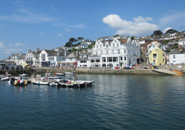
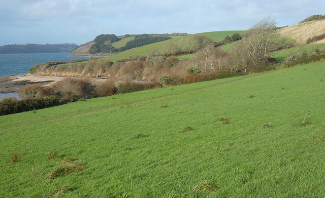
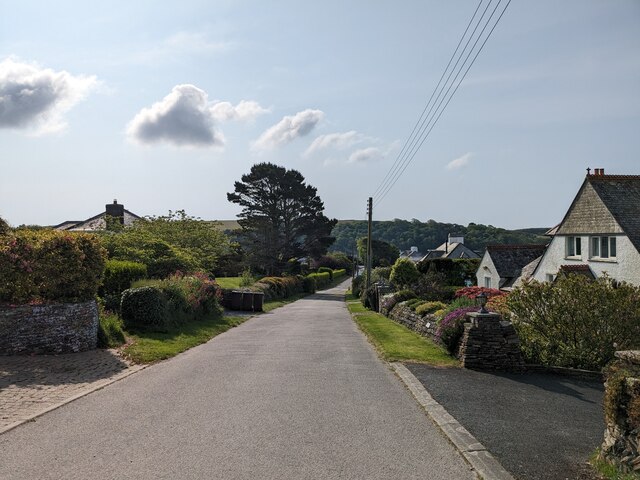
Percuil is a picturesque village located on the Roseland Peninsula in Cornwall, England. Situated on the eastern side of the peninsula, Percuil is nestled on the banks of the Percuil River, which flows into the Carrick Roads estuary. The village offers stunning views of the river, along with lush greenery and charming countryside.

With a population of around 200, Percuil is known for its peaceful and idyllic atmosphere. Its small size gives it a close-knit community feel, where locals and visitors can enjoy a sense of tranquility away from the bustle of larger towns. The village consists mainly of traditional Cornish cottages, many of which feature attractive gardens and well-maintained exteriors.

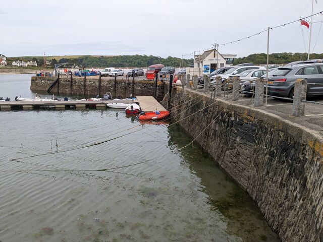
Percuil is a popular spot for boating enthusiasts, thanks to its location on the river. The calm waters and breathtaking scenery attract sailors and kayakers, who can explore the river and its surrounding creeks. The village also has a small boatyard and a public slipway, making it convenient for those looking to launch or moor their vessels.

In addition to its natural beauty, Percuil is conveniently located near several popular attractions. The nearby St Mawes Castle, built by Henry VIII, is a must-visit for history enthusiasts. The village is also within easy reach of numerous beautiful beaches and coastal walks, offering opportunities for outdoor activities and exploration.

Overall, Percuil is a hidden gem in Cornwall, offering a peaceful retreat for those seeking relaxation and natural beauty. Its charming riverside location and close proximity to other attractions make it an ideal destination for nature lovers and history buffs alike.

If you have any feedback on the listing, please let us know in the comments section below.

Percuil Images

Images are sourced within 2km of 50.166954/-5.0119267 or Grid Reference SW8534. Thanks to Geograph Open Source API. All images are credited.

Arriving by ferry at St Mawes
St. Just in Roseland church Photographed in summer 1965.
St. Just in Roseland church
Photographed in summer 1965.
Folbot folding canoe, St Mawes 1938 Folding canoes of fabric over a frame originated with Inuit kayaks. Commercial ones started in Germany with Klepper's Faltboot in 1908. In the UK Jack Kissner started making the Folbot in 1933, and the company continued to 2016. In World War 2 Special Forces used folding canoes, known as cockles, the first ones were based on the Folbot design.
The Folbot in the photo is on Tavern Beach; the photographer was on holiday in "Our Cottage" in Lower Castle Road, just above the beach.
View towards Carricknath Point, as shown in <a href="https://www.geograph.org.uk/photo/29338">SW8432 : Carricknath Point</a>, also a view from St Mawes.
Folbot folding canoe, St Mawes 1938
Folding canoes of fabric over a frame originated with Inuit kayaks. Commercial ones started in Germany with Klepper's Faltboot in 1908. In the UK Jack Kissner started making the Folbot in 1933, and the company continued to 2016. In World War 2 Special Forces used folding canoes, known as cockles, the first ones were based on the Folbot design. The Folbot in the photo is on Tavern Beach; the photographer was on holiday in "Our Cottage" in Lower Castle Road, just above the beach. View towards Carricknath Point, as shown in SW8432 : Carricknath Point, also a view from St Mawes.
Tavern Beach St Mawes with yachts on harbour, 1938 Photo from Lower Castle Road where the photographer was on holiday in "Our Cottage". The sea wall beside the road is seen on the left. Across the estuary is the coast from Carricknath Point to St. Anthony.  A similar recent view is <a href="https://www.geograph.org.uk/photo/774705">SW8432 : St Mawes Harbour, Roseland, Cornwall taken 1964</a>.
Tavern Beach St Mawes with yachts on harbour, 1938
Photo from Lower Castle Road where the photographer was on holiday in "Our Cottage". The sea wall beside the road is seen on the left. Across the estuary is the coast from Carricknath Point to St. Anthony. A similar recent view is SW8432 : St Mawes Harbour, Roseland, Cornwall taken 1964.
The Percuil River, Gerrans A view from the riverside footpath above Precuil to steep pastures on the St Just side.
The Percuil River, Gerrans
A view from the riverside footpath above Precuil to steep pastures on the St Just side.
Farmland, Gerrans Fields of barley beside the road above Percuil.
Farmland, Gerrans
Fields of barley beside the road above Percuil.
Cottages, St Just-in-Roseland The B3289 forks off to the left in the centre of the village beside cottages brightened by their paintwork and a sunny interval on a showery day.
Cottages, St Just-in-Roseland
The B3289 forks off to the left in the centre of the village beside cottages brightened by their paintwork and a sunny interval on a showery day.
Pastures, St Just-in-Roseland Messack Point is seen in the middle distance from a little above the coast path between St Mawes and St Just.
Pastures, St Just-in-Roseland
Messack Point is seen in the middle distance from a little above the coast path between St Mawes and St Just.
Church of St Just in Roseland
Former Wesleyan Methodist Chapel
St Mawes Parish Church
Catholic Church of Our Lady Star of the Sea and St Anthony
Former Wesleyan Methodist Chapel
Former Congregational chapel
St Mawes Castle
St Mawes Castle
Pedn-Moran Road
Pedn-Moran Road
St Mawes Quay
St Mawes Quay
Tea Shop Gardens
Tea Shop Gardens
Show me another place!

Percuil is located at Grid Ref: SW8534 (Lat: 50.166954, Lng: -5.0119267)

Unitary Authority: Cornwall

Police Authority: Devon and Cornwall

What 3 Words

///rooms.rebounder.pigment. Near Portscatho, Cornwall

Nearby Locations

Percuil

Related Wikis

Roseland Peninsula

The Roseland Peninsula, or just Roseland, (Cornish: Ros, meaning promontory) is a district of west Cornwall, England. Roseland is located in the south...

Percuil

Percuil is a hamlet in Roseland, Cornwall, England. Percuil (or Porthcuel) is on the east bank of the Percuil River and south-west of Gerrans. == References ==
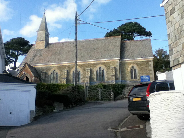
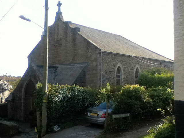
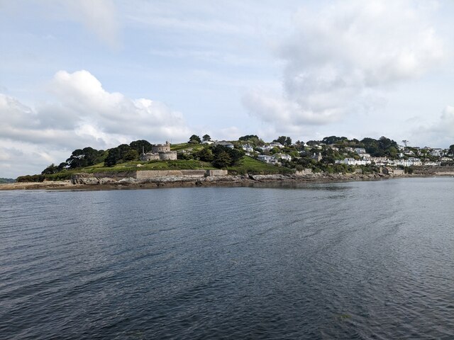
St Mawes

St Mawes' (Cornish: Lannvowsedh) is a village on the end of the Roseland Peninsula, in the eastern side of Falmouth harbour, on the south coast of Cornwall...

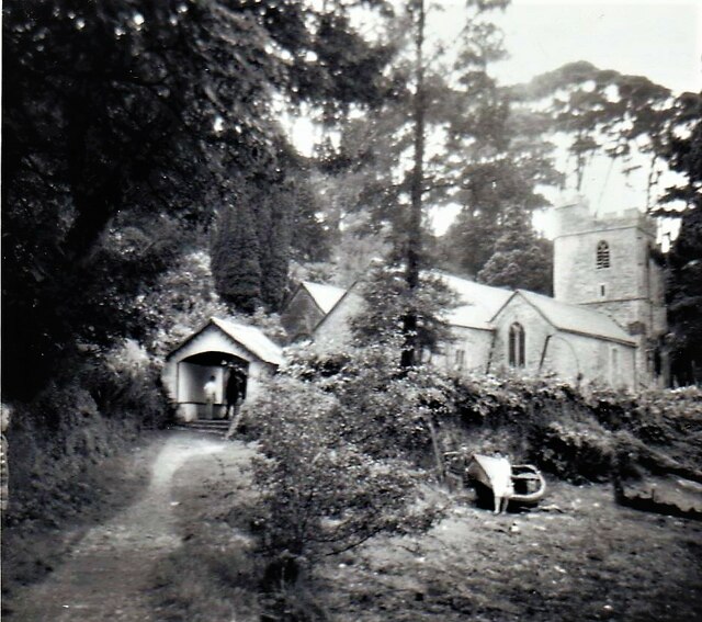
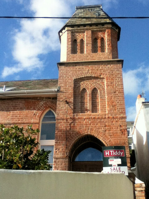
St Mawes' Church, St Mawes

St Mawes’ Church is a Grade II listed parish church in the Church of England Diocese of Truro in St Mawes, Cornwall, England, UK. == History == The name...

Nearby Amenities

Located within 500m of 50.166954,-5.0119267
Halwartha
Name Kw: Halwartha
Place: village
Source: OS_OpenData_StreetView
Lat/Long: 50.1672096/-5.0159438
Bus Stop
St Mawes Garage
Bench: no
Bus: yes
Naptan AdministrativeAreaCode: 73
Naptan AtcoCode: 0800COC30865
Naptan Bearing: S
Naptan BusStopType: CUS
Naptan CommonName: St Mawes Garage
Naptan Indicator: S-bound
Naptan LocalityName: St Mawes
Naptan NaptanCode: cordagtg
Naptan NptgLocalityCode: E0002956
Naptan RegionCode: cordagtg
Naptan Street: Windmill Hill
Naptan Verified: no
Public Transport: platform
Shelter: no
Source: naptan
Lat/Long: 50.1676925/-5.0158639
Barrier: stile
Material: wood
Stile: stepover
Lat/Long: 50.1686721/-5.0160609
Generator Method: photovoltaic
Generator Output Electricity: yes
Generator Source: solar
Generator Type: solar_photovoltaic_panel
Location: roof
Power: generator
Lat/Long: 50.1627018/-5.0098544
Generator Method: photovoltaic
Generator Output Electricity: yes
Generator Source: solar
Generator Type: solar_photovoltaic_panel
Location: roof
Power: generator
Lat/Long: 50.1627053/-5.0099268
Post Box
Collection Times: Mo-Fr 09:00; Sa 07:00; Su off
Note: This post box is a lamp box that's been embedded into the wall of a building
Operator: Royal Mail
Operator Wikidata: Q638098
Post Box Mounting: building
Post Box Type: lamp
Ref: TR2 219D
Royal Cypher: EIIR
Royal Cypher Wikidata: Q33102113
Source: survey;aerial imagery
Lat/Long: 50.1673448/-5.0159991
Barrier: stile
Material: wood
Stile: stepover
Lat/Long: 50.1687459/-5.0055841
Barrier: kissing_gate
Material: wood
Lat/Long: 50.1693498/-5.0113615
unknown helipad
Aeroway: helipad
Lat/Long: 50.1699316/-5.0091009
Bus Stop
St Mawes Garage
Bus: yes
Naptan AdministrativeAreaCode: 73
Naptan AtcoCode: 0800COC30867
Naptan Bearing: N
Naptan BusStopType: CUS
Naptan CommonName: St Mawes Garage
Naptan Indicator: N-bound
Naptan LocalityName: St Mawes
Naptan NptgLocalityCode: E0002956
Naptan RegionCode: cordagtd
Naptan Street: Windmill Hill
Naptan Verified: no
Public Transport: platform
Lat/Long: 50.1676852/-5.0160271
Bench
Backrest: yes
Survey Date: 2024-02-24
Lat/Long: 50.1700216/-5.0160608
The data included in this document is from www.openstreetmap.org. The data is made available under ODbL.

Have you been to Percuil?

Leave your review of Percuil below (or comments, questions and feedback).