Shire Ditch

Heritage Site in Herefordshire / Worcestershire

England

Shire Ditch

The British Camp The British Camp on the Herefordshire Beacon viewed from the north.
The British Camp Credit: Philip Halling

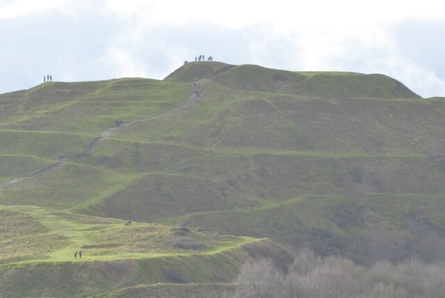
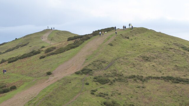
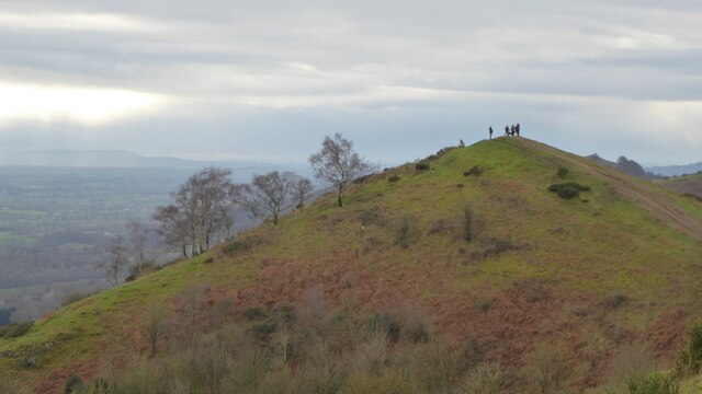
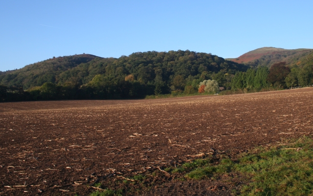
Shire Ditch is a historic earthwork located on the border between Herefordshire and Worcestershire, England. This site holds great significance as it marks the boundary between the two counties, dating back to medieval times.

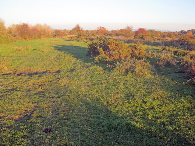
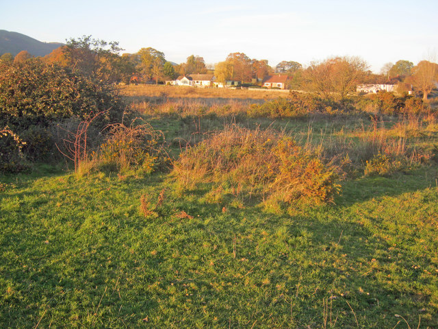
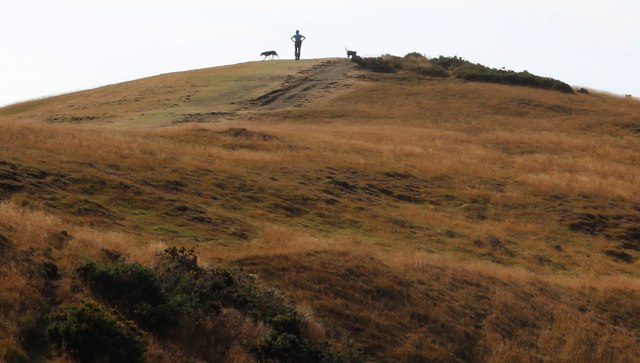
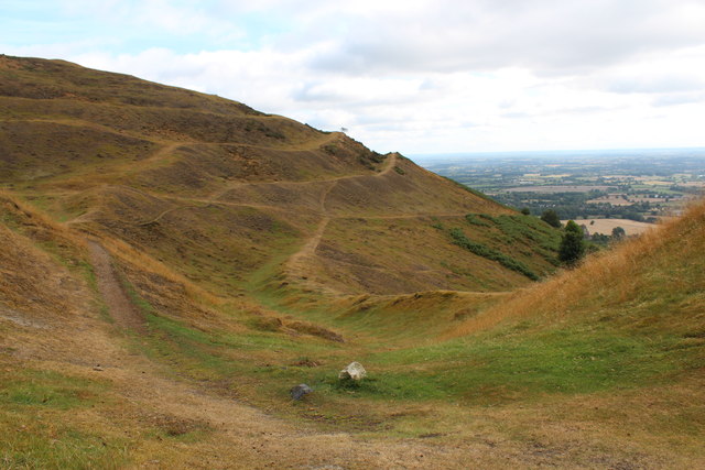
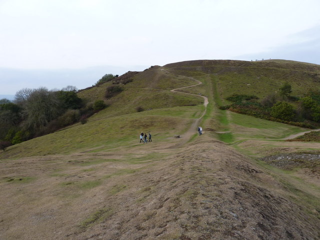
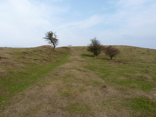
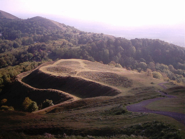
The earthwork itself is a large ditch that stretches for approximately 2 kilometers, creating a clear division between the two counties. It is believed to have been constructed in the 13th century during a period of border disputes and conflicts between Herefordshire and Worcestershire. The purpose of the ditch was to serve as a physical barrier and demarcation line, ensuring the separation of the two territories.

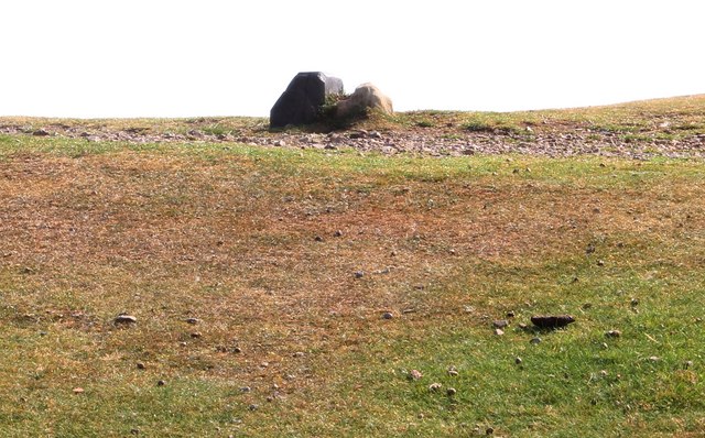
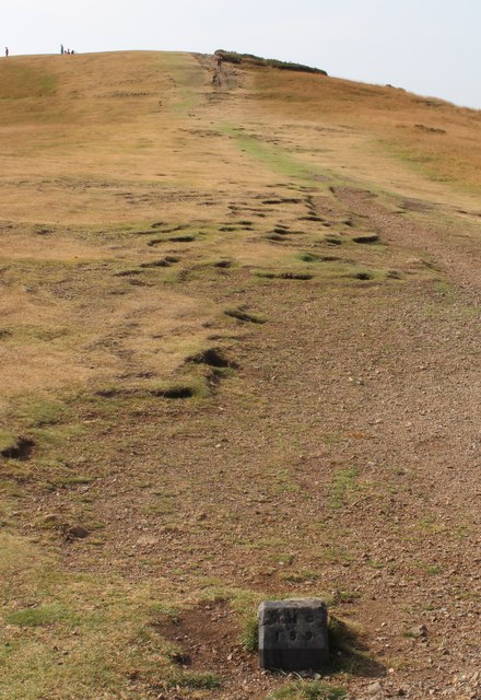
Shire Ditch is an impressive example of medieval engineering, with the ditch measuring up to 5 meters in width and 2 meters in depth. The site is also surrounded by a bank, which further emphasizes its function as a defensive structure.

Today, Shire Ditch is considered a heritage site and is protected by local conservation authorities. It serves as a reminder of the historical tensions and territorial disputes that once characterized the Herefordshire-Worcestershire border. The site offers a unique opportunity for visitors to explore and learn about the medieval period, as well as the significance of boundaries and their role in shaping local history.

Shire Ditch is easily accessible, with footpaths and trails running alongside it, allowing visitors to walk along its length and appreciate its historical significance.

If you have any feedback on the listing, please let us know in the comments section below.
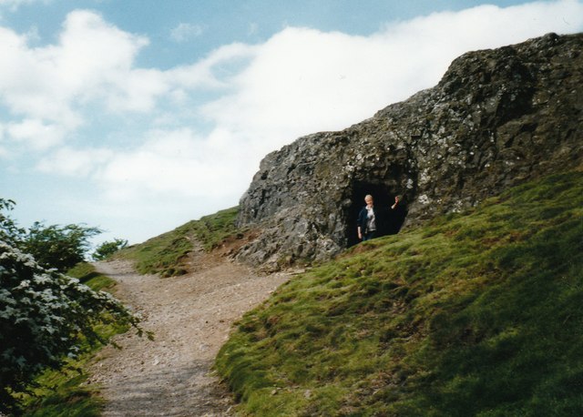
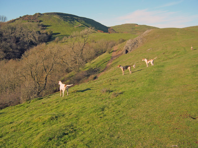
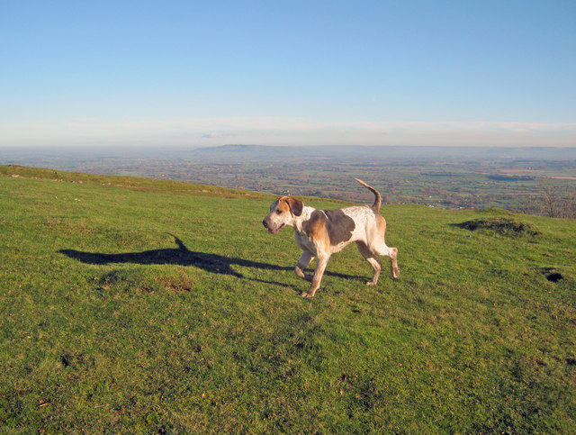
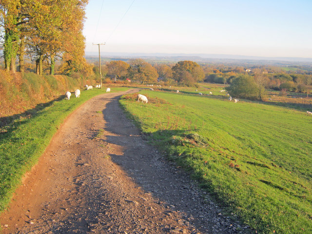
Shire Ditch Images

Images are sourced within 2km of 52.062/-2.343 or Grid Reference SO7640. Thanks to Geograph Open Source API. All images are credited.

The British Camp The British Camp on the Herefordshire Beacon viewed from the north.
The British Camp
The British Camp on the Herefordshire Beacon viewed from the north.
Walkers on Pinnacle Hill Walkers on Pinnacle Hill viewed from Black Hill.
Walkers on Pinnacle Hill
Walkers on Pinnacle Hill viewed from Black Hill.
Black Hill Walkers on Black Hill in the Malvern Hills.
Black Hill
Walkers on Black Hill in the Malvern Hills.
View to the flooded River Severn View to the flooded River Severn to the south of Upton upon Severn.  Viewed here from Pinnacle Hill in the Malvern Hills, to the right the road to Upper Hook and Upton can be seen, while to the left the line of trees indicate the route of the former Malvern to Ashchurch railway line.
View to the flooded River Severn
View to the flooded River Severn to the south of Upton upon Severn. Viewed here from Pinnacle Hill in the Malvern Hills, to the right the road to Upper Hook and Upton can be seen, while to the left the line of trees indicate the route of the former Malvern to Ashchurch railway line.
Giant's Cave, Hangman's Hill, Malvern Hills
Hounds on Broad Down View north to the Herefordshire Beacon with Clutter's Cave just ahead. The Ledbury Hunt is scouring the Eastnor estate off to the left and these hounds have come up to the hilltop to check things out.
Hounds on Broad Down
View north to the Herefordshire Beacon with Clutter's Cave just ahead. The Ledbury Hunt is scouring the Eastnor estate off to the left and these hounds have come up to the hilltop to check things out.
Hound on Broad Down A member of the Ledbury Hunt pack bounds across the top of the down. Bredon Hill and the Cotswold escarpment in the distance to the east.
Hound on Broad Down
A member of the Ledbury Hunt pack bounds across the top of the down. Bredon Hill and the Cotswold escarpment in the distance to the east.
Track across Castlemorton Common Heading east towards Bowling Green.
Track across Castlemorton Common
Heading east towards Bowling Green.
Scrubland at Castlemorton Common View east with Bredon Hill just visible on the horizon. The evening sun highlights the mixture of rough grazing, gorse and scrub in this more inaccessible part of the common.
Scrubland at Castlemorton Common
View east with Bredon Hill just visible on the horizon. The evening sun highlights the mixture of rough grazing, gorse and scrub in this more inaccessible part of the common.
West side of Castlemorton Common Looking north to the cottages on Hancock's Lane lit up by the evening sun.
West side of Castlemorton Common
Looking north to the cottages on Hancock's Lane lit up by the evening sun.
Boundary Stones, British Camp, the Malvern Hills Two boundary markers: the right-hand one being a somewhat sunken stone and the other being a Malvern Hills Conservators' blue brick marker.
They are on the ridge of the Malvern hills in the saddle between Herefordshire Beacon and Millennium Hill. 
The iron-age hill fort known as British camp occupies both hill tops and these markers are close to the western gate to the fort.
Boundary Stones, British Camp, the Malvern Hills
Two boundary markers: the right-hand one being a somewhat sunken stone and the other being a Malvern Hills Conservators' blue brick marker. They are on the ridge of the Malvern hills in the saddle between Herefordshire Beacon and Millennium Hill. The iron-age hill fort known as British camp occupies both hill tops and these markers are close to the western gate to the fort.
Boundary marker, British Camp, Malvern The blue brick marker is bears the inscription MHC 159.
It was placed here by the Malvern Hills Conservators on the ridge of the hills in the saddle between Herefordshire Beacon and Millennium Hill.
The peak of the latter can be seen along the well worn ridge.
Just behind the marker and barely visible in this photo is a much older boundary stone in a somewhat sunken state.
If one looks carefully it is possible to see the levelled hut platforms of the iron-age town on the slopes of the hill side.
Boundary marker, British Camp, Malvern
The blue brick marker is bears the inscription MHC 159. It was placed here by the Malvern Hills Conservators on the ridge of the hills in the saddle between Herefordshire Beacon and Millennium Hill. The peak of the latter can be seen along the well worn ridge. Just behind the marker and barely visible in this photo is a much older boundary stone in a somewhat sunken state. If one looks carefully it is possible to see the levelled hut platforms of the iron-age town on the slopes of the hill side.
Millennium Hill, Malvern Hills The hill is the southern of two peaks included in the iron-age hill fort known as British Camp.
Almost all of the Malvern Hills is under the care of the Malvern Hills Conservators and is open to the public and very popular with dog walkers.
Millennium Hill, Malvern Hills
The hill is the southern of two peaks included in the iron-age hill fort known as British Camp. Almost all of the Malvern Hills is under the care of the Malvern Hills Conservators and is open to the public and very popular with dog walkers.
Wake detection, British Camp reservoir The ducks were almost invisible (to my eyes), but with the sun at the right angle the wake indicates their location.
The reservoir is no longer used as a water supply, but it remains as an iconic reminder of Victorian engineering and it is also a picturesque scene
Wake detection, British Camp reservoir
The ducks were almost invisible (to my eyes), but with the sun at the right angle the wake indicates their location. The reservoir is no longer used as a water supply, but it remains as an iconic reminder of Victorian engineering and it is also a picturesque scene
Boundary Stones, British Camp, the Malvern Hills The county boundary making use of the iron-age defensive ditch. The stone marker is older and the blue brick is a Malvern Hills Conservator marker.
Boundary Stones, British Camp, the Malvern Hills
The county boundary making use of the iron-age defensive ditch. The stone marker is older and the blue brick is a Malvern Hills Conservator marker.
British Camp reservoir from high above
Shire Ditch and the path onto Millennium Hill
Shire Ditch running south on Hangman's Hill
Show me another place!

Shire Ditch is located at Grid Ref: SO7640 (Lat: 52.062, Lng: -2.343)

Unitary Authority: County of Herefordshire

Police Authority: West Mercia

What 3 Words

///clarifies.expectant.eminent. Near Great Malvern, Worcestershire

Related Wikis

Little Malvern

Little Malvern is a small village and civil parish in Worcestershire, England. It is situated on the lower slopes of the Malvern Hills, south of Malvern...

Tinkers Hill

Tinkers Hill is situated in the range of Malvern Hills that runs about 13 kilometres (8 mi) north-south along the Herefordshire-Worcestershire border....

St Wulstan's Roman Catholic Church

St Wulstan's Roman Catholic Church, Little Malvern, Worcestershire, England is a Benedictine parish church administered by the monks of Downside Abbey...

Herefordshire Beacon

The Herefordshire Beacon is one of the highest peaks of the Malvern Hills. It is surrounded by a British Iron Age hill fort earthwork known as British...

British Camp

British Camp is an Iron Age hill fort located at the top of Herefordshire Beacon in the Malvern Hills. The hill fort is protected as a Scheduled Ancient...

Upper Welland

Upper Welland is a small settled area within the civil parish of Malvern Wells, in Worcestershire, England. Lying close to the county boundaries of Herefordshire...

Abbey College, Malvern

Abbey College in Malvern, Worcestershire, England, is a small boarding school providing secondary education to a diverse and international student body...

Swinyard Hill

Swinyard Hill is a hill in the Malvern Range, a line of hills that runs approximately 13 kilometres (8 mi) north-south along the Herefordshire-Worcestershire...

Nearby Amenities

Located within 500m of 52.062,-2.343
Little Malvern
Place: village
Wikidata: Q576836
Wikipedia: en:Little Malvern
Lat/Long: 52.0619167/-2.3367585
Barrier: cattle_grid
Lat/Long: 52.0604589/-2.3468655
Post Box
Collection Plate: uncoded
Collection Times: Mo-Fr 09:00; Sa 07:00
Historic Operator: Post Office
Old Ref: M051 Wynds Point, Colwall
Post Box Mounting: building
Post Box Type: wall
Ref: WR13 51D
Royal Cypher: EVIIR
Royal Cypher Wikidata: Q33102324
Source: survey
Lat/Long: 52.0617871/-2.3468222
Telephone
Note: scheduled for removal
Booth: K6
Covered: booth
Operator: BT
Operator Wikidata: Q593786
Phone: +441684540447
Lat/Long: 52.0617307/-2.347402
Bench
Lat/Long: 52.0661932/-2.3410003
Bench
Lat/Long: 52.065898/-2.3411304
Bench
Lat/Long: 52.0655413/-2.3411303
Bench
Backrest: yes
Lat/Long: 52.0650511/-2.34172
Barrier: stile
Material: wood
Step Count: 1
Stile: stepover
Lat/Long: 52.0625999/-2.3475229
Bench
Lat/Long: 52.0604816/-2.3476405
Tourism: viewpoint
Lat/Long: 52.0605343/-2.3482843
Bench
Lat/Long: 52.0599169/-2.3472543
Hotel
Naptan AtcoCode: 2000G022301
Naptan Bearing: N
Naptan BusStopType: CUS
Naptan CommonName: Hotel
Naptan Indicator: Adj
Naptan Landmark: Hotel
Naptan NaptanCode: wocdmjtd
Naptan PlusbusZoneRef: GTMLVRN
Naptan Street: Jubilee Drive
Naptan Verified: no
Source: naptan_import
Lat/Long: 52.0617625/-2.3468259
Kiosk
Naptan AtcoCode: 2000G022302
Naptan Bearing: E
Naptan BusStopType: CUS
Naptan CommonName: Kiosk
Naptan Indicator: Adj
Naptan Landmark: by Kiosk
Naptan NaptanCode: wocdmjtg
Naptan PlusbusZoneRef: GTMLVRN
Naptan Street: A449
Naptan Verified: no
Source: naptan_import
Lat/Long: 52.061653/-2.3473793
Hotel
Naptan AtcoCode: 2000G022303
Naptan Bearing: N
Naptan BusStopType: CUS
Naptan CommonName: Hotel
Naptan Indicator: Opp
Naptan Landmark: Hotel
Naptan NaptanCode: wocdtmjw
Naptan PlusbusZoneRef: GTMLVRN
Naptan Street: Jubilee Drive
Naptan Verified: no
Source: naptan_import
Lat/Long: 52.0619509/-2.3469732
Kiosk
Naptan AtcoCode: 2000G022304
Naptan Bearing: W
Naptan BusStopType: CUS
Naptan CommonName: Kiosk
Naptan Indicator: Opp
Naptan Landmark: Car Park
Naptan NaptanCode: wocdtmpa
Naptan Street: A449
Naptan Verified: no
Source: naptan_import
Lat/Long: 52.0615183/-2.3473199
Bus Stop
Little Malvern Priory
Bus: yes
Naptan AtcoCode: 2000G043900
Naptan Bearing: SE
Naptan BusStopType: CUS
Naptan CommonName: Little Malvern Priory
Naptan Indicator: opp
Naptan Landmark: Little Malvern Priory
Naptan NaptanCode: wocgjdjd
Naptan Street: A4104
Naptan Verified: no
Public Transport: platform
Source: naptan_import
Lat/Long: 52.062118/-2.3371741
Bus Stop
Little Malvern Priory
Bus: yes
Naptan AtcoCode: 2000G323402
Naptan Bearing: NW
Naptan BusStopType: CUS
Naptan CommonName: Little Malvern Priory
Naptan Indicator: adj
Naptan Landmark: Little Malvern Priory
Naptan NaptanCode: wocdmdta
Naptan Street: A4104
Naptan Verified: no
Public Transport: platform
Source: naptan_import
Lat/Long: 52.0620733/-2.3372638
Barrier: stile
Lat/Long: 52.0618976/-2.335869
Bench
Lat/Long: 52.0625365/-2.3444035
Bench
Lat/Long: 52.0625382/-2.3450829
Bus Stop
Bus: yes
Public Transport: platform
Lat/Long: 52.062075/-2.3469335
Parking
Lat/Long: 52.0625471/-2.3400613
Barrier: stile
Lat/Long: 52.0631459/-2.3488248
Bus Stop
Bus: yes
Public Transport: platform
Lat/Long: 52.0620342/-2.3468005
Defibrillator
Defibrillator Location: On outside wall of Malvern Hills Hotel, on the outside of the entrance porch facing the junction of the B4232 and A449.
Emergency: defibrillator
Indoor: no
Ref GB The Circuit: B32A8965-1288-4FD7-846B-1D535A7692ED
Lat/Long: 52.0617871/-2.3466677
Bench
Lat/Long: 52.0654594/-2.3412712
Bench
Capacity: 3
Material: wood
Lat/Long: 52.065754/-2.3407527
Generator Method: photovoltaic
Generator Output Electricity: yes
Generator Source: solar
Generator Type: solar_photovoltaic_panel
Location: roof
Power: generator
Lat/Long: 52.0630973/-2.3433441
Direction: 110
Generator Method: photovoltaic
Generator Output Electricity: yes
Generator Solar Modules: 40
Generator Source: solar
Generator Type: solar_photovoltaic_panel
Location: roof
Power: generator
Lat/Long: 52.0621582/-2.3466405
Generator Method: photovoltaic
Generator Output Electricity: yes
Generator Source: solar
Generator Type: solar_photovoltaic_panel
Location: roof
Power: generator
Lat/Long: 52.0619051/-2.3373762
Generator Method: photovoltaic
Generator Output Electricity: yes
Generator Source: solar
Generator Type: solar_photovoltaic_panel
Location: roof
Power: generator
Lat/Long: 52.0618803/-2.3373185
Tourism: viewpoint
Lat/Long: 52.0598078/-2.3484794
Bicycle Parking
Lat/Long: 52.0613229/-2.34643
Power: pole
Transformer: distribution
Lat/Long: 52.0632259/-2.3362362
Note: Path ends here at the fence
Lat/Long: 52.0609134/-2.3437474
Note: Path peters out here
Lat/Long: 52.0621373/-2.3436918
Bench
Lat/Long: 52.0621697/-2.3447455
Fixme: incomplete
Lat/Long: 52.062145/-2.3450044
Fixme: incomplete
Lat/Long: 52.0607202/-2.3438484
Man Made: water_tap
Ref: Wynds Point Spout
Lat/Long: 52.0613952/-2.3459682
Bench
Backrest: yes
Capacity: 3
Material: wood
Lat/Long: 52.0609761/-2.34761
Tinker's Hill
Alt Name: Tinkers' Hill
Ele: 213
Natural: peak
Wikidata: Q7808348
Lat/Long: 52.057788/-2.3428345
Give Way
Lat/Long: 52.0615633/-2.346892
The data included in this document is from www.openstreetmap.org. The data is made available under ODbL.

Have you been to Shire Ditch?

Leave your review of Shire Ditch below (or comments, questions and feedback).