Shirehampton Park

Heritage Site in Gloucestershire

England

Shirehampton Park

River Avon West of Shirehampton Park
River Avon West of Shirehampton Park Credit: Michel Van den Berghe

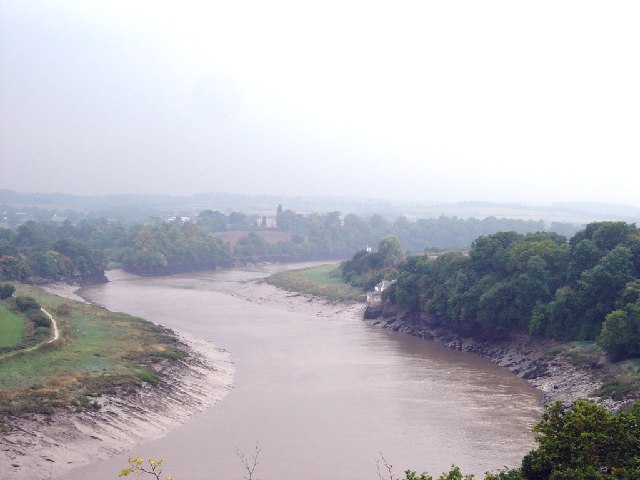
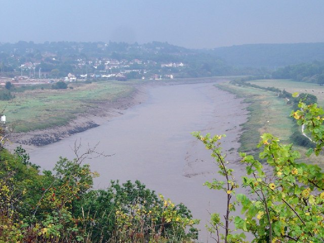
Shirehampton Park is a historic heritage site located in Gloucestershire, England. The park is renowned for its picturesque landscape, rich history, and architectural significance. Spread across a vast area of land, the park encompasses various features that make it a popular attraction for visitors and locals alike.

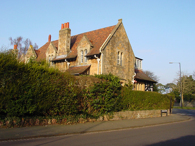
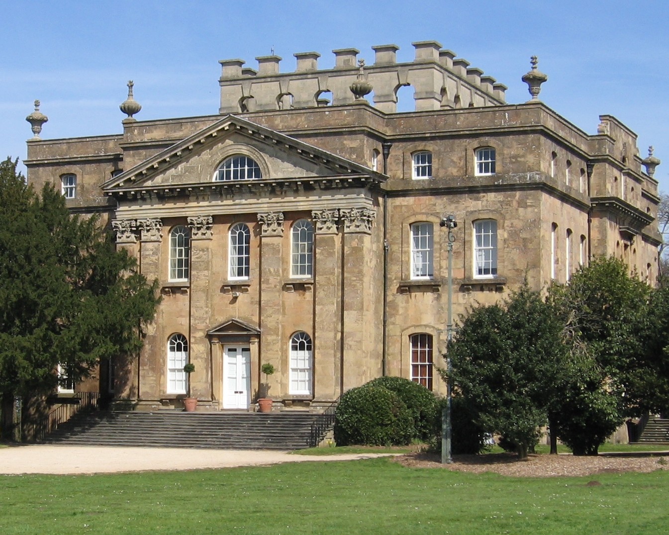
One of the most prominent features of Shirehampton Park is the Shirehampton House, a Grade II* listed mansion that dates back to the 18th century. The house showcases stunning Georgian architecture and is surrounded by well-maintained gardens and grounds. The mansion has been carefully restored to preserve its original charm and is often used for special events and weddings.

The park also boasts a diverse range of flora and fauna, with numerous walking trails and meadows for visitors to explore. The mature trees, including oak and chestnut, provide a tranquil environment and attract a variety of bird species, making it a paradise for birdwatchers.

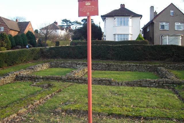
Additionally, Shirehampton Park holds historical significance as it was once owned by influential families such as the Smyths and the Codringtons. These families made significant contributions to the development of the park and the surrounding area.

Overall, Shirehampton Park is a cherished heritage site that offers visitors a unique blend of natural beauty, architectural splendor, and historical significance. Whether one is seeking a peaceful stroll, a glimpse into the past, or a stunning backdrop for an event, Shirehampton Park has something to offer everyone.

If you have any feedback on the listing, please let us know in the comments section below.

Shirehampton Park Images

Images are sourced within 2km of 51.488/-2.657 or Grid Reference ST5476. Thanks to Geograph Open Source API. All images are credited.

River Avon West of Shirehampton Park
River Avon East of Shirehampton Park
Sea Mills Remains of old harbour
Sea Mills
Remains of old harbour
Ham Green Halt This halt was mainly built to serve the nearby hospital. The line is still open to serve Portbury Docks
Ham Green Halt
This halt was mainly built to serve the nearby hospital. The line is still open to serve Portbury Docks
Remains of Roman Dwelling at Portus Abonae (Sea Mills) Portus Abonae was an ancient Roman Settlement at Sea Mills, where the Roman army would await embarkation for Caerleon, Wales.  The photo is apparently of remains of dwellings which formed part of a military fort in Claudian times.  It is taken between Roman Way and the Portway, facing due South.  Most commuters speeding down the Portway would never know it was there!
Remains of Roman Dwelling at Portus Abonae (Sea Mills)
Portus Abonae was an ancient Roman Settlement at Sea Mills, where the Roman army would await embarkation for Caerleon, Wales. The photo is apparently of remains of dwellings which formed part of a military fort in Claudian times. It is taken between Roman Way and the Portway, facing due South. Most commuters speeding down the Portway would never know it was there!
The Dingle, Combe Dingle The Dingle is a narrow steep winding road. And from The Dingle you can walk through woods up to the Blaise Castle Estate to the house itself <a href="https://www.geograph.org.uk/photo/101829">ST5678 : Blaise Castle House</a>, very popular with Bristol residents.
The Dingle, Combe Dingle
The Dingle is a narrow steep winding road. And from The Dingle you can walk through woods up to the Blaise Castle Estate to the house itself ST5678 : Blaise Castle House, very popular with Bristol residents.
Cheyne Road, Stoke Bishop This must be a private road as it isn't tarmaced.
Cheyne Road, Stoke Bishop
This must be a private road as it isn't tarmaced.
Canford Lane Looking north east up Canford Lane standing at the junction by The Dingle.
Canford Lane
Looking north east up Canford Lane standing at the junction by The Dingle.
Druid Stoke Avenue, Stoke Bishop House on the junction of Druid Stoke Avenue and Druid Hill. A Grade II listed building dating from 1860.
Druid Stoke Avenue, Stoke Bishop
House on the junction of Druid Stoke Avenue and Druid Hill. A Grade II listed building dating from 1860.
Looking up Kings Weston Lane The road cuts through the hill just around the corner, or if you take the footpath on the right of the road you can walk up to Kings Weston Hill.
Looking up Kings Weston Lane
The road cuts through the hill just around the corner, or if you take the footpath on the right of the road you can walk up to Kings Weston Hill.
View across the fields towards the River Severn Looking north across the field, towards the River Severn, the Second Severn Crossing can just be seen in the distance.
View across the fields towards the River Severn
Looking north across the field, towards the River Severn, the Second Severn Crossing can just be seen in the distance.
Broadlands Drive, Lawrence Weston Looking south-west along Broadlands Drive
Broadlands Drive, Lawrence Weston
Looking south-west along Broadlands Drive
Kings Weston Lane crossing the M5 Looking along Kings Weston Lane as it rises up over the M5 motorway. At this point the National Cycle Network 41 crosses the road.
Kings Weston Lane crossing the M5
Looking along Kings Weston Lane as it rises up over the M5 motorway. At this point the National Cycle Network 41 crosses the road.
View towards Avonmouth Bridge Looking across rough ground whilst standing on NCN 41 towards the Avonmouth Bridge in the distance (GR 521771)
View towards Avonmouth Bridge
Looking across rough ground whilst standing on NCN 41 towards the Avonmouth Bridge in the distance (GR 521771)
Flats in Lawrence Weston Looking at the back of the flats from the National Cycle Network 41.
Flats in Lawrence Weston
Looking at the back of the flats from the National Cycle Network 41.
Entrance to Penlea Court
Portway Community School The school was originally founded in 1932. It has recently been rebuilt.
Portway Community School
The school was originally founded in 1932. It has recently been rebuilt.
Shirehampton Park Golf Course The Golf Course was founded in 1904.
Shirehampton Park Golf Course
The Golf Course was founded in 1904.
Show me another place!

Shirehampton Park is located at Grid Ref: ST5476 (Lat: 51.488, Lng: -2.657)

Unitary Authority: Bristol

Police Authority: Avon and Somerset

What 3 Words

///occupy.rocky.sake. Near Easton-in-Gordano, Somerset

Related Wikis

Horseshoe Bend, Shirehampton

Horseshoe Bend, Shirehampton (grid reference ST542767) is an 11 acre (4.45 hectare) biological Site of Special Scientific Interest in Bristol, England...

Kingsweston Iron Bridge

Kingsweston Iron Bridge is a footbridge in Sea Mills, Bristol, UK, that crosses the B4057 (Kings Weston Road). == History == On 8 January 1959 the bridge...

Kings Weston House

Kings Weston House (grid reference ST529771) is a historic building in Kings Weston Lane, Kingsweston, Bristol, England. Built during the early 18th century...

Kingsweston School

Kingsweston School is a school for children with severe learning difficulties and Autism. It is located across 3 campuses in north west Bristol. The largest...

Bewys Cross

Bewys Cross (or Bewy's Cross) is a monument consisting of the steps, plinth and truncated shaft said to be of an ancient cross of uncertain age which used...

Bristol Manor Farm F.C.

Bristol Manor Farm Football Club is an English football club based in Bristol, England. They are currently members of the Southern League Division One...

Shirehampton F.C.

Shirehampton Football Club is a football club based in Bristol, England. They are currently members of the Western League Division One and play at Penpole...

Oasis Academy Brightstowe

Oasis Academy Brightstowe is a secondary school with academy status in Bristol, England. It opened in September 2008 in the buildings of the former Portway...

Nearby Amenities

Located within 500m of 51.488,-2.657
Crossing
Lat/Long: 51.4916964/-2.6568568
Turning Circle
Lat/Long: 51.4915269/-2.652956
Turning Circle
Lat/Long: 51.4850893/-2.6515628
Barrier: cycle_barrier
Bicycle: yes
Foot: yes
Lat/Long: 51.4923713/-2.6574734
Barrier: cycle_barrier
Bicycle: yes
Foot: yes
Lat/Long: 51.4924184/-2.6572857
Bus Stop
Westbury Lane
Bench: yes
Bin: yes
Naptan AtcoCode: 0100BRA10606
Naptan Bearing: W
Naptan CommonName: Westbury Lane
Naptan Crossing: Westbury Lane
Naptan NaptanCode: bstajap
Naptan PlusbusZoneRef: BRSTLTM
Naptan ShortCommonName: Iron Bridge
Naptan Street: Shirehampton Road
Naptan Verified: no
Shelter: yes
Source: naptan_import
Tactile Paving: yes
Lat/Long: 51.4915994/-2.6571552
Bus Stop
Westbury Lane
Bench: no
Bin: no
Lit: yes
Naptan AtcoCode: 0100BRA10607
Naptan Bearing: W
Naptan CommonName: Westbury Lane
Naptan Crossing: Westbury Lane
Naptan NaptanCode: bstajda
Naptan PlusbusZoneRef: BRSTLTM
Naptan ShortCommonName: Iron Bridge
Naptan Street: Shirehampton Road
Naptan Verified: no
Shelter: no
Source: naptan_import
Tactile Paving: yes
Lat/Long: 51.4917131/-2.6560961
Bus Stop
High Grove
Bench: yes
Bin: no
Naptan AtcoCode: 0100BRA10608
Naptan Bearing: NW
Naptan CommonName: High Grove
Naptan Crossing: High Grove
Naptan NaptanCode: bstpdtm
Naptan PlusbusZoneRef: BRSTLTM
Naptan Street: Shirehampton Road
Naptan Verified: no
Shelter: yes
Source: naptan_import
Tactile Paving: yes
Lat/Long: 51.4896339/-2.6529908
Bus Stop
Sylvan Way
Bench: no
Bin: no
Bus: yes
Lit: no
Naptan AtcoCode: 0100BRA10609
Naptan Bearing: SE
Naptan CommonName: Sylvan Way
Naptan Crossing: High Grove
Naptan NaptanCode: bstajgm
Naptan PlusbusZoneRef: BRSTLTM
Naptan Street: Shirehampton Road
Naptan Verified: no
Public Transport: platform
Shelter: no
Source: naptan_import
Tactile Paving: no
Lat/Long: 51.489441/-2.6521094
Bus Stop
Shirehampton Park
Bench: no
Bin: no
Bus: yes
Naptan AtcoCode: 0100BRA10641
Naptan Bearing: N
Naptan CommonName: Shirehampton Park
Naptan Crossing: Westbury Lane
Naptan NaptanCode: bstajdm
Naptan PlusbusZoneRef: BRSTLTM
Naptan Street: Shirehampton Road
Naptan Verified: no
Public Transport: platform
Shelter: no
Source: naptan_import
Tactile Paving: no
Lat/Long: 51.4909255/-2.6551842
Bus Stop
Woodleaze
Bench: no
Bin: no
Lit: no
Naptan AtcoCode: 0100BRA10651
Naptan Bearing: E
Naptan CommonName: Woodleaze
Naptan Crossing: Portway
Naptan NaptanCode: bstajga
Naptan PlusbusZoneRef: BRSTLTM
Naptan Street: Sylvan Way
Naptan Verified: no
Shelter: no
Source: naptan_import
Tactile Paving: no
Lat/Long: 51.4873918/-2.6534789
Bus Stop
Woodleaze
Bench: no
Bin: no
Lit: no
Naptan AtcoCode: 0100BRA10652
Naptan Bearing: W
Naptan CommonName: Woodleaze
Naptan Crossing: Portway
Naptan NaptanCode: bstajdt
Naptan PlusbusZoneRef: BRSTLTM
Naptan Street: Sylvan Way
Naptan Verified: no
Shelter: no
Source: naptan_import
Tactile Paving: no
Lat/Long: 51.4872259/-2.6537943
Bus Stop
Elberton Road
Bench: no
Naptan AtcoCode: 0100BRA10668
Naptan Bearing: W
Naptan CommonName: Elberton Road
Naptan Crossing: Elberton Road
Naptan NaptanCode: bstajgd
Naptan PlusbusZoneRef: BRSTLTM
Naptan Street: Westbury Lane
Naptan Verified: no
Shelter: no
Source: naptan_import
Lat/Long: 51.4920187/-2.6541699
Bus Stop
Elberton Road
Bench: no
Bin: no
Naptan AtcoCode: 0100BRA10669
Naptan Bearing: E
Naptan CommonName: Elberton Road
Naptan Crossing: Elberton Road
Naptan NaptanCode: bstajdj
Naptan PlusbusZoneRef: BRSTLTM
Naptan ShortCommonName: Iron Bridge
Naptan Street: Westbury Lane
Naptan Verified: no
Shelter: no
Source: naptan_import
Lat/Long: 51.4920473/-2.6555748
Bus Stop
Sylvan Way
Bench: no
Bin: yes
Lit: no
Naptan AtcoCode: 0100BRA10697
Naptan Bearing: NW
Naptan CommonName: Portway Sylvan Way
Naptan Crossing: Sylvan Way
Naptan NaptanCode: bstajat
Naptan PlusbusZoneRef: BRSTLTM
Naptan Street: Portway
Naptan Verified: no
Shelter: no
Source: naptan_import
Tactile Paving: no
Lat/Long: 51.4869448/-2.6562363
Bus Stop
Sylvan Way
Naptan AtcoCode: 0100BRA10711
Naptan Bearing: N
Naptan CommonName: Portway Sylvan Way
Naptan Crossing: Sylvan Way
Naptan NaptanCode: bstajdp
Naptan PlusbusZoneRef: BRSTLTM
Naptan Street: Portway
Naptan Verified: no
Source: naptan_import
Lat/Long: 51.4863865/-2.6548455
Post Box
Collection Times: Mo-Fr 09:00, Sa 07:00
Operator: Royal Mail
Post Box Type: pillar
Ref: BS9 518D
Royal Cypher: GR
Royal Cypher Wikidata: Q33102273
Lat/Long: 51.4895918/-2.6524974
Crossing: informal
Lat/Long: 51.48754/-2.6528257
Seamark Light Character: Q
Seamark Light Colour: red
Seamark Light Group: 2
Seamark Light Height: 5
Seamark Light Period: 4
Seamark Light Range: 1
Seamark Light Reference: A 5516
Seamark Name: Fir Tree
Seamark Type: light_minor
Source: US NGA Pub. 114. 2011-05-26.
Lat/Long: 51.4862167/-2.6588667
Seamark Light Character: Fl
Seamark Light Colour: red
Seamark Light Group: 3
Seamark Light Height: 5
Seamark Light Period: 6
Seamark Light Range: 1
Seamark Light Reference: A 5515
Seamark Name: Upper Horseshoe
Seamark Type: light_minor
Source: US NGA Pub. 114. 2011-05-26.
Lat/Long: 51.4877591/-2.6616005
Barrier: kissing_gate
Lat/Long: 51.4883815/-2.6628098
Tourism: viewpoint
Lat/Long: 51.4883296/-2.663064
Barrier: kissing_gate
Lat/Long: 51.4876259/-2.652904
Grit Bin
Lat/Long: 51.4889814/-2.6513062
Barrier: block
Bicycle: yes
Foot: yes
Lat/Long: 51.4863592/-2.6521647
Power: substation
Lat/Long: 51.4865101/-2.6518705
Barrier: bollard
Lat/Long: 51.4874667/-2.6527647
Bench
Backrest: no
Lat/Long: 51.4874859/-2.6563693
Note: hole 12
Lat/Long: 51.4886954/-2.6596426
Tourism: viewpoint
Lat/Long: 51.4888117/-2.6635196
Blaise Castle Estate
Information: board
Tourism: information
Lat/Long: 51.492464/-2.6566557
Barrier: bollard
Bicycle: yes
Foot: yes
Lat/Long: 51.4924337/-2.6569996
Shirehampton Park
Check Date: 2021-04-02
Information: board
Tourism: information
Lat/Long: 51.4922833/-2.6575523
Crossing
Crossing: unmarked
Tactile Paving: yes
Lat/Long: 51.4920332/-2.6563044
Bench
Backrest: no
Lat/Long: 51.4921155/-2.6579286
Barrier: bollard
Bicycle: yes
Foot: yes
Lat/Long: 51.492355/-2.6572069
Traffic Signals
Button Operated: yes
Crossing: traffic_signals
Crossing Ref: puffin
Tactile Paving: yes
Traffic Signals Sound: no
Traffic Signals Vibration: yes
Lat/Long: 51.4889325/-2.6512413
Traffic Signals
Button Operated: yes
Crossing: traffic_signals
Crossing Ref: puffin
Tactile Paving: yes
Traffic Signals Sound: no
Traffic Signals Vibration: yes
Lat/Long: 51.4890035/-2.6510046
Traffic Signals
Button Operated: yes
Crossing: traffic_signals
Crossing Ref: puffin
Tactile Paving: yes
Traffic Signals Sound: no
Traffic Signals Vibration: yes
Lat/Long: 51.4891213/-2.6513353
Traffic Signals
Button Operated: yes
Crossing: traffic_signals
Crossing Ref: puffin
Tactile Paving: yes
Traffic Signals Sound: no
Traffic Signals Vibration: yes
Lat/Long: 51.489179/-2.6510301
Addr Street: Shirehampton Road
Lat/Long: 51.4894513/-2.6516534
Grit Bin
Lat/Long: 51.4918214/-2.6558825
Traffic Signals
Crossing: traffic_signals
Crossing Ref: puffin
Lat/Long: 51.4864868/-2.6553659
Barrier: kissing_gate
Bicycle: yes
Foot: yes
Lat/Long: 51.4865753/-2.6558171
Crossing
Crossing: traffic_signals
Lat/Long: 51.486603/-2.6553193
Traffic Signals
Lat/Long: 51.4868656/-2.6557944
Crossing
Crossing: traffic_signals
Crossing Ref: pelican
Lat/Long: 51.4867901/-2.6554304
Information: guidepost
Tourism: information
Lat/Long: 51.4917991/-2.6561151
Barrier: bollard
Bicycle: yes
Bollard: removable
Foot: yes
Lat/Long: 51.4921477/-2.6549954
Bench
Backrest: yes
Colour: green
Material: wood
Lat/Long: 51.4912013/-2.6614648
Milestone
Lat/Long: 51.4912196/-2.6612113
Waste Basket
Lat/Long: 51.4916025/-2.6571163
Barrier: cycle_barrier
Bicycle: yes
Cycle Barrier: single
Cycle Barrier Installation: fixed
Foot: yes
Lat/Long: 51.4869099/-2.6508044
Marker: plate
Utility: gas
Lat/Long: 51.4874331/-2.6529495
Bus Stop
Bench: no
Bin: no
Lit: no
Mapillary: 3003294999904712
Public Transport: platform
Shelter: no
Survey Date: 2020-06-15
Tactile Paving: no
Lat/Long: 51.4871988/-2.6538205
Traffic Signals
Crossing: traffic_signals
Crossing Ref: pelican
Lat/Long: 51.4867479/-2.6553051
Waste Basket
Lat/Long: 51.4868861/-2.6561889
Bench
Backrest: yes
Lat/Long: 51.48835/-2.6629219
Waste Basket
Lat/Long: 51.4883304/-2.6630225
Bench
Backrest: yes
Lat/Long: 51.4883341/-2.6629897
Bench
Backrest: yes
Lat/Long: 51.4883321/-2.6630989
Bench
Backrest: yes
Lat/Long: 51.4883358/-2.6631854
Bench
Backrest: yes
Lat/Long: 51.4883675/-2.6628663
Milestone
Lat/Long: 51.4917728/-2.6565778
Power: substation
Lat/Long: 51.491018/-2.6529434
Bench
Lat/Long: 51.4917449/-2.6603732
Bench
Lat/Long: 51.4846664/-2.6593586
Barrier: bollard
Colour: purple;white
Lat/Long: 51.4849503/-2.6596309
Barrier: bollard
Colour: orange
Lat/Long: 51.4858781/-2.6605421
Barrier: bollard
Colour: green;white
Lat/Long: 51.4866268/-2.6617666
Barrier: bollard
Colour: red;white
Lat/Long: 51.4867579/-2.6635435
Marker: post
Utility: gas
Lat/Long: 51.49161/-2.6561788
Crossing
Crossing: unmarked
Tactile Paving: yes
Lat/Long: 51.4913274/-2.6555613
Crossing
Crossing: unmarked
Tactile Paving: yes
Lat/Long: 51.4915844/-2.6560045
Crossing
Crossing: unmarked
Crossing Island: yes
Tactile Paving: yes
Lat/Long: 51.4917182/-2.6559391
Maxspeed: 20 mph
Traffic Sign: maxspeed
Type: speed activated / electronic
Lat/Long: 51.492104/-2.6541763
Maxspeed: 30 mph
Traffic Sign: maxspeed
Type: speed activated / electronic
Lat/Long: 51.4911679/-2.6618068
Information: board
Tourism: information
Lat/Long: 51.4881291/-2.6498522
Crossing
Crossing: unmarked
Tactile Paving: yes
Lat/Long: 51.4918226/-2.6562893
Crossing
Crossing: unmarked
Tactile Paving: yes
Lat/Long: 51.4916419/-2.6559907
Crossing
Crossing: unmarked
Crossing Island: yes
Tactile Paving: yes
Lat/Long: 51.4917349/-2.6558932
Crossing
Crossing: unmarked
Crossing Island: yes
Tactile Paving: yes
Lat/Long: 51.4917255/-2.6559183
Crossing
Crossing: unmarked
Crossing Island: yes
Tactile Paving: yes
Lat/Long: 51.4917454/-2.6558711
Man Made: street_cabinet
Lat/Long: 51.4874289/-2.6529478
Fire Hydrant
Emergency: fire_hydrant
Fire Hydrant Type: underground
Lat/Long: 51.4847783/-2.6525686
Fire Hydrant
Emergency: fire_hydrant
Fire Hydrant Type: underground
Lat/Long: 51.487669/-2.6523585
Direction: 140
Generator Method: photovoltaic
Generator Output Electricity: yes
Generator Solar Modules: 8
Generator Source: solar
Generator Type: solar_photovoltaic_panel
Location: roof
Power: generator
Lat/Long: 51.4910282/-2.6535001
Direction: 230
Generator Method: photovoltaic
Generator Output Electricity: yes
Generator Solar Modules: 8
Generator Source: solar
Generator Type: solar_photovoltaic_panel
Location: roof
Power: generator
Lat/Long: 51.4910845/-2.653489
Direction: 140
Generator Method: photovoltaic
Generator Output Electricity: yes
Generator Solar Modules: 15
Generator Source: solar
Generator Type: solar_photovoltaic_panel
Location: roof
Power: generator
Lat/Long: 51.4912343/-2.6537574
Direction: 150
Generator Method: photovoltaic
Generator Output Electricity: yes
Generator Solar Modules: 4
Generator Source: solar
Generator Type: solar_photovoltaic_panel
Location: roof
Power: generator
Lat/Long: 51.4913918/-2.6552501
Direction: 60
Generator Method: photovoltaic
Generator Output Electricity: yes
Generator Solar Modules: 12
Generator Source: solar
Generator Type: solar_photovoltaic_panel
Location: roof
Power: generator
Lat/Long: 51.4914383/-2.6552594
Direction: 170
Generator Method: photovoltaic
Generator Output Electricity: yes
Generator Solar Modules: 16
Generator Source: solar
Generator Type: solar_photovoltaic_panel
Location: roof
Power: generator
Lat/Long: 51.4918034/-2.6552499
Direction: 190
Generator Method: photovoltaic
Generator Output Electricity: yes
Generator Solar Modules: 6
Generator Source: solar
Generator Type: solar_photovoltaic_panel
Location: roof
Power: generator
Lat/Long: 51.4911208/-2.6521595
Direction: 190
Generator Method: photovoltaic
Generator Output Electricity: yes
Generator Solar Modules: 6
Generator Source: solar
Generator Type: solar_photovoltaic_panel
Location: roof
Power: generator
Lat/Long: 51.4911189/-2.652287
Direction: 190
Generator Method: photovoltaic
Generator Output Electricity: yes
Generator Solar Modules: 22
Generator Source: solar
Generator Type: solar_photovoltaic_panel
Location: roof
Power: generator
Lat/Long: 51.4902199/-2.6518772
Direction: 230
Generator Method: photovoltaic
Generator Output Electricity: yes
Generator Solar Modules: 15
Generator Source: solar
Generator Type: solar_photovoltaic_panel
Location: roof
Power: generator
Lat/Long: 51.4867182/-2.6516292
Direction: 240
Generator Method: thermal
Generator Output Electricity: yes
Generator Solar Modules: 2
Generator Source: solar
Generator Type: solar_thermal_collector
Location: roof
Power: generator
Lat/Long: 51.4865603/-2.6520815
Direction: 240
Generator Method: thermal
Generator Output Electricity: yes
Generator Solar Modules: 2
Generator Source: solar
Generator Type: solar_thermal_collector
Location: roof
Power: generator
Lat/Long: 51.486611/-2.6521336
Direction: 240
Generator Method: thermal
Generator Output Electricity: yes
Generator Solar Modules: 2
Generator Source: solar
Generator Type: solar_thermal_collector
Location: roof
Power: generator
Lat/Long: 51.4866614/-2.6521853
Direction: 240
Generator Method: thermal
Generator Output Electricity: yes
Generator Solar Modules: 2
Generator Source: solar
Generator Type: solar_thermal_collector
Location: roof
Power: generator
Lat/Long: 51.4867539/-2.6522804
Direction: 150
Generator Method: thermal
Generator Output Electricity: yes
Generator Solar Modules: 2
Generator Source: solar
Generator Type: solar_thermal_collector
Location: roof
Power: generator
Lat/Long: 51.4867906/-2.652377
Direction: 120
Generator Method: photovoltaic
Generator Output Electricity: yes
Generator Solar Modules: 10
Generator Source: solar
Generator Type: solar_photovoltaic_panel
Location: roof
Power: generator
Lat/Long: 51.4881946/-2.6521537
Direction: 300
Generator Method: photovoltaic
Generator Output Electricity: yes
Generator Solar Modules: 6
Generator Source: solar
Generator Type: solar_photovoltaic_panel
Location: roof
Power: generator
Lat/Long: 51.4882078/-2.6521916
Artist Name: bumpsy
Artwork Type: graffiti
Tourism: artwork
Lat/Long: 51.4922161/-2.6580479
Crossing
Crossing: unmarked
Tactile Paving: yes
Lat/Long: 51.4913541/-2.6554929
Waste Basket
Lat/Long: 51.49234/-2.657785
The data included in this document is from www.openstreetmap.org. The data is made available under ODbL.

Have you been to Shirehampton Park?

Leave your review of Shirehampton Park below (or comments, questions and feedback).