Quarr Abbey

Heritage Site in Hampshire

England

Quarr Abbey

Track in Firestone Copse Well maintained, wide forestry tracks run all through the copse, making it a popular place for walking.
Track in Firestone Copse Credit: Des Blenkinsopp

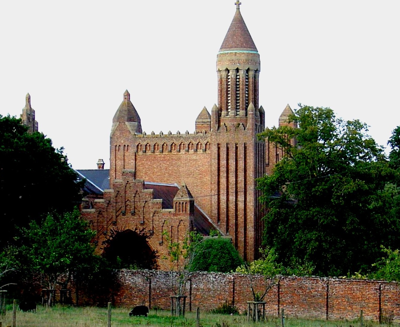
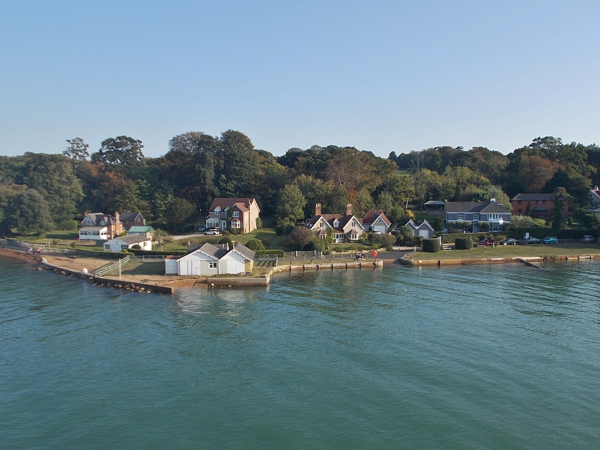
Quarr Abbey, located in Hampshire, England, is a historic site that holds immense cultural and religious significance. Founded in 1132, the abbey is a Benedictine monastery that has witnessed centuries of history and transformation.

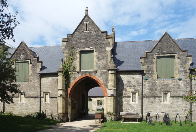
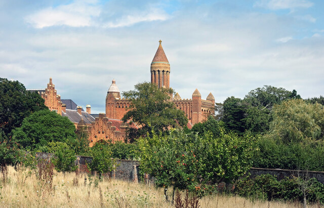
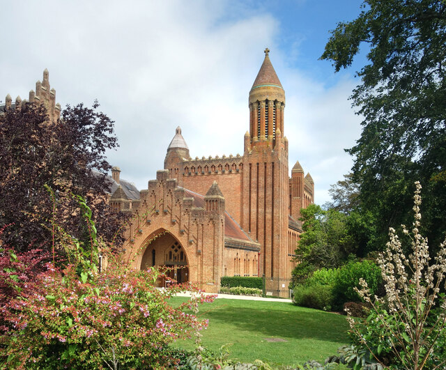
The architecture of Quarr Abbey is a testament to its medieval origins. The abbey features a stunning Norman church, built with local stone, which showcases intricate detailing and a traditional cruciform design. Over the years, additional structures, such as the cloister, chapter house, and refectory, have been added, reflecting different architectural styles and periods.

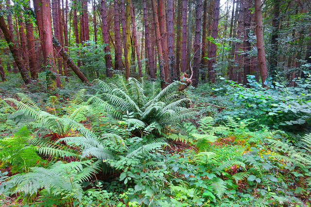
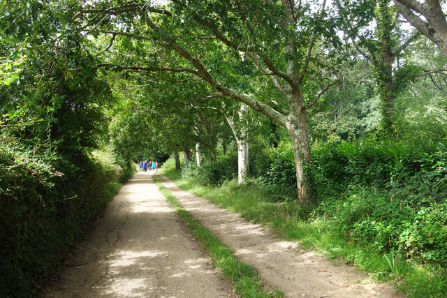
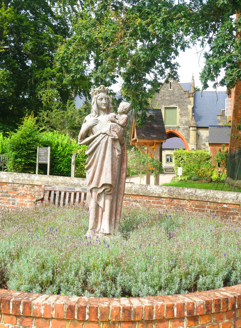
The abbey’s tranquil surroundings are equally captivating. Spread across extensive grounds, Quarr Abbey boasts lush gardens, including a delightful walled garden, which is home to a variety of plants and flowers. The site also features a traditional Victorian-style greenhouse, where visitors can admire a range of exotic plants.

Quarr Abbey has a rich history of religious devotion. The monks residing in the abbey follow the Rule of St. Benedict, dedicating their lives to prayer, work, and contemplation. Today, the abbey remains an active monastery, with a community of monks who maintain the spiritual traditions and offer spiritual retreats to visitors.

In addition to its religious and architectural significance, Quarr Abbey has become a popular visitor attraction. The site welcomes tourists from all over the world who come to explore the abbey’s history, enjoy the peaceful surroundings, and learn about the monastic way of life.

Overall, Quarr Abbey stands as a testament to centuries of religious devotion, architectural brilliance, and natural beauty, making it a must-visit heritage site in Hampshire.

If you have any feedback on the listing, please let us know in the comments section below.
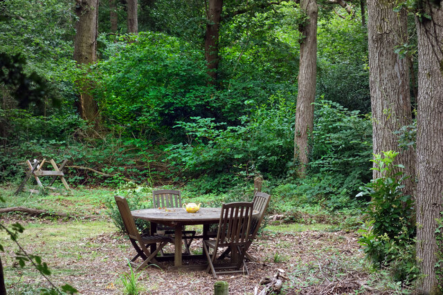
Quarr Abbey Images

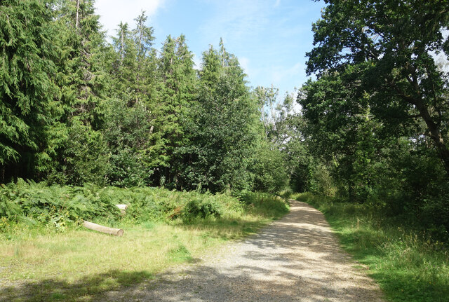
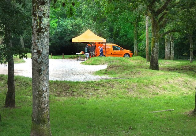
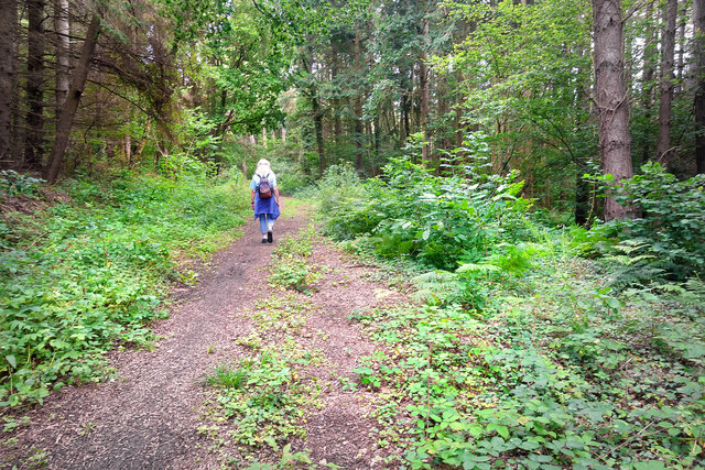
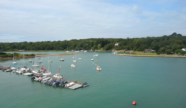
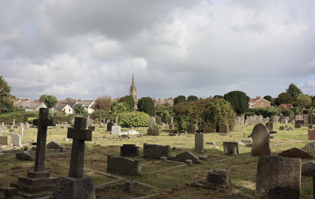
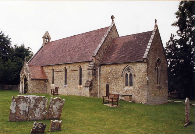
Images are sourced within 2km of 50.728/-1.198 or Grid Reference SZ5692. Thanks to Geograph Open Source API. All images are credited.

Track in Firestone Copse Well maintained, wide forestry tracks run all through the copse, making it a popular place for walking.
Track in Firestone Copse
Well maintained, wide forestry tracks run all through the copse, making it a popular place for walking.
Drew's Brews in the Forest A mobile coffee shop in the Firestone Copse car park.
Drew's Brews in the Forest
A mobile coffee shop in the Firestone Copse car park.
Gate into the Forest Access gate into the less visited eastern part of Firestone copse. The main forest tracks are open for cycling, but the yellow notice warns against using unofficial paths which have been made as they could be dangerous.
That's probably half the attraction, but at least the forestry people have covered themselves.
Gate into the Forest
Access gate into the less visited eastern part of Firestone copse. The main forest tracks are open for cycling, but the yellow notice warns against using unofficial paths which have been made as they could be dangerous. That's probably half the attraction, but at least the forestry people have covered themselves.
Path in the Forest The smaller, eastern section of Firestone Copse is much less visited than the main bit on the other side of Firestone Copse Road. The tracks are muddier and less well maintained.
Path in the Forest
The smaller, eastern section of Firestone Copse is much less visited than the main bit on the other side of Firestone Copse Road. The tracks are muddier and less well maintained.
Ferns in the Forest Away from the paths, a lot of the forest is not easy to wander about in.
Ferns in the Forest
Away from the paths, a lot of the forest is not easy to wander about in.
Archway at Quarr Abbey These outbuildings next to the abbey are made out of local stone and are quite different in appearance to the red brick abbey itself.
Archway at Quarr Abbey
These outbuildings next to the abbey are made out of local stone and are quite different in appearance to the red brick abbey itself.
Quarr Road A leafy avenue between the present abbey and the ruins of its medieval predecessor. Part of the Isle of Wight Coast Path.
Quarr Road
A leafy avenue between the present abbey and the ruins of its medieval predecessor. Part of the Isle of Wight Coast Path.
Quarr Abbey Tower The abbey buildings rise above the surrounding trees.
Quarr Abbey Tower
The abbey buildings rise above the surrounding trees.
Madonna & Child, Quarr Abbey A statue in the abbey garden.
Madonna & Child, Quarr Abbey
A statue in the abbey garden.
Quarr Abbey Another picture of the impressive brick built abbey which was constructed between 1907 and 1912 to the designs of one of the monks.
Quarr Abbey
Another picture of the impressive brick built abbey which was constructed between 1907 and 1912 to the designs of one of the monks.
The Shore, Binstead The sign on the path leading down here from the road says "to the shore."
Not to the beach, an important difference. A mess of mud, seaweed, shingle and a lot of dead wood, this is a decidedly uncharismatic bit of coastline.
The Shore, Binstead
The sign on the path leading down here from the road says "to the shore." Not to the beach, an important difference. A mess of mud, seaweed, shingle and a lot of dead wood, this is a decidedly uncharismatic bit of coastline.
Stones and Clay There is just a surface scatter of stones here, stuck in an underlying layer of soft bluey-grey clay as seen centre shot.
Walking over it is a strange sensation. Not at all like the get nowhere fast trudge of shingle, more like walking on some sort of cobblestoned bog.
Stones and Clay
There is just a surface scatter of stones here, stuck in an underlying layer of soft bluey-grey clay as seen centre shot. Walking over it is a strange sensation. Not at all like the get nowhere fast trudge of shingle, more like walking on some sort of cobblestoned bog.
Teapot in the Woods In a clearing beside Quarr Road.
Teapot in the Woods
In a clearing beside Quarr Road.
"The Needles" at the Ferry Port By the pedestrian entrance to the IOW ferry terminal at Fishbourne.
A model of the island's famous rocks and lighthouse at the western end.
A bit of concrete, a bit of pipe, a bit of paint and a bit of imagination.
"The Needles" at the Ferry Port
By the pedestrian entrance to the IOW ferry terminal at Fishbourne. A model of the island's famous rocks and lighthouse at the western end. A bit of concrete, a bit of pipe, a bit of paint and a bit of imagination.
Cones & Colours The entrance to the ferry terminal at Fishbourne.
Cones & Colours
The entrance to the ferry terminal at Fishbourne.
12:13 at the Dock By the two vehicle loading ramps at Fishbourne ferry terminal. The arriving and departing boats are passing each other mid shot.
12:13 at the Dock
By the two vehicle loading ramps at Fishbourne ferry terminal. The arriving and departing boats are passing each other mid shot.
Moorings on Wootton Creek Like other tidal estuaries on both sides of The Solent, Wootton Creek is home to a fleet of small boats.
Moorings on Wootton Creek
Like other tidal estuaries on both sides of The Solent, Wootton Creek is home to a fleet of small boats.
Ryde Cemetery A view towards All Saints Church.
Ryde Cemetery
A view towards All Saints Church.
Show me another place!

Quarr Abbey is located at Grid Ref: SZ5692 (Lat: 50.728, Lng: -1.198)

Unitary Authority: Isle of Wight

Police Authority: Hampshire

What 3 Words

///flame.flat.kicked. Near Wootton, Isle of Wight

Related Wikis

Quarr Abbey

Quarr Abbey (French: Abbaye Notre-Dame de Quarr) is a monastery between the villages of Binstead and Fishbourne on the Isle of Wight in southern England...

Quarr Abbey House

The Quarr Abbey House was one of several houses constructed along the north coast of the Isle of Wight in southern England. Built in the 19th century from...

Holy Cross Church, Binstead

Holy Cross Church, Binstead is a parish church in the Church of England located in Binstead, Isle of Wight. == History == The 11th and 13th century church...

Binstead

Binstead is a village in the civil parish of Ryde, on the Isle of Wight, England. It is located in the northeast part of the Island, 1+1⁄2 miles (2.4 km...

Ryde Sands and Wootton Creek SSSI

Ryde Sands and Wootton Creek is a 424.2-hectare (1,048-acre) Site of special scientific interest which stretches along the north-east coast of the Isle...

Fishbourne, Isle of Wight

Fishbourne is a village between Wootton and Ryde, on the Isle of Wight. The name "Fishbourne" might mean "stream of fish" or "fish spring."It is positioned...

Ryde Academy

Ryde Academy is an academy status secondary school, including sixth form, located in Ryde on the Isle of Wight, England. == History == Education on the...

Haylands

Haylands is an area just to the south of Ryde on the Isle of Wight, off the south coast of England. At the time of the 2011 Census the population etc....

Nearby Amenities

Located within 500m of 50.728,-1.198
Bus Stop
Binstead, Newnham Road
Bench: yes
Bin: yes
Bus: yes
Contact Website: https://www.islandbuses.info/stops/230000003690
Naptan AtcoCode: 230000003690
Naptan Bearing: W
Naptan CommonName: Top of Binstead Hill
Naptan Indicator: towards Newport
Naptan NaptanCode: iowdgda
Naptan Street: Quarr Hill
Public Transport: platform
Ref GB Uprn: 10025270781
Shelter: yes
Short Name: Newnham Road
Source: naptan_import
Tactile Paving: no
Lat/Long: 50.7271041/-1.1912978
Bus Stop
Quarr Abbey
Bench: no
Bin: no
Bus: yes
Contact Website: https://www.islandbuses.info/stops/230000004140
Lit: yes
Naptan AtcoCode: 230000004140
Naptan Bearing: W
Naptan CommonName: Quarr Abbey
Naptan Indicator: towards Newport
Naptan NaptanCode: iowdjam
Naptan Street: A3054
Public Transport: platform
Shelter: no
Tactile Paving: no
Lat/Long: 50.7276628/-1.2041939
Bus Stop
Quarr Abbey
Bench: no
Bin: no
Bus: yes
Contact Website: https://www.islandbuses.info/stops/230000004150
Lit: no
Naptan AtcoCode: 230000004150
Naptan Bearing: E
Naptan CommonName: Quarr Abbey
Naptan Indicator: towards Ryde
Naptan NaptanCode: iowdjap
Naptan Street: A3054
Public Transport: platform
Shelter: no
Tactile Paving: no
Lat/Long: 50.7278614/-1.2045989
Barrier: bollard
Lat/Long: 50.7298315/-1.2038985
Barrier: stile
Lat/Long: 50.7275435/-1.2018545
Turning Loop
Lat/Long: 50.7276993/-1.1935663
Information: guidepost
Tourism: information
Lat/Long: 50.7275252/-1.2017793
Hiking: yes
Information: guidepost
Tourism: information
Lat/Long: 50.7298997/-1.192054
Barrier: bollard
Lat/Long: 50.7299343/-1.1920052
Information: board
Tourism: information
Lat/Long: 50.7305145/-1.1991463
Power: substation
Ref GB Uprn: 10024887074
Lat/Long: 50.7301399/-1.1941516
Hiking: yes
Information: guidepost
Tourism: information
Lat/Long: 50.7276212/-1.2018563
Quarr Abbey Ruins (No Public Access)
Historic: ruins
Lat/Long: 50.7312264/-1.1992505
Generator Source: solar
Location: roof
Power: generator
Lat/Long: 50.727532/-1.1920273
The data included in this document is from www.openstreetmap.org. The data is made available under ODbL.

Have you been to Quarr Abbey?

Leave your review of Quarr Abbey below (or comments, questions and feedback).