Quarry Bank
Heritage Site in Cheshire
England
Quarry Bank
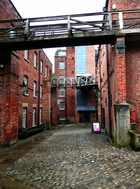
Quarry Bank is a historic site located in Styal, Cheshire, England. It is a former cotton mill complex that played a significant role during the Industrial Revolution. The site is now a heritage site and is managed by the National Trust.
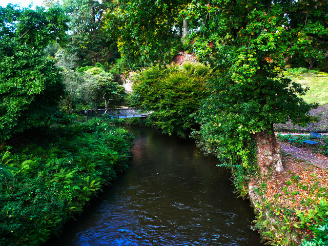
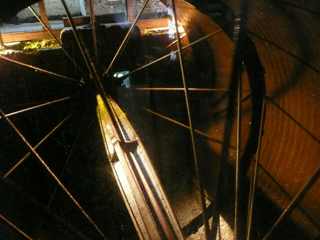
The mill complex was built in 1784 by Samuel Greg, a successful textile merchant. It was strategically located near the River Bollin, providing a source of water power for the machinery. Quarry Bank Mill became one of the largest and most productive cotton mills in the country during the 19th century.
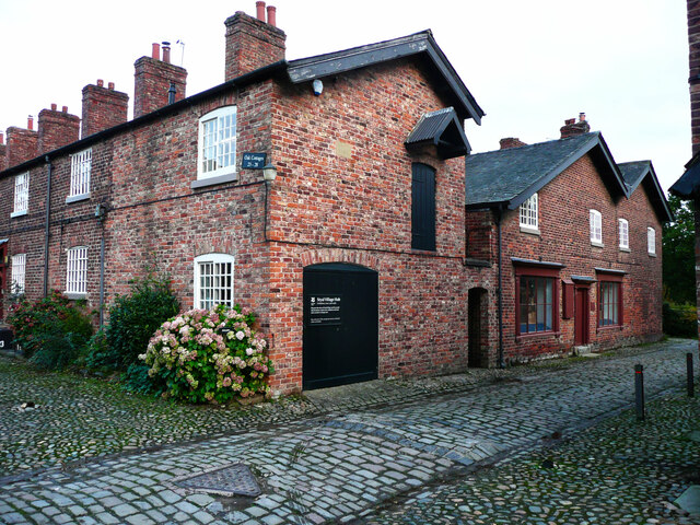
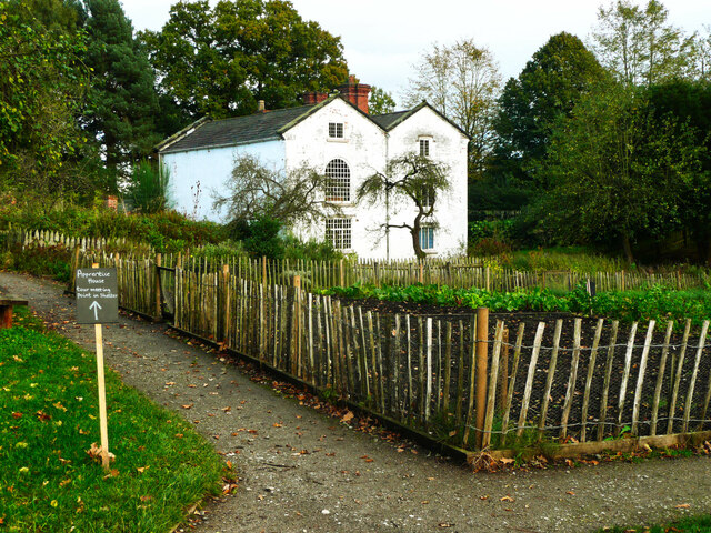
Visitors to Quarry Bank can explore various parts of the site, including the cotton mill itself, the Apprentice House, and the picturesque gardens. The cotton mill offers a glimpse into the harsh working conditions of the time, with preserved machinery and interactive exhibits showcasing the entire cotton manufacturing process.
The Apprentice House is a unique feature of Quarry Bank, as it was where child apprentices lived and worked. Visitors can learn about the lives of these young workers and the impact of the factory system on their daily routines.
The gardens at Quarry Bank are also worth exploring, with beautiful landscapes, a restored glasshouse, and a kitchen garden. The gardens provide a tranquil space to relax and reflect on the history of the site.
Throughout the year, Quarry Bank hosts various events, workshops, and exhibitions, offering visitors a chance to engage with the history and heritage of the area. It is an important heritage site that provides a valuable insight into the industrial past of Cheshire and the wider region.
If you have any feedback on the listing, please let us know in the comments section below.
Quarry Bank Images
Images are sourced within 2km of 53.348/-2.249 or Grid Reference SJ8383. Thanks to Geograph Open Source API. All images are credited.


Quarry Bank is located at Grid Ref: SJ8383 (Lat: 53.348, Lng: -2.249)
Unitary Authority: Cheshire East
Police Authority: Cheshire
What 3 Words
///bolt.talent.charge. Near Ringway, Manchester
Nearby Locations
Related Wikis

Styal
Styal (, like style) is a village and civil parish on the River Bollin near Wilmslow, Cheshire, England. == History == Styal village grew during the early...

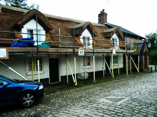
Norcliffe Chapel
Norcliffe Chapel is in the village of Styal, Cheshire, England. It is a Unitarian chapel, and is recorded in the National Heritage List for England as...

Quarry Bank Mill
Quarry Bank Mill (also known as Styal Mill) in Styal, Cheshire, England, is one of the best preserved textile factories of the Industrial Revolution....
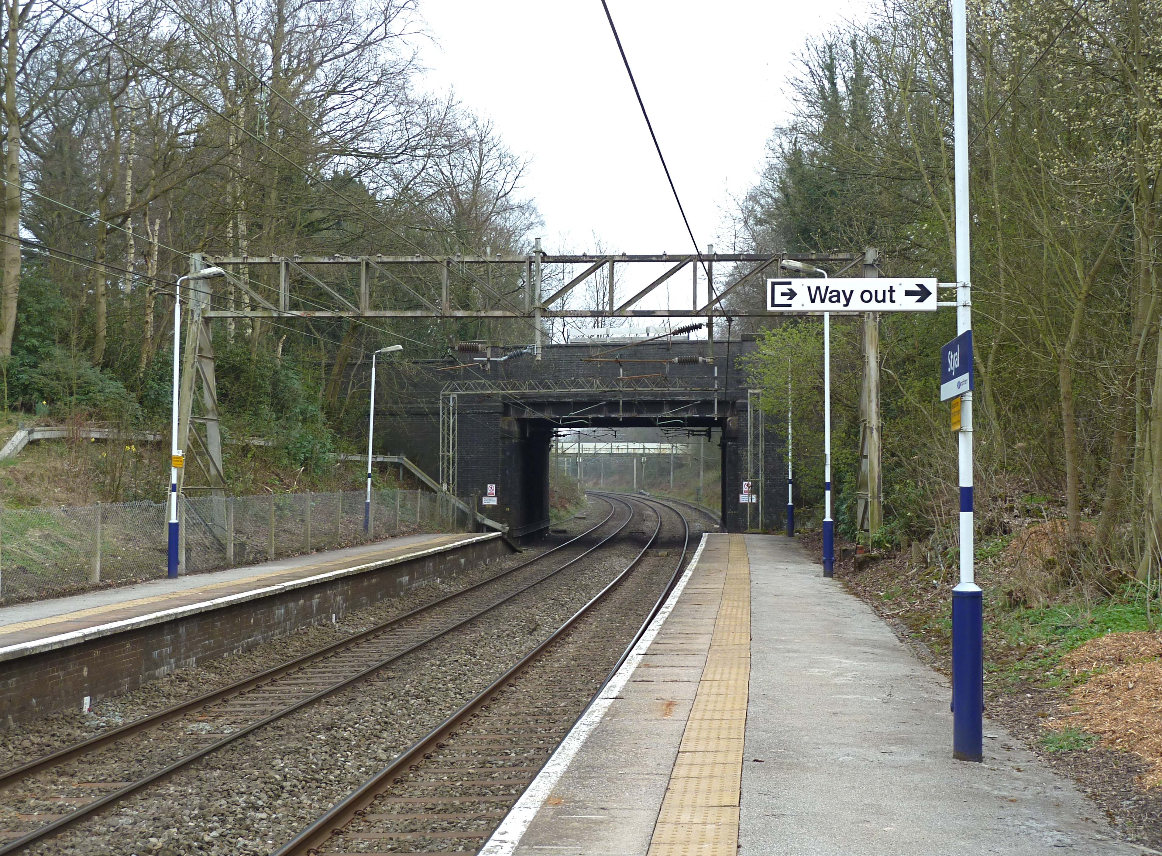
Styal railway station
Styal railway station is near Manchester Airport in Cheshire, England. == History == The station was opened in 1909 with the construction of the line from...

Norcliffe Hall
Norcliffe Hall is a large house encompassing 20,254 square feet near the village of Styal, Cheshire, England. It stands to the west of the village and...

Styal Cottage Homes
Styal Cottage Homes were open from October 1898 to 1956 and housed destitute children from the Manchester area. They were established in Styal by the...
HM Prison Styal
HM Prison Styal is a Closed Category prison for female adults and young offenders in Styal, Cheshire, England. The prison is operated by His Majesty's...

Pownall Hall
Pownall Hall is a former country house in Wilmslow, Cheshire, England. It was remodelled in 1830 as "a red sandstone Georgian house dressed up in the...
Nearby Amenities
Located within 500m of 53.348,-2.249Have you been to Quarry Bank?
Leave your review of Quarry Bank below (or comments, questions and feedback).