Devil's Dyke and Saddlescombe
Heritage Site in Sussex Mid Sussex
England
Devil's Dyke and Saddlescombe
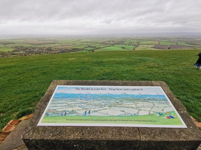
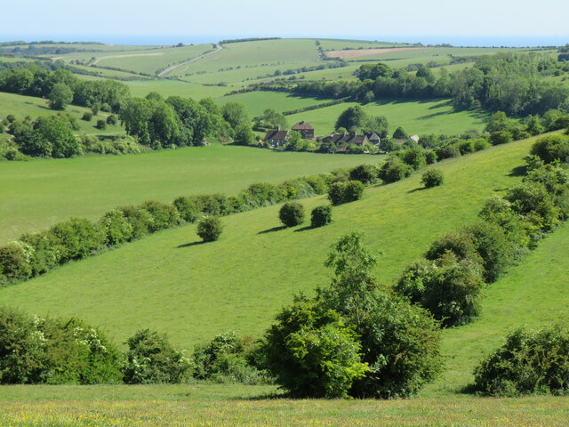
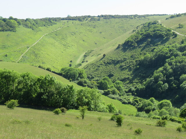
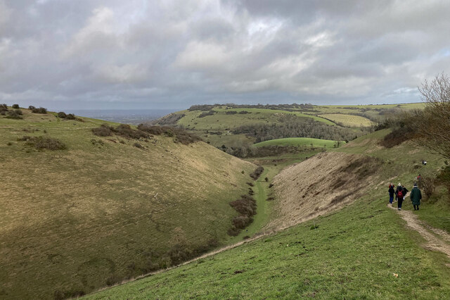
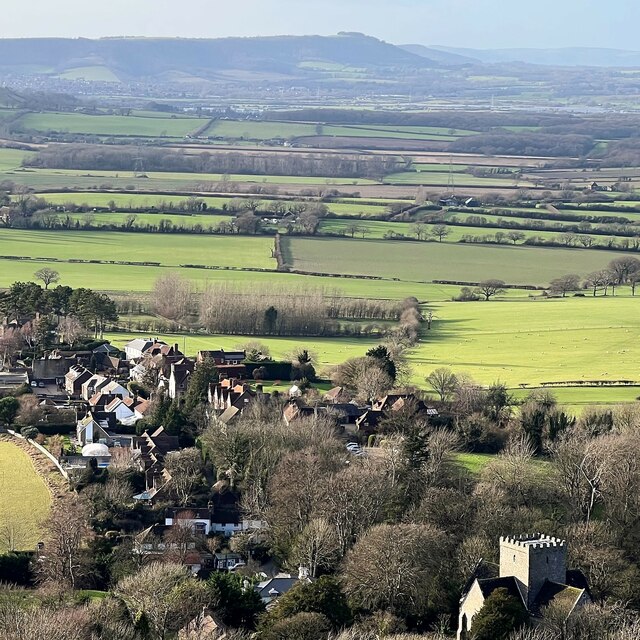
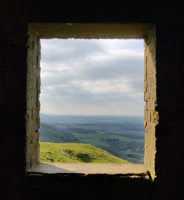
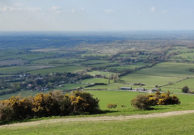
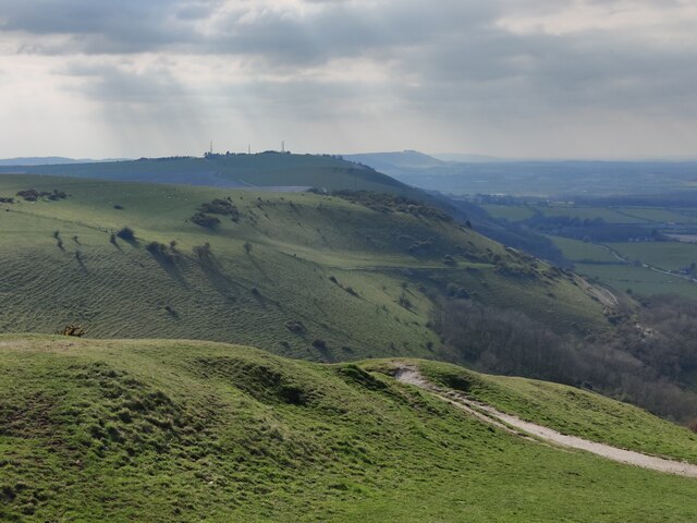
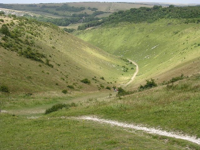
Devil's Dyke and Saddlescombe, located in Sussex, England, is a renowned heritage site that encompasses a unique geological formation and a charming historic village. Devil's Dyke itself is a massive V-shaped valley carved out by glacial erosion during the last Ice Age. With its steep slopes and panoramic views, it has become a popular destination for nature lovers and hikers alike.
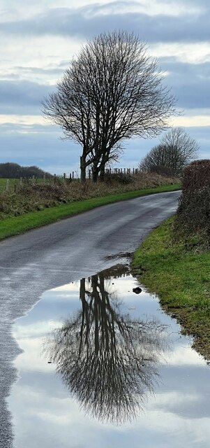
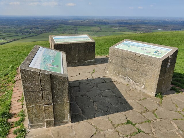
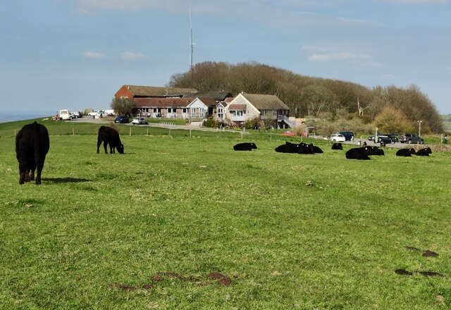
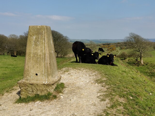
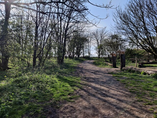
The site offers a range of recreational activities, such as walking trails, cycling routes, and picnicking spots, allowing visitors to immerse themselves in the natural beauty of the South Downs National Park. The area is home to a diverse array of flora and fauna, including rare orchids and butterflies, making it a haven for wildlife enthusiasts.
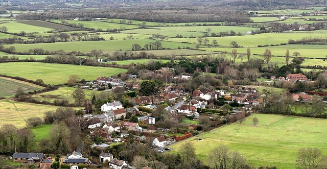
Adjacent to Devil's Dyke is the quaint village of Saddlescombe, which dates back to the 17th century. The village is characterized by its traditional thatched cottages, picturesque gardens, and a historic church known as St. Nicholas. It exudes a sense of tranquility and offers visitors a glimpse into rural life in times gone by.
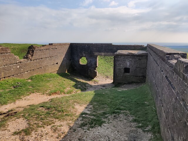
Moreover, the heritage site also boasts a rich cultural history. It is said that Devil's Dyke got its name from local folklore, which claims that the devil dug the valley to drown the parishioners of the nearby St. Nicholas Church as they traveled to worship in the village of Poynings. This legend has been immortalized in various literary works and adds an air of mystery to the site.
Overall, Devil's Dyke and Saddlescombe in Sussex offer a captivating blend of natural beauty, cultural heritage, and recreational opportunities, making it a must-visit destination for both locals and tourists alike.
If you have any feedback on the listing, please let us know in the comments section below.
Devil's Dyke and Saddlescombe Images
Images are sourced within 2km of 50.885/-0.21 or Grid Reference TQ2611. Thanks to Geograph Open Source API. All images are credited.

Devil's Dyke and Saddlescombe is located at Grid Ref: TQ2611 (Lat: 50.885, Lng: -0.21)
Administrative County: West Sussex
District: Mid Sussex
Police Authority: Sussex
What 3 Words
///error.volunteered.treatment. Near Portslade, East Sussex
Nearby Locations
Related Wikis
Devil's Dyke, Sussex
Devil's Dyke is a 100 metre (300') deep V-shaped dry valley on the South Downs in Sussex in southern England, 5 miles (8.0 km) north-west of Brighton....
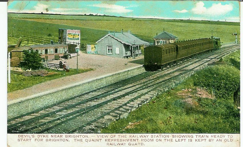
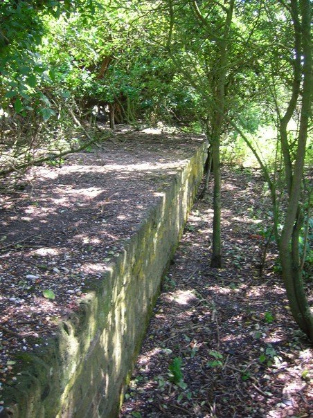
The Dyke railway station
The Dyke railway station was a railway station near Devil's Dyke in West Sussex, England which opened in 1887 and closed in 1939. == History == The Dyke...

Beeding Hill to Newtimber Hill
Beeding Hill to Newtimber Hill is a 321 ha (790-acre) biological and geological Downland Site of Special Scientific Interest (SSSI) north of Shoreham-by...

Poynings
Poynings ( or locally ) is a village and civil parish in the Mid Sussex District of West Sussex, England. The parish lies wholly with the South Downs...

Saddlescombe Preceptory
Saddlescombe Preceptory was a priory in West Sussex, England. == References == == Further reading == L. F. Salzmann (1907). "Religious Houses: The Preceptory...

Fulking
Fulking is a village and civil parish in the Mid Sussex District of West Sussex, England. The parish lies wholly with the South Downs National Park. The...
Golf Club Halt railway station (England)
Golf Club Halt railway station, was a railway station in Hove, in East Sussex, England which opened in 1891 and closed in 1939. The station served the...

Edburton Castle Ring
Edburton Castle Ring (or Castle Rings) is an archaeological site in West Sussex, England, on the peak of Edburton Hill on the South Downs, near the villages...
Nearby Amenities
Located within 500m of 50.885,-0.21Have you been to Devil's Dyke and Saddlescombe?
Leave your review of Devil's Dyke and Saddlescombe below (or comments, questions and feedback).