Bookham Commons

Heritage Site in Surrey

England

Bookham Commons

Bookham Road Rural road that leads to Little Bookham Common. It goes under the M25 and the New Guildford Railway (1885).
Bookham Road Credit: James Emmans

Bookham Commons is a historic heritage site located in Surrey, England. Spanning over 900 acres, it is a remarkable expanse of open land that has been preserved for its ecological and historical significance. The site is composed of two adjoining areas, namely Great Bookham Common and Little Bookham Common, which are managed by the National Trust.

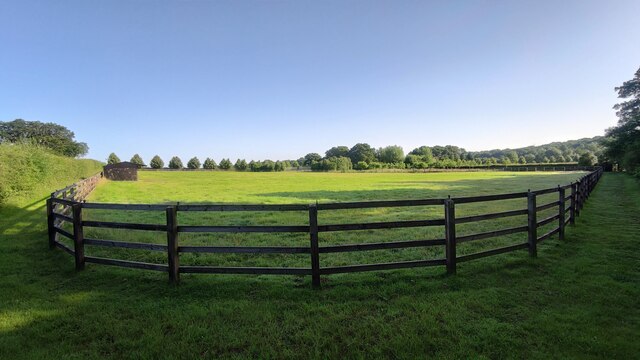
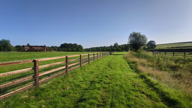
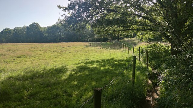
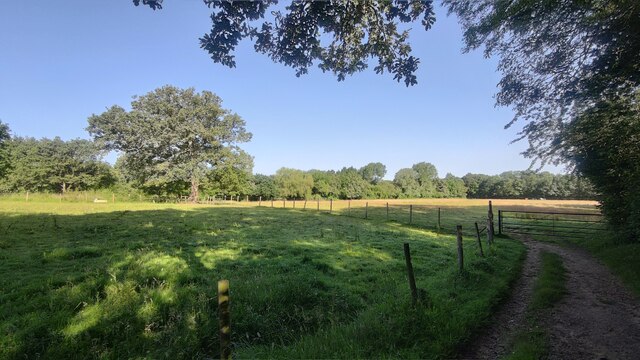
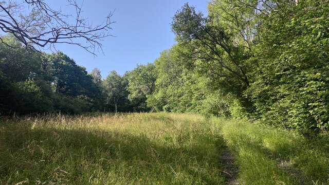
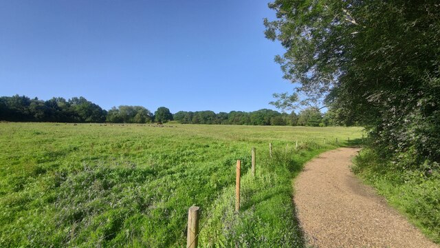
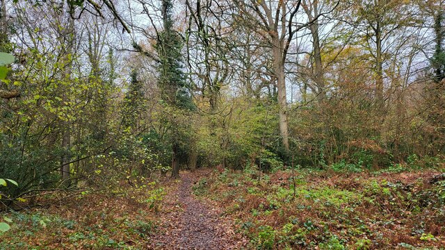
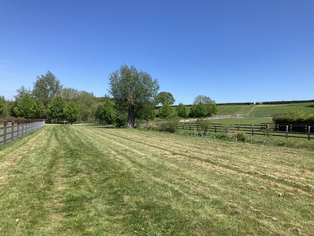
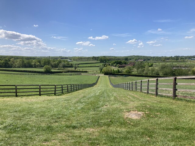
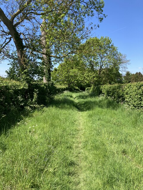
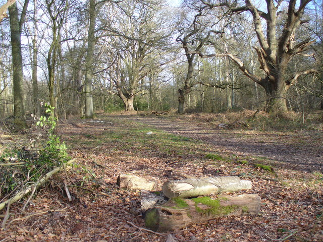
Bookham Commons offer visitors a unique opportunity to explore the picturesque beauty of the Surrey countryside. It is characterized by a diverse range of habitats, including woodland, heathland, and grassland, which supports a plethora of wildlife species. The commons are home to various notable bird species, such as nightjars and woodlarks, making it a popular destination for birdwatchers.

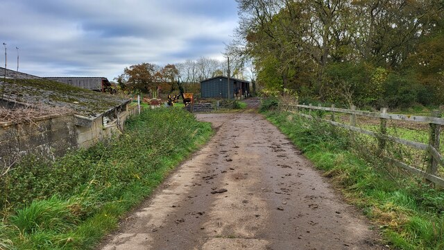
The heritage site also boasts a rich history dating back centuries. It is believed that the commons were once part of medieval farmland, and they have been used for grazing livestock since the 16th century. The area was also utilized for military training during World War II.

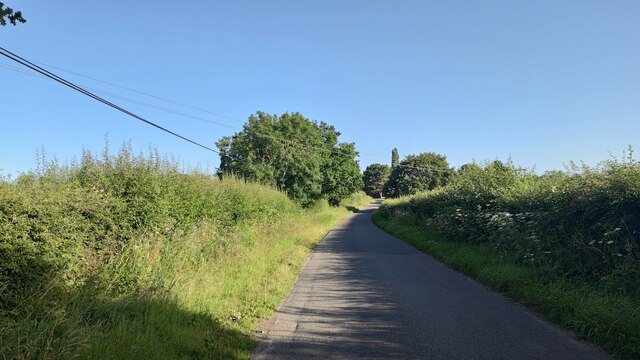
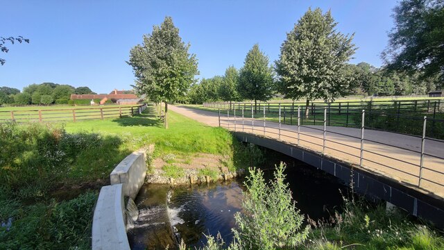
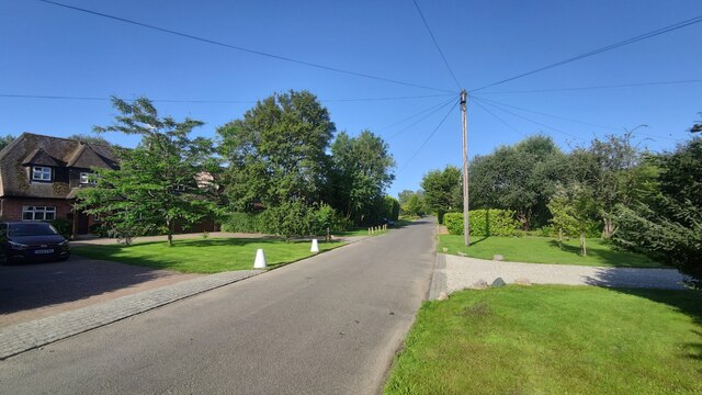
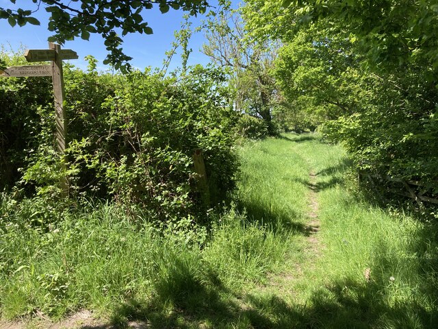
Today, Bookham Commons provide visitors with a tranquil retreat, offering numerous walking trails and picnic spots. The commons are crisscrossed by a network of footpaths, allowing visitors to explore the diverse landscapes and enjoy breathtaking views. The site is also a haven for nature enthusiasts, who can spot a wide range of flora and fauna throughout the year.

In conclusion, Bookham Commons in Surrey is a cherished heritage site that offers a blend of natural beauty and historical significance. With its vast open spaces, diverse habitats, and rich wildlife, it provides a delightful experience for visitors seeking to connect with nature and explore the region's cultural heritage.

If you have any feedback on the listing, please let us know in the comments section below.

Bookham Commons Images

Images are sourced within 2km of 51.295/-0.388 or Grid Reference TQ1256. Thanks to Geograph Open Source API. All images are credited.

Bookham Road Rural road that leads to Little Bookham Common. It goes under the M25 and the New Guildford Railway (1885).
Bookham Road
Rural road that leads to Little Bookham Common. It goes under the M25 and the New Guildford Railway (1885).
Paddock near Chasemore Farm
Paddock next to Chasemore Farm Chasemore Farm building is on the left.
Paddock next to Chasemore Farm
Chasemore Farm building is on the left.
Casemore Farm access road Bridge over a stream that has a check dam to prevent excess erosion during wet weather.
Casemore Farm access road
Bridge over a stream that has a check dam to prevent excess erosion during wet weather.
Lower Farm Road
Lower Farm Road
Footpath near Oaken Wood
Oaken Wood A track through the wood.
Oaken Wood
A track through the wood.
Geese in field Footpath passes Oaken Wood.
Geese in field
Footpath passes Oaken Wood.
Farm Track Access road for Slyfield Farm and a public footpath.
Farm Track
Access road for Slyfield Farm and a public footpath.
The River Mole snakes pass Slyfield House
Great Bookham Common Path near the National Trust carpark.
Great Bookham Common
Path near the National Trust carpark.
Great Bookham - Eastwick Park Avenue Residential road close to Keswick Care Home.
Great Bookham - Eastwick Park Avenue
Residential road close to Keswick Care Home.
Eastwick Park Avenue
Footpath near Chasemore Farm Footpath Esher 81/Leatherhead 600 near Chasemore Farm. The true line of the right of way passes through the paddock to the left (which, given the footpath was diverted out of the farm some while ago, suggests a lack of foresight). The stream, on the right, is the borough boundary between Elmbridge and Mole Valley — save that the boundary actually follows the old, meandering course of the stream which would twice have crossed this lower part of the field (this is why the footpath has two numbers).
Footpath near Chasemore Farm
Footpath Esher 81/Leatherhead 600 near Chasemore Farm. The true line of the right of way passes through the paddock to the left (which, given the footpath was diverted out of the farm some while ago, suggests a lack of foresight). The stream, on the right, is the borough boundary between Elmbridge and Mole Valley — save that the boundary actually follows the old, meandering course of the stream which would twice have crossed this lower part of the field (this is why the footpath has two numbers).
Chasemore Farm from footpath 1 Footpath Leatherhead 1 descends between horse paddocks towards a bridge over a stream marking the boundary between Mole Valley district and Elmbridge borough. Beyond is Chasemore Farm.
Chasemore Farm from footpath 1
Footpath Leatherhead 1 descends between horse paddocks towards a bridge over a stream marking the boundary between Mole Valley district and Elmbridge borough. Beyond is Chasemore Farm.
Stents Lane near Bookham Lodge Stents Lane at the junction between footpaths Leatherhead 1 and 6.  Footpath 6 here follows Stents Lane.
Stents Lane near Bookham Lodge
Stents Lane at the junction between footpaths Leatherhead 1 and 6. Footpath 6 here follows Stents Lane.
Stents Lane Footpath Leatherhead 6 here follows the course of Stents Lane behind <a href="https://www.geograph.org.uk/photo/676464">TQ1257 : Bookham Lodge</a>..
Stents Lane
Footpath Leatherhead 6 here follows the course of Stents Lane behind TQ1257 : Bookham Lodge..
Show me another place!

Bookham Commons is located at Grid Ref: TQ1256 (Lat: 51.295, Lng: -0.388)

Police Authority: Surrey

What 3 Words

///crash.darker.become. Near Great Bookham, Surrey

Related Wikis

Bookham Commons

Bookham Commons are two commons, situated just to the north of the villages of Great Bookham and Little Bookham, in Surrey, England, 154.7 hectares (382...

Bookham railway station

Bookham railway station is in the village of Great Bookham in Surrey, England. It also serves the adjacent village of Little Bookham. It is 20 miles...

Bookham Lodge

The Grange is a gothic regency manor house in Stoke d'Abernon, Surrey that dates back to the 15th Century. It was part of the Eastwick Manor estate and...

Yehudi Menuhin School

The Yehudi Menuhin School is a specialist music school in Stoke d'Abernon, Surrey, England, founded in 1963 by violinist and conductor Yehudi Menuhin....

Little Bookham

Little Bookham is a small, historic village in Surrey, England between Great Bookham and Effingham. It is home to several listed historical buildings,...

Eastwick Park

Eastwick Park, also Eastwich Park, at Great Bookham in Surrey, England (for the period 1726–1958) was the family seat of the Howards of Effingham for about...

Cobham MSA

Cobham services is a motorway service area on the M25 motorway in Surrey between junctions 9 and 10. It is operated by Extra MSA and was opened for business...

St Mary's Church, Stoke d'Abernon

The Church of St Mary is an Anglican church in the village of Stoke d'Abernon, Surrey, in the Diocese of Guildford. The church, the oldest parts of which...

Nearby Amenities

Located within 500m of 51.295,-0.388
Barrier: cattle_grid
Bicycle: yes
Foot: yes
Lat/Long: 51.2952685/-0.3939877
Isle of Wight
Place: locality
Lat/Long: 51.2944596/-0.3888574
Bench
Guy & Jean's Bench
Lat/Long: 51.2974929/-0.3919861
The data included in this document is from www.openstreetmap.org. The data is made available under ODbL.

Have you been to Bookham Commons?

Leave your review of Bookham Commons below (or comments, questions and feedback).