Tregonhawke

Settlement in Cornwall

England

Tregonhawke

View over Reefs towards Looe at Captain Blake's Point View over reefs in foreground - as detailed on the map - looking out across Whitsand Bay towards Looe.
View over Reefs towards Looe at Captain Blake's Point Credit: BB

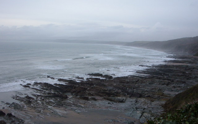
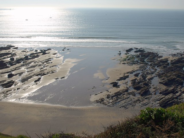
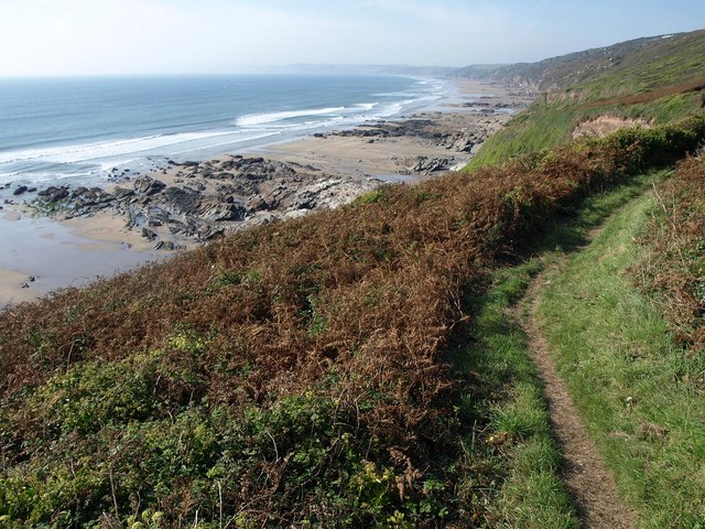
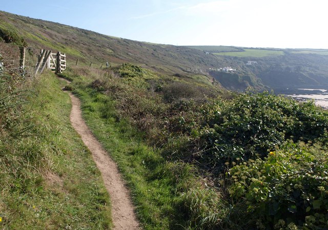
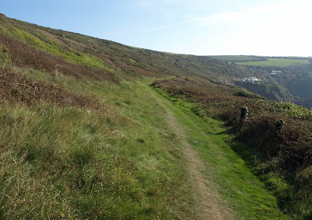
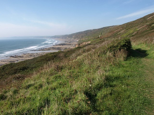
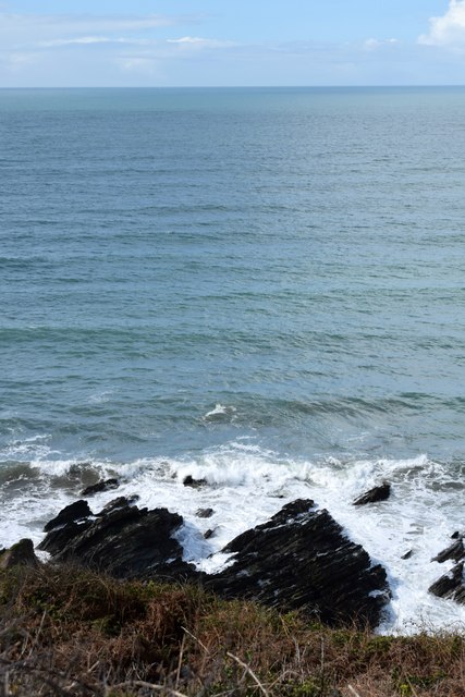
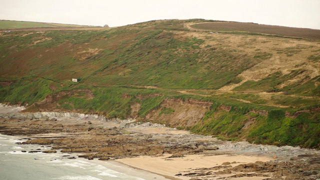
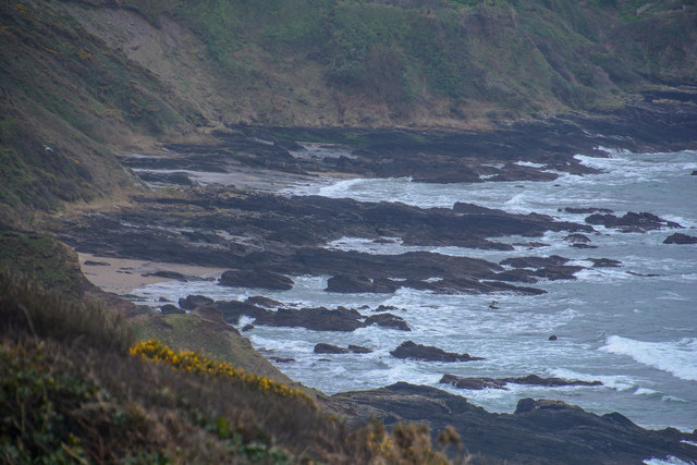
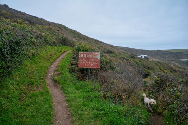
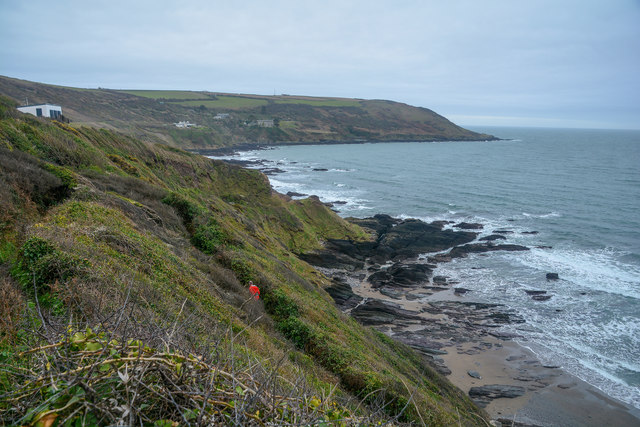
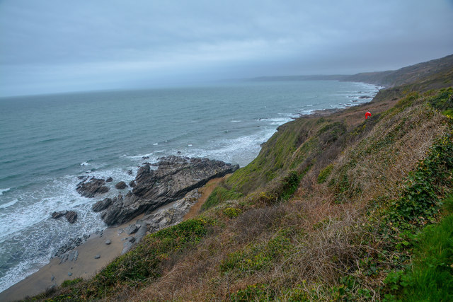
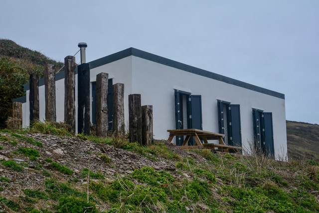
Tregonhawke is a picturesque coastal village located in Cornwall, England. Situated on the southeastern coast of the county, it is nestled between the popular seaside resorts of Whitsand Bay and Portwrinkle. The village is known for its stunning natural beauty, with rugged cliffs, sandy beaches, and breathtaking views of the English Channel.

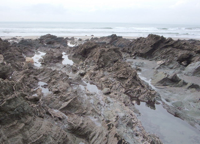
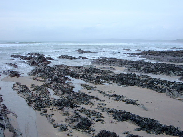
The main attraction of Tregonhawke is its expansive sandy beach, which stretches for miles and offers a tranquil spot for sunbathing, swimming, and picnicking. The beach is also a favorite among avid surfers, thanks to the consistent waves that roll in from the Atlantic Ocean. Visitors can enjoy long walks along the shore, taking in the stunning vistas and exploring the rock pools teeming with marine life.

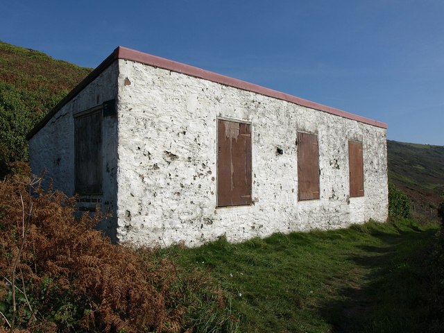
In addition to its natural splendor, Tregonhawke boasts a rich history. The village is home to several ancient landmarks, including the remains of an Iron Age fort that overlooks the bay. History enthusiasts can also visit the nearby Tregonhawke Cliff Castle, a medieval fortress that played a significant role in defending the region during times of conflict.

Tregonhawke is a peaceful and idyllic destination, ideal for those seeking a relaxing getaway by the sea. The village offers a range of accommodations, including charming cottages and bed and breakfasts, providing visitors with a comfortable stay amid the beautiful surroundings. With its stunning beaches, rich history, and natural charm, Tregonhawke is a must-visit destination for nature lovers and history enthusiasts alike.

If you have any feedback on the listing, please let us know in the comments section below.

Tregonhawke Images

Images are sourced within 2km of 50.339958/-4.2360032 or Grid Reference SX4051. Thanks to Geograph Open Source API. All images are credited.

View over Reefs towards Looe at Captain Blake's Point View over reefs in foreground - as detailed on the map - looking out across Whitsand Bay towards Looe.
View over Reefs towards Looe at Captain Blake's Point
View over reefs in foreground - as detailed on the map - looking out across Whitsand Bay towards Looe.
Great Britain!!!!!!!! I like this one of a Union Jack - perhaps an identifying flag from a small vessel - now in tatters stranded helplessly on a jagged rock, its former glory drained away with no one left to salute it - which perhaps represents the state of the UK at the moment?.
Great Britain!!!!!!!!
I like this one of a Union Jack - perhaps an identifying flag from a small vessel - now in tatters stranded helplessly on a jagged rock, its former glory drained away with no one left to salute it - which perhaps represents the state of the UK at the moment?.
Close up of Reef at low tide Like the caption says.
Close up of Reef at low tide
Like the caption says.
Reef at Low Tide Wouldn't like to be thrown onto these in a gale.
Reef at Low Tide
Wouldn't like to be thrown onto these in a gale.
View over Whitsand Bay View over Whitsand Bay from near the entrance to the drive to Polhawn Fort.
View over Whitsand Bay
View over Whitsand Bay from near the entrance to the drive to Polhawn Fort.
Beach at Wiggle Sandway The next cove of sand east of <a href="https://www.geograph.org.uk/photo/2635104">SX4150 : Beach at Wiggle Sandway</a>. On the left are rocks below  Captain Blake's Point.
Beach at Wiggle Sandway
The next cove of sand east of SX4150 : Beach at Wiggle Sandway. On the left are rocks below Captain Blake's Point.
Coast path at Wiggle Sandway The path above <a href="https://www.geograph.org.uk/photo/2635151">SX4149 : Beach at Wiggle Sandway</a>, with Whitsand Bay stretching away beyond.
Coast path at Wiggle Sandway
The path above SX4149 : Beach at Wiggle Sandway, with Whitsand Bay stretching away beyond.
Building above Captain Blake's Point I have no idea what this building is for. The coast path (following footpath 617/13/1) runs in front of it.
Building above Captain Blake's Point
I have no idea what this building is for. The coast path (following footpath 617/13/1) runs in front of it.
South West Coast Path near Captain Blake's Point Approaching a gate on the way to Polhawn.
South West Coast Path near Captain Blake's Point
Approaching a gate on the way to Polhawn.
South West Coast Path near Captain Blake's Point Taken from just beyond the gate shown in <a href="https://www.geograph.org.uk/photo/2635237">SX4249 : South West Coast Path near Captain Blake's Point</a>, with the coast path following footpath 617/13 towards Polhawn Fort and cottages.
South West Coast Path near Captain Blake's Point
Taken from just beyond the gate shown in SX4249 : South West Coast Path near Captain Blake's Point, with the coast path following footpath 617/13 towards Polhawn Fort and cottages.
South West Coast Path approaching Captain Blake's Point A reverse view along the area shown in <a href="https://www.geograph.org.uk/photo/2635413">SX4249 : South West Coast Path near Captain Blake's Point</a>, with the building shown in <a href="https://www.geograph.org.uk/photo/2635186">SX4249 : Building above Captain Blake's Point</a> visible, and Whitsand Bay stretching away on the left.
South West Coast Path approaching Captain Blake's Point
A reverse view along the area shown in SX4249 : South West Coast Path near Captain Blake's Point, with the building shown in SX4249 : Building above Captain Blake's Point visible, and Whitsand Bay stretching away on the left.
Captain Blake's Point Taken from above on the South west Coast path near the old lookout station.
Captain Blake's Point
Taken from above on the South west Coast path near the old lookout station.
Captain Blake's Point The short pointed promontory to the left of the shot above the western end of Whitsand Bay, viewed across Polhawn Cove from the coastal path.
Captain Blake's Point
The short pointed promontory to the left of the shot above the western end of Whitsand Bay, viewed across Polhawn Cove from the coastal path.
Maker-With-Rame : Coastal Scenery Looking across the coastline of Cornwall.
Maker-With-Rame : Coastal Scenery
Looking across the coastline of Cornwall.
Maker-With-Rame : South West Coast Path Looking along the coast path.
Maker-With-Rame : South West Coast Path
Looking along the coast path.
Maker-With-Rame : Coastal Scenery Looking across the coastline of Cornwall.
Maker-With-Rame : Coastal Scenery
Looking across the coastline of Cornwall.
Maker-With-Rame : Coastal Scenery Looking out across the coastline of Cornwall.
Maker-With-Rame : Coastal Scenery
Looking out across the coastline of Cornwall.
Maker-With-Rame : Captain Blakes Retreat Perched high on the cliff, above Whitsand Bay with no near neighbours.
Maker-With-Rame : Captain Blakes Retreat
Perched high on the cliff, above Whitsand Bay with no near neighbours.
Show me another place!

Tregonhawke is located at Grid Ref: SX4051 (Lat: 50.339958, Lng: -4.2360032)

Unitary Authority: Cornwall

Police Authority: Devon and Cornwall

What 3 Words

///deep.chilled.juggled. Near Millbrook, Cornwall

Related Wikis

Freathy

Freathy (Cornish: Frydhi) is a beach and coastal settlement on the Rame Peninsula in east Cornwall, England, United Kingdom.Freathy is accessible by the...

SS James Eagan Layne

SS James Eagan Layne was a liberty ship. She was beached and sunk during the Second World War off Whitsand Bay, Cornwall, United Kingdom. == History... ==

Millbrook, Cornwall

Millbrook (Cornish: Govermelin) is a civil parish and village in southeast Cornwall, England, United Kingdom. The village is situated on the Rame Peninsula...

List of shipwrecks in 2004

The list of shipwrecks in 2004 includes ships sunk, foundered, grounded, or otherwise lost during 2004. == January == === 15 January === === 19 January... ===

HMS Scylla (F71)

HMS Scylla (F71) was a Leander-class frigate of the Royal Navy (RN). She was built at Devonport Royal Dockyard, the last RN frigate to be built there as...

All Saints Church, Millbrook

All Saints Church is a Church of England parish church in Millbrook, Cornwall, England, UK. It was built in 1893–95 and has been Grade II listed since...

Anderton, Cornwall

Anderton is a settlement in south-east Cornwall, England, United Kingdom, located at grid reference SW 431 519. There are also places called Anderton in...

Millbrook A.F.C.

Millbrook Association Football Club is a football club based in Millbrook, Cornwall, England. They are currently members of the Western League Premier...

Nearby Amenities

Located within 500m of 50.339958,-4.2360032
Source: PGS
Lat/Long: 50.3358299/-4.2357861
Entrance: main
Lat/Long: 50.3400161/-4.2369582
Bus Stop
Whitsand Bay Holiday Park
Bus: yes
Naptan AtcoCode: 0800COA15562
Naptan Bearing: SE
Naptan BusStopType: CUS
Naptan CommonName: Whitsand Bay Holiday Park
Naptan Indicator: SE-bound
Naptan NaptanCode: corgjdja
Naptan Verified: no
Operator: Plymouth Citybus
Public Transport: platform
Shelter: no
Source: naptan;bing;naptan_compare_tool
Lat/Long: 50.3399252/-4.2359548
Bench
Lat/Long: 50.3399253/-4.2371242
Bench
Backrest: no
Lat/Long: 50.3374751/-4.2302531
Power: pole
Lat/Long: 50.3437265/-4.2321879
Power: pole
Lat/Long: 50.3437898/-4.2334458
Power: pole
Lat/Long: 50.3426617/-4.2364553
Power: pole
Lat/Long: 50.3433071/-4.2367691
Power: pole
Lat/Long: 50.3438497/-4.2348728
Power: pole
Lat/Long: 50.3439096/-4.2364392
Power: pole
Lat/Long: 50.3440585/-4.2374343
Information: board
Tourism: information
Lat/Long: 50.3399228/-4.2367936
Bench
Lat/Long: 50.3399276/-4.2370545
Bench
Lat/Long: 50.3399463/-4.2371677
Bicycle Parking
Lat/Long: 50.3399177/-4.2370837
Tregonhawk Beach RNLI
Lifeguard
Emergency: lifeguard
Layer: 1
Website: https://rnli.org/find-my-nearest/lifeguarded-beaches/tregonhawke-beach
Lat/Long: 50.3406277/-4.2419893
The data included in this document is from www.openstreetmap.org. The data is made available under ODbL.

Have you been to Tregonhawke?

Leave your review of Tregonhawke below (or comments, questions and feedback).