Ninney Cliff

Cliff, Slope in Cornwall

England

Ninney Cliff

View over Reefs towards Looe at Captain Blake's Point View over reefs in foreground - as detailed on the map - looking out across Whitsand Bay towards Looe.
View over Reefs towards Looe at Captain Blake's Point Credit: BB

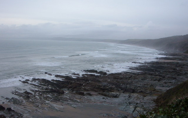
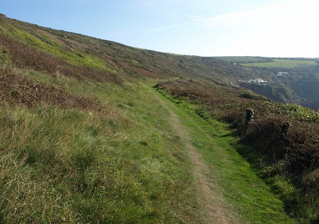
Ninney Cliff is a picturesque coastal area located in Cornwall, England. It is characterized by its stunning cliff formations and steep slopes, making it a popular destination for nature enthusiasts and hikers.

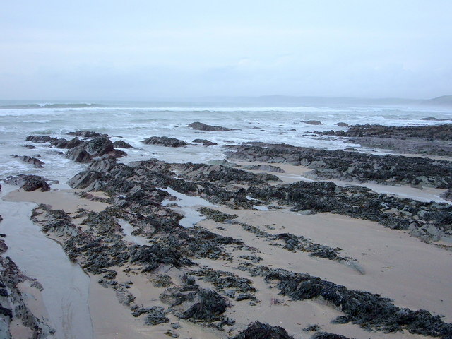
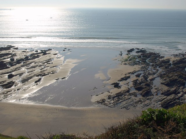
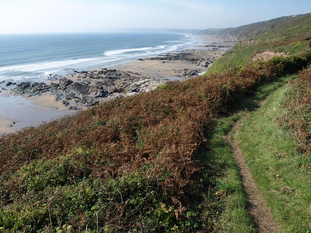
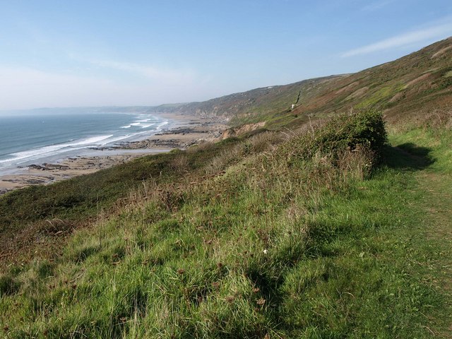
Situated on the southern coast of Cornwall, Ninney Cliff offers breathtaking panoramic views of the Atlantic Ocean. The cliffs, which rise to an impressive height, provide a dramatic backdrop to the surrounding landscape. The rugged terrain and the crashing waves below create a sense of awe and admiration for visitors.

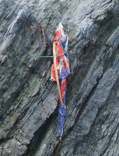
The cliff area is home to a diverse range of flora and fauna, with various species of seabirds nesting on the cliffs and numerous wildflowers blooming along the slopes. The vegetation is rich and varied, with grasses, heathers, and gorse covering the cliff tops.

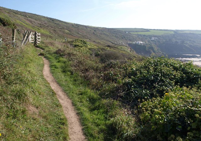
The steep slopes of Ninney Cliff make it a challenging yet rewarding destination for hikers. There are several well-marked trails that wind their way through the area, offering stunning views at every turn. The cliff paths provide an opportunity to explore the rugged coastline and discover hidden coves and secluded beaches along the way.

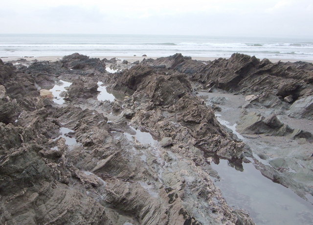
Ninney Cliff is also known for its geological significance, with layers of sedimentary rock exposed along the cliff faces. Fossils can occasionally be found, offering a glimpse into the area's ancient past.

Overall, Ninney Cliff in Cornwall is a captivating location that showcases the beauty and power of nature. Its towering cliffs, steep slopes, and stunning ocean views make it a must-visit destination for those seeking a true coastal experience.

If you have any feedback on the listing, please let us know in the comments section below.

Ninney Cliff Images

Images are sourced within 2km of 50.337932/-4.2361188 or Grid Reference SX4051. Thanks to Geograph Open Source API. All images are credited.

View over Reefs towards Looe at Captain Blake's Point View over reefs in foreground - as detailed on the map - looking out across Whitsand Bay towards Looe.
View over Reefs towards Looe at Captain Blake's Point
View over reefs in foreground - as detailed on the map - looking out across Whitsand Bay towards Looe.
Great Britain!!!!!!!! I like this one of a Union Jack - perhaps an identifying flag from a small vessel - now in tatters stranded helplessly on a jagged rock, its former glory drained away with no one left to salute it - which perhaps represents the state of the UK at the moment?.
Great Britain!!!!!!!!
I like this one of a Union Jack - perhaps an identifying flag from a small vessel - now in tatters stranded helplessly on a jagged rock, its former glory drained away with no one left to salute it - which perhaps represents the state of the UK at the moment?.
Close up of Reef at low tide Like the caption says.
Close up of Reef at low tide
Like the caption says.
Reef at Low Tide Wouldn't like to be thrown onto these in a gale.
Reef at Low Tide
Wouldn't like to be thrown onto these in a gale.
Knatterbury and Polhawn Cove From the clifftop lane at Knatterbury looking southwards across the cove to the little chapel on Rame Head.
Knatterbury and Polhawn Cove
From the clifftop lane at Knatterbury looking southwards across the cove to the little chapel on Rame Head.
View over Whitsand Bay View over Whitsand Bay from near the entrance to the drive to Polhawn Fort.
View over Whitsand Bay
View over Whitsand Bay from near the entrance to the drive to Polhawn Fort.
Polhawn Cove View over Polhawn Cove from the South West Coast Path.
Polhawn Cove
View over Polhawn Cove from the South West Coast Path.
Polhawn Cove View over Polhawn Cove from the South West Coast Path.
Polhawn Cove
View over Polhawn Cove from the South West Coast Path.
Low tide in Whitsand Bay Low tide in Whitsand Bay to the north of Polhawn Cove viewed from the coast path.
Low tide in Whitsand Bay
Low tide in Whitsand Bay to the north of Polhawn Cove viewed from the coast path.
Polhawn Cove Low tide in Polhawn Cove.
Polhawn Cove
Low tide in Polhawn Cove.
Beach at Wiggle Sandway The next cove of sand east of <a href="https://www.geograph.org.uk/photo/2635104">SX4150 : Beach at Wiggle Sandway</a>. On the left are rocks below  Captain Blake's Point.
Beach at Wiggle Sandway
The next cove of sand east of SX4150 : Beach at Wiggle Sandway. On the left are rocks below Captain Blake's Point.
Coast path at Wiggle Sandway The path above <a href="https://www.geograph.org.uk/photo/2635151">SX4149 : Beach at Wiggle Sandway</a>, with Whitsand Bay stretching away beyond.
Coast path at Wiggle Sandway
The path above SX4149 : Beach at Wiggle Sandway, with Whitsand Bay stretching away beyond.
Building above Captain Blake's Point I have no idea what this building is for. The coast path (following footpath 617/13/1) runs in front of it.
Building above Captain Blake's Point
I have no idea what this building is for. The coast path (following footpath 617/13/1) runs in front of it.
South West Coast Path near Captain Blake's Point Approaching a gate on the way to Polhawn.
South West Coast Path near Captain Blake's Point
Approaching a gate on the way to Polhawn.
South West Coast Path near Captain Blake's Point Taken from just beyond the gate shown in <a href="https://www.geograph.org.uk/photo/2635237">SX4249 : South West Coast Path near Captain Blake's Point</a>, with the coast path following footpath 617/13 towards Polhawn Fort and cottages.
South West Coast Path near Captain Blake's Point
Taken from just beyond the gate shown in SX4249 : South West Coast Path near Captain Blake's Point, with the coast path following footpath 617/13 towards Polhawn Fort and cottages.
South West Coast Path approaching Captain Blake's Point A reverse view along the area shown in <a href="https://www.geograph.org.uk/photo/2635413">SX4249 : South West Coast Path near Captain Blake's Point</a>, with the building shown in <a href="https://www.geograph.org.uk/photo/2635186">SX4249 : Building above Captain Blake's Point</a> visible, and Whitsand Bay stretching away on the left.
South West Coast Path approaching Captain Blake's Point
A reverse view along the area shown in SX4249 : South West Coast Path near Captain Blake's Point, with the building shown in SX4249 : Building above Captain Blake's Point visible, and Whitsand Bay stretching away on the left.
Southeast end of Whitsand Bay Almost the last sandy cove between rocks before the coast turns southwestwards towards Rame Head.
Southeast end of Whitsand Bay
Almost the last sandy cove between rocks before the coast turns southwestwards towards Rame Head.
Whitsand Bay Looking more to the right from the same spot as <a href="https://www.geograph.org.uk/photo/2635491">SX4249 : Southeast end of Whitsand Bay</a>, with almost the full width of the bay visible. Plenty of ivy flowers in the foreground, and plenty of insects visiting them, all along this coast.
Whitsand Bay
Looking more to the right from the same spot as SX4249 : Southeast end of Whitsand Bay, with almost the full width of the bay visible. Plenty of ivy flowers in the foreground, and plenty of insects visiting them, all along this coast.
Show me another place!

Ninney Cliff is located at Grid Ref: SX4051 (Lat: 50.337932, Lng: -4.2361188)

Unitary Authority: Cornwall

Police Authority: Devon and Cornwall

What 3 Words

///rudder.topmost.carriage. Near Millbrook, Cornwall

Related Wikis

SS James Eagan Layne

SS James Eagan Layne was a liberty ship. She was beached and sunk during the Second World War off Whitsand Bay, Cornwall, United Kingdom. == History... ==

Freathy

Freathy (Cornish: Frydhi) is a beach and coastal settlement on the Rame Peninsula in east Cornwall, England, United Kingdom.Freathy is accessible by the...

List of shipwrecks in 2004

The list of shipwrecks in 2004 includes ships sunk, foundered, grounded, or otherwise lost during 2004. == January == === 15 January === === 19 January... ===

HMS Scylla (F71)

HMS Scylla (F71) was a Leander-class frigate of the Royal Navy (RN). She was built at Devonport Royal Dockyard, the last RN frigate to be built there as...

Millbrook, Cornwall

Millbrook (Cornish: Govermelin) is a civil parish and village in southeast Cornwall, England, United Kingdom. The village is situated on the Rame Peninsula...

All Saints Church, Millbrook

All Saints Church is a Church of England parish church in Millbrook, Cornwall, England, UK. It was built in 1893–95 and has been Grade II listed since...

Anderton, Cornwall

Anderton is a settlement in south-east Cornwall, England, United Kingdom, located at grid reference SW 431 519. There are also places called Anderton in...

Rame, Maker-with-Rame

Rame (Cornish: Hordh) is a village and former civil parish, now in the parish of Maker-with-Rame, in the Cornwall district, in the ceremonial county of...

Nearby Amenities

Located within 500m of 50.337932,-4.2361188
Source: PGS
Lat/Long: 50.3358299/-4.2357861
Source: PGS
Lat/Long: 50.3346379/-4.2322659
Entrance: main
Lat/Long: 50.3400161/-4.2369582
Bus Stop
Whitsand Bay Holiday Park
Bus: yes
Naptan AtcoCode: 0800COA15562
Naptan Bearing: SE
Naptan BusStopType: CUS
Naptan CommonName: Whitsand Bay Holiday Park
Naptan Indicator: SE-bound
Naptan NaptanCode: corgjdja
Naptan Verified: no
Operator: Plymouth Citybus
Public Transport: platform
Shelter: no
Source: naptan;bing;naptan_compare_tool
Lat/Long: 50.3399252/-4.2359548
Bench
Lat/Long: 50.3399253/-4.2371242
Bench
Lat/Long: 50.337108/-4.2300028
Bench
Backrest: no
Lat/Long: 50.3365107/-4.230134
Bench
Lat/Long: 50.3363167/-4.2298902
Bench
Backrest: no
Lat/Long: 50.3374751/-4.2302531
Information: board
Tourism: information
Lat/Long: 50.3399228/-4.2367936
Bench
Lat/Long: 50.3399276/-4.2370545
Bench
Lat/Long: 50.3399463/-4.2371677
Bicycle Parking
Lat/Long: 50.3399177/-4.2370837
The data included in this document is from www.openstreetmap.org. The data is made available under ODbL.

Have you been to Ninney Cliff?

Leave your review of Ninney Cliff below (or comments, questions and feedback).